1. Introduction
Resilience is the ability of a system to withstand, adapt to, and recover from disruptions [
1]. With the deepening of research, the concept of resilience has been gradually refined. According to the research object, resilience can be subdivided into urban resilience [
2], infrastructure resilience [
3], water resilience [
4], hospital system resilience [
5], food system resilience [
6], economic resilience [
7], social resilience [
8], etc. According to the type of disruption, resilience can be classified into seismic resilience [
9], climate resilience [
10], flood resilience [
11], attack resilience [
12], etc. The concept of resilience is evolving, and the understanding of urban-scale disasters and disaster prevention work is also growing. People are gradually realizing that in the space dimension, the modern city is indeed a highly interdependent and complex system [
13]. The destruction of one part can destroy other parts of the same system or even some parts of other systems. Cascading failures have become a typical and familiar phenomenon [
14,
15,
16,
17], and their consequences are multifaceted. In addition to damaging the physical facilities, they affect the regional and even global economy, society, and other dimensions [
18]. In the time dimension, people have begun to pay more attention to the recovery and reconstruction of cities after disasters rather than only focusing on the reliability or risk analysis of structures and infrastructures under different hazards [
19]. Therefore, urban resilience and sustainability have gradually become a research hotspot [
20,
21,
22]. A deepened understanding of urban disasters and urban systems in the spatial and temporal dimensions is essential in the research on interdependent infrastructures and resilient cities. Obviously, the research on these two topics is not separate. In the past two decades, the resilience of interdependent infrastructures has gradually attracted the attention of many researchers [
23]. For this reason, a large amount of urban data, including buildings, population, transportation networks, water supply networks, power supply networks, and communication networks, have been collected. Owing to the availability of various satellite remote sensing maps (e.g., Google Maps, Baidu Maps, OpenStreetMap, and Nearmap), researchers can easily obtain the data of buildings and road networks. However, it is often difficult to find actual data for systems that require a high degree of confidentiality, such as water and power supply networks. Therefore, building a virtual city that conforms to actual engineering can be a feasible approach.
The current research on virtual cities mainly focuses on the digitization of real cities. Then the changes in urban forms, roads, drainage, and other systems because of economic development are studied. These virtual cities can be categorized as digital virtual cities. In recent years, with the development of smart cities, 3D digital virtual cities have become a new trend. Their key problems include the following two aspects. The first problem is how to quickly and accurately establish a virtual city. Many methods, software products, and standards have been suggested. The methods include semantic modeling, light detection and ranging, and oblique photogrammetry. The software products include CityBuilder, Unity3D, OpenSceneGraph, 3DsMax, AutoCAD, and SketchUp. The standards include VRML, OpenGL, CityGML, WebGL, X3D, and O3D. The second problem is how to study urban management, spatial planning, social networks, spatial knowledge, traffic flow, etc., based on a virtual urban environment. Agent-based modeling is probably the most popular method. For example, Lechner studied land use in cities using an agent-based model [
24]. Zhuge et al. studied the social network by using agents to synthesize a population comprising individuals and households, as well as their attributes and locations [
25]. Shafiee et al. suggested an agent-based modeling framework for assessing the public health protection of water advisories, in which agents are used to represent consumers, public health officials, and utility managers [
26]. Urich et al. used an agent model to generate virtual sewer systems [
27]. Other digital virtual environments are also popular. For example, Google Street View combined with the deep learning toolbox AlexNet has been used to access the risk of utility poles [
28]. In addition, a virtual urban environment has been built using Utility3D to analyze the influence of GPS-guided navigation on people’s spatial knowledge by tracking eye movement [
29].
Other research on virtual cities can be categorized as functional virtual cities or virtual benchmark cities. These virtual cities are established based on their engineering characteristics. They are used to study the effects of disasters and verify numerical programs for the analysis of urban functions, reliability, risks, resilience, and sustainability. The Memphis Testbed developed by the Mid-America Earthquake Center is probably the most famous. Similarly, some other benchmark cities have also been suggested by researchers in different countries. For example, Ellingwood et al. established a virtual city called Centerville [
30]. Cimellaro et al. suggested a virtual city called Ideal City based on buildings in the city of Turin, Italy [
31,
32]. Shang et al. established a virtual benchmark city for seismic resilience assessment based on a geographic information system, including power, transportation, water, drainage, and natural gas distribution networks, as well as the locations of hospitals, emergency shelters, and schools [
33]. Virtual infrastructure systems are also very common. For example, Brumbelow designed a virtual water distribution system in a virtual city named Mesopolis to study the effects of contamination events [
26,
34,
35]. Möderl et al. suggested a method to systematically generate virtual networks for water supply based on the graph theory and developed the VIBe software [
36]. Liu et al. designed a large-scale virtual power supply network for the research community [
37]. Li et al. created a large-scale testbed as a virtual power supply network for closed-loop control in research and testing [
38]. In addition, we can easily obtain many examples of virtual water and power supply networks away from specific urban geographic information, such as the water supply networks in the software package EPANET (e.g., the water supply networks of Anytown, D-town, EXNET, New York), and different IEEE bus systems and test feeders [
39,
40] (e.g., the WSCC 9-bus system, IEEE 14-bus, 24-bus systems, and the 200-bus synthetic grid of central Illinois).
However, researchers in different countries and regions using virtual benchmark cities often find that some fundamental physical information of infrastructures in the aforementioned cities is insufficient. For example, there is no information on how to determine a reasonable topology or estimate the amount of commodity consumed by some nodes. Thus, researchers need to build a virtual city with infrastructure in accordance with the characteristics of the cities in some specific areas. In particular, for water and power supply networks, research based on real-world data is very difficult to perform, owing to data confidentiality. Although there are some virtual water and power supply network cases as mentioned above, they cannot be integrated with existing geographic information such as buildings, roads, and communication systems. Furthermore, independent water and power supply networks cannot reflect the fact that the two are interdependent in engineering practice.
Therefore, we study the planning and design of the water and power supply networks in engineering practice and the interdependent relationship between the two networks during the planning and design process. A new framework for designing these networks with interdependent characteristics is proposed. First, this framework can establish virtual water and power networks with interdependent characteristics that conform to actual engineering and urban geographic information characteristics. Second, it can provide an effective modeling method for water and power networks in the absence of data for urban resilience and disaster risk studies. To verify the feasibility and practicality of this approach, the water and power supply networks of a virtual city called Virtual Shangcheng City (VSC) are established.
The remainder of this paper proceeds as follows.
Section 2 provides an overview of the proposed framework and the basic data required for the design of virtual water and power supply networks.
Section 3 and
Section 4 describe the procedure for the planning and design of the water and power supply networks, respectively.
Section 5 discusses the design interdependence between the two networks.
Section 6 details the establishment of the virtual water and power supply networks of VSC to prove the feasibility and practicality of the proposed approach. Finally, the conclusions are presented in
Section 7.
2. Overview of the Framework
A detailed flowchart of the framework for designing the virtual water and power supply networks with interdependent characteristics is shown in
Figure 1. This framework can be summarized in five steps.
(1) Step 1: Collect the basic data of the city selected as a blueprint. Usually, the virtual water and power supply networks are created based on a reference. A certain city or region is selected as the blueprint for designing a virtual city. Sometimes, the information of other systems, such as buildings and roads, and even economic data, such as per capita GDP (gross domestic product) and GDP growth rate, are already known. However, in some cases, only the name of the city is available. Therefore, we have to collect the basic data of the city selected as a blueprint to build the virtual water and power supply networks.
(2) Step 2: Plan and design the water supply network. The design of the water supply network is relatively simpler than that of the power supply network. Therefore, this framework prioritizes the planning and design of the water supply network. The main work includes determining the water sources, water demand in different regions, and pipeline networks. However, if the designers are more familiar with the power supply network, they can plan and design it first. The most important indicators for water supply networks are water pressure and flow. Consumers do not only want to get enough water but also hope the water head can maintain a certain range (for example, not less than 10 m).
(3) Step 3: Plan and design the power supply network. Similarly, the planning and design of the power supply network mainly include the determination of the power source, power consumption of different regions, and network structure. For power supply networks, the most important indicators are power and voltage. The designed network has to keep the voltage variation within a small range while providing sufficient power for consumers. For example, it is usually required that the voltage at both ends of the line does not vary by more than 5% from the rated voltage.
(4) Step 4: Design and verify the interdependence between the water supply network and power supply network. The most important process is to determine the interdependent point locations between the two networks, as well as the physical form of the connection between them. Interdependencies should be established according to the actual situation of the two networks. For example, a water plant in the water supply network has to need the power supplied by some node in the power supply network or a power plant in the power supply network sometimes needs the water supplied by a node in the water supply network. The establishment of interdependencies is discussed in detail in
Section 6.
(5) Step 5: Summarize and write the report. The report should contain the topology of both networks and physical information of different lines and nodes. In the case of a water supply network, for example, the line information should contain the material and diameter of different pipelines; the information of the water plant should contain water supply flow and pressure; and customer nodes should contain water flow and pressure requirement. Of course, how the different nodes or lines between the two networks are interdependent with each other should also be described in detail.
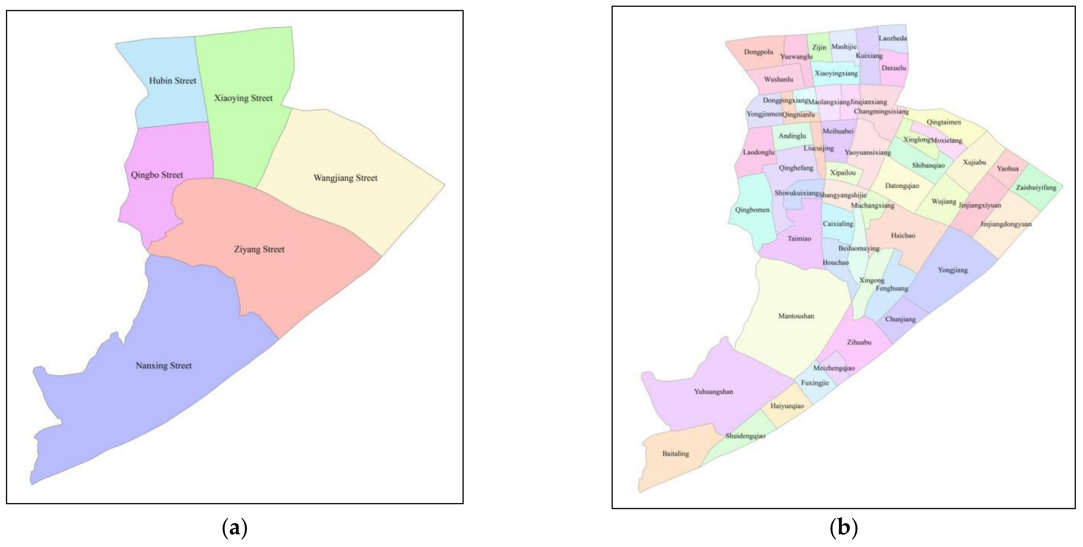
Before the formal design begins, some important data still need to be collected. The data will be collected primarily for the target city (which may be a real city or a virtual city). Typically, these data are the current state of physical quantities, but some historical data, such as economic growth rates over the past few years, may also be needed to predict future growth in water demand. Four types of information are required. The first is population distribution because it determines the actual requirements of different systems. The second is the urban administrative division. This is because the population census and the different infrastructures are generally managed by the administrative regions, especially in China. The level of administrative divisions can be determined according to the scale of the virtual network, such as residential areas, communities, and streets. The third is an electronic map containing geographic information, including buildings, roads, rivers, and land. Open-source electronic maps, such as Google Maps and Baidu Maps, can be used. The fourth requirement is economic data. This is because the economic condition and development can affect the water and power requirements.
7. Conclusions
This paper proposes a framework for designing virtual water and power supply networks with interdependent characteristics based on the physical mechanisms of the two networks. Using this framework, we were able to establish the water and power supply networks of a virtual city. The main conclusions are as follows:
(1) Geographical maps, road maps, and population distributions are indispensable materials for designing the virtual water and power supply networks.
(2) The functional interdependence between the water and power supply networks is complicated, especially after earthquakes. The water supply network provides water for power plants (especially thermal power plants) and firefighting. The power supply network provides energy for water plants, some booster pump stations, and other electrical equipment, such as monitors, electric valves, and electric instruments in the water supply network.
(3) The virtual networks must satisfy the actual basic system engineering. More importantly, the coupling function between the virtual networks should be verified.
(4) The technical details or parameters that need to be focused on when designing the system are also important points that should be considered when simplifying real networks. Such parameters include the supply pressure of the water source, voltage of the grid source, and water consumption of power substations for firefighting.


