
Influence of the Construction of the Urdinbide Road Tunnel on the Autzagane Aquifer in Biscay (Spain)


Abstract
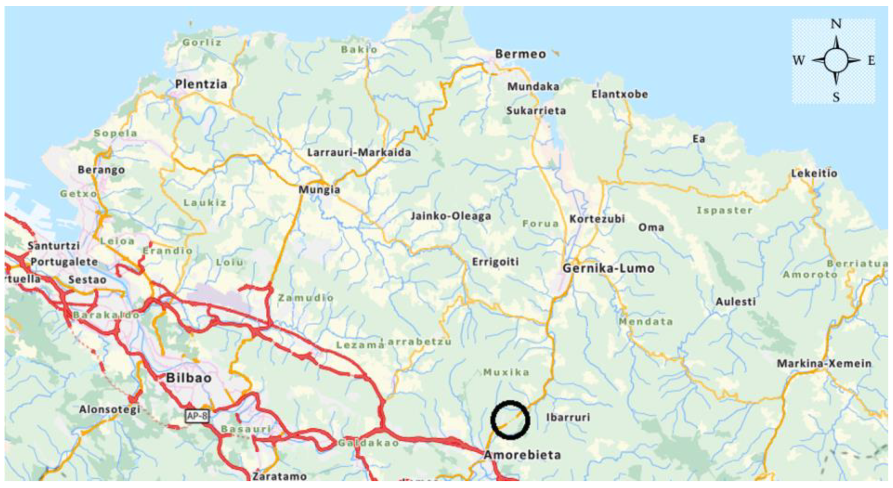
:1. Introduction
2. Materials and Methods
2.1. General Description of Tunnel Works
2.2. Geological Study
2.3. Hydrogeological Study
2.3.1. Conceptual Hydrogeological Functioning Model
2.3.2. Numerical model
2.3.3. Design of Waterproofing System
2.4. Hydrogeological Monitoring of the Tunnel during the Construction Phase
3. Results
Author Contributions
Funding
Institutional Review Board Statement
Informed Consent Statement
Data Availability Statement
Acknowledgments
Conflicts of Interest
References
- Interbiak. Project for Completion of the Works in the Amorebieta-Muxika Section; Diputación Foral de Bizkaia, Interbiak: Bilbao, Spain, 2015. [Google Scholar]
- Ilyushin, Y.V.; Asadulagi, M.-A.M. Development of a Distributed Control System for the Hydrodynamic Processes of Aquifers, Taking into Account Stochastic Disturbing Factors. Water 2023, 15, 770. [Google Scholar] [CrossRef]
- Martirosyan, A.V.; Kukharova, T.V.; Fedorov, M.S. Research of the Hydrogeological Objects’ Connection Peculiarities. In Proceedings of the 2021 IV International Conference on Control in Technical Systems (CTS), Saint Petersburg, Russia, 21–23 September 2021; pp. 34–38. [Google Scholar] [CrossRef]
- Martirosyan, A.V.; Martirosyan, K.V.; Mir-Amal, A.M.; Chernyshev, A.B. Assessment of a Hydrogeological Object’s Distributed Control System Stability. In Proceedings of the 2022 Conference of Russian Young Researchers in Electrical and Electronic Engineering (ElConRus), Saint Petersburg, Russia, 25–28 January 2022; pp. 768–771. [Google Scholar] [CrossRef]
- Wang, S.; Gao, Z.; Wang, Z.; Wu, X.; An, Y.; Ren, X.; He, M.; Wang, W.; Liu, J. Hydrodynamic characteristics of groundwater aquifer system under recharge and discharge conditions. Arab. J. Geosci. 2020, 13, 859. [Google Scholar] [CrossRef]
- Lasagna, M.; Mancini, S.; De Luca, D. Groundwater hydrodynamic behaviours based on water table levels to identify natural and anthropic controlling factors in the Piedmont Plain (Italy). Sci. Total Environ. 2020, 716, 137051. [Google Scholar] [CrossRef] [PubMed]
- Hu, L.Y.; Chugunova, T. Multiple-point geostatistics for modeling subsurface heterogeneity: A comprehensive review. Water Resour. Res. 2008, 44. [Google Scholar] [CrossRef]
- Tziritis, E.; Sachsamanoglou, E.; Aschonitis, V. Assessing Groundwater Evolution with a Combined Approach of Hydrogeochemical Modelling and Data Analysis: Application to the Rhodope Coastal Aquifer (NE Greece). Water 2023, 15, 230. [Google Scholar] [CrossRef]
- Dawson, C. A continuous/discontinuous Galerkin framework for modeling coupled subsurface and surface water flow. Comput. Geosci. 2008, 12, 451–472. [Google Scholar] [CrossRef]
- Harter, T. Finite-size scaling analysis of percolation in three-dimensional correlated binary Markov chain random fields. Phys. Rev. E 2005, 72, 026120. [Google Scholar] [CrossRef] [Green Version]
- Zammouri, M.; Brini, N. Efficiency of Artificial Groundwater Recharge, Quantification Through Conceptual Modelling. Water Resour. Manag. 2020, 34, 3345–3361. [Google Scholar] [CrossRef]
- Condon, L.E.; Kollet, S.; Bierkens, M.F.P.; Fogg, G.E.; Maxwell, R.M.; Hill, M.C.; Fransen, H.H.; Verhoef, A.; Van Loon, A.F.; Sulis, M.; et al. Global groundwater modeling and monitoring: Opportunities and challenges. Water Resour. Res. 2021, 57, e2020WR029500. [Google Scholar] [CrossRef]
- Condon, L.E.; Hering, A.S.; Maxwell, R.M. Quantitative assessment of groundwater controls across major US river basins using a multi-model regression algorithm. Adv. Water Resour. 2015, 82, 106–123. [Google Scholar] [CrossRef]
- Vázquez-Suñé, E.; Capino, B.; Abarca, E.; Carrera, J. Estimation of Recharge from Floods in Disconnected Stream Aquifer Systems. Groundwater 2007, 45, 579–589. [Google Scholar] [CrossRef] [PubMed]
- Kolymbas, D.; Wagner, P. Groundwater ingress to tunnels—The exact analytical solution. Tunn. Undergr. Space Technol. 2007, 22, 23–27. [Google Scholar] [CrossRef]
- Shin, J.H.; Addenbrooke, T.I. A numerical study of the effect of groundwater movement on long-term tunnel behaviour. Geotechnique 2002, 52, 391–403. [Google Scholar] [CrossRef]
- Nazarchuk, A. Water Intrusion in Underground Structures. Master’s Thesis, Massachusetts Institute of Technology, MCambridge, MA, USA, 12 June 2008. [Google Scholar]
- Dvanajščak, D.; Ratej, J.; Jovičić, V. Sustainability of Water Resources in Karst Undermined by Tunneling: A Case Example. Sustainability 2022, 14, 732. [Google Scholar] [CrossRef]
- Saito, H.; Date, K.; Narita, N.; Yamamoto, T.; Yokota, Y.; Koizumi, Y. Pre-grouting and tunnel excavation of watertight structure section. In Proceedings of the ISRM International Symposium—8th Asian Rock Mechanics Symposium, Sapporo, Japan, 14–16 October 2014; pp. 1184–1189. [Google Scholar]
- Golian, M.; Abolghasemi, M.; Hosseini, A.; Abbasi, M. Restoring groundwater levels after tunneling: A numerical simulation approach to tunnel sealing decision-making. Hydrogeol. J. 2021, 29, 1611–1628. [Google Scholar] [CrossRef]
- Trinh, N.Q. Controlling of groundwater inflow: From Norwegian sub-sea tunnels to tunnel in large cities. In Proceedings of the 13th World Conference of ACUUS: Advances in Underground Space Development, Singapore, Singapore, 7–9 November 2012; pp. 1170–1180. [Google Scholar]
- Rodríguez-Loinaz, G.; Amezaga, I.; Onaindia, M. Efficacy of Management Policies on Protection and Recovery of Natural Ecosystems in the Urdaibai Biosphere Reserve. Nat. Areas J. 2011, 31, 358–367. [Google Scholar] [CrossRef]
- Barton, N. Ground Stabilisation. The why’s and how’s of high pressure grouting—Part 1. Tunn. Tunn. Int. 2014, 28–30. [Google Scholar]
- Meschede, M. The tectonic and sedimentary development of the Biscay synclinorium in Northern Spain. Geol. Rundsch. 1987, 76, 567–577. [Google Scholar] [CrossRef]
- Lo Russo, S.; Taddia, G.; Cerino, E. Tunnelling and groundwater interaction: The role of the hydrogeological monitoring. Geoing. Ambient. E Min. 2015, 146, 37–44. [Google Scholar]
- EVE. Hydrogeological Map of the Basque Country at a Scale of 1:100.000; EVE: Bilbao, Spain, 1996. [Google Scholar]
- Manoj, P.; Madan, K. Estimation of Aquifer Parameters from Pumping Test Data by Genetic Algorithm Optimization Technique. J. Irrig. Drain. 2003, 129, 348–359. [Google Scholar] [CrossRef]
- Visual Modflow Flex 9.0. Available online: https://www.waterloohydrogeologic.com/products/visual-modflow-flex/ (accessed on 30 April 2023).
- Marinos, V.; Marinos, P.; Hoek, E. The geological strength index: Applications and limitations. Bull. Eng. Geol. Environ. 2005, 64, 55–65. [Google Scholar] [CrossRef]
- Baraibar, J.M.; Gil, M.; Escobal, I. Design of microcement-based injections in highly porous media. Urdinbide Tunnel. In Proceedings of the ITA-AITES World Tunnel Congress, Copenhagen, Denmark, 2–8 September 2022. [Google Scholar]
- Haugsand, M. Hydraulic Jacking and Pressure Distribution During Rock Mass Grouting with Cement Based Grouts. In Proceedings of the ISRM 9th Nordic Grouting Symposium, Helsinki, Finland, 2–3 September 2019. [Google Scholar]
- Escobal Marcos, I.; Alvarez-Fernandez, M.I.; Prendes-Gero, M.B.; Gonzalez-Nicieza, C. Designing Cement-Based Grouting in a Rock Mass for Underground Impermeabilization. Energies 2021, 14, 4062. [Google Scholar] [CrossRef]
- González-García, J.; González-Nicieza, C.; Álvarez-Fernández, M.-I.; Prendes-Gero, M.-B. Injection Treatment for Tunneling Excavation in Sandy Soils with High Fines Content. Energies 2021, 14, 6930. [Google Scholar] [CrossRef]


| Hydrostratigraphic Unit | Horizontal Permeability (m/s) | Vertical Permeability (m/s) | Storage Coefficient | Efficient Porosity (%) |
|---|---|---|---|---|
| Autzagane Aquifer | 2.5 × 10⁻⁶ | 2.5 × 10⁻⁶ | 1 × 10⁻⁵ | 5 |
| Balance Items | Flow (L/s) | |
|---|---|---|
| INPUT | Precipitation infiltration | 9.1 |
| OUTPUT | Ategorri stream (springs and diffuse discharges) | 4.1 |
| Etxanosolo stream (springs and diffuse discharges) | 1.5 | |
| Torreburu spring | 1.9 | |
| Asketa spring | 0.8 | |
| Sastratxu spring | 0.1 | |
| Existing railway line tunnel | 0.7 | |
| Total | 9.1 |
| Balance Items | Flow in Natural Regime (L/s) | Flow with Draining Tunnel (L/s) | Variation | |
|---|---|---|---|---|
| INPUT | Precipitation infiltration | 9.1 | 9.1 | - |
| OUTPUT | Ategorri stream (springs and diffuse discharges) | 4.1 | 0 | −100% |
| Urdinbide tunnel | - | 6.6 | - | |
| Etxanosolo stream (springs and diffuse discharges) | 1.5 | 0.8 | −46% | |
| Torreburu spring | 1.9 | 1 | −47% | |
| Asketa spring | 0.8 | 0.2 | −75% | |
| Sastratxu spring | 0.1 | 0 | −100% | |
| Existing railway line tunnel | 0.7 | 0.5 | −28% | |
| Total | 9.1 | 9.1 | - |
| Balance Items | Flow in Natural Regime (L/s) | Flow Limit Values (L/s) | Variation | |
|---|---|---|---|---|
| INPUT | Precipitation infiltration | 9.1 | 9.1 | - |
| OUTPUT | Ategorri stream (springs and diffuse discharges) | 4.1 | 1.4 | −65% |
| Urdinbide tunnel | - | 4.7 | - | |
| Etxanosolo stream (springs and diffuse discharges) | 1.5 | 0.8 | −46% | |
| Torreburu spring | 1.9 | 1.3 | −31% | |
| Asketa spring | 0.8 | 0.3 | −63% | |
| Sastratxu spring | 0.1 | 0 | −100% | |
| Existing railway line tunnel | 0.7 | 0.6 | −14% | |
| Total | 9.1 | 9.1 | - |
Disclaimer/Publisher’s Note: The statements, opinions and data contained in all publications are solely those of the individual author(s) and contributor(s) and not of MDPI and/or the editor(s). MDPI and/or the editor(s) disclaim responsibility for any injury to people or property resulting from any ideas, methods, instructions or products referred to in the content. |
© 2023 by the authors. Licensee MDPI, Basel, Switzerland. This article is an open access article distributed under the terms and conditions of the Creative Commons Attribution (CC BY) license (https://creativecommons.org/licenses/by/4.0/).
Share and Cite
Baraibar, J.-M.; Gil, M.; Escobal, I. Influence of the Construction of the Urdinbide Road Tunnel on the Autzagane Aquifer in Biscay (Spain). Appl. Sci. 2023, 13, 7034. https://doi.org/10.3390/app13127034
Baraibar J-M, Gil M, Escobal I. Influence of the Construction of the Urdinbide Road Tunnel on the Autzagane Aquifer in Biscay (Spain). Applied Sciences. 2023; 13(12):7034. https://doi.org/10.3390/app13127034
Chicago/Turabian StyleBaraibar, José-Manuel, Miguel Gil, and Iñigo Escobal. 2023. "Influence of the Construction of the Urdinbide Road Tunnel on the Autzagane Aquifer in Biscay (Spain)" Applied Sciences 13, no. 12: 7034. https://doi.org/10.3390/app13127034