Development of a Firefighting Drone for Constructing Fire-breaks to Suppress Nascent Low-Intensity Fires
Abstract
1. Introduction
1.1. Background and Objectives of the Study
1.2. Study Methodology and Procedures
2. Theoretical Background
2.1. Issues in Wildfire Management and Firebreak Construction
2.2. Case Studies on Fire-Extinguishing Drones
2.3. Investigation of Fire-Extinguishing Ball
2.4. Enhancement of Fire Response Messures Using Cluster Flight System
3. Prototype Development of Fire-Extinguishing Drone
3.1. Demand Survey through Focus Group Interviews
3.2. Verification and Discussion of Practical Scenarios through FGIs
3.3. Development of Prototype Fire-Extinguishing Drone Based on FGIs
4. Field Experiment of Fire-Extinguishing Drone
4.1. Experiment to Test the Accuracy of Fire Extinguisher Deployment (First Experiment)
4.1.1. Accuracy Performance Test and Method of Fire Extinguisher Deployment at Different Altitudes
4.1.2. Experimental Objectives
4.1.3. Experimental Plan
4.1.4. Experimental Results
4.2. Firebreak Construction and Fire Suppression Experiment (Second Experiment)
4.2.1. Experimental Objective
4.2.2. Experimental Plan
4.2.3. Performance Metrics Setup
4.2.4. Experimental Method
4.2.5. Experimental Results
5. Conclusions and Limitations
Author Contributions
Funding
Institutional Review Board Statement
Informed Consent Statement
Data Availability Statement
Conflicts of Interest
References
- Korea Forest Service. 2020 Basic Forest Statistics; Korea Forest Service: Daejeon, Republic of Korea, 2021. [Google Scholar]
- Korea Forest Service. 2021 Statistical Year Book of Forest Fires; Korea Forest Service: Daejeon, Republic of Korea, 2022. [Google Scholar]
- National Fire Agency. 2021 Fire Statistical Yearbook; National Fire Agency: New Taipei City, Taiwan, 2022. [Google Scholar]
- Ha, K.H.; Kim, J.H.; Choi, J.W. A study on the awareness of firefighters on the introduction of drones and the operation and application of drones–Focusing on the firefighters of Jeollanam-do. J. Korea Acad.-Ind. 2021, 22, 332–340. [Google Scholar]
- National Forestry Cooperative Federation. 2021 Forest Management Instructor Appointment Study Module Forest Civil Engineering—Forest Road Basic Book; National Forestry Cooperative Federation: Seoul, Republic of Korea, 2021. [Google Scholar]
- Kim, G.W. Measures to utilize forest fire-fighting forest road without water. Soc. For. Cult. 2022, 31, 10–14. [Google Scholar]
- Korea Northern Forest Service. Field Command Manual for Forest Fire Extinguishing; Korea Forest Service: Daejeon, Republic of Korea, 2005. [Google Scholar]
- Koo, W.H.; Baek, M.H. A study of status investigation to reinforce the capability of field responders in forest fires. J. Korean Soc. Haz. Mitigat. 2019, 19, 113–120. [Google Scholar] [CrossRef]
- Bae, T.H.; Choi, Y.C. Study of indirect attack method of aerial fire firefighting by helicopter on forest fire. Korean Soc. Aviat. Aeronaut. 2016, 24, 55–61. [Google Scholar] [CrossRef]
- Bae, T.H.; Lee, S.Y. A study on the recognition of effectiveness and safety of the helicopter aerial fire attack. J. Korean Inst. Fire Sci. Eng. 2012, 26, 97–104. [Google Scholar] [CrossRef]
- Bae, M.R.; Choi, H.M. Regional Characteristics of Forest Fire Occurrences in Korea from 1990 to 2018 . J. Korean Soc. Hazard Mitig. 2019, 12, 305–313. [Google Scholar] [CrossRef]
- Koo, K.S.; Lee, S.Y.; Lee, B.D.; Lee, M.B.; Park, H.S.; Kim, J.H.; Park, G.Y. Questionnaire concerning the actual state of the burning for farming and recognition of forest fire prevention policy. J. Korean Inst. Fire Sci. Eng. 2010, 24, 145–153. [Google Scholar]
- Kim, K.S. Measures to Improve Rural Public Transportation and Road Systems; Policy Research Report from Korea Rural Economic Institute; Korea Rural Economic Institute: Naju-si, Republic of Korea, 2012. [Google Scholar]
- Ha, K.H.; Kim, J.H.; Choi, J.W. A study on the application of drone in firefight field. J. Korea Acad.-Ind. 2021, 22, 321–330. [Google Scholar]
- Korea Forest Service. Final Report on the Development of Fire Extinguishing Charcoal and Fire Extinguishing Agent for All-Weather Use; Korea Forest Service: Daejeon, Republic of Korea, 2021; pp. 96–132. [Google Scholar]
- Alshbatat, A.I.N. Fire extinguishing system for high-rise buildings and rugged mountainous terrains utilizing quadrotor unmanned aerial vehicle. Int. J. Image Graph. Signal Process 2018, 10, 23–29. [Google Scholar] [CrossRef]
- Aydin, B.; Selvi, E.; Tao, J.; Starek, M.J. Use of fire-extinguishing balls for a conceptual system of drone-assisted wildfire fighting. Drones 2019, 3, 17. [Google Scholar] [CrossRef]
- Patil, R.; Patil, T.; Sawant, N.; Thakur, H.; Surve, D. Fire fighting drone using extinguisher bomb. Int. Res. J. Eng. Technol. 2020, 7, 3395–3398. [Google Scholar]
- Zadeh, N.R.N.; Abdulwakil, A.H.; Amar, M.J.R.; Durante, B.; Santos, C.V.N.R. Fire-fighting UAV with shooting mechanism of fire extinguishing ball for smart city. Indones. J. Electr. Eng. Comp. Sci. 2021, 22, 1320–1326. [Google Scholar] [CrossRef]
- Elide Fire Extinguishing Ball. Available online: https://www.elidefire.com/ (accessed on 15 January 2024).
- AFO Fire Extinguishing Ball. Available online: https://afoball.com/ (accessed on 15 January 2024).
- Lee, J.O.; Sung, S.M. Assessment of positioning accuracy of UAV photogrammetry based on RTK-GPS. J. Korea Acad.-Ind. Coop. Soc. 2018, 19, 63–68. [Google Scholar]
- Moon, S.T.; Kim, D.Y.; Lee, D.G. Outdoor swarm flight system based on the RTK-GPS. J. Korean Inst. Informat. Sci. Eng. 2020, 47, 328–334. [Google Scholar] [CrossRef]


| Introduction | |
| 1. The Literature Review and Case Studies | Review of the literature and case studies related to the use of fire-extinguisher drones and wildfire firebreak construction. |
| 2. FGI Expert Survey | - Phase 1: interviews with experts to ascertain the functionality and potential of using fire-extinguisher drones for firebreak construction. - Phase 2: evaluation and review of the design of fire-extinguisher drones. |
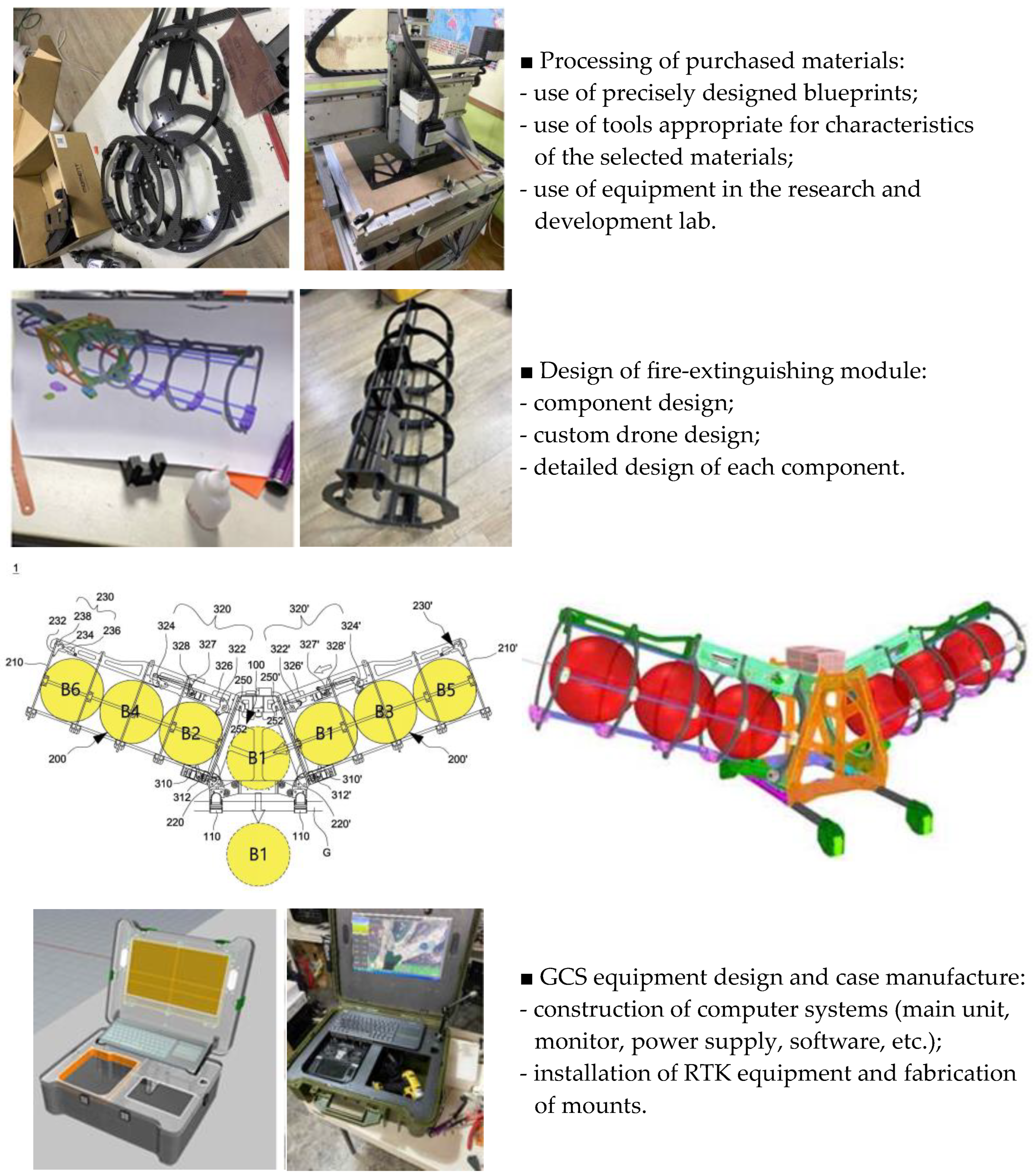
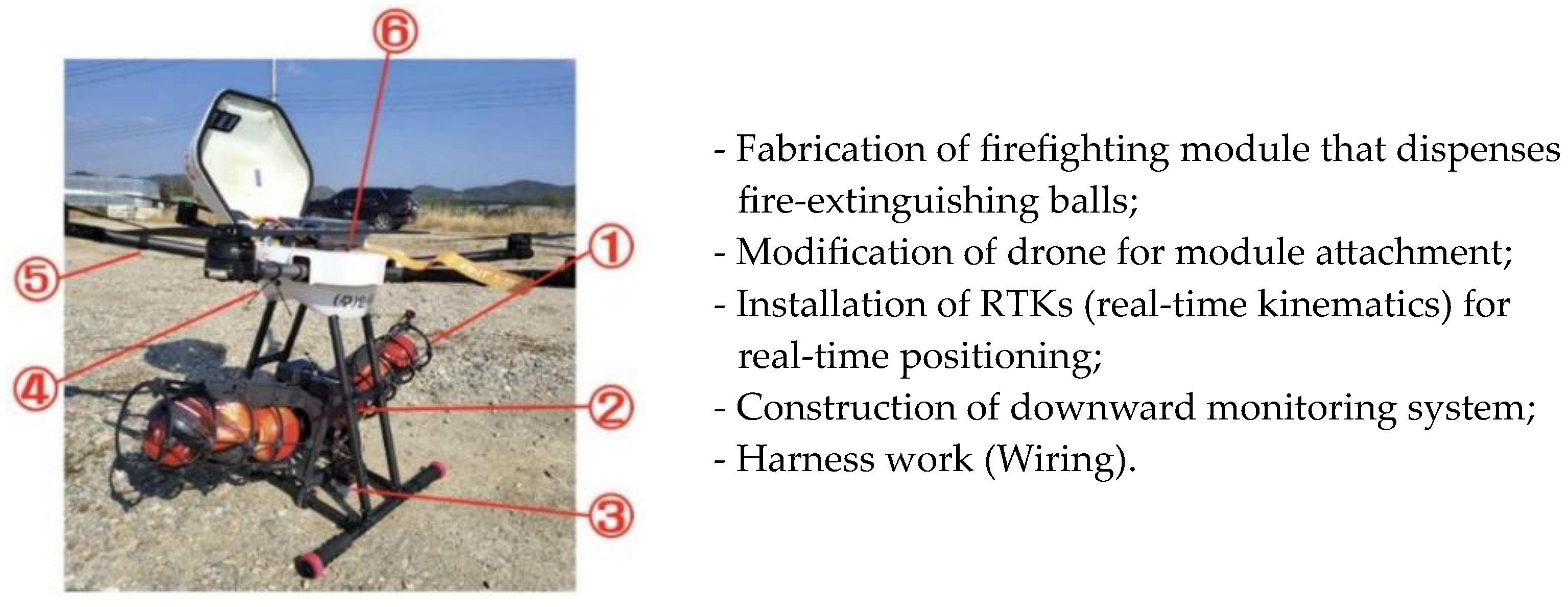
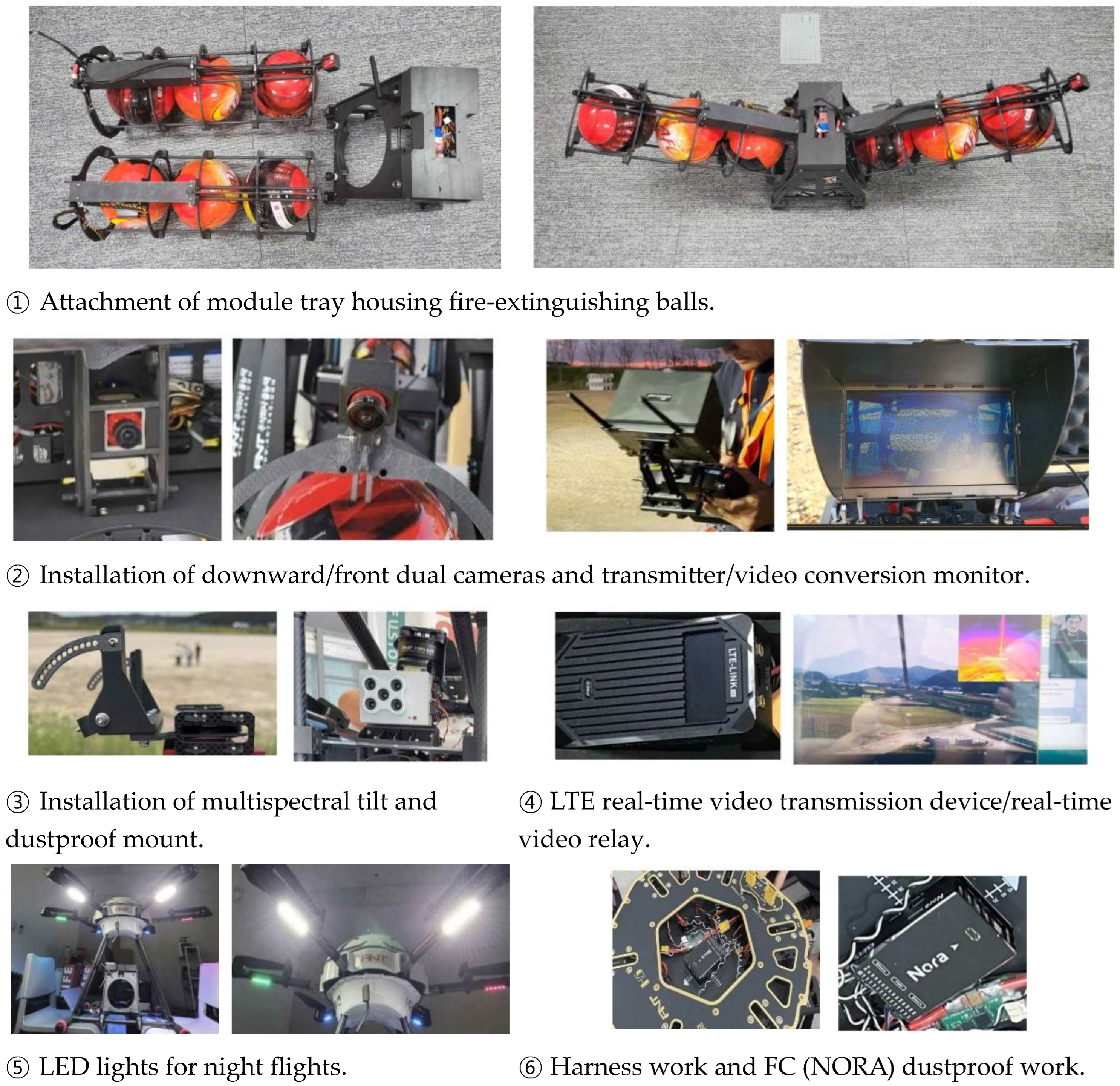
| 3. Equipment Production | Production of a consecutive fire extinguisher deployment module by considering expert opinions. |
| 4. Experimental Validation | - Experimental tests to determine the accuracy of fire extinguisher deployment and autonomous drone flight to target locations. - Verification of the accuracy of firebreak construction and effectiveness of fire suppression using drones. |
| Conclusion | Achievements, limitations, and future research directions. |
| Study | Image | Fire Extinguisher Deployment Method/Fire Extinguisher Payload/Status of Experimental Validation |
|---|---|---|
| Abdel Ilas N. Alshbatat (2018) [16] | 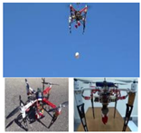 | - To address the difficulties and risks associated with firefighting in high-rise buildings or mountainous terrains, a safe fire-extinguishing system consisting of six components (drone, robot, firefighting equipment, fire-extinguishing ball, collision-avoidance system, and camera) was proposed. - The system was demonstrated to be suitable for initial fire suppression, and the experimental results proved its ability to operate safely at heights where fire-extinguishing balls can be reloaded while maintaining drone stability. |
| Burchan Aydin et al. (2019) [17] | 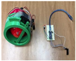 | - The potential utility of fire-extinguishing balls in the proposed firefighting system, which complements the traditional firefighting methods using drones and remote-sensing technology, was examined. - The experimental results demonstrated that small-sized fire-extinguishing balls may not be effective against building fires but they can be effective for suppressing grass fires. |
| Rupali Patil et al. (2020) [18] | 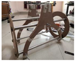 | - A holder was designed to store fire-extinguishing balls for firefighting purposes. - The holder consisted of a railing system attached to a base plate composed of an acrylic sheet. - Using Arduino and servo motors, the release and blocking of the balls were controlled, while the rails guided the balls, and the barriers released and stopped the balls. |
| Nastaran Reza Nazar Zadeh et al. (2021) [19] | 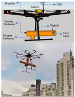 | - A system that uses unmanned aerial vehicles (UAVs) for firefighting was proposed to facilitate quick, efficient access to the top floors of buildings and to improve firefighters’ visual access to affected areas. In this system, fire-extinguishing balls were used to prevent the spread of fire. - This system was based on a newly designed firefighting UAV equipped with a mechanism to shoot and drop fire-extinguishing balls. The UAV was controlled using a 2.4 GHz radio frequency signal and video monitoring controller to operationalize the shooting and dropping mechanism. - This firefighting UAV can be utilized effectively in the early stages of a fire, and its ability to enhance the safety and efficiency of firefighters was demonstrated. |
| Professional Firefighter | Drone Engineer | ||||
|---|---|---|---|---|---|
| Lee | 68 | Fire Chief | Nam | 54 | Drone Manufacturing Engineer |
| Bak | 53 | Wildfire Safety Expert | Bak | 49 | Drone Pilot and Mapping Expert |
| Song | 65 | Fire Chief | Lee | 46 | Drone Communication Expert |
| Key Issues from Expert Interviews | |
|---|---|
| Issues Pertaining to Fire-Extinguishing Balls | 1. Fire-extinguishing balls are ineffective for directly suppressing and preventing wildfires because they can collide with terrain features, such as rocks and trees, which can cause them to deviate from their intended drop locations; 2. The currently available fire-extinguishing balls are suitable for small-scale fires or scenarios with low-intensity fires; 3. It is necessary to increase the fire-suppression range of the existing fire-extinguishing balls and reduce their weight; 4. To prevent rolling, fire-extinguishing balls with alternative forms (e.g., hemispherical, cuboid) should be developed. |
| Challenges in Constructing Firebreaks | 1. A large fleet of at least several dozen drones is required to construct firebreaks; 2. The use of drones for constructing firebreaks can be beneficial for protecting military facilities, rural villages near fire-prone areas, and cultural heritage sites; 3. From a safety perspective, using drones to construct firebreaks is more effective than using them directly for firefighting; 4. Firebreaks can be constructed easily on flat or low terrains but it is challenging to construct them in mountainous terrains. |
| Drone Functionality Improvements | 1. Reconnaissance drones are needed to gather information about fires; 2. Overcoming obstacles related to inter-drone communication at various distances is important; 3. Adequate flight capabilities are required to reach wildfire-affected areas; 4. Autonomous flight capabilities through a GCS are needed; 5. Achieving high GPS positioning accuracy by using real-time kinematics (RTK) is crucial; 6. There is a risk of drone loss or crash owing to updrafts during drone flights over mountainous fire zones; 7. The use of coordinates to set drop points for fire-extinguishing balls and the use of downward-facing cameras are necessary; 8. Accurate information about fire locations and precise targeting of drop points are crucial; 9. Drone specifications must be determined logically by considering the weight and number of fire-extinguishing projectiles. |
| Performance Objectives | Performance Indicators | Quantity | Target Value | Average Score | Grade | |
|---|---|---|---|---|---|---|
| Inside Box (10) | Outside Box (10) | |||||
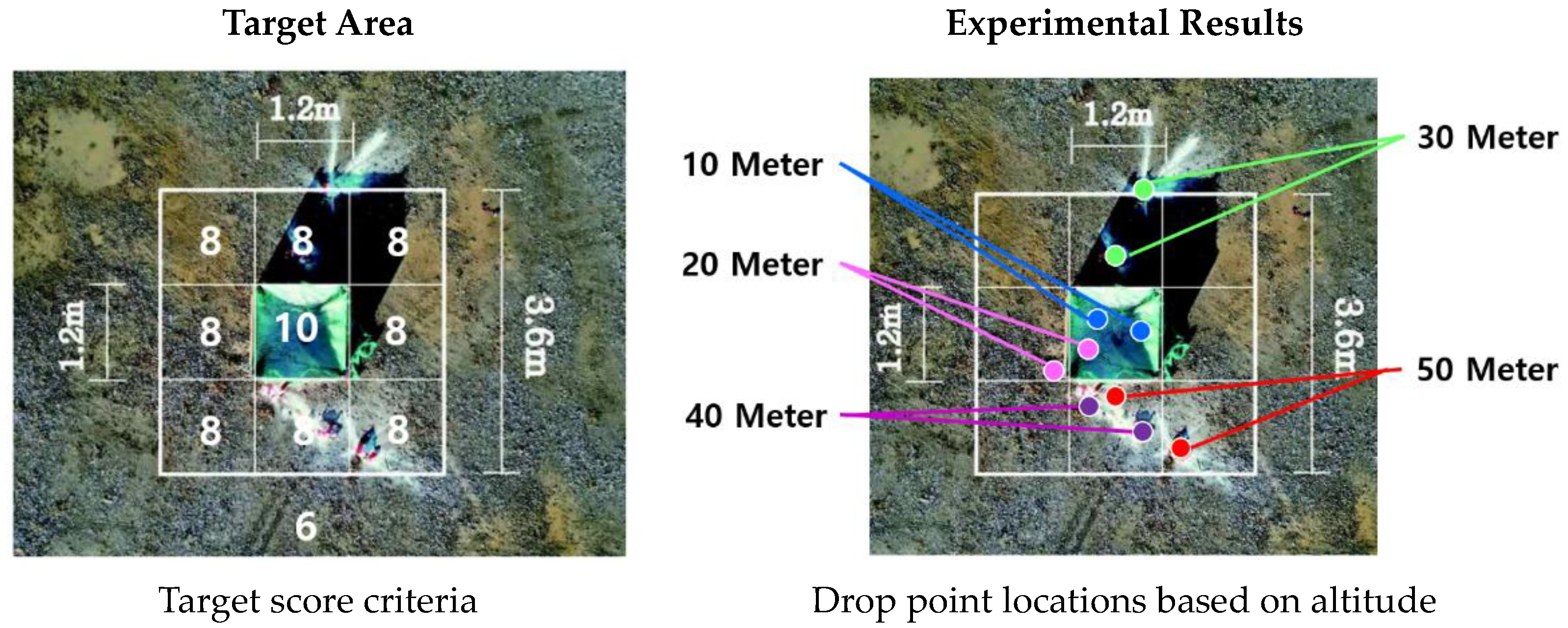
| Accuracy by Drop Altitude | High altitude (10 m) drop (1 m/s or less) | 2EA | 20 | - | 10 | High |
| High altitude (20 m) drop (1 m/s or less) | 2EA | 10 | 8 | 9 | Medium | |
| High altitude (30 m) drop (1 m/s or less) | 2EA | 8 | 6 | 7 | Low | |
| High altitude (40 m) drop (1 m/s or less) | 2EA | 8 | 8 | 8 | Low | |
| High altitude (50 m) drop (1 m/s or less) | 2EA | 8 | 8 | 8 | Low | |
| 10–50 m | 10EA | 6EA | 4EA | 8.4 | ||
| Performance Indicators | Target Value | Validation Method | Results | |
|---|---|---|---|---|
| 1 | Drop accuracy | Altitude-specific drop tests | On-site evaluation | 80% |
| 2 | Drone balance during drop | Fixed hovering | On-site evaluation | 100% |
| 3 | Operation of drop module | Six fire-extinguisher modules | Functioning | 100% |
| 4 | LTE video transmission | Real-time transmission | On-site evaluation | 100% |
| Scenario of Demonstration Experiment | |
|---|---|
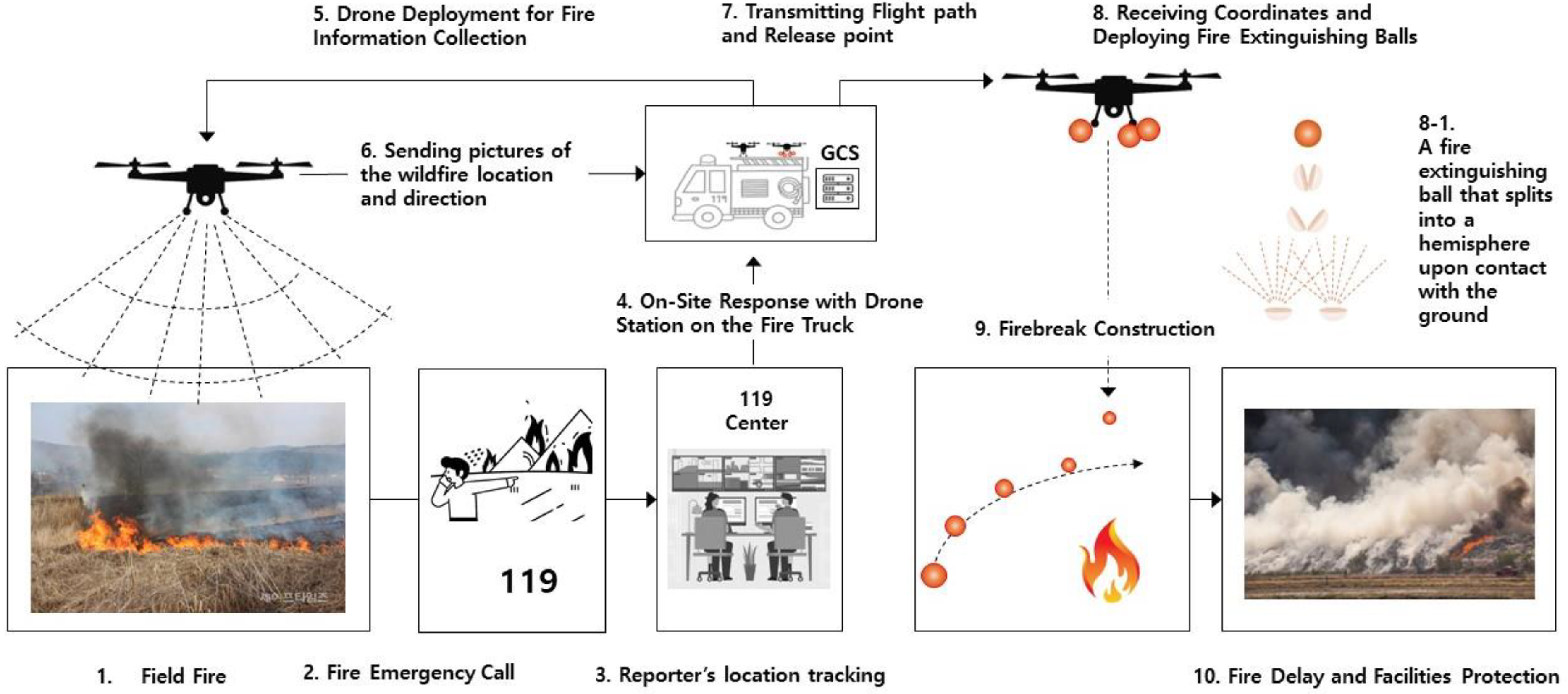
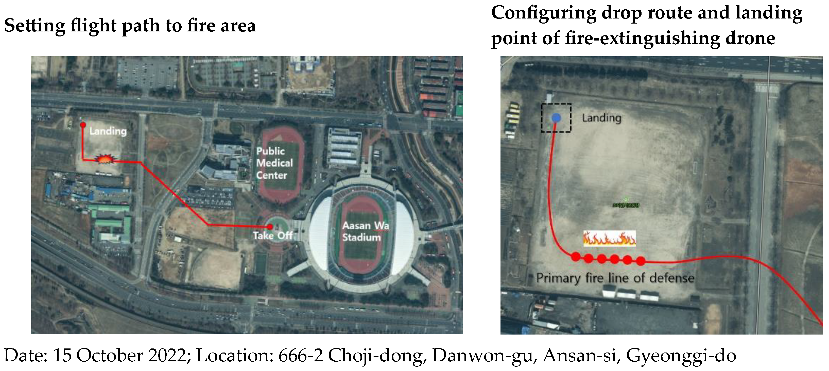
| 1 | Fire incident near Ansan-Wastadium Development Area; |
| 2 | Transmission of fire location and confirmation of drone flight path; |
| 3 | Although Ansan-Wastadium and the fire location are located along a straight line, the presence of the Central Danwon District Office in between necessitated a route change; |
| 4 | Confirmation of the risk of fire spreading to nearby residential areas, which necessitated the construction of firebreak lines; |
| 5 | Inputting drop locations of fire-extinguishing balls using GCS equipment; |
| 6 | Sequential deployment of two fire-extinguishing drones (drop-type) stationed at Ansan-Wastadium; |
| 7 | Arrival at the fire scene approximately 2 min later at a distance of 500 m; |
| 8 | Accurate route navigation and assessment of on-site conditions using the RTK equipment and camera mounted on the drone; |
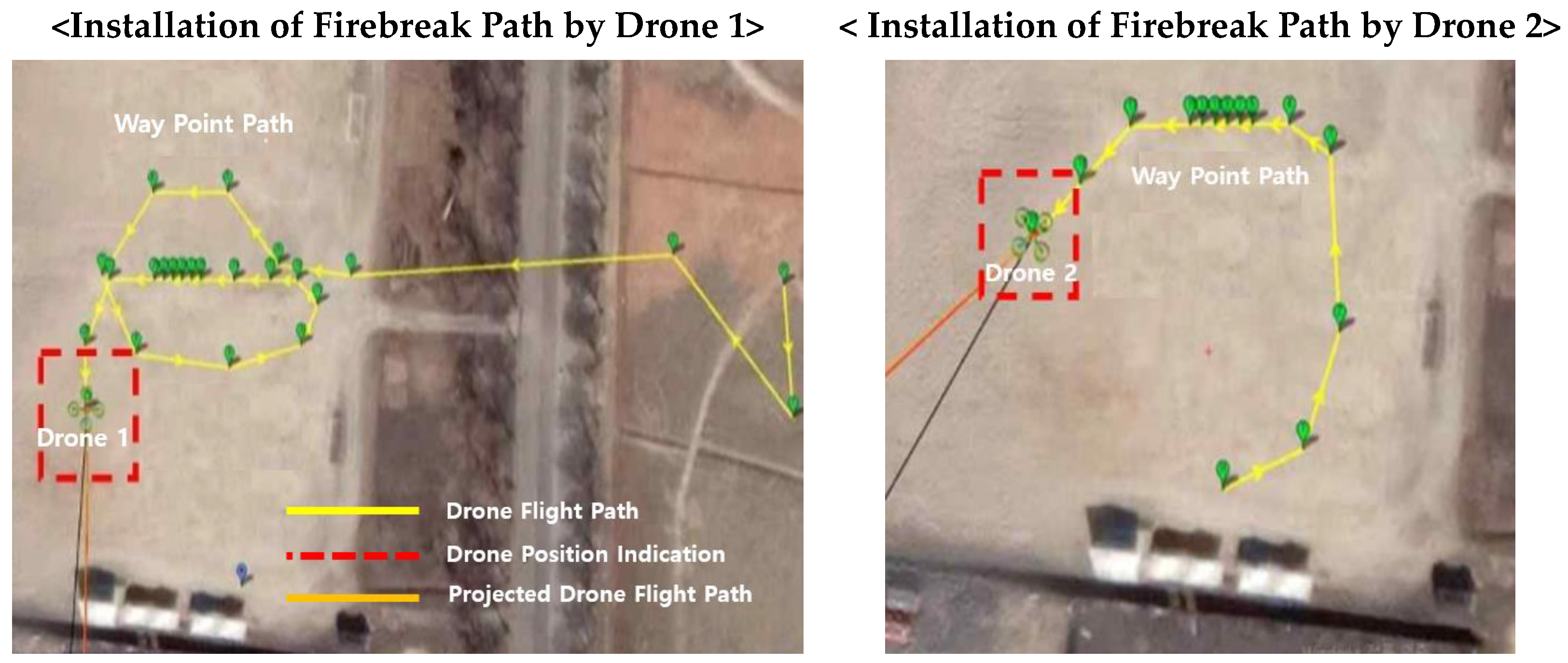
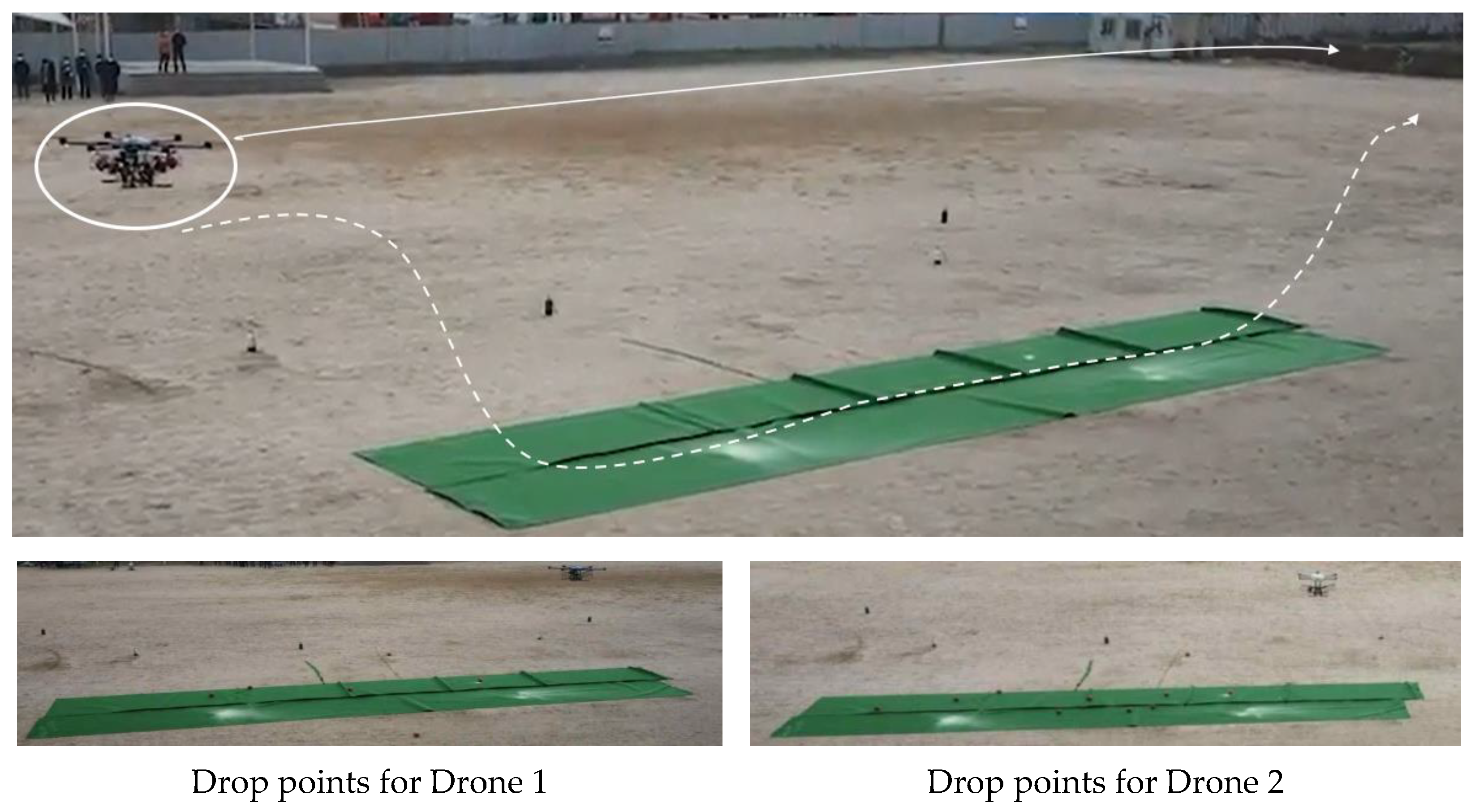
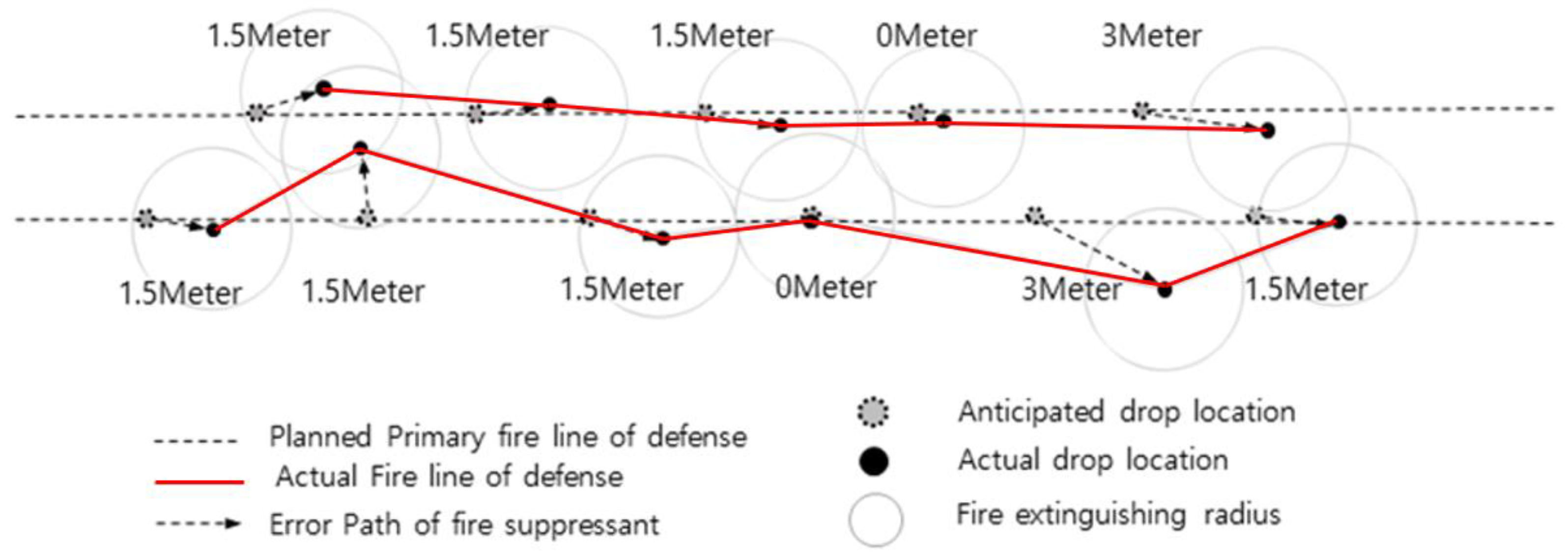
| 9 | Upon arrival at the scene, Drone 1 drops six fire-extinguishing balls to establish the first firebreak line; |
| 10 | Upon arrival at the scene, Drone 2 drops six fire-extinguishing balls to establish the second firebreak line; |
| 11 | Fire trucks and firefighters present at the scene directly extinguish the ignition point. |
| Performance Metric | Performance Result and Target | Basis for Setting Targets | Measurement Formula | |
|---|---|---|---|---|
| 1 | Flight accuracy | Accuracy in reaching the mission location | Flight accuracy with RTK-GPS | Error range within approximately 10 m |
| 2 | Firebreak construction | Construction of first and second firebreaks | Six fire-extinguishing balls per drone | 3 m × 6EA (1.3 kg) ≒ 18 m firebreak construction |
| 3 | Approach to fire suppression | Fire suppression through the first firebreak | Verification of remaining fire |
| Performance Indicators | Target | Validation Method | Results |
|---|---|---|---|
| Drop accuracy | Deployment of 12 fire-extinguishing balls along the defense lines (Drone 1: 6 balls/Drone 2: 6 balls) | On-site evaluation | 80% |
| Drone balance during deployment | Stable hovering | On-site evaluation | 100% |
| Functionality of deployment module | Activation of six fire-extinguishing balls (1st line of defense) | Operational | 100% |
| LTE video transmission | Real-time streaming | On-site evaluation | 100% |
| RTKs | Accuracy of path | On-site evaluation | 90% |
| GCS | Ground control system | On-site evaluation | 100% |
Disclaimer/Publisher’s Note: The statements, opinions and data contained in all publications are solely those of the individual author(s) and contributor(s) and not of MDPI and/or the editor(s). MDPI and/or the editor(s) disclaim responsibility for any injury to people or property resulting from any ideas, methods, instructions or products referred to in the content. |
© 2024 by the authors. Licensee MDPI, Basel, Switzerland. This article is an open access article distributed under the terms and conditions of the Creative Commons Attribution (CC BY) license (https://creativecommons.org/licenses/by/4.0/).
Share and Cite
Jin, J.; Kim, S.; Moon, J. Development of a Firefighting Drone for Constructing Fire-breaks to Suppress Nascent Low-Intensity Fires. Appl. Sci. 2024, 14, 1652. https://doi.org/10.3390/app14041652
Jin J, Kim S, Moon J. Development of a Firefighting Drone for Constructing Fire-breaks to Suppress Nascent Low-Intensity Fires. Applied Sciences. 2024; 14(4):1652. https://doi.org/10.3390/app14041652
Chicago/Turabian StyleJin, Juan, Seunghan Kim, and Jiwon Moon. 2024. "Development of a Firefighting Drone for Constructing Fire-breaks to Suppress Nascent Low-Intensity Fires" Applied Sciences 14, no. 4: 1652. https://doi.org/10.3390/app14041652
APA StyleJin, J., Kim, S., & Moon, J. (2024). Development of a Firefighting Drone for Constructing Fire-breaks to Suppress Nascent Low-Intensity Fires. Applied Sciences, 14(4), 1652. https://doi.org/10.3390/app14041652


