
Drought Damage Assessment for Crop Insurance Based on Vegetation Index by Unmanned Aerial Vehicle (UAV) Multispectral Images of Paddy Fields in Indonesia

 , ,
, ,  ,
, 
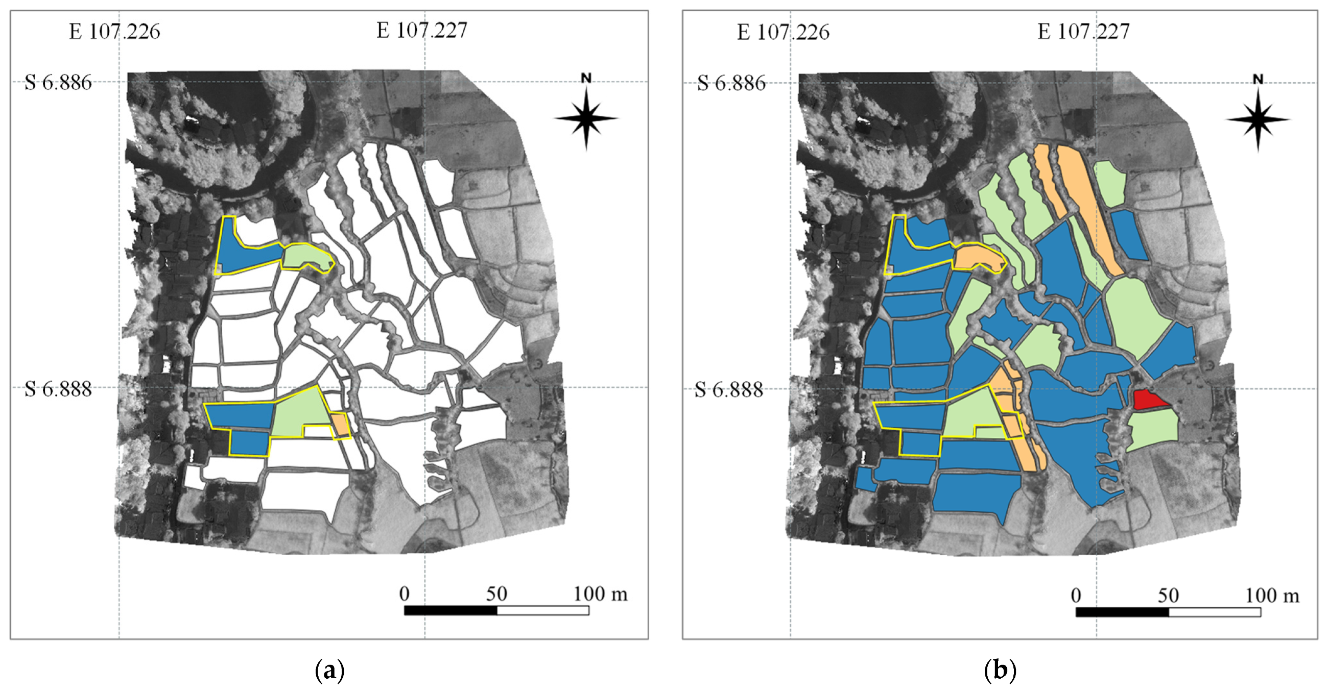
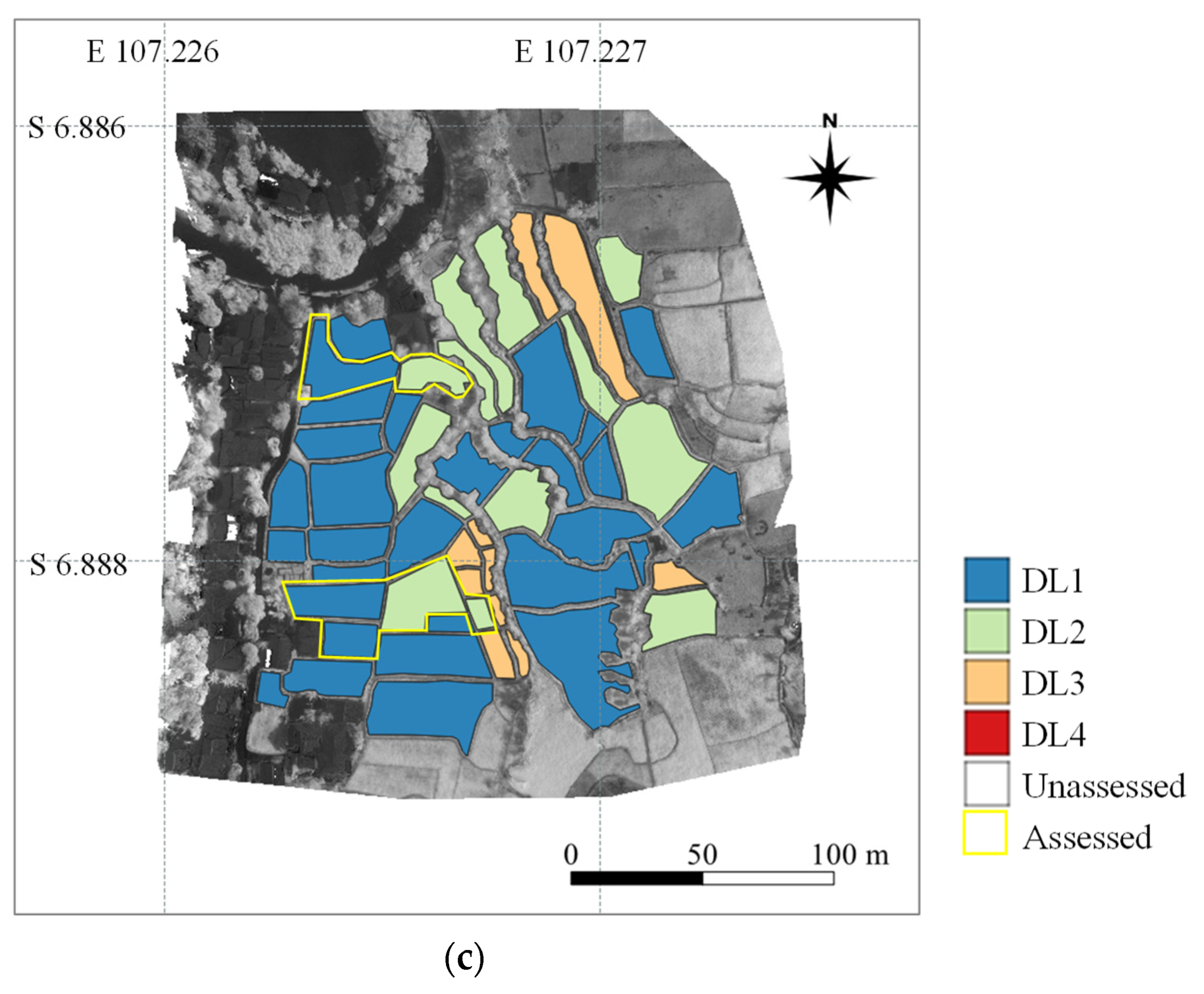
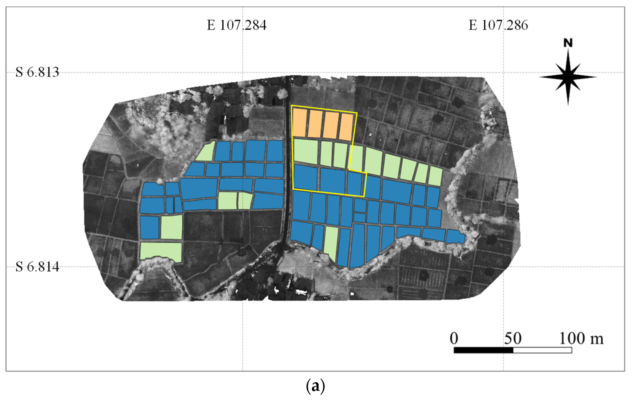
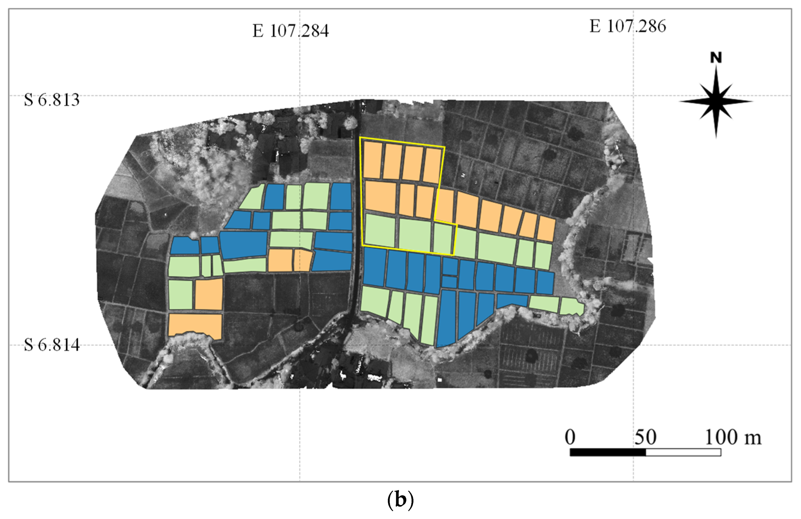
Abstract
Share and Cite
Iwahashi, Y.; Sigit, G.; Utoyo, B.; Lubis, I.; Junaedi, A.; Trisasongko, B.H.; Wijaya, I.M.A.S.; Maki, M.; Hongo, C.; Homma, K. Drought Damage Assessment for Crop Insurance Based on Vegetation Index by Unmanned Aerial Vehicle (UAV) Multispectral Images of Paddy Fields in Indonesia. Agriculture 2023, 13, 113. https://doi.org/10.3390/agriculture13010113
Iwahashi Y, Sigit G, Utoyo B, Lubis I, Junaedi A, Trisasongko BH, Wijaya IMAS, Maki M, Hongo C, Homma K. Drought Damage Assessment for Crop Insurance Based on Vegetation Index by Unmanned Aerial Vehicle (UAV) Multispectral Images of Paddy Fields in Indonesia. Agriculture. 2023; 13(1):113. https://doi.org/10.3390/agriculture13010113
Chicago/Turabian StyleIwahashi, Yu, Gunardi Sigit, Budi Utoyo, Iskandar Lubis, Ahmad Junaedi, Bambang Hendro Trisasongko, I Made Anom Sutrisna Wijaya, Masayasu Maki, Chiharu Hongo, and Koki Homma. 2023. "Drought Damage Assessment for Crop Insurance Based on Vegetation Index by Unmanned Aerial Vehicle (UAV) Multispectral Images of Paddy Fields in Indonesia" Agriculture 13, no. 1: 113. https://doi.org/10.3390/agriculture13010113
APA StyleIwahashi, Y., Sigit, G., Utoyo, B., Lubis, I., Junaedi, A., Trisasongko, B. H., Wijaya, I. M. A. S., Maki, M., Hongo, C., & Homma, K. (2023). Drought Damage Assessment for Crop Insurance Based on Vegetation Index by Unmanned Aerial Vehicle (UAV) Multispectral Images of Paddy Fields in Indonesia. Agriculture, 13(1), 113. https://doi.org/10.3390/agriculture13010113