Article

An Analysis of the 8.85- and 4.42-Year Cycles in the Gulf of Maine

1
Guangdong Provincial Key Laboratory of Marine Disaster Prediction and Protection, Institute of Marine Sciences, Shantou University, Shantou 515063, China
2
Southern Marine Science and Engineering Guangdong Laboratory, Guangzhou 511458, China
3
Equipment Public Service Center, South China Sea Institute of Oceanology, Chinese Academy of Sciences, Guangzhou 510301, China
*
Author to whom correspondence should be addressed.
J. Mar. Sci. Eng. 2021, 9(12), 1362; https://doi.org/10.3390/jmse9121362
Submission received: 15 October 2021 / Revised: 15 November 2021 / Accepted: 16 November 2021 / Published: 2 December 2021
(This article belongs to the Section Physical Oceanography)

Abstract

:
In the background of global warming and climate change, nuisance flooding is only caused by astronomical tides, which could be modulated by the nodal cycle. Therefore, much attention should be paid to the variation in the amplitude of the nodal cycle. In this paper, we utilize the enhanced harmonic analysis method and the independent point scheme to obtain the time-dependent amplitudes of the 8.85-year cycle of N2 tide and the 4.42-year cycle of 2N2 tide based on water level records of four tide gauges in the Gulf of Maine. Results indicate that the long-term trends of N2 and 2N2 tides vary spatially, which may be affected by the sea-level rise, coastal defenses, and other possible climate-related mechanisms. The comparison between Halifax and Eastport reveals that the topography greatly influences the amplitudes of those cycles. Moreover, a quasi 20-year oscillation is obvious in the 8.85-year cycle of N2 tide. This oscillation probably relates to a 20-year mode in the North Atlantic Ocean.

1. Introduction

The number of extreme sea-level events is expected to grow due to the influence of global warming and climate change. This poses a more damaging threat to coastal areas, especially for the low elevation coastal zones, where up to 310 million people reside [1] and are accompanied by many infrastructures. If adaptation measures are not implemented, 0.2% of the global population and 0.3% of the global domestic product are going to be flooded and lost annually in 2100 at the least [2]. An extreme sea-level indicator for the contiguous United States coastline has been recommended, which is comprised of separate indicators for mean sea level and storm surge climatology [3].
Extreme sea-level events are considered as a compounding effect of three factors: mean sea level (MSL), storm surge, and astronomical tides, if the effect of surface gravity wave is ignored [4]. Much focus has been paid to the change of MSL, and it is noted that MSLs have been rising during the 20th century [5] with multi-decadal fluctuations [6]. Recently, Frederikse et al. [7] reached an agreement between the rise of global mean sea level in the 20th century and its underlying causes, and offered a great explanation to the multidecadal variability of global MSL during the 1940s and 1970s. Storm surges are induced by tropical cyclones or winter storms in coastal zones, which are the direct response to wind stress and perturbation of atmospheric pressures on the sea surface [8]. What should be noted is that storm surges are often modulated through the nonlinear interaction between astronomical tides [9,10]. Astronomical tides are the rise and fall of sea levels influenced by the mutual position of the Moon, the Sun, and the rotating Earth, which are recurring and could be predicted by the equilibrium theory of tide [11]. Eliot [12] reported that tidal nodal modulations are a significant and regular factor for the high water level. Moreover, about 4.4 years’ periodicity was found in most time series of tidal extremes [13]. Therefore, the modulations on tidal levels by the nodal cycle could not be ignored.
Based on long-term hourly tide gauge observations distributed worldwide, Peng et al. [11] found that the variability in high water levels due to the 18.61-year nodal cycle could reach up to 30 cm in range in some locations, which is larger than the global mean sea-level rise in the next decades [14]. In reality, tidal levels are modulated by not only the 18.61-year cycle but also the 8.85-year cycle and 4.42-year cycle. The 18.61-year cycle, which is produced by the ascending lunar node, is called the lunar nodal cycle [11]. The lunar node is the intersection of the Moon’s orbital plane with the ecliptic and regresses backward along the ecliptic over 18.61 years. It has been noted that the 18.61-year cycle should be included for estimating regional sea level [15]. The period of 8.85 years is the variability cycle of the Moon’s perigee, which changes the time of the perigean spring tide. For the N2 tide in the Caribbean Sea, the modulation amplitude by the 8.85-year cycle is larger than that by the 18.61-year cycle [16]. Under the influence of lunar perigee, high tidal levels produce a quasi 4.42-year cycle, too [17], which mainly affects locations with semidiurnal tidal dominance [12].
The Gulf of Maine and the Bay of Fundy are renowned, because of the large tidal range all over the world. Many major cities are situated surrounding this region, such as Boston, Portland, Saint John, and so on. Additionally, some nuclear power stations are built there, e.g., the Seabrook Station Nuclear Power Plant and the Point Lepreau Nuclear Generating Station. These major cities and hazardous infrastructures desire a more meticulous extreme sea-level risk assessment [18]. Moreover, the complex geography brings about one of the world’s most dynamic environments [19] and the striking tidal resonance [20]. Previous research in the Gulf of Maine has pointed out that the high water is probably rising approximately 0.3 m over the next century in the absence of global warming [21] and the flooding caused only by high astronomical tides will be continual at Boston [22]. Therefore, the nodal modulation on tidal levels in the Gulf of Maine and the Bay of Fundy should be paid more attention to.
Traditionally, the amplitudes and phases of 18.61-, 8.85-, and 4.42-year cycles are treated as constants [23,24]. However, it has been proved that the traditional assumption may be invalid in some individual cases [25]. Therefore, it is necessary to analyze long-term water levels based on the varying amplitudes and phases of these cycles.
The 18.61-year nodal cycle has been reported in prior studies [17,26,27]. However, little is known about the 8.85- and 4.42-year cycles. In this study, we focus on the spatial and temporal changes of the 8.85-year cycle of N2 tide and the 4.42-year cycle of 2N2 tide in the Gulf of Maine and the Bay of Fundy and try to explain the long-term trend of tidal components and a quasi 20-year oscillation in the variation of the amplitude of these cycles. The remainder of this paper is organized as follows. Section 2 introduces the methodology and data. The 8.85- and 4.42-year cycles are presented in Section 3. Finally, the discussion and conclusion follow in Section 4 and Section 5, respectively.

2. Data and Methodology

2.1. Data

Hourly water level records were provided by the University of Hawaii Sea Level Center Four tide gauges could be found in the study area from the center, Boston, Portland, Eastport, and Halifax. Three gauges are located in the Gulf of Maine, and Halifax is located on the east side of the Nova Scotia Peninsula. Their locations are shown in Figure 1. Halifax was selected for examining the effect of topography on those cycles. The hourly raw data were processed preliminarily for the missing data at the beginning and end of the timespan, and the timespan was modified as listed in Table 1. The gaps in the middle of the timespan of the records were replaced by NaN. Then, these four water level records were divided into yearly windows, and the independent tidal analysis was performed by the T_TIDE for each window [28]. In this process, the calculated amplitude was set to NaN if the missing data exceeded 25% in one year. The total numbers of abandoned months at the four stations are listed in Table 1. Ignoring the long-period and shallow water constituents, 7 main tidal constituents (M2, S2, K1, O1, N2, P1, 2N2) were achieved by the T_TIDE. The average amplitudes of the main tidal constituents for the timespan at the four tide gauges are listed in Table 2. It can be found that the M2, N2, and S2 tides are the three major constituents in the Gulf of Maine. Amplitudes at Eastport are larger than the other three gauges for any main tidal constituent. Eastport and Halifax are located at similar latitudes, but they show a remarkable difference in the amplitude of the tidal constituents. This shows the effect of the semi-enclosed topography on the tide, and the amplitudes of M2, N2, and 2N2 tides increase by 4 times from Halifax to Eastport. In this work, the spatial and temporal variations in N2 and 2N2 tidal amplitudes were analyzed.

2.2. Methodology

Eliot pointed out that conventional harmonic and extreme analysis always obscures 18.61-, 8.85-, and 4.42-year cycles, and dedicated techniques are required for their identification [12]. Therefore, the enhanced harmonic analysis (EHA) method is applied in this paper for analyzing the water level time series of N2 and 2N2 tides. This method is proposed and used to investigate the temporal variations in internal tides in the South China Sea [29]. Then, it was conducted by the S_TIDE MATLAB toolbox [30], which is developed from the well-known T_TIDE. Besides, this method was also used to explore the tidal–fluvial interaction in the Columbia River Estuary [30] and the 18.61-year cycle of M2 tide in the Gulf of Maine [27]. Here, we applied it to analyze the variations in the 8.85- and the 4.42-year cycles in the Gulf of Maine and the Bay of Fundy.
Traditionally, the cycle with the fixed period is estimated by a least-squares method [23], and the equation can be expressed as:
P ( t ) = A 0 + A 1 t + a × cos ( 2 π c 0 t ) + b × sin ( 2 π c 0 t ) ,
where P(t) is the estimated value of the tidal amplitude or phase at the time t (unit: year), and A0 and A1 are a constant and the linear trend, respectively. a and b are the amplitudes of the cosine and sine functions of the cycle. c 0 represents the period of the cycle in years. Subsequently, the amplitude (H) and phase (G) of the cycle can be obtained as:
H = a 2 + b 2 ,
G = arctan ( b / a ) .
However, it is assumed that the amplitude (H) and phase (G) are time-varying and can be estimated by the EHA. Therefore, Equation (1) is modified for the N2 tide as:
P = A 0 + A 1 t + a 18.61 ( t ) × cos ( 2 π 18.61 t ) + b 18.61 ( t ) × sin ( 2 π 18.61 t ) + a 8.85 ( t ) × cos ( 2 π 8.85 t ) + b 8.85 ( t ) × sin ( 2 π 8.85 t ) .
Similarly, the equation for the 2N2 tide is:
P = A 0 + A 1 t + a 8.85 ( t ) × cos ( 2 π 8.85 t ) + b 8.85 ( t ) × sin ( 2 π 8.85 t ) + a 4.42 ( t ) × cos ( 2 π 4.42 t ) + b 4.42 ( t ) × sin ( 2 π 4.42 t ) .
The a c 0 ( t ) and b c 0 ( t ) ( c 0 = 18.61, 8.85, and 4.42, respectively) can be obtained by:
a c 0 ( t ) = i = 1 m w c 0 , t , i × a c 0 , i ,
b c 0 ( t ) = i = 1 m w c 0 , t , i × b c 0 , i ,
where a c 0 , i and b c 0 , i are values at the i -th independent point for the c 0 cycle, m is the number of the independent points (IPs), and w c 0 , t , i is the weighted coefficient for the i -th independent point at the time t for the c 0 cycle. Values of a c 0 and b c 0 at other points can be obtained by interpolation between the IPs. Equations (6) and (7) represent the independent point scheme, which has been examined successfully in many previous works [27,31,32].
Equations (2) and (3) are modified as:
H c 0 ( t ) = a c 0 ( t ) 2 + b c 0 ( t ) 2 ,
G c 0 ( t ) = arctan ( b c 0 ( t ) / a c 0 ( t ) ) .
To guarantee stabilization, convergence, and smoothness in the interpolation process, the cubic spline interpolation is implemented in this work [30,31]. The calculation method of the weighted coefficient refers to Equations (20) and (21) in Zong et al. [32].
Finally, A0, A1, a c 0 ( t ) , and b c 0 ( t ) can be obtained from many years’ observations. The detailed matrix form of the solution refers to Equations (6)–(8) in Pan et al. [27].

3. Results

3.1. Determine the Numbers of IPs

Different IP numbers represent oscillations at different time scales in the EHA method [30]. If the number of IPs is set equal to 1, the oscillation is a constant. If it is set equal to 0, the oscillation represents the long-term trend of the data. Moreover, the long-term trend consists of linear and nonlinear trends, which are decided by a parameter in the S_TIDE MATLAB toolbox. When the number of IPs is equal to 0, the result is the linear trend of data if the parameter is equal to 2. Additionally, if the parameter is equal to 3, the oscillation represents the nonlinear trend. It can be found that the S_TIDE is a powerful tool to analyze time-series data. Furthermore, it should be realized that the number of IPs plays a vital role in the results of the EHA. Either fewer or more IPs will affect the outcome of the EHA method. Small IPs will introduce large root-mean-square error (RMSE) and large IPs will cause the overfitting and fictitious conclusion. As a result, a primary and vital procedure is to develop a reasonable evaluation criterion on the number of IPs.
In this paper, three parameters are used to determine the number of IPs. The first is the RMSE between the hindcasts obtained by the EHA and the primary data. It can be expressed as follows:
R M S E = i = 1 N ( P i P i ) 2 / N ,
where P i represents the estimated value of the tidal amplitude or phase by the EHA and P i represents the real tidal amplitude or phase. N is the length of P i .
The second is the 95% confidence interval. The shorter confidence interval can give rise to a higher accuracy result based on the same confidence level. Therefore, the length of the 95% confidence interval can lead to a restriction for the result of EHA.
The third is the signal-to-noise ratio (SNR). It can be calculated as follows:
S N R = i = 1 N H N / i = 1 N H int N ,
where H represents the time-varying amplitude H(t), and H int represents the 95% confidence interval for H(t). It is credible when the SNR is greater than 2 [33].
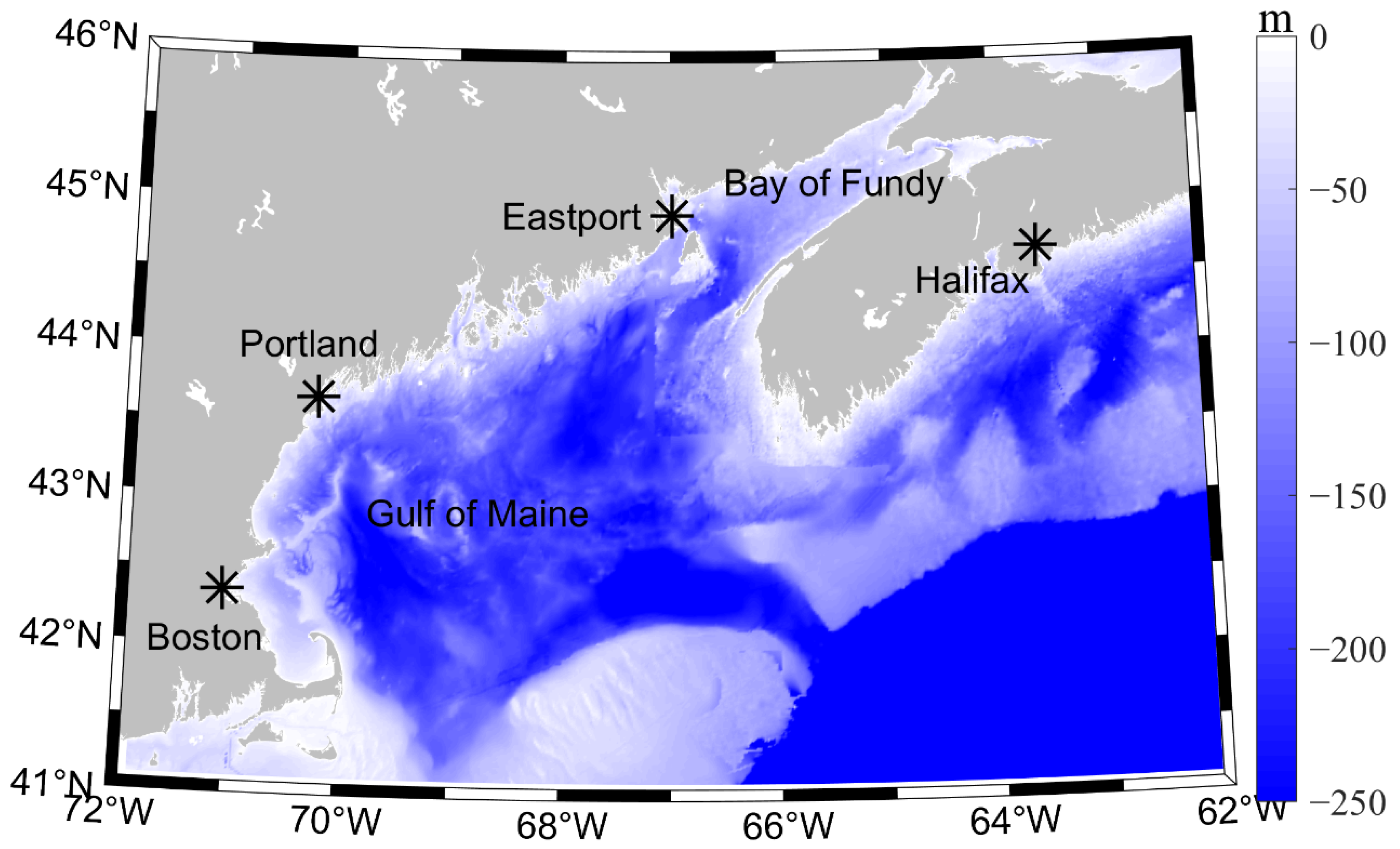
A series of sensitivity experiments are implemented to select the optimum number of IPs. The N2 tide is affected by 18.61- and 8.85-year cycles while 2N2 tides are mainly influenced by 8.85- and 4.42-year cycles. These two tides can be analyzed for these two cycles by the EHA method simultaneously. Then, the process of determining the numbers of IPs can be revealed distinctly by following analysis taking the 8.85-year cycle of N2 tide at Boston as an example.
Table 3 and Table 4 display the SNR and RMSE for the 8.85-year cycle of N2 tide at Boston, respectively. The IP1 and IP2 represent the numbers of IPs for the 18.61- and the 8.85-year cycle of N2 tide, respectively. The numbers of IP1 and IP2 are greater than 1 because the amplitudes of those cycles (18.61 and 8.85) change with time. In other words, the amplitudes are constant in the case of IPs equal to 1, which turns into the traditional method (Equation (1)) and are not the objective of this paper (Equation (4)). However, it is noteworthy that the number of IPs is set equal to 1 for the 8.85-year cycle when the EHA method is used to analyze the 2N2 tide because the major influence is introduced by the 4.42-year cycle.
The values of SNR and RMSE both reduce gradually with the increase of IP2 when the number of IP1 is fixed. The traditional standard that the SNR is greater than 2 is deemed to be credible. However, a more stringent criterion is applied in this paper: the last number of IP2 can keep the reduced tendency of SNR and the corresponding SNR value must be greater than 2.
According to the above stringent criterion, the applicable numbers of IP1 and IP2 are selected in Table 3 (bold). They are unique for the number of IP1 equal to 2, 4, 5, 7, and 8, respectively. However, there are two applicable choices for IP2 when IP1 = 3 and IP1 = 6, respectively. We may apply the 2nd criterion in determining the number of IPs, which is the length of the 95% confidence interval. Taking IP1 = 3 as an example, the corresponding values of RMSE and the length of the 95% confidence interval in the case of IP2 equal to 10 and 16 are listed in Table 5. Taking IP2 = 2 as a reference, it shows that the RMSE reduces by 4.8%, and the length increases by 84.6% when IP2 raises from 2 to 10. The RMSE reduces by 22.6%, and the length increases by 506.7% when IP2 raises from 2 to 16. Thus, 10 is the best choice for IP2 when IP1 = 3. According to the above method, 9 is the best choice for IP2 when IP1 = 6. The IP2 could be determined when IP1 ranges from 2 to 8 by the same method. Then, all the RMSE values listed in Table 4 are compared to each other, and 4 and 16 are the best-fit numbers for IP1 and IP2, respectively.
All the most suitable numbers for IPs in analyzing 8.85-year cycles of N2 tide and 4.42-year cycles of 2N2 tide at 4 stations are listed in Table 6. Meanwhile, the comparisons between the observational and hindcast amplitudes by the EHA methods of the N2 and 2N2 tide at four stations are exhibited in Figure 2 and Figure 3, respectively. These hindcasts are obtained with the best-fit numbers of IPs listed in Table 6. Their amplitudes agree well with the observations except for extreme values, which may be caused by weather factors and tidal resonance. The errors between hindcasts and observations are small and reasonable. However, hindcasts at Halifax (Figure 3d) show a large difference with observations. This phenomenon implies that the number of IP3 = 1 in analyzing the 2N2 tide is inapplicable at Halifax. In other words, the amplitude of the 8.85-year cycle is not a constant and its variation affects the water level remarkably at Halifax. Taking the numbers of IP3 for the 8.85-year cycle and IP4 for the 4.42-year cycle to be equal to 8 and 35, respectively, the results would improve remarkably (Figure 4 vs. Figure 3d). It is noted that the long-term trend shown in Figure 5 is not affected by the number of IPs. The numbers of IP3 and IP4 listed in Table 6 at Halifax are applied in Figure 6b and Figure 7b to keep the consistency of the method.

3.2. Long-Term Trend of N2 and 2N2 Tidal Amplitudes

As Ray and Foster [22] pointed out, the nuisance flooding, which is only triggered by high spring tides, has become more frequent since 2011 at Boston. Consequently, much attention should be paid to secular variation in water levels, as well as the long-term trend of tidal components. Figure 5 displays the long-term nonlinear trends of the N2 (blue dash line) and 2N2 (red solid line) tidal amplitudes at Boston, Eastport, Portland, and Halifax, respectively. As indicated in Section 3.1, the number of IPs is set equal to 0 and the parameter is equal to 3 to obtain the long-term nonlinear trend of N2 and 2N2 tidal amplitudes by the S_TIDE.
The N2 and 2N2 tidal amplitudes kept growing for almost one century at Boston; however, the trends of these two tides have reversed since the 1980s at Halifax. The trends are more complex at Eastport and Portland. The N2 tidal amplitude increases in the exponential profile at Eastport, while the amplitude of 2N2 tide started to decrease from the 1980s. At Portland, the trend of the N2 tidal amplitude keeps growing all the time, and the 2N2 tidal amplitude increased until it reached a constant value in the 1980s.
In summary, for the four stations, the N2 tidal amplitudes have increased in almost one century except for Halifax and the 2N2 tidal amplitudes have decreased in the recent 30 or 40 years except for Boston. These two tides’ amplitudes kept growing for one century only at Boston. This may account partially for the event that the nuisance flooding has become frequent at Boston by Ray and Foster [22].

3.3. The 8.85- and 4.42-Year Cycles

The changing amplitudes of the 8.85-year cycle of N2 tide and the 4.42-year cycle of 2N2 tide are displayed in Figure 6 for the four stations of Boston, Eastport, Portland, and Halifax. The variations in the amplitudes of the 8.85- and 4.42-year cycles are the largest at Eastport among the four stations, and the least at Halifax. As mentioned in Section 2.1, the water level record at Halifax is selected for contrasting the influence of topography on the 8.85- and 4.42-year cycles. Halifax and Eastport are located at an approximate latitude and the most striking difference is the topography, and these two cycles at these two stations are compared in Figure 7. An obvious same phase can be seen in the 8.85-year cycle at Eastport and Halifax from the middle 1930s to nowadays, and this phenomenon appears in the 4.42-year cycle from the middle 1930s to the middle 1980s. It is demonstrated that the topography does not affect the phase of these cycles. However, the amplitudes of these cycles are greatly influenced by the topography and resonance.
The amplitude of the 8.85-year cycle has an approximately 20-year periodic oscillation at Eastport and Halifax with a consistent phase (Figure 6a). The 20-year oscillation appears at Boston too, but it lags that at Eastport and Halifax. At Portland, the 20-year oscillation has emerged since the 1950s, and the phase was in step with those at Eastport and Halifax between the 1990s and the 2010s. The variation in the 4.42-year cycle amplitude of 2N2 tide is more complex than that in the 8.85-year cycle of N2 tide. The phenomenon of 20-year oscillation also appeared from the 1940s to the 2010s at Eastport (Figure 6b). From the early 1950s to the 1970s, there was a 10-year oscillation at Boston. Then, the phase adjusted to 20 years. At Portland, there was no obvious oscillation until the 1970s. Afterwards, the phases kept in step with that at Eastport and Boston. At Halifax, the quasi 20-year oscillation also appeared from the 1940s to the 1980s, which kept in step with that at Eastport.
The 95% confidence intervals for the 8.85-and 4.42-year cycles are presented in Figure 8. The confidence intervals are relatively large at the beginning and end of the time series for both cycles, of which the 8.85-year cycle is larger than those of the 4.42-year cycle. Nevertheless, they are all reasonable and demonstrate the validness of variations in the amplitude by the EHA method.

4. Discussion

Spatial and temporal variations are obvious among the four stations for the amplitudes and phases of 8.85- and 4.42-year cycles. Eastport kept in step with Halifax in the phase, but the modulation range is significantly different. A similar situation emerged along the Western Australian coast [12]. The lunar nodal cycle and the lunar perigean subharmonic occupy different areas. Haigh et al. [17] indicated that the main tidal constituents and tidal characteristics influence the spatial variations in the range and phase of the tidal modulations. The phase at Eastport agrees well with that at Halifax, and it may be proposed that the high water levels are in phase at these two tide gauges [17].
In addition, two key points are easily found in Figure 5. Firstly, different tidal constituents have different long-term nonlinear trends. Although the variations in the trends of the N2 and 2N2 tidal amplitudes are the same at Boston and Halifax, their change rates are different. Moreover, the trends are obviously different for the N2 and 2N2 tidal amplitudes at Eastport and Portland. Secondly, the nonlinear trend is localized and spatially varied. Taking the trend of N2 as an example, the monotonously increasing trend can only be found at Boston. The trends increased before the 1980s and decreased thereafter at Eastport, Portland, and Halifax, but the changing rates were different. A similar situation occurred for 2N2 tide.
Why did this phenomenon appear? Was there any change in 100 years at these four stations? The most obvious changes are the sea-level rise (SLR) and coastal defense. Figure 9 shows the long-term linear trend (the IPs is equal to 0 and the parameter is equal to 2) of the total sea levels at the four stations, and they increased evidently. Some papers have noticed the effect of SLR on the tide, and the localized responses have been explored on the European shelf [34,35,36]. Besides, the coastal defense could exacerbate the increases in the tidal range induced by the SLR, and flooding over land induces damping of the tidal amplitude [37,38,39]. In addition to local change induced by the SLR and coastal defense, Jay [40] proposed two climate-related mechanisms: variations in stratification and mean vorticity of the upper ocean induced by large-scale changes in wind-driven circulation. The reanalysis model data are useful to verify the proposed mechanisms, such as temperature, salinity, sea surface height, and horizontal flow velocity.
Figure 6 shows the amplitude variation in the 8.85-year cycle of N2 tide and the 4.42-year cycle of 2N2 tide. A quasi 20-year periodic oscillation in the 8.85-year cycle amplitude of N2 tide was obvious from 1942 to 2010 at Eastport and Halifax. They also kept the same step. The oscillation appeared at Boston from 1937 to 2000 and Portland from 1952 to 2010 with different phases. For the 4.42-year cycle, the oscillation existed at Eastport from the 1940s to the 2010s. Additionally, it also existed from the 1970s to the 2010s at Boston and Portland.
The reasons for this oscillation are proposed as follows. A 20- to 30-year timescale oscillation was reported in the North Atlantic by analyzing observational and model datasets, and it is triggered by the westward propagation of subsurface temperature anomalies [41]. Afterwards, a 20-year mode coupled ocean–sea ice–atmosphere variability in the North Atlantic was proposed by Escudier et al. [42]. This mode is driven by the west-propagation of the near-surface temperature and salinity anomalies, which leads to anomalous sea ice melting. Then, the anomalous surface atmospheric temperature forces sea-level pressure anomalies. It is hard to verify the relationship between the amplitude oscillation of the 8.85-year cycle of N2 tide and the 4.42-year cycle of 2N2 tide and the 20-year mode [42]. However, the western North Atlantic Ocean is a complex land–ocean–atmosphere system [43], and any variation that appeared at one place may interact with and propagate to other places in the coupled system.

5. Conclusions

This paper focused on the 8.85-year cycle of N2 tide and the 4.42-year cycle of 2N2 tide surrounding the Bay of Fundy and the Gulf of Maine at four stations: Boston, Portland, Eastport, and Halifax. To obtain the temporal variation in the amplitudes of the cycles, the enhanced harmonic analysis method and the independent point scheme were implemented. The method and scheme were effective as the hindcast results compared well with primary data. Enhanced harmonic analysis results showed that the long-term trends of N2 and 2N2 tidal amplitudes both increased at Boston, while they increased before the 1980s and decreased thereafter at Halifax. At Eastport and Portland, they increased at different rates before the 1980s but divided thereafter. The long-term trends of the tidal amplitudes at the four stations were probably triggered by the SLR, coastal defense, and other possible climate-related mechanisms. Moreover, the amplitude variations in the 8.85-year cycle of N2 tide and the 4.42-year cycle of 2N2 were extracted by the EHA method, and they varied spatially. The comparison at Eastport and Halifax revealed that the topography influences the amplitudes rather than the phase of these cycles. A quasi 20-year oscillation existed in the amplitude variations of the two cycles. For the 8.85-year cycle, the oscillation was remarkable at the four stations but with different amplitudes. For the 4.42-year cycle, the oscillation appeared throughout the century at Eastport and from the 1970s to the 2010s at Boston and Portland. It was also observed from the 1940s to the 1980s at Halifax. The quasi 20-year oscillation may be associated with the 20-year mode in the North Atlantic Ocean [43]. More measurements are needed to verify this hypothesis.

Author Contributions

For this research article, the specification of individual contributions of the authors is as follows: conceptualization, X.Z.; methodology, X.Z.; investigation, X.Z. and R.Z.; writing-original draft, X.Z. and R.Z.; writing—review and editing, X.Z. and Z.C.; visualization, X.Z. and F.D.; supervision, S.Z. and W.Z.; funding acquisition, S.Z. and Z.C. All authors have read and agreed to the published version of the manuscript.

Funding

This research was funded by the Natural Science Foundation of China (Grants 41706001, 41906144, and 41876005), the STU Scientific Research Foundation for Talents (Grants NTF 19002, NTF18010, and NTF19004), the Key Special Project for Introduced Talents Team of Southern Marine Science and Engineering Guangdong Laboratory (Guangzhou) (Grant GML2019ZD0606), and the Innovation and Entrepreneurship Project of Shantou (Grant 201112176541391).

Institutional Review Board Statement

Not applicable.

Informed Consent Statement

Not applicable.

Data Availability Statement

Not applicable.

Acknowledgments

Authors thank two anonymous reviewers for their valuable comments, and thank Haidong Pan for suggestions, and for providing the S_TIDE MATLAB toolbox. This study is supported by the Natural Science Foundation of China (Grants 41706001, 41906144, and 41876005), the STU Scientific Research Foundation for Talents (Grants NTF 19002, NTF18010, and NTF19004), the Key Special Project for Introduced Talents Team of Southern Marine Science and Engineering Guangdong Laboratory (Guangzhou) (Grant GML2019ZD0606), and the Innovation and Entrepreneurship Project of Shantou (Grant 201112176541391).

Conflicts of Interest

The authors declare no conflict of interest.

References

  1. Wahl, T.; Haigh, I.D.; Nicholls, R.J.; Arns, A.; Dangendorf, S.; Hinkel, J.; Slangen, A.B.A. Understanding Extreme Sea Levels for Broad-Scale Coastal Impact and Adaptation Analysis. Nat. Commun. 2017, 8, 16075. [Google Scholar] [CrossRef]
  2. Hinkel, J.; Lincke, D.; Vafeidis, A.T.; Perrette, M.; Nicholls, R.J.; Tol, R.S.J.; Marzeion, B.; Fettweis, X.; Ionescu, C.; Levermann, A. Coastal Flood Damage and Adaptation Costs under 21st Century Sea-Level Rise. Proc. Natl. Acad. Sci. USA 2014, 111, 3292–3297. [Google Scholar] [CrossRef] [Green Version]
  3. Rashid, M.M.; Wahl, T.; Chambers, D.P.; Calafat, F.M.; Sweet, W.V. An extreme sea level indicator for the contiguous United States coastline. Sci. Data 2019, 326, 326. [Google Scholar] [CrossRef] [PubMed] [Green Version]
  4. Weisse, R.; von Storch, H.; Niemeyer, H.D.; Knaack, H. Changing North Sea Storm Surge Climate: An Increasing Hazard? Ocean Coast. Manag. 2012, 68, 58–68. [Google Scholar] [CrossRef]
  5. Hay, C.C.; Morrow, E.; Kopp, R.E.; Mitrovica, J.X. Probabilistic Reanalysis of Twentieth-Century Sea-Level Rise. Nature 2015, 517, 481–484, Erratum in 2017, 552, 278. [Google Scholar] [CrossRef] [PubMed]
  6. Chambers, D.P.; Merrifield, M.A.; Nerem, R.S. Is There a 60-Year Oscillation in Global Mean Sea Level? Geophys. Res. Lett. 2012, 39. [Google Scholar] [CrossRef] [Green Version]
  7. Frederikse, T.; Landerer, F.; Caron, L.; Adhikari, S.; Parkes, D.; Humphrey, V.W.; Dangendorf, S.; Hogarth, P.; Zanna, L.; Cheng, L.; et al. The Causes of Sea-Level Rise since 1900. Nature 2020, 584, 393–397. [Google Scholar] [CrossRef]
  8. Zhang, H.; Sheng, J. Examination of Extreme Sea Levels Due to Storm Surges and Tides over the Northwest Pacific Ocean. Cont. Shelf Res. 2015, 93, 81–97. [Google Scholar] [CrossRef]
  9. Park, Y.H.; Suh, K.D. Variations of Storm Surge Caused by Shallow Water Depths and Extreme Tidal Ranges. Ocean Eng. 2012, 55, 44–51. [Google Scholar] [CrossRef]
  10. Feng, X.; Tsimplis, M.N. Sea Level Extremes at the Coasts of China. J. Geophys. Res. Oceans 2014, 119, 1593–1608. [Google Scholar] [CrossRef] [Green Version]
  11. Peng, D.; Hill, E.M.; Meltzner, A.J.; Switzer, A.D. Tide Gauge Records Show That the 18.61-Year Nodal Tidal Cycle Can Change High Water Levels by up to 30 cm. J. Geophys. Res. Oceans 2019, 124, 736–749. [Google Scholar] [CrossRef] [Green Version]
  12. Eliot, M. Influence of interannual tidal modulation on coastal flooding along the Western Australian coast. J. Geophys. Res. Oceans 2010, 115, 1–11. [Google Scholar] [CrossRef] [Green Version]
  13. Ray, R.D.; Merrifield, M.A. The Semiannual and 4.4-Year Modulations of Extreme High Tides. J. Geophys. Res. Oceans 2019, 124, 5907–5922. [Google Scholar] [CrossRef]
  14. Stocker, T.F.; Qin, D.; Plattner, G.K.; Tignor, M.M.B.; Allen, S.K.; Boschung, J.; Nauels, A.; Xia, Y.; Bex, V.; Midgley, P.M. Climate Change 2013: The Physical Science Basis: Working Group I Contribution to the Fifth Assessment Report of the Intergovernmental Panel on Climate Change; Cambridge University Press: New York, NY, USA, 2013; ISBN 9781107415324. [Google Scholar]
  15. Baart, F.; Van Gelder, P.H.; De Ronde, J.; Van Koningsveld, M.; Wouters, B. The effect of the 18.6-year lunar nodal cycle on regional sea-level rise estimates. J. Coast. Res. 2012, 28, 511–516. [Google Scholar] [CrossRef]
  16. Torres, R.R.; Tsimplis, M.N. Tides and long-term modulations in the Caribbean Sea. J. Geophys. Res. 2011, 116, C10022. [Google Scholar] [CrossRef] [Green Version]
  17. Haigh, I.D.; Eliot, M.; Pattiaratchi, C. Global Influences of the 18.61 Year Nodal Cycle and 8.85 Year Cycle of Lunar Perigee on High Tidal Levels. J. Geophys. Res. Oceans 2011, 116, 1–16. [Google Scholar] [CrossRef] [Green Version]
  18. Baranes, H.E.; Woodruff, J.D.; Talke, S.A.; Kopp, R.E.; Ray, R.D.; DeConto, R.M. Tidally Driven Interannual Variation in Extreme Sea Level Frequencies in the Gulf of Maine. J. Geophys. Res. Oceans 2020, 125. [Google Scholar] [CrossRef]
  19. Wang, Z.A.; Lawson, G.L.; Pilskaln, C.H.; Maas, A.E. Seasonal controls of aragonite saturation states in the Gulf of Maine. J. Geophys. Res. Oceans 2017, 122, 372–389. [Google Scholar] [CrossRef] [Green Version]
  20. Ku, L.F.; Greenberg, D.A.; Garrett, C.J.R.; Dobson, F.W. Nodal modulation of the lunar semidiurnal tide in the Bay of Fundy and Gulf of Maine. Science 1985, 230, 69–71. [Google Scholar] [CrossRef]
  21. Greenberg, D.A.; Blanchard, W.; Smith, B.; Barrow, E. Climate change, mean sea level and high tides in the Bay of Fundy. Atmos.-Ocean 2012, 50, 261–276. [Google Scholar] [CrossRef]
  22. Ray, R.D.; Foster, G. Future Nuisance Flooding at Boston Caused by Astronomical Tides Alone. Earth Future 2016, 4, 578–587. [Google Scholar] [CrossRef]
  23. Feng, X.; Tsimplis, M.N.; Woodworth, P.L. Nodal Variations and Long-Term Changes in the Main Tides on the Coasts of China. J. Geophys. Res. Oceans 2015, 120, 1215–1232. [Google Scholar] [CrossRef] [Green Version]
  24. Devlin, A.T.; Pan, J.; Lin, H. Tidal Variability in the Hong Kong Region. Ocean Sci. 2019, 15, 853–864. [Google Scholar] [CrossRef] [Green Version]
  25. Ray, R.D. Secular Changes of the M2 Tide in the Gulf of Maine. Cont. Shelf Res. 2006, 26, 422–427. [Google Scholar] [CrossRef] [Green Version]
  26. Capuano, P.; De Lauro, E.; De Martino, S.; Falanga, M. Observations of the 18.6-Year Cycle Effects on the Sea-Level Oscillations in the North Atlantic Ocean. EPL-Europhys. Lett. 2012, 100, 39003. [Google Scholar] [CrossRef]
  27. Pan, H.; Zheng, Q.; Lv, X. Temporal Changes in the Response of the Nodal Modulation of the M2 Tide in the Gulf of Maine. Cont. Shelf Res. 2019, 186, 13–20. [Google Scholar] [CrossRef]
  28. Pawlowicz, R.; Beardsley, B.; Lentz, S. Classical tidal harmonic analysis including error estimates in MATLAB using T_TIDE. Comput. Geosci. 2002, 28, 929–937. [Google Scholar] [CrossRef]
  29. Jin, G.; Pan, H.; Zhang, Q.; Lv, X.; Zhao, W.; Gao, Y. Determination of Harmonic Parameters with Temporal Variations: An Enhanced Harmonic Analysis Algorithm and Application to Internal Tidal Currents in the South China Sea. J. Atmos. Ocean. Tech. 2018, 35, 1375–1398. [Google Scholar] [CrossRef]
  30. Pan, H.; Lv, X.; Wang, Y.; Matte, P.; Chen, H.; Jin, G. Exploration of Tidal-Fluvial Interaction in the Columbia River Estuary Using S_TIDE. J. Geophys. Res. Oceans 2018, 123, 6598–6619. [Google Scholar] [CrossRef]
  31. Zong, X.; Xu, M.; Xu, J.; Lv, X. Improvement of the Ocean Pollutant Transport Model by Using the Surface Spline Interpolation. Tellus A Dyn. Meteorol. Oceanogr. 2018, 70, 1–13. [Google Scholar] [CrossRef] [Green Version]
  32. Zong, X.; Pan, H.; Liu, Y.; Lv, X. Improved Estimation of Pollutant Emission Rate in an Ocean Pollutant Diffusion Model by the Application of Spline Interpolation with the Adjoint Method. J. Atmos. Ocean. Tech. 2018, 35, 1961–1975. [Google Scholar] [CrossRef]
  33. Matte, P.; Jay, D.A.; Zaron, E.D. Adaptation of classical tidal harmonic analysis to nonstationary tides, with application to river tides. J. Atmos. Ocean. Tech. 2013, 30, 569–589. [Google Scholar] [CrossRef] [Green Version]
  34. Idier, D.; Paris, F.; Cozannet, G.L.; Boulahya, F.; Dumas, F. Sea-Level Rise Impacts on the Tides of the European Shelf. Cont. Shelf Res. 2017, 137, 56–71. [Google Scholar] [CrossRef]
  35. Rasquin, C.; Seiffert, R.; Wachler, B.; Winkel, N. The Significance of Coastal Bathymetry Representation for Modelling the Tidal Response to Mean Sea Level Rise in the German Bight. Ocean Sci. 2020, 16, 31–44. [Google Scholar] [CrossRef] [Green Version]
  36. Jiang, L.; Gerkema, T.; Idier, D.; Slangen, A.B.A.; Soetaert, K. Effects of Sea-Level Rise on Tides and Sediment Dynamics in a Dutch Tidal Bay. Ocean Sci. 2020, 16, 307–321. [Google Scholar] [CrossRef] [Green Version]
  37. Idier, D.; Bertin, X.; Thompson, P.; Pickering, M.D. Interactions Between Mean Sea Level, Tide, Surge, Waves and Flooding: Mechanisms and Contributions to Sea Level Variations at the Coast. Surv. Geophys. 2019, 40, 1603–1630. [Google Scholar] [CrossRef] [Green Version]
  38. Harker, A.; Green, J.A.M.; Schindelegger, M.; Wilmes, S.B. The Impact of Sea-Level Rise on Tidal Characteristics around Australia. Ocean Sci. 2019, 15, 147–159. [Google Scholar] [CrossRef] [Green Version]
  39. Khan, M.J.U.; Durand, F.; Testut, L.; Krien, Y.; Islam, A.K.M.S. Sea Level Rise Inducing Tidal Modulation along the Coasts of Bengal Delta. Cont. Shelf Res. 2020, 211, 104–289. [Google Scholar] [CrossRef]
  40. Jay, D.A. Evolution of Tidal Amplitudes in the Eastern Pacific Ocean. Geophys. Res. Lett. 2009, 36. [Google Scholar] [CrossRef] [Green Version]
  41. Frankcombe, L.M.; von der Heydt, A.; Dijkstra, H.A. North Atlantic Multidecadal Climate Variability: An Investigation of Dominant Time Scales and Processes. J. Clim. 2010, 23, 3626–3638. [Google Scholar] [CrossRef] [Green Version]
  42. Escudier, R.; Mignot, J.; Swingedouw, D. A 20-Year Coupled Ocean-Sea Ice-Atmosphere Variability Mode in the North Atlantic in an AOGCM. Clim. Dyn. 2013, 40, 619–636. [Google Scholar] [CrossRef]
  43. Painemal, D.; Corral, A.F.; Sorooshian, A.; Brunke, M.A.; Chellappan, S.; Afzali Gorooh, V.; Ham, S.H.; O’Neill, L.; Smith, W.L.; Tselioudis, G.; et al. An Overview of Atmospheric Features Over the Western North Atlantic Ocean and North American East Coast—Part 2: Circulation, Boundary Layer, and Clouds. J. Geophys. Res. Atmos. 2021, 126, e2020JD032592. [Google Scholar] [CrossRef]
Figure 1. The location of tide gauges (represented by “*”) and topography of the Gulf of Maine and Bay of Fundy. Water depth deeper than 250 m is shaded in dark blue.
Jmse 09 01362 g001
Figure 2. The primary amplitudes (red dots) and the hindcasts amplitudes by the EHA method (black lines) of N2 tide at 4 stations with the best-fit numbers of IPs for the 8.85-year cycle (listed in Table 6).
Jmse 09 01362 g002
Figure 3. Same as Figure 2 but for the 2N2 tide.
Jmse 09 01362 g003
Figure 4. The primary amplitudes (red dots) and the hindcast amplitudes by the EHA method (black lines) of 2N2 tide at Halifax by taking IP3 = 8 and IP4 = 35.
Jmse 09 01362 g004
Figure 5. The long-term nonlinear trend of the N2 (blue dash line) and 2N2 (red solid line) tidal amplitudes at four stations.
Jmse 09 01362 g005
Figure 6. The 8.85-year cycle amplitudes of N2 tide (a) and 4.42-year cycle amplitudes of 2N2 tide (b) at Boston, Eastport, Portland, and Halifax.
Jmse 09 01362 g006
Figure 7. The 8.85-year cycle amplitudes of N2 tide (a) and 4.42-year cycle amplitudes of 2N2 tide (b) at Eastport (blue lines) and Halifax (red lines).
Jmse 09 01362 g007
Figure 8. The 95% confidence interval for the 8.85-year cycle amplitudes of N2 tide (red shadows) and 4.42-year cycle amplitudes of 2N2 tide (blue shadows) at four stations. The solid lines represent the variations in amplitude (mm).
Jmse 09 01362 g008
Figure 9. The long-term linear trend of total sea levels at four stations: Boston (red line), Eastport (green line), Portland (cyan line), and Halifax (purple line). Equations in the figure represent the linear trend fitting for four tide gauges. sl is the total sea level (mm), t is the time (h).
Jmse 09 01362 g009
Table 1. Information for the four tide gauges.
StationsLocation (°)TimespanAbandoned Length (Month)
Boston71.052 W 42.355 N1922.1–2018.1210
Portland70.247 W 43.657 N1912.1–2019.1241
Eastport66.985 W 44.903 N1930.1–2018.1276
Halifax63.583 W 44.667 N1920.1–2013.1111
Table 2. Average amplitudes of the seven main tidal constituents at four tide gauges.
StationsAverage Amplitudes of the Main Tidal Constituents (mm)
M2S2K1O1N2P12N2
Boston1417.6156216.0642127.386397.3080317.305246.108848.9618
Portland1402.9259212.5526127.306195.3873313.749447.296348.0155
Eastport2731.3364424.3224137.6934100.0676560.565750.362583.0219
Halifax647.3143136.397192.287939.6253141.974131.591121.7130
Table 3. The signal-to-noise ratio (SNR) with different numbers of IPs for the 8.85-year cycle at Boston. The IP1 and IP2 represent the numbers of IPs for the 18.61- and 8.85-year cycles of N2 tide.
IP12345678
IP2
223.222523.101223.342623.321623.580623.378523.1794
322.627522.406022.673922.604622.763222.525422.1606
419.849819.634319.834619.696319.857019.474518.7069
518.116517.911418.014117.912317.909317.327816.0265
616.777916.542516.622416.413016.257914.837111.5837
715.819515.582015.608215.269514.228312.56777.3566
814.999214.681514.630713.547211.96329.80505.0835
914.435813.993413.225011.75539.71898.62056.8627
1013.306612.502011.815710.239710.24456.93183.2387
1113.138213.037510.67668.53518.03204.40104.0707
1212.450011.07628.59956.90546.70624.16741.8203
1310.24539.09016.79585.68235.42192.79213.1461
149.16377.16085.55005.36603.85672.41945.1636
157.39265.66474.41383.60563.38636.81164.9889
165.38104.05753.60898.04657.42234.24852.3126
177.30607.12366.60724.82163.88642.54215.5489
184.62094.38133.99843.21144.20314.71201.9262
Table 4. The root-mean-square error (RMSE, mm) between the hindcast amplitudes obtained by the EHA and the primary values with different numbers of IPs for the 8.85-year cycle at Boston.
IP12345678
IP2
23.33593.33413.25523.23213.17853.16043.1214
33.33023.32893.24213.22013.17273.15473.1138
43.32233.32093.23963.21543.16143.14513.1072
53.30613.30293.22303.19423.14593.13663.0362
63.28283.27893.20183.17023.11723.10192.9477
73.23423.22833.13713.09813.09552.95682.9265
83.20023.19753.09233.08853.04062.96232.8368
93.13553.13543.06863.00202.93172.66152.4439
103.18103.17242.89312.83042.53532.47642.4489
112.90262.72492.72402.69512.49512.46912.3922
122.77332.71512.70902.64892.43982.40602.3887
132.84982.68282.68582.59322.39972.39762.3643
142.66272.63452.62842.49412.40892.38542.2535
152.67222.63542.62572.55582.35322.16912.0378
162.60642.58002.55282.26062.11062.04562.0212
172.38492.29882.24322.19532.07052.01931.9361
182.36862.31712.23572.17891.98891.94441.9329
Table 5. The RMSEs and lengths of the 95% confidence interval for specific numbers of IP1 and IP2.
(IP1, IP2)RMSE (mm)length of 95% Confidence Interval
(3, 2)3.33410.5573
(3, 10)3.17241.0292
(3, 16)2.58003.3806
Table 6. The best-fit numbers of IPs for the 8.85-year cycle of N2 tide and the 4.42-year cycle of 2N2 tide at 4 stations. The IP1 and IP2 represent the numbers of IPs for the 18.61- and 8.85-year cycles of N2 tide. The IP3 and IP4 represent the numbers of IPs for the 8.85- and 4.42-year cycles of 2N2 tide.
StationsThe 8.85-Year Cycle of N2 TideThe 4.42-Year Cycle of 2N2 Tide
BostonIP1 = 4, IP2 = 16IP3 = 1, IP4 = 23
PortlandIP1 = 5, IP2 = 13IP3 = 1, IP4 = 19
EastportIP1 = 5, IP2 = 16IP3 = 1, IP4 = 20
HalifaxIP1 = 5, IP2 = 13IP3 = 1, IP4 = 10
Publisher’s Note: MDPI stays neutral with regard to jurisdictional claims in published maps and institutional affiliations.

