Review

Unmanned Aerial Vehicles (UAVs) in Landslide Investigation and Monitoring: A Review

Key Laboratory of Airborne Optical Imaging and Measurement, Changchun Institute of Optics, Fine Mechanics and Physics, Chinese Academy of Sciences, Changchun 130033, China
*
Author to whom correspondence should be addressed.
Drones 2024, 8(1), 30; https://doi.org/10.3390/drones8010030
Submission received: 22 December 2023 / Revised: 16 January 2024 / Accepted: 17 January 2024 / Published: 22 January 2024
(This article belongs to the Special Issue Drones for Natural Hazards)

Abstract

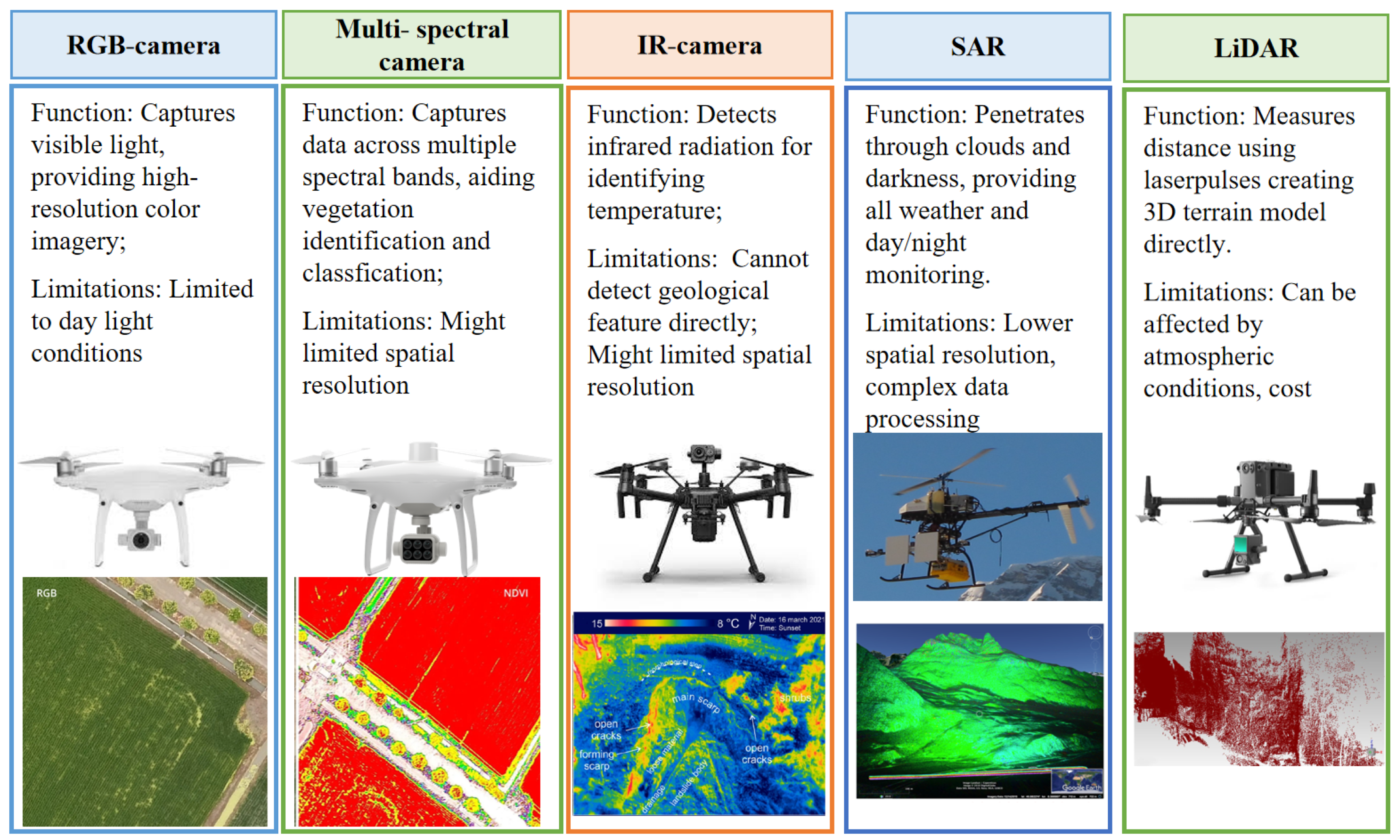
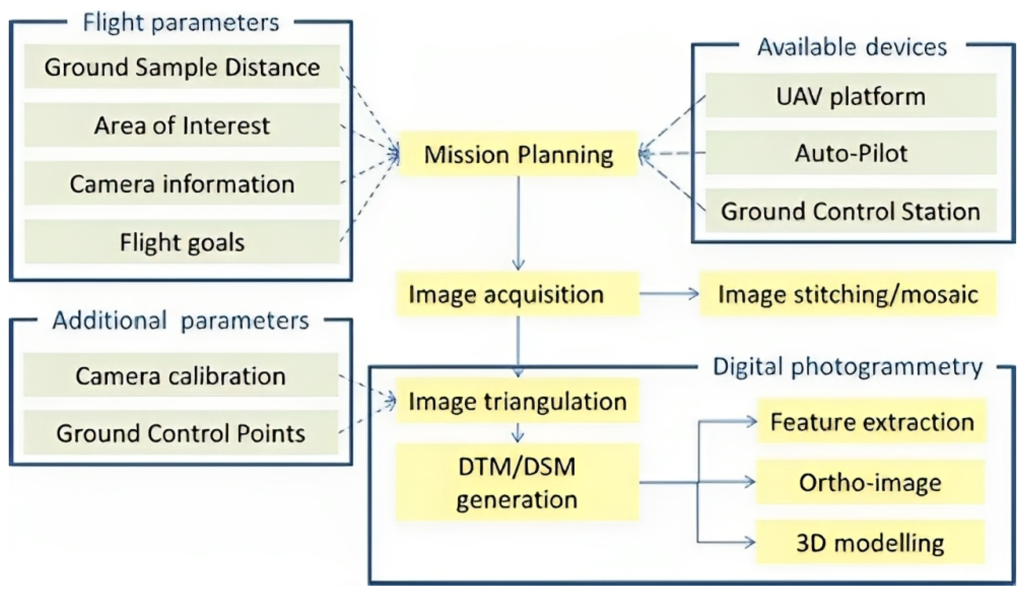
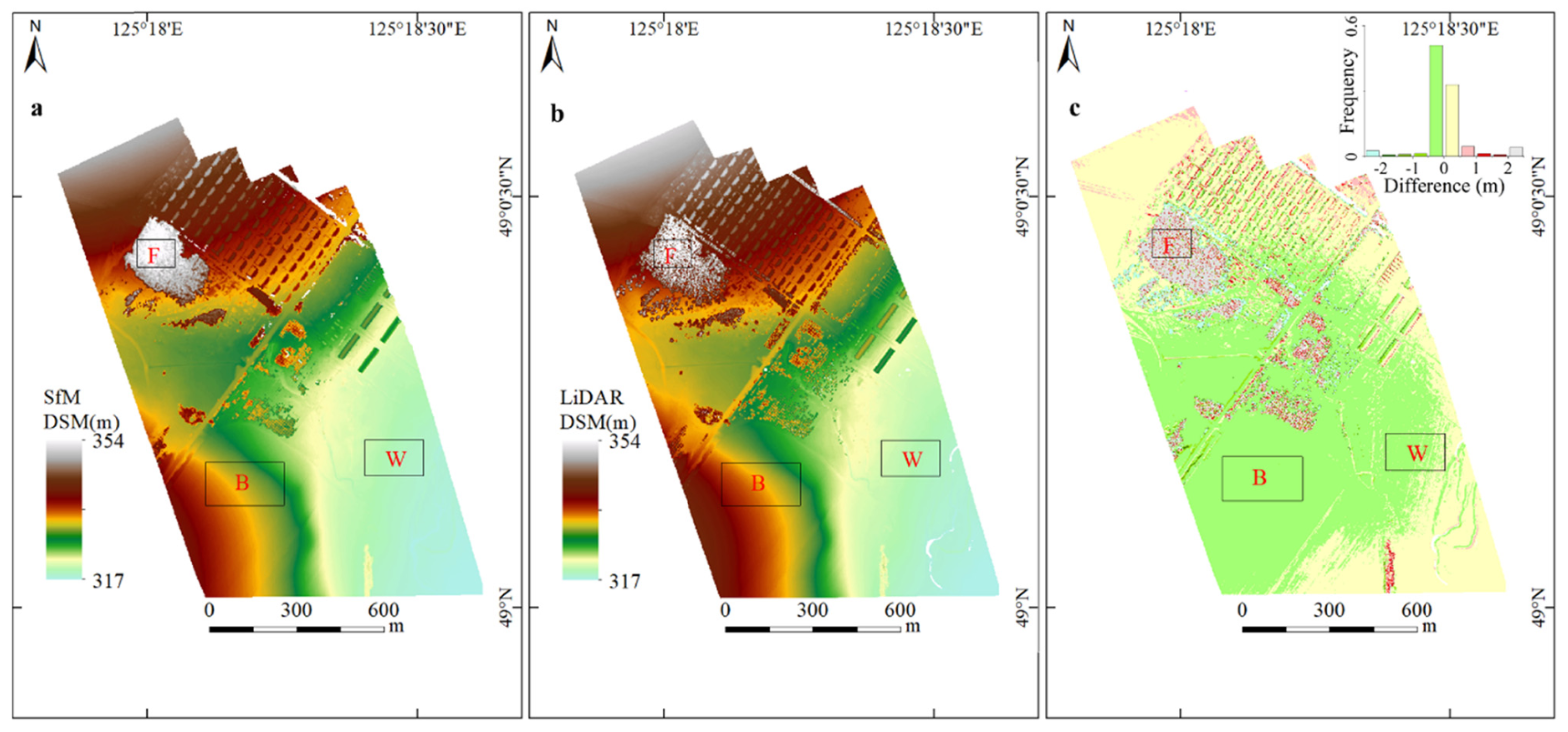
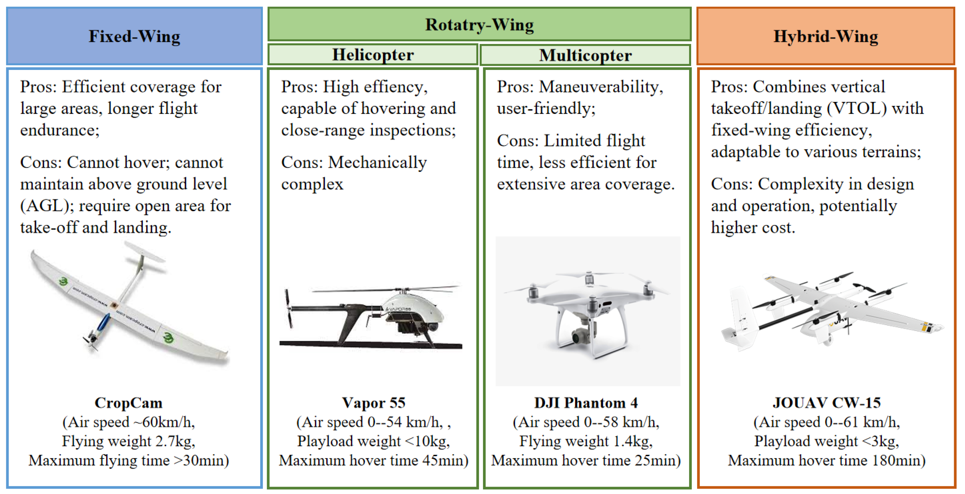
Over the past decade, Unmanned Aerial Vehicles (UAVs) have emerged as essential tools for landslide studies, particularly in on-site investigations. This paper reviews UAV applications in landslide studies, with a focus on static geological characteristics, monitoring temporal and spatial dynamics, and responses post-events. We discuss the functions and limitations of various types of UAVs and sensors (RGB cameras, multi-spectral cameras, thermal IR cameras, SAR, LiDAR), outlining their roles and data processing methods in landslide applications. This review focuses on the UAVs’ roles in landslide geology surveys, emphasizing landslide mapping, modeling and characterization. For change monitoring, it provides an overview of the temporal and spatial evolution through UAV-based monitoring, shedding light on dynamic landslide processes. Moreover, this paper underscores UAVs’ crucial role in emergent response scenarios, detailing strategies and automated detection using machine learning algorithms. The discussion on challenges and opportunities highlights the need for ongoing UAV technology advancements, addressing regulatory hurdles, hover time limitations, 3D reconstruction accuracy and potential integration with technologies like UAV swarms.
Keywords: UAVs; landslide; remote sensing; photogrammetry UAVs; landslide; remote sensing; photogrammetry