1. Introduction
Building on the extensive culture of investigation and innovation in wildland fire science in Canada [
1], we humbly add our research contribution to determining the effects of fuel thinning on the forest microclimate, and consequently, forest ecosystem sustainability. With the increased ingress of humans into the forest environment, through residential growth and recreational activities, there is less and less tolerance for the incidence of wildfires. Governments have allocated significant tax dollars (CAD 5000 to CAD 7400 per hectare [
2]) in fuel management practices to reduce the risk of wildfire. In municipalities like Whistler, British Columbia, Canada, with huge infrastructure investment, the cost of fuel thinning averages CAD 35,000 per ha depending on the ability to offset costs through timber sales [
3]. The consequences of wildfire are in turn driving government response which is misdirected at least partly because fire management terms have morphed from their original definition, leading to confusion and misuse (
Appendix A).
By limiting our focus to forest fuels, we have lost sight of natural forest resilience as an important factor in mitigating fire behaviour potential. We are ignoring the link between reduced fire intensity and stand conditions on fuel moisture such as slower spring snow melt, the water-holding capacity of coarse woody debris (CWD), and the lower flammability afforded by perennial herbaceous ground vegetation. Partial cutting can increase the severity of the fire climate enough to materially increase the number of days when disastrous crown fires can occur [
4].
Fuel thinning was conceived to control the start and spread of crown fires [
5,
6], which are expected to increase in the future [
1,
7]. But crown fires are not common in the coastal rainforests of the Pacific Northwest region of North America [
8,
9]. Crowning forest fires are associated with dense canopy conditions [
10], yet fuel thinning also dries out the surface and ground fuels in these forests through the effects of solar radiation [
11,
12,
13] and increases in-stand wind penetration, which can in turn increase crown fire potential [
14].
Fuel is one of three principal ingredients (ignition risk and weather being the other two) along with topographic characteristics that strongly influence wildfire activity in an area [
1,
7,
15]. Fuel thinning alone cannot mitigate against wildfire severity under instances of extreme fire behaviour, yet it is the cases associated with critical fire weather conditions that have triggered recent conflagrations in the Pacific Northwest region of North America [
9,
16,
17].
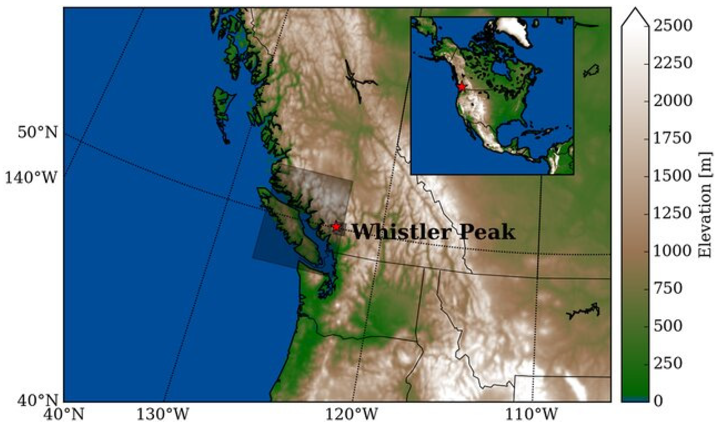
Given the general lack of knowledge on the subject, our research set out to examine the impact of fuel thinning in the coastal rainforest stands of the Whistler region of British Columbia, Canada (
Figure 1). We specifically wanted to know whether fuel thinning increases wildfire potential relative to the unthinned forest based on conditions associated with wildfires, namely (a) during spring (i.e., faster snow melt), (b) during the late summer (i.e., drier fuels), and (c) during both seasons (i.e., increased wind speed, ambient air temperature, and solar radiation, and decreased soil moisture and relative humidity).
2. Materials and Methods
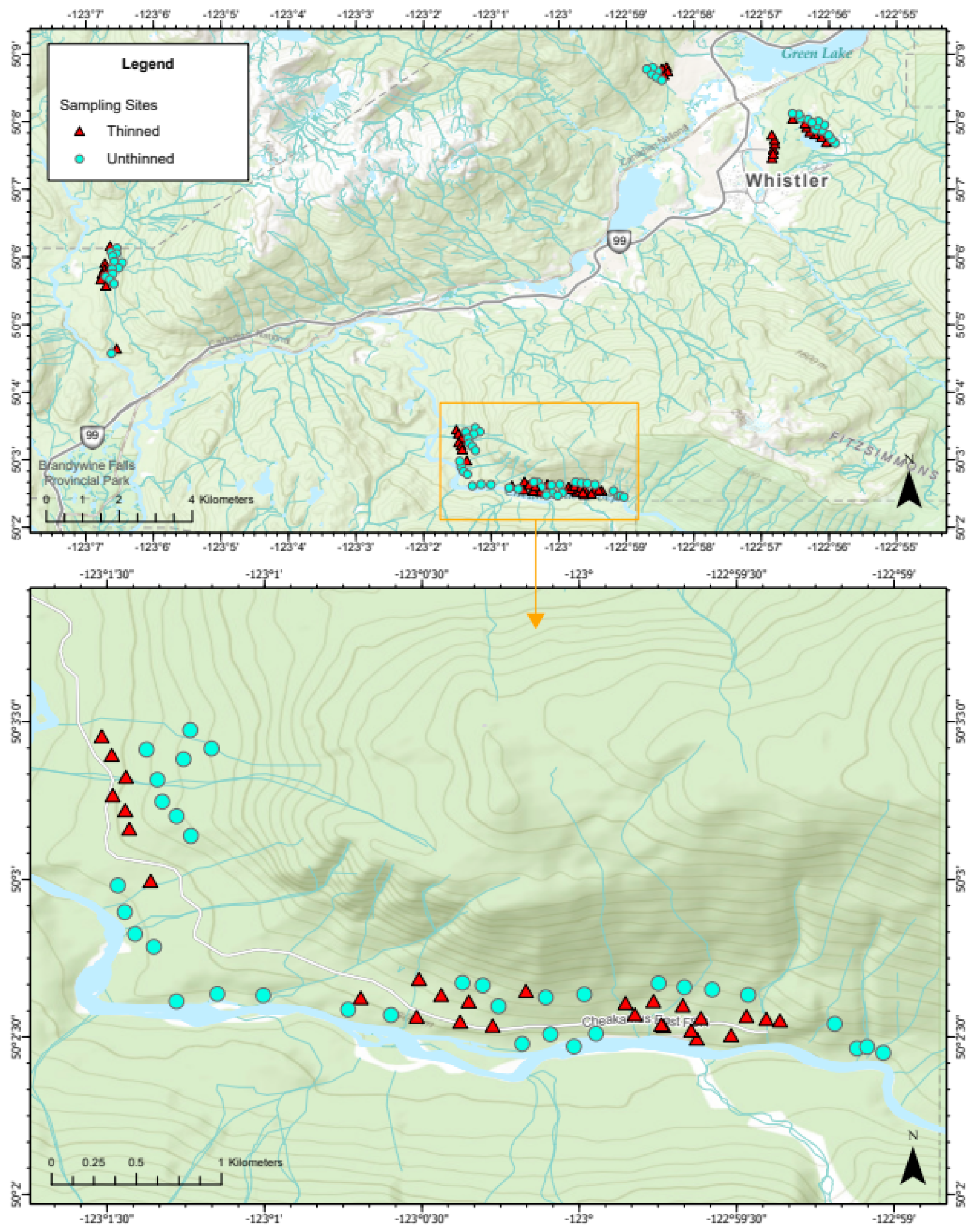
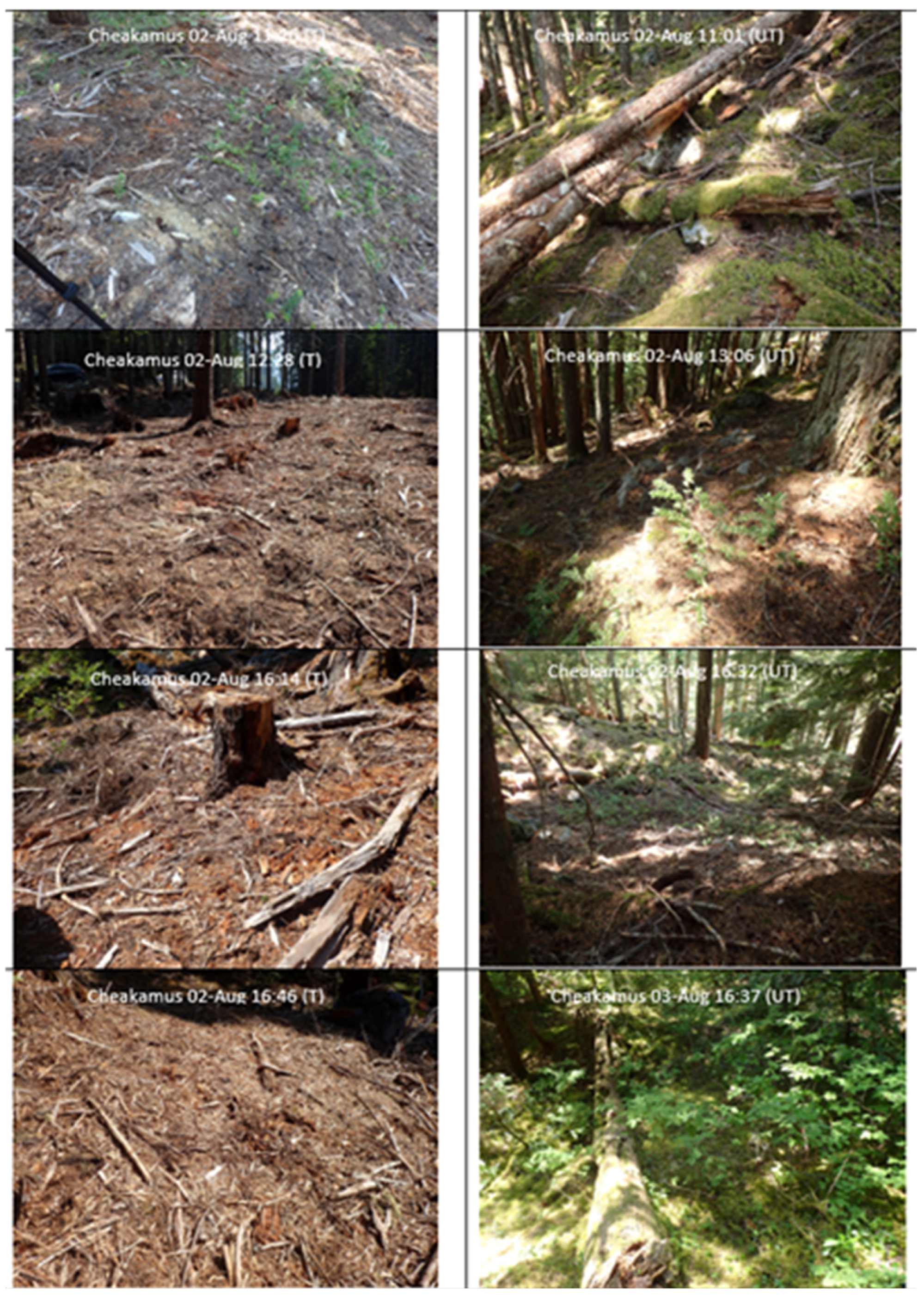
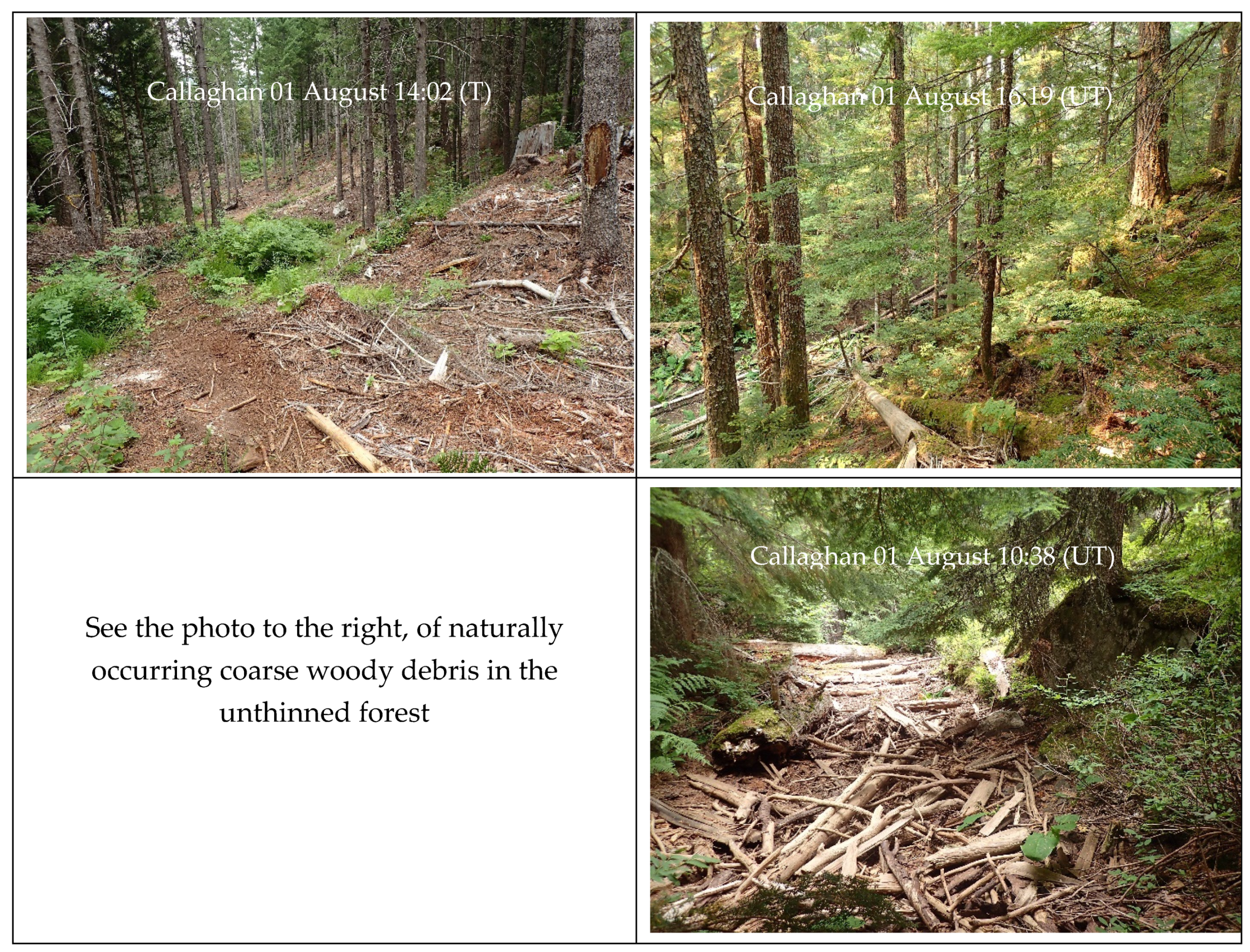
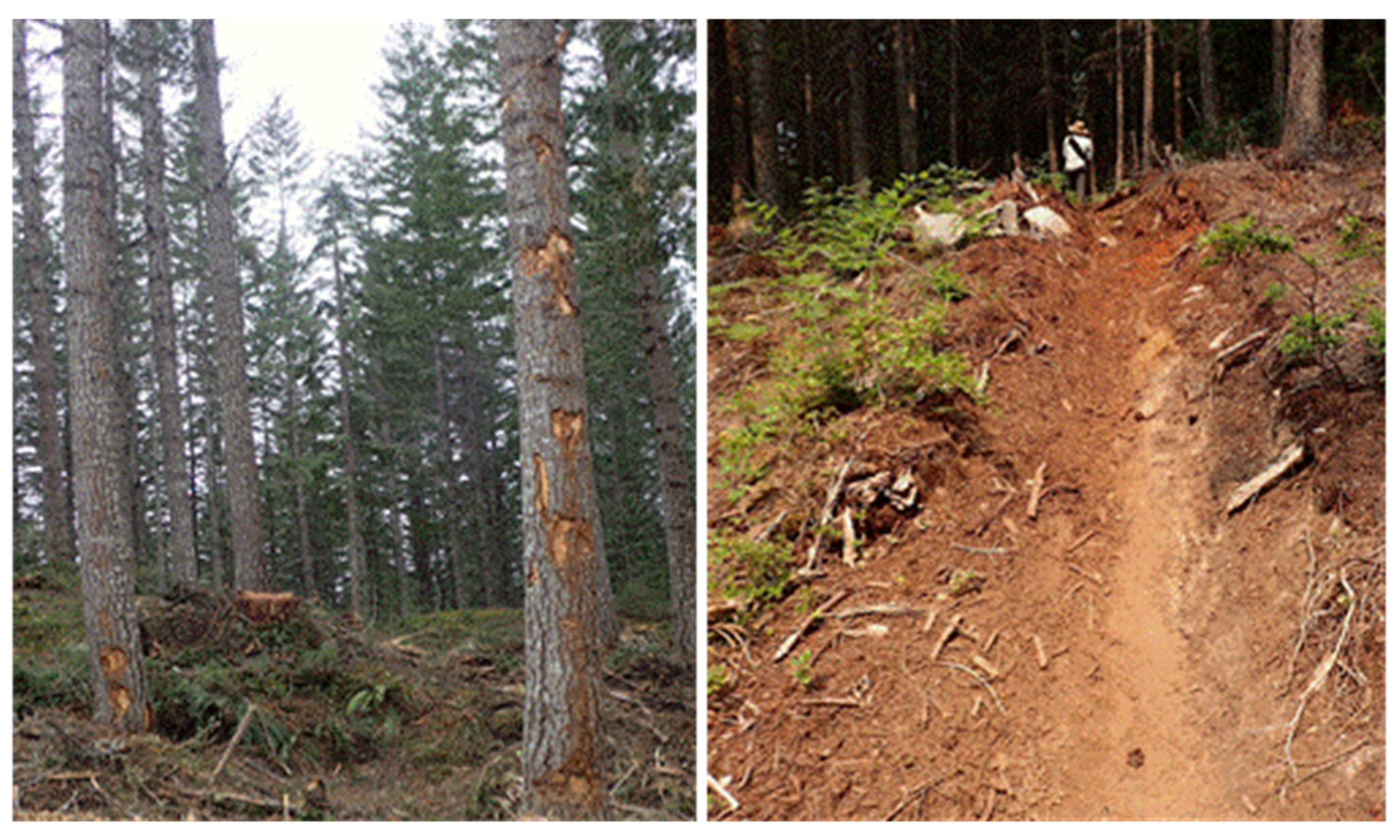
Given the expanse of the study area and to control for confounding effects on microclimate, sampling points were selected using a geographic information system (GIS), ArcGIS Pro Version 2.9, to a priori exclude non-forested fuel types (e.g., wetlands, roads, lakes and infrastructure), and to pair thinned (T) and unthinned (UT) locations by aspect, slope steepness, and forest type, while ensuring the sampling locations were at least 100 m apart (
Figure 2). In this region, variation in the local ultraviolet light (UV) input to the forest stand is almost the only source of heat that creates the variability in local weather and fuel conditions we were interested in measuring, so we sampled south-facing slopes which have a longer timeframe of higher UV heating [
18]. This would provide the potential contrast in the effect of treatment that we were interested in understanding.
The characteristics of the sampled forest stands are detailed in
Table 1. The four forest sites lie in the Coastal Western Biogeoclimatic zone of British Columbia (
https://www.for.gov.bc.ca/hre/becweb/ (accessed on 15 June 2024)). The overstory commonly comprises predominantly mature subalpine fir, western redcedar, Douglas fir, and western hemlock.
We replicated sampling at four sites in Whistler’s coastal forest (i.e., Alpine, Lost Lake, Cheakamus, and Callaghan) for two seasons of the year: (1) spring—during snow melt as an indicator of wildfire risk (April); and (2) late summer—during the period of highest fire danger (i.e., the latter part of July to early August). We sampled at 99 point- locations in the spring (
n = 44 in T and
n = 55 in UT stand locations) (
Table 2). More points (
n = 111) were accessible in late summer (
n = 52 in T and
n = 59 in UT locations) than in the spring. We avoided sampling within 24 h of a recent rainfall event and sampled across sites as close in time as possible given the availability of volunteer field assistants.
Though we did not sample on consecutive days over the full growing season for all forest areas, our sampling did span spring and late summer, morning to late afternoon, and a full range of ambient air temperatures, relative humidities, and precipitation amounts (
Table 3 and
Appendix B). It took an average of 2.5 days in the spring and 2 days in late summer to sample all the points at a site.
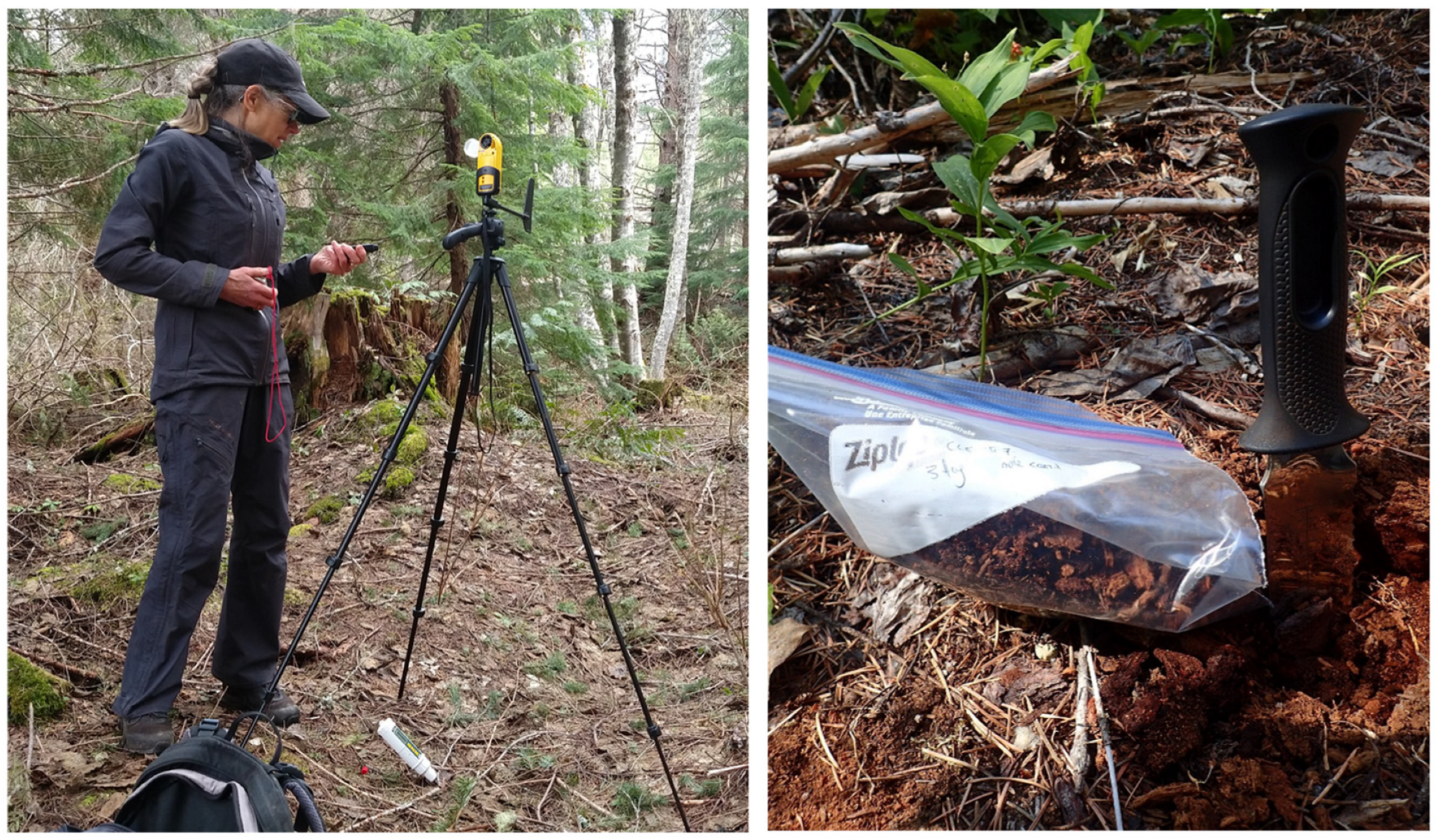
At each point, lab-calibrated equipment (
Table 4,
Figure 3) was used to measure ambient air temperature, relative humidity (RH), wind speed and direction, solar radiation, and soil moisture. In the spring, we included snow depth and snow cover. In late summer, we included fuel moisture, classification of fuel by volume, and digital photos of tree canopy closure and ground fuel (i.e., organic matter, CWD, and living plant cover).
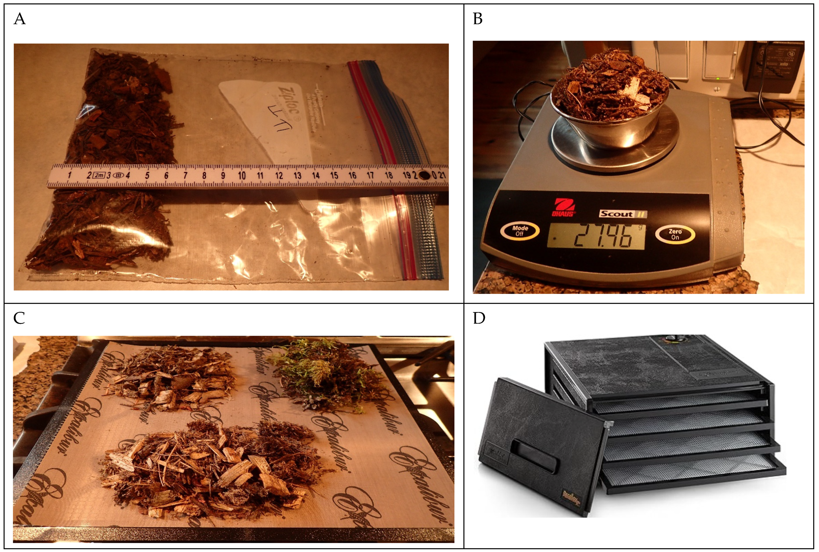
To analyze fuel moisture, samples of surface materials were collected using a trowel to a 3 cm soil depth (
Table 5). Each sample was put into a Ziplock plastic bag, labelled with the site location, date, and time of collection on the outside, and stored in a dark cupboard at a temperature of 20 °C and 50% RH for up to nine days. A measured volume (cm
2) of each sample was transferred to a half-cup metal container and weighed (to a 0.01 g accuracy) before and after drying.
The proportion of each fuel component was estimated visually at the initial weighing and again by photo analysis in the field. Fuels were categorized as living plants, moss, CWD, needles/cones, chipped wood, and bare ground/rock) to correspond with expected drying times reported in the literature.
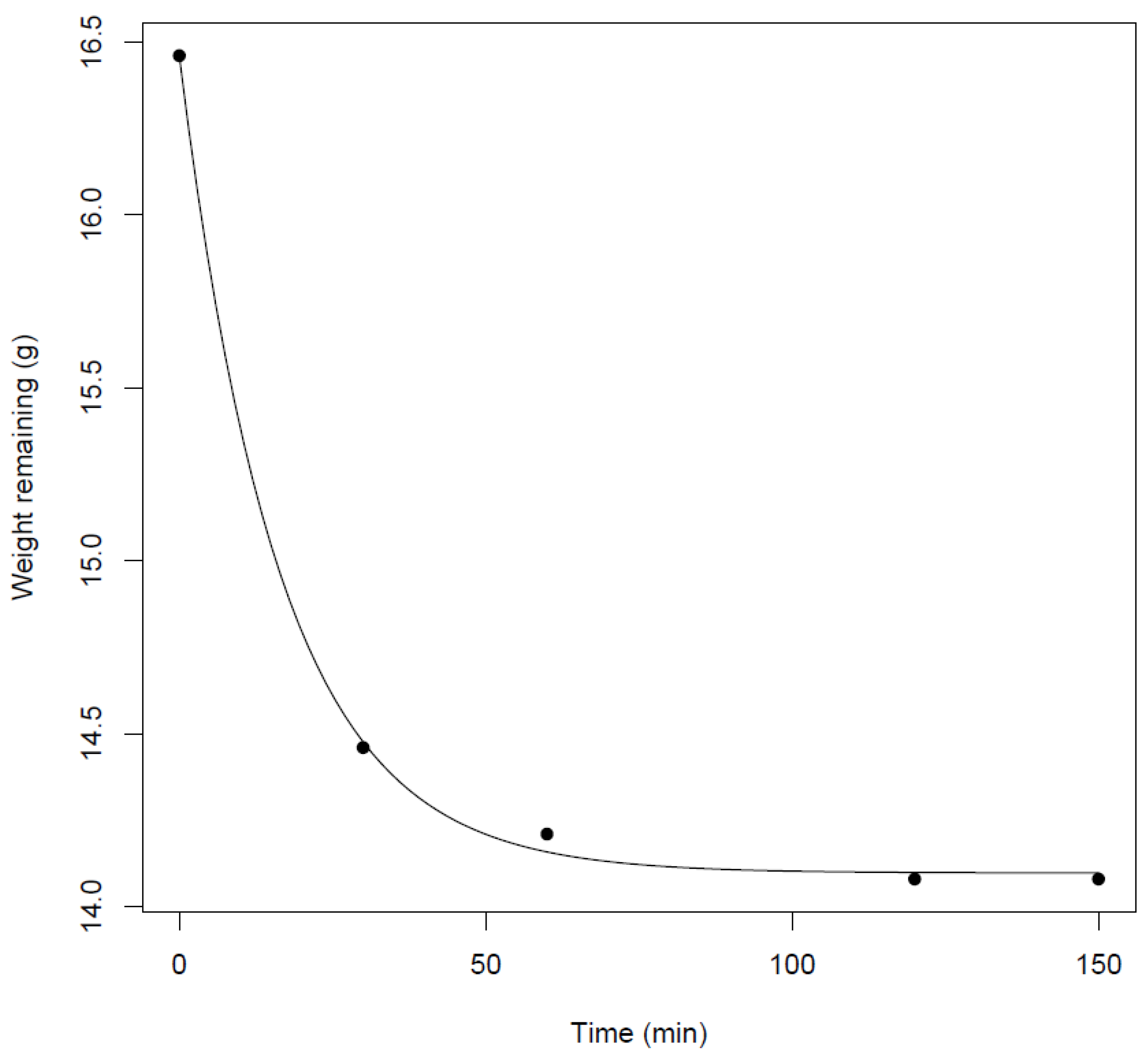
No laboratory drying oven was available locally so we purchased the highest-rated food dehydrator that could handle an initial moisture content of 60%, had sufficient and adjustable shelves to dry treated and untreated samples simultaneously, reusable non-stick paraflexx sheets to prevent sample loss, and a constant moderate temperature of 74 °C. We tested for the standard exponential decline in %moisture using this equipment (
Figure 4). Fuel moisture content was calculated as the quantity of moisture in the fuel (the difference in weight from initial to dried) and expressed as a percentage of the final weight when thoroughly dried. A food dehydrator has been used to determine the moisture content of soil and vegetative materials on an oven dry weight basis [
19,
20,
21].
Samples were dried at 74 °C until the weight did not change (2.0 to 4.5 h) using a 4-tray food dehydrator with a drying volume of 0.07 m
3 (
Figure 5). For 10 of the initial 30 samples, we noted an average 0.01 g increase in weight after 120 min (median 240 min) of drying. We attribute this to the spread of one sample to another during the transfer from the drying sheets back to the weighing cup. For this reason, we let subsequent samples dry for a longer initial interval (≥120 min). When weights plateaued or increased, we took the weight before that measured as the dry weight.
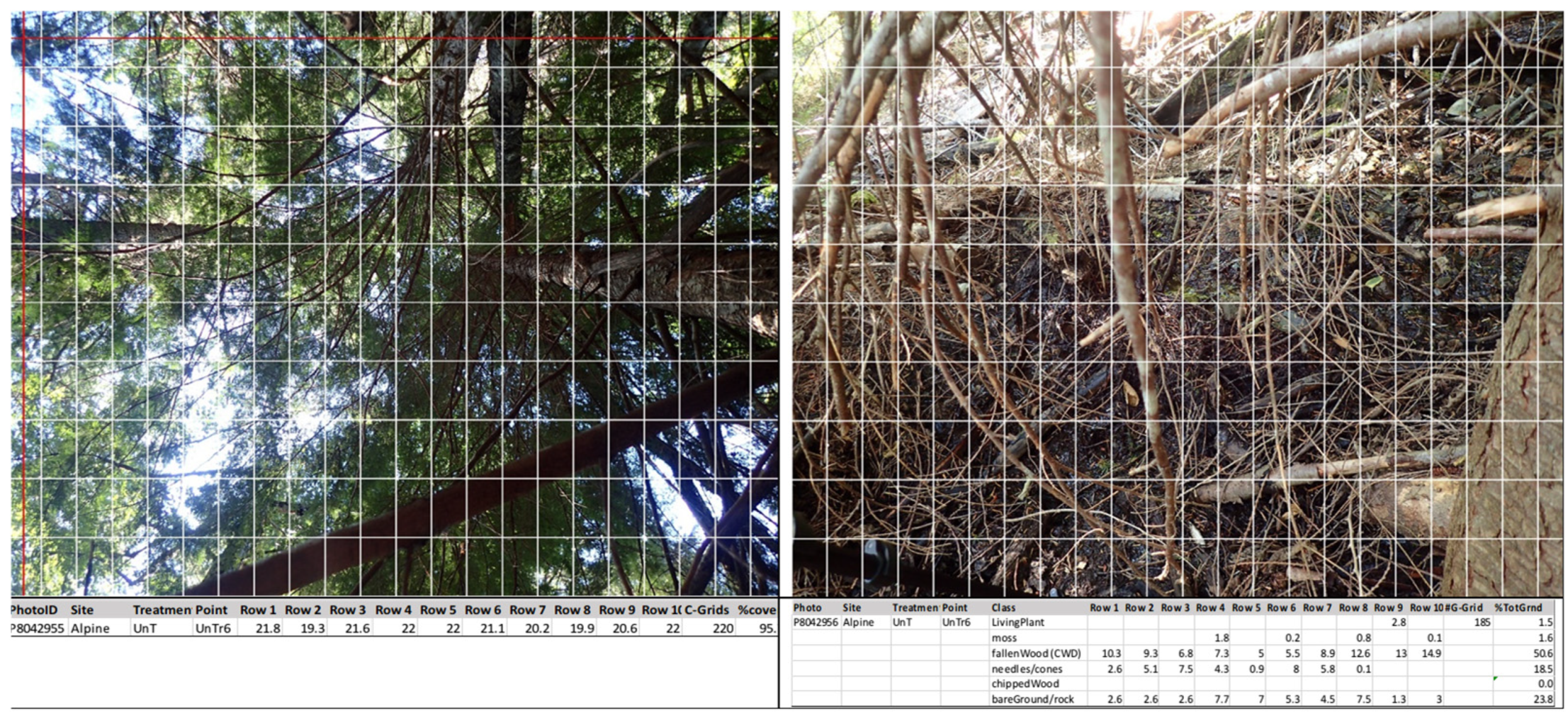
Ground and canopy photos were taken at 78 sites (
Table 6) and uploaded to a photo analysis software tool called ImageJ Version 1.54, where a grid (220 cells per image) was overlaid on every image and within each grid, the percent canopy cover (versus clear sky) and percent ground cover by fuel component were calculated (
Figure 6). For each image (
n = 156), invalid cells (i.e., not clear sky or no ground cover) were ignored and the portion of each valid cell tallied by grid–row for a total percentage per image ± variability across the rows. The average percent ground cover and percent canopy cover were compared by treatment and site. At Lost Lake, photos were only taken at thinned sites because we did not realize the utility of the photos until after UT sites were completed.
4. Discussion and Conclusions
Our objective was to measure the effect of thinning on the microclimate conditions that are associated with wildfires. The four sites measured for this study are naturally wet and as expected, have not experienced wildfires in recent times despite the wildfire activity across BC. The results of this work suggest the natural resilience has been compromised by thinning.
Our findings are consistent with those of others, e.g., [
15,
24,
25,
26], where thinning resulted in increased solar radiation, wind speed, and ambient air temperature, and decreased RH and dead fuel moisture. As Whitehead and others [
15,
16] have found, the effects on RH and soil moisture were less pronounced in late summer at the height of fire danger. The importance of forest canopy in maintaining high fuel moisture levels was pointed out by Stickel [
27] as early as 1931. The level of increased wind speeds we found in thinned stands was like that observed by Bigelow and North [
28], which increases the rate of fire spread in fire simulation modelling software. Opening the forest stand results in a warmer, drier, and windier fire environment that creates a net increase in fire hazard [
29].
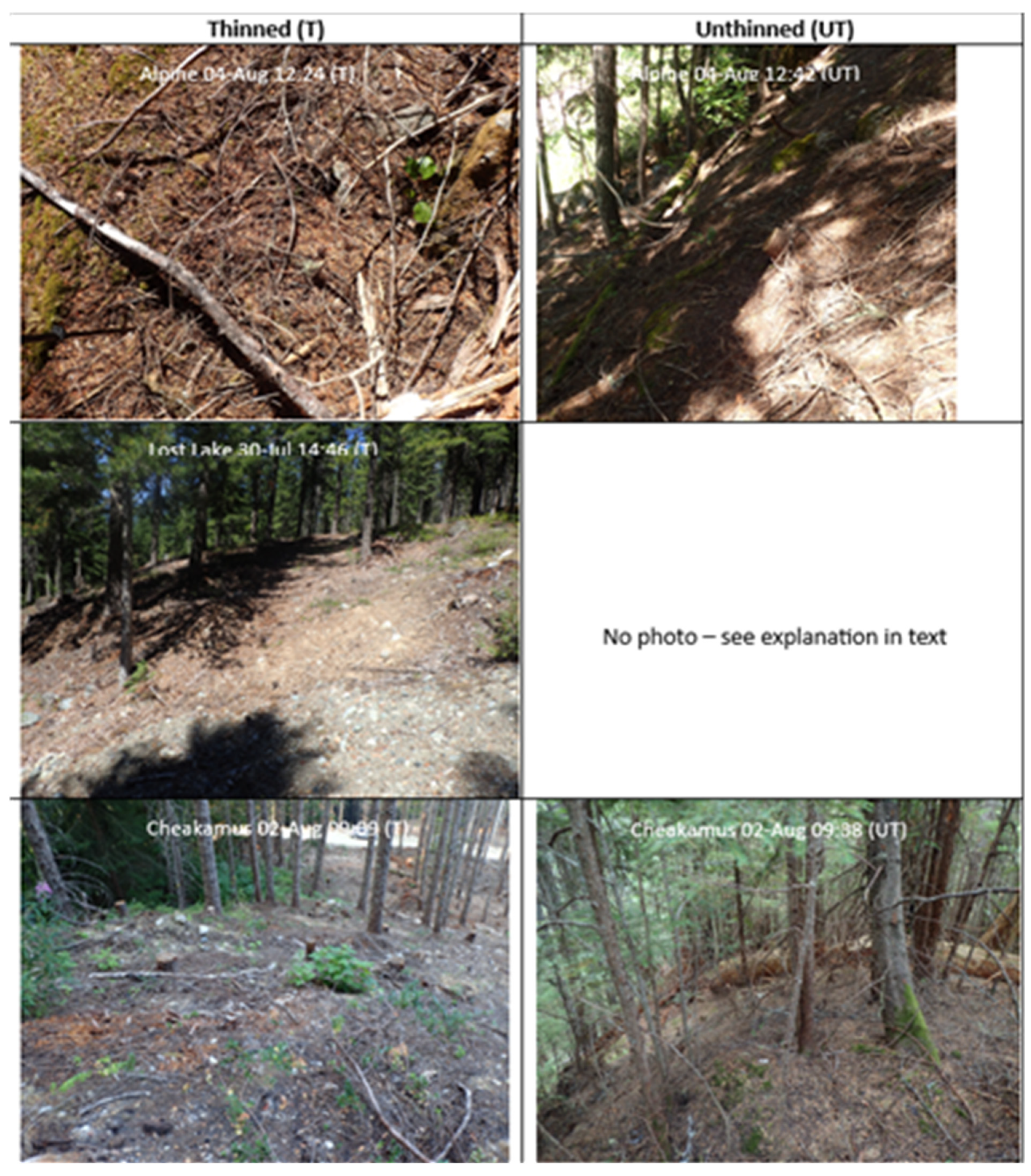
Based on the photo analysis, none of the fuel thinning reduced the canopy cover to the threshold reduction of 27.05% that Gibos [
12] noted for solar radiation levels needed to cause increased wildfire risk. Nonetheless, where the forest stands were thinned to below 50% (leaving 34–49% canopy coverage), the solar radiation levels reaching the ground surface were 39 to 65% higher than the unthinned places. Estes et al. [
30] found higher moisture in unthinned ponderosa pine only for large CWD in the early season. However, their unthinned plots had less canopy cover than our thinned sites (56% cover in their unthinned versus our 93% cover at unthinned and 63% cover at thinned sites). They noted higher windthrow on unthinned sites.
The ground fuels in thinned forest areas were predominantly covered by bare ground/rock which were associated with higher wildfire risk. Pickering and others [
25] found understorey vegetation to be important in mitigating fuel flammability. In our ground photo analysis, living plants were not found to be affected by fuel thinning.
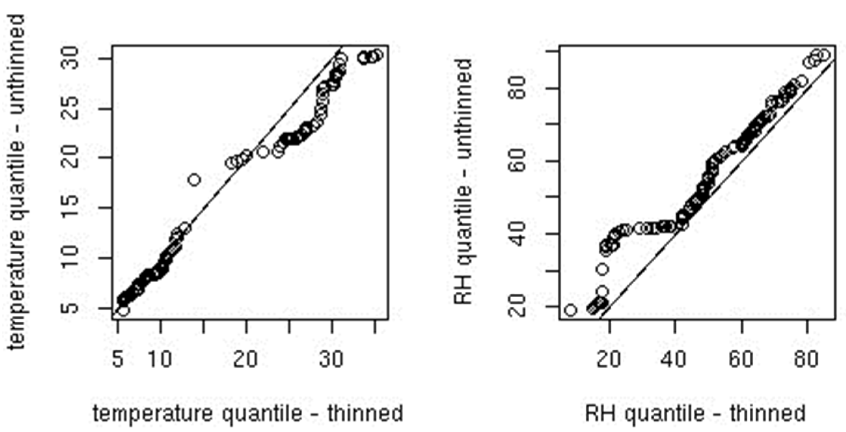
During peak burning conditions in daylight hours (i.e., 1300 to 1700 h local time), the south-facing site was on average 1.4 °C warmer and had an RH 5.5% lower than the north-facing site. Given that fuel moisture and response time of fuel are predicted from RH, and surface temperature is a function of ambient air temperature, wind speed, and solar radiation, fuel thinning in Whistler’s coastal forests has unquestionably increased forest fuel flammability.
Schroeder et al. [
31] found unthinned lodgepole pine stands that had similar fuel loads compared to thinned with no slash removal, but the bulk of weight came from larger-sized fuels (>7.0 cm diameter) which did not ignite during outdoor test fires. They found RH to be the best predictor of ignition probability over modelled twig moisture content. Our management concern was not to thin and then remove the fuel load, but to retain the CWD and the microclimate of a closed forest in the first place.
Fuel management is the only approach the Resort Municipality of Whistler is taking for wildland and urban areas. They believe “fuel is the only aspect of the fire behaviour triangle that can be directly managed to reduce wildlife threat” [
32]. We need to consider more than fuel in fire management strategies and go beyond a ‘one size fits all’ approach. As Brackebusch [
33] pointed out in 1973, “fuel management could lead to a trap of managing land simply for fire control”, where instead “how we manipulate vegetation ought to be tempered by the expected hazard associated”. Again, in Drysdale’s words 27 years later [
34], “Further major advances in combating wildfire are unlikely to be achieved simply by continued application of traditional methods. What is required is a more fundamental approach which can be applied at the design stage … such an approach requires a detailed understanding of fire behaviour”.
In general, fire susceptibility increases as RH decreases and ambient air temperature rises. We can increase humidity with sprinklers and perennial herbaceous plants and decrease ambient air temperature by shading (i.e., canopy tree retention, which has the added benefit of reduced air flow on fire spread). The significant funds currently being spent on fuel thinning could be diverted to increased vigilance in the wildland–urban interface (WUI).
The coastal, naturally regenerated forests of the Whistler region require a different fuel management strategy from the dry, wildfire-prone forests around Kelowna in southcentral British Columbia and the plantation forests surrounding Fort Nelson in the northeastern region of the province (
Appendix D). The humid climatic conditions in British Columbia’s southwestern coastal forests yield less frequent threatening wildfires [
35,
36,
37,
38,
39,
40]. Fuel thinning prescriptions of today (i.e., selection thinning and crown thinning that maintain multiple canopy layers, along with individual tree selection systems) will not reduce the risk of crown fire occurrence except in the driest of ponderosa pine stands [
41]. Silvicultural practices that involve the creation of high-density, even-aged stands of commercial conifer tree species have contributed to an increase in wildfire potential [
42,
43]. Similarly, unmanaged forests comprising mature ponderosa pine, western white pine, and western larch tend to exhibit tall stems (with the crowns separated from the surface fuels) that are deep-rooted (which are more resilient to drought) and are self-pruned (and therefore lack bridge or ladder fuels), even in moderately dense stands [
44].
The topographic differences illustrated in
Appendix D (
Figure A2 and
Table A2), and the slope effect graphs presented in
Appendix E (
Figure A3), confirm the unique features of mountainous terrain found in British Columbia from a wildfire mitigation standpoint. The Whistler area has a different topographic environment from the high-fire-risk towns in other parts of the province like Fort Nelson, which features a far flatter terrain compared to the Whistler landscape (
Table A2). Thinning increased the variability in slope steepness effects, in turn causing extremes in distribution, which are more of a wildfire concern due to their influence on the predictability of fire behaviour during a major wildfire event (
Figure A3). This provides further caution as to why fuel thinning, as a strategy for wildfire mitigation, is not appropriate due to the extremes in topography found in southwestern British Columbia.
There is an opportunity to integrate FireSmart [
45] efforts with fuel management in the WUI and reduce the harvesting of trees that are essential in mitigating climate change. Solar radiation and wind ingress in FireSmart-thinned stands can be greater than fuel-thinned stands. Research is needed on the potential for planting native perennial herbaceous plants to retain the climate resiliency in the WUI. Mitigating fire hazards with deciduous species provides protection [
46]. However, perennial herbaceous plants would provide year-round, RH-enhancing cover.
Gibos [
12] found that a FireSmart-thinned stand received 30% of the solar radiation and 30% of the wind measured in the open and was significantly warmer than all other stands during the peak solar radiation period of the day. In this study, unthinned locations in the stands received 12% of the solar radiation measured in the thinned portions of the stand in the spring and 5% in late summer. Gibos [
12] found FireSmart-thinned stands had wind speeds 18% higher than unthinned stands, compared to the 3–5 fold higher wind speed levels we observed at thinned versus unthinned locations within the stand associated with this study.
Further work is required to quantify the increased risk of wildfire ignitions due to improved access by motorized vehicles (i.e., dirt bikes, quads, and side-by-sides) [
22].
What is the confounding effect of a change in prescription and contractor when it comes to fuel thinning? The digital photo analysis revealed considerable variation in implementation. Our stands were moderate to heavily thinned compared to those of Bigelow and North [
28], who recorded a difference in canopy cover of 69 ± 7% to 57 ± 6% for lightly thinned stands and 49 ± 8% in moderately thinned stands.
Our results also suggest that the recent provincial strategy to remove debris using broadcast burning of woody surface debris [
47] following mechanized thinning will enhance the drying of ground and surface fuels. The retention of higher soil moisture in the late summer was associated with CWD in unthinned stands and wood chips in thinned stands. The removal of woody debris by burning releases carbon into the atmosphere, and both burning and/or the physical clearing of the debris remove organic matter (important for soil fertility and moisture retention) and enhance moisture loss by exposing tree roots [
48,
49,
50,
51]. The removal of post-thinning wood chips should be curtailed until their importance in retaining soil moisture is better understood.
Significant funds have been spent on fuel thinning in the coastal rainforests of British Columbia. The CAD 10.1 million allocated in 2022 for Whistler alone [
52] could have been directed towards research in collaboration with the FireSmart programme, to test the efficacy of planting green fuelbreaks on the urban side of the WUI, to protect infrastructure, instead of removing trees which are essential for climate change mitigation and, based on this research, maintain a fire-resilient microclimate. The current FireSmart prescription of harvesting conifer trees is opening up urban spaces, leading to increased warming and drying, which is in turn exacerbating the heat and drought stress already occurring in concert with climate change.
Where fuel thinning is proven to be efficacious (i.e., reduces wildfire risk), monitoring for other adverse effects should be included, specifically, the effect of fuel thinning on native wildlife populations (i.e., on the displacement of habitat-specialist species by disturbance-related species), and on soils with respect to fertility, erosion, and water retention. In communities like Whistler where the economy is dependent on recreation and tourism, the focus should be on the retention of the natural features of the forest ecosystem. Further research is required to understand the importance of CWD and old-growth trees in retaining the fire-resilient microclimate while also maintaining ecosystem function.
Our results show that fuel thinning on south-facing slopes in the coastal rainforests of southwestern British Columbia has a greater impact on the wildfire risk in unthinned stands in the same forest type. Under the conditions examined in this study, for the relevant days of monitoring (
Table 3 and
Appendix B), we are in turn increasing the wildfire risk with fuel thinning practices. The additional ignition risk of opening up the forest to unauthorized trails is a further reason to halt this practice. These results are consistent with those of Taylor and others [
53] and Countryman [
4], who found that the probability of wildfire severity increased in older stands. The topographic features of the Whistler region and other communities in the mountainous areas across southern British Columbia are of concern when it comes to fuel thinning as a strategy for wildfire mitigation. Further research is required to determine how general the increased wildfire risk is across other topographic forest conditions.


