

ISPRS Int. J. Geo-Inf., Volume 7, Issue 4 (April 2018) – 33 articles
Cover Story (view full-size image):
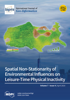
This study explores the inconsistent findings regarding the associations between environmental exposures and leisure-time physical inactivity (LTPI). By comparing the correlations between LTPI and different environmental factors for all counties in the conterminous U.S., the results highlight the spatial non-stationarity of the associations. The existence of spatial non-stationarity that leads to biased estimators, which were often ignored in past research, may be another reason for the inconsistent findings in previous studies besides the modifiable areal unit problem and the uncertain geographic context problem. Thus, the research findings at one location may not be generalized and applied globally. From the perspective of health policy, an effective policy that helps to promote public health in one county may not be effective in another place due to spatial non-stationarity. View the paper here.
- Issues are regarded as officially published after their release is announced to the table of contents alert mailing list.
- You may sign up for e-mail alerts to receive table of contents of newly released issues.
- PDF is the official format for papers published in both, html and pdf forms. To view the papers in pdf format, click on the "PDF Full-text" link, and use the free Adobe Reader to open them.
Previous Issue
Next Issue