Next Issue
Volume 6, March
Previous Issue
Volume 5, September


Urban Sci., Volume 5, Issue 4 (December 2021) – 24 articles

Cover Story (view full-size image): 
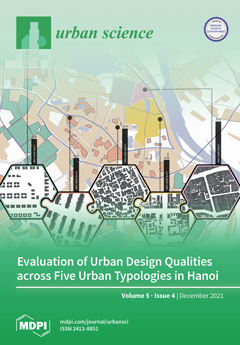
Studies of microscale urban design are underrepresented in comparison with macroscale urban design, especially from low- and middle-income countries in Asia, where urban forms are traditionally compact, complex and have multiple layers and varied urban typologies. The study evaluated the microscale urban design qualities of streets (n = 40) across five urban typologies in Hanoi and found that urban typologies and their characteristics have particular impacts on urban design qualities. Old and high-density urban typologies tend to report higher urban design qualities than modern and low-density typologies. Compared to Western cities, the urban design qualities in Hanoi are substantially different, especially in terms of imageability and complexity, reflecting the differences in urban design and cultural context between cities from various regions. View this paper.
  • Issues are regarded as officially published after their release is announced to the table of contents alert mailing list.
  • You may sign up for e-mail alerts to receive table of contents of newly released issues.
  • PDF is the official format for papers published in both, html and pdf forms. To view the papers in pdf format, click on the "PDF Full-text" link, and use the free Adobe Reader to open them.
Order results
Result details
Select all
Export citation of selected articles as:
23 pages, 6437 KiB  
Article
Exercising under COVID-2x: Conceptualizing Future Green Spaces in Australia’s Neighborhoods
by Dirk H. R. Spennemann
Urban Sci. 2021, 5(4), 93; https://doi.org/10.3390/urbansci5040093 - 13 Dec 2021
Cited by 10 | Viewed by 3820
Abstract
The COVID-19 pandemic has proven to be a social and economic disruptor on a global scale, severely curtailing people’s ability to travel and engage in many recreation activities. Periodic lockdown and stay-at-home orders have exacerbated the situation. In this social climate, urban green [...] Read more.
The COVID-19 pandemic has proven to be a social and economic disruptor on a global scale, severely curtailing people’s ability to travel and engage in many recreation activities. Periodic lockdown and stay-at-home orders have exacerbated the situation. In this social climate, urban green spaces have attained a high significance for the maintenance of the physical and mental health of the population. Given the presence of similar coronaviruses in animal populations, it can be predicted that future epidemics and even pandemics will occur. Urban planning needs to incorporate the lessons learnt during COVID-19 in order to future-proof our communities. This paper reviews the role that urban green spaces played during the COVID-19 pandemic. Based on these observations, the paper discusses a range of options for the provision of pandemic-sensitive spaces for physical exercise and mental recreation. Design concepts for long-term planning adjustments as well as for future ad-hoc solutions are provided. These include the provision of social distancing ‘pods’ embedded in design and landscaping of permanent parks, the design of ad-hoc, socially distanced ‘parklets’ on a quietened street and a rethink of the design of curb-to-boundary setbacks (nature strip) in residential streets. Full article
(This article belongs to the Special Issue The Post-COVID Urbanism)
Show Figures

Figure 1

23 pages, 1217 KiB  
Article
Practices and Barriers to Sustainable Urban Agriculture: A Case Study of Louisville, Kentucky
by Leigh Whittinghill and Sait Sarr
Urban Sci. 2021, 5(4), 92; https://doi.org/10.3390/urbansci5040092 - 1 Dec 2021
Cited by 13 | Viewed by 8114
Abstract
As urban populations increase, there is growing interest in developing innovative technologies, sustainable urban farming practices, policy measures, and other strategies to address key barriers in urban agriculture that impede improved food security and sustained urban livelihoods. We surveyed forty urban farmers and [...] Read more.
As urban populations increase, there is growing interest in developing innovative technologies, sustainable urban farming practices, policy measures, and other strategies to address key barriers in urban agriculture that impede improved food security and sustained urban livelihoods. We surveyed forty urban farmers and gardeners (growers) in Louisville, Kentucky, for base-level information to assess their agricultural practices and the various factors or key barriers that could influence such practices. Secondary objectives were identifying areas where practices could be improved, and identifying opportunities for research, outreach, and incentives for urban growers to transition to more sustainable and higher-yielding practices. The majority of these urban growers were white females, were more diverse than Kentucky farmers, and attained a higher degree of education than Kentucky residents as a whole. Most were engaged in urban agriculture for non-commercial reasons, and 11% were full-time urban growers operating farms for profit. Smaller farms were less likely to be operated for profit or have farm certifications than medium-sized or larger farms (Chi-squared = 14.459, p = 0.042). We found no significant differences among farm sizes in terms of whether growers rented or owned the land they were on (Chi-squared = 9.094, p = 0.168). The most common sustainable practices recorded were composting (60%), crop rotation (54%), polyculture (54%), organic farming (49%), and low or no-till (46%). The least common practices were alley cropping (5%), plasticulture (3%), and hydroponics (3%). Small farms were less likely to use crop rotation than medium-sized or large farms (Chi-squared = 13.548, p = 0.003), and farms responding to the survey in the latter part of the data collection were less likely to use compost than expected based on responses from the early part of data collection (Chi-shared = 5.972, p = 0.014). Challenges faced by these growers included limited space, accessibility to farm certification, presence of pests and diseases, and lack of record keeping and soil testing for fertility and contamination. Our study documents the need for more farm certification, education, outreach, training, research, investment, innovative ideas and solutions, collaboration among stakeholders, and better access to land through favorable urban policies and local support. Full article
Show Figures

Figure 1

18 pages, 8131 KiB  
Article
An Integrated System for Urban Parks Touring and Management
by Kostis Pristouris, Harry Nakos, Yannis Stavrakas, Konstantinos I. Kotsopoulos, Theofanis Alexandridis, Myrto S. Barda and Konstantinos P. Ferentinos
Urban Sci. 2021, 5(4), 91; https://doi.org/10.3390/urbansci5040091 - 23 Nov 2021
Cited by 3 | Viewed by 2771
Abstract
Urban parks are important recreational spaces of environmental interest for citizens and city visitors. Targeted and attractive promotion of these areas can help develop alternative forms of “green tourism” and increase environmental awareness among citizens, which is particularly important and vital for the [...] Read more.
Urban parks are important recreational spaces of environmental interest for citizens and city visitors. Targeted and attractive promotion of these areas can help develop alternative forms of “green tourism” and increase environmental awareness among citizens, which is particularly important and vital for the future of the planet. New technologies are a key tool for improving the experience of touring urban parks, as they can make the tour much more attractive by highlighting interesting information about the flora and fauna of the park, as well as various other points of interest. This paper presents an integrated system based on augmented reality, artificial intelligence, and data analytics methodologies, comprising both mobile and web applications, focusing on urban parks touring and management, respectively. Through the mobile app for the park visitors, an attractive, interactive touring environment is created which highlights the environmental and historical interest of those areas. At the same time, the web applications for the park managers receive and analyze visitor data to help improve the visitor experience and the overall quality of the park. Finally, the developed integrated system is evaluated to ensure that it meets all user requirements and that its usability and functional components satisfy both groups of potential users, i.e., park visitors and park managers. Full article
Show Figures

Figure 1

5 pages, 446 KiB  
Viewpoint
How COVID-19 Exposed Water Supply Fragility in Florida, USA
by Mary G. Lusk, Lisa S. Krimsky and Nicholas Taylor
Urban Sci. 2021, 5(4), 90; https://doi.org/10.3390/urbansci5040090 - 18 Nov 2021
Cited by 4 | Viewed by 3094
Abstract
Healthcare demand for liquid oxygen during the COVID-19 pandemic limited the availability of oxygen needed for ozone disinfection of drinking water in several urban areas of Florida. While the situation reduced the state’s capacity to provide normal drinking water treatment for millions of [...] Read more.
Healthcare demand for liquid oxygen during the COVID-19 pandemic limited the availability of oxygen needed for ozone disinfection of drinking water in several urban areas of Florida. While the situation reduced the state’s capacity to provide normal drinking water treatment for millions of people, calls for water conservation during the emergency period resulted in virtually no change in water consumption. Here, we point out that 38–40% of the potable water produced by one of the major utilities in Florida is not used for drinking water but instead is used for outdoor landscape irrigation. This suggests that emergency-level calls for reduced water use could have been made if outdoor irrigation was limited, but we present data showing that there was little change in public behavior, and the state was unable to meet necessary water use reductions during the emergency. This inability to meet short-term emergency water conservation needs foretells a long-term lack of resilience against other global change scenarios and suggests that much work is still needed to build resilience into Florida’s water future. We conclude this Viewpoint paper by calling for more urgent sociohydrological research to understand the coupled human-natural drivers of how water supplies respond to global change. Full article
(This article belongs to the Special Issue The Post-COVID Urbanism)
Show Figures

Figure 1

12 pages, 2024 KiB  
Case Report
Understanding Spatial Distribution of Retirement Villages: An Analysis of the Greater Brisbane Region
by Bo Xia, Jiaxuan E, Qing Chen, Laurie Buys, Tan Yigitcanlar and Connie Susilawati
Urban Sci. 2021, 5(4), 89; https://doi.org/10.3390/urbansci5040089 - 17 Nov 2021
Cited by 3 | Viewed by 2739
Abstract
The nature of the increasingly ageing populations of developed countries places residential issues of these populations at the heart of urban policy. Retirement villages as housing options for older adults in Australia has been growing steadily in recent years; however, there have been [...] Read more.
The nature of the increasingly ageing populations of developed countries places residential issues of these populations at the heart of urban policy. Retirement villages as housing options for older adults in Australia has been growing steadily in recent years; however, there have been a dearth of geographical studies looking into the distribution of existing retirement villages at the regional level. This study aims to reveal the geographical distributions and cluster patterns of retirement villages in the Greater Brisbane Region of Australia to better understand and serve the living requirements of current and potential retirement village residents. The geovisualization method was adopted to visually explore the distribution patterns of retirement villages. The Global Moran’s I and Local Moran’s I measures were employed to analyze the spatial correlation and the clusters of retirement villages in the study region. The study revealed that distribution of retirement villages was not random (z-score = 7.11; p < 0.001), but clustered in nature and included hotspot patterns, especially along the coastline and Brisbane River areas. Moreover, for-profit and not-for-profit retirement villages have different distribution patterns and adopted significantly different tenure agreements. In the study region, the spatial distribution of retirement villages aligns with the aggregation trend of older residents. The findings of this study disclosed the spatial distribution patterns of retirement villages and will provide developers and policymakers with geographically referenced data for the choice of new development sites to meet the market demand of potential customers, forming aged-friendly development strategies, and eventually leading to improved quality of life for older Australians. Full article
Show Figures

Figure 1

22 pages, 18957 KiB  
Article
3D LiDAR Scanning of Urban Forest Structure Using a Consumer Tablet
by Gursel Y. Çakir, Christopher J. Post, Elena A. Mikhailova and Mark A. Schlautman
Urban Sci. 2021, 5(4), 88; https://doi.org/10.3390/urbansci5040088 - 17 Nov 2021
Cited by 6 | Viewed by 3807
Abstract
Forest measurements using conventional methods may not capture all the important information required to properly characterize forest structure. The objective of this study was to develop a low-cost alternative method for forest inventory measurements and characterization of forest structure using handheld LiDAR technology. [...] Read more.
Forest measurements using conventional methods may not capture all the important information required to properly characterize forest structure. The objective of this study was to develop a low-cost alternative method for forest inventory measurements and characterization of forest structure using handheld LiDAR technology. Three-dimensional (3D) maps of trees were obtained using an iPad Pro with a LiDAR sensor. Freely-available software programs, including 3D Forest Software and CloudCompare software, were used to determine tree diameter at breast height (DBH) and distance between trees. The 3D point cloud data obtained from the iPad Pro LiDAR sensor was able to estimate tree DBH accurately, with a residual error of 2.4 cm in an urban forest stand and 1.9 cm in an actively managed experimental forest stand. Distances between trees also were accurately estimated, with mean residual errors of 0.21 m for urban forest, and 0.38 m for managed forest stand. This study demonstrates that it is possible to use a low-cost consumer tablet with a LiDAR sensor to accurately measure certain forest attributes, which could enable the crowdsourcing of urban and other forest tree DBH and density data because of its integration into existing Apple devices and ease of use. Full article
Show Figures

Graphical abstract

17 pages, 5142 KiB  
Article
Structural Analysis in Transit System Using Network Theory Case of Guadalajara, Mexico
by Orlando Barraza and Miquel Estrada
Urban Sci. 2021, 5(4), 87; https://doi.org/10.3390/urbansci5040087 - 4 Nov 2021
Viewed by 2198
Abstract
Structural analysis in a transit network is a key aspect used to evaluate in a planning process. In this sense, the use of network science was applied in this work to generate a framework of the main structural features of a transport network. [...] Read more.
Structural analysis in a transit network is a key aspect used to evaluate in a planning process. In this sense, the use of network science was applied in this work to generate a framework of the main structural features of a transport network. In this case, an alternative transport network in Guadalajara, Mexico was taken as an example. The network properties selected were grade of accessibility, spatial friction, and vulnerability. In the case of the grade of accessibility, this propriety makes reference to the efficiency of the travel time that the network gives due to its structural features. The spatial friction measures how direct in terms of distance the trips that the network provides are, and the vulnerability relates to the ease with which the network can comprise its performance by affectations to their nodes or links. In this sense, this work presents a detailed methodology and a set of open-source tools that can be used to measure these key structural elements for decision making. Full article
Show Figures

Figure 1

12 pages, 1191 KiB  
Article
Characterization of Visitors’ Perception of Landscape Heterogeneity in Urban Green Spaces
by Alice Meyer-GrandBastien, Françoise Burel, Emmanuelle Hellier and Benjamin Bergerot
Urban Sci. 2021, 5(4), 86; https://doi.org/10.3390/urbansci5040086 - 4 Nov 2021
Viewed by 2662
Abstract
In the current context of global urbanization, interdisciplinary research is needed to identify planning and management practices in urban green spaces (UGS) that would enhance both biodiversity and visitors’ well-being. The perception of landscape heterogeneity, a core ecological concept, has been demonstrated to [...] Read more.
In the current context of global urbanization, interdisciplinary research is needed to identify planning and management practices in urban green spaces (UGS) that would enhance both biodiversity and visitors’ well-being. The perception of landscape heterogeneity, a core ecological concept, has been demonstrated to have a positive impact on visitors’ psychological restoration. In order to apply these findings within UGS to planning and management practices, we need to characterize visitors’ perception of landscape heterogeneity. We gathered data on 390 visitors’ perception of landscape heterogeneity. Our results highlighted that visitors perceive landscape heterogeneity through the mixing of different heights of three vegetation strata and flower areas. Planning and management practices should enhance this landscape aspect within UGS to simultaneously promote biodiversity and visitors’ psychological well-being. Full article
Show Figures

Figure 1

20 pages, 5543 KiB  
Article
Urban Expansion Simulated by Integrated Cellular Automata and Agent-Based Models; An Example of Tallinn, Estonia
by Najmeh Mozaffaree Pour and Tõnu Oja
Urban Sci. 2021, 5(4), 85; https://doi.org/10.3390/urbansci5040085 - 1 Nov 2021
Cited by 11 | Viewed by 3562
Abstract
From 1990 to 2018, built-up areas in Tallinn, Estonia’s capital city, increased by 25.03%, while its population decreased by −10.19%. Investigating the factors affecting urban expansion and modeling it are critical steps to detect future expansion trends and plan for a more sustainable [...] Read more.
From 1990 to 2018, built-up areas in Tallinn, Estonia’s capital city, increased by 25.03%, while its population decreased by −10.19%. Investigating the factors affecting urban expansion and modeling it are critical steps to detect future expansion trends and plan for a more sustainable environment. Different models have been used to investigate, predict, and simulate urban expansion in recent years. In this paper, we coupled the cellular automata, agent-based, and Markov models (CA–Agent model) in a novel manner to address the complexity of the dynamic simulation, generate heterogeneity in space, define more complicated rules, and employ the suitability analysis. In the CA–Agent model, cells are dynamic agents, and the model’s outcome emerges from cellular agents’ interactions over time using the rules of behavior and their decisions concerning the adjacent neighboring cells and probabilities of spatial changes. We performed the CA–Agent model run two times for 2018 and 2030. The first simulated results were used to validate the performance of the model. Kappa showed 0.86, indicating a relatively high model fit, so we conducted the second 12-year run up to the year 2030. The results illustrated that using these model parameters, the overall built-up areas will reach 175.24 sq. km with an increase of 30.25% in total from 1990 to 2030. Thus, implementing the CA–Agent model in the study area illustrated the temporal changes of land conversion and represented the present spatial planning results requiring regulation of urban expansion encroachment on agricultural and forest lands. Full article
Show Figures

Figure 1

28 pages, 7077 KiB  
Article
Application of Multi-Criteria Decision-Making Model and Expert Choice Software for Coastal City Vulnerability Evaluation
by Milad Bagheri, Zelina Zaiton Ibrahim, Shattri Mansor, Latifah Abd Manaf, Mohd Fadzil Akhir, Wan Izatul Asma Wan Talaat and Amin Beiranvand Pour
Urban Sci. 2021, 5(4), 84; https://doi.org/10.3390/urbansci5040084 - 1 Nov 2021
Cited by 13 | Viewed by 3002
Abstract
Climate change is regarded as a serious threat to both environment and humanity, and as a result, it has piqued worldwide attention in the twenty-first century. Natural hazards are expected to have major effects in the coastal cities of the globe. At the [...] Read more.
Climate change is regarded as a serious threat to both environment and humanity, and as a result, it has piqued worldwide attention in the twenty-first century. Natural hazards are expected to have major effects in the coastal cities of the globe. At the same time, about two-thirds of the world’s human population lives in the coastal margins. One of the fundamental issues for coastal city planners is the coastal cities’ environmental change. This paper presents the application of a model framework for the management and sustainable development of coastal cities under a changing climate in Kuala Terengganu Malaysia. The analytic hierarchy process (AHP) is performed in the Expert Choice software for coastal city hazard management. This approach enables decision-makers to evaluate and identify the relative priorities of vulnerability and hazard criteria and sub-criteria based on a set of preferences, criteria, and alternatives. This paper also presents a hierarchy erosion design applied in Kuala Terengganu to choose the important sustainable weights of criteria and sub-criteria as well as the zone as an alternative model. Full article
Show Figures

Figure 1

17 pages, 1228 KiB  
Review
Urban Compactivity Models: Screening City Trends for the Urgency of Social and Environmental Sustainability
by Nadine Lobner, Paulo Castro Seixas, Ricardo Cunha Dias and Diogo Guedes Vidal
Urban Sci. 2021, 5(4), 83; https://doi.org/10.3390/urbansci5040083 - 28 Oct 2021
Cited by 3 | Viewed by 3584
Abstract
Urban compactivity models are increasing around the globe, and sustainability has become the new buzzword. In recent decades, the focus of ecological responsibility has been shifted to the world’s cities, as they are the source of excessive consumption, major waste production, social inequalities, [...] Read more.
Urban compactivity models are increasing around the globe, and sustainability has become the new buzzword. In recent decades, the focus of ecological responsibility has been shifted to the world’s cities, as they are the source of excessive consumption, major waste production, social inequalities, and global imbalances of economic wealth. This literature review is a contribution to the exploration of compactivity models that urgently aim at more sustainable forms of urban land-use, habitation, and transportation and considers: (i) compact cities; (ii) the 15-minute city; (iii) eco-villages/urban villages; (iv) transit oriented development; and (v) transit-corridor-livability. In the second section, we will address the debate on the need for governing authorities and the interdependence between micro-, meso- and macro dynamics for the implementation of transformational plans on a longue-durée. The work will be concluded with the presentation of a set of questions for exploring the need for a priority shift in political decision-making, the role of leadership articulation, and socio-economic inequity under the umbrella of environmental public anthropology. Full article
Show Figures

Figure 1

19 pages, 1076 KiB  
Article
An Integrated Economic-Energy-Environmental Framework for the Assessment of Alternative Eco-Sustainable Building Designs
by Maria Rosaria Guarini, Francesco Sica, Pierluigi Morano and Josè Antonio Vadalà
Urban Sci. 2021, 5(4), 82; https://doi.org/10.3390/urbansci5040082 - 27 Oct 2021
Viewed by 2307
Abstract
The International Energy Agency (2019) states 40% of CO2 emissions in cities are linked to the buildings stock, in particular to heating and cooling systems, material types and users’ performance. According to Green New Deal, the energy transition of buildings is becoming [...] Read more.
The International Energy Agency (2019) states 40% of CO2 emissions in cities are linked to the buildings stock, in particular to heating and cooling systems, material types and users’ performance. According to Green New Deal, the energy transition of buildings is becoming a priority. This is via investments with low environmental impacts through renewable energy sources. The paper describes an integrated economic-energy-environmental framework (IE3F), i.e., an economic evaluation protocol for new constructions and/or existing renewal projects aimed at supporting the choice phase between alternative technological solutions based on biocompatible materials. The IE3F borrows the logical-operative flow of the life cycle assessment multi-criteria approach. The value aspects translated into monetary terms that characterize the project life cycle are taken into account. The protocol was tested on an emergency project in Italy, namely in Messina City. The results obtained provide evidence of the versatile use of IE3F and its practical utility to guide economic convenience judgements on building investments and choice problems between alternatives in sustainable perspective. The research deepening will be about keeping track of multiple performance levels of the construction, not only the energy performance, and attempting to estimate the corresponding economic value in terms of increase/decrease of construction cost value. Full article
Show Figures

Figure 1

11 pages, 1488 KiB  
Article
Chemical Fractionation of Sediment Phosphorus in Residential Urban Stormwater Ponds in Florida, USA
by Mary G. Lusk and Kylie Chapman
Urban Sci. 2021, 5(4), 81; https://doi.org/10.3390/urbansci5040081 - 20 Oct 2021
Cited by 3 | Viewed by 2542
Abstract
Stormwater ponds collect and transform pollutants (including nutrients, such as nitrogen and phosphorus) in urban runoff and are often hydrologically connected to downstream waters, making it important to maximize their pollutant retention efficiency. A key mechanism for phosphorus (P) removal in stormwater ponds [...] Read more.
Stormwater ponds collect and transform pollutants (including nutrients, such as nitrogen and phosphorus) in urban runoff and are often hydrologically connected to downstream waters, making it important to maximize their pollutant retention efficiency. A key mechanism for phosphorus (P) removal in stormwater ponds is sedimentation. However, sediment P in stormwater ponds may be present in several chemical forms with varying bioavailability and potential to move from sediments into the overlying water column. The purpose of this study was to characterize the chemical fractions of sediment P in residential urban stormwater ponds, with the goal of better understanding expected movement of P from sediments to water. We used a chemical fractionation scheme to separate sediment P into the following pools: loosely adsorbed and readily available P, Fe- and Al-bound P, Ca- and Mg-bound P, NaOH-exchangeable organic P, and refractory P. From six stormwater ponds in the Tampa Bay, Florida urban area, we found the pool of readily available P was less than 3% of total sediment P, and the refractory P pool was 28–40% of Total P. However, both Fe/Al-bound and Ca/Mg-bound P each accounted for about 18% of total sediment P. These latter pools may become available under anoxic or low pH (<6) conditions, respectively, demonstrating that a change in environmental conditions could cause internal P loading from sediments to pond water. Full article
Show Figures

Figure 1

17 pages, 1608 KiB  
Article
How Do Socio-Demographic Characteristics Affect Users’ Perception of Place Quality at Station Areas? Evidence from Amsterdam, The Netherlands
by Jinglun Du, Oana Druta, Pauline van den Berg and Pieter J. V. van Wesemael
Urban Sci. 2021, 5(4), 80; https://doi.org/10.3390/urbansci5040080 - 19 Oct 2021
Cited by 4 | Viewed by 3585
Abstract
Incorporating users’ experiences in transport hub (re)development has become paramount, especially in the case of (high-speed) railway stations located in central urban locations. Designing “quality” according to users’ perspectives requires that we rethink about the dimensions to be prioritized, but also consider the [...] Read more.
Incorporating users’ experiences in transport hub (re)development has become paramount, especially in the case of (high-speed) railway stations located in central urban locations. Designing “quality” according to users’ perspectives requires that we rethink about the dimensions to be prioritized, but also consider the variegated perspectives of users. Drawing on data from a survey of 452 users of the Amsterdam Central station area in the Netherlands, the relative importance of three value perspectives (node, place, and experience) on place quality were assessed through exploratory factor analysis. Seven quality factors were identified. Furthermore, relationships between socio-demographic characteristics and quality perceptions were simultaneously analyzed using a path analysis. The outcome showed that age and gender play a key role in explaining different quality perceptions. Senior citizens attach a higher importance to basic needs and safety and advanced services, while women also find wayfinding important. Moreover, education and visiting purpose influence other aspects of place quality perception, such as shopping or transfer. These findings provide a better understanding of place quality considerations in railway station areas in general and can serve as guidelines for the improvement of Amsterdam Central station, in particular. Full article
Show Figures

Figure 1

18 pages, 1229 KiB  
Article
Measuring the Differentiated Impact of New Low-Income Housing Tax Credit (LIHTC) Projects on Households’ Movements by Income Level within Urban Areas
by Sohyun Park, Aram Yang, Hui Jeong Ha and Jinhyung Lee
Urban Sci. 2021, 5(4), 79; https://doi.org/10.3390/urbansci5040079 - 15 Oct 2021
Cited by 3 | Viewed by 2777
Abstract
Social mixing is one of the key objectives of the housing policy in OECD countries. The Low-Income Housing Tax Credit (LIHTC) program, the largest affordable housing construction program in the US since 1986, has recently set creating mixed-income communities as one of the [...] Read more.
Social mixing is one of the key objectives of the housing policy in OECD countries. The Low-Income Housing Tax Credit (LIHTC) program, the largest affordable housing construction program in the US since 1986, has recently set creating mixed-income communities as one of the standards. As a project-based program, LIHTC developments are likely to influence residential mobility; however, little is known about its empirical effects. This study investigated whether new LIHTC projects are effective at attracting heterogeneous income groups to LIHTC neighborhoods, thereby contributing to creating mixed-income communities. Using unique individual-level household movement data combined with origin–destination neighborhood characteristics, we developed zero-inflated negative binomial (ZINB) models to analyze the LIHTC’s impact on residential mobility patterns in Franklin County, Ohio, US, from 2011 to 2015. The results suggest that the LIHTC attracts low-income households while deterring higher-income families, and therefore the program is not proved to be effective at creating mixed-income neighborhoods. Full article
Show Figures

Figure 1

14 pages, 1380 KiB  
Article
Sustainable Development and Resilience: A Combined Analysis of the Cities of Rotterdam and Thessaloniki
by Theodore Metaxas and Stella Psarropoulou
Urban Sci. 2021, 5(4), 78; https://doi.org/10.3390/urbansci5040078 - 14 Oct 2021
Cited by 7 | Viewed by 4709
Abstract
The concept of a resilient city and its relationship with sustainable development has already received wide attention among academics, practitioners, and decision-makers, especially in the last decade. For many scholars, resilience is one of the concepts of sustainable development, in the sense that [...] Read more.
The concept of a resilient city and its relationship with sustainable development has already received wide attention among academics, practitioners, and decision-makers, especially in the last decade. For many scholars, resilience is one of the concepts of sustainable development, in the sense that even more sustainability is an essential goal for development, and resilience is a way of thinking and acting that would lead us towards achieving sustainability. Moreover, resilience is about building and planning to future-proof cities. Resilience is a process that represents a new way of thinking, determining which urban challenges and crises have the lowest impact, and also building back better and evolving. The main aim of this study is to identify the potential relationship between sustainable development and resilience by using the Espiner et al. model. The model, which was created in reference to nature-based tourism destinations, suggests that the relationship between sustainability and resilience in tourism can be illustrated by three potential states: emergent, developing, and mature. In the present study, we adapt these potential states in case studies of the cities of Rotterdam (The Netherlands) and Thessaloniki (Greece), in order to demonstrate whether they are emergent, developing, or mature, by examining the critical documents of the (a) City Resilience Framework, and (b) Resilient Strategy Reports for Thessaloniki and Rotterdam, respectively. Full article
(This article belongs to the Special Issue Nature & Culture for Cities and Territories)
Show Figures

Figure 1

14 pages, 2010 KiB  
Article
Why House Prices Increase in the COVID-19 Recession: A Five-Country Empirical Study on the Real Interest Rate Hypothesis
by Chung Yim Yiu
Urban Sci. 2021, 5(4), 77; https://doi.org/10.3390/urbansci5040077 - 5 Oct 2021
Cited by 13 | Viewed by 7923
Abstract
There are substantial rebounds in house prices in many developed economies after the outbreak of COVID-19. It provides a special opportunity to test the real interest rate hypothesis empirically as a “synchronized” price rebound implies a common cause of house price hikes across [...] Read more.
There are substantial rebounds in house prices in many developed economies after the outbreak of COVID-19. It provides a special opportunity to test the real interest rate hypothesis empirically as a “synchronized” price rebound implies a common cause of house price hikes across the economies. This study conducts a panel regression analysis on five economies, namely Australia, Canada, European Union, New Zealand, the United Kingdom, and the United States of America, to test the hypothesis. The data range from 2017Q1 to 2021Q1. The results confirm that the real interest rate imposes a negative and significant effect on house price growth rate after controlling for economic growth factors, unemployment factors, and cross-country fixed effects. The empirical result of the five housing markets shows that a 1% fall in the real interest rate caused a 1.5% increase in house prices, ceteris paribus, in this period. It also provides casual evidence refuting the economic growth hypothesis and the migrant hypothesis in New Zealand. The results provide far-reaching practical implications on housing policy and on the ways forward to solve housing affordability problems. Full article
Show Figures

Figure 1

17 pages, 1780 KiB  
Article
Evaluation of Urban Design Qualities across Five Urban Typologies in Hanoi
by Thanh Phuong Ho, Mark Stevenson, Jason Thompson and Tuan Quoc Nguyen
Urban Sci. 2021, 5(4), 76; https://doi.org/10.3390/urbansci5040076 - 1 Oct 2021
Cited by 4 | Viewed by 7198
Abstract
Urban design has been shown to play a vital role in promoting the health and wellbeing of urban citizens. However, studies of microscale urban design are underrepresented in comparison with macroscale urban design, especially from low- and middle-income countries in Asia, where urban [...] Read more.
Urban design has been shown to play a vital role in promoting the health and wellbeing of urban citizens. However, studies of microscale urban design are underrepresented in comparison with macroscale urban design, especially from low- and middle-income countries in Asia, where urban forms are traditionally compact, complex and with multiple layers and varied urban typologies. The study evaluated microscale urban design qualities of streets (n = 40) across five urban typologies in Hanoi—a typical city in a low- and middle-income country in Asia. The study found that urban typologies and their characteristics have particular impacts on urban design qualities. Old and high-density urban typologies tend to report higher urban design qualities than modern and low-density typologies. Urban design qualities are also significantly associated with the number of pedestrians on the streets. Compared to Western cities, the urban design qualities in Hanoi are substantially different, especially in terms of imageability and complexity, reflecting the differences in urban design and cultural context between cities from various regions. Overall, the study contributes to our understanding of urban design circumstances in Hanoi, providing policymakers, planners, urban designers and architects with important insights for sustainable urban design policies, strategies and interventions. Full article
Show Figures

Figure 1

12 pages, 2434 KiB  
Article
Preparing for COVID-2x: Urban Planning Needs to Regard Urological Wastewater as an Invaluable Communal Public Health Asset and Not as a Burden
by Dirk H. R. Spennemann
Urban Sci. 2021, 5(4), 75; https://doi.org/10.3390/urbansci5040075 - 1 Oct 2021
Cited by 4 | Viewed by 2996
Abstract
Prior to the COVID-19 pandemic, the analysis of urological wastewater had been a matter of academic curiosity and community-wide big-picture studies looking at drug use or the presence of select viruses such as Hepatitis. The COVID-19 pandemic saw systematic testing of urological wastewater [...] Read more.
Prior to the COVID-19 pandemic, the analysis of urological wastewater had been a matter of academic curiosity and community-wide big-picture studies looking at drug use or the presence of select viruses such as Hepatitis. The COVID-19 pandemic saw systematic testing of urological wastewater emerge as a significant early detection tool for the presence of SARS-CoV-2 in a community. Even though the pandemic still rages in all continents, it is time to consider the post-pandemic world. This paper posits that urban planners should treat urological wastewater as a communal public health asset and that future sewer design should allow for stratified multi-order sampling. Full article
(This article belongs to the Special Issue The Post-COVID Urbanism)
Show Figures

Figure 1

30 pages, 13603 KiB  
Article
Correlations between Spatial Attributes and Visitor Stay in Chinese Gardens: A Case Study of the Ningbo Tianyige Museum Gardens
by Jia Yu, Takashi Yokota, Emiko Itami and Jing Yang
Urban Sci. 2021, 5(4), 74; https://doi.org/10.3390/urbansci5040074 - 1 Oct 2021
Cited by 1 | Viewed by 3552
Abstract
Despite the growing popularity of Chinese gardens, few studies have explored Chinese garden tourism and the relationship between garden space and visitor behavior. Addressing this gap, this study examines the correlations between spatial attributes and visitor stay distribution in the Ningbo Tianyige Museum [...] Read more.
Despite the growing popularity of Chinese gardens, few studies have explored Chinese garden tourism and the relationship between garden space and visitor behavior. Addressing this gap, this study examines the correlations between spatial attributes and visitor stay distribution in the Ningbo Tianyige Museum gardens. This study divided the garden space into twenty units across four types—water, architecture, veranda, and rockery—and identified spatial attributes using measurements and configurational calculations. Visitor stay data was comprised of 1061 cases with a stay interval of more than 30 s in three investigation periods. Results produced three primary findings. First, architecture and water spaces had the highest visitor stay density, followed by veranda space and then rockery space. Second, there is a correlation between visitor stay density and six spatial attributes: integration, choice, width, length, enclosure ratio, and seating. Third, although each type has distinctive attributes, they can be divided into two groups: (1) spacious and highly accessible open spaces (water and architecture types); (2) long narrow spaces with low accessibility and abundant seating facilities (veranda and rockery types). By exploring the relationship between Chinese gardens and modern tourism, this study provides valuable insights and suggestions for the planning and management of Chinese garden tourism. Full article
Show Figures

Figure 1

17 pages, 2627 KiB  
Article
Sustainable Tourism Planning: A Strategy for Oecusse-Ambeno, East Timor
by Miguel Amado and Evelina Rodrigues
Urban Sci. 2021, 5(4), 73; https://doi.org/10.3390/urbansci5040073 - 28 Sep 2021
Cited by 1 | Viewed by 3375
Abstract
This paper aims to explore the topic of sustainable tourism activity. The subject has emerged in the last two decades from discussions about the content of the report, Our Common Future. The decision to transform developing countries into new offerings for ecological and [...] Read more.
This paper aims to explore the topic of sustainable tourism activity. The subject has emerged in the last two decades from discussions about the content of the report, Our Common Future. The decision to transform developing countries into new offerings for ecological and cultural tourism brings to the discussion the imprecise and conflicting definitions of the concept and the need to distinguish between the development of tourism, and sustainable tourism supported on the principles of sustainable development. The research reviews the environmental and social contexts of the Oecusse-Ambeno region in East Timor. It discusses the new sustainable tourism activities in the region with the need to ensure that the concept includes a strong base of perceived authenticity in the human context and the physical environment. The problems of the carrying capacity control of tourism development, and the term’s relevance to mass or conventional tourism, are strategically anticipated. The region is confronted with an offer that supports more peacefulness, and that is more aligned to the culture and the natural environment. This paper provides insight into the ways in which tourists perceive the authenticity of visitor attractions and highlights the importance of the cultural and environmental values of tourism destinations for strategic planning and marketing purposes. Full article
Show Figures

Figure 1

20 pages, 5878 KiB  
Article
Spatial Information Gaps on Deprived Urban Areas (Slums) in Low-and-Middle-Income-Countries: A User-Centered Approach
by Monika Kuffer, Jon Wang, Dana R. Thomson, Stefanos Georganos, Angela Abascal, Maxwell Owusu and Sabine Vanhuysse
Urban Sci. 2021, 5(4), 72; https://doi.org/10.3390/urbansci5040072 - 26 Sep 2021
Cited by 13 | Viewed by 4120
Abstract
Routine and accurate data on deprivation are needed for urban planning and decision support at various scales (i.e., from community to international). However, analyzing information requirements of diverse users on urban deprivation, we found that data are often not available or inaccessible. To [...] Read more.
Routine and accurate data on deprivation are needed for urban planning and decision support at various scales (i.e., from community to international). However, analyzing information requirements of diverse users on urban deprivation, we found that data are often not available or inaccessible. To bridge this data gap, Earth Observation (EO) data can support access to frequently updated spatial information. However, a user-centered approach is urgently required for the production of EO-based mapping products. Combining an online survey and several forms of user interactions, we defined five system specifications (derived from user requirements) for designing an open-access spatial information system for deprived urban areas. First, gridded maps represent the optimal spatial granularity to deal with high uncertainties of boundaries of deprived areas and to protect privacy. Second, a high temporal granularity of 1–2 years is important to respond to the high spatial dynamics of urban areas. Third, detailed local-scale information should be part of a city-to-global information system. Fourth, both aspects, community assets and risks, need to be part of an information system, and such data need to be combined with local community-based information. Fifth, in particular, civil society and government users should have fair access to data that bridges the digital barriers. A data ecosystem on urban deprivation meeting these requirements will be able to support community-level action for improving living conditions in deprived areas, local science-based policymaking, and tracking progress towards global targets such as the SDGs. Full article
Show Figures

Figure 1

4 pages, 213 KiB  
Editorial
Urban Geographies in Transition. A Vision from Spain
by Juan Manuel Parreño-Castellano, María José Piñeira-Mantiñán and Jesús M. González-Pérez
Urban Sci. 2021, 5(4), 71; https://doi.org/10.3390/urbansci5040071 - 24 Sep 2021
Cited by 1 | Viewed by 1706
Abstract
Habitual statements in academic and journalistic fields on the growing inequality of our cities call for multiple reflections [...] Full article
(This article belongs to the Special Issue Fragmented City: International Mobility and Housing in Spain)
15 pages, 85427 KiB  
Article
Mechanism for the Optimal Location of a Business as a Lever for the Development of the Economic Strength and Resilience of a City
by Stella Manika, Konstantinos Karalidis and Aspa Gospodini
Urban Sci. 2021, 5(4), 70; https://doi.org/10.3390/urbansci5040070 - 23 Sep 2021
Cited by 2 | Viewed by 2043
Abstract
Today, the location of a business is more important than ever, as it contributes to its consolidation in the market and, in parallel, to the economic development of a city. Over the years, the theories about the optimal location of a business have [...] Read more.
Today, the location of a business is more important than ever, as it contributes to its consolidation in the market and, in parallel, to the economic development of a city. Over the years, the theories about the optimal location of a business have undergone various changes, both financial and spatial. On the other hand, economic geography, as a discipline that studies the distribution of economic activities as well as the interactions between them, is also an important tool for the analysis of urban/spatial and business processes. This paper finds the optimal locations of economic activities through the combination of theories of economic geography and spatial analysis, for the sake of reducing urban shrinkage and increasing the resilience of businesses and cities. The analysis of this paper proved that the areas that are most exposed to urban shrinkage are the least central areas. Urban shopping centers, despite the large percentage of closed stores, continue due to their centrality to attracting more new businesses. The calculation of the optimal location of the economic activity showed that the optimal location depends on the financial sector itself but also on the economic activities that open or close over time in this region. In this way, an answer is sought regarding the way in which each region and its economic identity can influence a city’s future development and resilience. Thus, through this analysis, cities are able to control and strengthen their economic landscapes, vulnerable as they are in difficult times, and to implement policies in specific urban units, with a view to the prosperity of their economic activities. Full article
Show Figures

Figure 1

Previous Issue
Next Issue
Back to TopTop