Next Issue
Volume 2, December
Previous Issue
Volume 2, June


Fire, Volume 2, Issue 3 (September 2019) – 15 articles

Cover Story (view full-size image): 
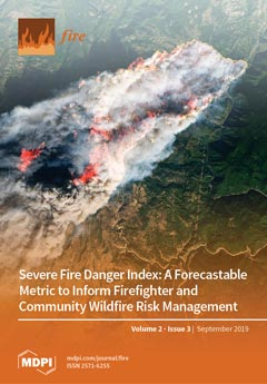
Here we present an index that can be used to assess, forecast, and map severe fire danger. The five-class Severe Fire Danger Index (SFDI) is normalized to the local climate and is easily communicated to both firefighters and the public. SFDI is strongly associated with firefighter entrapments, where 97 of 129 (75.2%) burnover deaths over the last 40 years occurred under Very High or Severe SFDI conditions. SFDI forecast maps produced before 9 major fire events in California in 2017 and 2018 also showed that 76.2% of satellite active fire detections during the first 48 h following ignition occurred under Very High or Severe SFDI conditions. These firefighter safety and community risk case studies indicate that fire danger conditions conducive to large, destructive, and deadly wildfires could be mapped ahead of time, allowing both fire managers and vulnerable communities additional time to prepare. View [...] Read more.
  • Issues are regarded as officially published after their release is announced to the table of contents alert mailing list.
  • You may sign up for e-mail alerts to receive table of contents of newly released issues.
  • PDF is the official format for papers published in both, html and pdf forms. To view the papers in pdf format, click on the "PDF Full-text" link, and use the free Adobe Reader to open them.
Order results
Result details
Section
Select all
Export citation of selected articles as:
15 pages, 1022 KiB  
Article
Century-Scale Fire Dynamics in a Savanna Ecosystem
by Bérangère A. Leys, Daniel Griffin, Evan R. Larson and Kendra K. McLauchlan
Fire 2019, 2(3), 51; https://doi.org/10.3390/fire2030051 - 17 Sep 2019
Cited by 6 | Viewed by 4030
Abstract
(1) Background: Frequent fire, climate variability, and human activities collectively influence savanna ecosystems. The relative role of these three factors likely varies on interannual, decadal, and centennial timescales. Here, we tested if Euro-American activities uncoupled drought and fire frequencies relative to previous centuries [...] Read more.
(1) Background: Frequent fire, climate variability, and human activities collectively influence savanna ecosystems. The relative role of these three factors likely varies on interannual, decadal, and centennial timescales. Here, we tested if Euro-American activities uncoupled drought and fire frequencies relative to previous centuries in a temperate savanna site. (2) Methods: We combined records of fire frequency from tree ring fire scars and sediment charcoal abundance, and a record of fuel type based on charcoal particle morphometry to reconstruct centennial scale shifts in fire frequency and fuel sources in a savanna ecosystem. We also tested the climate influence on fire occurrence with an independently derived tree-ring reconstruction of drought. We contextualized these data with historical records of human activity. (3) Results: Tree fire scars revealed eight fire events from 1822–1924 CE, followed by localized suppression. Charcoal signals highlight 13 fire episodes from 1696–2001. Fire–climate coupling was not clearly evident both before and after Euro American settlement The dominant fuel source shifted from herbaceous to woody fuel during the early-mid 20th century. (4) Conclusions: Euro-American settlement and landscape fragmentation disrupted the pre-settlement fire regime (fire frequency and fuel sources). Our results highlight the potential for improved insight by synthesizing interpretation of multiple paleofire proxies, especially in fire regimes with mixed fuel sources. Full article
Show Figures

Figure 1

27 pages, 7559 KiB  
Article
Forest Fire Susceptibility and Risk Mapping Using Social/Infrastructural Vulnerability and Environmental Variables
by Omid Ghorbanzadeh, Thomas Blaschke, Khalil Gholamnia and Jagannath Aryal
Fire 2019, 2(3), 50; https://doi.org/10.3390/fire2030050 - 3 Sep 2019
Cited by 107 | Viewed by 11660
Abstract
Forests fires in northern Iran have always been common, but the number of forest fires has been growing over the last decade. It is believed, but not proven, that this growth can be attributed to the increasing temperatures and droughts. In general, the [...] Read more.
Forests fires in northern Iran have always been common, but the number of forest fires has been growing over the last decade. It is believed, but not proven, that this growth can be attributed to the increasing temperatures and droughts. In general, the vulnerability to forest fire depends on infrastructural and social factors whereby the latter determine where and to what extent people and their properties are affected. In this paper, a forest fire susceptibility index and a social/infrastructural vulnerability index were developed using a machine learning (ML) method and a geographic information system multi-criteria decision making (GIS-MCDM), respectively. First, a forest fire inventory database was created from an extensive field survey and the moderate resolution imaging spectroradiometer (MODIS) thermal anomalies product for 2012 to 2017. A forest fire susceptibility map was generated using 16 environmental variables and a k-fold cross-validation (CV) approach. The infrastructural vulnerability index was derived with emphasis on different types of construction and land use, such as residential, industrial, and recreation areas. This dataset also incorporated social vulnerability indicators, e.g., population, age, gender, and family information. Then, GIS-MCDM was used to assess risk areas considering the forest fire susceptibility and the social/infrastructural vulnerability maps. As a result, most high fire susceptibility areas exhibit minor social/infrastructural vulnerability. The resulting forest fire risk map reveals that 729.61 ha, which is almost 1.14% of the study areas, is categorized in the high forest fire risk class. The methodology is transferable to other regions by localisation of the input data and the social indicators and contributes to forest fire mitigation and prevention planning. Full article
Show Figures

Graphical abstract

15 pages, 1149 KiB  
Article
Factors Associated with Structure Loss in the 2013–2018 California Wildfires
by Alexandra D. Syphard and Jon E. Keeley
Fire 2019, 2(3), 49; https://doi.org/10.3390/fire2030049 - 2 Sep 2019
Cited by 48 | Viewed by 14555
Abstract
Tens of thousands of structures and hundreds of human lives have been lost in recent fire events throughout California. Given the potential for these types of wildfires to continue, the need to understand why and how structures are being destroyed has taken on [...] Read more.
Tens of thousands of structures and hundreds of human lives have been lost in recent fire events throughout California. Given the potential for these types of wildfires to continue, the need to understand why and how structures are being destroyed has taken on a new level of urgency. We compiled and analyzed an extensive dataset of building inspectors’ reports documenting homeowner mitigation practices for more than 40,000 wildfire-exposed structures from 2013–2018. Comparing homes that survived fires to homes that were destroyed, we investigated the role of defensible space distance, defensive actions, and building structural characteristics, statewide and parsed into three broad regions. Overall, structural characteristics explained more of a difference between survived and destroyed structures than defensible space distance. The most consistently important structural characteristics—having enclosed eaves, vent screens, and multi-pane windows—were those that potentially prevented wind-born ember penetration into structures, although multi-pane windows are also known to protect against radiant heat. In the North-Interior part of the state, active firefighting was the most important reason for structure survival. Overall, the deviance explained for any given variable was relatively low, suggesting that other factors need to be accounted for to understand the full spectrum of structure loss contributors. Furthermore, while destroyed homes were preferentially included in the study, many “fire-safe” structures, having > 30 m defensible space or fire-resistant building materials, were destroyed. Thus, while mitigation may play an important role in structure survival, additional strategies should be considered to reduce future structure loss. Full article
Show Figures

Figure 1

13 pages, 1985 KiB  
Article
Fire Exclusion Destroys Habitats for At-Risk Species in a British Columbia Protected Area
by Kira M. Hoffman, Sara B. Wickham, William S. McInnes and Brian M. Starzomski
Fire 2019, 2(3), 48; https://doi.org/10.3390/fire2030048 - 29 Aug 2019
Cited by 5 | Viewed by 5506
Abstract
Fire exclusion and suppression has altered the composition and structure of Garry oak and associated ecosystems in British Columbia. The absence of frequent low severity ground fires has been one of the main contributors to dense patches of non-native grasses, shrubs, and encroaching [...] Read more.
Fire exclusion and suppression has altered the composition and structure of Garry oak and associated ecosystems in British Columbia. The absence of frequent low severity ground fires has been one of the main contributors to dense patches of non-native grasses, shrubs, and encroaching Douglas-fir trees in historical Garry oak dominated meadows. This case study uses remote sensing and dendrochronology to reconstruct the stand dynamics and long-term fire history of a Garry oak meadow situated within Helliwell Provincial Park located on Hornby Island, British Columbia. The Garry oak habitat in Helliwell Park has decreased by 50% since 1950 due to conifer encroachment. Lower densities and mortalities of Garry oak trees were associated with the presence of overstory Douglas-fir trees. To slow conifer encroachment into the remaining Garry oak meadows, we recommend that mechanical thinning of Douglas-fir be followed by a prescribed burning program. Reintroducing fire to Garry oak ecosystems can restore and maintain populations of plants, mammals, and insects that rely on these fire resilient habitats. Full article
Show Figures

Figure 1

24 pages, 13897 KiB  
Article
Severe Fire Danger Index: A Forecastable Metric to Inform Firefighter and Community Wildfire Risk Management
by W. Matt Jolly, Patrick H. Freeborn, Wesley G. Page and Bret W. Butler
Fire 2019, 2(3), 47; https://doi.org/10.3390/fire2030047 - 27 Aug 2019
Cited by 36 | Viewed by 34326
Abstract
Despite major advances in numerical weather prediction, few resources exist to forecast wildland fire danger conditions to support operational fire management decisions and community early-warning systems. Here we present the development and evaluation of a spatial fire danger index that can be used [...] Read more.
Despite major advances in numerical weather prediction, few resources exist to forecast wildland fire danger conditions to support operational fire management decisions and community early-warning systems. Here we present the development and evaluation of a spatial fire danger index that can be used to assess historical events, forecast extreme fire danger, and communicate those conditions to both firefighters and the public. It uses two United States National Fire Danger Rating System indices that are related to fire intensity and spread potential. These indices are normalized, combined, and categorized based on a 39-yr climatology (1979–2017) to produce a single, categorical metric called the Severe Fire Danger Index (SFDI) that has five classes; Low, Moderate, High, Very High, and Severe. We evaluate the SFDI against the number of newly reported wildfires and total area burned from agency fire reports (1992–2017) as well as daily remotely sensed numbers of active fire pixels and total daily fire radiative power for large fires (2003–2016) from the Moderate-Resolution Imaging Spectroradiometer (MODIS) across the conterminous United States. We show that the SFDI adequately captures geographic and seasonal variations of fire activity and intensity, where 58% of the eventual area burned reported by agency fire records, 75.2% of all MODIS active large fire pixels, and 81.2% of all fire radiative power occurred when the SFDI was either Very High or Severe (above the 90th percentile). We further show that SFDI is a strong predictor of firefighter fatalities, where 97 of 129 (75.2%) burnover deaths from 1979 to 2017 occurred when SFDI was either Very High or Severe. Finally, we present an operational system that uses short-term, numerical weather predictions to produce daily SFDI forecasts and show that 76.2% of all satellite active fire detections during the first 48 h following the ignition of nine high-profile case study fires in 2017 and 2018 occurred under Very High or Severe SFDI conditions. The case studies indicate that the extreme weather events that caused tremendous damage and loss of life could be mapped ahead of time, which would allow both wildland fire managers and vulnerable communities additional time to prepare for potentially dangerous conditions. Ultimately, this simple metric can provide critical decision support information to wildland firefighters and fire-prone communities and could form the basis of an early-warning system that can improve situational awareness and potentially save lives. Full article
Show Figures

Figure 1

18 pages, 476 KiB  
Article
Interactions between Resident Risk Perceptions and Wildfire Risk Mitigation: Evidence from Simultaneous Equations Modeling
by James R. Meldrum, Hannah Brenkert-Smith, Patricia Champ, Jamie Gomez, Lilia Falk and Christopher Barth
Fire 2019, 2(3), 46; https://doi.org/10.3390/fire2030046 - 12 Aug 2019
Cited by 18 | Viewed by 4561
Abstract
Fire science emphasizes that mitigation actions on residential property, including structural hardening and maintaining defensible space, can reduce the risk of wildfire at a home. Accordingly, a rich body of social science literature investigates the determinants of wildfire risk mitigation behaviors of residents [...] Read more.
Fire science emphasizes that mitigation actions on residential property, including structural hardening and maintaining defensible space, can reduce the risk of wildfire at a home. Accordingly, a rich body of social science literature investigates the determinants of wildfire risk mitigation behaviors of residents living in fire-prone areas. Here, we investigate relationships among wildfire hazards, residents’ risk perceptions, and conditions associated with mitigation actions using a combination of simulated wildfire conditions, household survey responses, and professionally assessed parcel characteristic data. We estimate a simultaneous model of these data that accounts for potential direct feedbacks between risk perceptions and parcel-level conditions. We also compare the use of self-reported versus assessed parcel-level data for estimating these relationships. Our analysis relies on paired survey and assessment data for approximately 2000 homes in western Colorado. Our simultaneous model demonstrates dual-directional interactions between risk perceptions and conditions associated with mitigation actions, with important implications for inference from simpler approaches. In addition to improving general understanding of decision-making about risk and natural hazards, our findings can support the effectiveness of publicly supported programs intended to encourage mitigation to reduce society’s overall wildfire risk. Full article
Show Figures

Graphical abstract

22 pages, 5236 KiB  
Article
Half-Century Changes in LULC and Fire in Two Iberian Inner Mountain Areas
by Catarina Romão Sequeira, Francisco Castro Rego, Cristina Montiel-Molina and Penelope Morgan
Fire 2019, 2(3), 45; https://doi.org/10.3390/fire2030045 - 8 Aug 2019
Cited by 2 | Viewed by 3621
Abstract
Wildfires in the Iberian Peninsula were large and frequent in the second half of the 20th century. Land use and land cover (LULC) also changed greatly. Our aim was to understand the relationship between LULC and fire in the western and eastern ends [...] Read more.
Wildfires in the Iberian Peninsula were large and frequent in the second half of the 20th century. Land use and land cover (LULC) also changed greatly. Our aim was to understand the relationship between LULC and fire in the western and eastern ends of the Iberian Central Mountain System. We compared two case study landscapes, the Estrela massif and the Ayllón massif, which are biophysically similar but with different social-ecological contexts. In both, fires were in general more likely in shrublands and pastures than in forests. Shrublands replaced forests after fires. Contrasting LULC in the two massifs, particularly pastures, likely explained the differences in fire occurrence, and reflected different regional land use policies and history. Fire here is a social-ecological system, influenced by specific LULC and with implications from landscape to regional scales. Understanding how LULC changes interact with fire is powerful for improving landscape and regional planning. Full article
(This article belongs to the Special Issue Land-Use and Fire around the World from the Past to the Present)
Show Figures

Figure 1

28 pages, 9500 KiB  
Article
Have Historical Land Use/Land Cover Changes Triggered a Fire Regime Shift in Central Spain?
by Cristina Montiel-Molina, Lara Vilar, Catarina Romão-Sequeira, Oskar Karlsson, Luis Galiana-Martín, Gonzalo Madrazo-García de Lomana and Ma Teresa Palacios-Estremera
Fire 2019, 2(3), 44; https://doi.org/10.3390/fire2030044 - 3 Aug 2019
Cited by 14 | Viewed by 4790
Abstract
Fire is one of the main disturbance factors shaping the landscape, and landscape is a key driver of fire behavior. Considering the role played by land use and land cover (LULC) changes as the main driver of landscape dynamics, the aim of this [...] Read more.
Fire is one of the main disturbance factors shaping the landscape, and landscape is a key driver of fire behavior. Considering the role played by land use and land cover (LULC) changes as the main driver of landscape dynamics, the aim of this study was to calculate and analyze (i) the real impact of fire on LULC changes and (ii) how these LULC changes were influencing the fire regime. We used methods of historical geography and socio-spatial systemic analysis for reconstructing and assessing the LULC change and fire history in six case studies in the Central Mountain System (Spain) from archival documentary sources and historical cartography. The main result is an accurate dataset of fire records from 1497 to 2013 and a set of LULC maps for three time points (1890s–1930s, 1956–1957, and the 2000s). We have shown the nonlinear evolution of the fire regime and the importance of the local scale when assessing the interaction of landscape dynamics and fire regime variation. Our findings suggest that LULC trends have been the main influencing factor of fire regime variation in Central Spain since the mid-19th century. Full article
(This article belongs to the Special Issue Land-Use and Fire around the World from the Past to the Present)
Show Figures

Figure 1

23 pages, 4377 KiB  
Article
Spatial Prediction of Wildfire Susceptibility Using Field Survey GPS Data and Machine Learning Approaches
by Omid Ghorbanzadeh, Khalil Valizadeh Kamran, Thomas Blaschke, Jagannath Aryal, Amin Naboureh, Jamshid Einali and Jinhu Bian
Fire 2019, 2(3), 43; https://doi.org/10.3390/fire2030043 - 28 Jul 2019
Cited by 101 | Viewed by 10721
Abstract
Recently, global climate change discussions have become more prominent, and forests are considered as the ecosystems most at risk by the consequences of climate change. Wildfires are among one of the main drivers leading to losses in forested areas. The increasing availability of [...] Read more.
Recently, global climate change discussions have become more prominent, and forests are considered as the ecosystems most at risk by the consequences of climate change. Wildfires are among one of the main drivers leading to losses in forested areas. The increasing availability of free remotely sensed data has enabled the precise locations of wildfires to be reliably monitored. A wildfire data inventory was created by integrating global positioning system (GPS) polygons with data collected from the moderate resolution imaging spectroradiometer (MODIS) thermal anomalies product between 2012 and 2017 for Amol County, northern Iran. The GPS polygon dataset from the state wildlife organization was gathered through extensive field surveys. The integrated inventory dataset, along with sixteen conditioning factors (topographic, meteorological, vegetation, anthropological, and hydrological factors), was used to evaluate the potential of different machine learning (ML) approaches for the spatial prediction of wildfire susceptibility. The applied ML approaches included an artificial neural network (ANN), support vector machines (SVM), and random forest (RF). All ML approaches were trained using 75% of the wildfire inventory dataset and tested using the remaining 25% of the dataset in the four-fold cross-validation (CV) procedure. The CV method is used for dealing with the randomness effects of the training and testing dataset selection on the performance of applied ML approaches. To validate the resulting wildfire susceptibility maps based on three different ML approaches and four different folds of inventory datasets, the true positive and false positive rates were calculated. In the following, the accuracy of each of the twelve resulting maps was assessed through the receiver operating characteristics (ROC) curve. The resulting CV accuracies were 74%, 79% and 88% for the ANN, SVM and RF, respectively. Full article
Show Figures

Figure 1

18 pages, 1701 KiB  
Article
Is Anthropogenic Pyrodiversity Invisible in Paleofire Records?
by Christopher I. Roos, Grant J. Williamson and David M. J. S. Bowman
Fire 2019, 2(3), 42; https://doi.org/10.3390/fire2030042 - 18 Jul 2019
Cited by 22 | Viewed by 5767
Abstract
Paleofire studies frequently discount the impact of human activities in past fire regimes. Globally, we know that a common pattern of anthropogenic burning regimes is to burn many small patches at high frequency, thereby generating landscape heterogeneity. Is this type of anthropogenic pyrodiversity [...] Read more.
Paleofire studies frequently discount the impact of human activities in past fire regimes. Globally, we know that a common pattern of anthropogenic burning regimes is to burn many small patches at high frequency, thereby generating landscape heterogeneity. Is this type of anthropogenic pyrodiversity necessarily obscured in paleofire records because of fundamental limitations of those records? We evaluate this with a cellular automata model designed to replicate different fire regimes with identical fire rotations but different fire frequencies and patchiness. Our results indicate that high frequency patch burning can be identified in tree-ring records at relatively modest sampling intensities. However, standard methods that filter out fires represented by few trees systematically biases the records against patch burning. In simulated fire regime shifts, fading records, sample size, and the contrast between the shifted fire regimes all interact to make statistical identification of regime shifts challenging without other information. Recent studies indicate that integration of information from history, archaeology, or anthropology and paleofire data generate the most reliable inferences of anthropogenic patch burning and fire regime changes associated with cultural changes. Full article
(This article belongs to the Special Issue Land-Use and Fire around the World from the Past to the Present)
Show Figures

Figure 1

9 pages, 2051 KiB  
Technical Note
firebehavioR: An R Package for Fire Behavior and Danger Analysis
by Justin P. Ziegler, Chad M. Hoffman and William Mell
Fire 2019, 2(3), 41; https://doi.org/10.3390/fire2030041 - 13 Jul 2019
Cited by 5 | Viewed by 6550
Abstract
Wildland fire and ecological researchers use empirical and semi-empirical modeling systems to assess fire behavior and danger. This technical note describes the firebehavioR package, a porting of two fire behavior modeling systems, Crown Fire Initiation and Spread and a Rothermel-based framework, to the [...] Read more.
Wildland fire and ecological researchers use empirical and semi-empirical modeling systems to assess fire behavior and danger. This technical note describes the firebehavioR package, a porting of two fire behavior modeling systems, Crown Fire Initiation and Spread and a Rothermel-based framework, to the R programming language. We also highlight supporting data objects and functions to predict inputs required for fire behavior estimation. Last, this package contains functions for fifteen indices to express fire danger using weather and/or fuels observations. Specific advantages of predicting fire behavior using R, a free-and-open-source programming language, include freedom to adapt calculations to suit users’ needs, transparency of source code, and reduction of workflow inefficiencies, thereby aiding in sophisticated fire behavior analyses. Full article
Show Figures

Figure 1

19 pages, 9572 KiB  
Article
Escape Route Index: A Spatially-Explicit Measure of Wildland Firefighter Egress Capacity
by Michael J. Campbell, Wesley G. Page, Philip E. Dennison and Bret W. Butler
Fire 2019, 2(3), 40; https://doi.org/10.3390/fire2030040 - 8 Jul 2019
Cited by 23 | Viewed by 9378
Abstract
For wildland firefighters, the ability to efficiently evacuate the fireline is limited by terrain, vegetation, and fire conditions. The impacts of terrain and vegetation on evacuation time to a safety zone may not be apparent when considering potential control locations either at the [...] Read more.
For wildland firefighters, the ability to efficiently evacuate the fireline is limited by terrain, vegetation, and fire conditions. The impacts of terrain and vegetation on evacuation time to a safety zone may not be apparent when considering potential control locations either at the time of a wildfire or during pre-suppression planning. To address the need for a spatially-explicit measure of egress capacity, this paper introduces the Escape Route Index (ERI). Ranging from 0 to 1, ERI is a normalized ratio of the distance traveled within a time frame, accounting for impedance by slope and vegetation, to the optimal distance traveled in the absence of these impediments. An ERI approaching 1 indicates that terrain and vegetation conditions should have little impact on firefighter mobility while an ERI approaching 0 is representative of limited cross-country travel mobility. The directional nature of evacuation allows for the computation of four ERI metrics: (1) ERImean (average ERI in all travel directions); (2) ERImin (ERI in direction of lowest egress); (3) ERImax (ERI in direction of highest egress); and (4) ERIazimuth (azimuth of ERImax direction). We demonstrate the implementation of ERI for three different evacuation time frames (10, 20, and 30 min) on the Angeles National Forest in California, USA. A previously published, crowd-sourced relationship between slope and travel rate was used to account for terrain, while vegetation was accounted for by using land cover to adjust travel rates based on factors from the Wildland Fire Decision Support System (WFDSS). Land cover was found to have a stronger impact on ERI values than slope. We also modeled ERI values for several recent wildland firefighter entrapments to assess the degree to which landscape conditions may have contributed to these events, finding that ERI values were generally low from the crews’ evacuation starting points. We conclude that mapping ERI prior to engaging a fire could help inform overall firefighter risk for a given location and aid in identifying locations with greater egress capacity in which to focus wildland fire suppression, thus potentially reducing risk of entrapment. Continued improvements in accuracy of vegetation density mapping and increased availability of light detection and ranging (lidar) will greatly benefit future implementations of ERI. Full article
Show Figures

Figure 1

33 pages, 7193 KiB  
Article
Sharing Multiple Perspectives on Burning: Towards a Participatory and Intercultural Fire Management Policy in Venezuela, Brazil, and Guyana
by Bibiana Bilbao, Jayalaxshmi Mistry, Adriana Millán and Andrea Berardi
Fire 2019, 2(3), 39; https://doi.org/10.3390/fire2030039 - 5 Jul 2019
Cited by 34 | Viewed by 9548
Abstract
Although there is convincing scientific research for the role of Indigenous fire practices in sustainable land management, Indigenous peoples’ involvement in policy-making is limited. This paper presents findings from a fire management workshop where experiences and perspectives were shared among 60 academic, government, [...] Read more.
Although there is convincing scientific research for the role of Indigenous fire practices in sustainable land management, Indigenous peoples’ involvement in policy-making is limited. This paper presents findings from a fire management workshop where experiences and perspectives were shared among 60 academic, government, and Indigenous representatives from 27 organizations from Venezuela, Brazil, and Guyana. The data, in the form of small group discussions, participatory drawings, whole group reflections, and videos, showed that although there was general acceptance about the central role of fire in traditional Indigenous livelihoods and its importance for protecting the biological and cultural diversity of ecosystems, there were also tensions around the past imposition of a dominant fire exclusion discourse of governmental institutions in Indigenous territories. Overcoming the gaps derived from different experiences and historical worldviews, and building mutual trust and respect were the main challenges when integrating multiple perspectives through the “intercultural interface” of institutions working on environmental management and governance. The elaboration of a common declaration and next steps in the framework of a “Participatory and Intercultural Fire Management Network”, created during the workshop to enhance a sustainable fire policy, revealed the conviction of working together for Indigenous fire management legitimization and strengthening from all participants of the three countries. Full article
(This article belongs to the Special Issue Land-Use and Fire around the World from the Past to the Present)
Show Figures

Figure 1

19 pages, 4108 KiB  
Article
Estimating Canopy Fuel Attributes from Low-Density LiDAR
by Peder S. Engelstad, Michael Falkowski, Peter Wolter, Aaron Poznanovic and Patty Johnson
Fire 2019, 2(3), 38; https://doi.org/10.3390/fire2030038 - 28 Jun 2019
Cited by 19 | Viewed by 5761
Abstract
Simulations of wildland fire risk are dependent on the accuracy and relevance of spatial data inputs describing drivers of wildland fire, including canopy fuels. Spatial data are freely available at national and regional levels. However, the spatial resolution and accuracy of these types [...] Read more.
Simulations of wildland fire risk are dependent on the accuracy and relevance of spatial data inputs describing drivers of wildland fire, including canopy fuels. Spatial data are freely available at national and regional levels. However, the spatial resolution and accuracy of these types of products often are insufficient for modeling local conditions. Fortunately, active remote sensing techniques can produce accurate, high-resolution estimates of forest structure. Here, low-density LiDAR and field-based data were combined using randomForest k-nearest neighbor imputation (RF-kNN) to estimate canopy bulk density, canopy base height, and stand age across the Boundary Waters Canoe Area in Minnesota, USA. RF-kNN models produced strong relationships between estimated canopy fuel attributes and field-based data for stand age (Adj. R2 = 0.81, RMSE = 10.12 years), crown fuel base height (Adj. R2 = 0.78, RMSE = 1.10 m), live crown base height (Adj. R2 = 0.7, RMSE = 1.60 m), and canopy bulk density (Adj. R2 = 0.48, RMSE = 0.09kg/m3). These results suggest that low-density LiDAR can help estimate canopy fuel attributes in mixed forests, with robust model accuracies and high spatial resolutions compared to currently utilized fire behavior model inputs. Model map outputs provide a cost-efficient alternative for data required to simulate fire behavior and support local management. Full article
Show Figures

Figure 1

24 pages, 4429 KiB  
Article
The Effect of Surface Fire in Savannah Systems in the Kruger National Park (KNP), South Africa, on the Backscatter of C-Band Sentinel-1 Images
by Renaud Mathieu, Russell Main, David P. Roy, Laven Naidoo and Hannah Yang
Fire 2019, 2(3), 37; https://doi.org/10.3390/fire2030037 - 27 Jun 2019
Cited by 7 | Viewed by 6000
Abstract
Savannahs are mixed woody-grass communities where low-intensity surface fires are common, affecting mostly the grass layer and rarely damaging trees. We investigated the effect of surface fires in a savannah system in the Kruger National Park, South Africa, on the backscatter of synthetic [...] Read more.
Savannahs are mixed woody-grass communities where low-intensity surface fires are common, affecting mostly the grass layer and rarely damaging trees. We investigated the effect of surface fires in a savannah system in the Kruger National Park, South Africa, on the backscatter of synthetic aperture radar (SAR) C-band Sentinel-1A images. Pre-fire and post-fire dual polarized (VH, VV) C-band backscatter values were examined for 30 burn events. For all events, a systematic backscatter decrease from pre-fire to post-fire conditions was observed, with mean backscatter decreases of 1.61 dB and 0.99 dB for VH and VV, respectively. A total of 90% and 75% of the burn events showed a decrease in VH and VV backscatter greater than 0.43 dB, the overall absolute radiometric of Sentinel-1A products. The VH data were, overall, 1.7 times more sensitive to surface fire effects than the VV data. C-band data are likely sensitive to a reduction in grass biomass typical of surface fires, as well as in grass/soil moisture levels. Early season fires had higher backscatter decreases due to greater early season moisture conditions. For region with more than 30% woody cover, the effect of fire on the C-band backscatter was reduced. Denser woody communities tend to produce lower grass fuel load and less intense surface fires, and limit the penetration of C-band microwaves to the ground where most savannah fires and associated effects occur. This research provides evidence that C-band space-borne SAR is sensitive to the effects of surface-level fires in southern African savannahs. The unique availability of frequent and spatially detailed C-band data from the Sentinel-1 SAR constellation provide new opportunities for burned area mapping and systematic monitoring in savannahs systems, for instance, for fine-scale fire propagation studies. Full article
(This article belongs to the Special Issue Remote Sensing of Fire and Its Impact on Land and Atmosphere)
Show Figures

Figure 1

Previous Issue
Next Issue
Back to TopTop