Article

Study Variability of the Land Surface Temperature of Land Cover during El Niño Southern Oscillation (ENSO) in a Tropical City

by
Oliver Valentine Eboy
1 and
Ricky Anak Kemarau
2,*
1
Faculty of Social Sciences and Humanities, Universiti Malaysia Sabah (UMS), Kota Kinabalu 88400, Sabah, Malaysia
2
Earth Observation Centre, Institute of Climate Change, Universiti Kebangsaan Malaysia, Bangi 43600, Selangor, Malaysia
*
Author to whom correspondence should be addressed.
Sustainability 2023, 15(11), 8886; https://doi.org/10.3390/su15118886
Submission received: 18 April 2023 / Revised: 25 May 2023 / Accepted: 29 May 2023 / Published: 31 May 2023
(This article belongs to the Section Sustainability in Geographic Science)

Abstract

:
The World Health Organization has reported numerous fatalities, primarily among urban residents, during El Niño events. This study employed remote sensing technology to investigate the influence of the El Niño Southern Oscillation on temperature. The objective was to analyze the effect of ENSO on temperature across different land cover types using Landsat satellite data. Pre-processing was applied to the satellite data before converting numerical values into surface temperatures. The findings revealed that RS technology effectively captured the impact of varying ENSO intensity levels on surface temperatures. ENSO strength influenced temperature variations in the study areas. During El Niño events, urban areas exhibited higher land surface temperatures compared to vegetation, wetlands, and water bodies, a pattern consistent during La Niña. Specifically, there was a 2.5 °C temperature increase in the urban land cover area during El Niño events between 2016 and 1997. Water bodies, vegetation, and wetlands experienced respective temperature increases of 0.17 °C, 0.17 °C, and +0.7 °C during ONI value 1 events between 2016 and 1997. These findings are crucial for local authorities, providing spatial information on hot spots to enhance vigilance against potential El Niño temperatures.

1. Introduction

Understanding the impact of ENSO on cities is crucial for managing public health and essential resources. By analyzing temperature patterns during ENSO events, remote sensing (RS) can help identify areas at higher risk of heat-related illnesses and guide the allocation of resources to mitigate health impacts. It also provides valuable information for managing water resources, energy consumption, and urban infrastructure during periods of extreme heat and drought associated with ENSO. ENSO events can exacerbate the urban heat island effect, leading to higher temperatures in urban areas compared to surrounding rural or suburban regions. Remote sensing allows for the quantification of surface temperature variations within the city, helping to assess the intensity and spatial extent of the urban heat island effect during ENSO events. The location of the study areas in Southeast Asia is associated with the occurrence of several climate phenomena, including the Madden–Julian Oscillation, the Indian Ocean Dipole, monsoons, and ENSO [1]. El Niño events contribute to extremely hot weather in Southeast Asian countries such as Malaysia, Indonesia, Thailand, and Vietnam [2,3]. Moreover, El Niño leads to warmer weather than usual and can result in prolonged droughts, which have been responsible for the highest recorded temperature increases in Southeast Asia’s history, observed in 1997/1998 and 2015/2016 [4,5]. These intense heat conditions also have detrimental effects on human health, such as heat stroke, discomfort, increased electricity consumption, and scarcity of water and food resources [1,5,6,7]. The impact of temperature increase is more pronounced in urban areas due to global warming and the presence of urban heat islands [8]. The Intergovernmental Panel on Climate Change [9] supports this statement and predicts the occurrence of extremely hot weather in the future. During El Niño, the urban heat island effect intensifies this warming effect, as urban areas exhibit higher temperatures than rural or suburban areas due to modifications in vegetation cover, which absorb and release heat, particularly during nighttime [10,11,12].
NOAA (2018) classifies past El Niño events based on strength levels, including weak, moderate, and strong. It is important to analyze and study the differences in each strength level to understand the potential effects of future El Niño events [7]. Previous studies have shown an increase in El Niño effects, but there is limited research on the impact of El Niño on temperature in other countries, including those in Southeast Asia [7,8]. Studying the impact and response to ENSO is crucial for developing national policies and response measures to manage droughts based on accurate scientific data [7]. Furthermore, the lack of information dissemination and infrastructure during droughts and El Niño events has resulted in the loss of lives, as seen in India and Pakistan. Therefore, there is a need for diversified studies to enhance our knowledge of the effects of ENSO on humans, especially beyond the directly affected areas. Kemarau and Eboy [7] highlight the insufficient knowledge and research providing information outside the affected regions. These factors have motivated researchers to utilize GIS and remote sensing (RS) techniques, which provide valuable external information. In the realm of remote sensing research, studying ENSO is important as it allows for a better understanding of its impact on temperature patterns and changes in land cover. Remote sensing techniques, such as thermal remote sensing, enable researchers to assess temperature variations over large spatial areas. By analyzing satellite data, they can identify and monitor thermal anomalies associated with El Niño events and their effects on different regions and land cover types.
However, there are limitations to thermal remote sensing data. One limitation is the spatial resolution of the data, which may not capture fine-scale temperature variations. For example, low-resolution data may not accurately detect temperature differences within small urban areas or localized hotspots. Additionally, the remote sensing sensor, whether thermal or optical, cannot penetrate clouds, resulting in missing data. Overall, studying ENSO using remote sensing techniques helps researchers gain insights into the spatial and temporal patterns of temperature changes and their association with land cover dynamics. However, there is a lack of knowledge regarding the utilization of remote sensing technology to examine the impact of ENSO events on land cover temperature. Conducting further research in this area is necessary to offer a fresh perspective on how remote sensing technology can assess weather changes resulting from ENSO events. This information is valuable for understanding the impacts of El Niño events, especially in urban areas affected by the urban heat island effect, and for developing strategies to mitigate the adverse effects of extreme weather events in the future. There is a question about the application of remote sensing to study the impact of ENSO: Can remote sensing data be used to study the impact of ENSO on the temperature of different types of land cover in Kuching City, Sarawak? This motivates the study of the application of remote sensing data, which offers spatial information. This spatial information is important as it provides knowledge and awareness to the population about hot spot areas to avoid, as seen in India and Pakistan, where an estimated 4000 people were killed due to heat stroke during El Niño in 2016 [13]. In addition, studies on the impact of ENSO on each type of land cover in the city are still lacking because many past studies have used meteorological data from a single station [7,8].
However, there are currently two studies on the use of remote sensing techniques to study the effect of ENSO on temperature: Felix and Guo [14] on a global scale and Melo et al. [15] on a regional scale throughout Brazil. The two studies used MODIS data with a low resolution of 5600 m, which failed to identify the type of land cover and land use in nearby areas. This study attempts to overcome this problem by using Landsat satellites, which have a resolution of 30 m for thermal data and 100 m for surface coverage area classification. However, the question arises: Can the remote sensing technique provide spatial information on temperature distribution changes based on the strength level of ENSO in Kuching City? If so, where are the hot and cold areas near ENSO incidents in Kuching City? Why did these areas become hotspots?

2. Materials and Methods

Daily temperatures in Kuching City, Malaysia (Figure 1), range from 23 °C to 32 °C during the day [7]. The weather in Kuching is influenced by various climatic factors such as the Madden–Julian Oscillation, El Niño-Southern Oscillation, monsoons, and the Indian Ocean Dipole [7]. Kuching experiences two monsoon seasons: the Northeast monsoon from November to February and the Northwest monsoon from May to September. The Northeast monsoon brings more rainfall, while the Northwest monsoon is relatively drier [7]. The transition between the monsoons occurs in April and October.
Kuching City was specifically selected for this study to assess the impact of ENSO on temperature for several reasons. Firstly, Kuching City is situated in a tropical climate zone characterized by consistently high temperatures and humidity throughout the year. Tropical regions are known to be highly susceptible to the influences of climate phenomena like ENSO, which can significantly affect temperature patterns and variability. Additionally, Kuching City, like many other cities in tropical regions, faces specific vulnerabilities related to temperature changes due to factors such as high population density, the urban heat island effect, and limited access to cooling infrastructure. Moreover, Kuching City has experienced rapid urban growth compared to other cities in East Malaysia [16]. This growth, coupled with the lack of a comprehensive understanding of the specific effects of ENSO on temperature in tropical cities like Kuching, underscores the importance of conducting this study. By investigating the impact of ENSO on Kuching City, the research aims to provide valuable insights into the vulnerability of the city to heat during ENSO events. This knowledge can guide future preparations and assist in building a more resilient city to cope with the potential impacts of climate change. By studying the impact of ENSO on the temperature in Kuching City, researchers can gain insights into the local climate dynamics, identify temperature trends during different ENSO phases, and contribute to climate change adaptation strategies for tropical urban areas.
This research utilized Landsat 5 TM, 7 ETM, and 8 OLI TIR satellite data. The selected remote sensing data for the study period from 1988 to 2019 were limited to cloud-free areas in the study location. A total of 37 Landsat data were involved in the analysis, downloaded from https://earthexplorer.usgs.gov/ (accessed on 15 September 2019). The Landsat satellites offer ample coverage, enabling researchers to process data for a comprehensive examination and assessment of urban environments. Table 1 displays information about the type of Landsat sensor, the date and time the data were taken (metadata), and the selection of thermal bands applied in this study.
Table 2, Table 3 and Table 4 provide wavelength information for the Landsat series applied in this study. The detailed information is based on https://landsat.gsfc.nasa.gov/ (accessed on 15 September 2019). The Landsat 8 OLI TIRS satellite orbits the Earth in a sun-synchronous orbit, near the poles, at an altitude of 705 km. Landsat 8 is equipped with the Operational Land Imager (OLI), which consists of nine spectral bands and two thermal infrared sensors, as indicated in Table 2.
The Landsat 7 ETM + satellite orbits the Earth in a sun-synchronous and near-polar orbit. Table 3 presents information regarding the available bands and resolution on the Landsat 7 ETM + satellite.
Table 3. Information bands on the Landsat 7 ETM + satellite.
BandWavelengthResolution
Band 1Blue (0.45–0.52 µm)30 m
Band 2Green (0.52–0.60 µm)30 m
Band 3Red (0.63–0.69 µm)30 m
Band 4Near Red (0.77–0.90 µm)30 m
Band 5Near-Infrared (1.55–1.75 µm)30 m
Band 6Thermal (10.40–12.50 µm)60 m
Band 7Mid-infrared (2.08–2.35 µm)30 m
Band 8Panchromatic (PAN) (0.52–0.90 µm)15 m
Table 4 contains information such as the spectral bands available on the Landsat 5 satellite and the level of detail or resolution at which the data were captured.
Table 4. Bands and resolution Landsat 4/5 TM.
BandWavelengthResolution
Band 1Blue (0.43–0.52 µm)30 m
Band 2Green (0.52–0.60 µm)30 m
Band 3Red (0.63–0.69 µm)30 m
Band 4Near-Infrared (0.76–0.90 µm)30 m
Band 5Near-Infrared (1.55–1.65 µm)30 m
Band 6Thermal (10.40–12.50 µm)30 m
Band 7Mid–Infrared (2.08–2.35 µm)120 m
The Oceanic Niño Index (ONI) is frequently used to identify El Niño and La Niña events [7]. The ONI index shows the development and intensity of El Niño or La Niña events in the Pacific Ocean and can be accessed at https://origin.cpc.ncep.noaa.gov/products/analysis_monitoring/ensostuff/ONI_v5.php (accessed on 10 September 2019). ONI is a three-month sea surface temperature anomaly in the Niño region of 3.4 at 5° North–5° South, 120°–170° West. El Niño events are defined as three-month values at or above +0.5 °C anomaly, while La Niña events are defined as at or below −0.5 °C anomaly (NOAA Climate Prediction Center, 2019). ENSO value degrees explain Weak (with sea surface temperature anomalies of 0.5 to 0.9), Moderate (1.0 to 1.4), Strong (1.5 to 1.9), and Very Strong (≥2.0) for El Niño events and vice versa for La Niña events. Figure 2 shows the flow of steps in producing a land cover map. In the first step, the collected data require an initial process of atmospheric and radiometric correction to improve the remote sensing data.
The method used in this study involves several steps to process and analyze the Landsat 5 and 8 data; we followed an existing method [16]. The first step is pre-processing, which includes geometric, radiometric, and atmospheric correction of the data. Geometric correction ensures that the data are accurately aligned and registered spatially. LST is estimated using the thermal infrared (TIR) bands of Landsat sensors, such as Landsat 5, Landsat 7, and Landsat 8 [16]. These sensors have TIR bands that capture thermal radiation emitted by the Earth’s surface. The TIR bands used for LST calculations are typically band 6 for Landsat 5 and Landsat 7 and bands 10 and 11 for Landsat 8. The calculation of LST involves a series of steps, which typically include radiometric calibration [16]: the TIR bands are radiometrically calibrated to convert the digital numbers into radiance values. Next, second-atmosphere correction. Since the atmosphere absorbs and emits thermal radiation, atmospheric effects need to be corrected to obtain accurate LST values. Different approaches, such as atmospheric models or empirical methods, can be employed for atmospheric correction. The third step is conversion to brightness temperature: the radiance values are converted to brightness temperature, which represents the temperature of the emitting surface without atmospheric interference, and the next emissivity estimation: Emissivity is the measure of the efficiency with which a surface emits thermal radiation. It is typically estimated using ancillary data or through empirical relationships with land cover types. Finally, the LST calculation: the estimated emissivity and brightness temperature are used in an algorithm to calculate LST. Different algorithms, such as the split-window algorithm or the radiative transfer equation, can be applied for this purpose.
The next step focuses on processing the corrected and converted data, ensuring proper geometric alignment for remote sensing analysis. This step is crucial to accurately overlay and compare different datasets. It helps in aligning the thermal bands and other relevant information from Landsat 5 and 8 when the procedure map land surface temperature and land cover. In the second-to-last step, the researchers employ the ISO Cluster classification method to generate land cover maps for specific years, such as 1998, 2011, 2016, and 2018. The ISO Cluster classification is a clustering algorithm that groups pixels with similar spectral characteristics into different land cover categories. This classification allows the identification and mapping of different land cover types within the study area. Finally, the accuracy of the land cover maps from specific years, such as 1972, 1988, and 2019, is assessed using time series analysis from Google Earth, as described in reference [16]. This analysis involves comparing the classified land cover maps with high-resolution satellite imagery or other reliable sources to evaluate the correctness and consistency of the land cover classification results. The study focuses on classifying the data into four different surface cover categories: urban areas, vegetation, wetland areas, and water bodies.
The confirmation of findings and results of the study is conducted using data from the Malaysian Meteorological Department through regression and correlation analysis. In regression analysis, a regression model is constructed based on the data collected from the Malaysian Meteorological Department. This model is used to understand the relationship between the independent and dependent variables and determine the strength and significance of the relationship. Furthermore, correlation analysis is also performed to measure the strength and direction of the relationship between two variables. Data from the Malaysian Meteorological Department are used to calculate the correlations between relevant variables in the study. By utilizing data from the Malaysian Meteorological Department and conducting regression and correlation analysis, the conclusions and findings of the study can be validated and confirmed based on the analyzed statistical relationships. This helps strengthen the credibility and validity of the study by utilizing reliable and credible data sources from the Malaysian Meteorological Department.
Table 5, presented in this study, demonstrates the accuracy of the modeling process in terms of user and producer accuracy. These accuracy measures indicate how well the classification model performed in correctly identifying and assigning land cover categories. According to Table 5, the user and producer accuracy values for all phases of the classification process exceeded 90%. This means that the model achieved a high level of accuracy in correctly identifying and classifying land cover categories based on the input data. Additionally, the kappa coefficient, which is a statistical measure of agreement between the classification results and reference data, was reported to be 98 for each of the four years analyzed. Kappa coefficients range from −1 to 1, with values above 0 indicating agreement between the classification and reference data. In general, kappa coefficients greater than 0.75 are considered to indicate a high level of compatibility between the classification and reference data. Therefore, based on the reported kappa coefficients of 98 for each year, it can be concluded that the classification results were highly compatible with the reference data. This suggests that the modeling process was successful in accurately classifying the land cover categories and that the results can be considered reliable for further analysis and interpretation. Kemarau and Eboy [17] stated that kappa coefficients above 0.75 indicate a high level of compatibility between the classification and reference data, reinforcing the findings from the current study.

3. Results

3.1. Validation and Verification of LST Data from Satellite Landsat with In-Situ Temperature Measurements

The relationship between meteorological temperature data and temperature measured by the Landsat satellite is strong, with a correlation coefficient of 0.97. This study examined the correlation between meteorological temperature and surface temperature using Landsat data. Daily air temperature data were collected from Kuching Airport station, which is a grassy land cover area, at latitude 01° 29 North and longitude 110° 20 East. The unit for temperature is °C. The average temperature value was taken between 0200 PM and 0300 PM on the same date that satellite data were captured. This time range corresponds to when Landsat 4–5 TM (0214–0244 PM), Landsat 7 ETM (0244–0254 PM), and Landsat 8 OLI TIRS (0251–0252 PM) orbit data passed through and captured images in the study area. Temperature data were obtained from MMD from 1988 to 2019. These meteorological data are used as a benchmark to assess the accuracy and effectiveness of RS data in studying the effects of ENSO on temperature in Kuching City, Sarawak.
Figure 3 shows the largest temperature differences observed in December 1995 (−1.7 °C), August 2004 (−1.4 °C), February 2011 (−1.3 °C), as well as September and October 2005 (−1.2 °C). These differences can be attributed to the different sensors used, as Landsat measures surface temperature while meteorological stations measure air temperature. Overall, the correlation analysis indicated a positive relationship between the daily data from the Malaysian Meteorological Department and the Landsat satellite, with a coefficient value of 0.97, indicating a close agreement with temperature differences of less than ±0.5 °C. Based on the graph presented in Figure 3, a high positive correlation (correlation coefficient of 0.97) is observed between meteorological data and surface temperature from the Landsat satellite. The correlation of temperature data from MMD is based on the average temperature value between 0200 PM and 0300 PM on the same date that satellite data were captured. This time range corresponds to when Landsat 4-5 TM (0214-0244 PM), Landsat 7 ETM (0244–0254 PM), and Landsat 8 OLI TIRS (0251-0252PM) orbit data passed through and captured images in the study area. The average land surface temperature value from the Landsat satellite at the pixel location of in situ measurement is used. The selection of time is important in explaining the high correlation relationship between temperature from the Meteorological Department and temperature from the Landsat LST satellite.
Referring to Figure 4, differences between daily temperatures obtained from the Malaysia Meteorology Department (MMD) and the Landsat satellite are observed. The study identified the largest difference to be −1.7 °C in December 1995, followed by −1.4 °C in August 2004, −1.3 °C in February 2011, and −1.2 °C in September and October 2005. These differences arise because the Landsat remote sensing sensors measure surface temperature, while meteorological stations measure air temperature [18].
However, the overall difference between RS Landsat data and temperature data from the Malaysian Meteorological Department (MMD) is below ±0.5 °C. This indicates that 97% of the data exhibit a small difference of less than ±0.5 °C. The positive relationship between RS Landsat data and MMD temperature data is supported by a correlation coefficient of 0.97. This suggests that the majority of daily data from MMD and Landsat satellites have a difference below ±0.5 °C. The high correlation coefficient of 0.97 indicates that RS data have the potential to study land surface temperature characteristics in specific locations [19,20]. The use of remote sensing (RS) enables areas without weather station facilities to stay informed about weather conditions and global climate changes, such as El Niño-Southern Oscillation (ENSO). Landsat satellites are the primary choice for temperature studies, as they provide data from 1989 to the present (2021) through second-generation satellites, including Landsat 4/5 TM, 7 ETM, 8 OLI TIRS, and 9 OLI TIRS 2. These satellites have been extensively utilized by researchers studying the effects of development changes on temperature [18]. Additionally, Landsat data offer a higher resolution of 100 m compared to the MODIS satellite, which has a resolution of 5600 m. The finer resolution of 100 m is crucial for temperature studies, allowing researchers to investigate the impacts of land use and surface features on temperature.
In addition, Zhou et al. [20] utilized MODIS and Landsat data to investigate temperature changes resulting from development activities in the Himalayan Mountain region. They reported 90% accuracy in measuring temperature using MODIS and Landsat data. The authors employed the correlation method to assess the effectiveness of these datasets in studying the effects of temperature changes due to land use and surface modifications in mountainous areas, yielding a correlation coefficient of 0.90. Parastatidis et al. [21] found that the overall root mean square error (RMSE) was 1.52 °C, indicating that the accuracy of the land surface temperature (LST) product is influenced by emissivity when using the online Google Earth Engine. Different emissivity sources were found to yield varying levels of LST accuracy, depending on the type of surface cover. Ermida et al. [22] conducted a validation exercise using in situ land surface temperature (LST) data from 12 stations. The overall accuracy for Landsat 5, 7, and 8 was found to be 0.5 K, −0.1 K, and 0.2 K, respectively. The overall root mean square error (RMSE) for Landsat 5, 7, and 8 was 2.0 K, 2.1 K, and 2.1 K, respectively. The study focuses on developing a split-window (SW) algorithm to retrieve land surface temperature (LST) from Landsat 8 satellite data in the Beas River basin, India. The algorithm utilizes spectral radiance and emissivity data from two bands of the thermal infrared sensor (TIRS) and shows accurate results compared to in situ air temperature measurements and LST values obtained from other algorithms. Rongali et al. [23] also highlight the variation of LST in different terrain types, with higher temperatures in barren/rocky areas and lower temperatures in snow/glacier areas. The SW algorithm demonstrates good transferability and has a maximum difference of 5 °C compared to measured air temperature. Jiménez et al. [24] applied the method for the retrieval of land surface temperature (LST) using split-window (SW) algorithms. In this study, both single-channel (SC) and SW algorithms were proposed and tested using simulated data, demonstrating mean errors below 1.5 K. The SW algorithm performed slightly better, especially in areas with higher atmospheric water vapor content. This highlights the significance of LST retrieval from Landsat-8 TIRS data for various applications.

3.2. Land Cover Change between the Years 1998 and 2016

The study found that there were changes in land cover as described in Figure 5. This study identified land cover changes between the years 1998 and 2016. A detailed explanation is provided based on the figure.
The study found that there were changes in land cover between the years 1998 and 2016. Based on Figure 3, it was observed that there was an increase in urban areas, transitioning from central urban areas to suburban areas. This process of urbanization led to a decrease in the extent of wetland and vegetation areas, as depicted in Figure 6.
The study found that there were changes in land cover between the years 1998 and 2016. The selection of this period was based on the occurrence of a strong El Niño event, specifically an ONI (Oceanic Nino Index) value of 1. The objective was to understand the changes in the land cover extent to assess the impact of the strong El Niño events during both years on land surface temperature. Based on the above figure, it was observed that there was a decrease in vegetation area from 216 km2 in 1998 to 193 km2 in 2016. This decrease in vegetation was due to the transformation into urban areas. The urban area extent increased from 112 km2 to 162 km2. Additionally, the area of water bodies and wetlands also experienced a decrease, with wetland area decreasing from 234 km2 to 183 km2, and water body area decreasing from 56 km2 to 54 km2.

3.3. Land Surface Temperature during El Niño with ONI 1 during 1998 and 2016, and La Niña in 2011 and 2018

During the El Niño events in 1997 (19 April 1997) and 2016 (1 July 2016), when the data were recorded, the strength of El Niño was considered strong with an ONI value of 1. Figure 7 shows that the maximum temperature during the El Niño event in 2016 was 34.5 °C, which was higher compared to the El Niño event in 1998, which recorded a maximum temperature of 32.2 °C. Additionally, the average temperature during the El Niño event in 2016 was higher at 33.6 °C compared to 30 °C during the El Niño event in 1998. The minimum temperature during the El Niño event in 2016 was also higher at 25 °C compared to 24.1 °C during the El Niño event in 1997.
Figure 8 illustrates the distribution of temperatures during the La Niña events in 2011 and 2018. Based on Figure 8, it was found that the highest temperature recorded was 30 °C during the La Niña event in 2011, and 31 °C during the La Niña event in 2018.
The average temperature during the La Niña events was 28 °C in 2011 and 29 °C in 2018. Additionally, the minimum temperature reported during the La Niña events in 2018 and 2011 was 19 °C. This study found that during the El Niño events, which bring hot and dry weather, compared to the La Niña events, which bring higher-than-usual rainfall, there was an impact on the maximum, average, and minimum temperature values. The El Niño events were found to result in higher land surface temperature (LST) in the study area compared to the La Niña events.

4. Discussion

4.1. Influence of ENSO Events on LST (Maximum, Minimum, and Mean) in Land Cover

Milica et al. [
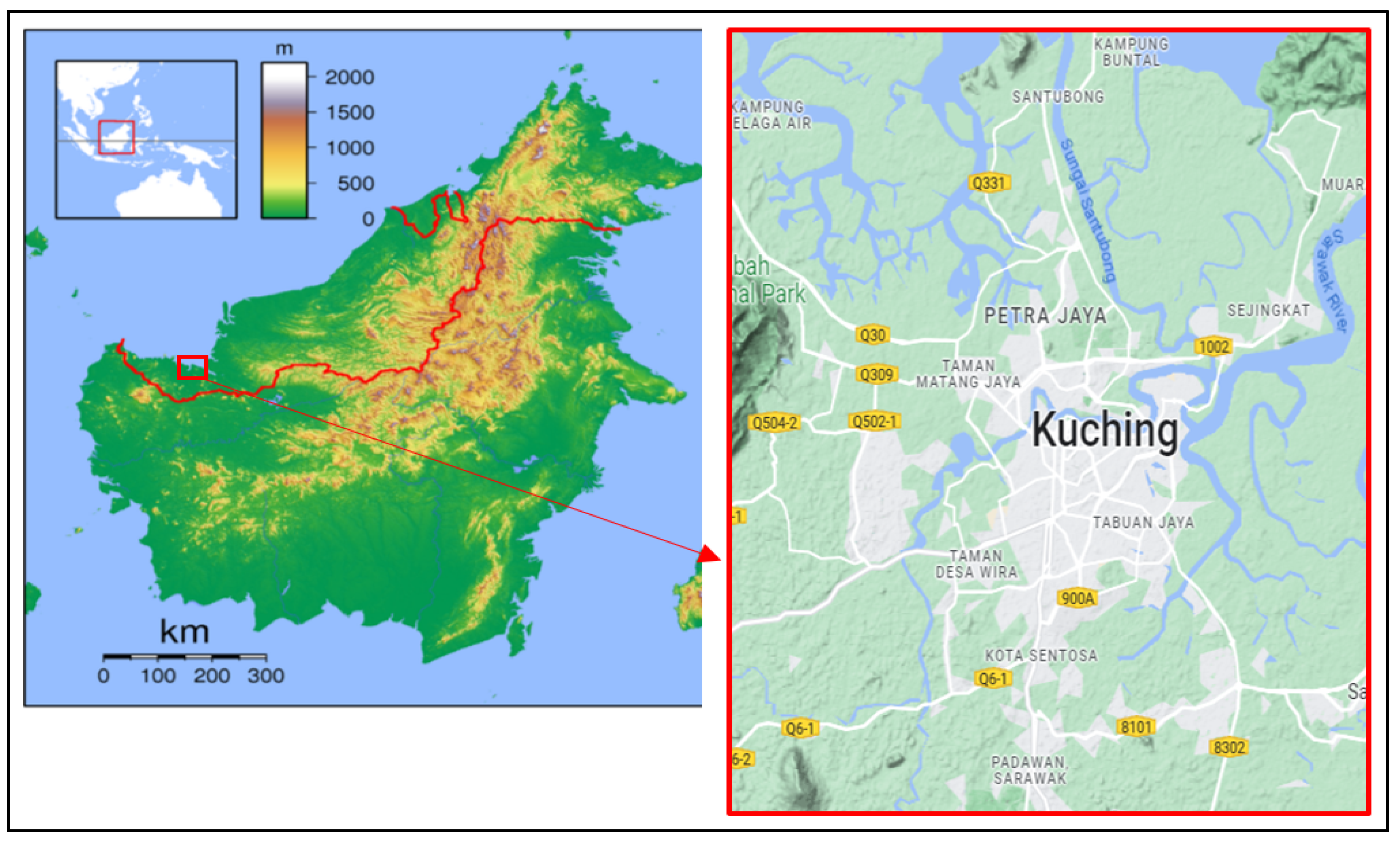
25] stated that humans start to feel discomfort when the land surface temperature exceeds 30 °C for residents in Kuching City. Figure 3 describes the land surface temperature (LST) and land cover map during El Niño and La Niña events in the study areas. It illustrates the changes in temperature patterns and land cover types during these climatic events. According to the findings depicted in Figure 8, during the La Niña event, hotspots were observed in specified areas (e.g., a zone near area G) to a greater extent compared to other events. For instance, during the El Niño event in 2016, hotspots were identified in areas A, B, C, D, E, and F (urban areas) and G, H, I, and J (industrial areas). Similarly, during the La Niña event in 2018, hotspots were observed in areas B, C, D (urban areas), and G (industrial area). Another example mentioned is the El Niño event in 1998, where additional hotspots were found in areas B, C, D, E, F (urban areas), and G, H, and I (industrial areas) compared to the time of the La Niña event. In summary, Figure 7 provides visual representations of temperature and land cover changes during El Niño and La Niña events in Kuching City. The information suggests that specific areas, particularly urban and industrial zones, tend to exhibit hotspots during these climatic events, with variations observed between El Niño and La Niña conditions.
Urban areas typically experience higher temperatures compared to surrounding rural or natural areas due to the urban heat island effect. This effect is primarily caused by the extensive use of impervious surfaces such as asphalt, concrete, and buildings in urban environments. These surfaces absorb and retain heat from the sun, leading to elevated temperatures. Additionally, the lack of vegetation and green spaces in urban areas reduces the cooling effect of evapotranspiration. Urban and industrial areas are characterized by high levels of human activities and infrastructure. These activities release significant amounts of heat into the environment. Heat-generating sources such as factories, power plants, vehicles, and air conditioning systems contribute to localized heating.
Urban areas often have limited vegetation cover compared to natural or rural areas. Trees and plants play a crucial role in regulating temperatures by providing shade and evaporative cooling through transpiration. The absence of vegetation results in reduced shading and less evapotranspiration. The presence of tall buildings and narrow streets can create a canyon-like effect that traps heat within urban areas. This can limit airflow and prevent heat dissipation. Moreover, urban areas tend to have higher levels of air pollution which can contribute to increased temperatures. Overall, factors such as the urban heat island effect, human activities and infrastructure, reduced vegetation cover, and heat-trapping contribute to urban and industrial areas becoming hotspots with elevated temperatures. Mitigation strategies can help alleviate the heat island effect and create more comfortable and sustainable urban environments. The figure clearly shows more hot spot areas in the study area at the time of the El Niño event. This result is supported by Melo et al. [15], Kanghyun et al. [26], and Jin et al. [27], who show that during El Niño, the temperature increased compared to La Niña. This explains the statistical value and distribution of high temperatures around Kuching City during El Niño. Figure 9 shows that the maximum value of land surface temperature during El Niño in 1997 and 1998 was higher than during La Niña events. For example, during El Niño 1998, the maximum value was 33 °C compared to 30 °C during La Niña 2011. Kemarau and Eboy [2] showed that during El Niño events, rainfall decreases, which can cause temperatures to rise, while during La Niña, rainfall is high, which can cause temperatures in Kuching City to decrease. Kemarau and Eboy [28] reported that the El Niño phenomenon can cause temperatures to rise between 0.5 °C and 1.5 °C, while the La Niña phenomenon can cause temperatures to drop between 0 °C and 1.2 °C.
This study discovered that the value of the absolute maximum, mean, and absolute minimum LST was higher during El Niño events compared to La Niña events for each type of land cover (Figure 7). The study also found that urban and industrial areas had higher LST values compared to wetlands, water bodies, and vegetation during El Niño and La Niña events. This study also found that the center’s urban and industrial activities experienced a decrease in LST value during the La Niña event in 2018 compared to during the El Niño event in 2016. The study showed that the effect of ENSO on the absolute maximum temperature of each type of land cover during the El Niño event was higher than during the La Niña event. For example, as shown in Figure 4, during the El Niño phenomenon in 2016, the absolute maximum LST in an urban area was 35.81 °C, while during La Niña in 2018, it was 31.89 °C. A second example is that industrial zones during El Niño 2016 had an absolute maximum LST value of 35.9 °C, while during the La Niña event in 2018, it was 31.99 °C. In addition to other areas surveyed during the El Niño event, the vegetation area reported a temperature in 2016 with an absolute maximum LST of 26.29 °C, while during La Niña in 2011, it was 24.1 °C. The figure also shows that during El Niño in 1998, wetland areas had an absolute maximum LST of 26.77 °C which was higher compared to the absolute maximum LST of 23.14 °C during La Niña in 2011. The values of the absolute minimum and mean LST have similar patterns to the absolute maximum LST values in each type of cover during El Niño events, being higher than during La Niña events, as shown in Figure 9.
Melo et al. [15], Kemarau and Eboy [2] and Jin et al. [28] support this result based on Figure 4 and report that rainfall plays an important role in LST variability in study areas during La Niña and El Niño. Melo et al. [15], Kemarau and Eboy [2], Jin et al. [28] and Mahmud [29] reported that there were times when La Niña caused temperatures to drop from 0 °C to 1.2 °C while El Niño increased temperatures from 0.5 °C to 1.5 °C based on data provided by a meteorological station in Kuching discussed in Section 3.3. Overall, industrial areas are typically found to be the hottest areas within urban environments due to high heat generation [30,31]. Table 5 describes in-depth surface temperature patterns with different types of coverage. There are numerous studies on the impact of land cover change on land surface temperature. For instance, in the study conducted in the Kuala Lumpur metropolitan city, researchers [30] found that there was an increase in non-evaporating surfaces (such as concrete or asphalt) and a decrease in vegetation area. This change in land cover resulted in elevated surface temperatures and modified the overall temperature of the study area. In another study conducted in Omeno et al. [31], the capital of Botswana, researchers discovered that there was a net gain in built-up areas and tree-covered areas. This means that these areas increased in size or density. However, cropland and grassland experienced a net loss, meaning they decreased in size or density. The study also observed that there was an increase in mean land surface temperature (LST) values across all villages between the years 2000 and 2018. The sentence also mentions a specific El Niño event. It states that during this event, there was a higher temperature increase in 2016 compared to 1998. This increase in temperature was mainly attributed to factors related to land cover changes, particularly in urban areas affected by the urban heat island effect [16,28,32]. Overall, these studies highlight the impact of land cover changes on surface temperatures and demonstrate the significance of factors such as non-evaporating surfaces, vegetation area, built-up areas, and the urban heat island effect in modifying the temperature patterns of the respective study areas.
The significant increase in the time gap between the two periods (1998 and 2016) highlights the potential influence of global warming on the observed higher land surface temperature (LST) values. It is important to note that while global warming and El Niño events can both contribute to temperature increases, they are separate phenomena with distinct impacts. In the given statement, the specific relation to the El Niño event may not be explicitly addressed. However, it is possible to infer that the El Niño event, in combination with long-term global warming trends, could have exacerbated the already high temperatures observed in 2016. El Niño events often lead to regional climate anomalies, including altered precipitation patterns and changes in atmospheric circulation, which can influence local temperature conditions. Therefore, while global warming is a broader and ongoing phenomenon, the occurrence of an El Niño event can contribute to short-term temperature variations within a specific period.
To provide a more comprehensive analysis of the relation between El Niño events and the observed temperature increases, additional information about the specific El Niño conditions during 1998 and 2016, as well as their influence on regional climate patterns and land surface temperature, would be needed. Similarly, in the case of La Niña events, such as those that occurred in 2011 and 2018, it was found that maximum, average, and minimum temperatures were lower compared to the El Niño event in 2016, as indicated by the findings in Figure 7. This is despite changes in land cover, particularly the increase in urban areas and the decrease in wetlands and vegetation. This study conducts correlation and regression analyses to identify the effects of the ENSO event on LST. Figure 3 illustrates a significant positive correlation between the Oceanic Niño Index (ONI) and land surface temperature obtained from Landsat satellite data, with a correlation coefficient of 0.71. This strong positive correlation indicates a direct relationship, indicating that an increase in ONI results in an increase in land surface temperature. Additionally, this study utilizes linear regression to understand both parameters. Table 6 presents the findings of the linear regression analysis, aiming to comprehend the influence of the El Niño-Southern Oscillation (ENSO) on land surface temperature in Kuching, Sarawak, derived from Landsat remote sensing data.
Table 7 presents the regression coefficient R and R2. The R-value of 0.75 indicates a high correlation between the effect of ONI on land surface temperature from Landsat satellite data. The R2 value of 0.57 indicates that 57% of the variation in the dependent variable (temperature) can be explained by the independent variable (ONI). In this case, 57% of the effect of ONI on temperature can be explained by ONI. Table 6, which is the analysis of the variance table, reports the extent to which the relationship between the dependent and independent variables is significant. ANOVA is used to test the adequacy of understanding the dependent variable.
Table 7 demonstrates a well-fitting regression model that supports the importance of regression analysis in understanding the dependent variable. A p-value of < 0.0005, which is less than 0.05, is reported. Overall, the regression model is consistent with the study’s data. Table 7 is the ANOVA table, which reports the extent to which the regression equation aligns with the data in understanding the dependent variable.

4.2. Impact of Land Cover Changes on Maximum during El Niño

Figure 5 illustrates the land cover map during the El Niño events in 1998 and 2016. The figure reveals changes in land cover, including the clearance of vegetation areas for the construction of commercial areas in the western and southern regions of the study area. Moreover, an increase in commercial and industrial areas can be observed in the northeastern part of the study area. A detailed description of the land cover changes in 1998 and 2016 is provided in Table 8. Table 8 presents the land cover distribution for the years 1998 and 2016. In 2016, there was an increase in the municipal area, which expanded by 50.7 km2, from 112.06 km2 to 162.82 km2. This increase is the only one observed among the different land use types, as the remaining areas experienced a decrease in size.
The most significant decrease occurred in the vegetation area, which decreased by 50.76 km2. In 1998, the vegetation area covered 234.34 km2, but by 2016, it had decreased to 183.58 km2. The next land use type that reported a decline is the wetland area, which decreased from 216 km2 to 193 km2, representing a reduction of 23.1 km2 between 1998 and 2016. Lastly, the water area experienced a decrease of 2.30 km2. This reduction is attributed to reclamation activities in the river area for the construction of a port in the Sama Jaya industrial area.
This study found that changes in the land cover area had an influence on the maximum Land Surface Temperature (LST) during El Niño events. The study compared the maximum LST temperature during El Niño at the same ONI 1 scale value for two selected years. In 2016, the maximum LST temperature reached 35.81 °C, which showed an increase of 2.5 °C compared to the maximum LST of 33.31 °C observed in the urban area during the El Niño event in 1998. Furthermore, the study revealed that the maximum LST value also increased in the ground cover vegetation (0.7 °C), wetland area (0.12 °C), and water body area (0.17 °C). This increase was influenced by the decrease in the area of the water body, vegetation, and wetland. The rise in maximum temperature values in 2016 was attributed to the expansion of urban areas (commercial, residential, and industrial). The increase in urban areas indirectly modified the natural ecosystem by reducing cooling elements such as green plants and water bodies. This indirectly led to an increase in the urban heat island effect, contributing to the upward trend in maximum LST values in 2016 compared to 1998.
These findings are consistent with the research conducted by Kemarau and Eboy [33], which showed that El Niño events lead to an expansion of heat island areas compared to La Niña and neutral events. Additionally, the increase in maximum temperature in each land cover type is also influenced by the presence of urban land cover, especially the changes in urban areas, which contribute to local temperature increases due to the lack of green plants and water areas that help moderate the temperature in the environment [33]. A visual representation of the temperature distribution in each land cover is presented in Figure 10.
Based on Figure 10, it is evident that the water body area (Sarawak River) and vegetation exhibit lower temperatures compared to the urban area. For instance, the water body temperature is around 26 °C, while vegetation ranges from 27.5 °C to 29 °C, whereas urban areas exceed 29 °C. The temperature variations depend on factors such as vegetation volume, quantity, and area. Additionally, the presence of human-made structures and impervious surfaces tends to increase surface temperatures, making urban areas hotspots [29,30]. Human activities, especially indoor air conditioning usage in urban areas, significantly contribute to the urban heat island effect [16,30,31]. The urban area within the black square comprises areas B, C, D, E, F, and G [29,30]. Moreover, Kemarau and Eboy [16] demonstrated that emissions of carbon dioxide (CO2) and carbon monoxide (CO) from industrial zones contribute to elevated temperatures in the surrounding areas.
Vegetation and water bodies play critical roles in mitigating high temperatures in urban environments by providing cooling effects and offsetting the heat generated by human activities and infrastructure. Vegetation, including trees, plants, and green spaces, offers a natural cooling effect through a process called evapotranspiration. During evapotranspiration, plants release water vapor through their leaves, which helps cool the surrounding atmosphere. The evaporation of water from vegetation surfaces absorbs heat from the environment, thereby reducing the temperature of the surrounding air. This process creates a more comfortable microclimate in urban areas and helps alleviate the heat buildup caused by human activities and urban infrastructure.
Water bodies, such as rivers, lakes, and ponds, also contribute to heat mitigation. Water possesses a high heat capacity, allowing it to absorb and store significant amounts of heat energy. In urban areas, water bodies act as heat sinks, absorbing excess heat from the surroundings. This helps lower the overall temperature and provides a cooling effect in the immediate vicinity. Overall, vegetation and water bodies offer crucial mechanisms for mitigating high temperatures in urban environments. Their cooling effects, capacity to offset heat from human activities, and ability to absorb and dissipate heat from infrastructure contribute to creating more comfortable and sustainable urban spaces. Encouraging the presence of green spaces, promoting urban greening initiatives, and preserving water bodies are vital strategies for combating the heat island effect and enhancing the livability of cities.

5. Conclusions

This study utilized remote sensing techniques to investigate the impact of ENSO on land surface temperature across different land cover types in Kuching City, Sarawak. The results revealed a positive relationship between the Oceanic Niño Index (ONI) and temperature, indicating that an increase in ONI leads to higher land surface temperatures. The study compared land surface temperature changes during El Niño and La Niña events in various land cover types within the study area. El Niño events resulted in land surface temperature increases, with land surface temperature rises of 1.8 °C during the 1997/1998 event and 2.5 °C during the 2015/2016 event. On the other hand, La Niña events caused a decrease in land surface temperature ranging from 0 °C to 1.2 °C. Urban and industrial areas with high-temperature building materials and areas near CO2 emission sources were particularly susceptible to the effects of ENSO. However, during the La Niña event, certain land cover areas such as urban areas, industrial areas, wetlands, water bodies, and regions with lower maximum, minimum, and mean land surface temperatures exhibited higher land surface temperatures compared to the El Niño event. Conversely, cold areas such as wetlands, water bodies, and vegetation experienced higher temperatures during El Niño events compared to La Niña events.
These findings highlight the impacts of urban heat islands and ENSO on ambient land surface temperatures, emphasizing the need for preparations and practices to mitigate the warming effects. The results can provide valuable forecast and spatial information regarding hotspots and cold spots in Kuching City, Sarawak, benefiting the general population in terms of health, comfort, and productivity. The information can assist organizations and policymakers in making informed decisions and implementing appropriate measures in hotspot areas such as industrial zones and city centers. It also emphasizes the importance of eco-friendly building practices and urban climate maps for town planners and engineers. Studying the impact of ENSO on cities using remote sensing contributes to our understanding of climate change adaptation and provides valuable data for urban planners and policymakers to develop strategies to mitigate its adverse effects. These strategies may include implementing urban greening initiatives, enhancing heat-resistant infrastructure, and improving urban design. The findings have important implications for local authorities and policymakers, allowing them to identify hotspots and implement targeted interventions and strategies during El Niño events to minimize potential health risks and impacts on urban residents.

Author Contributions

Conceptualization, R.A.K. and R.A.K.; methodology, R.A.K.; software, R.A.K.; validation, R.A.K. and O.V.E., formal analysis, R.A.K. and O.V.E.; investigation, R.A.K. and O.V.E.; resources, R.A.K. and O.V.E.; data curation, R.A.K. and O.V.E.; writing—original draft preparation, R.A.K. and O.V.E.; writing—review and editing, R.A.K. and O.V.E.; visualization, R.A.K. and O.V.E.; supervision, O.V.E.; project administration, R.A.K. and O.V.E.; funding acquisition, O.V.E. All authors have read and agreed to the published version of the manuscript.

Funding

The publication fee of this paper is funded by Universiti Malaysia Sabah.

Institutional Review Board Statement

Not applicable.

Informed Consent Statement

Not applicable.

Data Availability Statement

The data used to support the findings of this study are available from the corresponding author upon reasonable request.

Acknowledgments

The authors are grateful to the Malaysia Meteorology Department, NASA, and NOAA for providing valuable data that contributed to this study, enhancing our understanding of ENSO’s impact on temperature patterns in Kuching City.

Conflicts of Interest

The authors declare no conflict of interest.

References

  1. Lin, L.; Chen, C.; Luo, M. Impacts of El Niño–Southern Oscillation on heatwaves in the Indochina peninsula. Atmos. Sci. Lett. 2018, 19, 11. [Google Scholar] [CrossRef]
  2. Kemarau, R.A.; Eboy, O.V. Application Remote Sensing in Study Influence Of El Niño Incident in 2015/2016 On the Amount of Rainfall in Sarawak. J. Techno-Soc. 2021, 13, 12–22. [Google Scholar]
  3. Al-Amin, A.Q.; Alam, G.M. Impact of El-Niño on agro-economics in Malaysia and the surrounding regions: An analysis of the events from 1997–1998. Asian J. Earth Sci. 2016, 9, 1–8. [Google Scholar]
  4. Thirumalai, K.; DiNezio, P.N.; Okumura, Y.; Deser, C. Extreme temperatures in Southeast Asia caused by El Niño and worsened by global warming. Nat. Commun. 2017, 8, 15531. [Google Scholar] [CrossRef]
  5. Chen, X.; Shanshan, W.; Zengyun, H.; Qiming, Z.; Qi, H. Spatiotemporal characteristics of seasonal precipitation and their relationships with ENSO in Central Asia during 1901–2013. J. Geogr. Sci. 2018, 28, 1341–1368. [Google Scholar] [CrossRef]
  6. Kamal, N.I.A.; Ash’Aari, Z.H.; Abdullah, A.M.; Kusin, F.M.; Yusuff, F.M.; Sharaai, A.H.; Muharam, F.M.; Ariffin, N.A.M. Extreme heat vulnerability assessment in the tropical region: A case study in Malaysia. Clim. Dev. 2021, 14, 472–486. [Google Scholar] [CrossRef]
  7. Kemarau, R.A.; Eboy, O.V. How do El Niño Southern Oscillation (ENSO) Events Impact Fish Catch in Sarawak Water? J. Phys. Conf. Ser. 2022, 2314, 012013. [Google Scholar] [CrossRef]
  8. Tan, M.L.; Juneng, L.; Tangang, F.T.; Chung, J.X.; Firdaus, R.B.R. Changes in Temperature Extremes and Their Relationship with ENSO in Malaysia from 1985 to 2018. Int. J. Climatol. 2021, 41, E2564–E2580. [Google Scholar] [CrossRef]
  9. Pachauri, R.K.; Allen, M.R.; Barros, V.R.; Broome, J.; Cramer, W.; Christ, R.; Church, J.A.; Clarke, L.; Dahe, Q.; Dasgupta, P.; et al. Climate Change 2014: Synthesis Report. Contribution of Working Groups I, II, and III to the Fifth Assessment Report of the Intergovernmental Panel on Climate Change; IPCC: Geneva, Switzerland, 2014; 151p, Available online: https://www.ipcc.ch/report/ar5/syr/ (accessed on 30 July 2019).
  10. Zaki, S.A.; Azid, N.S.; Shahidan, M.F.; Hassan, M.Z.; Daud, M.Y.M.; Abu Bakar, N.A.; Ali, M.S.M.; Yakub, F. Analysis of Urban Morphological Effect on the Microclimate of the Urban Residential Area of Kampung Baru in Kuala Lumpur Using a Geospatial Approach. Sustainability 2020, 12, 7301. [Google Scholar] [CrossRef]
  11. Oke, T.R. The energetic basis of the urban heat island. Q. J. R. Meteorol. Soc. 1982, 108, 1–24. [Google Scholar] [CrossRef]
  12. Shuyun, Z.; Zhang, H.; Xie, B. The effects of El Niño–Southern Oscillation on the winter haze pollution of China. Atmos. Chem. Phys. 2018, 18, 1863–1877. [Google Scholar]
  13. World Health Organization. 2017. Available online: https://www.who.int/news-room/feature-stories/detail/el-ni%C3%B1o-affects-more-than-60-million-people (accessed on 30 July 2019).
  14. Felix, K.; Guo, W. Strong 2015–2016 El Niño and implication to global ecosystems from space data. Int. J. Remote Sens. 2017, 38, 161–178. [Google Scholar]
  15. Melo, M.M.; Santos, A.R.D.; Pezzopane, J.E.M.; Alexandre, R.S.; da Silva, S.F.; Pimentel, S.M.; de Andrade, M.S.S.; Moreira, T.; da Silva, R.G.; de Carvalho, J.R.; et al. Relation of El Niño and La Niña phenomena to precipitation, evapotranspiration, and temperature in the Amazon basin. Sci. Total Environ. 2019, 651, 1639–1651. [Google Scholar]
  16. Anak, K.R.; Eboy, O.V. Urbanization and its impacts to land surface temperature on the small medium-size city for the year 1991, 2011 and 2018: Case study Kota Kinabalu. J. Borneo Soc. Transform. Stud. 2020, 6, 58–76. [Google Scholar]
  17. Anak, K.R.; Eboy, O.V. Land Cover Change Detection in Kuching, Malaysia Using Satellite Imagery. Borneo J. Sci. Technol. 2021, 3, 61–65. [Google Scholar]
  18. Ricky, A.K.; Oliver, V.E. Evaluation of the Effectiveness of the Use of Moderate Resolution Imaging Spectroradiometer (MODIS) and Landsat Satellites in Studying Land Surface Temperature Values: Penilaian Keberkesanan Penggunaan Satelit Moderate Resolution Imaging Spektroradiometer (MODIS) dan Landsat dalam Mengkaji Nilai Suhu Permukaan Darat. GEOGRAFI 2021, 9, 41–61. [Google Scholar]
  19. Naeem, S.; Cao, C.; Qazi, W.A.; Zamani, M.; Wei, C.; Acharya, B.K.; Rehman, A.U. Studying the association between green space characteristics and land surface temperature for sustainable urban environments: An analysis of Beijing and Islamabad. ISPRS Int. J. Geoinf. 2018, 7, 38. [Google Scholar] [CrossRef]
  20. Zhou, D.; Xiao, J.; Bonafoni, S.; Berger, C.; Deilami, K.; Zhou, Y.; Frolking, S.; Yao, R.; Qiao, Z.; Sobrino, J.A. Satellite Remote Sensing of Surface Urban Heat Islands: Progress, Challenges, and Perspectives. Remote Sens. 2019, 11, 48. [Google Scholar] [CrossRef]
  21. Parastatidis, D.; Mitraka, Z.; Chrysoulakis, N.; Abrams, M. Online global land surface temperature estimation from Landsat. Remote Sens. 2017, 9, 1208. [Google Scholar] [CrossRef]
  22. Ermida, S.L.; Soares, P.; Mantas, V.; Göttsche, F.M.; Trigo, I.F. Google Earth engine open-source code for land surface temperature estimation from the Landsat series. Remote Sens. 2020, 12, 1471. [Google Scholar] [CrossRef]
  23. Rongali, G.; Keshari, A.K.; Gosain, A.K.; Khosa, R. Split-window algorithm for retrieval of the land surface temperature using Landsat 8 thermal infrared data. J. Geovisualization Spat. Anal. 2018, 2, 14. [Google Scholar] [CrossRef]
  24. Jiménez-Muñoz, J.C.; Sobrino, J.A.; Skoković, D.; Mattar, C.; Cristobal, J. Land surface temperature retrieval methods from Landsat-8 thermal infrared sensor data. IEEE Geosci. Remote Sens. Lett. 2014, 11, 1840–1843. [Google Scholar] [CrossRef]
  25. Milica, L.; Pecelj, M.; Protić, B.; Filipović, D. An evaluation of summer discomfort in Niš (Serbia) using Humidex. J. Geogr. Inst. Jovan Cvijić SASA 2019, 69, 109–122. [Google Scholar]
  26. Kanghyun, S.; Son, S.-W. Revisiting the ENSO–SSW relationship. J. Clim. 2018, 31, 2133–2143. [Google Scholar]
  27. Jin-Yi, Y.; Paek, H.; Saltzman, E.S.; Lee, T. The early 1990s change in ENSO–PSA–SAM relationships and its impact on Southern Hemisphere climate. J. Clim. 2015, 28, 9393–9408. [Google Scholar]
  28. Kemarau, A.R.; Eboy, V.O. Spatial-Temporal of Urban Green Space in Tropical City Of Kuching, Sarawak, Malaysia. J. Appl. Sci. Process Eng. 2021, 8, 660–670. [Google Scholar] [CrossRef]
  29. Mahmud, M. Peristiwa El Nino dan pengaruh IOD terhadap hujan di Malaysia. e-BANGI 2018, 13, 166–177. [Google Scholar]
  30. Hua, A.K.; Ping, O.W. The influence of land-use/land-cover changes on land surface temperature: A case study of Kuala Lumpur metropolitan city. Eur. J. Remote Sens. 2018, 51, 1049–1069. [Google Scholar] [CrossRef]
  31. Omeno, M.O.; Yu, Y.; Fan, W.; Lubalega, T.; Chen, C.; Kaiko, C.K.S. Analysis of the Impact of Land-Use/Land-Cover Change on Land-Surface Temperature in the Villages within the Luki Biosphere Reserve. Sustainability 2021, 13, 11242. [Google Scholar] [CrossRef]
  32. Anak, K.R.; Eboy, O.V. Analyses Water Bodies Effect in Mitigation of Urban Heat Effect: Case Study Small Size Cities Ku- ching, Sarawak. IOP Conf. Ser. Earth Environ. Sci. 2019, 540, 012010. [Google Scholar]
  33. Kemarau, R.A.; Eboy, O.V. The influence of El Niño Southern Oscillation on urban heat island formation at tropical city: Case of Kuching City, Sarawak. GEOGRAFIA. Malays. J. Soc. Space 2021, 17, 288–304. [Google Scholar]
Figure 1. Location of study [Google Earth].
Sustainability 15 08886 g001
Figure 2. Shows the steps in producing a land cover and land surface temperature map.
Sustainability 15 08886 g002
Figure 3. Correlation R-value between Temperature from Malaysian Meteorological Department and Surface Temperature from Landsat Satellites.
Sustainability 15 08886 g003
Figure 4. Daily Temperature Difference between the Malaysian Meteorological Department and the Landsat satellite.
Sustainability 15 08886 g004
Figure 5. Land cover map in 1998 and 2016.
Sustainability 15 08886 g005aSustainability 15 08886 g005b
Figure 6. The land cover area between 1997 and 2016.
Sustainability 15 08886 g006
Figure 7. The LST distribution map during El Niño 1998 and 2016.
Sustainability 15 08886 g007aSustainability 15 08886 g007b
Figure 8. Distribution of temperatures during La Niña in year 2011 and 2016.
Sustainability 15 08886 g008
Figure 9. The absolute maximum, absolute minimum, and mean value of LST during El Niño and La Niña for each type of land cover in Kuching City, Sarawak.
Sustainability 15 08886 g009
Figure 10. LST Patterns for Each Land Cover Type.
Sustainability 15 08886 g010
Table 1. Information on the Landsat satellite used in this study.
NoSensorDate and Time Data Were TakenThermal Band
1Landsat 5 TM25 May 1988, 0222 PMBand 6
2Landsat 5 TM28 June 1988, 0222 PMBand 6
3Landsat 5 TM28 May 1989, 0220 PMBand 6
4Landsat 5 TM24 August 1992, 0214 PMBand 6
5Landsat 5 TM08 April 1994, 0212 PMBand 6
6Landsat 5 TM30 June 1995, 0157 PMBand 6
7Landsat 5 TM17 August 1995, 0155 PMBand 6
8Landsat 5 TM31 May 1996, 0203 PMBand 6
9Landsat 5 TM19 June 1997, 0219 PMBand 6
10Landsat 5 TM19 April 1998, 0229 PMBand 6
11Landsat 5 TM10 May 2000, 0227 PMBand 6
12Landsat 5 TM1 June 2000, 0230 PMBand 6
13Landsat 7 ETM08 July 2001, 0241 PMBand 6
14Landsat 7 ETM29 September 2002, 0239 PMBand 6
15Landsat 5 TM03 April 2004, 0231 PMBand 6
16Landsat 5 TM22 June 2004, 0233 PMBand 6
17Landsat 5 TM12 August 2005, 0240 PMBand 6
18Landsat 5 TM09 April 2006, 0243 PMBand 6
19Landsat 5 TM28 June 2006, 0244 PMBand 6
20Landsat 7 ETM10 August 2007, 0242 PMBand 6
21Landsat 7 ETM08 May 2008, 0242 PMBand 6
22Landsat 7 ETM29 September 2008, 0240 PMBand 6
23Landsat 7 ETM30 July 2009, 0242 PMBand 6
24Landsat 7 ETM14 May 2010, 0244 PMBand 6
25Landsat 7 ETM24 October 2011, 0245 PMBand 6
26Landsat 7 ETM20 June 2012, 0246 PMBand 6
27Landsat 7 ETM20 April 2013, 0248 PMBand 6
28Landsat 7 ETM23 June 2013, 0247 PMBand 6
29Landsat 7 ETM23 April 2014, 0249 PMBand 10
30Landsat 8 OLI10 August 2016, 0252 PMBand 10
31Landsat 7 ETM01 July 2016, 0254 PMBand 6
32Landsat 7 ETM18 August 2016. 0254 PMBand 6
33Landsat 7 ETM21 August 2017, 0254 PMBand 6
34Landsat 7 ETM24 October 2017, 0254 PMBand 6
35Landsat 7 ETM04 May 2018, 0252 PMBand 6
36Landsat 8 OLI15 July 2018, 0251 PMBand 10
37Landsat 7 ETM11 August 2019, 0239 PMBand 6
Table 2. Comprehensive Information on Bands for Landsat 8 OLI TIRS.
BandWavelengthResolution
Band 1Coastal Aerosol (0.43–0.45 µm)30 m
Band 2Blue (0.450–0.51 µm)30 m
Band 3Green (0.53–0.59 µm)30 m
Band 4Red (0.64–0.67 µm)30 m
Band 5Near-Infrared (0.85–0.88 µm)30 m
Band 6Short-wave infrared (SWIR) 1 (1.57–1.65 µm)30 m
Band 7SWIR 2 (2.11–2.29 µm)30 m
Band 8Panchromatic (PAN) (0.50–0.68 µm)15 m
Band 9Cirrus (1.36–1.38 µm)30 m
Band 10Thermal Infrared Sensor (TIRS) 1
(10.6–11.19 µm)
100 m
Band 11TIRS 2 (11.5–12.51 µm)100 m
Table 5. Accuracy Assessment.
IndexLand Cover201120162018
User Accuracy (%)Water bodies979597
Urban Area949296
Wetland959999
Vegetation979698
Producer Accuracy (%)Water Bodies969899
Urban Areas1009997
Wetland929897
Vegetation9910099
Overall Accuracy (%) 989998
Kappa coefficients (%) 989898
Table 6. Linear Regression Impact of ENSO on Land Surface Temperature.
ModelRR2Adjusted R2Std. Error for the Estimation
40.7550.5700.5560.661
Predictor: (Constant) ONI Index.
Table 7. ANOVA for the Regression Results of the Impact of ENSO on Land Surface Temperature from Landsat Satellite.
ModelSum of SquaresDfMean SquareFSig
Regression18.81118.8142.3680
Residual14.207320.44
Total33.01733
Dependent Variable: LST Landsat; Predictor: (Constant): ONI.
Table 8. Impact Land cover areas (km2) change on LST Maximum (° C).
Land CoverThe Maximum Land Surface Temperature (LST) in Degrees Celsius during the ONI Index (1) in 2016.Area in Square Kilometers (km2) in the Year 2016.The Maximum Land Surface Temperature (LST) in Degrees Celsius during the ONI Index (1) in 1998.Area in Square Kilometers (km2) in the Year 1998.Trend Land CoverTrend LST Max (°C)
Urban area35.81162.8233.31112.06+50.7+2.5
Water Bodies27.2954.6927.1256.99−2.30+0.17
Vegetation26.99183.5826.29234.34−50.76+0.7
Wetland26.89193.726.77216.71−23.1+0.12
Disclaimer/Publisher’s Note: The statements, opinions and data contained in all publications are solely those of the individual author(s) and contributor(s) and not of MDPI and/or the editor(s). MDPI and/or the editor(s) disclaim responsibility for any injury to people or property resulting from any ideas, methods, instructions or products referred to in the content.

