Article

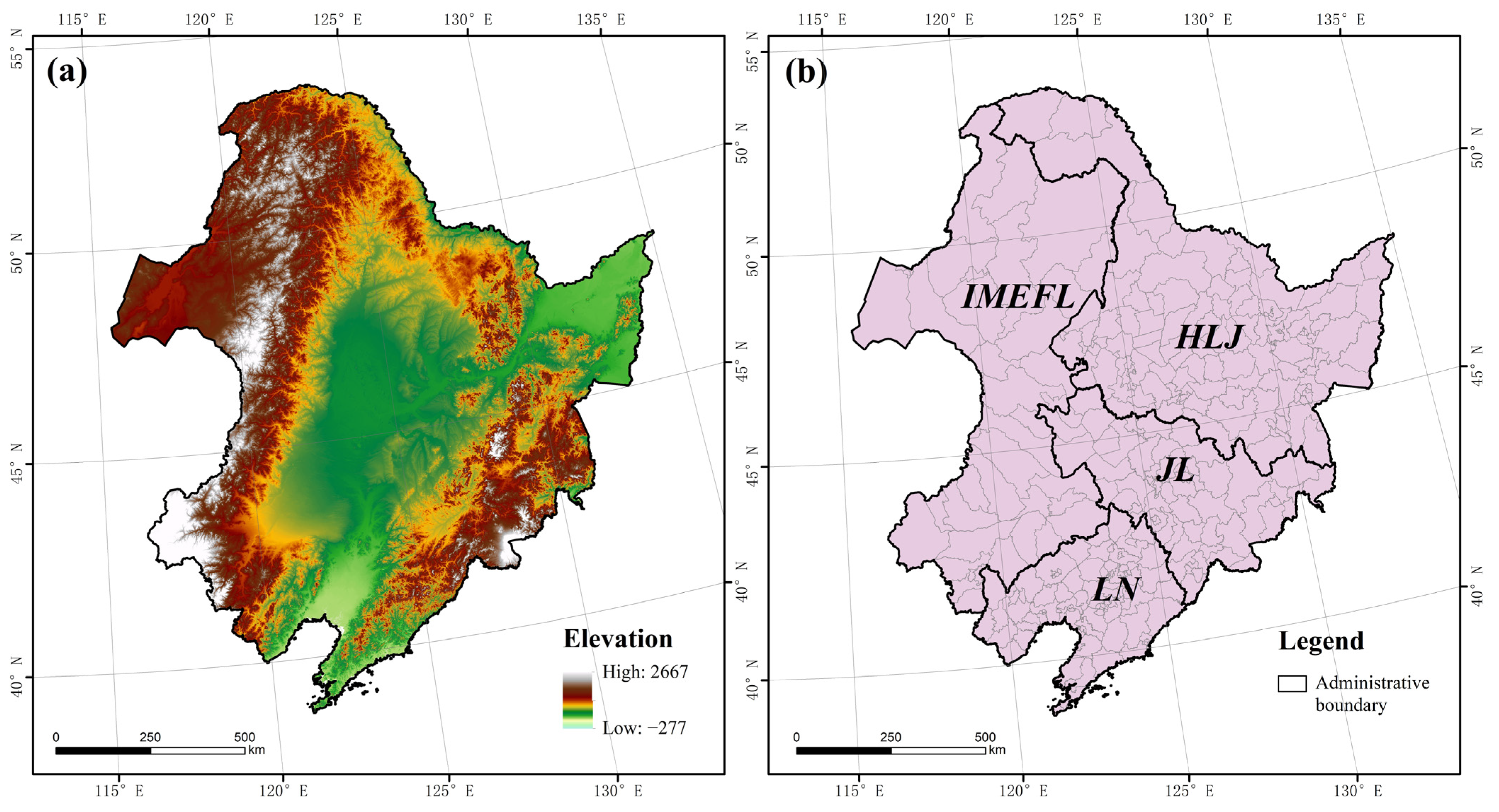
Cropland Zoning Based on District and County Scales in the Black Soil Region of Northeastern China
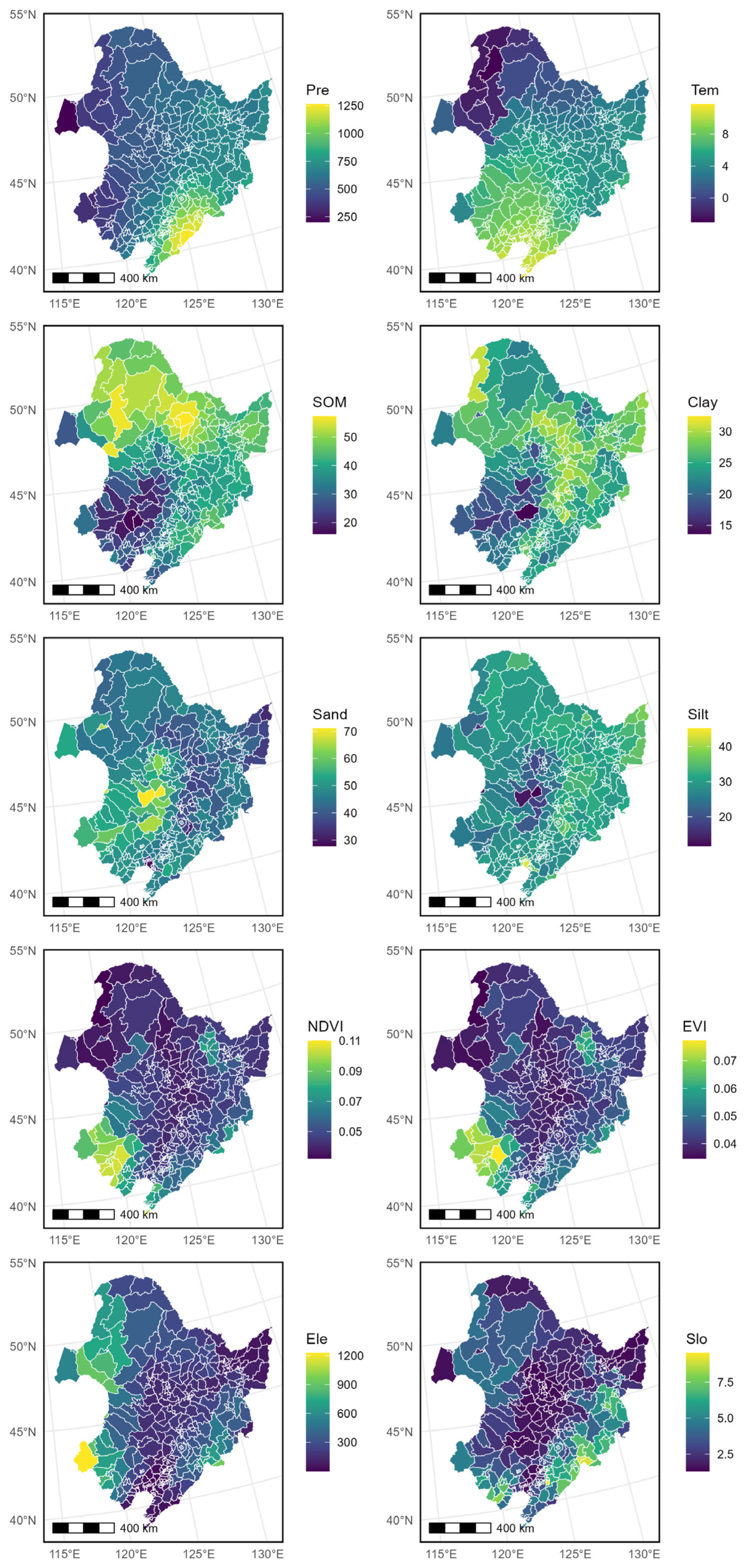
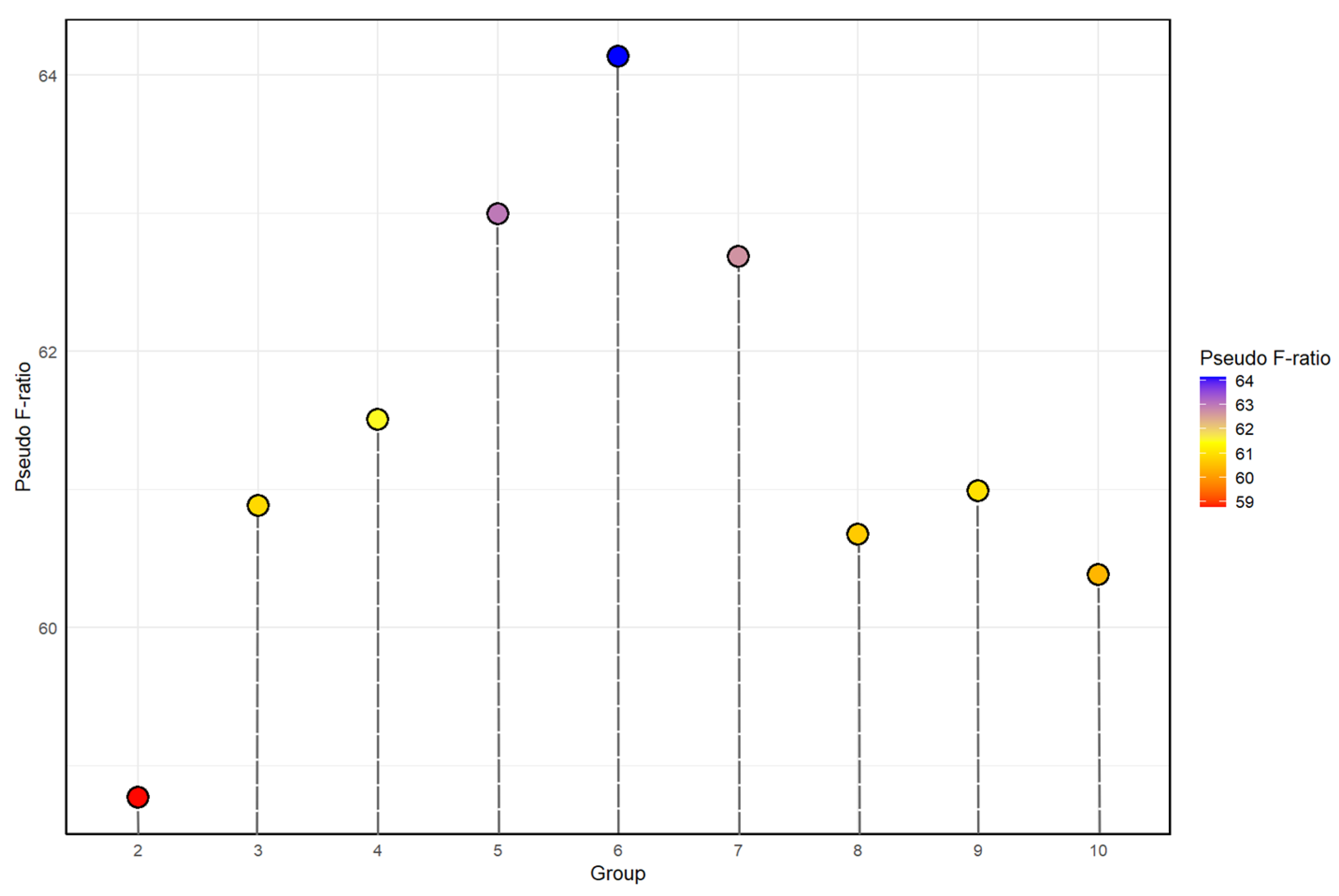
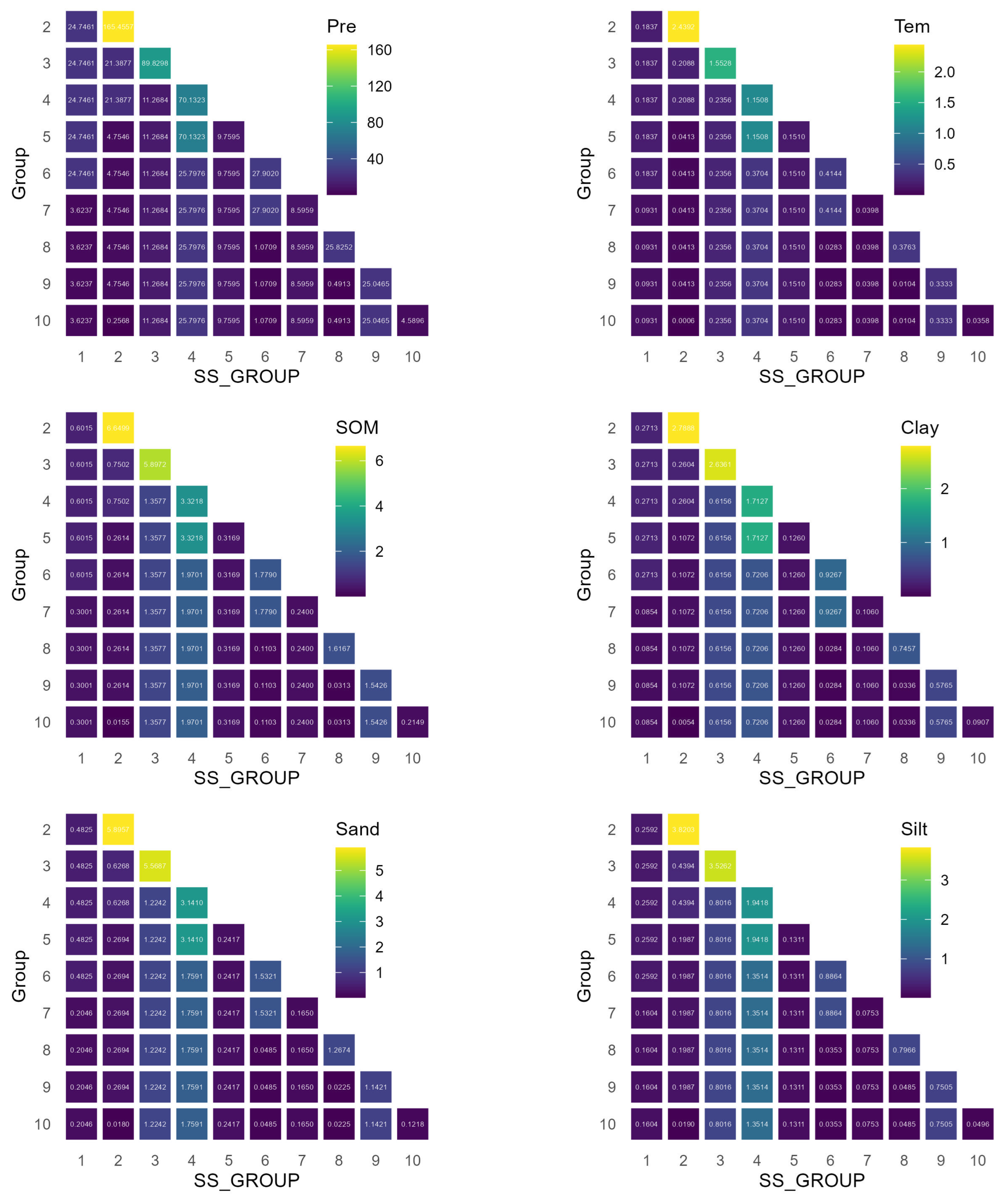
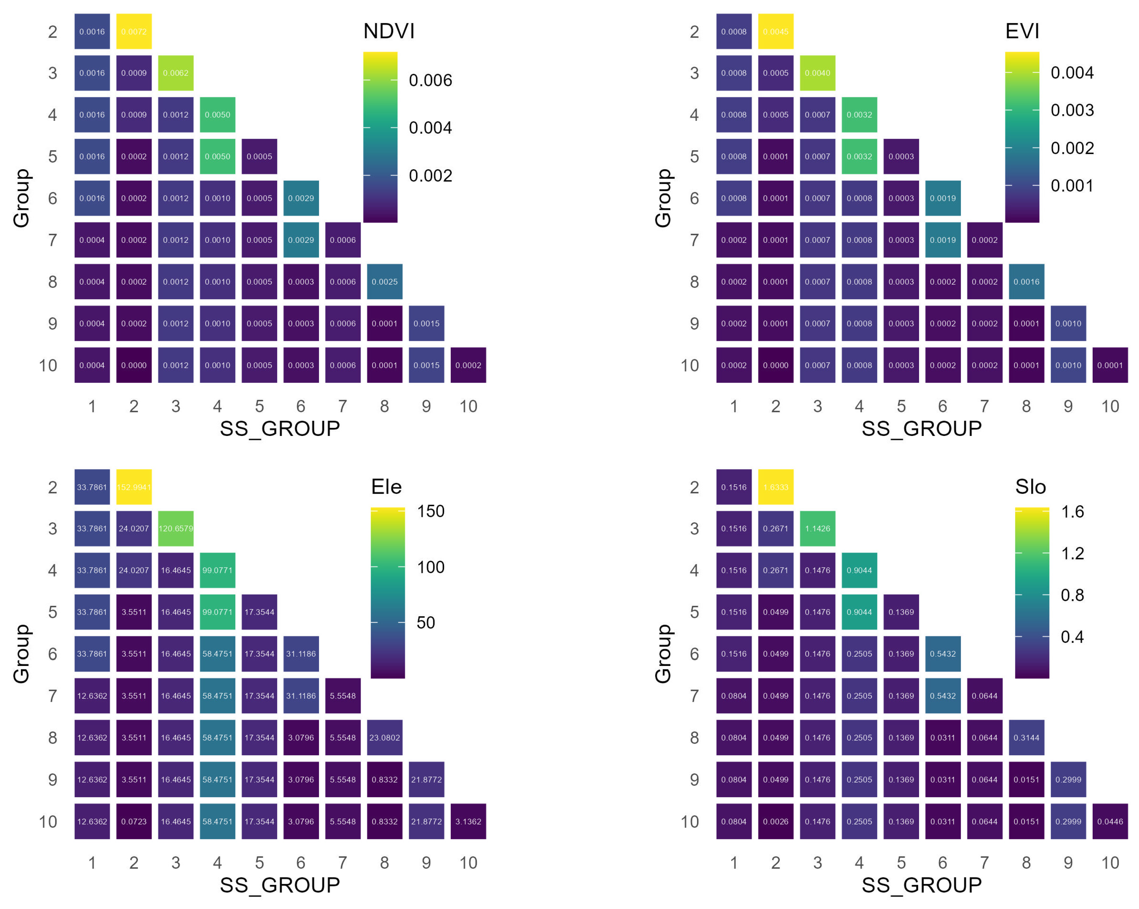
1
School of Government, Heilongjiang University, Harbin 150080, China
2
State Key Laboratory of Black Soils Conservation and Utilization, Northeast Institute of Geography and Agroecology, Chinese Academy of Sciences, Changchun 130102, China
3
University of Chinese Academy of Sciences, Beijing 100049, China
4
Northeast Institute of Geography and Agroecology, Chinese Academy of Sciences, Changchun 130102, China
5
School of Public Administration and Law, Northeast Agricultural University, Harbin 150030, China
6
College of Geographical Science, Harbin Normal University, Harbin 150025, China
*
Author to whom correspondence should be addressed.
Sustainability 2024, 16(8), 3341; https://doi.org/10.3390/su16083341
Submission received: 21 March 2024 / Revised: 11 April 2024 / Accepted: 12 April 2024 / Published: 16 April 2024
(This article belongs to the Special Issue Agriculture, Land and Farm Management)

Abstract

The black soil region of northeastern China, one of the world’s major black soil belts, is China’s main grain-producing area, producing a quarter of China’s commercial grain. However, over-exploitation and unsustainable management practices have led to a steady decline in the quality of arable land. Scientific and reasonable zoning of arable land is the key to ensuring that black soil arable land achieves sustainable development. In this study, the 317 districts and counties under the jurisdiction of Heilongjiang, Jilin, and Liaoning Provinces in the northeast region and the four eastern leagues of the Inner Mongolia Autonomous Region were taken as the study area, and arable land zoning in the northeast black soil region was explored through group analysis. Ten types of indicators were selected according to the four levels of climate, soil, vegetation, and topography of the northeast black soil region, including average precipitation and average temperature for many years at the climate level, organic matter content and soil texture (including clay, silt, and sand) at the soil level, NDVI and EVI indicators at the vegetation level, and DEM and slope indicators at the topographic level. In accordance with the principle of distinguishing differences and summarizing commonalities, nine scenarios of dividing the northeast black soil zones into 2 regions to 10 regions were explored, and these nine zoning scenarios were evaluated in terms of zoning. The results showed that (1) the spatial variability of cropland zoning in the northeast black soil zone based on four indicators, namely climate, soil, vegetation, and topography, was significant; (2) the results of the nine types of zoning based on cropland in the northeast black soil zone showed that intra-zonal zoning was optimal when zoning the northeast black soil zone into six types of zones, which enhanced the variability between the zones and the consistency within the zones; and (3) the assessment of large-scale cropland zoning using the pseudo F-statistic and area-weighted standard deviation methods revealed similarities in their outcomes. The results provide a scientific basis for the subregional protection of arable land in the black soil zone and help to formulate effective policies for different regions.
Keywords: district and county scales; spatial heterogeneity; northeastern black soil region; zoning district and county scales; spatial heterogeneity; northeastern black soil region; zoning

