Next Issue
Volume 12, July
Previous Issue
Volume 12, May


Atmosphere, Volume 12, Issue 6 (June 2021) – 145 articles

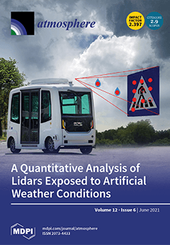
Cover Story (view full-size image): Although LiDAR sensors are critical for autonomous driving, they are impacted by weather events. To increase the safety and availability of self-driving vehicles, analysis of the phenomena at stake is necessary. This paper presents experiments performed in a climatic chamber with LiDARs of different technologies that are compared in various artificial conditions. A specific target with calibrated reflectance is used to make the first quantitative analysis. We observe sensor-dependent results, and unexpected behaviors are seen in artificial rain conditions with valuable multi-echo information being obtained. View this paper.
  • Issues are regarded as officially published after their release is announced to the table of contents alert mailing list.
  • You may sign up for e-mail alerts to receive table of contents of newly released issues.
  • PDF is the official format for papers published in both, html and pdf forms. To view the papers in pdf format, click on the "PDF Full-text" link, and use the free Adobe Reader to open them.
Order results
Result details
Section
Select all
Export citation of selected articles as:
19 pages, 7940 KiB  
Article
The Optimization of Aircraft Acceleration Response and EDR Estimation Based on Linear Turbulence Field Approximation
by Debao Wang, Zhenxing Gao, Hongbin Gu and Xinyu Guan
Atmosphere 2021, 12(6), 799; https://doi.org/10.3390/atmos12060799 - 21 Jun 2021
Viewed by 2858
Abstract
The estimation of aircraft vertical acceleration response to atmospheric turbulence is fundamental to acceleration-based eddy dissipation rate (EDR) estimation. The linear turbulence field approximation with the wind gradients effects is utilized to describe the turbulence effects on civil aviation aircraft. To consider the [...] Read more.
The estimation of aircraft vertical acceleration response to atmospheric turbulence is fundamental to acceleration-based eddy dissipation rate (EDR) estimation. The linear turbulence field approximation with the wind gradients effects is utilized to describe the turbulence effects on civil aviation aircraft. To consider the wind gradients effects, the aircraft was modeled by a cruciform assembly in this study. A vertical acceleration estimation based on the unsteady vortex lattice method (UVLM) was proposed, in which the air-compression effects in high-subsonic flight were compensated by the Karman–Tsien rule. Results indicate that compared with the wing-tail assembly, the cruciform assembly with the wind gradients effects has better accuracy in computing acceleration response. The vertical acceleration response only induced by turbulence can be obtained for acceleration-based EDR estimation. Furthermore, with the optimized acceleration response, the estimated EDR value has got better accuracy and stability. Full article
(This article belongs to the Section Atmospheric Techniques, Instruments, and Modeling)
Show Figures

Figure 1

14 pages, 4588 KiB  
Article
Spatial and Temporal Analysis of Dry and Wet Spells in the Wadi Cheliff Basin, Algeria
by Mohammed Achite, Nir Y. Krakauer, Andrzej Wałęga and Tommaso Caloiero
Atmosphere 2021, 12(6), 798; https://doi.org/10.3390/atmos12060798 - 21 Jun 2021
Cited by 18 | Viewed by 3087
Abstract
The Mediterranean Basin, located in a transition zone between the temperate and rainy climate of central Europe and the arid climate of North Africa, is considered a major hotspot of climate change, subject to water scarcity and drought. In this work, dry and [...] Read more.
The Mediterranean Basin, located in a transition zone between the temperate and rainy climate of central Europe and the arid climate of North Africa, is considered a major hotspot of climate change, subject to water scarcity and drought. In this work, dry and wet spells have been analyzed in the Wadi Cheliff basin (Algeria) by means of annual precipitation observed at 150 rain gauges in the period 1970–2018. In particular, the characteristics of dry and wet spells (frequency, duration, severity, and intensity) have been evaluated by means of the run theory applied to the 12-month standardized precipitation index (SPI) values. Moreover, in order to detect possible tendencies in the SPI values, a trend analysis has been performed by means of two non-parametric tests, the Theil–Sen and Mann–Kendall test. The results indicated similar values of frequency, severity, duration, and intensity between the dry and the wet spells, although wet events showed higher values in the extreme. Moreover, the results of the trend analysis evidenced a different behavior between the northern side of the basin, characterized by a negative trend in the 12-month SPI values, and the southern side, in which positive trends were detected. Full article
Show Figures

Figure 1

20 pages, 3714 KiB  
Article
Can a Warm Ocean Feature Cause a Typhoon to Intensify Rapidly?
by Leo Oey and Shimin Huang
Atmosphere 2021, 12(6), 797; https://doi.org/10.3390/atmos12060797 - 21 Jun 2021
Cited by 3 | Viewed by 5290
Abstract
The hypothesis that a warm ocean feature (WOF) such as a warm eddy may cause a passing typhoon to undergo rapid intensification (RI), that is, the storm’s maximum 1-min wind speed at 10-m height increases by more than 15.4 m/s in 1 day, [...] Read more.
The hypothesis that a warm ocean feature (WOF) such as a warm eddy may cause a passing typhoon to undergo rapid intensification (RI), that is, the storm’s maximum 1-min wind speed at 10-m height increases by more than 15.4 m/s in 1 day, is of interest to forecasters. Testing the hypothesis is a challenge, however. Besides the storm’s internal dynamics, typhoon intensity depends on other environmental factors such as vertical wind shear and storm translation. Here we designed numerical experiments that exclude these other factors, retaining only the WOF’s influence on the storm’s intensity change. We use a storm’s translation speed Uh = 5 m/s when surface cooling is predominantly due to 1D vertical mixing. Observations have shown that the vast majority (70%) of RI events occur in storms that translate between 3 to 7 m/s. We conducted a large ensemble of twin experiments with and without ocean feedback and with and without the WOF to estimate model uncertainty due to internal variability. The results show that the WOF increases surface enthalpy flux and moisture convergence in the storm’s core, resulting in stronger updrafts and intensity. However, the intensification rate is, in general, insufficiently rapid. Consequently, the number of RIs is not statistically significantly different between simulations with and without the WOF. An analytical coupled model supports the numerical findings. Furthermore, it shows that WOF-induced RI can develop only over eddies and ambient waters that are a few °C warmer than presently observed in the ocean. Full article
(This article belongs to the Special Issue Rapid Intensity Changes of Tropical Cyclones)
Show Figures

Figure 1

17 pages, 6574 KiB  
Article
Observations of Atmospheric Aerosol and Cloud Using a Polarized Micropulse Lidar in Xi’an, China
by Chao Chen, Xiaoquan Song, Zhangjun Wang, Wenyan Wang, Xiufen Wang, Quanfeng Zhuang, Xiaoyan Liu, Hui Li, Kuntai Ma, Xianxin Li, Xin Pan, Feng Zhang, Boyang Xue and Yang Yu
Atmosphere 2021, 12(6), 796; https://doi.org/10.3390/atmos12060796 - 21 Jun 2021
Cited by 8 | Viewed by 2706
Abstract
A polarized micropulse lidar (P-MPL) employing a pulsed laser at 532 nm was developed by the Institute of Oceanographic Instrumentation, Qilu University of Technology (Shandong Academy of Sciences). The optomechanical structure, technical parameters, detection principle, overlap factor calculation method, and inversion methods of [...] Read more.
A polarized micropulse lidar (P-MPL) employing a pulsed laser at 532 nm was developed by the Institute of Oceanographic Instrumentation, Qilu University of Technology (Shandong Academy of Sciences). The optomechanical structure, technical parameters, detection principle, overlap factor calculation method, and inversion methods of the atmospheric boundary layer (ABL) depth and depolarization ratio (DR) were introduced. Continuous observations using the P-MPL were carried out at Xi’an Meteorological Bureau, and the observation data were analyzed. In this study, we gleaned much information on aerosols and clouds, including the temporal and spatial variation of aerosols and clouds, aerosol extinction coefficient, DR, and the structure of ABL were obtained by the P-MPL. The variation of aerosols and clouds before and after a short rainfall was analyzed by combining time-height-indication (THI) of range corrected signal (RCS) and DR was obtained by the P-MPL with profiles of potential temperature (PT) and relative humidity (RH) detected by GTS1 Digital Radiosonde. Then, the characteristics of tropopause cirrus cloud were discussed using the data of DR, PT, and RH. Finally, a haze process from January 1st to January 5th was studied by using aerosol extinction coefficients obtained by the P-MPL, PT, and RH profiles measured by GTS1 Digital Radiosonde and the time-varying of PM2.5 and PM10 observed by ambient air quality monitor. The source of the haze was simulated by using the NOAA HYSPLIT Trajectory Model. Full article
Show Figures

Figure 1

22 pages, 3208 KiB  
Article
Early Spread of COVID-19 in the Air-Polluted Regions of Eight Severely Affected Countries
by Riccardo Pansini and Davide Fornacca
Atmosphere 2021, 12(6), 795; https://doi.org/10.3390/atmos12060795 - 21 Jun 2021
Cited by 21 | Viewed by 5588
Abstract
COVID-19 escalated into a pandemic posing several humanitarian as well as scientific challenges. We here investigated the geographical character of the early spread of the infection and correlated it with several annual satellite and ground indexes of air quality in China, the United [...] Read more.
COVID-19 escalated into a pandemic posing several humanitarian as well as scientific challenges. We here investigated the geographical character of the early spread of the infection and correlated it with several annual satellite and ground indexes of air quality in China, the United States, Italy, Iran, France, Spain, Germany, and the United Kingdom. The time of the analysis corresponded with the end of the first wave infection in China, namely June 2020. We found more viral infections in those areas afflicted by high PM 2.5 and nitrogen dioxide values. Higher mortality was also correlated with relatively poor air quality. In Italy, the correspondence between the Po Valley pollution and SARS-CoV-2 infections and induced mortality was the starkest, originating right in the most polluted European area. Spain and Germany did not present a noticeable gradient of pollution levels causing non-significant correlations. Densely populated areas were often hotspots of lower air quality levels but were not always correlated with a higher viral incidence. Air pollution has long been recognised as a high risk factor for several respiratory-related diseases and conditions, and it now appears to be a risk factor for COVID-19 as well. As such, air pollution should always be included as a factor for the study of airborne epidemics and further included in public health policies. Full article
(This article belongs to the Special Issue Coronavirus Pandemic Shutdown Effects on Urban Air Quality)
Show Figures

Figure 1

12 pages, 1529 KiB  
Article
Indoor Environmental Health Assessment in Eco-Building and Its Case Study
by Jing Yuan, Xiaohui Zhao, Giwa Abdulmoseen Segun, Mohammadtaghi Vakili and Lexuan Zhong
Atmosphere 2021, 12(6), 794; https://doi.org/10.3390/atmos12060794 - 21 Jun 2021
Cited by 4 | Viewed by 3140
Abstract
It is necessary to consider all aspects of environmental factors when assessing the health impact of an eco-building environment on its occupants. However, the multi-criteria and imprecise nature of the indoor-environment in the eco-buildings has caused difficulties in quantifying the indoor environmental pollution [...] Read more.
It is necessary to consider all aspects of environmental factors when assessing the health impact of an eco-building environment on its occupants. However, the multi-criteria and imprecise nature of the indoor-environment in the eco-buildings has caused difficulties in quantifying the indoor environmental pollution level. This paper describes the optimal classification and priority weight methods, which are particularly useful for assessing the indoor environmental quality (IEQ) of an eco-building to demonstrate its innovative applications. The analytic hierarchy process (AHP) was used to set up the strategic decision-making evaluation system for computing the indoor environment index (IEI) risk ranking of eco-buildings. Combined with this, a Microsoft Delphi-based IEQ intelligent forecasting software simulations package was developed, and the innovative application of indoor environmental comprehensive assessment was verified by a case study in Shanghai. The evaluation result was analyzed by the priority weight methods and the AHP decision-making system noted above. This health assessment method and system provides an innovative way for the indoor environment risk evaluation of eco-buildings and is helpful to standardize the local building market. Full article
Show Figures

Figure 1

15 pages, 2928 KiB  
Article
Automatic Regional Interpretation and Forecasting System Supported by Machine Learning
by Chao Yan, Jing Feng, Kaiwen Xia and Chaofan Duan
Atmosphere 2021, 12(6), 793; https://doi.org/10.3390/atmos12060793 - 21 Jun 2021
Cited by 2 | Viewed by 2278
Abstract
The Model Output Statistics (MOS) model is a dynamic statistical weather forecast model based on multiple linear regression technology. It is greatly affected by the selection of parameters and predictors, especially when the weather changes drastically, or extreme weather occurs. We improved the [...] Read more.
The Model Output Statistics (MOS) model is a dynamic statistical weather forecast model based on multiple linear regression technology. It is greatly affected by the selection of parameters and predictors, especially when the weather changes drastically, or extreme weather occurs. We improved the traditional MOS model with the machine learning method to enhance the capabilities of self-learning and generalization. Simultaneously, multi-source meteorological data were used as the input to the model to improve the data quality. In the experiment, we selected the four areas of Nanjing, Beijing, Chengdu, and Guangzhou for verification, with the numerical weather prediction (NWP) products and observation data from automatic weather stations (AWSs) used to predict the temperature and wind speed in the next 24 h. From the experiment, it can be seen that the accuracy of the prediction values and speed of the method were improved by the ML-MOS. Finally, we compared the ML-MOS model with neural networks and support vector machine (SVM), the results show that the prediction result of the ML-MOS model is better than that of the above two models. Full article
(This article belongs to the Section Atmospheric Techniques, Instruments, and Modeling)
Show Figures

Figure 1

15 pages, 3906 KiB  
Article
Impacts of Climate Change on the Hydrometeorological Characteristics of the Soan River Basin, Pakistan
by Muhammad Usman, Christopher E. Ndehedehe, Rodrigo Manzanas, Burhan Ahmad and Oluwafemi E. Adeyeri
Atmosphere 2021, 12(6), 792; https://doi.org/10.3390/atmos12060792 - 19 Jun 2021
Cited by 13 | Viewed by 3909
Abstract
The global hydrological cycle is vulnerable to changing climatic conditions, especially in developing regions, which lack abundant resources and management of freshwater resources. This study evaluates the impacts of climate change on the hydrological regime of the Chirah and Dhoke Pathan sub catchments [...] Read more.
The global hydrological cycle is vulnerable to changing climatic conditions, especially in developing regions, which lack abundant resources and management of freshwater resources. This study evaluates the impacts of climate change on the hydrological regime of the Chirah and Dhoke Pathan sub catchments of the Soan River Basin (SRB), in Pakistan, by using the climate models included in the NEX-GDDP dataset and the hydrological model HBV-light. After proper calibration and validation, the latter is forced with NEX-GDDP inputs to simulate a historic and a future (under the RCP 4.5 and RCP 8.5 emission scenarios) streamflow. Multiple evaluation criteria were employed to find the best performing NEX-GDDP models. A different ensemble was produced for each sub catchment by including the five best performing NEX-GDDP GCMs (ACCESS1-0, CCSM4, CESM1-BGC, MIROC5, and MRI-CGCM3 for Chirah and BNU-ESM, CCSM4, GFDL-CM3. IPSL-CM5A-LR and NorESM1-M for Dhoke Pathan). Our results show that the streamflow is projected to decrease significantly for the two sub catchments, highlighting the vulnerability of the SRB to climate change. Full article
(This article belongs to the Special Issue Hydro-Climatic Hotspots of Extreme Events during the Anthropocene)
Show Figures

Figure 1

6 pages, 213 KiB  
Editorial
The Dichotomy between Indoor Air Quality and Energy Efficiency in Light of the Onset of the COVID-19 Pandemic
by Gaetano Settimo and Pasquale Avino
Atmosphere 2021, 12(6), 791; https://doi.org/10.3390/atmos12060791 - 19 Jun 2021
Cited by 28 | Viewed by 4144
Abstract
Recently, there has been a great increase in the importance of issues related to energy efficiency [...] Full article
(This article belongs to the Section Air Quality)
30 pages, 861 KiB  
Review
Combined Effect of Hot Weather and Outdoor Air Pollution on Respiratory Health: Literature Review
by Elena Grigorieva and Artem Lukyanets
Atmosphere 2021, 12(6), 790; https://doi.org/10.3390/atmos12060790 - 19 Jun 2021
Cited by 68 | Viewed by 13517
Abstract
Association between short-term exposure to ambient air pollution and respiratory health is well documented. At the same time, it is widely known that extreme weather events intrinsically exacerbate air pollution impact. Particularly, hot weather and extreme temperatures during heat waves (HW) significantly affect [...] Read more.
Association between short-term exposure to ambient air pollution and respiratory health is well documented. At the same time, it is widely known that extreme weather events intrinsically exacerbate air pollution impact. Particularly, hot weather and extreme temperatures during heat waves (HW) significantly affect human health, increasing risks of respiratory mortality and morbidity. Concurrently, a synergistic effect of air pollution and high temperatures can be combined with weather–air pollution interaction during wildfires. The purpose of the current review is to summarize literature on interplay of hot weather, air pollution, and respiratory health consequences worldwide, with the ultimate goal of identifying the most dangerous pollution agents and vulnerable population groups. A literature search was conducted using electronic databases Web of Science, Pubmed, Science Direct, and Scopus, focusing only on peer-reviewed journal articles published in English from 2000 to 2021. The main findings demonstrate that the increased level of PM10 and O3 results in significantly higher rates of respiratory and cardiopulmonary mortality. Increments in PM2.5 and PM10, O3, CO, and NO2 concentrations during high temperature episodes are dramatically associated with higher admissions to hospital in patients with chronic obstructive pulmonary disease, daily hospital emergency transports for asthma, acute and chronic bronchitis, and premature mortality caused by respiratory disease. Excessive respiratory health risk is more pronounced in elderly cohorts and small children. Both heat waves and outdoor air pollution are synergistically linked and are expected to be more serious in the future due to greater climate instability, being a crucial threat to global public health that requires the responsible involvement of researchers at all levels. Sustainable urban planning and smart city design could significantly reduce both urban heat islands effect and air pollution. Full article
(This article belongs to the Special Issue Challenges in Measuring and Assessing Environmental Health)
Show Figures

Figure 1

21 pages, 3376 KiB  
Article
A Case Study of Birch Pollen and the Synergy with Environmental Factors: Relation to Asthma in Montreal, Canada
by Alain Robichaud
Atmosphere 2021, 12(6), 789; https://doi.org/10.3390/atmos12060789 - 19 Jun 2021
Cited by 4 | Viewed by 3118
Abstract
Environmental factors such as air pollution are known to exacerbate respiratory illness and increase the overall health risk. However, on a daily or seasonal basis, the relation between air pollutants, weather and a disease such as asthma is not clear. When combined with [...] Read more.
Environmental factors such as air pollution are known to exacerbate respiratory illness and increase the overall health risk. However, on a daily or seasonal basis, the relation between air pollutants, weather and a disease such as asthma is not clear. When combined with aeroallergens such as birch pollen and under specific weather conditions, synergistic effects may increase symptoms of respiratory illness and morbidity and then reveal interesting links with environmental factors. Hence, it is important to improve the understanding of pollution-pollen-weather and broaden the public health message. Combined analysis and model simulation of aeroallergens, air pollution and weather as presented here is important to correctly evaluate health burdens and allow a better forecast of the potential health risk. However, analyzing the combined effects of several environmental factors is not well understood and represents a challenging task. This paper shows: (1) the results of data analysis performed in Montreal for asthma hospitalization in relation to complex synergistic environmental factors, and (2) model simulation of birch pollen using a coupled weather-air quality model (GEM-MACH) compared with model-data fusion of classical chemical species (e.g., near-surface ozone, nitrogen dioxide and fine particulate matter) in order to evaluate spatiotemporal vulnerable zone for asthma health risk. Full article
(This article belongs to the Special Issue Challenges in Measuring and Assessing Environmental Health)
Show Figures

Figure 1

16 pages, 2401 KiB  
Article
Quantifying Air Pollutant Variations during COVID-19 Lockdown in a Capital City in Northwest China
by Rong Feng, Hongmei Xu, Zexuan Wang, Yunxuan Gu, Zhe Liu, Haijing Zhang, Tian Zhang, Qiyuan Wang, Qian Zhang, Suixin Liu, Zhenxing Shen and Qin Wang
Atmosphere 2021, 12(6), 788; https://doi.org/10.3390/atmos12060788 - 19 Jun 2021
Cited by 19 | Viewed by 3166
Abstract
In the context of the outbreak of coronavirus disease 2019 (COVID-19), strict lockdown policies were implemented to control nonessential human activities in Xi’an, northwest China, which greatly limited the spread of the pandemic and affected air quality. Compared with pre-lockdown, the air quality [...] Read more.
In the context of the outbreak of coronavirus disease 2019 (COVID-19), strict lockdown policies were implemented to control nonessential human activities in Xi’an, northwest China, which greatly limited the spread of the pandemic and affected air quality. Compared with pre-lockdown, the air quality index and concentrations of PM2.5, PM10, SO2, and CO during the lockdown reduced, but the reductions were not very significant. NO2 levels exhibited the largest decrease (52%) during lockdown, owing to the remarkable decreased motor vehicle emissions. The highest K+ and lowest Ca2+ concentrations in PM2.5 samples could be attributed to the increase in household biomass fuel consumption in suburbs and rural areas around Xi’an and the decrease in human physical activities in Xi’an (e.g., human travel, vehicle emissions, construction activities), respectively, during the lockdown period. Secondary chemical reactions in the atmosphere increased in the lockdown period, as evidenced by the increased O3 level (increased by 160%) and OC/EC ratios in PM2.5 (increased by 26%), compared with pre-lockdown levels. The results, based on a natural experiment in this study, can be used as a reference for studying the formation and source of air pollution in Xi’an and provide evidence for establishing future long-term air pollution control policies. Full article
Show Figures

Figure 1

17 pages, 4598 KiB  
Article
Spatial–Temporal Assessment of Historical and Future Meteorological Droughts in China
by Rucun Han, Zhanling Li, Zhanjie Li and Yuanyuan Han
Atmosphere 2021, 12(6), 787; https://doi.org/10.3390/atmos12060787 - 18 Jun 2021
Cited by 23 | Viewed by 3109
Abstract
Drought is a natural phenomenon in which the natural amount of water in an area is below the normal level. It has negative impacts on production in numerous industries and people’s lives, especially in the context of climate change. Investigating the spatial–temporal variation [...] Read more.
Drought is a natural phenomenon in which the natural amount of water in an area is below the normal level. It has negative impacts on production in numerous industries and people’s lives, especially in the context of climate change. Investigating the spatial–temporal variation of drought is of great importance in water resource allocation and management. For a better understanding of how drought has changed in China from 1961 to 2020 and will change in the future period of this century (2021–2100), a spatial–temporal assessment of drought based on the standardized precipitation evapotranspiration index (SPEI) was carried out. The trends and characteristics (number, duration, and severity) of historical and future droughts in China were evaluated based on 12-month SPEI by employing the Mann–Kendall test, Sen’s slope and run theory. The similarities, differences, and spatial–temporal evolution of droughts in these two periods were analyzed. The results showed that in the historical period the number of droughts decreased gradually from the south of China to the north. Less frequent drought but with longer duration and stronger severity occurred in the northeast and the northern areas. In the future period, most parts of China are projected to suffer more severe droughts with longer duration, especially for Northeast China, North China, Qinghai–Tibetan Plateau, and Southwest China. The likely increasing severity and duration of droughts in most areas of China in the future makes it very necessary to formulate the corresponding drought prevention and relief strategies to reduce the possible losses caused by droughts. Full article
(This article belongs to the Special Issue Advances in Drought Monitoring, Simulation and Prediction)
Show Figures

Figure 1

21 pages, 42198 KiB  
Article
A Refined Study of Atmospheric Wind Properties in the Beijing Urban Area Based on a 325 m Meteorological Tower
by Shi Zhang, Bo Li, Giovanni Solari, Xinxin Zhang and Xiaoda Xu
Atmosphere 2021, 12(6), 786; https://doi.org/10.3390/atmos12060786 - 18 Jun 2021
Cited by 6 | Viewed by 3194
Abstract
The urban atmospheric boundary layer (UABL) is complex due to the heterogeneous underlying city surface. The nine anemometers installed at different heights along the 325 m meteorological tower provide an opportunity to carry out a refined study of wind properties in the UABL [...] Read more.
The urban atmospheric boundary layer (UABL) is complex due to the heterogeneous underlying city surface. The nine anemometers installed at different heights along the 325 m meteorological tower provide an opportunity to carry out a refined study of wind properties in the UABL in central Beijing, China. Based on the recent 5-year high-resolution measured data, in total, 229,488 10-min length segments of wind records related to each anemometer are reliable for further analyses. Accordingly, the statistical properties of the wind speed and direction are first analyzed to present the local wind climate in a comprehensive way. Moreover, the pattern of the wind profiles related to two typical synoptic intense events are illustrated in order to give a preliminary perspective, then the statistical properties corresponding to a series of intense windstorms are described. Here, the deviations in the wind direction occur between 200 m and 280 m of the atmosphere, which might be due to the existence of an Ekman spiral; besides this, the laws of wind profiles based on open terrain are not suitable for the UABL, and the aerodynamic characteristic parameters of the UABL based on vertical stratified structures have to be considered. The results contribute to the establishment of revised models for the wind profile and are useful for the further understanding of the structure of UABL wind. Full article
(This article belongs to the Section Meteorology)
Show Figures

Figure 1

22 pages, 2578 KiB  
Article
Spatial Regression Modeling Approach for Assessing the Spatial Variation of Air Pollutants
by Seunghoon Park and Dongwon Ko
Atmosphere 2021, 12(6), 785; https://doi.org/10.3390/atmos12060785 - 18 Jun 2021
Cited by 8 | Viewed by 3312
Abstract
Over the past decades, industrialization has resulted in radical economic development in Korea. The resulting urban sprawl and unsustainable development have led to considerable air pollution. In this study, using spatial regression models, we examine the effects of the physical and socioeconomic characteristics [...] Read more.
Over the past decades, industrialization has resulted in radical economic development in Korea. The resulting urban sprawl and unsustainable development have led to considerable air pollution. In this study, using spatial regression models, we examine the effects of the physical and socioeconomic characteristics of neighborhoods on particulate matter (PM10, PM2.5), NO2, CO, and SO2 concentrations in the Daegu Metropolitan area. Results reveal the following: (i) the socioeconomic characteristics were not statistically significant regardless of the air pollutant type; (ii) the effects of the built environment characteristics of the neighborhoods were different for each air pollutant. Compared with other pollutants, PM2.5 was affected more by the built environment. Concerning the neighborhoods’ main roads, the SO2 concentration was higher, that of PM2.5 was higher in neighborhoods with more bus stops, and those of CO and PM2.5 were possibly higher in the neighborhood of industrial zones. In neighborhoods with parks and green areas, air pollutant concentrations are likely to be lower. When the total used surface of residential buildings was higher, the air pollutant concentrations were lower. Contextually, similar neighborhoods with more single-family houses seemed to have high pollution levels. Overall, this study is expected to guide policymakers and planners in making smart decisions for eco-friendly and healthy cities. Full article
(This article belongs to the Special Issue Regional Air Quality Modeling)
Show Figures

Figure 1

14 pages, 3055 KiB  
Article
Characteristics and Source Apportionment of Black Carbon (BC) in a Suburban Area of Klang Valley, Malaysia
by Eliani Ezani, Sairam Dhandapani, Mathew R. Heal, Sarva M. Praveena, Md Firoz Khan and Zamzam T. A. Ramly
Atmosphere 2021, 12(6), 784; https://doi.org/10.3390/atmos12060784 - 18 Jun 2021
Cited by 10 | Viewed by 4043
Abstract
Black carbon (BC) is of concern due to its contribution to poor air quality and its adverse effects human health. We carried out the first real-time monitoring of BC in Malaysia using an AE33 Aethalometer. Measurements were conducted between 1 January and 31 [...] Read more.
Black carbon (BC) is of concern due to its contribution to poor air quality and its adverse effects human health. We carried out the first real-time monitoring of BC in Malaysia using an AE33 Aethalometer. Measurements were conducted between 1 January and 31 May 2020 in a university area in a suburban location of the Klang Valley. The measurement period coincided with the implementation of a movement control order (MCO) in response to COVID-19. The mean concentration of BC before the MCO was 2.34 µg/m3 which decreased by 38% to 1.45 µg/m3 during the MCO. The BC is dominated by fossil-fuel sources (mean proportion BCff = 79%). During the MCO, the BCff concentration decreased by more than the BCbb concentration derived from biomass burning. BC and BCff show very strong diurnal cycles, which also show some weekday–weekend differences, with maxima during the night and just before noon, and minima in the afternoon. These patterns indicate strong influences on concentrations from both traffic emissions and boundary layer depth. BC was strongly correlated with NO2 (R = 0.71), another marker of traffic emission, but less strongly with PM2.5 (R = 0.52). The BC absorption Ångström exponent (AAE) ranged between 1.1 and 1.6. We observed pronounced diurnal cycles of lower AAE in daytime, corresponding to BCff contributions from traffic. Average AAE also showed a pronounced increase during the MCO. Our data provides a new reference for BC in suburban Malaysia for the public and policy-makers, and a baseline for future measurements. Full article
Show Figures

Graphical abstract

20 pages, 1814 KiB  
Article
Performance Evaluation of a Nowcasting Modelling Chain Operatively Employed in Very Small Catchments in the Mediterranean Environment for Civil Protection Purposes
by Martina Raffellini, Federica Martina, Francesco Silvestro, Francesca Giannoni and Nicola Rebora
Atmosphere 2021, 12(6), 783; https://doi.org/10.3390/atmos12060783 - 18 Jun 2021
Cited by 2 | Viewed by 2803
Abstract
The Hydro-Meteorological Centre (CMI) of the Environmental Protection Agency of Liguria Region, Italy, is in charge of the hydrometeorological forecast and the in-event monitoring for the region. This region counts numerous small and very small basins, known for their high sensitivity to intense [...] Read more.
The Hydro-Meteorological Centre (CMI) of the Environmental Protection Agency of Liguria Region, Italy, is in charge of the hydrometeorological forecast and the in-event monitoring for the region. This region counts numerous small and very small basins, known for their high sensitivity to intense storm events, characterised by low predictability. Therefore, at the CMI, a radar-based nowcasting modelling chain called the Small Basins Model Chain, tailored to such basins, is employed as a monitoring tool for civil protection purposes. The aim of this study is to evaluate the performance of this model chain, in terms of: (1) correct forecast, false alarm and missed alarm rates, based on both observed and simulated discharge threshold exceedances and observed impacts of rainfall events encountered in the region; (2) warning times respect to discharge threshold exceedances. The Small Basins Model Chain is proven to be an effective tool for flood nowcasting and helpful for civil protection operators during the monitoring phase of hydrometeorological events, detecting with good accuracy the location of intense storms, thanks to the radar technology, and the occurrence of flash floods. Full article
(This article belongs to the Special Issue Weather Radar in Rainfall Estimation)
Show Figures

Figure 1

4 pages, 167 KiB  
Editorial
Meteorological Extremes in Korea: Prediction, Assessment, and Impact
by Okjeong Lee and Sangdan Kim
Atmosphere 2021, 12(6), 782; https://doi.org/10.3390/atmos12060782 - 18 Jun 2021
Viewed by 1726
Abstract
The extreme climates that occur around the world every year have a profound impact on the quality of life for mankind since they can cause natural disasters beyond our control, such as droughts and floods [...] Full article
(This article belongs to the Special Issue Meteorological Extremes in Korea: Prediction, Assessment, and Impact)
13 pages, 33700 KiB  
Article
Abrupt Change Detection Method Based on Features of Lorenz Trajectories
by Chaojiu Da, Binglu Shen, Jian Song, Cairang Xaiwu and Guolin Feng
Atmosphere 2021, 12(6), 781; https://doi.org/10.3390/atmos12060781 - 17 Jun 2021
Cited by 1 | Viewed by 2290
Abstract
This paper presents a definition of bifurcation-type abrupt changes based on the bifurcation features of Lorenz trajectories. These abrupt changes are the result of the transition behavior of dynamical system trajectories among different equilibrium regions. We demonstrate that these bifurcation-type jumps can better [...] Read more.
This paper presents a definition of bifurcation-type abrupt changes based on the bifurcation features of Lorenz trajectories. These abrupt changes are the result of the transition behavior of dynamical system trajectories among different equilibrium regions. We demonstrate that these bifurcation-type jumps can better reflect the nature of abrupt change. In analyzing the features of Lorenz equation trajectories, a dynamical method for detecting bifurcation-type abrupt changes is presented. A numerical solution of the Lorenz equation is adopted, using a curve integral or vector product to construct a time series of positive and negative values. Changes in the sign of this time series accurately determine whether the trajectory is in the right or left equilibrium region, and the points at which the time series is equal to zero are the times at which the trajectory jumps between different equilibrium regions, that is, the occurrence times of bifurcation-type abrupt changes. This method is completely dependent on the dynamical characteristics of the system. A theoretical approach for detecting abrupt climate changes based on the dynamical characteristics of the atmospheric model is described. Compared with the original method of identifying abrupt climate changes, this method has dynamic significance and can detect abrupt changes in multi-dimensional time series. Although this method can be applied theoretically, applications to real atmospheric data first require the data to be smoothed. Full article
Show Figures

Figure 1

27 pages, 10765 KiB  
Article
Assessment of GPM IMERG Satellite Precipitation Estimation under Complex Climatic and Topographic Conditions
by Chengxuan Lu, Jian Ye, Guohua Fang, Xianfeng Huang and Min Yan
Atmosphere 2021, 12(6), 780; https://doi.org/10.3390/atmos12060780 - 17 Jun 2021
Cited by 20 | Viewed by 3093
Abstract
Satellite precipitation estimation provides crucial information for those places lacking rainfall observations from ground–based sensors, especially in terrestrial or marine areas with complex climatic or topographic conditions. This is the case over much of Western China, including Upper and Middle Lancang River Basin [...] Read more.
Satellite precipitation estimation provides crucial information for those places lacking rainfall observations from ground–based sensors, especially in terrestrial or marine areas with complex climatic or topographic conditions. This is the case over much of Western China, including Upper and Middle Lancang River Basin (UMLRB), an extremely important transnational river system in Asia (the Lancang–Mekong River Basin) with complex climate and topography that has limited long–term precipitation records and high–elevation data, and no operational weather radars. In this study, we evaluated three GPM IMERG satellite precipitation estimation (IMERG E, IMERG L and IMERG F) over UMLRB in terms of multi–year average precipitation distribution, amplitude consistency, occurrence consistency, and elevation–dependence in both dry and wet seasons. Results demonstrated that monsoon and solid precipitation mainly affected amplitude consistency of precipitation, aerosol affected occurrence consistency of precipitation, and topography and wind–induced errors affected elevation dependence. The amplitude and occurrence consistency of precipitation were best in wet seasons in the Climate Transition Zone and worst in dry seasons in the same zone. Regardless of the elevation–dependence of amplitude or occurrence in dry and wet seasons, the dry season in the Alpine Canyon Area was most positively dependent and most significant. More significant elevation–dependence was correlated with worse IMERG performance. The Local Weighted Regression (LOWERG) model showed a nonlinear relationship between precipitation and elevation in both seasons. The amplitude consistency and occurrence consistency of both seasons worsened with increasing precipitation intensity and was worst for extreme precipitation cases. IMERG F had great potential for application to hydroclimatic research and water resources assessment in the study area. Further research should assess how the dependence of IMERG’s spatial performance on climate and topography could guide improvements in global precipitation assessment algorithms and the study of mountain landslides, floods, and other natural disasters during the monsoon period. Full article
(This article belongs to the Section Meteorology)
Show Figures

Figure 1

20 pages, 13299 KiB  
Article
Ice Nucleation Activity of Alpine Bioaerosol Emitted in Vicinity of a Birch Forest
by Teresa M. Seifried, Paul Bieber, Anna T. Kunert, David G. Schmale III, Karin Whitmore, Janine Fröhlich-Nowoisky and Hinrich Grothe
Atmosphere 2021, 12(6), 779; https://doi.org/10.3390/atmos12060779 - 17 Jun 2021
Cited by 13 | Viewed by 3786
Abstract
In alpine environments, many plants, bacteria, and fungi contain ice nuclei (IN) that control freezing events, providing survival benefits. Once airborne, IN could trigger ice nucleation in cloud droplets, influencing the radiation budget and the hydrological cycle. To estimate the atmospheric relevance of [...] Read more.
In alpine environments, many plants, bacteria, and fungi contain ice nuclei (IN) that control freezing events, providing survival benefits. Once airborne, IN could trigger ice nucleation in cloud droplets, influencing the radiation budget and the hydrological cycle. To estimate the atmospheric relevance of alpine IN, investigations near emission sources are inevitable. In this study, we collected 14 aerosol samples over three days in August 2019 at a single site in the Austrian Alps, close to a forest of silver birches, which are known to release IN from their surface. Samples were taken during and after rainfall, as possible trigger of aerosol emission by an impactor and impinger at the ground level. In addition, we collected aerosol samples above the canopy using a rotary wing drone. Samples were analyzed for ice nucleation activity, and bioaerosols were characterized based on morphology and auto-fluorescence using microscopic techniques. We found high concentrations of IN below the canopy, with a freezing behavior similar to birch extracts. Sampled particles showed auto-fluorescent characteristics and the morphology strongly suggested the presence of cellular material. Moreover, some particles appeared to be coated with an organic film. To our knowledge, this is the first investigation of aerosol emission sources in alpine vegetation with a focus on birches. Full article
(This article belongs to the Special Issue Bioaerosols: Composition, Meteorological Impact, and Transport)
Show Figures

Figure 1

15 pages, 2761 KiB  
Article
Teak Tree-Ring Cellulose δ13C, δ18O, and Tree-Ring Width from Northwestern Thailand Capture Different Aspects of Asian Monsoon Variability
by Nathsuda Pumijumnong, Paramate Payomrat, Supaporn Buajan, Achim Bräuning, Chotika Muangsong, Uthai Chareonwong, Piyarat Songtrirat, Kritsadapan Palakit, Yu Liu and Qiang Li
Atmosphere 2021, 12(6), 778; https://doi.org/10.3390/atmos12060778 - 17 Jun 2021
Cited by 4 | Viewed by 3299
Abstract
The inter-annual variability in tree-ring cellulose δ13C (δ13CTR, δ18OTR), and tree-ring chronology in teak (TRW) (Tectona grandis L.f.) trees from Northwestern Thailand during 1901–2009 AD was performed. The δ13C [...] Read more.
The inter-annual variability in tree-ring cellulose δ13C (δ13CTR, δ18OTR), and tree-ring chronology in teak (TRW) (Tectona grandis L.f.) trees from Northwestern Thailand during 1901–2009 AD was performed. The δ13CTR and δ18OTR have a positive correlation, significant at r =0.400, p <0.0001, and both of the stable isotopes were not significantly related to the TRW. The TRW is related to rainfall in the first half of the rainy season and has a strong relationship with the relative humidity. The δ18OTR captured moisture well throughout the rainy season, and the δ13CTR had a strong correlation with rainfall in the second half of the rainy season and had a high correlation with cloud fraction and vapor pressure. The δ13CTR and δ18OTR were associated with the stomata conductance response, but had no effect on photosynthesis. The three indices of the teak annual ring respond well to the variability in the Asian monsoon, and give us a better understanding of both the hydrological cycle and the factors that contribute to the growing of tropical broadleaf trees under changing climates. Full article
(This article belongs to the Special Issue Climate and the Oxygen Isotope Patterns from Trees)
Show Figures

Figure 1

15 pages, 9945 KiB  
Article
Understanding the Major Impact of Planetary Boundary Layer Schemes on Simulation of Vertical Wind Structure
by Lei Zhang, Jinyuan Xin, Yan Yin, Wenyuan Chang, Min Xue, Danjie Jia and Yongjing Ma
Atmosphere 2021, 12(6), 777; https://doi.org/10.3390/atmos12060777 - 16 Jun 2021
Cited by 12 | Viewed by 4264
Abstract
The structure and evolution of the atmospheric planetary boundary layer (PBL) plays an important role in the physical and chemical processes of cloud–radiation interaction, vertical mixing and pollutant transport in the atmosphere. The PBL parameterization scheme describes the vertical transport of atmospheric momentum, [...] Read more.
The structure and evolution of the atmospheric planetary boundary layer (PBL) plays an important role in the physical and chemical processes of cloud–radiation interaction, vertical mixing and pollutant transport in the atmosphere. The PBL parameterization scheme describes the vertical transport of atmospheric momentum, heat, water vapor and other physical quantities in the boundary layer. The accuracy of wind field simulation and prediction is one of the most significant parameters in the field of atmospheric science and wind energy. Limited by the observation data, there are few studies on wind energy development. A 3D Doppler wind LiDAR (DWL) providing the high-vertical-resolution wind data over the urban complex underlying surface in February 2018 was employed to systematically evaluate the accuracy of vertical wind field simulation for the first time. 11 PBL schemes of the Weather Research and Forecasting Model (WRF) were employed in simulation. The model results were evaluated in groups separated by weather (sunny days, hazy days and windy days), observation height layers of wind field, and various observation wind speeds. Among these factors, the simulation accuracy is most closely related to the observation height layers of wind field. The simulation is fairly accurate at a height of 1000–2000 m, as most of the relative mean biases for wind speed and wind direction are less than 20% and 6% respectively. Below 1000 m, the wind speed and direction biases are about 30–150% m·s−1 and 6–30%, respectively. Moreover, when the observed wind speed was lower than 5 m·s−1, the biases were usually large, and the wind speed relative mean bias reaches up to 50–300%. In addition, the accuracy of the simulated wind profile is better in the range of 10–15 m·s−1 than other speed ranges, and is better above 1000 m than below 1000 m in the boundary layer. We see that the WRF boundary layer schemes have different applicabilities to different weather conditions. The WRF boundary layer schemes have significant differences in wind field simulations, with larger error under the complex topographies. A PBL scheme is not likely to maintain its advantages in the long term under different conditions including altitude and weather conditions. Full article
(This article belongs to the Section Atmospheric Techniques, Instruments, and Modeling)
Show Figures

Figure 1

11 pages, 2553 KiB  
Article
Does Increasing Model Resolution Improve the Real-Time Forecasts of Western North Pacific Tropical Cyclones?
by Jihong Moon, Jinyoung Park and Dong-Hyun Cha
Atmosphere 2021, 12(6), 776; https://doi.org/10.3390/atmos12060776 - 16 Jun 2021
Cited by 7 | Viewed by 2404
Abstract
In this study, the general impact of high-resolution moving nesting domains on tropical cyclone (TC) intensity and track forecasts was verified, for a total of 107 forecast cases of 33 TCs, using the Weather Research and Forecasting (WRF) model. The experiment, with a [...] Read more.
In this study, the general impact of high-resolution moving nesting domains on tropical cyclone (TC) intensity and track forecasts was verified, for a total of 107 forecast cases of 33 TCs, using the Weather Research and Forecasting (WRF) model. The experiment, with a coarse resolution of 12 km, could not significantly capture the intensification process, especially for maximum intensities (>60 m s−1). The intense TCs were better predicted by experiments using a moving nesting domain with a horizontal resolution of 4 km. The forecast errors for maximum wind speed and minimum sea-level pressure decreased in the experiment with higher resolution; the forecast of lifetime maximum intensity was improved. For the track forecast, the experiment with a coarser resolution tended to simulate TC tracks deviating rightward to the TC motions in the best-track data; this erroneous deflection was reduced in the experiment with a higher resolution. In particular, the track forecast in the experiment with a higher resolution improved more frequently for intense TCs that were generally distributed at relatively lower latitudes among the test cases. The sensitivity of the track forecast to the model resolution was relatively significant for lower-latitude TCs. On the other hand, the track forecasts of TCs moving to the mid-latitudes, which were primarily influenced by large-scale features, were not sensitive to the resolution. Full article
(This article belongs to the Section Meteorology)
Show Figures

Figure 1

15 pages, 2526 KiB  
Article
Improved Measurement Performance for the Sharp GP2Y1010 Dust Sensor: Reduction of Noise
by Jonathan E. Thompson
Atmosphere 2021, 12(6), 775; https://doi.org/10.3390/atmos12060775 - 16 Jun 2021
Cited by 2 | Viewed by 3595
Abstract
Sharp GP2Y1010 dust sensors are increasingly being used within distributed sensing networks and for personal monitoring of exposure to particulate matter (PM) pollution. These dust sensors offer an easy-to-use solution at an excellent price point; however, the sensors are known to offer limited [...] Read more.
Sharp GP2Y1010 dust sensors are increasingly being used within distributed sensing networks and for personal monitoring of exposure to particulate matter (PM) pollution. These dust sensors offer an easy-to-use solution at an excellent price point; however, the sensors are known to offer limited dynamic range and poor limits of detection (L.O.D.), often >15 μg m−3. The latter figure of merit precludes the use of this inexpensive line of dust sensors for monitoring PM2.5 levels in environments within which particulate pollution levels are low. This manuscript presents a description of the fabrication and circuit used in the Sharp GP2Y1010 dust sensor and reports several effective strategies to minimize noise and maximize limits of detection for PM. It was found that measurement noise is primarily introduced within the photodiode detection circuitry, and that electromagnetic interference can influence dust sensor signals dramatically. Through optimization of the external capacitor and resistor used in the LED drive circuit—and the inter-pulse delay, electromagnetic shielding, and data acquisition strategy—noise was reduced approximately tenfold, leading to a projected noise equivalent limit of detection of 3.1 μg m−3. Strategies developed within this manuscript will allow improved limits of detection for these inexpensive sensors, and further enable research toward unraveling the spatial and temporal distribution of PM within buildings and urban centers—as well as an improved understanding of effect of PM on human health. Full article
Show Figures

Figure 1

13 pages, 6625 KiB  
Article
Associations between Incense-Burning Temples and Respiratory Mortality in Hong Kong
by Wen Hui Cai and Paulina Pui Yun Wong
Atmosphere 2021, 12(6), 774; https://doi.org/10.3390/atmos12060774 - 16 Jun 2021
Cited by 7 | Viewed by 5112
Abstract
Incense burning is an important topic facing many countries in Asia. As a highly urbanized area, the overlapping of urban functional blocks in Hong Kong has resulted in many temples being located near residential and commercial areas. Therefore, the pollutants emitted by temples’ [...] Read more.
Incense burning is an important topic facing many countries in Asia. As a highly urbanized area, the overlapping of urban functional blocks in Hong Kong has resulted in many temples being located near residential and commercial areas. Therefore, the pollutants emitted by temples’ incense burning could cause severe health problems to the population. This study identified 366 Hong Kong temples and classified them into four categories: open, semi-closed, closed, and non-active, according to their incense burning characteristics. Among them, open temples have the largest average area and least quantity. Principal component analysis (PCA) indicated that building density, greenery density, water density, and temple weight are the most highly influencing factors. The temple weight is the only loading factor with a contributing factor from PC2, especially in 2006 and 2011. Furthermore, the linear regression model has been applied to analyze the correlation between variables. Although this study did not reach conclusive results about the actual impact of each temple type, the model results confirm that the temple is a sub-factor to respiratory mortality. This provides the theoretical foundation for government policy establishment of temple construction planning and community optimization in Asian cities. Full article
(This article belongs to the Collection Measurement of Exposure to Air Pollution)
Show Figures

Figure 1

18 pages, 5486 KiB  
Article
Assessing the Factors of Dengue Transmission in Urban Environments of Pakistan
by Bushra Khalid, Cholaw Bueh and Abdul Ghaffar
Atmosphere 2021, 12(6), 773; https://doi.org/10.3390/atmos12060773 - 16 Jun 2021
Cited by 11 | Viewed by 4019
Abstract
The rationale of this study is to highlight the significance of relationships of dengue transmission with climate and societal factors for four major cities in Pakistan (i.e., Islamabad, Rawalpindi, Lahore, and Karachi). These cities have been observed to report higher numbers of dengue [...] Read more.
The rationale of this study is to highlight the significance of relationships of dengue transmission with climate and societal factors for four major cities in Pakistan (i.e., Islamabad, Rawalpindi, Lahore, and Karachi). These cities have been observed to report higher numbers of dengue cases in the last few years, with the highest number of cases reported during 2011. With careful consideration, the relationships of dengue transmission with climate factors, human population density, and traveling in the study areas have been taken into account. Regression model and generalized linear mixed model (GLM) with Markov chain Monte Carlo (MCMC) algorithm are computed to determine the relationships and random effects of different social (human population density, traveling) and climate (minimum-maximum temperatures, and rainfall) factors on dengue transmission. Neural network (NN) with multilayer perceptron algorithm is used to analyze the normalized importance of different covariates relative to dengue transmission. The results show that minimum temperature and rainfall, together with societal factors, significantly affecting the transmission of dengue in the study areas. The magnitude of these relationships is also shown by the results of the neural network. GLM also shows the significant random effects of minimum temperature, rainfall, human population density, and traveling on dengue transmission during the studied years (2009–2018). Full article
(This article belongs to the Section Biometeorology and Bioclimatology)
Show Figures

Figure 1

21 pages, 20201 KiB  
Article
Single Image Atmospheric Veil Removal Using New Priors for Better Genericity
by Alexandra Duminil, Jean-Philippe Tarel and Roland Brémond
Atmosphere 2021, 12(6), 772; https://doi.org/10.3390/atmos12060772 - 15 Jun 2021
Cited by 5 | Viewed by 3215
Abstract
From an analysis of the priors used in state-of-the-art algorithms for single image defogging, a new prior is proposed to obtain a better atmospheric veil removal. Our hypothesis is based on a physical model, considering that the fog appears denser near the horizon [...] Read more.
From an analysis of the priors used in state-of-the-art algorithms for single image defogging, a new prior is proposed to obtain a better atmospheric veil removal. Our hypothesis is based on a physical model, considering that the fog appears denser near the horizon rather than close to the camera. It leads to more restoration when the fog depth is more important, for a more natural rendering. For this purpose, the Naka–Rushton function is used to modulate the atmospheric veil according to empirical observations on synthetic foggy images. The parameters of this function are set from features of the input image. This method also prevents over-restoration and thus preserves the sky from artifacts and noises. The algorithm generalizes to different kinds of fog, airborne particles, and illumination conditions. The proposed method is extended to the nighttime and underwater images by computing the atmospheric veil on each color channel. Qualitative and quantitative evaluations show the benefit of the proposed algorithm. The quantitative evaluation shows the efficiency of the algorithm on four databases with different types of fog, which demonstrates the broad generalization allowed by the proposed algorithm, in contrast with most of the currently available deep learning techniques. Full article
(This article belongs to the Special Issue Vision under Adverse Weather Conditions)
Show Figures

Figure 1

22 pages, 8170 KiB  
Article
Performing Hydrological Monitoring at a National Scale by Exploiting Rain-Gauge and Radar Networks: The Italian Case
by Giulia Bruno, Flavio Pignone, Francesco Silvestro, Simone Gabellani, Federico Schiavi, Nicola Rebora, Pietro Giordano and Marco Falzacappa
Atmosphere 2021, 12(6), 771; https://doi.org/10.3390/atmos12060771 - 15 Jun 2021
Cited by 25 | Viewed by 4670
Abstract
Hydrological monitoring systems relying on radar data and distributed hydrological models are now feasible at large-scale and represent effective early warning systems for flash floods. Here we describe a system that allows hydrological occurrences in terms of streamflow at a national scale to [...] Read more.
Hydrological monitoring systems relying on radar data and distributed hydrological models are now feasible at large-scale and represent effective early warning systems for flash floods. Here we describe a system that allows hydrological occurrences in terms of streamflow at a national scale to be monitored. We then evaluate its operational application in Italy, a country characterized by various climatic conditions and topographic features. The proposed system exploits a modified conditional merging (MCM) algorithm to generate rainfall estimates by blending data from national radar and rain-gauge networks. Then, we use the merged rainfall fields as input for the distributed and continuous hydrological model, Continuum, to obtain real-time streamflow predictions. We assess its performance in terms of rainfall estimates from MCM, using cross-validation and comparison with a conditional merging technique at an event-scale. We also assess its performance against rainfall fields from ground-based data at catchment-scale. We further evaluate the performance of the hydrological system in terms of streamflow against observed data (relative error on high flows less than 25% and Nash–Sutcliffe Efficiency greater than 0.5 for 72% and 46% of the calibrated study sections, respectively). These results, therefore, confirm the suitability of such an approach, even at national scale, over a wide range of catchment types, climates, and hydrometeorological regimes, and for operational purposes. Full article
(This article belongs to the Special Issue Weather Radar in Rainfall Estimation)
Show Figures

Figure 1

4 pages, 214 KiB  
Editorial
Ambient Air Quality in the Czech Republic
by Iva Hůnová
Atmosphere 2021, 12(6), 770; https://doi.org/10.3390/atmos12060770 - 15 Jun 2021
Cited by 3 | Viewed by 2214
Abstract
Ambient air quality in the present-day Czech Republic (CR), one of the two succession countries of Czechoslovakia post-1993, was perceived as a major problem with severe human health and environmental consequences, particularly between the 1970s and 1990s [...] Full article
(This article belongs to the Special Issue Ambient Air Quality in the Czech Republic)
Previous Issue
Next Issue
Back to TopTop