Article

The Influence of Solar Activity on Snow Cover over the Qinghai–Tibet Plateau and Its Mechanism Analysis

1
China Meteorological Administration Training Centre, Beijing 100081, China
2
Shanxi Climate Center, Taiyuan 030006, China
3
Jinzhong Meteorological Bureau of Shanxi Province, Jinzhong 030600, China
4
Institute of Atmospheric Physics, Chinese Academy of Sciences, Beijing 100017, China
5
School of Atmospheric Sciences, Chengdu University of Information Technology, Chengdu 610103, China
6
Fangshan District Meteorological Bureau, Beijing 102488, China
*
Author to whom correspondence should be addressed.
Atmosphere 2022, 13(9), 1499; https://doi.org/10.3390/atmos13091499
Submission received: 30 June 2022 / Revised: 1 September 2022 / Accepted: 5 September 2022 / Published: 14 September 2022
(This article belongs to the Section Climatology)

Abstract

:
Using global ocean vertical temperature anomaly data, we identified that a significant response of the sea temperature anomaly (STA) to the solar radio flux (SRF) exists. We found that the STA exhibited a significant correlation with Asian summer and winter precipitation, among which the response from the Qinghai–Tibet Plateau (the QTP) was particularly noticeable. Based on NCEP/NCAR reanalysis data, the latent heat flux (LHF) anomaly, which plays a key role in winter precipitation in China, especially over the QTP, showed a significant response to the SRF in the Pacific. The results demonstrated the bottom-up mechanism of impact of solar activity (SA) on the plateau snow through sea–air interaction. Meanwhile, a top-down mechanism was also present. When the SRF was high, the stratospheric temperature in the low and mid-latitudes increased and the temperature gradient pointed to the pole to strengthen the westerly wind in the mid-latitudes. The EP flux showed that atmospheric long waves in the high altitudes propagated downward from the stratosphere to the troposphere. A westerly (easterly) wind anomaly occurred in the south (north) of the QTP at 500 hPa and the snowfall rate over the QTP tended to increase. When the SRF was low, the situation was the opposite, and the snowfall rate tended to decrease. The model results confirmed that when total solar irradiance (TSI) became stronger (weaker), both of the solar radiation fluxes at the top of the atmosphere and the surface temperature over the QTP increased (decreased), the vertical updraft intensified (weakened), and the snowfall rate tended to increase (decrease) accordingly. These conclusions are helpful to deepen the understanding of SA’s influence on the snow cover over the QTP.

1. Introduction

As the major energy driving the Earth’s atmospheric circulation, solar radiation plays a key role in weather and climate [1,2,3,4,5,6,7,8,9,10,11]. A well-known example of the significant impact of SA on global climate change is the cold event known as the Little Ice Age. Due to a decrease in the number of solar sunspots, the global climate became significantly colder in different regions of the world [12,13,14,15,16].
The Qinghai–Tibet Plateau snow cover is one of the physical factors that affects China’s climate [17,18,19,20,21,22,23]. The thermal conditions and snow cover on the QTP are sensitive to SA. When the SA intensifies (weakens), the plateau receives more (less) shortwave radiation and the temperature rises (drops); moreover, the snow cover in the winter and spring increases (decreases) [24,25,26]. Although there have been some studies on the response of the snow albedo and melting rate to the different bands in the solar spectrum [27,28,29], there is still a large gap in terms of a deep understanding of the relationship between SA and snow cover variation on the QTP. Therefore, there is an urgent need for research on SA’s impact on snow cover on the QTP. Based on the analysis and a significance test, Song Yan et al. [24] pointed out that on an interdecadal time scale, both the correlation of SA and winter snow depth on the QTP and the correlation of SA and the East Asian winter monsoon reached the most significant lag of 2–6 years, indicating that East Asia is the significant response area to SA. Plateau snow cover is closely related to the East Asian winter monsoon and summer monsoon. An observation showed that on the time scale of the solar 11-year cycle, SA may impact the plateau snow cover by affecting the East Asian winter monsoon [25,26]. SA may also affect the correlation distribution of plateau snow cover and the following East Asian summer monsoon, resulting in abnormal summer precipitation in China. In this sense, the sun’s signal is transmitted and amplified [25,26] by the plateau’s snow cover. The study showed that in years of strong or weak solar activity, the correlation distribution between the plateau snow cover and precipitation in China in the following summer differed greatly and the precipitation belt in East China shifted northward (southward) in the strong (weak) year [25,27,30]. This demonstrated that the modulation of SA affects the relationship between plateau snow cover and summer precipitation in China.
Solar activity also has a significant impact on the global STA and heat content [31,32], especially in the Pacific Ocean, Indian Ocean, and Atlantic Ocean. Through air–sea interaction, STA in these areas affects the global distribution of precipitation anomalies, especially over the QTP. When the STA index is high (low), the precipitation on the plateau is less (more) in summer and more (less) in winter [31]. A calculation showed that there was a high correlation between winter precipitation and snow depth in the plateau (up to 99.9%). Hence, the amount of winter precipitation on the plateau reflects the amount of snow cover. The results of Zhou et al. (2021) confirmed the impact of how STA responds to SA in a precipitation anomaly, which transmits and amplifies the effect of SA.
The previous studies revealed two physical paths of solar activity’s impact on climate, namely a top-down mechanism (ultraviolet irradiance) and a bottom-up mechanism (total solar irradiance) [5,9,33,34,35,36,37,38]. Although the ultraviolet irradiance can only accounts for 9% of the overall solar radiation energy, its 11-year-cycle variation range reaches as high as 6–8%, far surpassing that of the total solar irradiance energy, which can be as low as 0.1% [10], comprising 32% of the total radiation variation of solar irradiance [11]. The energy variation caused by the ultraviolet irradiance affects the earth’s atmosphere significantly. In particular, the ultraviolet irradiance can directly modulate the ozone distribution in the stratosphere, resulting in an increase (decrease) in the ozone amounts at low (high) latitude. The redistribution of heat energy at different latitudes leads to a change in the thermal balance in the stratosphere, and consequently to a change in atmospheric circulation. Moreover, the interaction between the stratosphere and troposphere as well as the vertical transfer anomaly of the long wave in the atmosphere affect the troposphere and cause the anomalous climate phenomena [10,11,32,39]. This mechanism is called a top-down mechanism (also called a UV mechanism). Another mechanism for the impact of SA on the climate system is the bottom-up mechanism (also called the TSI mechanism), which refers to the direct influence of TSI variation on the heat distribution on the earth’s surface. In particular, the ocean in the clear-sky region receives more solar radiation and causes redistribution of the sea surface temperature anomaly (SSTA), which affects oceanic evaporation and moisture content in the atmosphere through sea–air interaction and changes Hadley circulation and Walker circulation [34,38,40,41,42,43,44]. It also causes the anomalous vertical draft and determines cloud amounts in the subtropical area, resulting in the convergence of water vapor toward the precipitation in the ITCZ [9]. The climate model verified that the effects of the two physical mechanisms are in phase [35,45], so the overlapping effect of the two paths amplifies SA’s impact. According to numerical experiments, the contribution of the top-down mechanism is seemingly higher than that of the bottom-up mechanism [35]. In recent years, more studies proved the two mechanisms of top-down and bottom-up paths in the impact of SA on East Asian climate and the tropical Pacific. For example, Zhao et al. [46] pointed out that the dynamical responses of the tropical summer monsoon in the low levels and the upper subtropical westerly jet to the 11-year solar cycle transmitted both bottom-up and top-down solar signals, respectively, and that the common actions of the monsoon and the jet likely amplified the solar signals at the northern boundary of the monsoon to some extent. Huo et al. (2021) also revealed that a distinct 11-year solar signal in the tropical Pacific SSTA was found through model simulation and observation. Moreover, it was independent of the ENSO cycle; however, both of the patterns were similar to some extent. This indicated that the atmospheric forcing caused by net shortwave radiation is the major contributor to the initial warming in the solar maximum years, but this warming response is amplified by the air–sea interaction during the lagged years (bottom-up) [47]. Meanwhile, cloud cover patterns provide the positive feedback in the solar maximum years to amplify the initial solar signal but have a negative contribution during the lagged years, which also suggests a “bottom-up” influence of SA.
Previous studies indicated that SA affected the plateau snow cover and East Asian Monsoon significantly. Moreover, SA influenced the tropical sea–air system through the top-down and bottom-up mechanisms together. However, the physical paths through which SA affects precipitation and snow cover on the plateau are still not clear. Hence, based on the previous studies, this study aimed to reveal the physical phenomena and explore the possible paths through which SA affects the plateau snow cover.
This study was organized as follows. In Section 2, the data and methods used in this study are introduced briefly, including the model simulation. The main analysis of the mechanisms of SA’s impact on the plateau snow cover is presented in Section 3. A description of numerical experiments on the response of plateau snow to SA is included in Section 3 as well. Finally, conclusions and discussions are provided in Section 4.

2. Data and Methodology
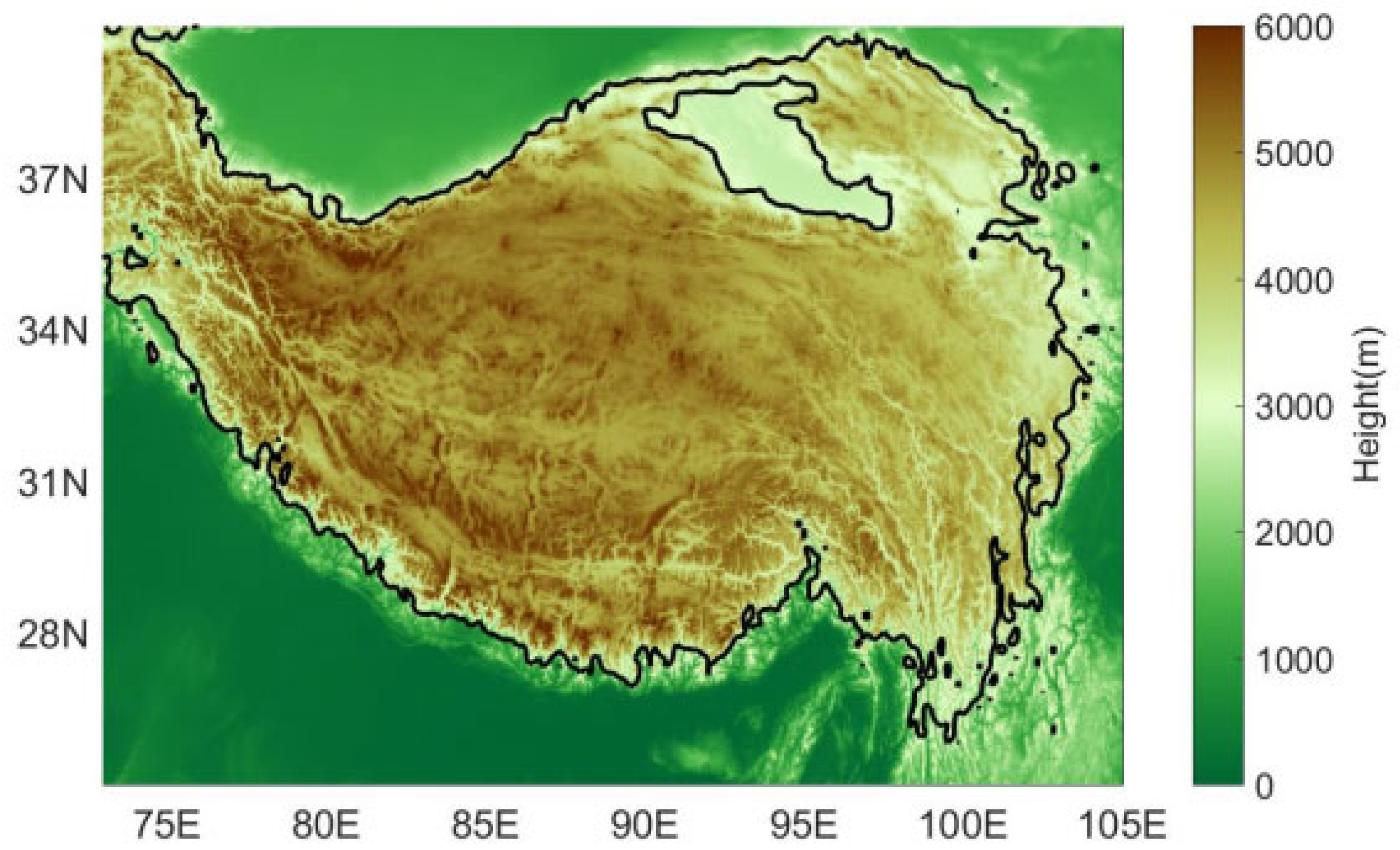
2.1. Data

The SRF data used in this paper were the 0.7 cm (2800 MHz) wavelength data for the sun from the data center of the National Oceanic and Atmospheric Administration (NOAA) from 1947 to 2018 (http://www.esrl.noaa.gov/psd/data/correlation/solar.data; unit: sfu; 1 sfu = 10−22 W·m−2·Hz−1). SRF data were used to depict the solar activity. The atmospheric circulation data were from the global reanalysis monthly data of NCEP/NCAR [48]. The precipitation data from China were the rain gauge data from 160 stations of the National Meteorological Information Center, China Meteorological Administration. The snow cover data on the QTP were the daily snow depth data from National Meteorological Information Center, China Meteorological Administration; these data were sorted into the continuous time series from 51 stations (1951–2015). The study area of this paper (the QTP) is shown in Figure 1. For the detailed method of processing the plateau snow cover data, please refer to Song et al. (2011) [49]. The monthly average water-equivalent snow depth grid data (1951–2017) were from the second edition of the 20th Century Reanalysis data set (20 CRv2) (the grid data represent the mass of melted water from the snow cover per unit area; unit: kg·m−2; resolution: 2° × 2°). Compared with the observation data, the grid data were more applicable for depicting the spatial pattern of snow anomalies on the QTP and conducting an empirical orthogonal decomposition (EOF) analysis because the observation data for the QTP were not evenly distributed, with more data from the east, where it is densely populated, and less from the west, where it is sparsely populated.
The STA data were from the WOD09 data set (World Ocean Atlas, NCAR Climate Data Guide; 1955–2016) of the National Oceanic Data Center (NODC) at a grid resolution of 1° × 1°. The STA data for the 0~700 m vertical depth were considered to be 5-year running mean data to filter out the effects of ENSO. The global precipitation data were the CMAP monthly precipitation rate data (CPC merged analysis of precipitation) of the NOAA (January 1979 to September 2017) at a grid resolution of 2.5 × 2.5.

2.2. Methodology

2.2.1. Power Spectrum Method

Power spectrum analysis is widely used as a method for frequency domain analysis based on a Fourier transform. In this way, the total energy of one time series is decomposed into components at different frequencies and then the variance contribution of different frequency waves is used to identify the main cycle of the sequence to determine the main frequency of the cycle; namely, the significant period implied in the sequence [31,50]. In this paper, this method was used to detect the SA signal from STA caused by SA to determine whether the STA was of an 11-year periodic cycle.

2.2.2. Composite Mean Difference (CMD) Method

The CMD method is usually used to deduce the spatial distribution of climate element fields in response to SA [51]. In this paper, the CMD method was used to distinguish the spatial distribution of the climate element difference field of high SA years (HSAYs) from low SA years (LSAYs). The normalized SRF data values larger (lower) than zero were ascribed to high (low) SA years (called HSAYs (LSAYs)) to obtain two groups of climate element data corresponding to HSAYs and LSAYs, respectively. The spatial distribution of climate elements in response to SRF was generated by calculating the difference between the two groups of data.

2.2.3. Eliassen–Palm (EP) Flux

EP flux, which was pointed out by Eliassen and Palm [52] in 1961, can represent the propagation of a planetary wave in the atmosphere. It can describe the propagation direction and size of atmospheric long waves along meridional and vertical directions. It can also express the size and direction of the eddy motion heat flux and momentum flux. The specific formula is as follows:
F ( y ) = ϕ v ¯ = u v ¯ F ( p ) = ϕ ω ¯ = f θ v ¯ / θ p
The divergence of EP flux can also reflect the wave–flow interaction. When the divergence of the EP flux is larger (smaller) than zero, the average speed of the zonal wind will increase (decrease). In addition, EP flux divergence can also diagnose the meridional flux of potential vorticity and its distribution inhomogeneity with latitude can reflect the change of potential vorticity with time.

2.2.4. Model Simulation

Using the Earth system model from the National Center for Atmospheric Research, USA (NCAR CESM2.1.1), fully coupled numerical integration experiments, including the annual variation in TSI from 1979 to 2009, were carried out to analyze the variation in the climate system within the 30 years of time. The atmospheric horizontal resolution was 1.9° × 2.5°. The horizontal resolution of ocean mode and sea ice mode was a nominal 1° × 1°. The detailed model parameters are shown in Table 1. The atmospheric component of the CESM was the Community Atmosphere Model, version 6 (CAM6). It used the finite volume (FV) dynamical core with a hybrid sigma coordinate. The Community Land Model (CLM5) was chosen for the land component mode, which updated the parameter settings for new snow density to provide a more realistic description of the effect of temperature and wind field on snow density. The ocean component was the Parallel Ocean Program, version 2 (POP2); the sea ice component was the Los Alamos Sea Ice Model, version 5 (CICE5); the land ice component was the Community Ice Sheet Model, version 2 (CISM2); the river runoff component was the Model for Scale Adaptive River Transport (MOSART); and the wave component was Wave Watch, version 3 (WW3). The Whole Atmosphere Community Climate Model, version 6 (CESM2) long preindustrial control simulation and historical simulations were performed first to obtain some of the necessary forcing data sets to run the corresponding CESM2 (CAM6) simulations. Please refer to Danabasoglu et al. (2020) [53] for details.
Based on the TSI variation between 1979 and 2009, the years with TSI values higher than a 1.0 standard deviation were regarded as high TSI years: 1979, 1980, 1981, 1989, 1990, 2000, 2001, and 2002, altogether eight years; and the years with TSI values lower than a −1.0 standard deviation were categorized as low TSI years: 1985, 1986, 1995, 1996, 1997, 2007, 2008, and 2009, also eight years in total.

3. Results

3.1. Analysis of the Bottom-Up Mechanism of the Impact of SRF on Plateau Snow Cover

Song et al. (2016, 2022) [24,30] pointed out that the impact of SRF on plateau snow cover is especially significant in peak and valley years of SRF. The SRF time series exhibits an obvious 11-year cycle with alternating peak and valley SA years (Figure 2). When considering the impact of SA on snow cover on the QTP, the effects of ENSO and volcano eruption must be excluded because they are strong interannual signals that cause climate anomalies and ENSO has a distinct interdecadal variation, which could induce anomalous snow cover on the QTP [54]. Therefore, the peak years of SRF selected, excluding the impact of strong ENSO events (i.e., strong El Niño and La Niña events) and volcano eruption, were 1957/1958, 1967/1968, 1979/1980, 1990/1991, and 2001/2002; while the valley years were 1963/1964, 1975/1976, 1986/1987, 1995/1996, and 2008/2009, respectively. Figure 3a shows that the peak (valley) years of SRF were accompanied by higher (lower) winter precipitation over the plateau; the black dots represent a score of more than 0.05 in the significance test. The significant precipitation anomaly areas covered Northeast China, the Hetao area, and the QTP (the circled area), with the correlation coefficients distributed in “+–+” mode. According to our calculations, the correlation coefficients of winter precipitation and snow amount on the QTP were significantly correlated. This implied that the plateau winter precipitation could reflect the snow cover on the plateau. Figure 3b and Figure 3c represent the differences in the average snow days at the gauge station in HSAYs and LSAYs in winter and in spring, respectively. It is obvious that the snow amount in HSAYs was more than in LSAYs over most area of the QTP whether in winter or spring. Based on our calculation results, we discovered that the average snow days in winters of HSAYs surpassed those of LSAYs by 50 days per year, whereas the average snow days in springs of HSAYs exceeded those of LSAYs by 57 days per year.
This study analyzed the spatial distribution of the synchronous and lag correlation between winter snow cover and the SRF (Figure 4). We found that there was a significant synchronous and 1-year lag correlation (it exceeded the 0.05 significant level) between the plateau snow and SA signals by calculating the correlation coefficients (omitted). A positive correlation was identified between snow over most area of the plateau and the SRF, while a local negative correlation only existed on the western edge and in the northeast and southeast of the QTP. The significantly correlated areas were mainly in the middle of the QTP along the Tanggula Mountains/Nianqing Tanggula Mountains/Hengduan Mountains and the eastern section of Bayankala Mountains and Animaqing Mountains. With the lag time increasing, the extent of the positively correlated regions gradually decreased and that of the negative correlation regions gradually increased.
For the same amount of incident solar irradiance, there is increasing absorption of incident solar radiation on the cloudless underlying surface than that with clouds, which will cause an abnormal heat exchange between the underlying surface and the atmosphere. This can be reflected as the anomalous sensible heat flux (SHF) and latent heat flux (LHF) between the ocean and atmosphere. Figure 5 presents the difference field of the LHF between the peak and valley years of the SRF. It shows four areas with a significantly anomalous LHF in the Pacific. The detailed extents of these four areas (A, B, C, and D) are displayed in Table 2. The index Ilatent was defined as the sum of the values of anomalous LHFs in Zone A, Zone B, Zone C, and Zone D; i.e., Ilatent = LB + LC + LD − LA. Figure 6 presents the spatial distribution of the correlation between the LHF and winter precipitation in China. It shows that the positive plateau precipitation anomaly was very similar to that given in Figure 3a, indicating that the LHF in the central and western tropical Pacific responding to the SRF played a key role in winter precipitation anomalies over the QTP. The plateau snow cover anomaly affected precipitation in China in the following summer, transmitting the energy of SA from winter to summer. Comparatively speaking, the correlation between the SHF anomaly’s response to the SRF and winter precipitation was relatively weaker than that of the LHF. This showed that SHF played less of a role in precipitation. The reason was most likely that precipitation is more closely related to the LHF than the SHF, which includes the water cycle. Jin et al. (2017) [55] pointed out that there was a significant correlation between the geomagnetic index and the global LHF that leads to global climate change by influencing the release of Joule energy from the inner earth and air–sea interaction. The connection of the geomagnetic index and SA is relatively close. Therefore, it is also an example of the indirect influence of SA on global climate change by causing anomalous LHF [55].
An LHF anomaly caused by SRF during the sun’s 11-year cycle can also affect summer precipitation in the following summer season of China, hence extending and amplifying the impact of solar role in the climate from winter to the following summer. Meanwhile, by impacting the global vertical ocean temperature, SA could affect winter and summer precipitation over the QTP indirectly. This also amplifies the impact of SA. Here, the WOD09 data set (World Ocean Atlas, NCAR Climate Data Guide, 1955–2016) (grid point resolution: 1° × 1°) of STA data from the National Oceanographic Data Center (NODC, USA) was utilized to determine the 5-year running mean of STA data at each level of the vertical range from 0 m to 700 m. In this way, ENSO signals were eliminated. The calculation results showed that the STA at 0–200 m responded to the SRF more significantly than at 300–700 m. Using the accumulated STA at 0–200 m, we analyzed the composite difference in STA response to the SRF between high and low years, as shown in Figure 7. Six regions with a significant response were generated based on the calculations; namely, the A–F regions, all of which responded significantly to SA. The detailed extent and significant period are exhibited in Table 3.
According to the power spectrum analysis, six regions (A, B, C, D, E, and F) among the global significant response regions were detected to contain the similar significant period of the SRF; that is, a period of around 11.3 years. In addition, all six of the regions passed the 95% reliability test of red noise. The temporal–meridional profile of STA further verified that the six regions indeed exhibited an 11-year cycle of STA significantly, which we thought to be the solar signal [31]. Comparatively, the six regions we obtained as shown in Figure 7 were in accordance with those shown in Figure 3 in Wang (2015) [56], including two high-responding areas over the Pacific Ocean.
We obtained the average of the absolute values of STA in these six areas and defined the index of STA as Z = STB + STF−STA−STC−STD−STE. The correlation coefficient of the index and the SRF reached 0.473, thus passing the 0.001 significance test. This indicated that the index Z defined by the STA’s response to the SRF could reflect the intensity of the SA.
The synchronous correlation between the STA index Z and winter (summer) precipitation in East Asia showed that there was a significant precipitation anomaly both in winter and in summer over the QTP (Figure 8). A higher (lower) index Z was accompanied by higher (lower) winter precipitation and lower (higher) summer precipitation over the QTP. This indicated that the STA could reflect the SA’s signals and affected the plateau’s precipitation, hence amplifying the impact of SA.

3.2. Analysis of the Top-Down Mechanism of the Impact of SRF on Plateau Snow Cover

The discussion in the previous subsection regarded the bottom-up mechanism of SA’s impact on climate. SRF affects STA and causes ocean LHF anomalies, which further lead to winter and summer precipitation anomalies in East Asia. Consequently, winter precipitation increases significantly over the QTP in high years of SRF, resulting in higher amounts of plateau snow cover. This subsection begins to discuss the top-down mechanism. Figure 9 consists of two diagrams: the vertical profile of the winter temperature difference (Figure 9a) and the geopotential height difference (Figure 9b) with a zonal mean between the high and low years of SRF. The profiles show that during peak years of SA (from 400 hPa to 100 hPa of the northern hemisphere), the Arctic cools and the low and middle latitudes become warmer, which corresponds to the temperature gradient pointing to the pole and is conducive to the positive phase of the Arctic Oscillation and the strengthening of the westerly wind in the middle latitudes. Such a distribution of temperature anomalies is in accordance with Figure 1 in the paper by Frame and Gray (2010) [57]. The mean temperature difference profile between the equator and the pole shows that the size of temperature gradient in the lower stratosphere and the upper troposphere is greater than zero, which is conducive to the strengthening of the westerly in the northern hemisphere (figure omitted). Such a temperature gradient can last until the spring, summer, or autumn of the next year and can also propagate downward to the lower troposphere in the spring and summer. The geopotential height anomaly profile demonstrated that in the troposphere and the middle and lower stratosphere of the Northern Hemisphere, negative anomalies were identified in the polar regions while positive anomalies were present in the middle and low latitudes. The pressure gradient force pointed from the equator to the pole, which was also conducive to the strengthening of the westerly. During the valley years of SA, the situation reversed.
Figure 10 presents the profile of the zonal wind difference in winter between high and low SRF years. It shows that westerlies prevailed in the atmosphere from the stratosphere to the troposphere at 40–60° N of the mid-latitudes, easterlies prevailed at 25–40° N, and an east wind prevailed in the troposphere and upper middle stratosphere north of 65° N. These phenomena indicated that in the middle latitudes of the stratosphere, the zonal westerly wind can propagate into the troposphere, strengthening the westerlies in the mid-latitudes of the troposphere and enhancing the annular mode in the Northern Hemisphere. Thus, westerly winds prevailed in the tropical stratosphere during HSAYs and easterly winds prevailed during LSAYs.
How does the westerly circulation anomaly of the stratosphere transfer down to the troposphere? One path is the downward vertical propagation of atmospheric long waves triggered by thermal anomalies in the stratosphere. Figure 11 presents the EP flux and its divergence in high and low years of SRF, respectively. It is clearly shown that long waves in the stratosphere were transferred to the troposphere through vertical propagation of long waves during HSAYs. Between 60° N and 80° N at high latitudes, there were consistent downward flows of EP flux from the stratosphere to the troposphere, indicating the downward propagation of long waves. Consequently, the impact of SA was transferred downward into the troposphere. In the meridional direction, the sensible heat flux and momentum flux pointed from the pole to the lower latitude and the heat and momentum were transported to the middle latitudes, which was conducive to the warming and momentum accumulation in the middle latitudes. In the stratosphere, the EP flux arrows point from the pole to the equator, indicating a northward transport of potential vorticity. From 45° N to 70° N of the stratosphere, there was a strong divergence in the EP flux and the zonal westerly wind there was strengthened. On the contrary, in the southern and polar regions, there was a convergence of the EP flux, the zonal westerly wind weakened, and the easterly wind strengthened. Such a zonal wind distribution with latitude corresponded to the positive phase of the annular mode; that is, the positive phase of the Arctic Oscillation (AO). The above situation reversed during LSAYs. Composites of the EP flux vector in HSAYs and LSAYs were in accordance with Figure 1 in the paper by Matthes (2006) [39] between the solar max and min numerical experiments.
The monthly EP flux showed that during high SRF years, SA signals were transmitted downward from November to December, causing a downward transfer of long waves. Accordingly, the westerly wind was strengthened in high-latitude area, accompanied by the barotropic structure and the positive phase of AO. The barotropic structure and the positive phase lasted until January of the following year. During low-SRF years, the wave vertical transmission signal weakened in high-latitude areas and long waves were transferred upward. The upward transmission reached its highest level in January, resulting in the accumulation of heat in the Arctic region. This situation lasted until February, and was conducive to the negative phase of the AO. The barotropic structure was identified from January to February. The figures above are omitted here.
The interaction between the stratosphere and troposphere alters the distribution of atmospheric circulation field in the troposphere. It is the difference at 500 hPa zonal wind field between HSAYs and LSAYs (Figure 12a) that causes not only a significant easterly wind anomaly over the QTP, but also a strong westerly wind anomaly to the south of the QTP around the Indian Peninsula, the Bay of Bengal, and the Arabian Sea. Such an anomalous zonal wind shear with latitude can produce positive vorticity anomalies, which are favorable for the generation of anomalous cyclones there, and hence favorable for the rich precipitation over the QTP. In this way, the plateau snow cover increased accordingly, as shown in Figure 2b. Based on our calculations, we discovered that the average snow days in winters of HSAYs surpassed those of LSAYs by 50 days per year. The anomalous zonal wind caused by SA can last until spring continuously (Figure 12b), although the wind shear becomes weak. In particular, a significant westerly wind anomaly existed in the Bay of Bengal to the south of the QTP in spring. It was also favorable for the increase in spring snow on the QTP (Figure 2c). In fact, the average snow days in springs of HSAYs exceeded those of LSAYs by 57 days per year.
The above analysis explained the top-down mechanism (ultraviolet irradiance mechanism) relevant to the impact of SA on plateau snow cover. Together with the analysis of the bottom-up mechanism (total solar irradiance mechanism), this paper proved that SA affects plateau snow cover through two physical paths (bottom-up and top-down mechanisms). Thus, the physical reason for the response of plateau snow to SA has been deeply explored.

3.3. Numerical Experiments on the Response of Plateau Snow to SA

By using the Climate Earth System Model (CESM) of the USA (NCAR CESM2.1.1), this paper studied the impact of TSI (total solar irradiance), including its annual variation, on plateau snow and the atmosphere circulation.
The simulation results showed a significant response of plateau snow to SA. Based on the high and low years of SA selected by using TSI standardized data in the model, the spatial distributions of the annual temperature at the reference height (TREHFT) (2 m air temperature) as well as the annual net solar flux at the top of the atmosphere (FSNT) in HSAY and LSAY are given in Figure 13. We found that on the QTP in HSAYs, the solar flux at the top of the atmosphere intensified and that the near-surface air temperature also increased significantly; both of these results passed the 0.05 confidence level significance test. The findings indicated that with a strong SA, both the heat flux at the top of the atmosphere and the near-surface air temperature over the QTP would increase, and vice versa.
The atmosphere circulation field showed that in HSAYs, there was a low-pressure anomaly (Figure 14a) and a positive vorticity shear on the plateau at 500 hPa (omitted), while a high-pressure anomaly (Figure 14b) and a negative vorticity shear were identified at 100 hPa (omitted), which was consistent with the observation given above. Furthermore, an anomalous ascending movement was found on the plateau area (Figure 14c), resulting in an excessive snowfall rate there (Figure 14d). The above circulation anomalies were conducive to increased snow on the QTP in HSAYs, while the opposite occurred in LSAYs. These results also were accordance with those of Song Yan et al. [24,25]; i.e., when SA became strong, the winter and spring snow increased over the QTP.

4. Conclusions

Using observation and model simulation methods, this study explained the possible mechanisms of SA’s influence on the plateau snow cover using two aspects; namely, the bottom-up mechanism (the impact of ocean thermal anomalies on the atmosphere) and the top-down mechanism (the impact of the stratospheric atmosphere on tropospheric atmosphere). Moreover, with CESM, the response of the plateau snowfall rate to SA was verified. In fact, the two mechanisms worked together to affect snow cover on the QTP and the atmospheric circulation. However, the simulation results could not present such a combined effect. The reason was very likely that CESM was inappropriate, especially in the description of SA-triggered chemical and physical processes in the stratosphere. The model should be improved in the future to better describe the impact of SA on snow cover on the QTP.
It should be noted that compared with human activities and the internal variability of the climate, the impact of SA on the climate is relatively weak. Only when other influence factors are offset will SA begin to play an important role in climate anomalies. However, before this hypothesis is proved, we need to be prepared to learn more about the knowledge of SA’s impact on the climate system. This requires the development and improvement of coupled climate models to better understand the physical mechanisms by which SA affects the climate.
Finally, the results obtained above are summarized as follows:
(1)
Solar activity could directly affect the amount and spatial distribution of snow cover on the QTP, which was consistent with previous results. We focused on analyzing the spatial pattern of correlations between the SRF and snow cover on the QTP. We found that when the SA was strong, the number of snow days and the amount of snow cover on the QTP in winter and in spring increased significantly. The contemporaneous and lag 1-year correlations were the most significant, and then the correlation gradually weakened with time.
(2)
In addition to its direct impact, SA can also affect snow cover on the QTP indirectly. SST anomalies at 0–200 m in the Pacific and the Atlantic respond to SA significantly, as does the LHF in the Pacific, resulting in abnormal sea–air interactions. The abnormal sea–air heat exchanges correlate significantly with the abnormal precipitation over the QTP. Generally speaking, in peak (valley) years of SA, winter precipitation over the QTP increases (decreases); in HSAYs (LSAYs), SST anomalies respond to SA more (less) significantly, while winter precipitation over the QTP increases (decreases) but summer precipitation decreases (increases). Therefore, we deduced that SA causes plateau snow cover anomalies indirectly by influencing the sea–air interaction. The above analysis regarded the bottom-up mechanism relevant to the impact of SA on plateau snow cover. Plateau snow cover anomalies caused by SA could further affect summer precipitation in the following flood season in China [30] through their nonlinear amplified effect on the atmosphere. In this sense, the effect of SA is amplified.
(3)
In addition to the bottom-up mechanism, the research results showed that there is also top-down mechanism relevant to the impact of SA on snow cover over the QTP. In peak (valley) years of SA, the temperature in the stratosphere of the Arctic region drops (rises) while the low- and mid-latitude temperatures rise (drop) and the westerly wind strengthens around mid-latitude, which is conducive to AO presenting a positive (negative) phase. In HSAYs (LSAYs), long waves are transferred downward (upward) from the stratosphere (troposphere) to the troposphere (stratosphere) vertically. A strong divergence (convergence) of the EP flux exists between 45° N and 70° N of the stratosphere, and the zonal westerly wind strengthens (weakens). Such a distribution of the zonal wind along the latitude is favorable for the formation of the positive (negative) phase of the AO.
(4)
As the result of the interaction between the stratospheric atmosphere and tropospheric atmosphere, the zonal wind field at 500 hPa is featured with a significant easterly (westerly) wind anomaly in winter over the QTP in HSAYs (LSAYs). Meanwhile, a significant westerly (easterly) wind anomaly was identified to the south of the QTP over the Indian Peninsula, the Bay of Bengal, and the Arabian Sea. This anomaly was favorable for the generation of abnormal (anti)cyclones, and hence favorable for the increase (decrease) in plateau precipitation, leading to the increase (decrease) in plateau snow. Triggered by SA, such a meridional shear of the zonal wind can last until spring, so it continues to influence the spring snow anomaly over the QTP.
(5)
By using CESM of the USA (NCAR CESM2.1.1), this paper carried out a fully coupled numerical experiment that included TSI variation during 1979–2009 to analyze the impact of SA on snow cover on the QTP and the atmospheric circulation. The simulation results indicated that in HSAYs (LSAYs), the snowfall rate rose (fell) in the main part of the QTP. This finding verified the results of the previous observation analysis and proved the reliability of the conclusions.
The analysis of the mechanism of the impact of SA on plateau snow cover was based on the analysis of observation data. In the future, improved climate system models will be selected for numerical experiments to verify the above analysis results. The climate model needs to have a good simulation performance in simulating upper atmospheric chemical and physical processes, including those of the ionospheric atmosphere. It also needs to include an objective multilevel air–sea coupling system. Moreover, the spatial scope of the snow cover will not be limited to the QTP and will be extended to involve Eurasian snow, including the sea ice of the Arctic. The possible study findings will be more helpful in understanding the impact of SA on the entire cryosphere objectively.

Author Contributions

Conceptualization, Y.S., X.B. and T.X.; Data curation, Z.L., Y.Z., B.S. and L.S.; Formal analysis, Y.S. and B.S.; Funding acquisition, Y.S.; Investigation, Z.L., Y.Z., L.S. and W.Z.; Methodology, Y.S., Y.Z., B.S. and W.Z.; Project administration, Y.S.; Resources, Y.Z. and W.Z.; Software, Z.L., Y.Z., B.S., L.S. and W.Z.; Supervision, Y.S., X.B., T.X. and Z.X.; Validation, Z.L., Y.Z., B.S. and W.Z.; Visualization, Z.L., Y.Z., B.S., L.S. and W.Z.; Writing—original draft, Y.S.; Writing—review & editing, Y.S. and C.W. All authors have read and agreed to the published version of the manuscript.

Funding

This paper was supported by the National Natural Science Foundation of China (Contract Nos. 41575091 and 42075008), the National Natural Science Foundation of China and Civil Aviation Administration of China (U2033207), the Second Tibetan Plateau Scientific Expedition and Research Program (STEP) (Grant No. 2019QZKK0208), the Major National Scientific Research Project of China (Contract No. 2012CB957803), and the “Study on Physical Factors to Affect China Climate” project of the Training Center of the China Meteorological Administration.

Institutional Review Board Statement

Not applicable.

Informed Consent Statement

Not applicable.

Data Availability Statement

The raw data supporting the conclusions of this article will be made available by the authors, without undue reservation.

Acknowledgments

We would like to express our gratitude to Li Delin of the College of Ocean and Meteorology, Guangdong Ocean University.

Conflicts of Interest

The authors declare no conflict of interest.

References

  1. Herman, J.R.; Goldberg, R.A. The Sun, Weather and Climate; University Press of the Pacific: Stockton, CA, USA, 1978; p. 426. [Google Scholar]
  2. Herschel, W. Observations tending to investigate the nature of the Sun, in order to find the causes or symptoms of its variable emission of light and heat: With remarks on the use that may possibly be drawn from solar observations. Philos. Trans. R. Soc. Lond. 1801, 91, 265–318. [Google Scholar]
  3. Hines, C.O. A possible mechanism for the production of Sun-weather correlations. J. Atmos. Sci. 1974, 31, 589–591. [Google Scholar] [CrossRef]
  4. Sfîcă, L.; Voiculescu, M. Possible effects of atmospheric teleconnections and solar variability on tropospheric and stratospheric temperatures in the Northern Hemisphere. J. Atmos. Solar-Terr. Phys. 2014, 109, 7–14. [Google Scholar] [CrossRef]
  5. Haigh, J.D. The impact of solar variability on climate. Science 1996, 272, 981–985. [Google Scholar] [CrossRef]
  6. Ineson, S.; Scaife, A.A.; Knight, J.R.; Manners, J.C.; Dunstone, N.J.; Gray, L.J.; Haigh, J.D. Solar forcing of winter climate variability in the Northern Hemisphere. Nat. Geosci. 2011, 4, 753–757. [Google Scholar] [CrossRef]
  7. Lockwood, M.; Harrison, R.G.; Woollings, T.; Solanki, S.K. Are cold winters in Europe associated with low solar activity? Environ. Res. Lett. 2010, 5, 024001. [Google Scholar] [CrossRef]
  8. Woollings, T.; Lockwood, M.; Masato, G.; Bell, C.; Gray, L. Enhanced signature of solar variability in Eurasian winter climate. Geophys. Res. Lett. 2010, 37, L20805. [Google Scholar] [CrossRef]
  9. Gray, L.; Beer, J.; Geller, M.; Haigh, J.; Lockwood, M.; Matthes, K.; Cubasch, U.; Fleitmann, D.; Harrison, G.; Hood, L.; et al. Solar Influences on Climate. Rev. Geophys. 2010, 48, RG4001. [Google Scholar] [CrossRef]
  10. Zhao, L.; Xu, Y.; Wang, J.S.; Ding, Y.H.; Xiao, Z.N. Progress in studies on the influence of solar activity on climate change during the last 100 years. Adv. Meteorol. Sci. Technol. 2011, 1, 37–48. (In Chinese) [Google Scholar]
  11. Xiao, Z.; Zhong, Q.; Yin, Z.; Zhou, L.; Song, Y.; Han, Y.; Huang, C.; Pan, J.; Zhao, L. Advances in the research of impact of decadal solar cycleon modern climate. Adv. Earth Sci. 2013, 28, 1335–1348. (In Chinese) [Google Scholar]
  12. Nesme-Ribes, E. The maunder minimum and the deepest phase of the little ice age: Solar output and climate during the Holocene. In Proc. 14th EPC/ESF Workshop; 1995; pp. 131–144. (In German) [Google Scholar]
  13. Sakurai, K.; Mikami, T. (Eds.) Solar activity during the Little Ice Age. In Proceedings of the International Symposium on the Little Ice Age Climate; Tokyo Metropolitan University, Department of Geography: Tokyo, Japan, 1992; pp. 337–340. [Google Scholar]
  14. Eddy, J.A. The maunder minimum. Science 1976, 192, 1189–1202. [Google Scholar] [CrossRef]
  15. Eddy, J.A. Climate and the changing sun. Clim. Chang. 1977, 1, 173–190. [Google Scholar] [CrossRef]
  16. Song, Y.; Ji, J.; Wang, Y.; Wang, P. Reviews on little ice age climate and approach to its mechanism. Meteor. Mon. 2003, 29, 3–6. (In Chinese) [Google Scholar]
  17. Zhao, P.; Yang, S.; Yu, R. Long-Term Changes in Rainfall over Eastern China and Large-Scale Atmospheric Circulation Associated with Recent Global Warming. J. Clim. 2010, 23, 1544–1562. [Google Scholar] [CrossRef]
  18. Wei, Z.; Luo, S.; Dong, W.; Li, P. Snow cover data on Qinghai-Xizang plateau and its correlation with summer rainfall in China. J. Appl. Meteor. Sci. 1998, 9, 39–46. (In Chinese) [Google Scholar]
  19. Zheng, Y.; Qian, Y.; Miao, M.; Ji, J. Effect of the Tibetan plateau snow cover on China summer monsoon climate. Chin. J. Atoms. Sci. 2000, 24, 761–774. (In Chinese) [Google Scholar]
  20. Wu, T.; Qian, Z. The relation between the Tibetan winter snow and the Asian summer monsoon and rainfall: An observational investigation. J. Clim. 2003, 16, 2038–2051. [Google Scholar] [CrossRef]
  21. Zhang, Y.; Li, T.; Wang, B. Decadal change of the spring snow depth over the Tibetan Plateau: The associated circulation and influence on the East Asian summer monsoon. J. Clim. 2004, 17, 2780–2793. [Google Scholar] [CrossRef]
  22. Peng, J.; Chen, L.; Zhang, Q. Multi-scale variations of snow cover over QXP and tropical Pacific SST and their influences on summer rainfall in China. Plateau. Meteor. 2005, 24, 366–376. (In Chinese) [Google Scholar]
  23. Zhao, P.; Zhou, Z.; Liu, J. Variability of Tibetan spring snow and its associations with the hemispheric extratropical circulation and east Asian Summer Monsoon rainfall: An observation investigation. J. Clim. 2007, 20, 3942–3955. [Google Scholar] [CrossRef]
  24. Song, Y.; Li, Z.; Xiao, Z.; Zhang, J.; Li, H.; Zhu, Y. Analysis on interdecadal correlation between solar activity and snow depth over the Qinghai-Xizang plateau and East Asian atmospheric circulation in winter. Plateau. Meteor. 2016, 35, 1135–1147. (In Chinese) [Google Scholar]
  25. Song, Y.; Li, Z.; Zhang, J.; Xiao, Z. Review of progress in modulation effects of solar activity on snow depth over the Tibetan plateau and East Asian summer monsoon. Adv. Meteor. Sci. Technol. 2016, 6, 148–154. (In Chinese) [Google Scholar]
  26. Song, Y.; Li, Z.; Gu, Y.; Liou, J.N.; Zhang, X.; Xiao, Z. The effect of solar cycle on climate of Northeast Asia. J. Meteor. Res. 2019, 33, 885–894. [Google Scholar] [CrossRef]
  27. Zhao, L.; Wang, J. Robust Response of the East Asian Monsoon Rainband to Solar ariability. J. Clim. 2014, 27, 3043–3051. [Google Scholar] [CrossRef]
  28. Li, W.; Sun, S.; Wang, B.; Liu, X. Numerical Simulation of Sensitivities of Snow Melting to Spectral Composition of the Incoming Solar Radiation. Adv. Atmos. Sci. 2009, 26, 403–412. [Google Scholar] [CrossRef]
  29. Meinander, O.; Wuttke, S.; Seckmeyer, G.; Kazadzis, S.; Lindfors, A.; Kyrö, E. Solar zenith angle asymmetry cases in polar snow UV albedo. Geophys. 2009, 45, 183–198. [Google Scholar]
  30. Song, Y.; Li, Z.; Gu, Y.; Xiao, Z. Impact of Solar Activity on Snow Cover Variation Over the Tibetan Plateau and Linkage to the Summer Precipitation in China. Front. Earth Sci. 2022, 9, 756762. [Google Scholar] [CrossRef]
  31. Zhou, Y.; Song, Y.; Xiao, Z. Response of Global Sea Temperature to Solar Radio Flux and Influence on Precipitation. Chin. J. Geophys. 2021, 64, 1518–1530. (In Chinese) [Google Scholar] [CrossRef]
  32. Wang, G.; Yan, S.; Qiao, F. Decadal variability of upper ocean heat content in the Pacific: Responding to the 11-year solar cycle. J. Atmos. Sol.-Terr. Phys. 2015, 135, 101–106. [Google Scholar] [CrossRef]
  33. Meehl, G.A.; Washington, W.M.; Wigley, T.M.; Arblaster, J.M.; Dai, A. Solar and greenhouse gas forcing and climate response in the 20th century. J. Clim. 2003, 16, 426–444. [Google Scholar] [CrossRef]
  34. Meehl, G.A.; Arblaster, J.M.; Branstator, G.; van Loon, H. A coupled air-sea response mechanism to solar forcing in the Pacific region. J. Clim. 2008, 21, 2883–2897. [Google Scholar] [CrossRef]
  35. Meehl, G.A.; Arblaster, J.M.; Matthes, K.; Sassi, K.; van Loon, H. Amplifying the Pacific climate system response to a small 11 year solar cycle forcing. Science 2009, 325, 1114–1118. [Google Scholar] [CrossRef] [PubMed]
  36. Haigh, J.D. A GCM study of climate change in response to the 11-year solar cycle. Q. J. R. Meteorol. Soc. 1999, 125, 871–892. [Google Scholar] [CrossRef]
  37. Kodera, K.; Kuroda, Y. Dynamical response to the solar cycle: Winter stratopause and lower stratosphere. J. Geophys. Res. 2002, 10, 4749. [Google Scholar]
  38. Kodera, K. Solar influence on the Indian Ocean Monsoon through dynamical processes. Geophys. Res. Lett. 2004, 31, 1183–1186. [Google Scholar] [CrossRef]
  39. Matthes, K.; Kuroda, Y.; Kodera, K.; Langematz, U. Transfer of the solar signal from the stratosphere to the troposphere: Northern winter. J. Geophys. Res. 2006, 111, D06108. [Google Scholar] [CrossRef]
  40. Loon, V.H.; Meehl, G.A.; Arblaster, J.M. A decadal solar effect in the tropics in July-August. J. Atmos. Sol.-Terr. Phys. 2004, 66, 1767–1778. [Google Scholar] [CrossRef]
  41. Loon, V.H.; Meehl, G.A.; Shea, D.J. Coupled air-sea response to solar forcing in the Pacific region during northern winter. J. Geophys. Res. 2007, 112, D02108. [Google Scholar]
  42. Lee, J.N.; Shindell, D.T.; Hameed, S. The influence of solar forcing on tropical circulation. J. Clim. 2009, 22, 5870–5885. [Google Scholar] [CrossRef]
  43. White, W.B.; Liu, Z. Resonant excitation of the quasi-decadal oscillation by the 11-year signal in the Sun’s irradiance. J. Geophys. Res. Oceans 2008, 113. [Google Scholar] [CrossRef]
  44. White, W.B.; Liu, Z. Non-linear alignment of El Nino to the 11-yr solar cycle. Geophys. Res. Lett. 2008, 35, L19607. [Google Scholar] [CrossRef]
  45. Rind, D.; Lean, J.; Lerner, J.; Lonergan, J.; Leboissitier, A. Exploring the stratospheric/tropospheric response to solar forcing. J. Geophys. Res. 2008, 113, D24103. [Google Scholar] [CrossRef] [Green Version]
  46. Zhao, L.; Wang, J.; Liu, H.; Xiao, Z. Amplification of the solar signal in the summer monsoon rainband in China by synergistic actions of different dynamical responses. J. Meteor. Res. 2017, 31, 61–72. [Google Scholar] [CrossRef]
  47. Huo, W.; Xiao, Z.; Wang, X.; Zhao, L. Lagged responses of the tropical Pacific to the 11-yr solar cycle forcing and possible mechanisms. J. Meteor. Res. 2021, 35, 444–459. [Google Scholar] [CrossRef]
  48. Kalnay, E.; Kanamitsu, M.; Kistler, R.; Collins, W.; Deaven, D.; Gandin, L.; Iredell, M.; Saha, S.; White, G.; Woollen, J.; et al. The NCEP/NCAR 40-year reanalysis project. Bull. Amer. Meteor. Soc. 1996, 77, 437–471. [Google Scholar] [CrossRef]
  49. Song, Y.; Zhang, J.; Li, Z.; Zhao, P. Interdecadal change of winter snow depth on Tibetan plateau and its effect on summer precipitation in China. Plateau. Meteor. 2011, 30, 843–851. (In Chinese) [Google Scholar]
  50. Wei, F. Application of Modern Climate Statistical Diagnosis and Prediction Technology; China Meteorological Press: Beijing, China, 2007. (In Chinese) [Google Scholar]
  51. Camp, C.; Tung, K.K. Surface warming by the solar cycle as revealed by the composite mean difference projection. Geophys. Res. Lett. 2007, 34, L14703. [Google Scholar] [CrossRef]
  52. Eliassen, A.; Palm, E. On the transfer of energy in stationary mountain waves. Geofys. Publ. 1960, 22, 1–23. [Google Scholar]
  53. Danabasoglu, G.; Lamarque, J.F.; Bacmeister, J.; Bailey, D.A.; DuVivier, A.K.; Edwards, J.; Emmons, L.K.; Garcia, R.; Hannay, C.; Neale, R.; et al. The Community Earth System. Model Version 2 (CESM2). J. Adv. Modeling Earth Syst. 2020, 12, e2019MS001916. [Google Scholar] [CrossRef]
  54. Wang, Z.; Wu, R.; Yang, S.; Lu, M. An interdecadal change in the influence of ENSO on the spring Tibetan Plateau snow cover variability in early 2000s. J. Clim. 2022, 35, 725–743. [Google Scholar] [CrossRef]
  55. Jin, W.; Zhang, X.; Song, Y.; He, F.; Li, L.; Yu, C.; Lv, J.; Xiao, Z. Progress of research on the effect of geomagnetic activity on climate elements. Chin. J. Geophys. 2017, 60, 1276–1283. (In Chinese) [Google Scholar] [CrossRef]
  56. Wang, R.; Xiao, Z.; Zhu, K.; Gao, C. Asymmetric impact of solar activity on the East Asian winter climate and its possible mechanism. Chin. J. Atmos. Sci. 2015, 39, 815–826. (In Chinese) [Google Scholar]
  57. Frame, T.H.A.; Gray, L.J. The 11-Yr Solar Cycle in ERA-40 Data: An Update to 2008. J. Clim. 2010, 23, 2213–2222. [Google Scholar] [CrossRef]
Figure 1. The area of the Qinghai–Tibet Plateau.(Units: latitude is ° N, and longitude is ° E).
Atmosphere 13 01499 g001
Figure 2. Time series of standardized SRF data with the solid (empty) circles representing peak (valley) years of SA (Song et al., 2016). (● represents the peak year of solar activity, and ○ represents the valley year of solar activity).
Atmosphere 13 01499 g002
Figure 3. (a) Differences in winter precipitation in China between peak and valley years of SRF. The black dots represent stations that passed the 0.1 significance test. (b) Differences between high and low SRF years of the plateau snow days in winter and (c) the plateau snow days in spring (● indicates the stations that passed the 0.1 significance test). (Units: latitude is ° N, and longitude is ° E).
Atmosphere 13 01499 g003
Figure 4. Spatial distribution of the synchronous and lag correlation between winter snow over the QTP and SRF during 1951–2017: (a) in the same period; (bk) in the lag of 1–10 years. The black dots represent the grid points that passed the 0.05 significance test.(Units: latitude is ° N and longitude is ° E).
Atmosphere 13 01499 g004
Figure 5. Differences in latent heat flux between peak and valley years of SRF in winter. Stippling indicates the grid points that passed the 0.05 significance test (unit: W/m2). (Units: latitude is ° N, and longitude is ° E).
Atmosphere 13 01499 g005
Figure 6. Correlation between latent heat flux anomaly index and winter precipitation in China. Stippling indicates stations that passed the 0.05 significance test. (Units: latitude is ° N, and longitude is ° E).
Atmosphere 13 01499 g006
Figure 7. The composite mean difference (CMD) of 0–200 m accumulated annual STA response to SRF after 5-year running mean. The AF regions had significant responses; a warm color indicates a positive response and a cold color indicates a negative response. All regions passed the 0.05 significance test of red noise (as verified by the difference value between peak and valley years of SRF). (Units: latitude is ° N and longitude is ° E).
Atmosphere 13 01499 g007
Figure 8. Correlation of STA index Z with (a) winter precipitation rate and (b) summer precipitation rate in East Asia. Shading indicates the anomaly regions that reached a 0.1 significance level; the contour interval is 0.5%. (Units: latitude is ° N and longitude is ° E).
Atmosphere 13 01499 g008
Figure 9. The composite mean difference (CMD)-derived spatial patterns of (a) winter temperature and (b) winter geopotential height response to SRF. Shading indicates that the regions passed the 0.1 and 0.05 significance tests, respectively. (The solid blue line indicates the positive value, and the dot red line indicates the negative value. Units: latitude is ° N, and longitude is ° E).
Atmosphere 13 01499 g009
Figure 10. Profile of zonal wind differences in winter between high and low SRF years. Light and heavy shading indicate the regions that passed the 0.1 and 0.05 significance tests, respectively. (Units: latitude is ° N and the vertical pressure is hPa).
Atmosphere 13 01499 g010
Figure 11. EP flux (arrow) and divergence (shading) in winter of (a) HSAYs and (b) LSAYs. Stippling indicates the grid points that passed the 0.1 significance test). Units: latitude is ° N, and the vertical pressure is hPa).
Atmosphere 13 01499 g011
Figure 12. Differences between high and low SRF years of 500 hPa zonal wind field (a) in winter and (b) in spring. Stippling indicates the grid points that passed the 0.1 significance test. (Units: latitude is ° N and longitude is ° E).
Atmosphere 13 01499 g012
Figure 13. Differences in high and low SA years of (a) annual net solar flux (unit: W/m2) at the top of the atmosphere and (b) annual temperature (unit: °C) at the reference height. Stippling indicates the grid points that passed the 0.05 significance test, shading indicates plateau areas, solid and red lines represent the isolines greater than zero, and dashed and blue lines represent the isolines less than zero. (Units: latitude is ° N, and longitude is ° E).
Atmosphere 13 01499 g013
Figure 14. Spatial distribution of annual average differences between high and low TSI years of (a) geopotential height field at 500 hPa (unit: m), (b) geopotential height field at 100 hPa (unit: m), and (c) vertical velocity ω (unit: Pa/s), and (d) snowfall rate (unit: mm/d). Stippling indicates the grid points that passed the 0.05 significance test; shading indicates plateau areas. (The red line indicates the positive value, and the blue line indicates the negative value).
Atmosphere 13 01499 g014
Table 1. Model parameters.
Component
AtmosphereLand SurfaceSeaSea IceLand IceRiver Runoff
CAM6CLM5POP2CICE5CISM2MOSART
Physical Parameters
Deep convectionZhang and McFarlane (ZM)
Shallow convectionCloud Layers Unified by Binormals (CLUBB)
Cloud microphysicsMorrison and Gettelman (MG 2.0)
Cloud macrophysicsCloud Layers Unified by Binormals (CLUBB)
Boundary layerCloud Layers Unified by Binormals (CLUBB)
RadiationRapid Radiative Transfer Method (RRTMG)
Table 2. The extent of anomalous latent heat flux regions.
ZoneRangeMark
A44°–58° N, 140°–158° ENegative
B27°–40° N, 130°–155° EPositive
C2.5°–7.5° N, 85°–110° EPositive
D23°–35° N, 180°–210° EPositive
Table 3. Extents and significant period of 0–200 m accumulated annual STA response to SRF.
RegionRange (Latitude and Longitude)Symbol of ResponseSignificant Period (Year)
A120–160° E, 0–20° N17, 11.3, 8.5
B120–180° W, 10° S–10° N+11.3, 8.5
C130–180° W, 25–50° N17, 11.3
D130–170° W, 25–40° S11.3, 8.5
E20° W–10° E, 20° S–011.3, 8.5
F10–40° W, 25–40° S+11.3, 8.5
Publisher’s Note: MDPI stays neutral with regard to jurisdictional claims in published maps and institutional affiliations.

