Article

Wildfire and Prescribed Fire Effects on Forest Floor Properties and Erosion Potential in the Central Appalachian Region, USA

by
Emma Georgia Thompson
1,
Thomas Adam Coates
1,*,
Wallace Michael Aust
1 and
Melissa A. Thomas-Van Gundy
2
1
Department of Forest Resources and Environmental Conservation, Virginia Polytechnic Institute and State University, Blacksburg, VA 24061, USA
2
US Department of Agriculture Forest Service, Northern Research Station, Parsons, WV 26287, USA
*
Author to whom correspondence should be addressed.
Forests 2019, 10(6), 493; https://doi.org/10.3390/f10060493
Submission received: 10 May 2019 / Revised: 4 June 2019 / Accepted: 6 June 2019 / Published: 8 June 2019
(This article belongs to the Special Issue Fire Effects and Management in Forests)

Abstract

:
Short- and long-term impacts of wildland fires on forest floor properties and erosion potential were examined at three locations in the Central Appalachian region, U.S.A. In 2018, two wildfires were investigated within six months of burning on the George Washington–Jefferson National Forest (GWJNF) in Bland County, Virginia and the Monongahela National Forest (MNF) in Grant County, West Virginia. An additional wildfire was studied eight years post-fire on the Fishburn Forest (FF) in Montgomery County, Virginia. A 2018 prescribed fire was also studied within six months of burning on the MNF in Pendleton County, West Virginia. Litter and duff consumption were examined to evaluate fire severity and char heights were measured to better understand fire intensity. The Universal Soil Loss Equation for forestlands (USLE-Forest) was utilized to estimate potential erosion values. For the 2018 comparisons, litter depth was least as a result of the wildfires on both the MNF and GWJNF (p < 0.001). Wildfire burned duff depths in 2018 did not differ from unburned duff depths on either the MNF or GWJNF. Eight years after the FF wildfire, post-fire litter depth was less than that of an adjacent non-burned forest (p = 0.29) and duff depth was greater than that of an adjacent non-burned forest (p = 0.76). Mean GWJNF wildfire char heights were greatest of all disturbance regimes at 10.0 m, indicating high fire intensity, followed by the MNF wildfire and then the MNF prescribed fire. USLE-Forest potential erosion estimates were greatest on the MNF wildfire at 21.6 Mg soil ha−1 year−1 due to slope steepness. The next largest USLE-Forest value was 6.9 Mg soil ha−1 year−1 on the GWJNF wildfire. Both the prescribed fire and the 2010 wildfire USLE-Forest values were approximately 0.00 Mg soil ha−1 year−1. Implications for potential long-term soil erosion resulting from similar wildfires in Central Appalachian forests appeared to be minimal given the 2010 wildfire results.

1. Introduction

Fire is a landscape-scale natural disturbance that has been present formatively and continually for millennia [1]. In the eastern United States and around the globe, fire is a very complex phenomenon that has varied extensively from region to region depending upon vegetative cover type [2], which represents long-term adaptations to soils, climate, topography, and disturbance. Following the onset of extensive fire exclusion in the early 1900s, landscapes and cover types have changed. These changes are marked by the increasing abundance of more mesic, late successional species across the landscape [3,4]. Many upland pine–hardwood stands now have increased red maple (Acer rubrum L.) and blackgum (Nyssa sylvatica Marshall) understories, for example, [5,6] exemplifying the ecological theory of mesophication [7]. Historic fire return intervals for portions of the Central Appalachians were as short as four years in some locations [8,9]. In the absence of frequent fire, fire-adapted species regeneration has decreased, and fuels are increasing, which may result in increasing wildfire hazard [10].
Wildland fires have been evaluated in many ways, including fire severity (based upon organic matter consumption) and intensity (based upon energy output) [11]. Fire behavior and effects can be altered by the conditions under which burning occurs, such as seasonality and local weather [12]. The amount of litter and duff consumed during a fire may indicate its severity while fire intensity might be associated with post-fire char heights on tree boles [13,14]. Combinations of both high and low severity and intensity resulting from wildland fires may be critical for fuel reduction, wildlife habitat management, and vegetative species control [12].
Several constraints affect the use of prescribed fire as a management tool [12], including the perception that all wildland fires accelerate soil erosion. The Universal Soil Loss Equation (USLE) was created to understand and evaluate erosion across all landscapes, including an equation specifically developed for forests (USLE-Forests) used in this study [15]. Post-fire effects such as soil exposure and increased erosion are more consistently evaluated using standardized numbers, which USLE-Forest provides. When considering the effects of prescribed fire on the landscape, estimations of representative values to compare disturbance regimes allows for informed management decisions.
Most severe wildfires in the United States occur in the western United States [16]. Despite this western dominance, eastern locations may also be affected by wildfire or may be considered at risk for wildfire, as evidenced by the extensive wildfire activity of 2016 (Figure 1). During that year, 15 large wildfires burned over 200,000 acres [17]. The extensive wildfire event that occurred in Gatlinburg, TN, in 2016 provided an example of potential fire severity under pervasively dry conditions and high winds.
The literature indicates that global fire management could be improved with better information regarding fire behavior and potential fire effects [19,20,21]. Therefore, the purpose of this study was three-fold; first, to investigate litter and duff depth resulting from two 2018 wildfires, one 2010 wildfire, and one 2018 prescribed fire in the Central Appalachian region (as an assessment of fire severity); second, to estimate potential erosion based upon fire severity estimates (defined as the consumption of litter and duff); and finally, to observe litter and duff accumulation eight years post-wildfire in southwestern Virginia to determine post-fire recovery of the litter and duff layers over time.
We hypothesized that post-fire litter depth would not differ between the 2018 prescribed fire and 2018 wildfire locations, but that both would be significantly less than adjacent, non-burned forests. It was also hypothesized that post-fire duff depth would be greater for the 2018 prescribed fire locations than the 2018 wildfire locations due to the intended and prescribed lower fire severities. This duff depth in the 2018 prescribed fire locations was hypothesized to be statistically similar to adjacent, non-burned forests. Prescribed fire erosion estimates were hypothesized to be statistically similar to non-burned estimates, but wildfire erosion estimates were hypothesized to be significantly greater than both prescribed fires and non-burned locations due to the expected increase in fire severity. As a result of the 2010 wildfire, litter and duff depths and estimated erosion were not expected to differ between areas impacted by the wildfire and those that were unaffected.

2. Materials and Methods
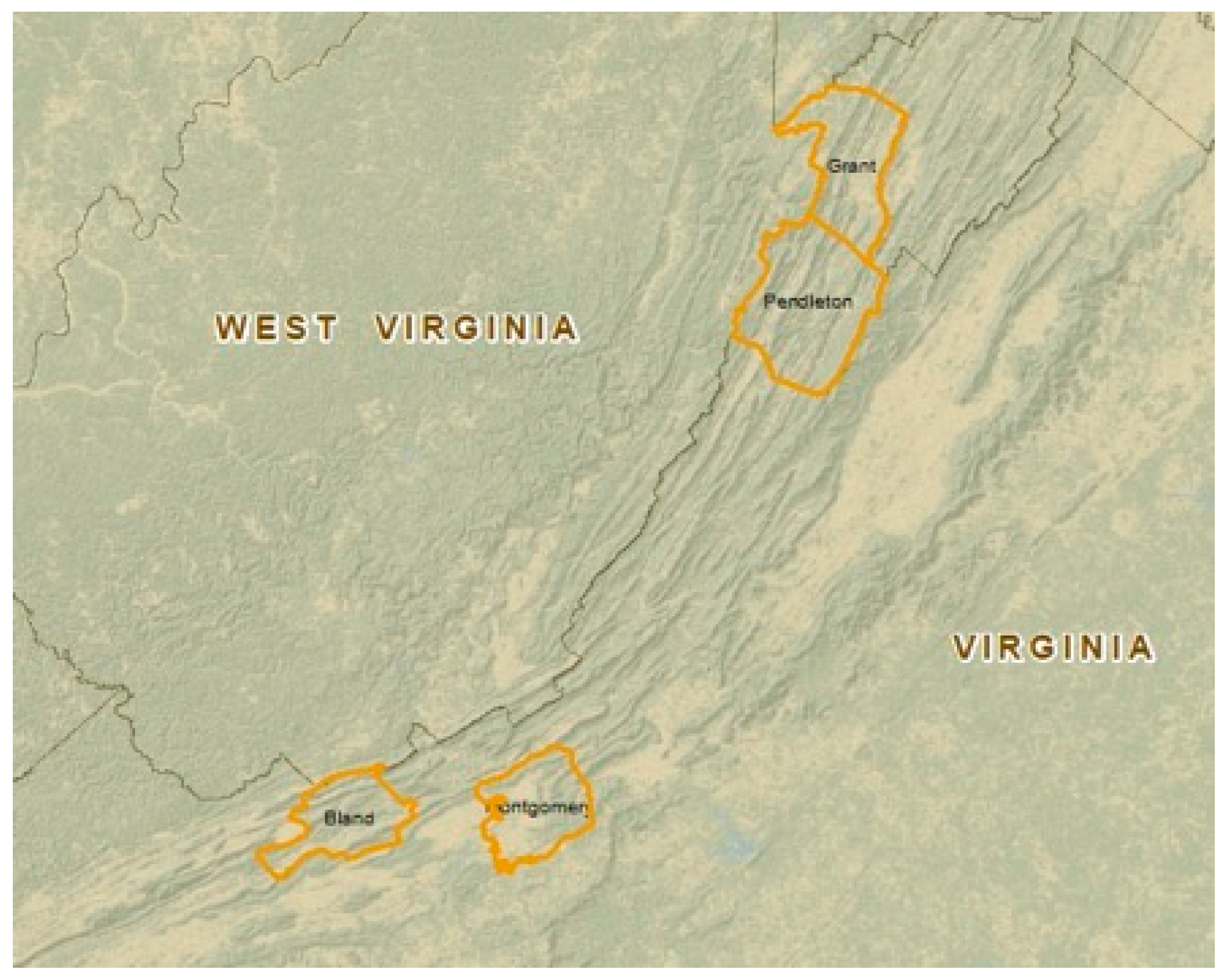
2.1. Study Sites

This study was conducted at four locations across four different counties in the Ridge and Valley and Allegheny Plateau regions of Virginia and West Virginia; specifically in Bland, Grant, Pendleton, and Montgomery counties (Figure 2). Descriptive site characteristics are outlined in Table 1. Briefly, we sampled a wildfire that occurred on the Fishburn Forest (FF) in Montgomery County, VA in November 2010. An additional study site was located on the Monongahela National Forest (MNF) in Pendleton County, WV. At that location, a prescribed burn was conducted in April 2018 to reduce potentially hazardous fuels and improve wildlife habitat. In that same month, a wildfire occurred on the MNF in Grant County, WV and was included in our study. We also took advantage of a wildfire that occurred in Bland County, VA on the George Washington-Jefferson National Forest (GWJNF) in May 2018 as an additional study site.

2.2. Sampling: Burned and Non-burned Ridges

In July 2018, linear transects were established along two (MNF, FF) or three (GWJNF) ridges at each site, depending upon ridge length. These fires occurred on ridges; therefore, we sampled burned and non-burned ridges with similar aspects as a basis for comparison. Sampling locations were established along these transects every 45 m. At each sampling location, approximately 20 m perpendicular to the transect, four measurements were obtained: litter (Oi Horizon) depth (cm), duff (Oe + Oa Horizons) depth (cm), char height (m), and Universal Soil Loss Equation-Forest (USLE-Forest) (Mg soil ha−1 year−1). Litter, duff, and char heights were obtained in three separate locations at each sampling point along each transect and averaged to obtain one measurement per sampling point. Litter and duff were measured to the nearest mm. Char heights were measured to the nearest 0.3 m.
Sample sizes were as follows (Table 2): 1) GWJNF, MNF, and FF non-burned ridge litter and duff depth, 20; 2) MNF and FF non-burned USLE-Forest, 20, and GWJNF, 7; 3) MNF prescribed fire, all variables, 20; 4) GWJNF, MNF, and FF wildfire litter and duff depth and char height (40, 20, and 30, respectively) and USLE-Forest (14, 20, and 30, respectively). Differing sample sizes were based upon accessible ridge lengths for litter and duff depth and char height. Differing USLE-Forest sample sizes on the MNF were additionally related to the time available for sampling prior to imminent, significant precipitation events.

2.3. Universal Soil Loss Equation

Universal Soil Loss Equation for forest land (USLE-Forest) was calculated using the USDA guide [15]. The equation is
A = RKLSCP,
where:
  • A = the estimated loss of soil (Mg ha−1 year−1),
  • R = the annual rainfall and runoff index value, which was taken from the USLE-Forest manual (MJmm ha−1 h year) [15,25],
  • K = the soil erodibility factor, which was taken from the Natural Resource Conservation Service (NRCS) Soil Map (Mg ha−1 R unit−1) [24,25]. Larger K values were always utilized in this equation to err on the side of A (total estimated loss) overestimation,
  • LS = the slope length and steepness factor, which were obtained by measuring slope distance (Nikon rangefinder or Haglof DME) and steepness (Suunto clinometer) in the field,
  • C = cover management factor (i.e., the percent of bare soil with a fine root mat, disturbed or undisturbed),
  • P = an evaluation of the practices affecting the soil, with associated values for each (i.e., percent bare soil, canopy height and percent cover, steps, onsite storage, vegetation, and organic matter values).

2.4. Statistical Analysis

For the GWJNF and FF datasets, t-tests were conducted via JMP 14 [26] to compare litter depth, duff depth, and USLE-Forest between the non-burned and wildfire ridges. For the MNF data, analysis of variance (ANOVA) was used to determine differences in these variables between the non-burned, prescribed fire, and wildfire ridges. Least square means were determined, and a Tukey’s test was used to separate means when differences were detected. These results are shown in Table 2. The cumulative effect of wildfires on the GWJNF and MNF, regardless of site and aspect, were determined using t-tests (Table 3). Significant differences were determined at α = 0.05.
Normality was assessed for each dependent variable, and non-parametric tests (i.e., Mann–Whitney for the GWJNF and FF datasets and Kruskal Wallis for the MNF dataset) were conducted as necessary. However, those tests did not yield different results than those generated under assumptions of normality. Therefore, our results only reflect the t-tests (GWJNF and FF), ANOVA (MNF), and Tukey’s (MNF) analyses described above.

3. Results

3.1. George Washington-Jefferson National Forest (GWJNF) (Figure 3)

Mean char height was 10.0 m on the wildfire ridges. Mean litter depth differed (p < 0.01) between the non-burned (2.54 cm) and wildfire ridges (0.13 cm) (Table 2), but mean duff depth did not differ (p = 0.88) between the non-burned (3.76 cm) and wildfire ridges (3.69 cm) (Table 2). Mean USLE-Forest values differed significantly (p = 0.00) between the non-burned (0.12 Mg soil ha−1 year−1) and wildfire ridges (6.90 Mg soil ha−1 year−1) (Table 2).

3.2. Monongahela National Forest (MNF) (Figure 3)

Mean char height was 0.60 m on the prescribed fire ridge and 2.35 m on the wildfire ridge. Mean litter depth differed (p < 0.0001) between the ridges in the following order: non-burned (2.71 cm) > prescribed fire (0.69 cm) > wildfire ridges (0.01 cm) (Table 2). Mean duff depth differed (p = 0.03) in a slightly different manner: prescribed fire (2.09 cm) = non-burned (1.88 cm); prescribed fire (2.09 cm) > wildfire (1.25 cm) (Table 2). Mean USLE-Forest values were 0.00 Mg soil ha−1 year−1 for both the non-burned and prescribed fire ridges and were significantly less (p < 0.0001) than the wildfire ridges (21.60 Mg soil ha−1 year−1) (Table 2).

3.3. Fishburn Forest (FF) (Figure 3)

Eight years post-wildfire, char heights were undetectable on the FF. Mean litter depth did not differ (p = 0.29) between the non-burned (3.30 cm) and wildfire (2.92 cm) locations (Table 2). Mean duff depth also did not differ (p = 0.76) between the non-burned (2.10 cm) and wildfire locations (2.43 cm) (Table 2). Mean USLE-Forest values for both the wildfire and non-burned ridges equaled 0.00 Mg soil ha−1 year−1 and did not differ (p = 0.00) (Table 1).

3.4. Combined Wildfires: GWJNF and MNF

To examine the collective wildfire effects regardless of location, results for the recent GWJNF and MNF wildfires were combined (Table 3). Mean char heights for the wildfires equaled 7.45 m (Table 3). Mean litter depth on the wildfire ridges (0.09 cm) differed (p < 0.001) from the non-burned ridges (2.62 cm). Mean duff depth on the wildfire ridges (2.88 cm) did not differ (p = 0.86) from the non-burned ridges (2.82 cm). Mean USLE-Forest differed (p < 0.0001) between the wildfire (15.57 Mg soil ha−1 year−1) and non-burned ridges (0.03 Mg soil ha−1 year−1).

4. Discussion

Individual wildfire occurrences are generally unplanned and are, therefore, unanticipated. Therefore, few wildfire studies include pre-fire measurements prior to ignition. For this reason, similar, adjacent, non-burned locations are often used as comparisons to approximate wildfire effects. While this is an opportunistic way to evaluate wildfire effects, these investigations are somewhat limited in their capacity to communicate exact before and after wildfire differences and impacts. These studies are also often not replicable when the complexity of fire-related topographic, weather, ignition source, and fuel variables are considered [21]. These constraints limited this study’s scope, therefore, these inferences must be placed in that context. Specifically, GWJNF and MNF wildfire effects must be assessed based upon inherent differences at these locations. Aspect (GWJNF: west; MNF: east), vegetative composition (GWJNF: upland pines; MNF: mixed oaks), climate (GWJNF: mean temperature 14.6 °C; MNF: mean temperature 7.6 °C); and slope percentage (GWJNF: 47%; MNF: 78%) differed between these locations, therefore differences in wildfire effects might be expected. For this reason, we avoided strict comparisons between wildfires. Additionally, slope position differed between the MNF wildfire (78%) and prescribed fire (13%) despite similarities in aspect and vegetative composition. In this regard, despite including numerous ridges in this study, these site locations are unreplicated when all inherent, potential differences between sites are considered. However, as an opportunistic way to quantify potential wildfire impacts within this region, these datasets do provide a unique assessment of natural phenomenon that should be broadly considered for effective, long-term natural resource management.
Comparisons of burned ridge litter depth to non-burned litter depth suggested that litter consumption was nearly complete on the GWJNF and MNF. Duff consumption was not, however, as was intended for the MNF prescribed fire. This is a common prescribed fire phenomenon in the eastern United States [12] and in other locations, globally. Litter and fine fuels often drive low intensity, low severity, surface fires in this region and elsewhere. Char heights resulting from the MNF wildfires and prescribed fires indicated this type of fire behavior. In contrast, the high intensity crown fires observed on the GWJNF wildfire highlight a different fire dynamic, possibly due to the greater abundance of pine on these sites compared to the MNF. At both sites, however, duff depth was less affected, indicating low fire severity [27] across sites regardless of aspect and vegetative cover. As defined here, fire severity is most related to organic matter consumption and mineral soil exposure as opposed to the composite of all fire effects across the burned landscape [11]. In this regard, there is little concern for hydrophobic soil formation or altered mineral soil aggregates, which has been observed in some wildfire-related soil effects studies, particularly in the western United States [27,28,29,30].
Despite the lack of duff consumption and mineral soil exposure resulting from these wildfires, USLE-Forest estimates were greater than those for non-burned ridges. These values are similar to those that might be experienced following harvest when site-closure practices are implemented, such as seeding, mulching, and water control features [31,32,33,34]. Aust et al. [35] found that the recovery time for recently harvested sites averaged four years through an examination of previous research [36,37]. USLE-Forest values might indicate potential soil erosion and subsequent water quality effects, which may include sedimentation, eutrophication, increased water temperatures, and altered aquatic habitats. In a recent literature review of prescribed fire water quality effects, Hahn et al. [38] determined that very few prescribed fires in the eastern United States, regardless of intensity, had drastic water quality impacts. Impacts were generally related to vegetative cover type, slope position, and the time since fire when measurements were obtained.
While pre-fire litter and duff values were not present for the FF study location, a few inferences might be posed. Given the current lack of significant observable char heights, it appears the wildfire event exhibited both low fire intensity and severity. Since the 2010 wildfire, litter and duff have reaccumulated to non-burned values, and USLE-Forest values were equal, regardless of fire history. Therefore, wildland fire impacts were temporary as suggested in additional Appalachian [39,40] and global [41,42,43] fire studies.
The GWJNF (May 2018) and MNF (April 2018) wildfires occurred in the growing season and offered a unique opportunity to examine post-fire vegetative response following a single fire entry in long-term non-burned forests. Most planned, prescribed fires in long-term non-burned forests in this region occur in the dormant season [12]. This prescription is often favored to reduce potentially negative impacts for specific wildlife species, to reduce potentially erratic fire behavior, and to utilize trained personnel outside the most common wildfire seasons in this region. One vegetative effect desired through prescribed fire in the eastern United States is the restoration of competitive oak regeneration. For many years, forest managers and silviculturists have attempted to utilize prescribed fire to avert potentially negative mesophication impacts in long-term non-burned forests residing in historically frequent fire landscapes [7,44,45]. In many cases dormant season prescribed fires as a singular treatment have produced less than desired results to reduce mesophytic hardwood competition and increase oak regeneration [46,47,48,49].
Many studies have examined the importance of wildland fire for Table Mountain pine (Pinus pungens Lamb.) regeneration, a fire-adapted, Appalachian endemic tree species [50]. This species possesses serotinous cones and exhibits shade intolerance. It has been suggested that periodic, high intensity, stand replacement fires might best promote conditions needed for Table Mountain pine regeneration. This includes heat to open the serotinous cones and bare mineral soil in which the released seed may germinate [51,52]. Other studies, however, suggest that frequent, low intensity fires may actually be most beneficial for long-term Table Mountain pine development and stand maintenance [3,50,51,52,53]. These conditions might be more easily obtained through the use of frequent and repeated low intensity prescribed fires. This is a critical management consideration for these ecological communities in this region given their threatened and endangered status. In our study we found numerous Table Mountain pine seedlings present post-wildfire in Bland County (Figure 4). These seedlings were growing in duff greater than 3.69 cm deep. This is similar to the findings of Mohr et al. [54]; numerous seedlings were found in their study growing in 7.5 cm duff. In conjunction with these other studies, this information may provide much-needed information to better understand how these communities can be restored and maintained over time.
Universal Soil Loss Equation-Forest estimates for the wildfires on the GWJNF and MNF suggested that immediate, potential soil erosion losses post-wildfire were potentially significant. Several other studies have found much higher erosion rates due to higher severity fires [55,56,57]. In Oregon, on a severely burned site with 60% average slope, Robichaud and Brown [58] found erosion rates of 25 Mg soil ha−1 year−1. However, it is important to note that the USLE-Forest estimates potential erosion but does not estimate sediment delivery to streams, which would be considerably less. With this in mind, the authors do recognize the limitations USLE-Forest estimates provide as opposed to more robust and site-specific estimates that might be evaluated with experimental plots closer to stream channels or other erosional features. However, time was limited to capture these estimates, both in terms of time since wildfire and time available during the 2018 summer research season. Therefore, based upon these constraints, USLE-Forest was the best option available for the completion of this project with the time available.
While unplanned and unaccompanied by pre-fire measurements, these fires provided a limited (i.e., only three individual, unreplicated wildfires and one prescribed fire), unique, opportunistic evaluation of potential wildfire impacts on the landscape in the Central Appalachian region. We hope to include these study sites on the FF, GWJNF, and MNF in future long-term regeneration studies to determine potential regeneration following single entry wildfires.

5. Conclusions

This observational study examined forest floor properties and potential soil erosion following three wildfires and one prescribed fire in the Central Appalachian Mountain region. On two recent (2018) wildfires within the region, litter (Oi) depth was lower on burned areas compared to adjacent non-burned areas. Duff (Oe + Oa) depth, however, did not differ between burned and non-burned areas. Measurements taken eight years following a 2010 wildfire at an additional location suggested that forest floor effects and the potential for soil erosion were temporally related to wildfires, however, and were most likely related to both fire intensity (heat release during the fire) and fire severity (consumption of organic matter). Litter depth on one prescribed fire conducted in the region was also lower than adjacent, non-burned areas, with no differences in duff depth between burned and non-burned sites, and there were no significant impacts on Universal Soil Loss Equation-Forest estimates between burned and non-burned areas.
The high intensity, low severity, growing season wildfire that occurred in Bland County, Virginia contained considerable Table Mountain pine regeneration seeded in duff over 3.69 cm deep less than two months post-fire, adding further information to suggest that high severity burns might not be necessary for successful, long-term Table Mountain pine regeneration. Additional research will be conducted in this forest to confirm this observation. Given the narrow opportunities to conduct prescribed fires in this region based upon weather, topography, and smoke management concerns, consideration should be given to utilize wildfire incidents as potential first-entry prescribed fires to achieve potential forest management and restoration goals where appropriate. Future burning in the growing season as opposed to the dormant season may help managers and silviculturists better understand potential burn season–vegetation effects. Overall, it appeared that an appropriately managed Central Appalachian prescribed fire significantly reduced surface fuels with minimal concern for negative long-term forest floor and erosion impacts. Additionally, it appeared that a 2010 wildfire may have temporarily altered forest floor properties that recovered within an eight-year window and may have, in fact, provided long-term ecosystem benefits including the reduction of potentially hazardous, wildfire fuels and the improvement of wildlife habitat.

Author Contributions

T.A.C. and E.G.T. designed and conducted the experiment and analyzed the data. W.M.A. designed the experiment. All authors contributed to the writing of this paper.

Funding

This research was funded by the Virginia Polytechnic Institute and State University.

Acknowledgments

The authors wish to acknowledge George Hahn, Caleb Keen, Christopher Dukes, and Margaret Thompson for their assistance in collecting data. We also acknowledge two anonymous reviewers for their comments and suggestions that greatly improved the written quality of this manuscript.

Conflicts of Interest

The authors declare no conflict of interest.

References and Notes

  1. Willig, M.R.; Walker, L.R. Disturbance in terrestrial ecosystems: Salient themes, synthesis, and future directions. In Ecosystems of Disturbed Ground; Elsevier: Amsterdam, The Netherland, 1999. [Google Scholar]
  2. Loudermilk, E.; Hiers, J.; O’Brien, J. The role of fuels for understanding fire behavior and fire effects. In Ecological Restoration and Management of Longleaf Pine Forests; Kirkman, L., Jack, S., Eds.; CRC Press: Boca Raton, FL, USA, 2017; pp. 107–122. [Google Scholar]
  3. Waldrop, T.A.; Brose, P.H.; Welch, N.T. Fire and the Ecology of Table Mountain Pine. In Forest Encyclopedia Network; USDA Forest Service Southern Research Station: Asheville, NC, USA, 2007. Available online: https://www.firescience.gov/projects/06-4-1-01/project/06-4-1-01_06_4_1_01_Deliverable_01.pdf (accessed on 4 September 2018).
  4. Sutherland, E.K.; Grissino-Mayer, H.; Woodhouse, G.A.; Covington, W.W.; Horn, S.; Huckaby, L.; Kerr, R.; Kush, J.; Moore, M.; Plumb, T. Two Centuries of Fire in the Southwestern Virginia Pinus pungens Community. In Inventory and Management Techniques in the Context of Catastrophic Events: Altered States of the Forest. Available online: https://www.fs.usda.gov/treesearch/pubs/40897 (accessed on 4 September 2018).
  5. Hagan, D.L.; Waldrop, T.A.; Reilly, M.; Shearman, T.M. Impacts of repeated wildfire on long-nonburned plant communities of southern Appalachian Mountains. Int. J. Wildland Fire 2015, 24, 911–920. [Google Scholar] [CrossRef]
  6. Delcourt, H.R.; Delcourt, P.A. Pre-Columbian Native American Use of Fire on Southern Appalachian Landscapes. Conser. Biol. 1997, 11, 1010–1014. [Google Scholar] [CrossRef] [Green Version]
  7. Nowacki, G.J.; Abrams, M.D. The Demise of Fire and “Mesophication” of Forests in the Eastern United States. BioScience 2008, 58, 123–138. [Google Scholar] [CrossRef]
  8. Guyette, R.P.; Stambaugh, M.C.; Day, D.C.; Muzika, R.M. Predicting Fire Frequency with Chemistry and Climate. Ecosystems 2012, 15, 322–335. [Google Scholar] [CrossRef] [Green Version]
  9. Lafon, C.W.; Naito, A.T.; Trissino-Mayer, H.D.; Horn, S.P.; Waldrop, T.A. Fire History of the Appalachian Region: A Review and Synthesis; USDA Southern Research Station: Asheville, NC, USA, 2017.
  10. Hessl, A.E.; Saladyga, T.; Schuler, T.; Clark, P.; Wixom, J. Fire history from three species on a central Appalachian ridgetop. Can. J. For. Res. 2011, 41, 2031–2039. [Google Scholar] [CrossRef]
  11. Keeley, J. Fire intensity, fire severity and burn severity: A brief and suggested usage. Int. J. Wildland Fire 2009, 10, 116–126. [Google Scholar] [CrossRef]
  12. Waldrop, T.; Goodrick, S. Introduction to Prescribed Fire in Southern Ecosystems; USDA Forest Service Southern Research Station: Asheville, NC, USA, 2012.
  13. Wade, D. Fire Intensity and Fire Severity: How Hot is Your Fire and Why Is that Important? Southern Fire Exchange Fact Sheet: Gainesville, FL, USA, 2013. [Google Scholar]
  14. Alexander, M.E.; Cruz, M.G. Interdependencies between flame length and wireline intensity in predicting crown fire initiation and crown scorch height. Int. J. Wildland Fire 2012, 21, 95–113. [Google Scholar] [CrossRef]
  15. Dissmeyer, G.E.; Foster, G.R. A Guide for Predicting Sheet and Rill Erosion on Forestland; General Technical Report R8-TP-6; U.S. Department of Agriculture, Forest Service: Washington, DC, USA, 1980; p. 40.
  16. Miller, J.D.; Skinner, C.N.; Safford, H.D.; Knapp, E.E.; Ramirez, C.M. Trends and causes of severity, size, and number of fires in northwestern California, USA. Ecol. Appl. 2012, 22, 184–203. [Google Scholar] [CrossRef]
  17. Berwyn, B. The Southeast is Burning: Wildfires Feast on Hot, Dry Region. Available online: https://insideclimatenews.org/news/30112016/southeast-wildfires-drought-tennessee-north-carolina-georgia (accessed on 30 November 2016).
  18. Wildfire Today. Available online: https://wildfiretoday.com/2016/11/14/maps-of-five-wildfires-in-georgia-and-north-carolina/ (accessed on 12 April 2019).
  19. Ryan, K.C.; Knapp, E.E.; Varner, J.M. Prescribed fire in North American forests and woodlands: History, current practice, and challenges. Front. Ecol. Environ. 2013, 11, e15–e24. [Google Scholar] [CrossRef]
  20. Hiers, J.K.; O’Brien, J.J.; Mitchell, R.J.; Grego, J.M.; Loudermilk, E.L. The wildland fuel cell concept: An approach to characterize fine-scale variation in fuels and fire in frequently burned longleaf pine forests. Int. J. Wildland Fire 2009, 18, 315–325. [Google Scholar] [CrossRef]
  21. Yedinak, K.M.; Strand, E.K.; Hiers, J.K.; Varner, J.M. Embracing complexity to advance the science of wildland fire behavior. Fire 2018, 1, 20. [Google Scholar] [CrossRef]
  22. USGS: The National Map. TNM Elevation. Available online: https://viewer.nationalmap.gov/theme/elevation/ (accessed on 16 March 2019).
  23. National Weather Service Climate Forecast Office. Local Data; National Weather Station, 2010. Available online: https://w2.weather.gov/climate/index.php?wfo=rnk (accessed on 16 March 2019).
  24. USDA Natural Resources Conservation Service. Web Soil Survey. Available online: https://websoilsurvey.sc.egov.usda.gov/App/WebSoilSurvey.aspx (accessed on 16 March 2019).
  25. Pham, T.G.; Degener, J.; Kappas, M. Integrated universal soil loss equation (USLE) and Geographical Information System (GIS) for soil erosion estimation in A Sap basin: Central Vietnam. Int. Soil Water Conserv. Res. 2018, 6, 99–110. [Google Scholar] [CrossRef]
  26. JMP®, version 12.0; SAS Institute Inc.: Cary, NC, USA, 1989–2015.
  27. Wells, C.; Campbell, R.; DeBano, L.; Lewis, C.; Fredericksen, R.; Franklin, E.; Froelich, R.; Dunn, P. Effects of Fire on Soil: A State-of-Knowledge Review; General Technical Report WO-7; USDA Forest Service Washington Office: Washington, DC, USA, 1979.
  28. Woods, S.W.; Birkas, A.; Ahl, R. Spatial Variability of soil hydrophobicity after wildfires in Montana and Colorado. Geomorphology 2007, 86, 465–479. [Google Scholar] [CrossRef]
  29. Nave, L.; Vance, E.; Swanston, C.; Curtis, P. Fire effects on temperate forest soil C and N storage. Ecol. Appl. 2011, 21, 234–243. [Google Scholar] [CrossRef]
  30. Fultz, L.M.; Moore-Kucera, J.; Dathe, J.; Davinic, M.; Perry, G.; Wester, D.; Schwilk, D.W.; Rideout-Hanzak, S. Forest wildfire and grassland prescribed fire effects on soil biogeochemical processes and microbial communities: Two Case studies in the semi-arid Southwest. Appl. Soil Ecol. 2016, 99, 118–128. [Google Scholar] [CrossRef]
  31. Wade, C.R.; Aust, W.M.; Bolding, M.C.; Lakel, W.A., III. Evaluation of Best Management Practices for Bladed Skid Trail Erosion Control and Determination of Erosion Model Accuracy and Applicability. Master’s Thesis, Virginia Polytechnic Institute and State University, Blacksburg, VA, USA, 2 November 2010. [Google Scholar]
  32. Vinson, J.A.; Barrett, S.M.; Aust, W.M.; Bolding, M.C. Soil Erosion and Modeling Following Closure Best Management Practices for Bladed Skid Trails in the Ridge and Valley Region. Master’s Thesis, Virginia Polytechnic Institute and State University, Blacksburg, VA, USA, 29 April 2016. [Google Scholar]
  33. Christie, A.M.; Aust, W.M.; Zedaker, S.M.; Strahm, B.D. Potential Erosion from Bladed Firelines in the Appalachian Region Estimated with USLE-Forest and WEPP Models. South. J. Appl. For. 2013, 37, 140–147. [Google Scholar] [CrossRef]
  34. Christopher, E.A., Jr.; Visser, J.M.; Aust, W.M.; Shaffer, R.M. Post Harvest Evaluation of Best Management Practices for the Prevention of Soil Erosion in Virginia. Master’s Thesis, Virginia Polytechnic Institute and State University, Blacksburg, VA, USA, April 2002. [Google Scholar]
  35. Aust, W.M.; Shaffer, R.M.; Burger, J.A. Benefits and Costs of Forestry Best Management Practices in Virginia. South J. Appl. For. 1996, 20, 23–29. [Google Scholar] [Green Version]
  36. Golden, M.S.; Tuttle, C.L.; Kush, J.S.; Bradley III, J.M. Forestry activities and water quality in Alabama: Effects, recommended practices, and an erosion-classification system. Alabama Agric. Exp. Sta. Bull. 1984, 555, 87. [Google Scholar]
  37. Dissmeyer, G.E. Predicted erosion rates for forest management activities and conditions in the southeast. Proceedings of U.S. Forestry and Water Quality: What course in the 80’s? Water Pollut. Control Fed, Virginia Water Pollut. Control Fed. Virginia For. Assoc. 1980, 42–50.
  38. Hahn, G.E.; Coates, T.A.; Latham, R.E.; Majidzadeh, H. Prescribed Fire Effects on Water Quality and Freshwater Ecosystems in Moist-Temperate Eastern North America. Nat. Areas J. 2019, 39, 46–57. [Google Scholar] [CrossRef]
  39. Knoepp, J.D.; Swank, W.T. Site preparation burning to improve southern Appalachian pine-hardwood stands: Nitrogen responses in soil, soil water, and streams. Can. J. For. Res. 1993, 23, 2263–2270. [Google Scholar] [CrossRef]
  40. Knoepp, J.; Vose, J.; Swank, W. Long-term soil responses to site preparation burning in the southern Appalachians. Forest Sci. 2004, 50, 540–550. [Google Scholar]
  41. Santin, C.; Doerr, S.H. Fire effects on soils: The human dimension. Phil. Trans. R. Soc. 2016, 371, 20150171. [Google Scholar] [CrossRef] [PubMed]
  42. Shakesby, R.A. Post-wildfire soil erosion in the Mediterranean: Review and future research directions. Earth-Sci Rev. 2011, 105, 71–100. [Google Scholar] [CrossRef]
  43. Cerda, A.; Brazier, R.; Nearing, M.; de Vente, J. Scales and erosion. Catena 2013, 102, 1–2. [Google Scholar] [CrossRef]
  44. Kreye, J.K.; Kobziar, L.N.; Zipperer, W.C. Effects of fuel load and moisture content on fire behaviour and heating in masticated litter-dominated fuels. Int. J. Wildland Fire 2013, 22, 440–445. [Google Scholar] [CrossRef]
  45. Varner, J.M.; Kane, J.M.; Kiers, J.K.; Kreye, J.K.; Veldman, J.W. Suites of fire-adapted traits in the southeastern USA oaks: Multiple strategies for persistence. Fire Ecol. 2016, 12, 48–64. [Google Scholar] [CrossRef]
  46. Waldrop, T.A.; Hagan, D.L.; Simon, D.M. Repeated Application of Fuel Reduction Treatments in the Southern Appalachian Mountains, USA: Implications for Achieving Management Goals. Fire Ecology 2016, 12, 28–47. [Google Scholar] [CrossRef] [Green Version]
  47. Hutchinson, T.F.; Long, R.P.; Ford, R.D.; Kennedy Sutherland, E. Fire history and the establishment of oaks and maples in second-growth forests. Can. J. For. Res. 2008, 38, 1184–1198. [Google Scholar] [CrossRef] [Green Version]
  48. Alexander, H.D.; Arthur, M.A. Foliar morphology and chemistry of upland oaks, red maple, and sassafras seedlings in response to single and repeated prescribed fires. Can. J. For. Res. 2009, 39, 740–754. [Google Scholar] [CrossRef]
  49. Thomas-Van Gundy, M.A.; Wood, K.U.; Rentch, J.S. Impacts of Wildfire Recency and Frequency on an Appalachian Oak Forest. J. For. 2015, 113, 393–403. [Google Scholar] [CrossRef]
  50. Waldrop, T.A.; Brose, P.H.; Welch, N.T.; Mohr, H.H.; Gray, E.A.; Tainter, F.H.; Ellis, L.E. Are crown fires necessary for Table Mountain Pine? In The First National Congress on Fire Ecology, Prevention, and Management; Tall Timbers Research Station: Tallahassee, FL, USA, 2000; pp. 157–163. [Google Scholar]
  51. Waldrop, T.A.; Mohr, H.H.; Brose, P.H.; Baker, R.B. Seedbed requirements for regenerating table mountain pine with prescribed fire. In Proceedings of the Tenth Biennial Southern Silvicultural Research Conference; U.S. Department of Agriculture, Forest Service, Southern Research Station: Shreveport, LA, USA, 1999. [Google Scholar]
  52. Welch, N.T.; Waldrop, T.A.; Buckner, E.R. Response of southern Appalachian table mountain pine (Pinus pungens) and pitch pine (P. rigida) stands to prescribed burning. For. Ecol. Manage. 2000, 136, 185–197. [Google Scholar] [CrossRef]
  53. Brose, P.H.; Waldrop, T.A. Fire and the origin of Table Mountain pine - pitch pine communities in the southern Appalachian Mountains, USA. Can. J. For. Res. 2006, 36, 710–718. [Google Scholar] [CrossRef]
  54. Mohr, H.H.; Waldrop, T.A.; Shelburne, V.B. Optimal seedbed requirements for regenerating Table Mountain pine. In Proceedings of the Eleventh Biennial Southern Silvicultural Research Conference, Asheville, NC, USA, 20–22 March 2001. [Google Scholar]
  55. Rich, L.R. Erosion and Sediment Movement Following a Wildfire in a Ponderosa Pine Forest in Central Arizona. In USDA Forest Service Research Note-76; Rocky Mountain Forest and Range Experiment Station: Fort Collins, CO, USA, 1962. [Google Scholar]
  56. Campbell, R.E.; Baker, M.B., Jr.; Ffolliott, P.F.; Larson, F.R.; Avery, C.C. Wildfire effects on a ponderosa pine ecosystem: An Arizona case study. In USDA Forest Service Research Paper RM-191; Rocky Mountain Forest and Range Experiment Station: Fort Collins, CO, USA, 1977. [Google Scholar]
  57. Megahan, W.F.; Molitor, D.C. Erosion effects of wildfire and logging in Idaho. In Watershed Management Symposium; Logan, Ut, American Society of Civil Engineers Irrigation and Drainage Division: New York, YN, USA, 1975; pp. 423–444. [Google Scholar]
  58. Robichaud, P.R.; Brown, R.E. What happned after the smoke cleared: Onsite erosion rates after a wildfire in eastern Oregon. In Proceedings, Wildland Hydrology Conference; Olsen, D.S., Potyondy, J.P., Eds.; American Water Resource Association: Bozeman, MT, USA; Hernon, VA, USA, 2000; pp. 419–426. [Google Scholar]
Figure 1. Map of Appalachian wildfire activity during November 2016 [18].
Forests 10 00493 g001
Figure 2. Location of the study sites on the George Washington-Jefferson National Forest (Bland County, Virginia; 37.13° N, −81.16° W), the Fishburn Forest (Montgomery County, Virginia; 37.19° N, −80.47° W), and the Monongahela National Forest (Grant and Pendleton counties, West Virginia; 38.92° N, −79.25° W and 38.61° N, −79.58° W).
Forests 10 00493 g002
Figure 3. Images taken from each of the sites (a) George Washington–Jefferson National Forest (GWJNF) non-burned; (b) GWJNF wildfire; (c) Monongahela National Forest (MNF) non-burned; (d) MNF prescribed burn; (e) MNF wildfire; (f) Fishburn Forest (FF) non-burned; (g) FF wildfire.
Forests 10 00493 g003
Figure 4. Table Mountain pine (Pinus pungens Lamb.) regeneration in 3.69 cm duff post-fire on the GWJNF.
Forests 10 00493 g004
Table 1. Site characteristics for each Central Appalachian study location.
Study SiteGeorge Washington-Jefferson National Forest (GWJNF)Fishburn Forest (FF)Monongahela National Forest (MNF)
LocationBland County, VAMontgomery County, VAGrant County, WVPendleton County, WV
Disturbance RegimeWildfireWildfireWildfirePrescribed Fire
DateMay 2018November 2010April 2018April 2018
Latitude, Longitude37.13° N, −81.16° W37.19° N, −80.47° W38.92° N, −79.25° W38.61° N, −79.58° W
AspectWestEastEastEast
Average Slope47%28%78%13%
Elevation [22]953 m717 m670 m1121 m
Cover TypeTable Mountain pine (Pinus pungens Lamb.), pitch pine (Pinus rigida Mill.)Mixed Hardwood-PineMixed Oak
(Quercus spp.)
Mixed Oak
(Quercus spp.)
Mean Temperature [23]14.6 °C11.6 °C7.6 °C7.6 °C
Annual Precipitation [23]120.47 cm93.83 cm138.43 cm138.43 cm
Soil and Series [24]Berks and Weikert, InceptisolBerks and Weikert, InceptisolHazleton and Dekalb, InceptisolHazleton and Dekalb, Inceptisol
Table 2. Comparisons of non-burned, wildfire, and prescribed fire (when applicable) means (±mean standard error, MSE) litter depth, duff depth, Universal Soil Loss Equation-Forest (USLE-Forest), and char heights (when applicable) for three locations measured within the Central Appalachian region.
George Washington-Jefferson National Forest, Bland County, Virginia
West Aspect, 2018
Physical PropertyNon-burned mean ± MSE (n)Wildfire Mean ± MSE (n)p-Value
Char Ht (m)n/a10.0 ± 0.96 (n = 40)n/a
Litter Depth (cm)2.54 ± 0.27 a (n = 20)0.13 ± 0.02 b (n = 40)<0.001
Duff Depth (cm)3.76 ± 0.31 (n = 20)3.69 ± 0.28 (n = 40)0.88
USLE-Forest
(Mg soil ha−1 year−1)
0.12 ± 0.09 b (n = 7)6.90 ± 2.31 a (n = 14)0.00
Monongahela National Forest, Grant/Pendleton Counties, West Virginia
East Aspect, 2018
Physical PropertyNon-burned mean ± MSE (n)Prescribed Fire Mean ± MSE (n)Wildfire Mean ± MSE (n)p-Value
Char Ht (m)n/a0.60 ± 0.07 b (n = 20)2.35 ± 0.37 a (n = 20)<0.0001
Litter Depth (cm)2.71 ± 0.19 a (n = 20)0.69 ± 0.07 b (n = 20)0.01 ± 0.01 c (n = 20)<0.0001
Duff Depth (cm)1.88 ± 0.20 ab (n = 20)2.09 ± 0.15 a (n = 20)1.25 ± 0.42 b (n = 20)0.03
USLE-Forest
(Mg soil ha−1 year−1)
0.00 ± 0.00 b (n = 20)0.00 ± 0.00 b (n = 20)21.60 ± 4.59 a (n = 20)<0.0001
Fishburn Forest, Montgomery County, Virginia
East Aspect, 2010
Physical PropertyNon-Burned Mean ± MSE (n)Wildfire Mean ± MSE (n)p-Value
Char Ht (m)n/an/an/a
Litter Depth (cm)3.30 ± 0.30 (n = 20)2.92 ± 0.17 (n = 30)0.29
Duff Depth (cm)2.10 ± 0.17 (n = 20)2.43 ± 0.31 (n = 30)0.76
(USLE-Forest)
(Mg soil ha−1 year−1)
0.00 ± 0.00 (n = 20)0.00 ± 0.00 (n = 30)1.00
Table 3. Combined short-term effects of two 2018 growing season wildfires in the Central Appalachian region.
Physical PropertyNon-Burned Mean ± MSE (n)Wildfire Mean ± MSE (n)p-Value
Char Ht (m)n/a7.45 ± 0.80n/a
Litter Depth (cm)2.62 ± 0.16 a (n = 40)0.09 ± 0.01 b (n = 60)<0.001
Duff Depth (cm)2.82 ± 0.24 (n = 40)2.88 ± 0.28 (n = 60)0.86
(USLE-Forest)
(Mg soil ha−1 year−1)
0.03 ± 0.03 b (n = 27)15.57 ± 3.10 (n = 34)<0.0001

