Remote Sensing and Geo-Archaeological Data: Inland Water Studies for the Conservation of Underwater Cultural Heritage in the Ferrara District, Italy

Abstract
:
1. Introduction
2. Materials and Methods
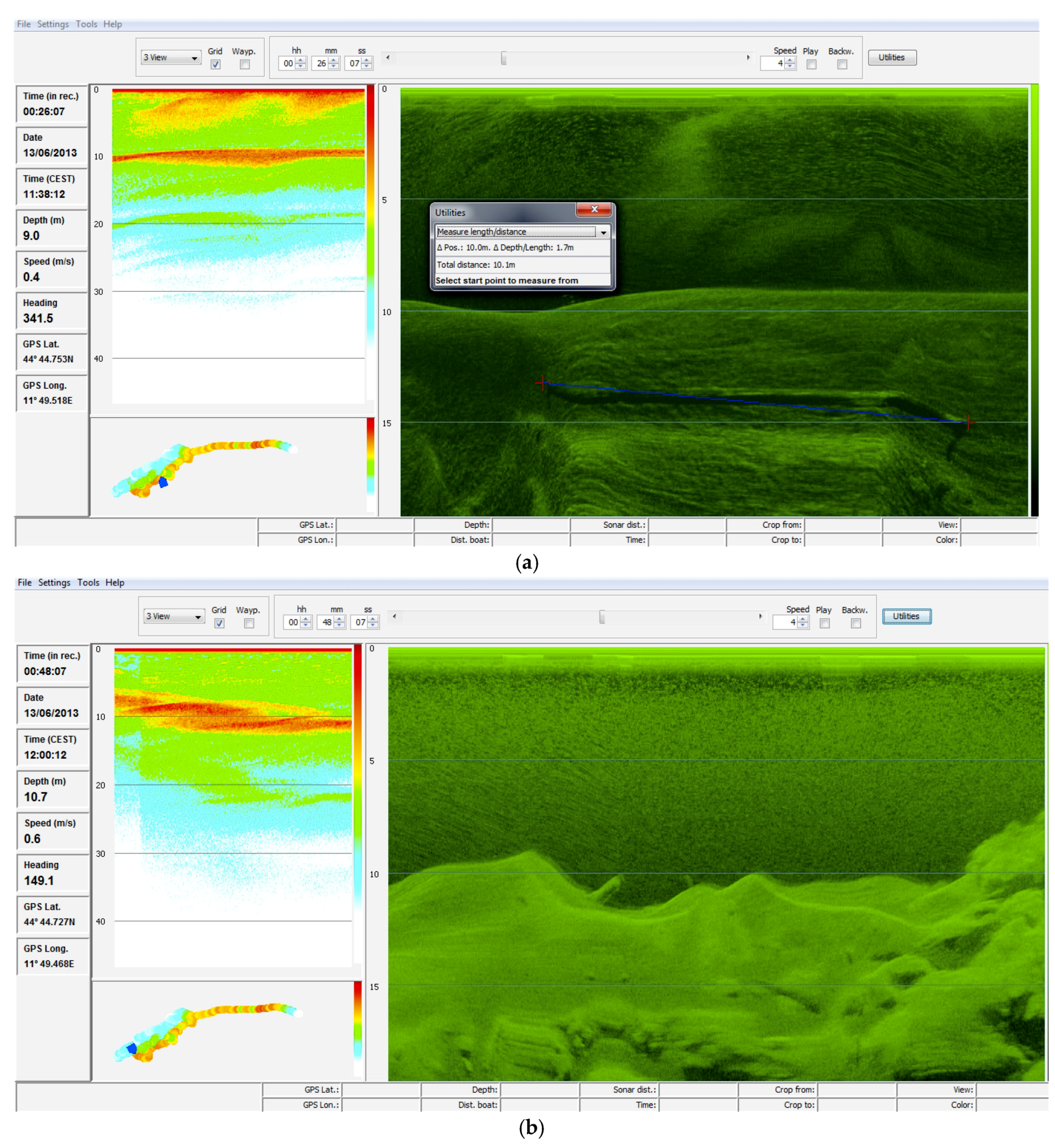
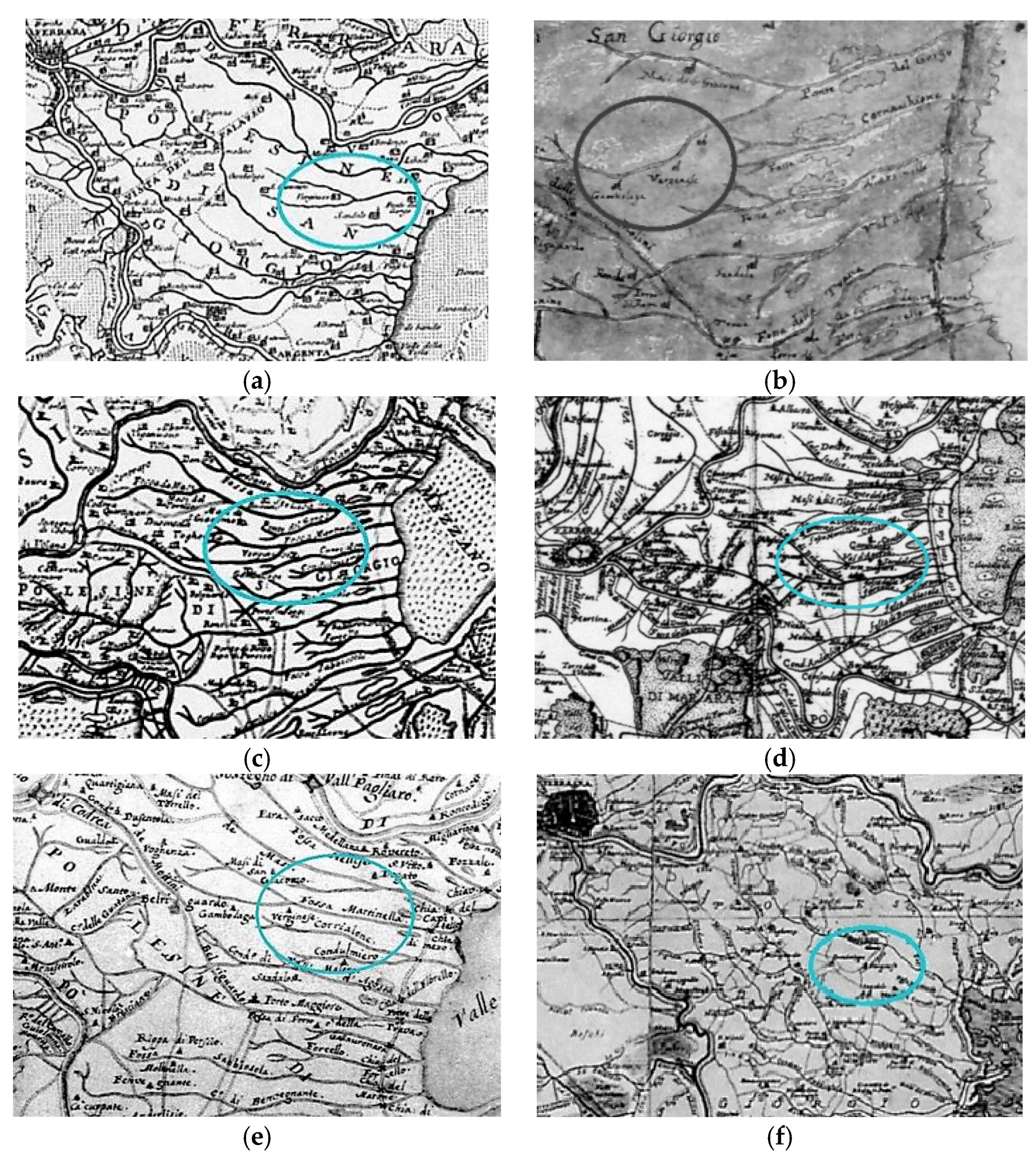
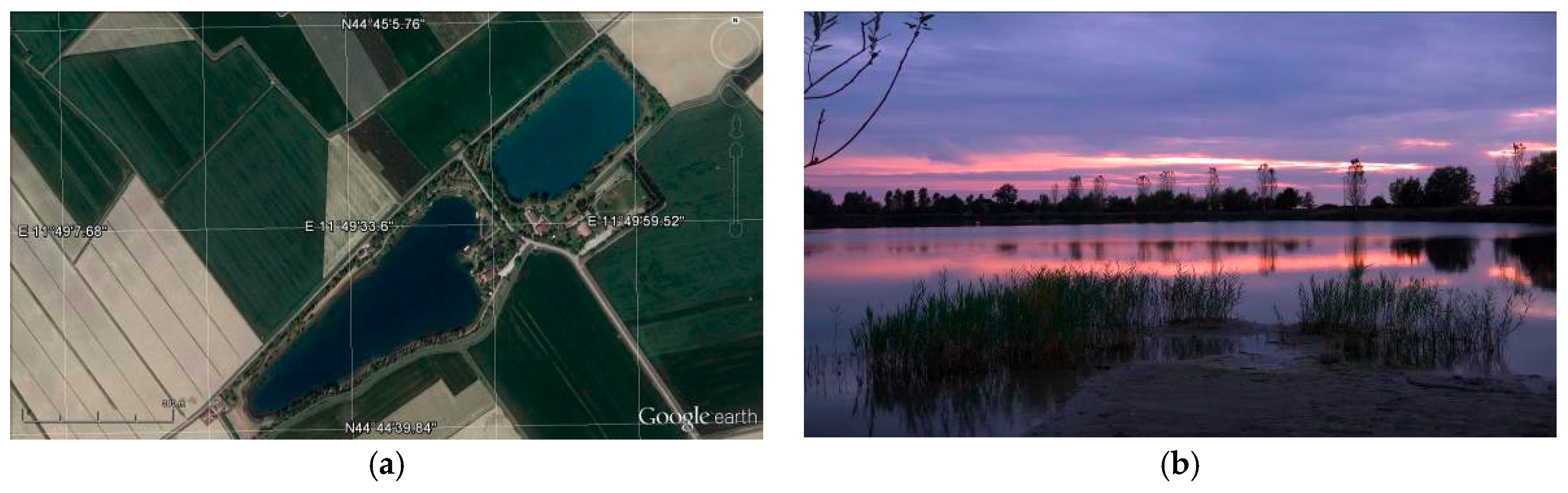
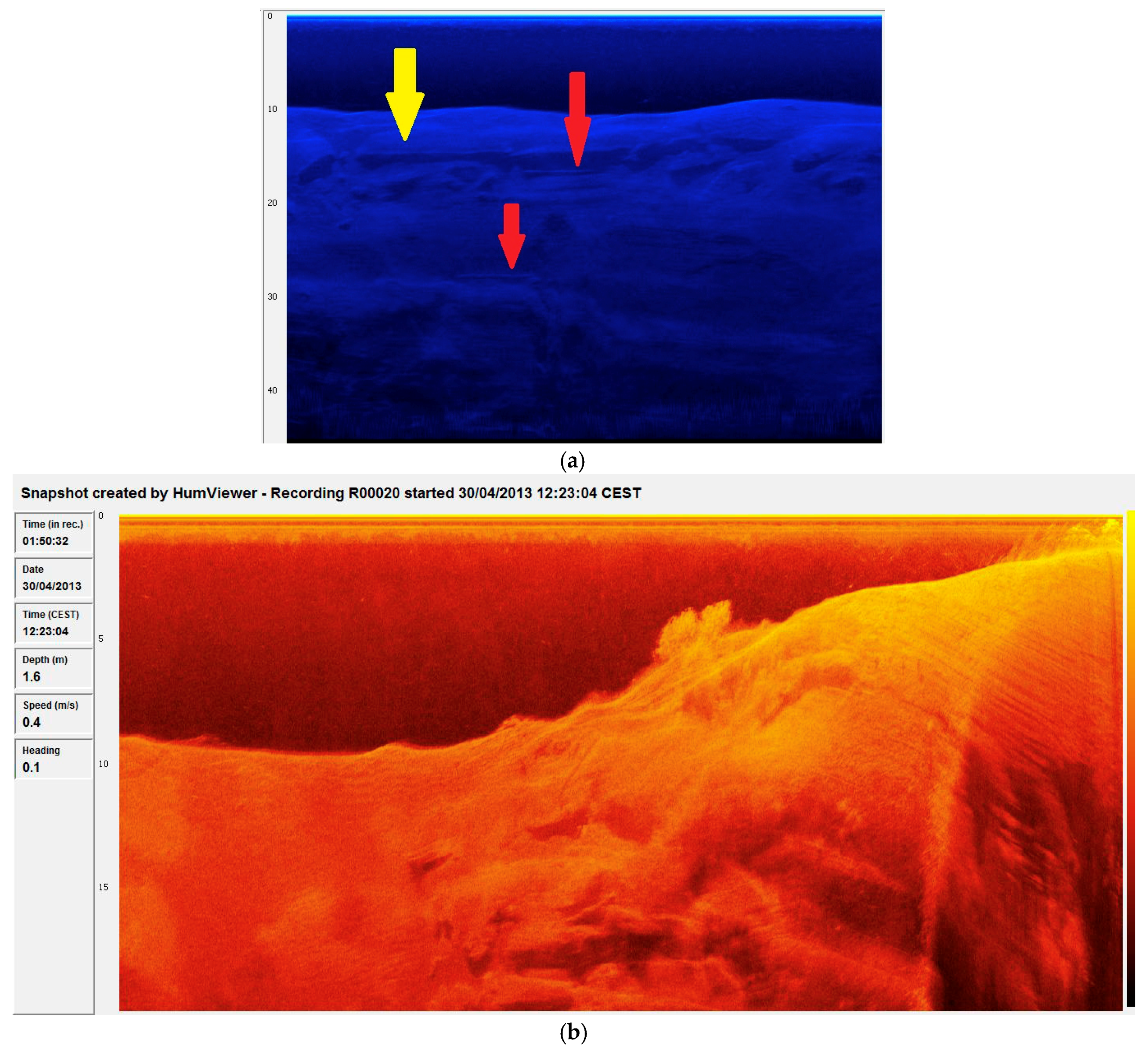
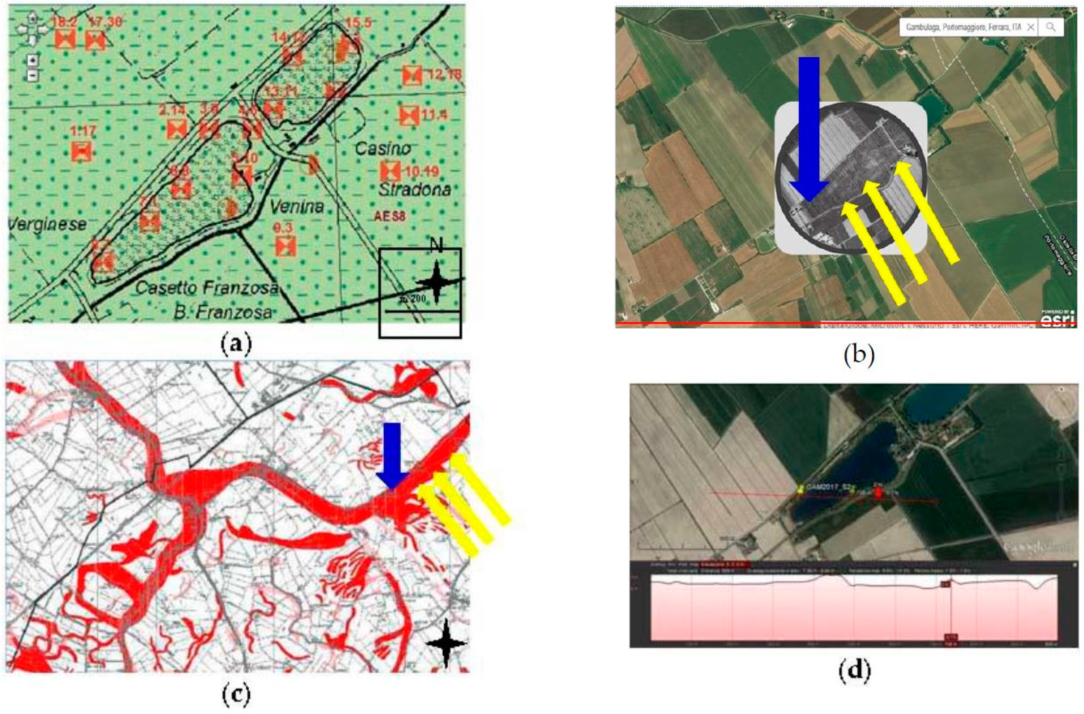
2.1. Remote Sensing Surveys
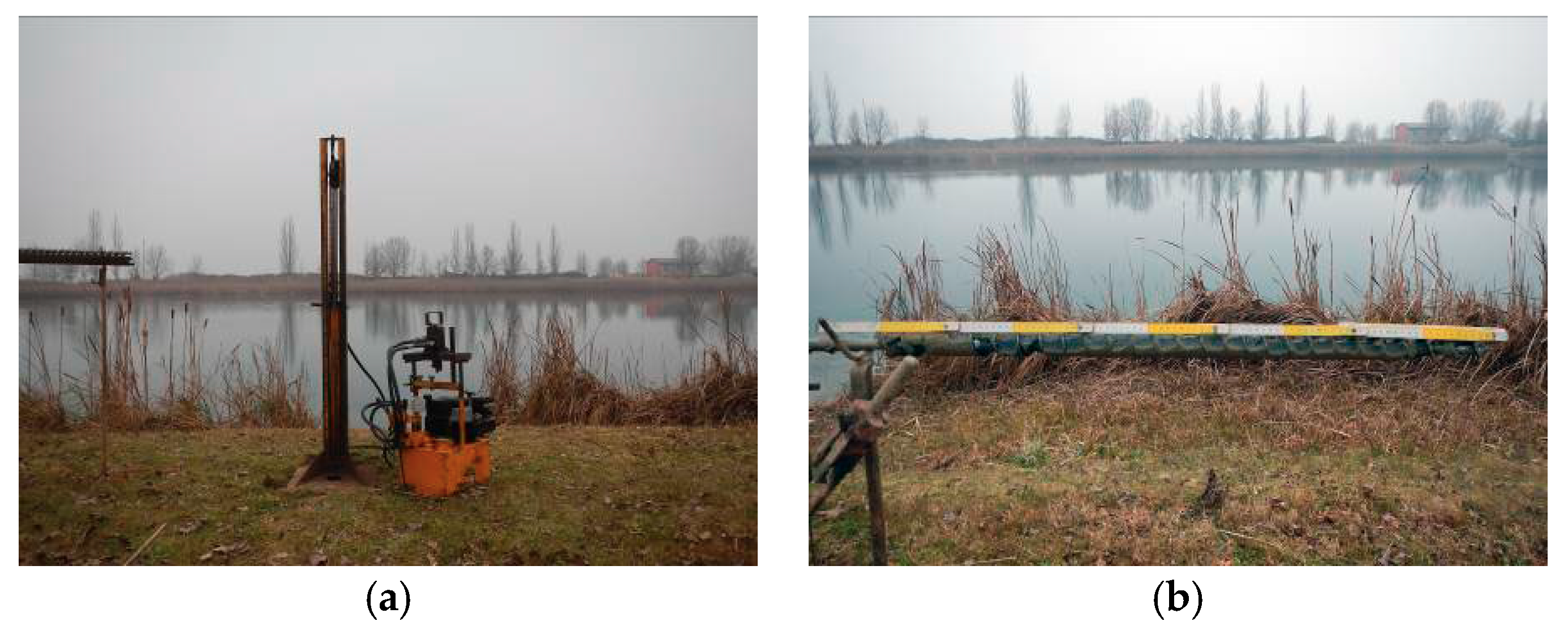
2.2. Geological and Geo-Archaeological Drillings
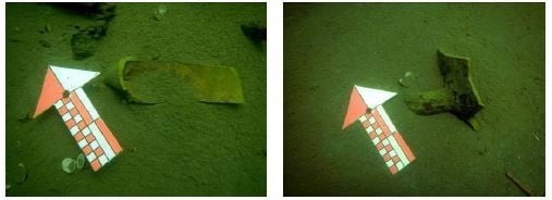
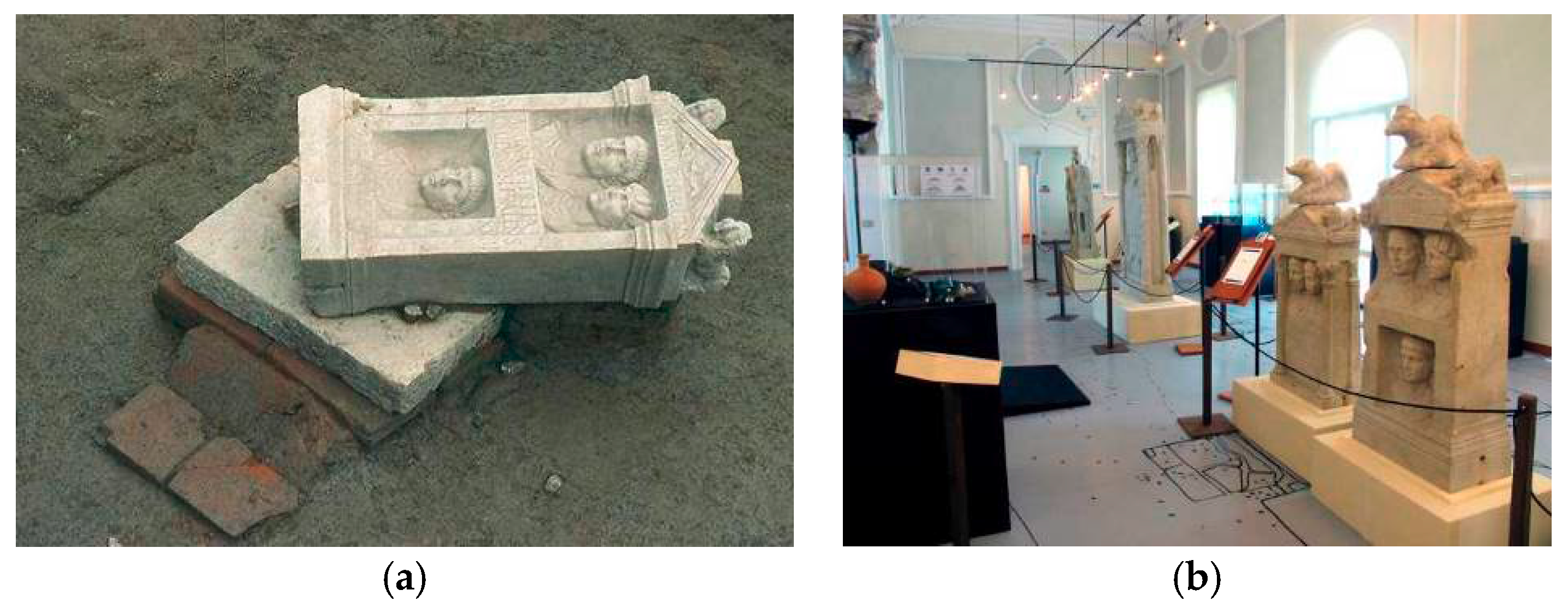
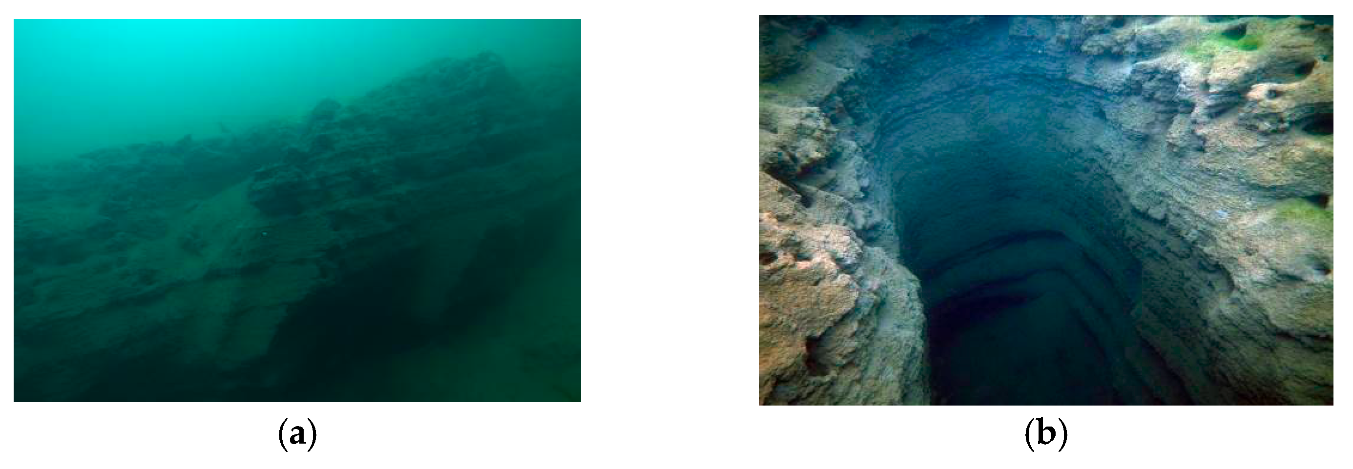
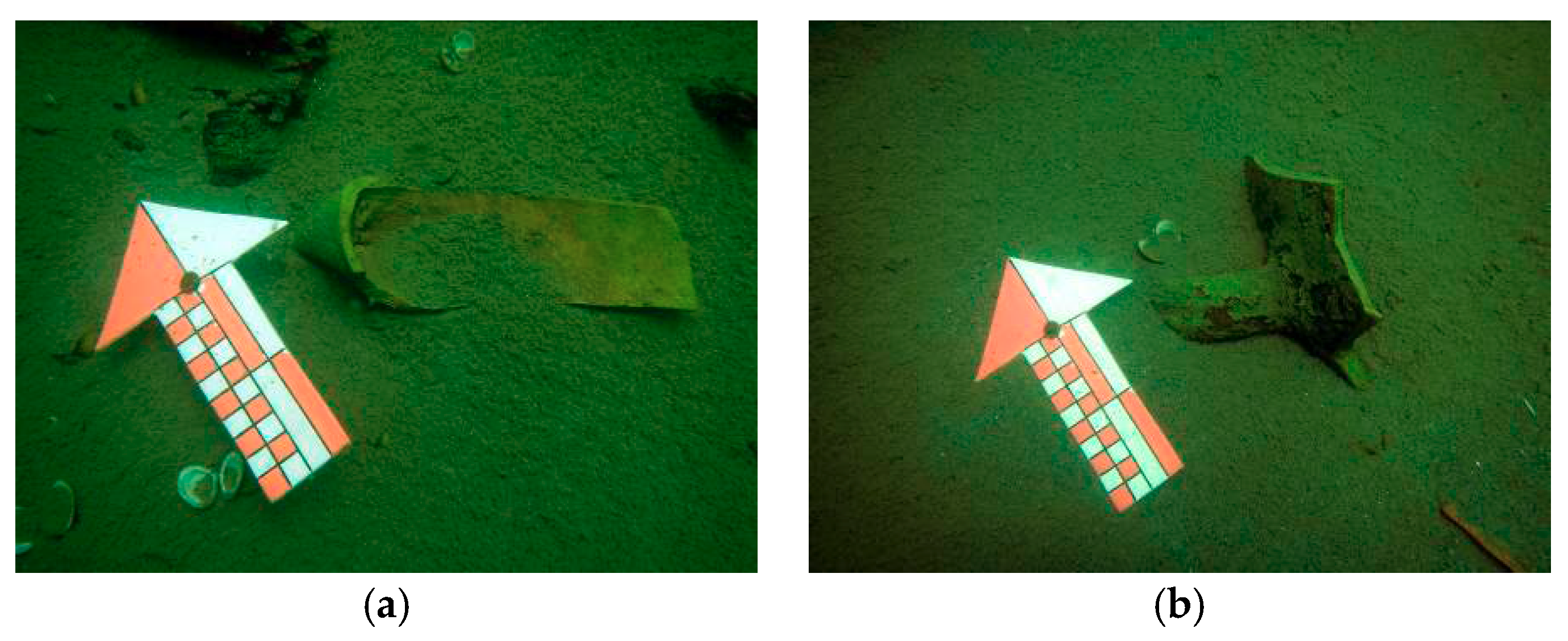
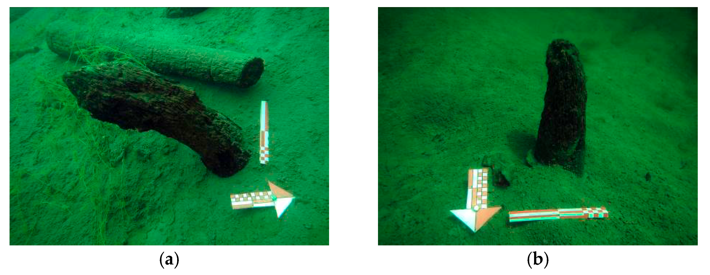
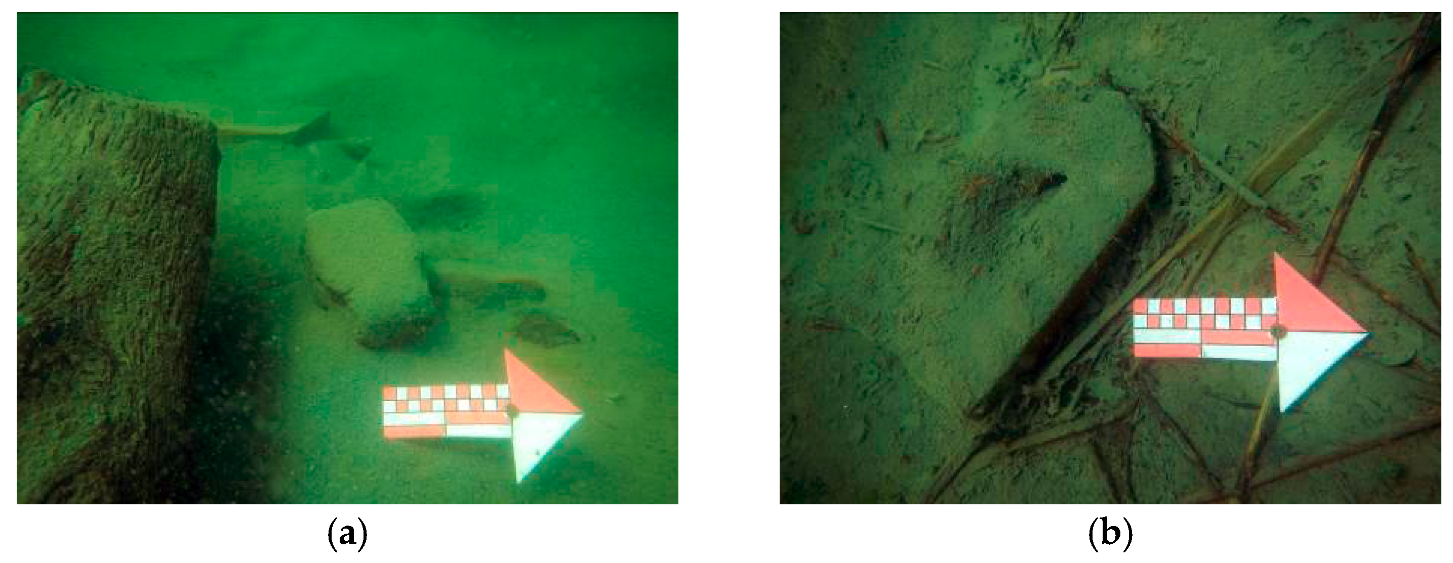
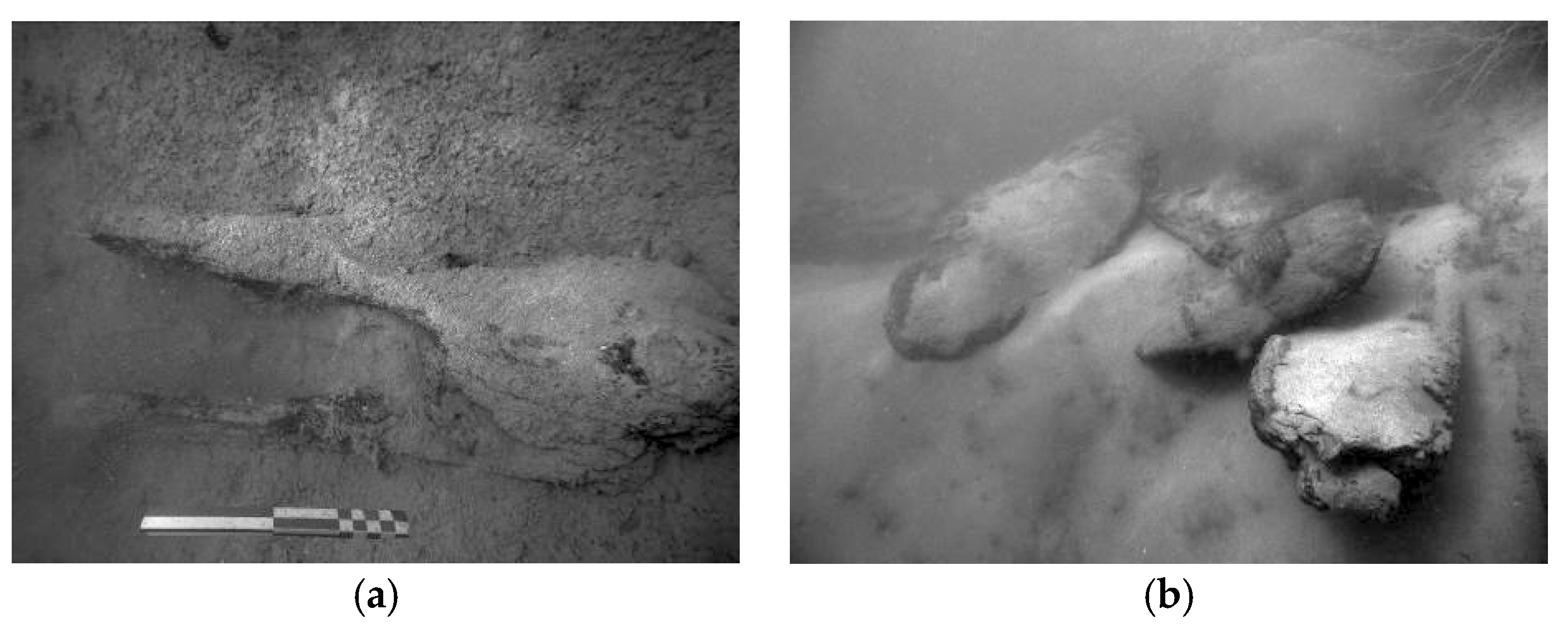
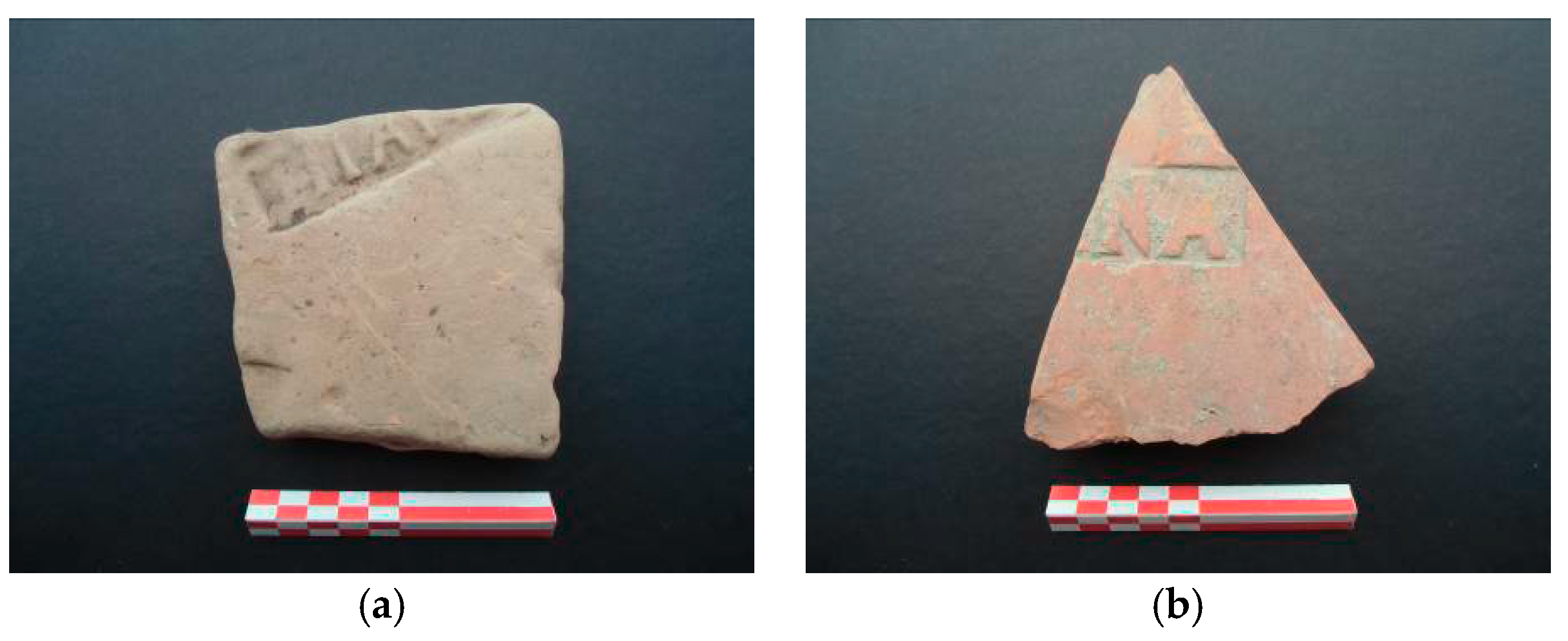
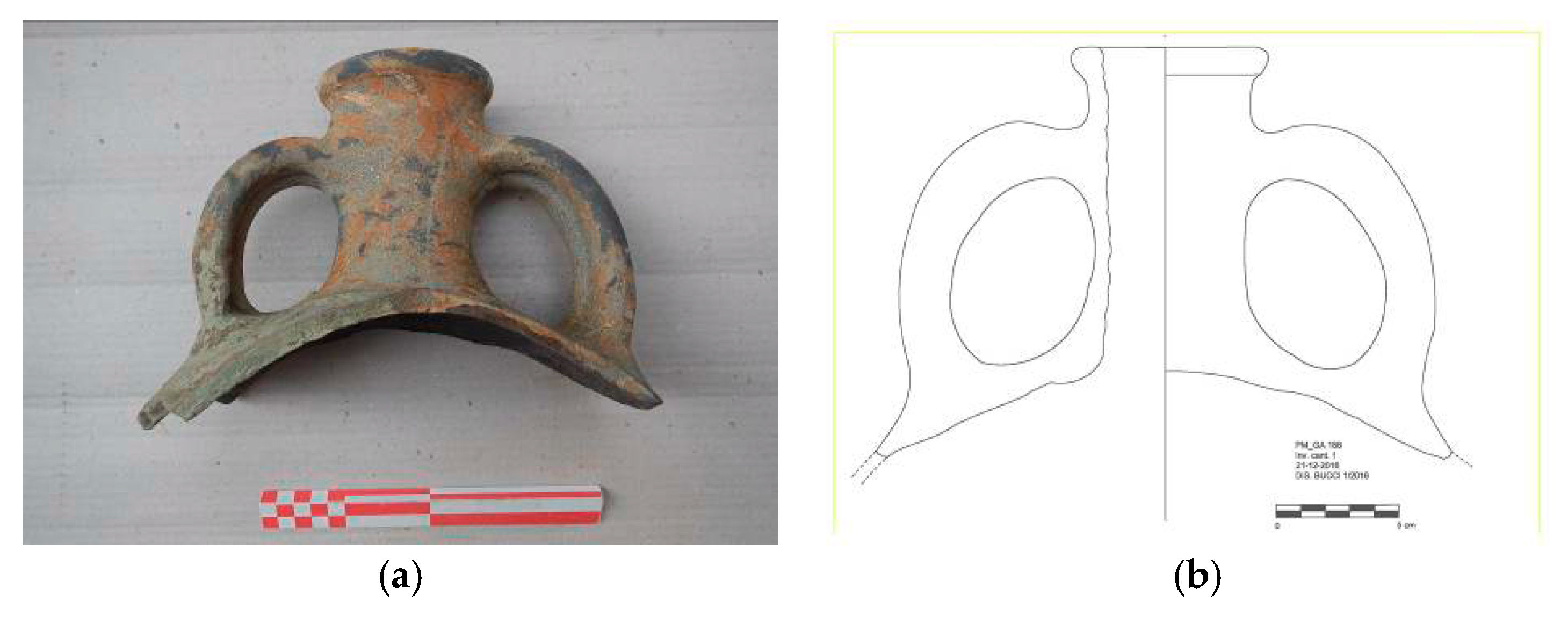
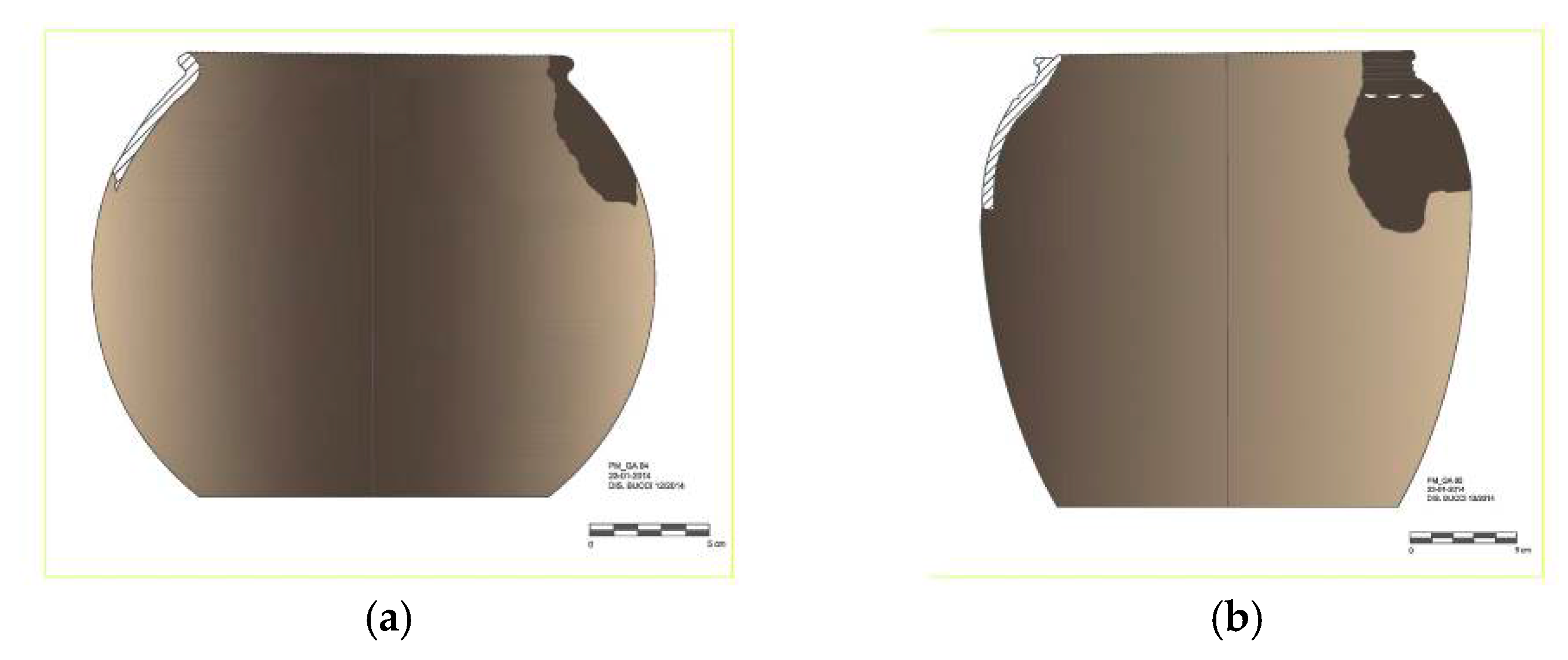
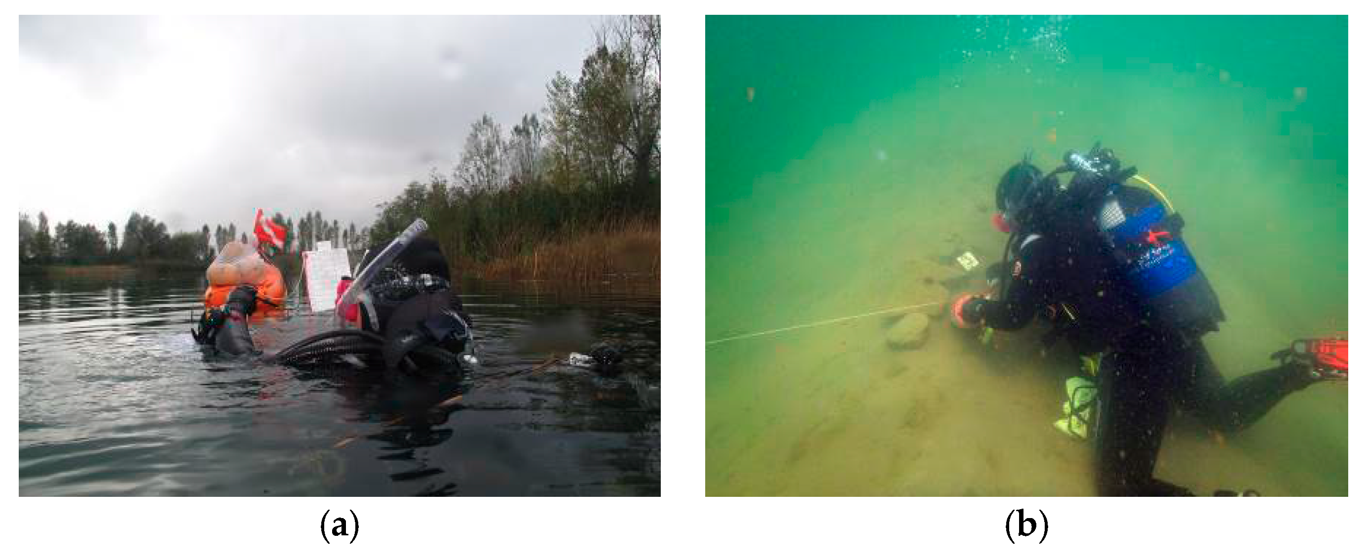
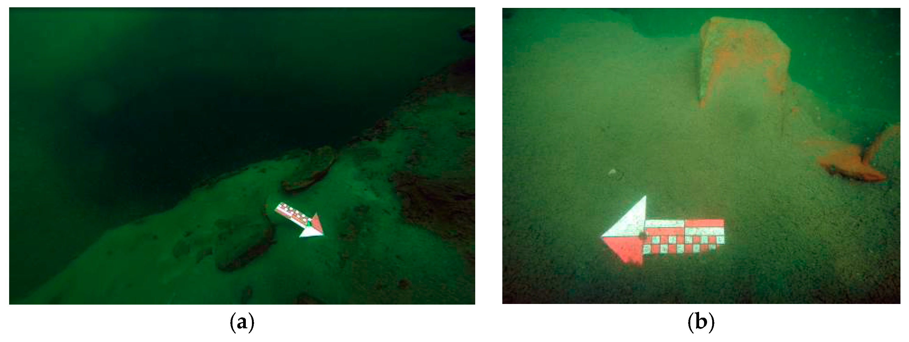
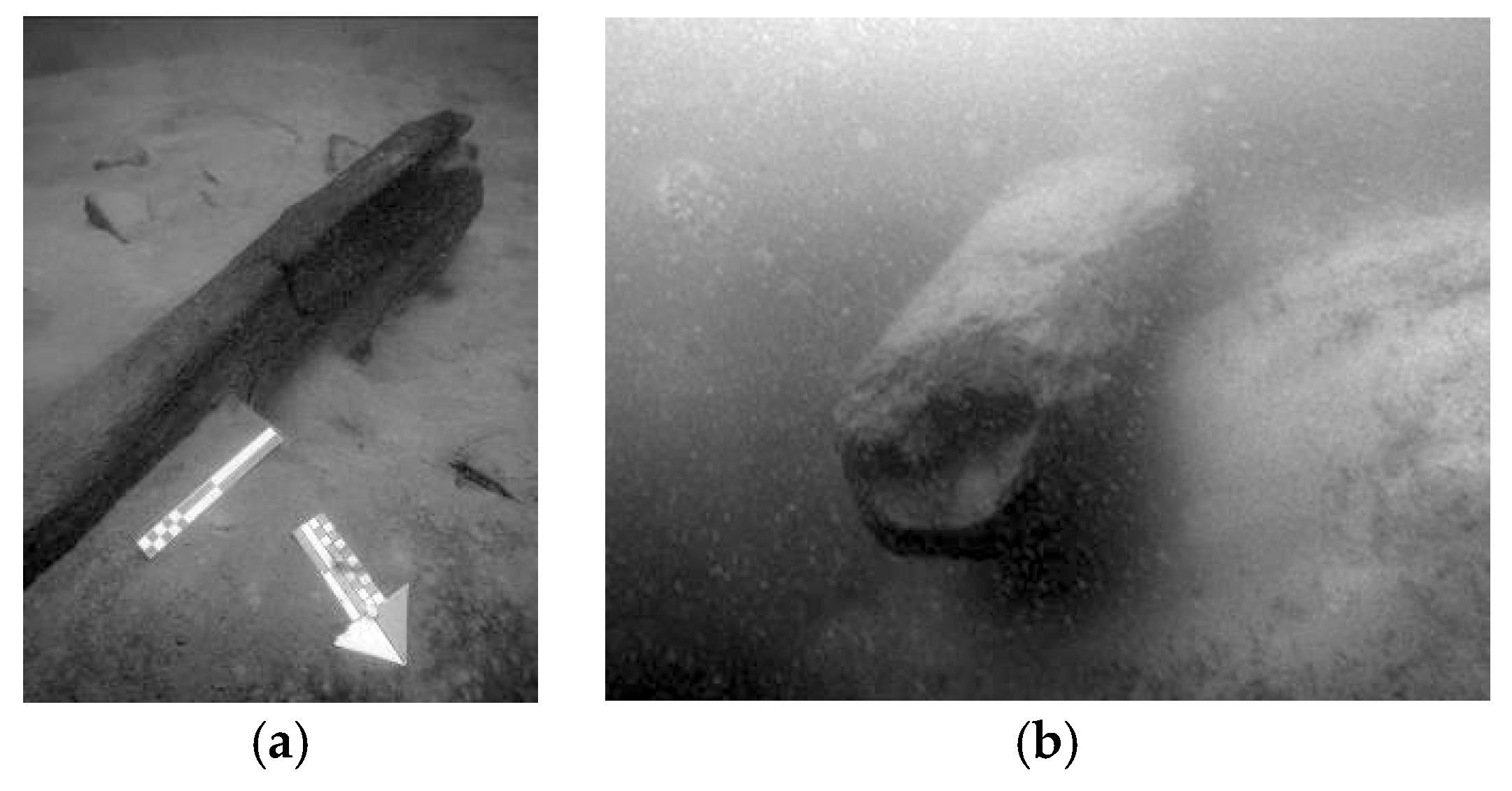
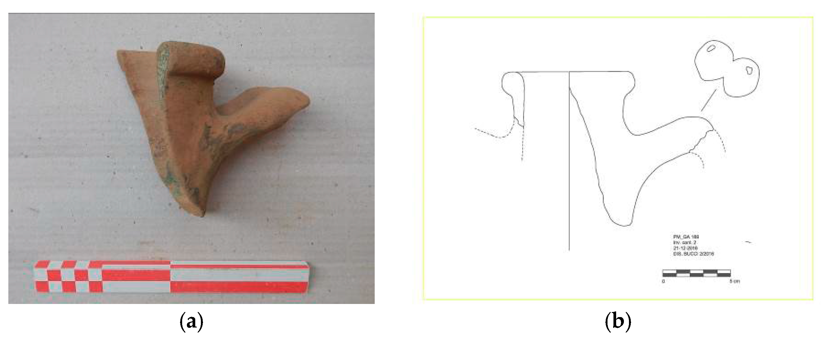
2.3. Underwater Surveys
3. Results
4. Discussion
5. Conclusions
Acknowledgments
Conflicts of Interest
Appendix A

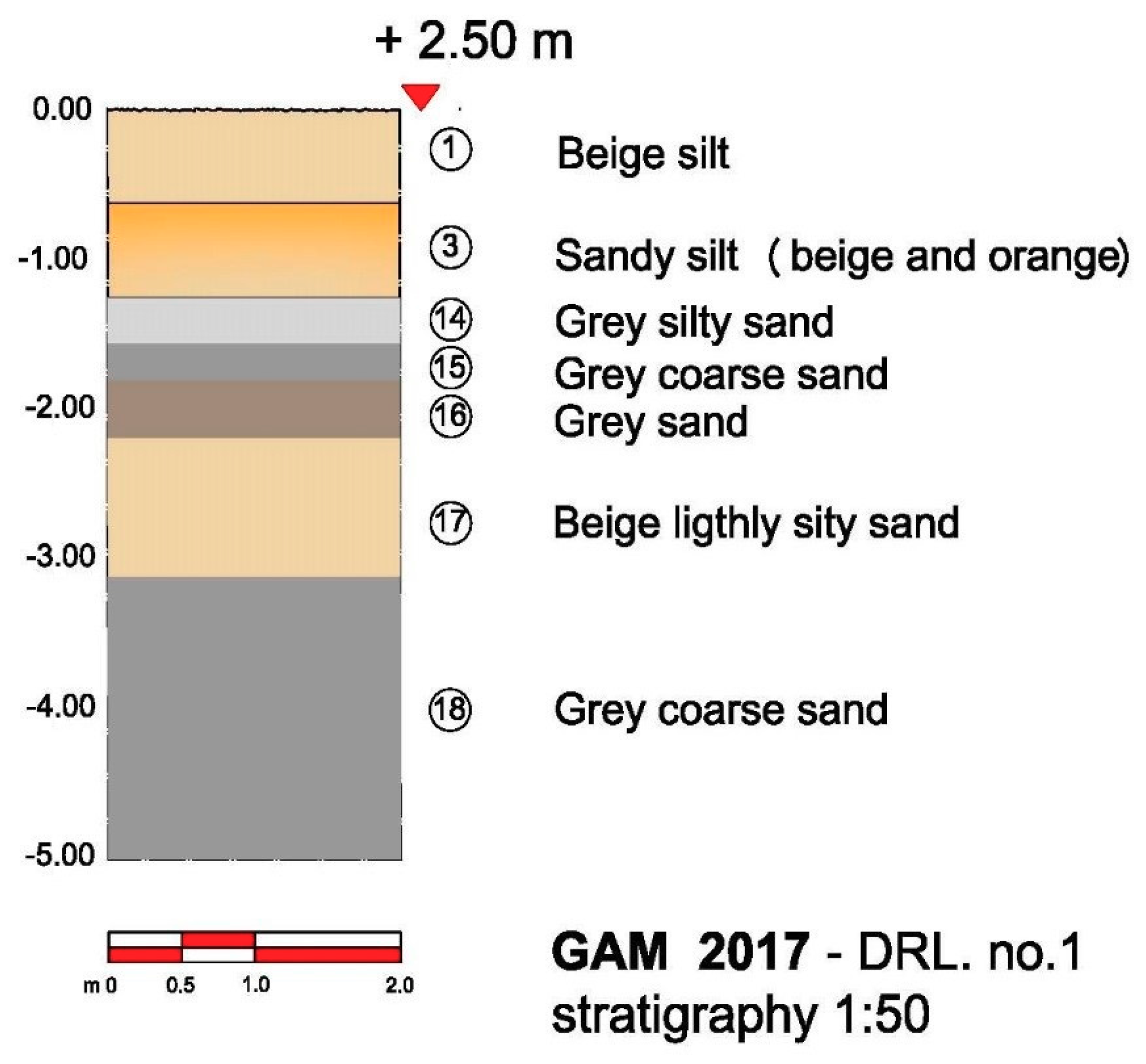
| Site Code GAM 2017 | Area | South Sector | |||
|---|---|---|---|---|---|
| Drilling No. | 1 | ||||
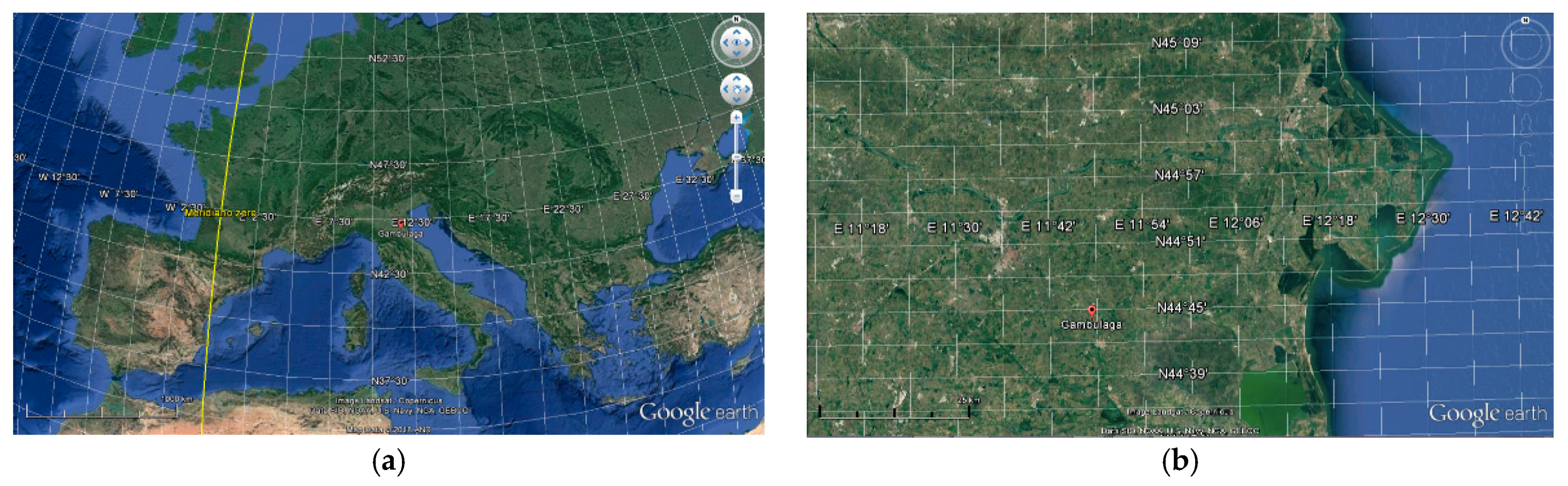
| Topographical Data Gambulaga (FE), Via Bargellesi | District Ferrara | GPS position | 11°49′35.9″E | ||
| 44°44′44.2″N | |||||
| Elevation [m] | +2.50 | ||||
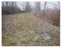
| Context Ex sand quarry lake | |||||
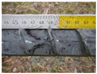
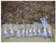
| Photo 1: Site | Photo 2: Work in Progress | Photo 3: Sediment | |||
 |  |  | |||
| Photo 4: Sediment | Photo 5: Sediment | Photo 6: Samples | |||
 | 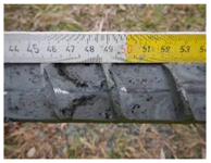 | 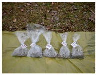 | |||
| Levels [m] | Stratigraphic Data | ||||
| from | to | ||||
| 0 | 0.60 | Beige silt | |||
| 0.60 | 1.25 | Sandy silt (beige, orange) | |||
| 1.25 | 1.55 | Grey silty sand | |||
| 1.55 | 1.80 | Grey coarse sand | |||
| 1.80 | 2.20 | Grey sand | |||
| 2.20 | 3.10 | Beige lightly silty sand | |||
| 3.10 | 5.00 | Grey coarse sand | |||
| Day 1 February 2017 | Supervisor: Giovanna Bucci Technical Assistant: Fabio Facchini | ||||


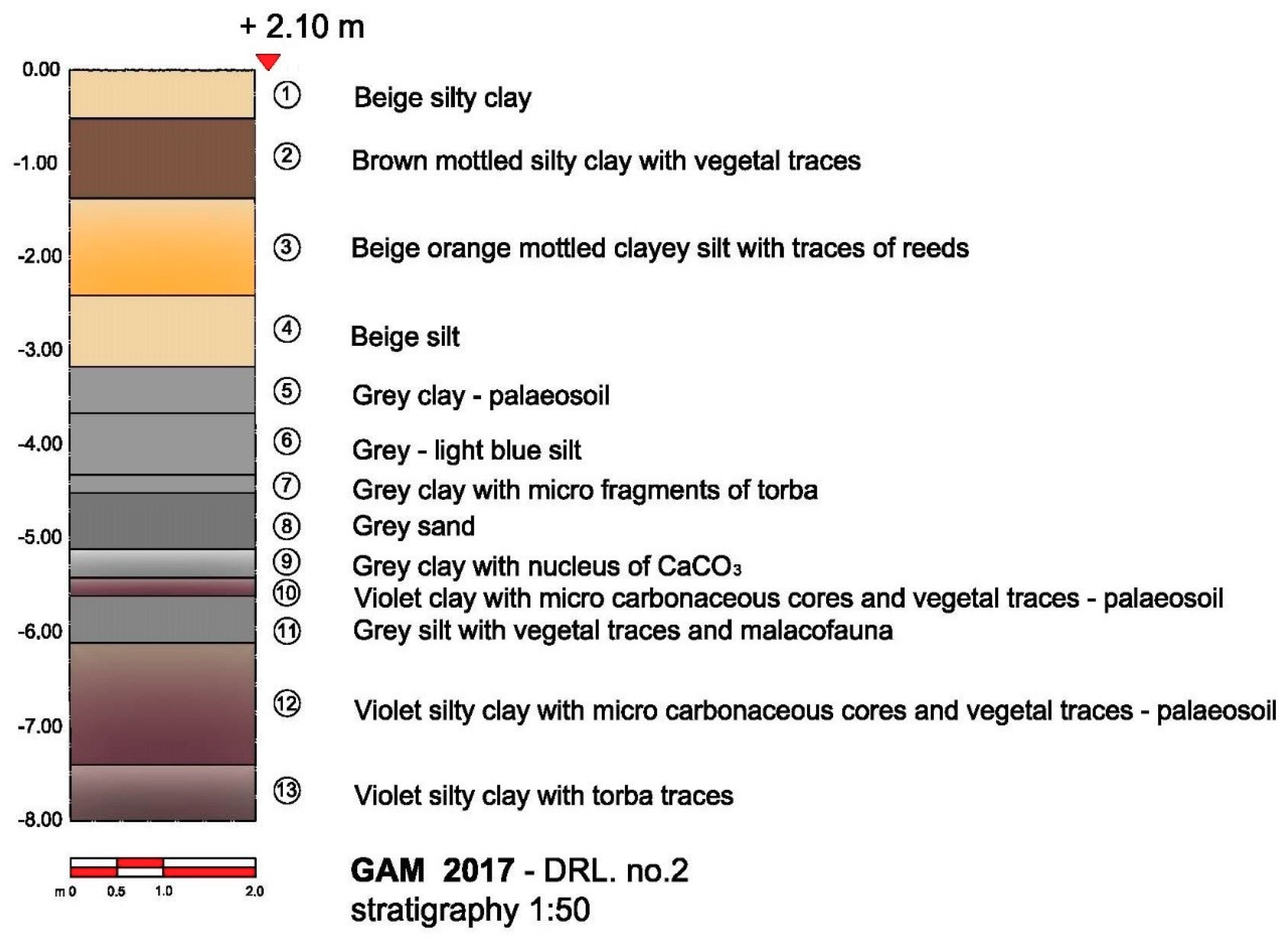
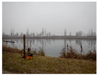
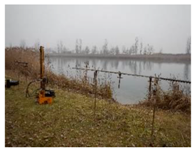
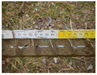
| Site Code Gam 2017 | Area | North Sector | |||
|---|---|---|---|---|---|
| Drilling No. | 2 | ||||
| Topographical Data Gambulaga (FE), Via Bargellesi | District Ferrara | GPS position | 11°49′25.5″E | ||
| 44°44′44.3″N | |||||
| Elevation [m] | +2.10 | ||||
| Context Ex sand quarry lake | |||||
| Photo 1: Site | Photo 2: Work in Progress | Photo 3: Sediment | |||
 |  | 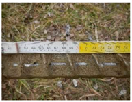 | |||
| Photo 4: Sediment | Photo 5: Sediment | Photo 6: Samples | |||
 |  |  | |||
| Levels [m] | Stratigraphic Data | ||||
| from | to | ||||
| 0 | 0.50 | Beige silty clay | |||
| 0.50 | 1.35 | Brown mottled silty clay with vegetal traces | |||
| 1.35 | 2.40 | Beige orange mottled clayey silt with traces of reeds | |||
| 2.40 | 3.15 | Beige silt | |||
| 3.15 | 3.65 | Grey clay (palaeo-soil) | |||
| 3.65 | 4.30 | Grey–light blue silt | |||
| 4.30 | 4.50 | Grey clay with micro-fragments of torba | |||
| 4.50 | 5.10 | Grey sand | |||
| 5.10 | 5.40 | Grey clay with nucleus of CaCO3 | |||
| 5.40 | 5.60 | Violet clay with micro-carbonaceous cores and vegetal traces (palaeo-soil) | |||
| 5.60 | 6.10 | Grey silt with vegetal traces and malacofauna | |||
| 6.10 | 7.40 | Violet silty clay with micro-carbonaceous cores and vegetal traces (palaeo-soil) | |||
| 7.40 | 8.00 | Violet silty clay with torba micro-levels | |||
| Data 1 February 2017 | Supervisor: Giovanna Bucci Technical Assistant: Fabio Facchini | ||||
References
- Bondesan, M.; Masè, G. Geomorfologia del Territorio di Voghenza e di Voghiera in Voghenza. In Una Necropoli di età Romana nel Territorio Ferrarese; Banca di Credito Agrario di Ferrara: Ferrara, Italy, 1984; pp. 11–22. [Google Scholar]
- Veggiani, A. Il Delta del Po e l’evoluzione. In Atti Tav. Rotonda 1982, ACC Scienze dell’Ist. Di Bologna Il Delta del Po; Sezione Geologica, Accademia delle Scienze, Università di Bologna: Bologna, Italy, 1992; pp. 37–68. [Google Scholar]
- Calabrese, L.; Centineo, M.C.; Cibin, U. Note Illustrative della Carta Geologica d’Italia Alla Scala 1:50,000, Foglio 204, Portomaggiore; ISPRA Progetto CARG, Regione Emilia Romagna, Istituto Superiore per la Protezione e la Ricerca Ambientale: Firenze, Italy, 2009. [Google Scholar]
- Luetti, R.; Veronese, T.; Brunaldi, R. PSC 5 Comuni, Relazione Geologica; Unione dei Comuni Valli e Delizie Argenta Ostellato Portomaggiore: Ferrara, Italy, 2005. [Google Scholar]
- Stefani, M. Il Contesto Plaeostratigrafico e Sedimentologico-Stratigrafico Della Necropoli Romana del VERGINESE. In Mors Immatura: I Fadieni e il Loro Sepolcreto, “Quaderni di Archeologia dell'Emilia Romagna”; Berti, F., Ed.; All’Insegna del Giglio: Borgo San Lorenzo, Italy, 2006; pp. 41–47. [Google Scholar]
- Berti, F. (Ed.) Mors immatura: I Fadieni e il Loro Sepolcreto, “Quaderni di Archeologia dell’Emilia Romagna; All’Insegna del Giglio: Fiorentino, Italy, 2006. [Google Scholar]
- Bucci, G. Gambulaga 2009. Archeologia Subacquea Delle Acque Interne: Bacini Artificiali e Controllo Archeologico. Osservazioni Metodologiche, Tecniche e Stratigrafiche. Felix Ravenna 2010, 157, 171–188. [Google Scholar]
- Bucci, G. Low visibility underwater archaeological researches: Gambulaga Project 2009–2010. In Proceedings of the 4th International Symposium on Underwater Research by Eastern Mediterranean University, Famagusta, Northern Cyprus, 18–20 March 2010; pp. 21–38. [Google Scholar]
- Bucci, G. Padus, Sandalus, Gens Fadiena. underwater surveys, in palaeo-watercourses (Ferrara District—Italy). In Proceedings of the The International Archives of the Photogrammetry, Remote Sensing and Spatial Information Sciences, 2015 Underwater 3D Recording and Modeling, Piano di Sorrento, Italy, 16–17 April 2015; Volume XL-5/W5, pp. 55–60. [Google Scholar]
- Facchini, F. Caratterizzazione Sedimentologica e Geochimica nel Contesto Archeologico del Lago Tramonto a Gambulaga—Portomaggiore (FE). Master’s Thesis, Quaternario, Preistoria e Archeologia, Università di Ferrara, Ferrara, Italy, 2017. [Google Scholar]
- Wiseman, J.R.; El-Baz, F. (Eds.) Remote Sensing in Archaeology; Springer: New York, NY, USA, 2007; pp. 483–495. [Google Scholar]
- Mindell, D.A. Precision Navigation and Remote Sensing for Underwater Archaeology. In Remote Sensing in Archaeology; Wiseman, J.R., El-Baz, F., Eds.; Springer: New York, NY, USA, 2007; pp. 499–510. [Google Scholar]
- Westley, K.; Mcneary, R. Archaeological Applications of Low-Cost Integrated Sidescan Sonar/Single-Beam Echosounder Systems in Irish Inland Waterways. Archaeol. Prospect. 2017, 24, 37–57. [Google Scholar] [CrossRef]
- Cazzola, F. La Grande Impresa. Le Bonifiche Estensi. In Il Parco del Delta del Po—L’ambiente Come Storia; Bassi, C., Visser, A.M., Eds.; Spazio Libri Editore: Ferrara, Italy, 1990; pp. 123–145. [Google Scholar]
- Pellicioni, M.T. La Pansiana in Adriatico—Tegole Romane per Navigare tra le Sponde; Arstudio C: Ferrara, Italy, 2012. [Google Scholar]
- Rambaldi, V. Caratterizzazione archeometrica di alcuni reperti archeologici ceramici provenienti da Lago Tramonto di Gambulaga—Portomaggiore (FE). Master’s Thesis, Quaternario, Preistoria e Archeologia, Università di Ferrara, Ferrara, Italy, 2013. [Google Scholar]
- Bucci, G. Voghiera (FE) 2011, Fondo Fioresi: Indagini archeologiche. In La Pansiana in Adriatico—Tegole Romane per Navigare tra le Sponde; Pellicioni, M.T., Ed.; Edizioni Arstudio C: Ferrara, Italy, 2012; pp. 123–135. [Google Scholar]
- Patitucci Uggeri, S. Carta Archeologica Medievale del Territorio Ferrarese, II, Le vie D’acqua in Rapporto al Nodo Idroviario di Ferrara; All’Insegna del Giglio: Firenze, Italy, 2002; pp. 7–25. [Google Scholar]
- Berti, F. Rinvenimenti di Archeologia Fluviale ed Endolagunare nel Delta Ferrarese; Bollettino d’Arte, Supplemento, Archeologia Subacquea” 3; MiBACT: Roma, Italy, 1987; pp. 19–38.


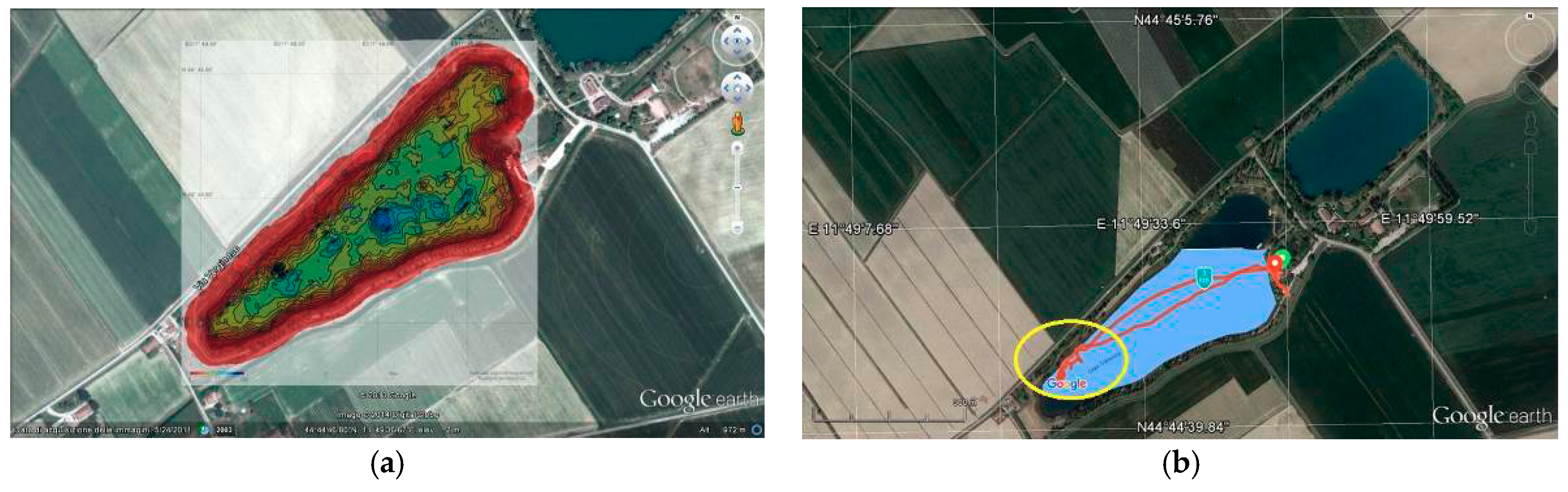


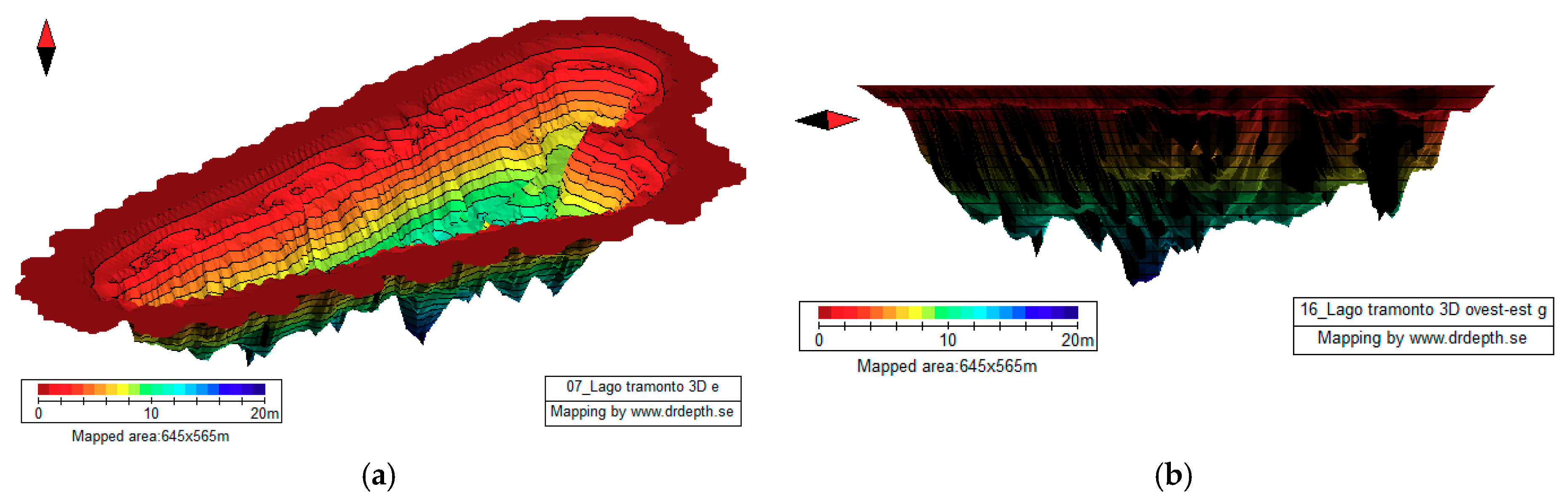
| S No. | Date | Track [km] | Diving Time [h] | Max Depth [m] | T [°C] | Remarks | Satellite Photo-Plan Google Earth with Survey Track |
|---|---|---|---|---|---|---|---|
| 1 | 22 May 2016 | 0.57 | 01:02:05 | 7.4 | 16.4 | Very poor visibility, absence of archaeological findings | 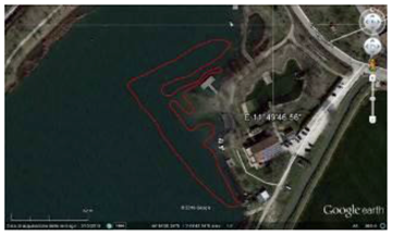 |
| 2 | 15 August 2016 | 1.27 | 02:50:50 | 7.8 | 24.4 | Good visibility, documentation of the archaeological site | 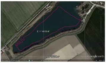 |
| 3 | 15 September 2016 | 0.38 | 01:05:20 | 6.9 | 26.3 | Very good visibility, documentation of the archaeological site | 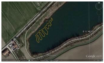 |
© 2018 by the author. Licensee MDPI, Basel, Switzerland. This article is an open access article distributed under the terms and conditions of the Creative Commons Attribution (CC BY) license (http://creativecommons.org/licenses/by/4.0/).
Share and Cite
Bucci, G. Remote Sensing and Geo-Archaeological Data: Inland Water Studies for the Conservation of Underwater Cultural Heritage in the Ferrara District, Italy. Remote Sens. 2018, 10, 380. https://doi.org/10.3390/rs10030380
Bucci G. Remote Sensing and Geo-Archaeological Data: Inland Water Studies for the Conservation of Underwater Cultural Heritage in the Ferrara District, Italy. Remote Sensing. 2018; 10(3):380. https://doi.org/10.3390/rs10030380
Chicago/Turabian StyleBucci, Giovanna. 2018. "Remote Sensing and Geo-Archaeological Data: Inland Water Studies for the Conservation of Underwater Cultural Heritage in the Ferrara District, Italy" Remote Sensing 10, no. 3: 380. https://doi.org/10.3390/rs10030380
APA StyleBucci, G. (2018). Remote Sensing and Geo-Archaeological Data: Inland Water Studies for the Conservation of Underwater Cultural Heritage in the Ferrara District, Italy. Remote Sensing, 10(3), 380. https://doi.org/10.3390/rs10030380