Next Issue
Volume 7, June
Previous Issue
Volume 6, December


Land, Volume 7, Issue 1 (March 2018) – 39 articles

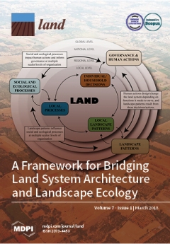
Cover Story (view full-size image): Coupled human and natural system (CHANS) models often treat system components separately, linking them through specific processes. This makes it difficult to bridge the integrated coupling of both social and ecological processes suggested by land systems architecture (LA) and landscape ecology (LE). We have developed a framework that integrates LA and LE via linkages between human action (governance), landscape patterns, and social–ecological processes at multiple levels/scales. Drawing on common resource use (public land and water) in the Southern Great Plains, we show how governance impacts human land-use/land-cover change (LULCC) decisions (LA) and how such LULCC patterns influence, and are influenced by, underlying ecological processes (LE). We provide a means to investigate feedback between the different system components in a CHANS that subsequently impact future human design decisions. View this [...] Read more.
  • Issues are regarded as officially published after their release is announced to the table of contents alert mailing list.
  • You may sign up for e-mail alerts to receive table of contents of newly released issues.
  • PDF is the official format for papers published in both, html and pdf forms. To view the papers in pdf format, click on the "PDF Full-text" link, and use the free Adobe Reader to open them.
Order results
Result details
Section
Select all
Export citation of selected articles as:
19 pages, 2389 KiB  
Article
System Properties Determine Food Security and Biodiversity Outcomes at Landscape Scale: A Case Study from West Flores, Indonesia
by Neil French Collier, Jeffrey Sayer, Agni Klintuni Boedhihartono, Jan Hanspach, Dave Abson and Joern Fischer
Land 2018, 7(1), 39; https://doi.org/10.3390/land7010039 - 20 Mar 2018
Cited by 5 | Viewed by 5158
Abstract
The food-biodiversity nexus is a concept that defines and characterizes the complex interactions between agricultural systems and biodiversity conservation. Here we use a social-ecological systems approach that combines fuzzy cognitive mapping and graph theoretic analyses to uncover system properties that determine food security [...] Read more.
The food-biodiversity nexus is a concept that defines and characterizes the complex interactions between agricultural systems and biodiversity conservation. Here we use a social-ecological systems approach that combines fuzzy cognitive mapping and graph theoretic analyses to uncover system properties that determine food security and biodiversity outcomes at a landscape scale. We studied a rice-based agricultural landscape system situated in Mbeliling district of West Flores, Indonesia. A graphical representation of the Mbeliling district food-biodiversity nexus was created by local experts. The representation revealed system properties that help reconcile the trade-offs between food security and biodiversity conservation. The graph represented a diverse set of food security and biodiversity nodes, and showed that there is not a simple dichotomy between ‘production and protection’. The analysis captured greater complexity than popular academic concepts such as land sparing–land sharing or sustainable intensification. Three major themes emerged from the graph. We found distinct clusters of factors influencing biodiversity and food security. We named these sources of influence (1) Modernisation and sustainable farming; (2) Knowledge and management; and (3) Governance and processes. Component 2 was the most representative of emergent system properties that contribute positively to managing a sustainable food-biodiversity nexus in the Mbeliling landscape. The key determinants of outcomes were: improving agronomic practices, diversifying production, maintaining forest cover and connectivity, and using knowledge and natural resource management processes to mitigate the main drivers of change. Our approach highlights the complexities in the food-biodiversity nexus, and could have wide application in other locations. Full article
Show Figures

Figure 1

17 pages, 3422 KiB  
Article
Post-War Land Cover Changes and Fragmentation in Halgurd Sakran National Park (HSNP), Kurdistan Region of Iraq
by Rahel Hamad, Kamal Kolo and Heiko Balzter
Land 2018, 7(1), 38; https://doi.org/10.3390/land7010038 - 19 Mar 2018
Cited by 14 | Viewed by 6268
Abstract
Context: The fundamental driving force of land use and land cover (LULC) change is related to spatial and temporal processes caused by human activities such as agricultural expansion and demographic change. Landscape metrics were used to analyze post-war changes in a rural mountain [...] Read more.
Context: The fundamental driving force of land use and land cover (LULC) change is related to spatial and temporal processes caused by human activities such as agricultural expansion and demographic change. Landscape metrics were used to analyze post-war changes in a rural mountain landscape, the protected area of Halgurd-Sakran National Park (HSNP) in north-east Iraq. Therefore, the present work attempts to identify the temporal trends of the most fragmented land cover types between two parts of the national park. Objectives: The objectives of this study are to compare two land cover classification algorithms, maximum likelihood classification (MLC) and random forest (RF) in the upper and lower parts of HSCZ, and to examine whether landscape configuration in the park has changed over time by comparing the fragmentation, connectivity and diversity of LULC classes. Methods: Two Landsat images were used to analyze LULC fragmentation and loss of habitat connectivity (before and after the Fall of Baghdad in 2003). Seven landscape pattern metrics, percentage of land (PLAND), number of patch (NP), largest patch index (LPI), mean patch size (MPS), euclidian nearest neighborhood distance (ENN_AM), interspersion and juxtaposition (IJI) and cohesion at class level were selected to assess landscape composition and configuration. Results: A significant change in LULC classes was noticed in the lower part of the park, especially for pasture, cultivated and forest-lands. The fragmentation trends and their changes were observed in both parts of the park, however, more were observed in the lower part. The inherent causes of these changes are the socio-economic factors created by the 1991–2003 UN post-war economic sanctions. The changes increased during sanctions and decreased afterwards. The fall of Baghdad in 2003, followed by rapid economic boom, marked the greatest cause in land use change, especially in changes-susceptible cultivated areas. Conclusions: Shrinkage of forest patches in the lower part of the park increases the distance between them, which contributes to a decline in biological diversity from decreasing habitat area. Lastly, the results confirm the applicability of the combined method of remote sensing and landscape metrics. Full article
(This article belongs to the Special Issue Biodiversity and Protected Areas)
Show Figures

Figure 1

22 pages, 8062 KiB  
Article
Quantifying the Spatiotemporal Pattern of Urban Expansion and Hazard and Risk Area Identification in the Kaski District of Nepal
by Bhagawat Rimal, Lifu Zhang, Hamidreza Keshtkar, Xuejian Sun and Sushila Rijal
Land 2018, 7(1), 37; https://doi.org/10.3390/land7010037 - 16 Mar 2018
Cited by 41 | Viewed by 11270
Abstract
The present study utilized time-series Landsat images to explore the spatiotemporal dynamics of urbanization and land use/land-cover (LULC) change in the Kaski District of Nepal from 1988 to 2016. For the specific overtime analysis of change, the LULC transition was clustered into six [...] Read more.
The present study utilized time-series Landsat images to explore the spatiotemporal dynamics of urbanization and land use/land-cover (LULC) change in the Kaski District of Nepal from 1988 to 2016. For the specific overtime analysis of change, the LULC transition was clustered into six time periods: 1988–1996, 1996–2000, 2000–2004, 2004–2008, 2008–2013, and 2013–2016. The classification was carried out using a support vector machine (SVM) algorithm and 11 LULC categories were identified. The classified images were further used to predict LULC change scenarios for 2025 and 2035 using the hybrid cellular automata Markov chain (CA-Markov) model. Major hazard risk areas were identified using available databases, satellite images, literature surveys, and field observations. Extensive field visits were carried out for ground truth data acquisition to verify the LULC maps and identify multihazard risk areas. The overall classification accuracy of the LULC map for each year was observed to be from 85% to 93%. We explored the remarkable increase in urban/built-up areas from 24.06 km2 in 1988 to 60.74 km2 by 2016. A majority of urban/built-up areas were sourced from cultivated land. For the six time periods, totals of 91.04%, 78.68%, 75.90%, 90.44%, 92.35%, and 99.46% of the newly expanded urban land were sourced from cultivated land. Various settlements within and away from the city of Pokhara and cultivated land at the river banks were found at risk. A fragile geological setting, unstable slopes, high precipitation, dense settlement, rampant urbanization, and discrete LULC change are primarily accountable for the increased susceptibility to hazards. The predicted results showed that the urban area is likely to continue to grow by 2025 and 2035. Despite the significant transformation of LULC and the prevalence of multiple hazards, no previous studies have undertaken a long-term time-series and simulation of the LULC scenario. Updated district-level databases of urbanization and hazards related to the Kaski District were lacking. Hence, the research results will assist future researchers and planners in developing sustainable expansion policies that may ensure disaster-resilient sustainable urban development of the study area. Full article
Show Figures

Figure 1

11 pages, 1297 KiB  
Review
Transferring Landscape Character Assessment from the UK to the Eastern Mediterranean: Challenges and Perspectives
by Geoffrey Griffiths
Land 2018, 7(1), 36; https://doi.org/10.3390/land7010036 - 15 Mar 2018
Cited by 12 | Viewed by 6046
Abstract
Landscape character assessment (LCA) has a significant contribution to make as a spatial framework for the emerging concept of ‘multi-functional landscapes’, a landscape providing a range of functions, services, and human-derived benefits. The paper reviews the development of LCA in Northwest Europe with [...] Read more.
Landscape character assessment (LCA) has a significant contribution to make as a spatial framework for the emerging concept of ‘multi-functional landscapes’, a landscape providing a range of functions, services, and human-derived benefits. The paper reviews the development of LCA in Northwest Europe with a brief description of more recent LCA projects in a Mediterranean context. This is followed by a comparative description of the Living Landscapes approach developed in the UK as applied to Cyprus. The focus is upon the challenges, and limitations, of transferring a method developed in one context to the different physical and cultural setting of the island of Cyprus examining differences in the definition of landscapes, the availability of information on the cultural landscape, the importance of incorporating a strong element of ‘time-depth’, and the potential of LCA for enhancing land use policy at a time of increased land pressures in the Mediterranean. Full article
Show Figures

Figure 1

21 pages, 948 KiB  
Article
Chiefs in a Democracy: A Case Study of the ‘New’ Systems of Regulating Firewood Harvesting in Post-Apartheid South Africa
by Sarah J. Findlay and Wayne C. Twine
Land 2018, 7(1), 35; https://doi.org/10.3390/land7010035 - 12 Mar 2018
Cited by 10 | Viewed by 5601
Abstract
Much of the international commons literature reveals a decreased functioning of local traditional institutions that regulate natural resource harvesting. In South Africa, it is believed that the creation of new democratic structures at the end of Apartheid has contributed significantly to the deterioration [...] Read more.
Much of the international commons literature reveals a decreased functioning of local traditional institutions that regulate natural resource harvesting. In South Africa, it is believed that the creation of new democratic structures at the end of Apartheid has contributed significantly to the deterioration in traditional resource regulation and this in turn has led to the extensive resource degradation seen in parts of the country. Many of these assertions, though, remain anecdotal in nature. Given the high reliance by rural households on natural resources, and the serious negative implications that over-use has on livelihood security, understanding how well or poorly such commons are regulated is key to ensuring the sustainability of such resource-dependent populations. The aim of this study was therefore to examine systems of resource governance, focusing specifically on firewood, and to determine the roles of traditional and democratically elected community leaders in six rural villages spanning two chieftaincies in Bushbuckridge, South Africa. In each study village, five local leaders were interviewed and five community focus groups were conducted. Results indicate that most parties still regard the Chief as the ultimate authority for regulating firewood harvesting. However, overall firewood management appears weak, at best, across the region. Although some authors attribute this to community confusion over the roles of local leaders in a new democracy, we provide evidence that other socio-political factors, including political expediency, may be driving the increasingly relaxed implementation of these firewood management systems. With resource dependence remaining a vital contributor to livelihood security across the developing world and with many rural communities facing increasing strain under local resource depletion, these findings shed new light on the complex social dynamics underlying the widely reported weakening of traditional institutions in South Africa. In so doing, it offers insights into local firewood governance that can be used to combat these challenges and thereby reduce regional social and ecological vulnerability being experienced in communal landscapes across the region. Full article
Show Figures

Figure 1

15 pages, 7509 KiB  
Article
A Regional Perspective on Urbanization and Climate-Related Disasters in the Northern Coastal Region of Central Java, Indonesia
by Iwan Rudiarto, Wiwandari Handayani and Jawoto Sih Setyono
Land 2018, 7(1), 34; https://doi.org/10.3390/land7010034 - 12 Mar 2018
Cited by 41 | Viewed by 8858
Abstract
Indonesia, as an archipelagic nation, has about 150 million people (60%) living in coastal areas. Such communities are increasingly vulnerable to the effects of change, in the form of sea level rise and stronger, more intense storms. Population growth in coastal areas will [...] Read more.
Indonesia, as an archipelagic nation, has about 150 million people (60%) living in coastal areas. Such communities are increasingly vulnerable to the effects of change, in the form of sea level rise and stronger, more intense storms. Population growth in coastal areas will also increase the disaster risk mainly because of climate change-related effects such as flooding, droughts, and tidal floods. This study examines the dynamic changes of urban population and urban villages in three decadal periods, from 1990, 2000, to 2010. To highlight different disasters that are increasingly tied to climate change, the analysis was conducted in the northern coastal area of Central Java province using village potential (PODES) data, which are routinely collected by the government. Results show that about 41% of people in Central Java province live in the northern coastal region and 50% live in urban areas. The numbers of hazard events within a distance range of 0–40 km from the shoreline are: flooding (non-tidal)—335; tidal flooding—65; and droughts—28. Based on this study, about half of flood disasters (non-tidal) occurred within 10 km of the shoreline, while tidal flooding accounted for 80%. Most of the climate-related disasters were found in rural areas at low levels of population growth, while in urban areas the disasters were found to be associated in less than 1% and in more than 3% of population growth. Full article
Show Figures

Figure 1

18 pages, 7045 KiB  
Article
Towards a Simpler Characterization of Urban Sprawl across Urban Areas in Europe
by Jean-Philippe Aurambout, Ricardo Barranco and Carlo Lavalle
Land 2018, 7(1), 33; https://doi.org/10.3390/land7010033 - 9 Mar 2018
Cited by 21 | Viewed by 8464
Abstract
Urban sprawl is a concept commonly used to describe the physical expansion of urban areas. It is traditionally associated with lower residential density, poorer connectivity, and higher energy costs for heating and transport. From the period of 1980 to 2000, the extent of [...] Read more.
Urban sprawl is a concept commonly used to describe the physical expansion of urban areas. It is traditionally associated with lower residential density, poorer connectivity, and higher energy costs for heating and transport. From the period of 1980 to 2000, the extent of the built-up area in Europe has increased at a rate three times higher than that of population increase, and urban sprawl is now recognized as a major challenge. However, for policies to address this issue, it is essential to be able to identify and quantify sprawl. Yet, there is no internationally agreed upon definition of what constitutes sprawl, nor is there an agreed upon methodology on how to measure and define it in a quantitative manner. This paper describes an attempt at characterizing urban sprawl across urban areas at a pan European scale by presenting a new indicator, the Averaged Concentric Weighted Urban Proliferation (ACWUP) index. This index is calculated by aggregating the “sprawl profile” of urban areas, derived from an adapted version of the Weighted Urban Proliferation (WUP) index and applied to EU28-wide, 100 m resolution gridded population and land-use data. In comparison to other approaches, the proposed indicator (1) is data cheap and quick to produce, and (2) provides a unique synthetic value that characterizes the sprawl status of individual cities. We believe this indicator and its associated sprawl profile could be used as a first-pass approximation that characterizes and compares urban sprawl across cities. Full article
(This article belongs to the Special Issue Land, Environment, and Policy)
Show Figures

Figure 1

16 pages, 602 KiB  
Article
Forest Cover Change, Key Drivers and Community Perception in Wujig Mahgo Waren Forest of Northern Ethiopia
by Negasi Solomon, Hadgu Hishe, Ted Annang, Opoku Pabi, Isaac K Asante and Emiru Birhane
Land 2018, 7(1), 32; https://doi.org/10.3390/land7010032 - 9 Mar 2018
Cited by 47 | Viewed by 9341
Abstract
This study assessed forest cover change from 1985 to 2016, analyzed community perception on forest cover change and its drivers, and suggested possible solutions in northern Ethiopia. Landsat images of 1985, 2000 and 2016, household interviews and focus group discussions were used. While [...] Read more.
This study assessed forest cover change from 1985 to 2016, analyzed community perception on forest cover change and its drivers, and suggested possible solutions in northern Ethiopia. Landsat images of 1985, 2000 and 2016, household interviews and focus group discussions were used. While dense forests and open forests increased by 8.2% and 32.3% respectively between 1985 and 2000, they decreased by 10.4% and 9.8% respectively from 2000 to 2016. Grasslands and cultivated land decreased in the first period by 37.3% and 5.5% but increased in the second period by 89.5% and 28.5% respectively. Fuel wood collection, cultivated land expansion, population growth; free grazing, logging for income generation and drought were the major drivers of the change reported by local communities. Soil erosion, reduction in honey bee production, flooding and drought were the most perceived impacts of the changes. Most of the farmers have a holistic understanding of forest cover change. Strengthening of forest protection, improving soil and water conservation, enrichment planting, awareness creation, payment for ecosystem services and zero grazing campaigns were mentioned as possible solutions to the current state of deforestation. In addition, concerted efforts of conservation will ensure that the forests’ ecosystems contribute to increased ecosystem services. Full article
Show Figures

Figure 1

16 pages, 4700 KiB  
Article
Improving Object-Based Land Use/Cover Classification from Medium Resolution Imagery by Markov Chain Geostatistical Post-Classification
by Wenjie Wang, Weidong Li, Chuanrong Zhang and Weixing Zhang
Land 2018, 7(1), 31; https://doi.org/10.3390/land7010031 - 7 Mar 2018
Cited by 16 | Viewed by 6638
Abstract
Land use/land cover maps derived from remotely sensed imagery are often insufficient in quality for some quantitative application purposes due to a variety of reasons such as spectral confusion. Although object-based classification has some advantages over pixel-based classification in identifying relatively homogeneous land [...] Read more.
Land use/land cover maps derived from remotely sensed imagery are often insufficient in quality for some quantitative application purposes due to a variety of reasons such as spectral confusion. Although object-based classification has some advantages over pixel-based classification in identifying relatively homogeneous land use/cover areas from medium resolution remotely sensed images, the classification accuracy is usually still relatively low. In this study, we aimed to test whether the recently proposed Markov chain random field (MCRF) post-classification method, that is, the spectral similarity-enhanced MCRF co-simulation (SS-coMCRF) model, can effectively improve object-based land use/cover classifications on different landscapes. Four study areas (Cixi, Yinchuan and Maanshan in China and Hartford in USA) with different landscapes and classification schemes were chosen for case studies. Expert-interpreted sample data (0.087% to 0.258% of total pixels) were obtained for each study area from the original Landsat images used in object-based pre-classification and other sources (e.g., Google satellite imagery). Post-classification results showed that the overall classification accuracies of the four cases were obviously improved over the corresponding pre-classification results by 14.1% for Cixi, 5% for Yinchuan, 11.8% for Maanshan and 5.6% for Hartford, respectively. At the meantime, SS-coMCRF also reduced the noise and minor patches contained in pre-classifications. This means that the Markov chain geostatistical post-classification method is capable of improving the accuracy and quality of object-based land use/cover classification from medium resolution remotely sensed imagery in various landscape situations. Full article
(This article belongs to the Special Issue Land, Environment, and Policy)
Show Figures

Figure 1

21 pages, 1797 KiB  
Article
Assessing Climate Smart Agriculture and Its Determinants of Practice in Ghana: A Case of the Cocoa Production System
by Felix Akrofi-Atitianti, Chinwe Ifejika Speranza, Louis Bockel and Richard Asare
Land 2018, 7(1), 30; https://doi.org/10.3390/land7010030 - 4 Mar 2018
Cited by 69 | Viewed by 10938
Abstract
Agriculture in Africa is not only exposed to climate change impacts but is also a source of greenhouse gases (GHGs). While GHG emissions in Africa are relatively minimal in global dimensions, agriculture in the continent constitutes a major source of GHG emissions. In [...] Read more.
Agriculture in Africa is not only exposed to climate change impacts but is also a source of greenhouse gases (GHGs). While GHG emissions in Africa are relatively minimal in global dimensions, agriculture in the continent constitutes a major source of GHG emissions. In Ghana, agricultural emissions are accelerating, mainly due to ensuing deforestation of which smallholder cocoa farming is largely associated. The sector is also bedevilled by soil degradation, pests, diseases and poor yields coupled with poor agronomic practices. Climate Smart Agriculture (CSA) thus offers a way to reduce the sector’s GHG emissions and to adapt the sector to the adverse impacts of climate change. This study assesses the potential of CSA vis-à-vis conventional cocoa systems to enhance production, mitigate and/or remove GHG emissions and build resilience, in addition to understanding key determinants influencing CSA practices. Using a mixed methods approach, data was collected in Ghana’s Juabeso and Atwima Mponua districts through semi-structured household questionnaires administered to 80 household heads of cocoa farms, two focus group discussions and expert interviews. A farm budget analysis of productivity and economic performance for both scenarios show that CSA practitioners had a 29% higher income per ha compared to the conventional farmers. Estimations using the FAO Ex-Ante Carbon-Balance Tool (EX-ACT) indicate CSA practices preserve forest resources without which the effect on carbon balance as presented by conventional farming would remain a source of GHG emissions. Farm tenure, age of farmers, location of farm, residential status and access to extension services were the main determining factors influencing CSA practices among cocoa farmers. An in-depth understanding of these indicators can help identify ways to strengthen CSA strategies in the cocoa sector and their contributions to climate change mitigation and resilience. Full article
Show Figures

Figure 1

12 pages, 7398 KiB  
Article
Estimation of the Spatiotemporal Patterns of Vegetation and Associated Ecosystem Services in a Bornean Montane Zone Using Three Shifting-Cultivation Scenarios
by Shogoro Fujiki, Shogo Nishio, Kei-ichi Okada, Jamili Nais, Rimi Repin and Kanehiro Kitayama
Land 2018, 7(1), 29; https://doi.org/10.3390/land7010029 - 2 Mar 2018
Cited by 5 | Viewed by 3592
Abstract
Tropical countries are now facing increasing global pressure to conserve tropical forests, while having to maintain cultivated lands (particularly shifting cultivation) for the subsistence of local people. To accomplish the effective conservation of tropical forests in harmony with subsistence shifting cultivation, we evaluated [...] Read more.
Tropical countries are now facing increasing global pressure to conserve tropical forests, while having to maintain cultivated lands (particularly shifting cultivation) for the subsistence of local people. To accomplish the effective conservation of tropical forests in harmony with subsistence shifting cultivation, we evaluated the influence of shifting cultivation on ecosystem services (i.e., biodiversity and carbon stock) at a landscape level based on three land-use scenarios. The study focus was the upland area between the Kinabalu Park and the Crocker Range Park in Sabah, northern Borneo, where local people conduct shifting cultivation for their subsistence. In this area, vegetation patches of various stages of secondary succession admix with shifting-cultivation lands. An earlier study in the same site depicted significant relationships between the stand ages of vegetation patches (which form a sere of secondary succession after the abandonment of cultivated land) and the above-ground biomass (i.e., carbon stock) and species composition of the stands. We incorporated these significant relationships to a stand-age estimation algorithm that had been developed earlier. We first mapped current (as of 2010) spatial patterns of the above-ground biomass and plant-community composition for the whole landscape. Subsequently, we simulated the spatiotemporal patterns of the above-ground biomass and plant-community distribution using three land-use scenarios: (1) reducing the area of shifting cultivation by one half and protecting the rest of the area; (2) shortening the minimum fallow period from 7 to 4 years while maintaining the same area of cultivation; and (3) elongating the minimum fallow period from 7 to 10 years while maintaining the same area of cultivation. Results indicated that land use based on scenario 2 could increase the carbon stock while maintaining the cultivation area. Our methods were effective in mapping the structure and composition of highly dynamic forests at a landscape level, and at predicting the future patterns of important ecosystem services based on land-use scenarios. Full article
Show Figures

Figure 1

12 pages, 12181 KiB  
Article
The Cultural Landscape Past of the Eastern Mediterranean: The Border Lord’s Gardens and the Common Landscape Tradition of the Arabic and Byzantine Culture
by Konstantinos Moraitis
Land 2018, 7(1), 28; https://doi.org/10.3390/land7010028 - 26 Feb 2018
Cited by 2 | Viewed by 4557
Abstract
An evaluation of landscape tradition, in Near and Middle East area, could emphasize a profound past of agricultural experience, as well as of landscape and garden art. In reference to this common past, Byzantine and Arabic landscape and garden art paradigms appear to [...] Read more.
An evaluation of landscape tradition, in Near and Middle East area, could emphasize a profound past of agricultural experience, as well as of landscape and garden art. In reference to this common past, Byzantine and Arabic landscape and garden art paradigms appear to be geographically and culturally correlated, as proved by a Byzantine 12th century folksong, presenting the construction of a villa, with its surrounding gardens and landscape formations, in the territory of Euphrates River. This song refers to Vasilios Digenes Akritas or ‘Border Lord’, a legendary hero of mixed Byzantine-Greek and Arab blood; ‘Digenes’ meaning a person of dual genes, both of Byzantine and Arabic origin, and ‘Akritas’ an inhabitant of the borderline. At the end of the narration of the song, contemporary reader feels skeptical. Was modern landscape and garden art born in the European continent or was it transferred to Western world through an eastern originated lineage of Byzantine and Arabic provenance? Full article
Show Figures

Graphical abstract

20 pages, 13872 KiB  
Article
A Land Systems Science Framework for Bridging Land System Architecture and Landscape Ecology: A Case Study from the Southern High Plains
by Jacqueline M. Vadjunec, Amy E. Frazier, Peter Kedron, Todd Fagin and Yun Zhao
Land 2018, 7(1), 27; https://doi.org/10.3390/land7010027 - 26 Feb 2018
Cited by 22 | Viewed by 6721
Abstract
Resource-use decisions affect the ecological and human components of the coupled human and natural system (CHANS), but a critique of some frameworks is that they do not address the complexity and tradeoffs within and between the two systems. Land system architecture (LA) was [...] Read more.
Resource-use decisions affect the ecological and human components of the coupled human and natural system (CHANS), but a critique of some frameworks is that they do not address the complexity and tradeoffs within and between the two systems. Land system architecture (LA) was suggested to account for these tradeoffs at multiple levels/scales. LA and landscape ecology (LE) focus on landscape structure (i.e., composition and configuration of land-use and land-cover change [LULCC]) and the processes (social-ecological) resulting from and shaping LULCC. Drawing on mixed-methods research in the Southern Great Plains, we develop a framework that incorporates LA, LE, and governance theory. Public land and water are commons resources threatened by overuse, degradation, and climate change. Resource use is exacerbated by public land and water policies at the state- and local-levels. Our framework provides a foundation for investigating the mechanisms of land systems science (LSS) couplings across multiple levels/scales to understand how and why governance impacts human LULCC decisions (LA) and how those LULCC patterns influence, and are influenced by, the underlying ecological processes (LE). This framework provides a mechanism for investigating the feedbacks between and among the different system components in a CHANS that subsequently impact future human design decisions. Full article
Show Figures

Figure 1

9 pages, 218 KiB  
Article
Effect of Feeding System on Enteric Methane Emissions from Individual Dairy Cows on Commercial Farms
by Max Eckert, Matt Bell, Sarah Potterton, Jim Craigon, Neil Saunders, Ruth Wilcox, Morag Hunter, Jennifer Goodman and Phil Garnsworthy
Land 2018, 7(1), 26; https://doi.org/10.3390/land7010026 - 24 Feb 2018
Cited by 6 | Viewed by 4839
Abstract
This study investigated the effects of feeding system on diurnal enteric methane (CH4) emissions from individual cows on commercial farms. Data were obtained from 830 cows across 12 farms, and data collated included production records, CH4 measurements (in the breath [...] Read more.
This study investigated the effects of feeding system on diurnal enteric methane (CH4) emissions from individual cows on commercial farms. Data were obtained from 830 cows across 12 farms, and data collated included production records, CH4 measurements (in the breath of cows using CH4 analysers at robotic milking stations for at least seven days) and diet composition. Cows received either a partial mixed ration (PMR) or a PMR with grazing. A linear mixed model was used to describe variation in CH4 emissions per individual cow and assess the effect of feeding system. Methane emissions followed a consistent diurnal pattern across both feeding systems, with emissions lowest between 05:00 and 08:59, and with a peak concentration between 17:00 and 20:59. No overall difference in emissions was found between feeding systems studied; however, differences were found in the diurnal pattern of CH4 emissions between feeding systems. The response in emissions to increasing dry matter intake was higher for cows fed PMR with grazing. This study showed that repeated spot measurements of CH4 emissions whilst cows are milked can be used to assess the effects of feeding system and potentially benchmark farms on level of emissions. Full article
25 pages, 5099 KiB  
Article
Spatial Modeling of Soil Erosion Risk and Its Implication for Conservation Planning: the Case of the Gobele Watershed, East Hararghe Zone, Ethiopia
by Gezahegn Weldu Woldemariam, Anteneh Derribew Iguala, Solomon Tekalign and Ramireddy Uttama Reddy
Land 2018, 7(1), 25; https://doi.org/10.3390/land7010025 - 21 Feb 2018
Cited by 72 | Viewed by 11772
Abstract
Soil erosion by water has accelerated over recent decades due to non-sustainable land use practices resulting in substantial land degradation processes. Spatially explicit information on soil erosion is critical for the development and implementation of appropriate Soil and Water Conservation (SWC) measures.The objectives [...] Read more.
Soil erosion by water has accelerated over recent decades due to non-sustainable land use practices resulting in substantial land degradation processes. Spatially explicit information on soil erosion is critical for the development and implementation of appropriate Soil and Water Conservation (SWC) measures.The objectives of this study were to estimate the magnitude of soil loss rate, assess the change of erosion risk, and elucidate their implication for SWC planning in the Gobele Watershed, East Hararghe Zone, Ethiopia. Applying remote sensing data, the study first derived the Revised Universal Soil Loss Equation (RUSLE) model parameters in an ArcGIS environment and estimated the soil loss rates. The estimated total soil loss in the watershed was 1,390,130.48 tons in 2000 and 1,022,445.09 tons in 2016 with a mean erosion rate of 51.04 t ha−1 y−1 and 34.26 t ha−1 y−1, respectively. The study area was divided into eight erosion risk classes ranging from very low to extremely high. We established a change detection matrix of the soil erosion risk classes between 2000 and 2016. The change analysis results have revealed that about 70.80% of the soil erosion risk areas remained unchanged, 19.67% increased in total area, and 9.53% decreased, showing an overall worsening of the situation. We identified and mapped areas with a higher and increasing erosion risk as SWC priority areas using a Multi-criteria Decision Rules (MCDR) method. The top three priority levels marked for the emergency SWC measures account for about 0.04%, 0.49%, and 0.83%, respectively. These priority levels are situated along the steep slope areas in the north, northwest, south, and southeast of the Gobele Watershed. It is, thus, very critical to undertake proper intervention measures in upslope areas based on the priority levels to establish sustainable watershed management in the study area. Full article
Show Figures

Figure 1

20 pages, 2769 KiB  
Article
“Medium-Scale” Forestland Grabbing in the Southwestern Highlands of Ethiopia: Impacts on Local Livelihoods and Forest Conservation
by Tola Gemechu Ango
Land 2018, 7(1), 24; https://doi.org/10.3390/land7010024 - 14 Feb 2018
Cited by 17 | Viewed by 7240
Abstract
Tropical forest provides a crucial portion of sustenance in many rural communities, although it is increasingly under pressure from appropriations of various scales. This study investigated the impacts of medium-scale forestland grabbing on local livelihoods and forest conservation in the southwestern highlands of [...] Read more.
Tropical forest provides a crucial portion of sustenance in many rural communities, although it is increasingly under pressure from appropriations of various scales. This study investigated the impacts of medium-scale forestland grabbing on local livelihoods and forest conservation in the southwestern highlands of Ethiopia. Data were generated through interviews, discussions and document review. The results indicate that state transfer of part of the forestland since the late 1990s to investors for coffee production created in situ displacement- a situation where farmers remained in place but had fully or partially lost access to forest- that disrupted farmers’ livelihoods and caused conflicts between them and the investors. Court cases about the appropriated land and related imprisonment, inflicted financial and opportunity costs on farmers. Farmers considered the livelihood opportunities created by the companies insufficient to compensate for loss of forest access. Companies’ technology transfers to farmers and contributions to foreign currency earnings from coffee exports have not yet materialized. Forest conservation efforts have been negatively affected by deforestation caused by conversion to coffee plantations and by farmers’ efforts to secure rights to forestland by more intensive use. The medium-scale forestland grabbing has been detrimental to farmers’ livelihoods and forest conservation in a way that recalls criticism of large- and mega-scale land grabbing since 2007–2008. The overall failure to achieve the objectives of transferring forestland to investors highlights a critical need to shift institutional supports to smallholders’ informal forest access and management practices for better development and conservation outcomes. Full article
Show Figures

Figure 1

38 pages, 1334 KiB  
Article
Compensation for Expropriated Community Farmland in Nigeria: An In-Depth Analysis of the Laws and Practices Related to Land Expropriation for the Lekki Free Trade Zone in Lagos
by Nicholas K. Tagliarino, Yakubu A. Bununu, Magbagbeola O. Micheal, Marcello De Maria and Akintobi Olusanmi
Land 2018, 7(1), 23; https://doi.org/10.3390/land7010023 - 11 Feb 2018
Cited by 30 | Viewed by 16704
Abstract
In Nigeria, the recurring impoverishment and other negative socioeconomic impacts endured by landholders affected by expropriation are well-documented and call into question the Land Use Act’s (LUA) effectiveness in protecting local land rights. The World Bank’s Land Governance Assessment Framework found that, in [...] Read more.
In Nigeria, the recurring impoverishment and other negative socioeconomic impacts endured by landholders affected by expropriation are well-documented and call into question the Land Use Act’s (LUA) effectiveness in protecting local land rights. The World Bank’s Land Governance Assessment Framework found that, in Nigeria, “a large number of acquisitions occurs without prompt and adequate compensation, thus leaving those losing land worse off, with no mechanism for independent appeal even though the land is often not utilized for a public purpose”. Such negative outcomes may be due to a number of factors, including corruption, limited capacity, and insufficient financing as well as Nigeria’s weak legal framework. According to a recent study of compensation procedures established in national laws of 50 countries, Nigeria’s compensation procedure lags behind many of the countries assessed because the LUA mostly fails to adopt international standards on the valuation of compensation. This article examines Nigerian expropriation and compensation procedures in more detail by combining both an in-depth legal analysis of Nigeria’s expropriation laws as well as survey and qualitative research that indicates, to some extent, how expropriation laws function in practice in Nigeria. Based on our legal assessment, surveys, and interviews with both government and private sector officials involved in the LFTZ, we found that the Nigerian government failed to comply with international standards on expropriation and compensation, both in terms of its laws and its practices in the LFTZ case. This article expands our conference paper written for the UN Economic Commission of Africa Conference on Land Policy in Africa, which took place in Addis Ababa, Ethiopia in November of 2017. Under Nigeria’s LUA, affected landholders are not granted the right to participate in expropriation and compensation decision-making or otherwise be consulted on matters affecting their land and livelihoods. In 2004, the LUA enabled the Lagos State government to set aside 16,500 hectares of expropriated agricultural land from Lagos coastal communities to develop the Lekki Free Trade Zone (LFTZ). Following the expropriation, the Lagos State Government (LSG) and Lekki Worldwide Investment Limited signed a Memorandum of Understand (MOU) with nine affected communities in 2007. The MOU is a legally binding document that promises compensation, alternative land, jobs, healthcare, and educational opportunities to the communities affected by expropriation. However, our research suggests that the MOU has not been fully honored. According to a survey of 140 affected households conducted in August 2017, the government still had not paid sufficient compensation to all affected communities or had not yet provided them with suitable alternative land, jobs, equity shares and other entitlements promised by the MOU. While there are several reasons why the MOU has not been honored, this article mainly focuses on the failure of the LUA to establish binding obligations on government officials to compensation, resettle, and reconstruct the livelihoods of affected landholders. This article argues that the LUA must be reformed so that, whenever land is expropriated for development projects, the government and private sector entities (i.e., acquiring bodies) have a legal obligation to provide sufficient and prompt compensation, alternative land, jobs, equity shares, and other entitlements to affected landholders. Moreover, the LUA should obligate the government and acquiring bodies to follow a transparent and participatory process when expropriating land and compensating communities so that, if properly enforced, the reformed LUA can mitigate the risks commonly associated with expropriation, including landholder impoverishment, displacement, food insecurity, and conflict. Full article
Show Figures

Figure 1

13 pages, 661 KiB  
Review
Moderating Climate Hazard Risk through Cooperation in Asian Drylands
by Troy Sternberg
Land 2018, 7(1), 22; https://doi.org/10.3390/land7010022 - 7 Feb 2018
Cited by 12 | Viewed by 4563
Abstract
Asia drylands face increasing climate hazard risk, changing socio-economic forces, and environmental challenges that affect community viability. As home to >1 billion residents, deserts are at the centre of the continent’s climate-human predicament. Extreme water scarcity, dependence on food imports and now conflict [...] Read more.
Asia drylands face increasing climate hazard risk, changing socio-economic forces, and environmental challenges that affect community viability. As home to >1 billion residents, deserts are at the centre of the continent’s climate-human predicament. Extreme water scarcity, dependence on food imports and now conflict increase hazard exposure across shared drylands, yet management differs from state to state. This paper argues that a more coherent strategy for mitigating risk would be based on natural environments. Linking hazards with livelihoods and social stability identifies how recent drought events disrupted ecosystems and societies. This results in borders rather than geography defining risk and response. Developing a dryland perspective across the continent can be an effective approach to reduce hazard risk and improve cooperation across Asia’s extensive arid lands. Full article
(This article belongs to the Special Issue Arid Land Systems: Sciences and Societies)
Show Figures

Figure 1

19 pages, 5520 KiB  
Article
Urban Land Cover Change in Ecologically Fragile Environments: The Case of the Galapagos Islands
by Fátima L. Benítez, Carlos F. Mena and Leo Zurita-Arthos
Land 2018, 7(1), 21; https://doi.org/10.3390/land7010021 - 1 Feb 2018
Cited by 18 | Viewed by 6139
Abstract
The Galapagos Islands are a unique sanctuary for wildlife and have gone through a fluctuating process of urbanization in the three main inhabited islands. Despite being colonized since the 1800s, it is during the last 25 years that a dramatic increase in population [...] Read more.
The Galapagos Islands are a unique sanctuary for wildlife and have gone through a fluctuating process of urbanization in the three main inhabited islands. Despite being colonized since the 1800s, it is during the last 25 years that a dramatic increase in population has been observed. Analyzing impervious surface change over this period in an ecologically fragile environment is a challenging task, thus two methods that have been widely employed in studying urban environments were compared in this study: sub-pixel using spectral mixture analyses (SMA) and object-based classification. The SMA linear model, applied over moderate spatial resolution imagery, does not produce accurate results for urban composition mapping showing significant spectral confusion between classes. Instead, the object-based classification using spectral indices proved to be more effective for detecting impervious surfaces over heterogeneous urban environments in inhabited islands. The accuracy assessment showed a correlation between estimated and true impervious surface abundance fraction higher than first expected (R2 = 67.7%) for the object-based classification, considering the limitations of pixel size (Landsat imagery) in small heterogeneous urban landscapes. Hence, this methodology was applied to all three urban centers for further analysis. Through this assessment, the average annual growth rate in urban areas was calculated as 3.3% from 1992 to 2017. The foreseen applications and local implications for land planning and management are especially important for the Galapagos Islands. There is a need for planning systems and processes that involve all stakeholders, in order to support pre-existing conservation initiatives and sustainable development policies. Full article
Show Figures

Figure 1

12 pages, 2480 KiB  
Case Report
Investigation of Collapsed Building Incidents on Soft Marine Deposit: Both from Social and Technical Perspectives
by Hai-Min Lyu, Wen-Chieh Cheng, Jack Shuilong Shen and Arul Arulrajah
Land 2018, 7(1), 20; https://doi.org/10.3390/land7010020 - 1 Feb 2018
Cited by 14 | Viewed by 5392
Abstract
A collapsed incident occurred on 10 October 2016 in Wenzhou City, China, which resulted in 22 casualties and 6 injuries. Most of victims were migrant laborers (rural dwellers who move to urban for a temporary work), who rented apartments in these residential buildings, [...] Read more.
A collapsed incident occurred on 10 October 2016 in Wenzhou City, China, which resulted in 22 casualties and 6 injuries. Most of victims were migrant laborers (rural dwellers who move to urban for a temporary work), who rented apartments in these residential buildings, which were originally constructed by local rural residents. This case report investigates the collapsed incident as well as other similar previous incidents. From the perspectives of both social and technical aspects, this report analyzed the Chinese rural land use policy with relevant technical factors. These incidents reveal social problems of the existing dual structure land-use policy in China. Chinese dual structure land-use policy caused deficiencies in the supervision of the construction market in rural area so that the following technical factors were not well supervised by the various quality control departments: (1) poorly quality of residential buildings, (2) unauthorized rooftop additions, and (3) differential settlement caused by the uneven distribution of underlying Wenzhou clay under creep conditions. Mandatory regulation by the government for any construction in China, particularly for the construction of self-constructed house building sites in rural areas, was recommended to minimize the resettlement issue of migrant workers. Full article
(This article belongs to the Special Issue Land, Environment, and Policy)
Show Figures

Figure 1

13 pages, 6111 KiB  
Article
Satellite Monitoring of Vegetation Response to Precipitation and Dust Storm Outbreaks in Gobi Desert Regions
by Yuki Sofue, Buho Hoshino, Yuta Demura, Kenji Kai, Kenji Baba, Eunice Nduati, Akihiko Kondoh and Troy Sternberg
Land 2018, 7(1), 19; https://doi.org/10.3390/land7010019 - 1 Feb 2018
Cited by 13 | Viewed by 5881
Abstract
Recently, droughts have become widespread in the Northern Hemisphere, including in Mongolia. The ground surface condition, particularly vegetation coverage, affects the occurrence of dust storms. The main sources of dust storms in the Asian region are the Taklimakan and Mongolian Gobi desert regions. [...] Read more.
Recently, droughts have become widespread in the Northern Hemisphere, including in Mongolia. The ground surface condition, particularly vegetation coverage, affects the occurrence of dust storms. The main sources of dust storms in the Asian region are the Taklimakan and Mongolian Gobi desert regions. In these regions, precipitation is one of the most important factors for growth of plants especially in arid and semi-arid land. The purpose of this study is to clarify the relationship between precipitation and vegetation cover dynamics over 29 years in the Gobi region. We compared the patterns between precipitation and Normalized Difference Vegetation Index (NDVI) for a period of 29 years. The precipitation and vegetation datasets were examined to investigate the trends during 1985–2013. Cross correlation analysis between the precipitation and the NDVI anomalies was performed. Data analysis showed that the variations of NDVI anomalies in the east region correspond well with the precipitation anomalies during this period. However, in the southwest region of the Gobi region, the NDVI had decreased regardless of the precipitation amount, especially since 2010. This result showed that vegetation in this region was more degraded than in the other areas. Full article
(This article belongs to the Special Issue Arid Land Systems: Sciences and Societies)
Show Figures

Figure 1

17 pages, 1115 KiB  
Article
Inclusive Businesses and Land Reform: Corporatization or Transformation?
by Wytske O. Chamberlain and Ward Anseeuw
Land 2018, 7(1), 18; https://doi.org/10.3390/land7010018 - 26 Jan 2018
Cited by 21 | Viewed by 8580
Abstract
Inclusive businesses (IBs), embodying partnerships between commercial agribusinesses and smallholder farmers/low-income communities, are considered to contribute towards rural development and agricultural sector transformation. Structured as complex organizational set-ups consisting of, and overcoming the limitations of, standard inclusive instruments (collective organization, mentorship, supply contract, [...] Read more.
Inclusive businesses (IBs), embodying partnerships between commercial agribusinesses and smallholder farmers/low-income communities, are considered to contribute towards rural development and agricultural sector transformation. Structured as complex organizational set-ups consisting of, and overcoming the limitations of, standard inclusive instruments (collective organization, mentorship, supply contract, lease/management contract and equity), they allow for the inclusion of smallholders and low-income communities into commercial agricultural value chains. IBs are a way for governments to engage private agribusinesses in agricultural and rural policies. However, will the commercial sector, through IB partnerships, contribute towards the government’s transformation and developmental objectives? Based on case studies in South Africa—a country engaged in land and agrarian reforms—the effects of IBs at the project level appear positive, illustrated by an increase in production and growth in agricultural assets. However, individual beneficiaries experience only a marginal change in income and livelihoods. Whereas land reform, project development and market integration are generally achieved, the transformation and beneficiary development objectives are compromised. Although commercial agribusinesses contribute to investment needs in the sector and smallholder exposure to commercial markets, IB partnerships allow commercial entities control over the smallholders’ assets. Ownership and secure rights, especially of land, and support of external parties to capacitate beneficiaries and adjust power asymmetries, are essential starting points. Without these aspects, IBs will not lead to effective transformation and development. Full article
Show Figures

Figure 1

25 pages, 13068 KiB  
Article
Mapping Urban Green Infrastructure: A Novel Landscape-Based Approach to Incorporating Land Use and Land Cover in the Mapping of Human-Dominated Systems
by Matthew Dennis, David Barlow, Gina Cavan, Penny A. Cook, Anna Gilchrist, John Handley, Philip James, Jessica Thompson, Konstantinos Tzoulas, C. Philip Wheater and Sarah Lindley
Land 2018, 7(1), 17; https://doi.org/10.3390/land7010017 - 25 Jan 2018
Cited by 72 | Viewed by 18377
Abstract
Common approaches to mapping green infrastructure in urbanised landscapes invariably focus on measures of land use or land cover and associated functional or physical traits. However, such one-dimensional perspectives do not accurately capture the character and complexity of the landscapes in which urban [...] Read more.
Common approaches to mapping green infrastructure in urbanised landscapes invariably focus on measures of land use or land cover and associated functional or physical traits. However, such one-dimensional perspectives do not accurately capture the character and complexity of the landscapes in which urban inhabitants live. The new approach presented in this paper demonstrates how open-source, high spatial and temporal resolution data with global coverage can be used to measure and represent the landscape qualities of urban environments. Through going beyond simple metrics of quantity, such as percentage green and blue cover, it is now possible to explore the extent to which landscape quality helps to unpick the mixed evidence presented in the literature on the benefits of urban nature to human well-being. Here we present a landscape approach, employing remote sensing, GIS and data reduction techniques to map urban green infrastructure elements in a large U.K. city region. Comparison with existing urban datasets demonstrates considerable improvement in terms of coverage and thematic detail. The characterisation of landscapes, using census tracts as spatial units, and subsequent exploration of associations with social–ecological attributes highlights the further detail that can be uncovered by the approach. For example, eight urban landscape types identified for the case study city exhibited associations with distinct socioeconomic conditions accountable not only to quantities but also qualities of green and blue space. The identification of individual landscape features through simultaneous measures of land use and land cover demonstrated unique and significant associations between the former and indicators of human health and ecological condition. The approach may therefore provide a promising basis for developing further insight into processes and characteristics that affect human health and well-being in urban areas, both in the United Kingdom and beyond. Full article
Show Figures

Graphical abstract

11 pages, 208 KiB  
Article
Plantation Development in the Turkana Basin: The Making of a New Desert?
by Edward G. J. Stevenson
Land 2018, 7(1), 16; https://doi.org/10.3390/land7010016 - 25 Jan 2018
Cited by 7 | Viewed by 5298
Abstract
Since the early 20th century, “desert reclamation” has been synonymous with large-scale waterworks and irrigation. These techniques have made it possible to produce abundant crops in arid or semi-arid environments. The costs have often been externalized, with increased environmental productivity in the new [...] Read more.
Since the early 20th century, “desert reclamation” has been synonymous with large-scale waterworks and irrigation. These techniques have made it possible to produce abundant crops in arid or semi-arid environments. The costs have often been externalized, with increased environmental productivity in the new croplands counterbalanced by increased aridity elsewhere. In this paper I consider whose interests are served by such projects, and what kinds of social constructions of the natural and human environment make them possible. I focus on the Turkana basin, a watershed spanning the Ethiopian and Kenyan borders, where large dams and irrigation projects are currently being established with the goal of producing cash crops and hydro-electricity. In the narratives of the projects’ proponents, the schemes are represented as part of a tradition of development stretching back to the American West. In the discourse of critics, the Aral Sea of Central Asia is frequently invoked. Considering Turkana in relation to these cases sheds light on the political and ecological gambits involved in desert reclamation, and helps us to understand the costs and benefits of such projects. Full article
(This article belongs to the Special Issue Arid Land Systems: Sciences and Societies)
21 pages, 757 KiB  
Article
Groundwater Irrigation Management and the Existing Challenges from the Farmers’ Perspective in Central Iran
by Forough Jafary and Chris Bradley
Land 2018, 7(1), 15; https://doi.org/10.3390/land7010015 - 23 Jan 2018
Cited by 26 | Viewed by 6220
Abstract
The sustainable management of natural resources, and particularly groundwater, presents a major challenge in arid regions to ensure security of water supply and support agricultural production. In many cases, the role of smallholder farmers is often neglected when managing irrigated water and land [...] Read more.
The sustainable management of natural resources, and particularly groundwater, presents a major challenge in arid regions to ensure security of water supply and support agricultural production. In many cases, the role of smallholder farmers is often neglected when managing irrigated water and land processes. However, management decisions have a major impact on farmers’ livelihoods, and it is essential: first, to recognise the crucial role of regional and local social, political and economic systems; and second, to integrate farmers’ perspectives in the governance and management of local groundwater practices. This is particularly important as the ways in which arid region farmers use land and water have wider implications for land degradation and salinization. This paper uses a community-based approach to identify and examine the social, economic and cultural dimensions to groundwater irrigation systems from the perspective of local farmers in central Iran. The paper utilises interviews with local farmers and water agencies in Iran to reflect on their respective roles within the irrigation system and in developing management plans for the sustainable use of groundwater. Through social research, we investigate the reasons why farmers might reject government irrigation management schemes and outline how local problems with land degradation and salinization and reduced water availability have arisen as a result of changing management policies. In conclusion, we identify future challenges and consider appropriate future management strategies. Full article
(This article belongs to the Special Issue Arid Land Systems: Sciences and Societies)
Show Figures

Figure 1

12 pages, 3096 KiB  
Article
Responding to Landscape Change: Stakeholder Participation and Social Capital in Five European Landscapes
by Thanasis Kizos, Tobias Plieninger, Theodoros Iosifides, María García-Martín, Geneviève Girod, Krista Karro, Hannes Palang, Anu Printsmann, Brian Shaw, Julianna Nagy and Marie-Alice Budniok
Land 2018, 7(1), 14; https://doi.org/10.3390/land7010014 - 22 Jan 2018
Cited by 25 | Viewed by 4878
Abstract
The concept of landscape has been increasingly used, in the last decades, in policy and land use planning, both in regard to so-called “special” and to “ordinary” or “everyday” landscapes. This has raised the importance of local and public participation in all issues [...] Read more.
The concept of landscape has been increasingly used, in the last decades, in policy and land use planning, both in regard to so-called “special” and to “ordinary” or “everyday” landscapes. This has raised the importance of local and public participation in all issues that refer to landscapes and the definition of the groups that “have a stake” in the landscape. In this paper, we provide insights into how stakeholders perceive the dynamics of local processes of landscape change (and continuity) and which processes of landscape change they perceive as important, in positive and negative ways, from five communities within the European Union. These landscapes involve different landscape issues “at stake”, different national and local planning and decision-making traditions and practices, and varying degrees of engagement. The understanding of these complexities and the unraveling of the insights is done through the concept of social capital and its different forms. We report on three series of workshops that have been organized to discuss landscape issues and approaches or ideas for landscape management. We witnessed interactions between the different stakeholders and gained insights into how social capital affects landscape change. We found that despite differences, similarities emerged concerning the interplay between “expert” and “local” knowledge and between “insideness” and “outsideness”. Social capital plays an important part, as it provides the template for personal and collective evaluation of landscape changes, who should manage these changes and how they should be managed. These findings are important to develop in-depth insights on dynamics and values of cultural landscapes and visions for re-coupling social and ecological components in cultural landscapes and translate them into policy and management options. Full article
Show Figures

Figure 1

24 pages, 4813 KiB  
Article
Assessing Riparian Vegetation Condition and Function in Disturbed Sites of the Arid Northwestern Mexico
by Lara Cornejo-Denman, Jose Raul Romo-Leon, Alejandro E. Castellanos, Rolando E. Diaz-Caravantes, Jose Luis Moreno-Vázquez and Romeo Mendez-Estrella
Land 2018, 7(1), 13; https://doi.org/10.3390/land7010013 - 22 Jan 2018
Cited by 16 | Viewed by 6013
Abstract
Transformation or modification of vegetation distribution and structure in arid riparian ecosystems can lead to the loss of ecological function. Mexico has 101,500,000 ha of arid lands, however there is a general lack of information regarding how arid riparian ecosystems are being modified. [...] Read more.
Transformation or modification of vegetation distribution and structure in arid riparian ecosystems can lead to the loss of ecological function. Mexico has 101,500,000 ha of arid lands, however there is a general lack of information regarding how arid riparian ecosystems are being modified. To assess these modifications, we use eight sites in the San Miguel River (central Sonora) to analyze (1) riparian vegetation composition, structure and distribution using field sampling and remote sensing data from Unmanned Aerial Vehicles (UAV); (2) productivity (proxies), using vegetation indices derived from satellite data; and (3) variability posed by riparian vegetation and vegetation adjacent to riparian habitats. The development of a simple yet informative Anthropogenic-disturbance Index (ADI) allowed us to classify and describe each study site. We found sharp differences in vegetation composition and structure between sites due to the absence/presence of obligate-riparian species. We also report significant difference between EVI (Enhanced Vegetation Index) values for the dry season among vegetation types that develop near the edges of the river but differ in composition, suggesting that land cover changes form obligate-riparian to facultative-riparian species can lead to a loss in potential productivity. Finally, our tests suggest that sites with higher disturbance present lower photosynthetic activity. Full article
(This article belongs to the Special Issue Arid Land Systems: Sciences and Societies)
Show Figures

Graphical abstract

25 pages, 257 KiB  
Article
The Community Land Act in Kenya Opportunities and Challenges for Communities
by Liz Alden Wily
Land 2018, 7(1), 12; https://doi.org/10.3390/land7010012 - 19 Jan 2018
Cited by 38 | Viewed by 24207
Abstract
Kenya is the most recent African state to acknowledge customary tenure as producing lawful property rights, not merely rights of occupation and use on government or public lands. This paper researches this new legal environment. This promises land security for 6 to 10 [...] Read more.
Kenya is the most recent African state to acknowledge customary tenure as producing lawful property rights, not merely rights of occupation and use on government or public lands. This paper researches this new legal environment. This promises land security for 6 to 10 million Kenyans, most of who are members of pastoral or other poorer rural communities. Analysis is prefaced with substantial background on legal trends continentally, but the focus is on Kenya’s Community Land Act, 2016, as the framework through which customary holdings are to be identified and registered. A main conclusion is that while Kenya’s law is positive and even cutting-edge in respects, legal loopholes place communities at risk of their lands not being as secure as promised ahead of formalization, and at risk of losing some of their most valuable lands during the formalization process. This is mainly due to overlapping claims by the national and local government authorities. Political will to apply the law is also weak. The truism that the law is never enough on its own to secure social change is illustrated. With or without legal protection, the assistance of non-state actors will be needed to help communities secure their lands under formal collective entitlements. The need for judicial interpretation of disputed legal provisions may also be required to ensure new constitutional principles are delivered. Full article
9 pages, 1028 KiB  
Article
Effect of Land Use Change on Soil Carbon Storage over the Last 40 Years in the Shi Yang River Basin, China
by Shurong Yang, Danrui Sheng, Jan Adamowski, Yifan Gong, Jian Zhang and Jianjun Cao
Land 2018, 7(1), 11; https://doi.org/10.3390/land7010011 - 18 Jan 2018
Cited by 28 | Viewed by 5804
Abstract
Accounting for one quarter of China’s land area, the endorheic Shiyang River basin is a vast semi-arid to arid region in China’s northwest. Exploring the impact of changes in land use on this arid area’s carbon budget under global warming is a key [...] Read more.
Accounting for one quarter of China’s land area, the endorheic Shiyang River basin is a vast semi-arid to arid region in China’s northwest. Exploring the impact of changes in land use on this arid area’s carbon budget under global warming is a key component to global climate change research. Variation in the region’s soil carbon storage due to land use changes occurring between 1973 and 2012 was estimated. The results show that land use change has a significant impact on the soil carbon budget, with soil carbon storage having decreased by 3.89 Tg between 1973 and 2012. Grassland stored the greatest amount of soil carbon (114.34 Mg ha−1), whereas considerably lower carbon storage occurred in woodland (58.53 Mg ha−1), cropland (26.75 Mg ha−1) and unused land (13.47 Mg ha−1). Grasslands transformed into cropland, and woodlands degraded into grassland have substantially reduced soil carbon storage, suggesting that measures should be adopted to reverse this trend to improve soil productivity. Full article
(This article belongs to the Special Issue Arid Land Systems: Sciences and Societies)
Show Figures

Figure 1

10 pages, 5450 KiB  
Article
The Effects of Grazing Systems on Plant Communities in Steppe Lands—A Case Study from Mongolia’s Pastoralists and Inner Mongolian Settlement Areas
by Yintai Na, Saixiyalt Bao, Kanji Hashimoto, Christopher McCarthy and Buho Hoshino
Land 2018, 7(1), 10; https://doi.org/10.3390/land7010010 - 18 Jan 2018
Cited by 10 | Viewed by 5798
Abstract
This study examines the effects of different grazing systems in two neighboring regions with similar biotic and abiotic factors, Nalan Soum in Mongolia and Naren Soum in Inner Mongolia, China. We employed the quadrat sampling method and remote sensing to set three perpendicular [...] Read more.
This study examines the effects of different grazing systems in two neighboring regions with similar biotic and abiotic factors, Nalan Soum in Mongolia and Naren Soum in Inner Mongolia, China. We employed the quadrat sampling method and remote sensing to set three perpendicular lines that dissect the boundary between the two countries, and seven lines parallel to the boundary to form a rectangular shape as a means to compare plant community response to different grazing systems under natural conditions. NDVI data is included in discussing the causes of Mongolian grassland degradation. The results of quadrat sampling and NDVI analysis show that rotational grazing has greater values for the quadrat’s average height, total coverage, total individual density, and total aboveground biomass (p < 0.05), but has lower species richness than continuous grazing (p > 0.05). The NVDI values of rotational grazing in 1989, 2005, 2011, and 2016 were higher those of continuous grazing, and significant difference was shown in 2011 and 2016; the NDVI value of continuous grazing in 1993 was higher than that of rotational grazing, but did not show a significant difference. This indicates that different grazing approaches affect steppe ecological systems in different ways, despite their similar biotic and abiotic factors, as well as grazing intensity. Nonetheless, we find rotational grazing to be better for ecosystem vitality than continuous grazing, to some degree. Full article
(This article belongs to the Special Issue Arid Land Systems: Sciences and Societies)
Show Figures

Figure 1

Previous Issue
Next Issue
Back to TopTop