Next Issue
Volume 3, March
Previous Issue
Volume 2, September


Drones, Volume 2, Issue 4 (December 2018) – 14 articles

Cover Story (view full-size image): 
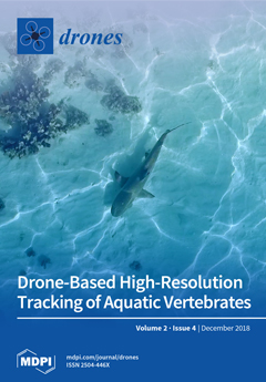
After years of research in the Heron Island Reef Lagoon with colleagues from Macquarie University, we recognized the difficulty of observing the behaviour and movement of animals in this shallow exposed environment. The lagoon was almost exclusively accessible by boat during high tides, or by foot at low tides. These environments prevent the use of many traditional animal movement tracking approaches. Initially interested in using drones to find the enigmatic Epaulette sharks, for which very little ecological information is available, we realised that drones themselves could become an effective tracking tool for marine vertebrate research. This paper outlines a simple approach to tracking the movement and behaviour of marine vertebrates in shallow environments that any researcher can use with an off-the-shelf drone and open access software. View this paper.
  • Issues are regarded as officially published after their release is announced to the table of contents alert mailing list.
  • You may sign up for e-mail alerts to receive table of contents of newly released issues.
  • PDF is the official format for papers published in both, html and pdf forms. To view the papers in pdf format, click on the "PDF Full-text" link, and use the free Adobe Reader to open them.
Order results
Result details
Section
Select all
Export citation of selected articles as:
16 pages, 4446 KiB  
Article
Using Digital Surface Models from UAS Imagery of Fire Damaged Sphagnum Peatlands for Monitoring and Hydrological Restoration
by Shannon De Roos, Darren Turner, Arko Lucieer and David M. J. S. Bowman
Drones 2018, 2(4), 45; https://doi.org/10.3390/drones2040045 - 14 Dec 2018
Cited by 10 | Viewed by 5053
Abstract
The sub-alpine and alpine Sphagnum peatlands in Australia are geographically constrained to poorly drained areas c. 1000 m a.s.l. Sphagnum is an important contributor to the resilience of peatlands; however, it is also very sensitive to fire and often shows slow recovery after [...] Read more.
The sub-alpine and alpine Sphagnum peatlands in Australia are geographically constrained to poorly drained areas c. 1000 m a.s.l. Sphagnum is an important contributor to the resilience of peatlands; however, it is also very sensitive to fire and often shows slow recovery after being damaged. Recovery is largely dependent on a sufficient water supply and impeded drainage. Monitoring the fragmented areas of Australia’s peatlands can be achieved by capturing ultra-high spatial resolution imagery from an unmanned aerial systems (UAS). High resolution digital surface models (DSMs) can be created from UAS imagery, from which hydrological models can be derived to monitor hydrological changes and assist with rehabilitation of damaged peatlands. One of the constraints of the use of UAS is the intensive fieldwork required. The need to distribute ground control points (GCPs) adds to fieldwork complexity. GCPs are often used for georeferencing of the UAS imagery, as well as for removal of artificial tilting and doming of the photogrammetric model created by camera distortions. In this study, Tasmania’s northern peatlands were mapped to test the viability of creating hydrological models. The case study was further used to test three different GCP scenarios to assess the effect on DSM quality. From the five scenarios, three required the use of all (16–20) GCPs to create accurate DSMs, whereas the two other sites provided accurate DSMs when only using four GCPs. Hydrological maps produced with the TauDEM tools software package showed high visual accuracy and a good potential for rehabilitation guidance, when using ground-controlled DSMs. Full article
(This article belongs to the Special Issue Drones for Topographic Mapping)
Show Figures

Figure 1

9 pages, 2192 KiB  
Article
Estimating Wildlife Tag Location Errors from a VHF Receiver Mounted on a Drone
by André Desrochers, Junior A. Tremblay, Yves Aubry, Dominique Chabot, Paul Pace and David M. Bird
Drones 2018, 2(4), 44; https://doi.org/10.3390/drones2040044 - 11 Dec 2018
Cited by 13 | Viewed by 11842
Abstract
Recent studies have demonstrated the high potential of drones as tools to facilitate wildlife radio-tracking in rugged, difficult-to-access terrain. Without estimates of accuracy, however, data obtained from receivers attached to drones will be of limited use. We estimated transmitter location errors from a [...] Read more.
Recent studies have demonstrated the high potential of drones as tools to facilitate wildlife radio-tracking in rugged, difficult-to-access terrain. Without estimates of accuracy, however, data obtained from receivers attached to drones will be of limited use. We estimated transmitter location errors from a drone-borne VHF (very high frequency) receiver in a hilly and dense boreal forest in southern Québec, Canada. Transmitters and the drone-borne receiver were part of the Motus radio-tracking system, a collaborative network designed to study animal movements at local to continental scales. We placed five transmitters at fixed locations, 1–2 m above ground, and flew a quadrotor drone over them along linear segments, at distances to transmitters ranging from 20 m to 534 m. Signal strength was highest with transmitters with antennae pointing upwards, and lowest with transmitters with horizontal antennae. Based on drone positions with maximum signal strength, mean location error was 134 m (range 44–278 m, n = 17). Estimating peak signal strength against drone GPS coordinates with quadratic, least-squares regressions led to lower location error (mean = 94 m, range 15–275 m, n = 10) but with frequent loss of data due to statistical estimation problems. We conclude that accuracy in this system was insufficient for high-precision purposes such as finding nests. However, in the absence of a dense array of fixed receivers, the use of drone-borne Motus receivers may be a cost-effective way to augment the quantity and quality of data, relative to deploying personnel in difficult-to-access terrain. Full article
(This article belongs to the Special Issue Drones for Biodiversity Conservation and Ecological Monitoring)
Show Figures

Graphical abstract

13 pages, 9283 KiB  
Article
Multirotor Drone Aerodynamic Interaction Investigation
by Dhwanil Shukla and Narayanan Komerath
Drones 2018, 2(4), 43; https://doi.org/10.3390/drones2040043 - 03 Dec 2018
Cited by 107 | Viewed by 19315
Abstract
Aerodynamic interactions between rotors are important factors affecting the performance of in-plane multirotor Unmanned Air Vehicles (UAVs) or drones, which are the majority of small size UAVs (or mini-drones). Optimal design requires knowledge of the flow features. The low Reynolds number of many [...] Read more.
Aerodynamic interactions between rotors are important factors affecting the performance of in-plane multirotor Unmanned Air Vehicles (UAVs) or drones, which are the majority of small size UAVs (or mini-drones). Optimal design requires knowledge of the flow features. The low Reynolds number of many UAV rotors raises the question of how these features differ from those expected by traditional analytical methods for rotorcraft. Aerodynamics of a set of side-by-side rotors in hover over a range of rotor separation and Reynolds number is studied using high-speed Stereo Particle Image Velocimetry (SPIV) and performance measurements. The instantaneous and time-averaged SPIV data presented here indicate an increase in inter-rotor wake interactions with decrease in rotor spacing and Reynolds number. A dip in rotor efficiency at small rotor spacing at low Reynolds number is observed through thrust and torque measurements. The basic components of in-plane multirotor wake and velocity profiles are identified and discussed to help generalize the findings to a wide range of drones. However, the data provide confidence in traditional analysis tools, with small modifications. Full article
Show Figures

Graphical abstract

13 pages, 6839 KiB  
Article
Drone Monitoring of Breeding Waterbird Populations: The Case of the Glossy Ibis
by Isabel Afán, Manuel Máñez and Ricardo Díaz-Delgado
Drones 2018, 2(4), 42; https://doi.org/10.3390/drones2040042 - 01 Dec 2018
Cited by 35 | Viewed by 7522
Abstract
Waterbird communities are potential indicators of ecological changes in threatened wetland ecosystems and consequently, a potential object of ecological monitoring programs. Waterbirds often breed in largely inaccessible colonies in flooded habitats, so unmanned aerial vehicle (UAV) surveys provide a robust method for estimating [...] Read more.
Waterbird communities are potential indicators of ecological changes in threatened wetland ecosystems and consequently, a potential object of ecological monitoring programs. Waterbirds often breed in largely inaccessible colonies in flooded habitats, so unmanned aerial vehicle (UAV) surveys provide a robust method for estimating their breeding population size. Counts of breeding pairs might be carried out by manual and automated detection routines. In this study we surveyed the main breeding colony of Glossy ibis (Plegadis falcinellus) at the Doñana National Park. We obtained a high resolution image, in which the number and location of nests were determined manually through visual interpretation by an expert. We also suggest a standardized methodology for nest counts that would be repeatable across time for long-term monitoring censuses, through a supervised classification based primarily on the spectral properties of the image and a subsequent automatic size and form based count. Although manual and automatic count were largely similar in the total number of nests, accuracy between both methodologies was only 46.37%, with higher variability in shallow areas free of emergent vegetation than in areas dominated by tall macrophytes. We discuss the potential challenges for automatic counts in highly complex images. Full article
(This article belongs to the Special Issue Drones for Biodiversity Conservation and Ecological Monitoring)
Show Figures

Graphical abstract

24 pages, 11175 KiB  
Article
Thermal Infrared and Visual Inspection of Photovoltaic Installations by UAV Photogrammetry—Application Case: Morocco
by Yahya Zefri, Achraf ElKettani, Imane Sebari and Sara Ait Lamallam
Drones 2018, 2(4), 41; https://doi.org/10.3390/drones2040041 - 23 Nov 2018
Cited by 70 | Viewed by 11039
Abstract
Being sustainable, clean, and eco-friendly, photovoltaic technology is considered as one of the most hoped solutions face to worldwide energetic challenges. Morocco joins this context with the inauguration of numerous clean energy projects. However, one key factor in making photovoltaic installations a profitable [...] Read more.
Being sustainable, clean, and eco-friendly, photovoltaic technology is considered as one of the most hoped solutions face to worldwide energetic challenges. Morocco joins this context with the inauguration of numerous clean energy projects. However, one key factor in making photovoltaic installations a profitable investment are regular and effective inspections in order to detect occurred defects. Unmanned aerial vehicles (UAV) are increasingly used in various inspection fields. In this respect, this work focuses on the use of thermal and visual imagery taken by UAV in the inspection of photovoltaic installations. Visual and thermal images of photovoltaic modules, obtained by UAV, from different installations, and with different acquisition conditions and parameters, were exploited to generate orthomosaics for inspection purposes. The methodology was tested on a dataset we have acquired by a mission in Rabat (Morocco), and also on external datasets acquired in Switzerland. As final results, several visual defects were detected in visual RGB and thermal orthomosaics, such as cracks, soiling, and hotspots. In addition, a procedure of semi-automatic hotspots’ extraction was also developed and is presented within this work. On the other side, various tests were conducted on the influence of some acquisition and processing parameters (images’ overlap, the ground sampling distance, the flying height, the use of ground control points, the internal camera parameters’ optimization) on the detection of defects and the quality of visual and thermal generated orthomosaics. In the end, the potential of UAV thermal and visual imagery in the inspection of photovoltaic installations was discussed in function of various parameters. On the basis of the discussion feedback, UAV were concluded as advantageous tools within the thematic of this project, which proves the necessity of their implementation in this context. Full article
Show Figures

Figure 1

15 pages, 4110 KiB  
Article
UAS-GEOBIA Approach to Sapling Identification in Jack Pine Barrens after Fire
by Raechel A. White, Michael Bomber, Joseph P. Hupy and Ashton Shortridge
Drones 2018, 2(4), 40; https://doi.org/10.3390/drones2040040 - 21 Nov 2018
Cited by 12 | Viewed by 3851
Abstract
Jack pine (pinus banksiana) forests are unique ecosystems controlled by wildfire. Understanding the traits of revegetation after wildfire is important for sustainable forest management, as these forests not only provide economic resources, but also are home to specialized species, like the [...] Read more.
Jack pine (pinus banksiana) forests are unique ecosystems controlled by wildfire. Understanding the traits of revegetation after wildfire is important for sustainable forest management, as these forests not only provide economic resources, but also are home to specialized species, like the Kirtland Warbler (Setophaga kirtlandii). Individual tree detection of jack pine saplings after fire events can provide information about an environment’s recovery. Traditional satellite and manned aerial sensors lack the flexibility and spatial resolution required for identifying saplings in early post-fire analysis. Here we evaluated the use of unmanned aerial systems and geographic object-based image analysis for jack pine sapling identification in a region burned during the 2012 Duck Lake Fire in the Upper Peninsula of Michigan. Results of this study indicate that sapling identification accuracies can top 90%, and that accuracy improves with the inclusion of red and near infrared spectral bands. Results also indicated that late season imagery performed best when discriminating between young (<5 years) jack pines and herbaceous ground cover in these environments. Full article
Show Figures

Figure 1

16 pages, 5783 KiB  
Article
Identification of Citrus Trees from Unmanned Aerial Vehicle Imagery Using Convolutional Neural Networks
by Ovidiu Csillik, John Cherbini, Robert Johnson, Andy Lyons and Maggi Kelly
Drones 2018, 2(4), 39; https://doi.org/10.3390/drones2040039 - 20 Nov 2018
Cited by 169 | Viewed by 16404
Abstract
Remote sensing is important to precision agriculture and the spatial resolution provided by Unmanned Aerial Vehicles (UAVs) is revolutionizing precision agriculture workflows for measurement crop condition and yields over the growing season, for identifying and monitoring weeds and other applications. Monitoring of individual [...] Read more.
Remote sensing is important to precision agriculture and the spatial resolution provided by Unmanned Aerial Vehicles (UAVs) is revolutionizing precision agriculture workflows for measurement crop condition and yields over the growing season, for identifying and monitoring weeds and other applications. Monitoring of individual trees for growth, fruit production and pest and disease occurrence remains a high research priority and the delineation of each tree using automated means as an alternative to manual delineation would be useful for long-term farm management. In this paper, we detected citrus and other crop trees from UAV images using a simple convolutional neural network (CNN) algorithm, followed by a classification refinement using superpixels derived from a Simple Linear Iterative Clustering (SLIC) algorithm. The workflow performed well in a relatively complex agricultural environment (multiple targets, multiple size trees and ages, etc.) achieving high accuracy (overall accuracy = 96.24%, Precision (positive predictive value) = 94.59%, Recall (sensitivity) = 97.94%). To our knowledge, this is the first time a CNN has been used with UAV multi-spectral imagery to focus on citrus trees. More of these individual cases are needed to develop standard automated workflows to help agricultural managers better incorporate large volumes of high resolution UAV imagery into agricultural management operations. Full article
Show Figures

Graphical abstract

11 pages, 4427 KiB  
Article
A Hybrid Battery Charging Approach for Drone-Aided Border Surveillance Scheduling
by Seon Jin Kim and Gino J. Lim
Drones 2018, 2(4), 38; https://doi.org/10.3390/drones2040038 - 18 Nov 2018
Cited by 16 | Viewed by 7242
Abstract
This paper proposes a new method to extend the flight capability of drones in real time. The new method combines two wireless charging methods (stationary wireless charging systems and dynamic wireless charging systems) into a hybrid mode. The drones must frequently return to [...] Read more.
This paper proposes a new method to extend the flight capability of drones in real time. The new method combines two wireless charging methods (stationary wireless charging systems and dynamic wireless charging systems) into a hybrid mode. The drones must frequently return to a ground control center to replace or recharge its battery due to the limited performance of batteries mounted in the drones. To reduce the need of returning to the center, stationary wireless charging systems and dynamic wireless charging systems have been proposed. However, a few drawbacks of the two systems include the needs of landing/stopping on the stationary charging systems and the uncertainty of charging efficiency over the dynamic charging systems. Hence, to resolve the current limitations, we propose the hybrid approach for extending drone flight duration in real time. A mathematical formulation model is proposed to decide an optimal installation location and operating time of the hybrid mode. A case study is conducted to illustrate feasibility and effectiveness of the proposed method. Results from the case study show that we can lengthen the flight duration per charge from the initial launching point (30 min → 32–59 min), and if the value of charging efficiency of the dynamic charging systems is maintained above a certain level, the time spent on the stationary charging systems is significantly reduced (58 min → 22 min). Full article
Show Figures

Figure 1

14 pages, 7074 KiB  
Article
Drone-Based High-Resolution Tracking of Aquatic Vertebrates
by Vincent Raoult, Louise Tosetto and Jane E. Williamson
Drones 2018, 2(4), 37; https://doi.org/10.3390/drones2040037 - 08 Nov 2018
Cited by 49 | Viewed by 11664
Abstract
Determining the small-scale movement patterns of marine vertebrates usually requires invasive active acoustic tagging or in-water monitoring, with the inherent behavioural impacts of those techniques. In addition, these techniques rarely allow direct continuous behavioural assessments or the recording of environmental interactions, especially for [...] Read more.
Determining the small-scale movement patterns of marine vertebrates usually requires invasive active acoustic tagging or in-water monitoring, with the inherent behavioural impacts of those techniques. In addition, these techniques rarely allow direct continuous behavioural assessments or the recording of environmental interactions, especially for highly mobile species. Here, we trial a novel method of assessing small-scale movement patterns of marine vertebrates using an unmanned aerial vehicle that could complement longer-term tracking approaches. This approach is unlikely to have behavioural impacts and provides high accuracy and high frequency location data (10 Hz), while subsequently allowing quantitative trajectory analysis. Unmanned aerial vehicle tracking is also relatively low cost compared to single-use acoustic and GPS tags. We tracked 14 sharks for up to 10 min in a shallow lagoon of Heron Island, Australia. Trajectory analysis revealed that Epaulette sharks (Hemiscyllium ocellatum) displayed sinusoidal movement patterns, while Blacktip Reef Sharks (Carcharhinus melanopterus) had more linear trajectories that were similar to those of a Lemon shark (Negaprion acutidens). Individual shark trajectory patterns and movement speeds were highly variable. Results indicate that Epaulette sharks may be more mobile during diurnal low tides than previously thought. The approach presented here allows the movements and behaviours of marine vertebrates to be analysed at resolutions not previously possible without complex and expensive acoustic arrays. This method would be useful to assess the habitat use and behaviours of sharks and rays in shallow water environments, where they are most likely to interact with humans. Full article
(This article belongs to the Special Issue Drones for Coastal Environments)
Show Figures

Figure 1

19 pages, 1732 KiB  
Article
Monitoring Human Visual Behavior during the Observation of Unmanned Aerial Vehicles (UAVs) Videos
by Vassilios Krassanakis, Matthieu Perreira Da Silva and Vincent Ricordel
Drones 2018, 2(4), 36; https://doi.org/10.3390/drones2040036 - 19 Oct 2018
Cited by 17 | Viewed by 6659
Abstract
The present article describes an experimental study towards the examination of human visual behavior during the observation of unmanned aerial vehicles (UAVs) videos. Experimental performance is based on the collection and the quantitative & qualitative analysis of eye tracking data. The results highlight [...] Read more.
The present article describes an experimental study towards the examination of human visual behavior during the observation of unmanned aerial vehicles (UAVs) videos. Experimental performance is based on the collection and the quantitative & qualitative analysis of eye tracking data. The results highlight that UAV flight altitude serves as a dominant specification that affects the visual attention process, while the presence of sky in the video background seems to be the less affecting factor in this procedure. Additionally, the main surrounding environment, the main size of the observed object as well as the main perceived angle between UAV’s flight plain and ground appear to have an equivalent influence in observers’ visual reaction during the exploration of such stimuli. Moreover, the provided heatmap visualizations indicate the most salient locations in the used UAVs videos. All produced data (raw gaze data, fixation and saccade events, and heatmap visualizations) are freely distributed to the scientific community as a new dataset (EyeTrackUAV) that can be served as an objective ground truth in future studies. Full article
Show Figures

Figure 1

14 pages, 398 KiB  
Review
UAVs in Support of Algal Bloom Research: A Review of Current Applications and Future Opportunities
by Chippie Kislik, Iryna Dronova and Maggi Kelly
Drones 2018, 2(4), 35; https://doi.org/10.3390/drones2040035 - 17 Oct 2018
Cited by 101 | Viewed by 14555
Abstract
Algal blooms have become major public health and ecosystem vitality concerns globally. The prevalence of blooms has increased due to warming water and additional nutrient inputs into aquatic systems. In response, various remotely-sensed methods of detection, analysis, and forecasting have been developed. Satellite [...] Read more.
Algal blooms have become major public health and ecosystem vitality concerns globally. The prevalence of blooms has increased due to warming water and additional nutrient inputs into aquatic systems. In response, various remotely-sensed methods of detection, analysis, and forecasting have been developed. Satellite imaging has proven successful in the identification of various inland and coastal blooms at large spatial and temporal scales, and airborne platforms offer higher spatial and often spectral resolution at targeted temporal frequencies. Unmanned aerial vehicles (UAVs) have recently emerged as another tool for algal bloom detection, providing users with on-demand high spatial and temporal resolution at lower costs. However, due to the challenges of processing images of water, payload costs and limitations, and a lack of standardized methods, UAV-based algal bloom studies have not gained critical traction. This literature review explores the current state of this field, and highlights opportunities that could promote its growth. By understanding the technical parameters required to identify algal blooms with airborne platforms, and comparing these capabilities to current UAV technology, such knowledge will assist managers, researchers, and public health officials in utilizing UAVs to monitor and predict blooms at greater spatial and temporal precision, reducing exposure to potentially toxic events. Full article
Show Figures

Graphical abstract

15 pages, 2719 KiB  
Article
Autonomous Landing of a UAV on a Moving Platform Using Model Predictive Control
by Yi Feng, Cong Zhang, Stanley Baek, Samir Rawashdeh and Alireza Mohammadi
Drones 2018, 2(4), 34; https://doi.org/10.3390/drones2040034 - 12 Oct 2018
Cited by 81 | Viewed by 15242
Abstract
Developing methods for autonomous landing of an unmanned aerial vehicle (UAV) on a mobile platform has been an active area of research over the past decade, as it offers an attractive solution for cases where rapid deployment and recovery of a fleet of [...] Read more.
Developing methods for autonomous landing of an unmanned aerial vehicle (UAV) on a mobile platform has been an active area of research over the past decade, as it offers an attractive solution for cases where rapid deployment and recovery of a fleet of UAVs, continuous flight tasks, extended operational ranges, and mobile recharging stations are desired. In this work, we present a new autonomous landing method that can be implemented on micro UAVs that require high-bandwidth feedback control loops for safe landing under various uncertainties and wind disturbances. We present our system architecture, including dynamic modeling of the UAV with a gimbaled camera, implementation of a Kalman filter for optimal localization of the mobile platform, and development of model predictive control (MPC), for guidance of UAVs. We demonstrate autonomous landing with an error of less than 37 cm from the center of a mobile platform traveling at a speed of up to 12 m/s under the condition of noisy measurements and wind disturbances. Full article
Show Figures

Figure 1

18 pages, 1225 KiB  
Article
Biologically-Inspired Intelligent Flocking Control for Networked Multi-UAS with Uncertain Network Imperfections
by Mohammad Jafari and Hao Xu
Drones 2018, 2(4), 33; https://doi.org/10.3390/drones2040033 - 29 Sep 2018
Cited by 3 | Viewed by 3538
Abstract
In this paper, a biologically-inspired distributed intelligent control methodology is proposed to overcome the challenges, i.e., networked imperfections and uncertainty from the environment and system, in networked multi-Unmanned Aircraft Systems (UAS) flocking. The proposed method is adopted based on the emotional learning phenomenon [...] Read more.
In this paper, a biologically-inspired distributed intelligent control methodology is proposed to overcome the challenges, i.e., networked imperfections and uncertainty from the environment and system, in networked multi-Unmanned Aircraft Systems (UAS) flocking. The proposed method is adopted based on the emotional learning phenomenon in the mammalian limbic system, considering the limited computational ability in the practical onboard controller. The learning capability and low computational complexity of the proposed technique make it a propitious tool for implementing in real-time networked multi-UAS flocking considering the network imperfection and uncertainty from environment and system. Computer-aid numerical results of the implementation of the proposed methodology demonstrate the effectiveness of this algorithm for distributed intelligent flocking control of networked multi-UAS. Full article
Show Figures

Figure 1

11 pages, 3609 KiB  
Review
Person Identification from Drones by Humans: Insights from Cognitive Psychology
by Matthew C. Fysh and Markus Bindemann
Drones 2018, 2(4), 32; https://doi.org/10.3390/drones2040032 - 28 Sep 2018
Cited by 8 | Viewed by 6221
Abstract
The deployment of unmanned aerial vehicles (i.e., drones) in military and police operations implies that drones can provide footage that is of sufficient quality to enable the recognition of strategic targets, criminal suspects, and missing persons. On the contrary, evidence from Cognitive Psychology [...] Read more.
The deployment of unmanned aerial vehicles (i.e., drones) in military and police operations implies that drones can provide footage that is of sufficient quality to enable the recognition of strategic targets, criminal suspects, and missing persons. On the contrary, evidence from Cognitive Psychology suggests that such identity judgements by humans are already difficult under ideal conditions, and are even more challenging with drone surveillance footage. In this review, we outline the psychological literature on person identification for readers who are interested in the real-world application of drones. We specifically focus on factors that are likely to affect identification performance from drone-recorded footage, such as image quality, and additional person-related information from the body and gait. Based on this work, we suggest that person identification from drones is likely to be very challenging indeed, and that performance in laboratory settings is still very likely to underestimate the difficulty of this task in real-world settings. Full article
Show Figures

Figure 1

Previous Issue
Next Issue
Back to TopTop