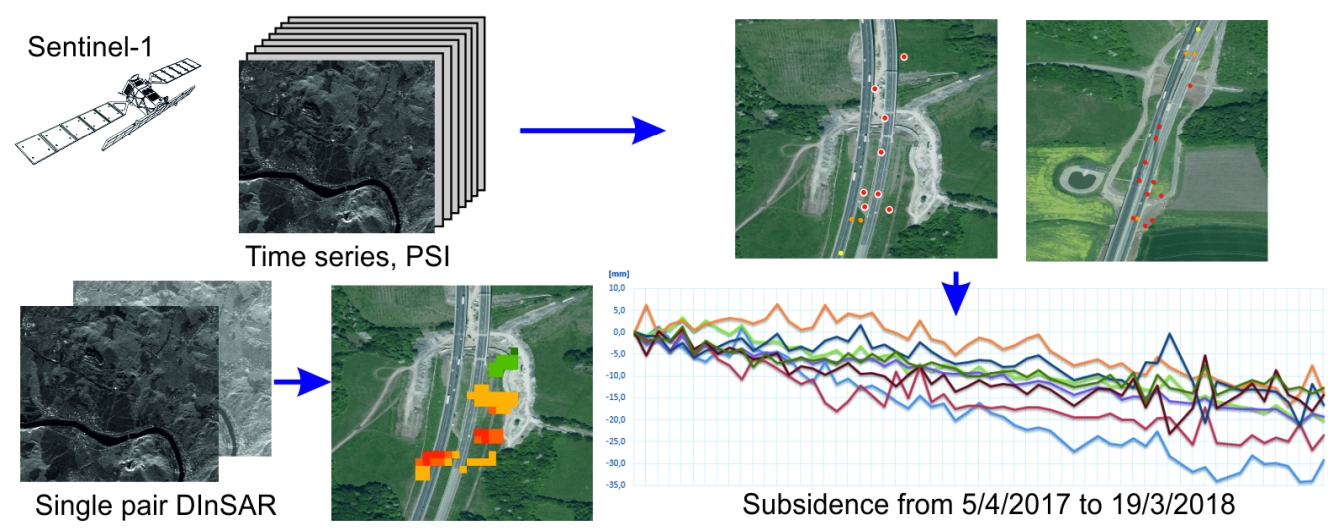
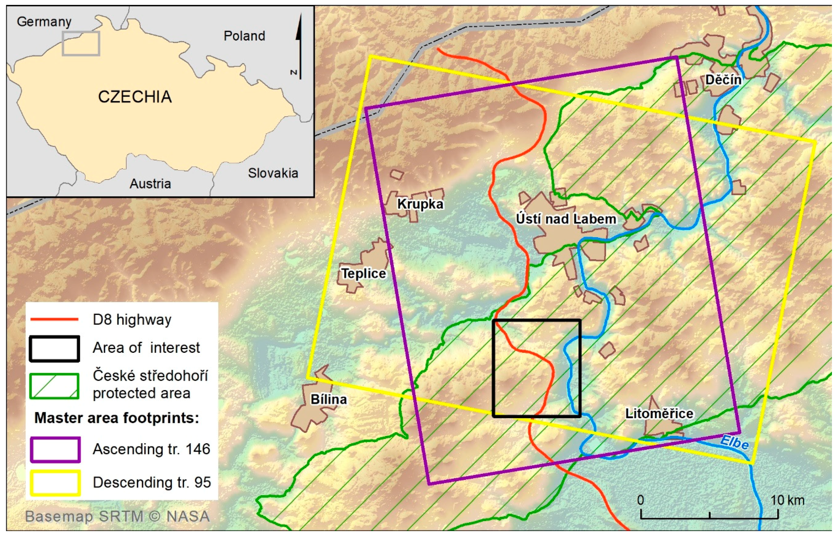
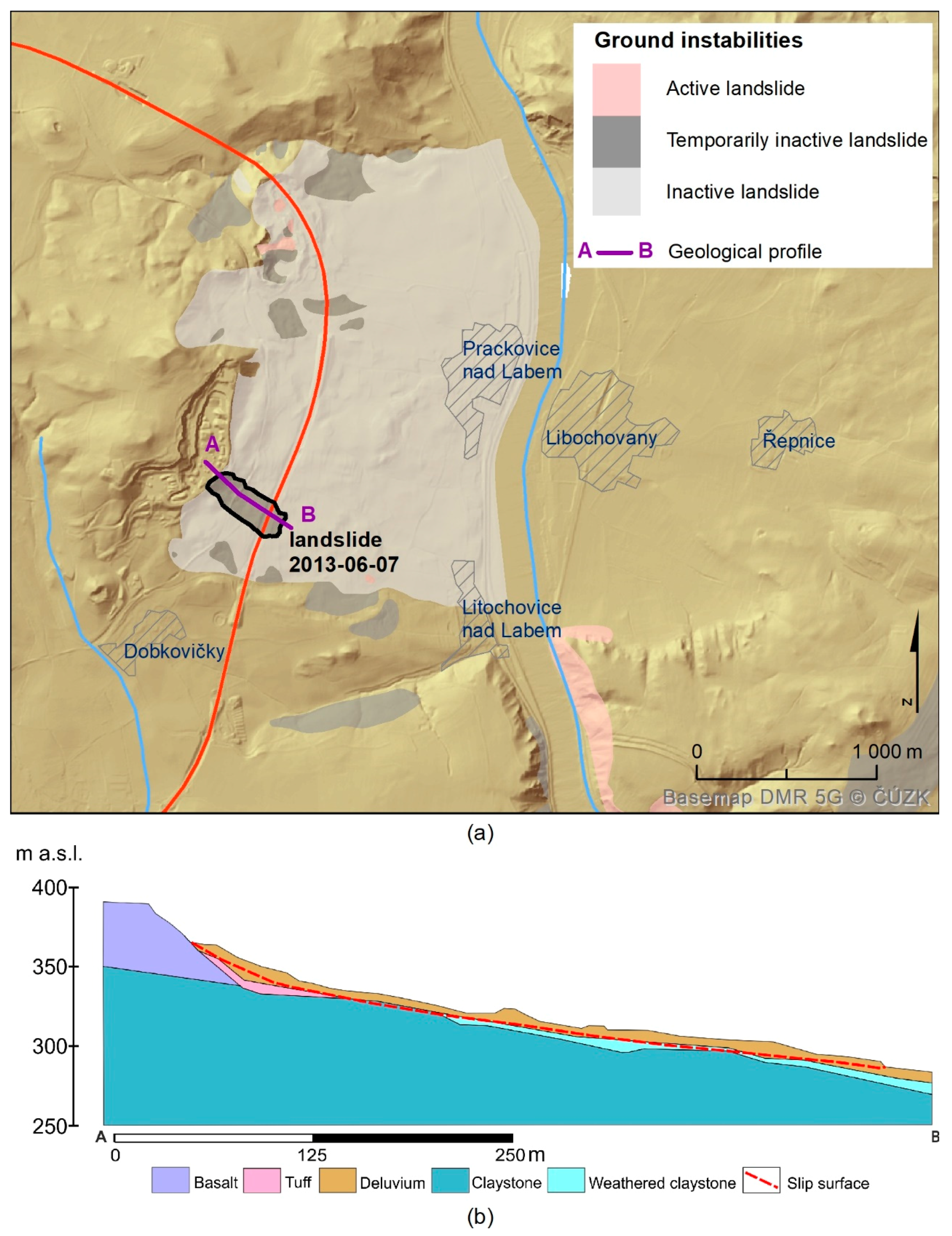
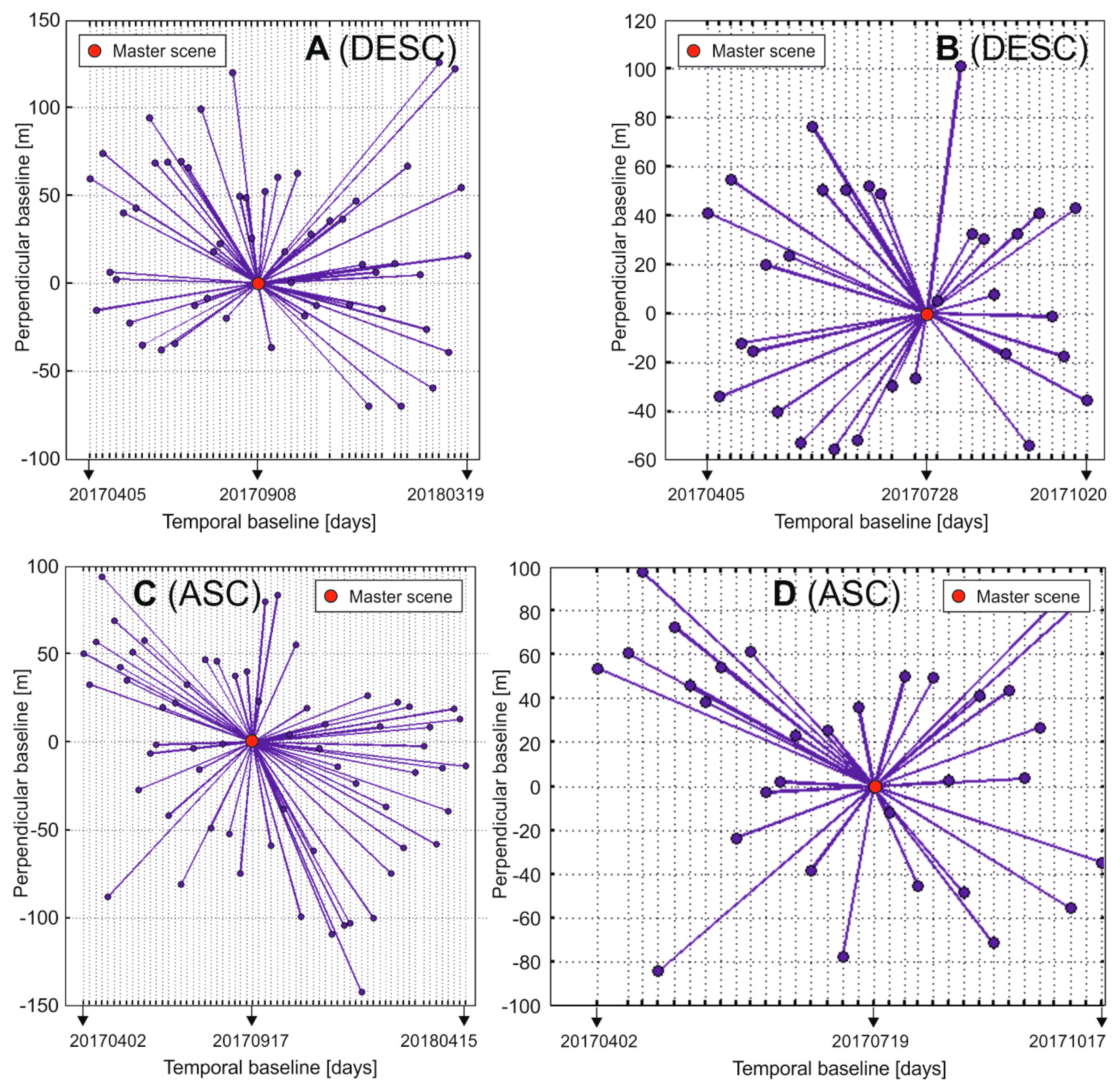
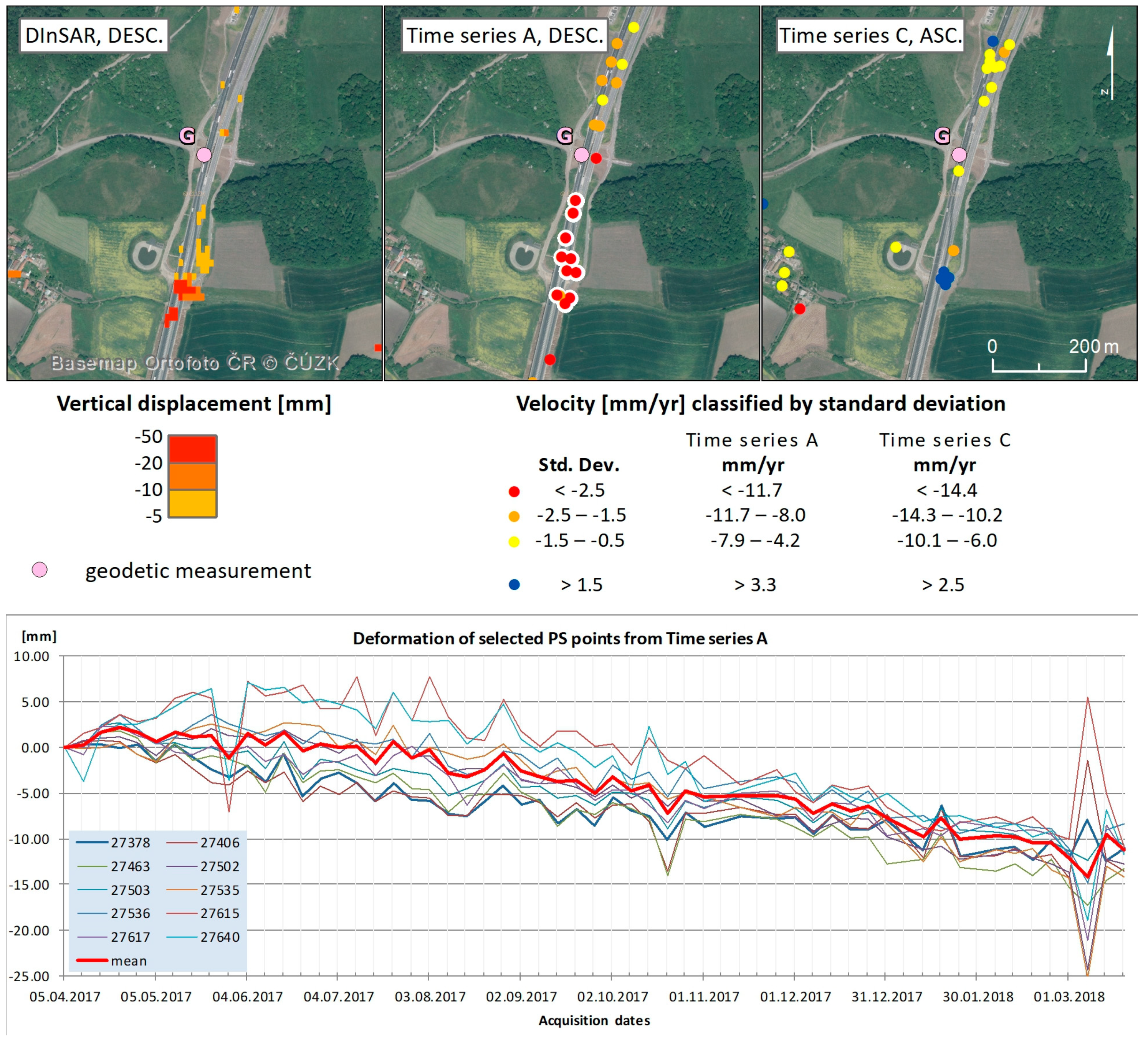
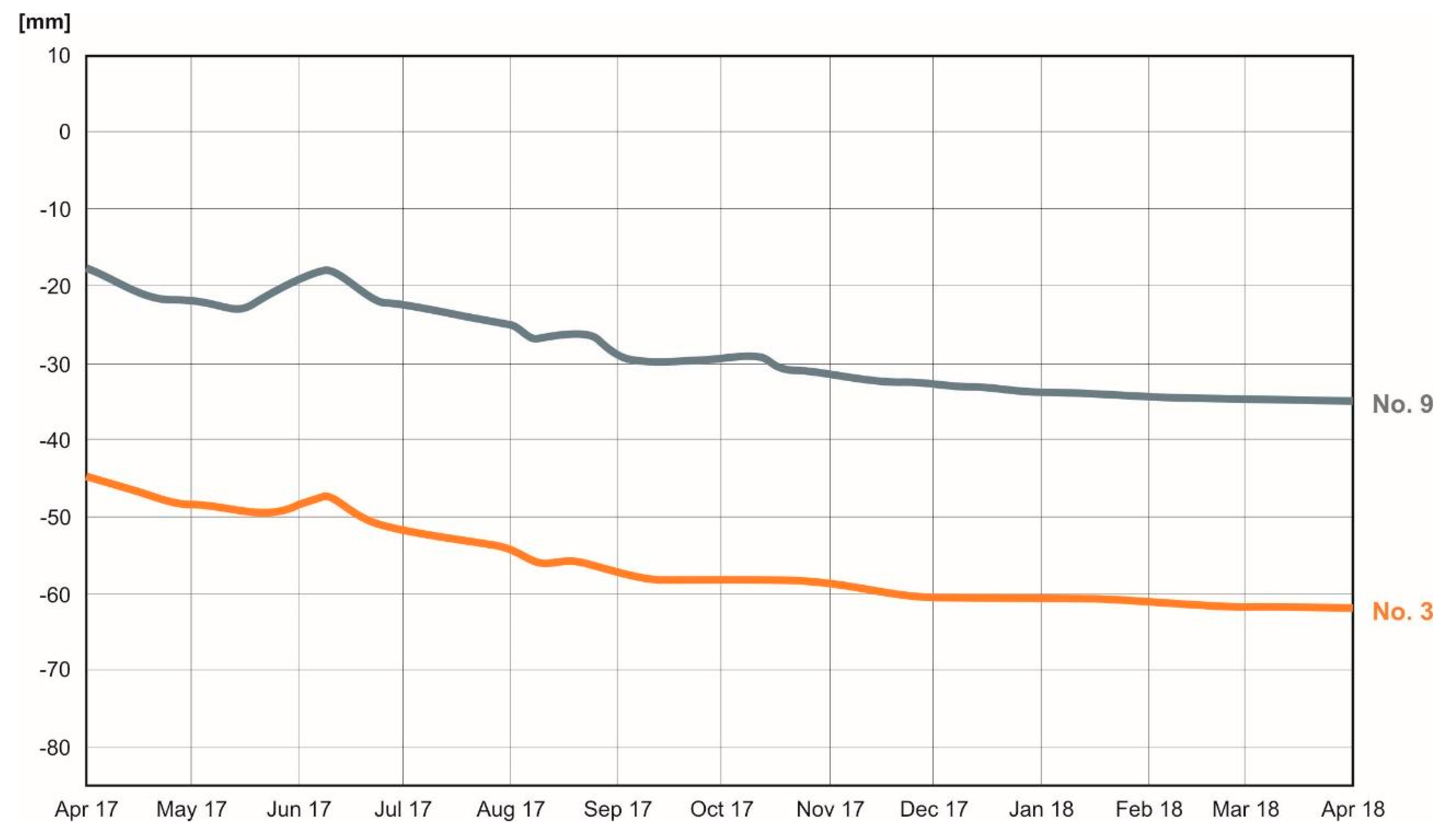
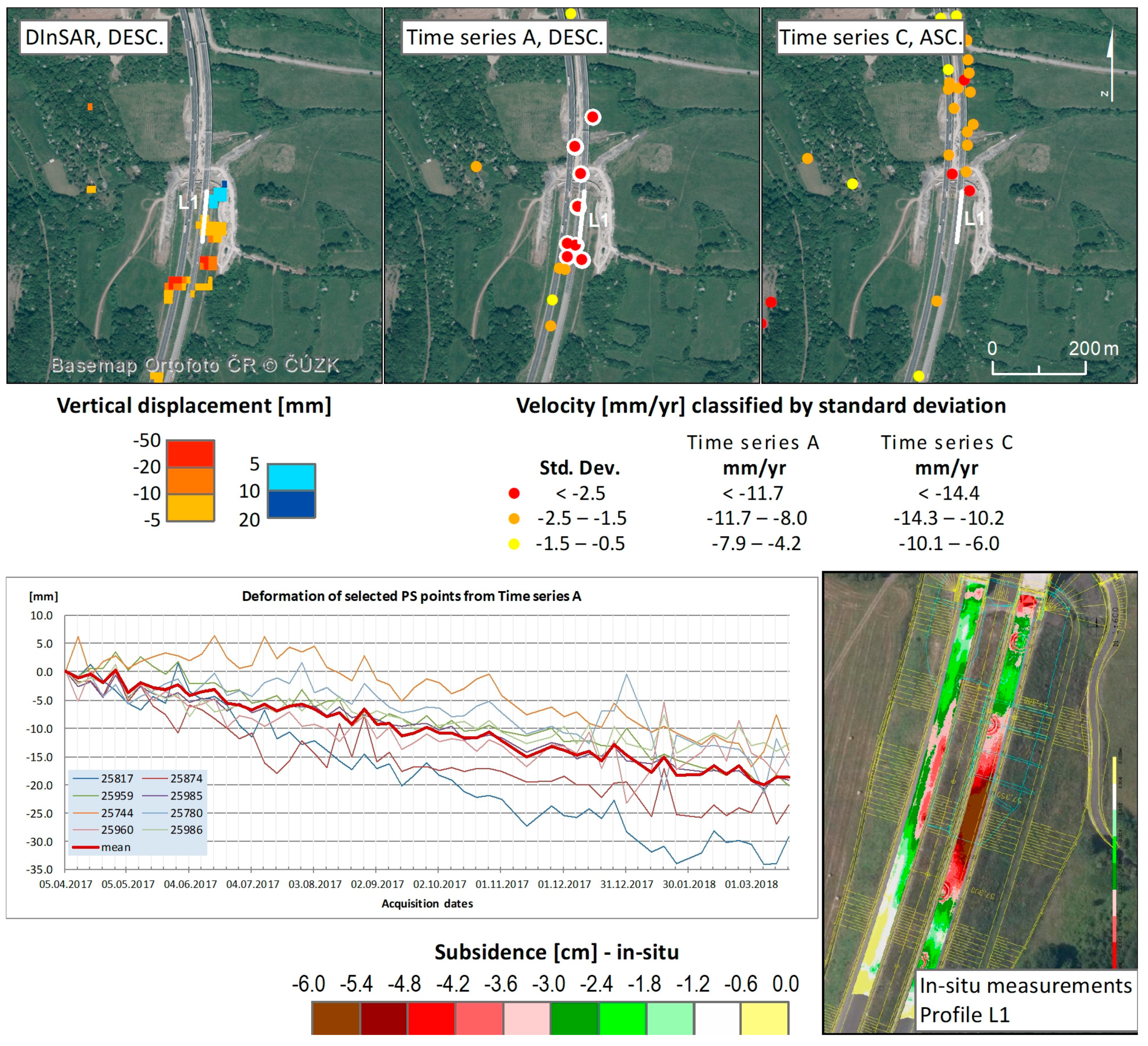
Comparing DInSAR and PSI Techniques Employed to Sentinel-1 Data to Monitor Highway Stability: A Case Study of a Massive Dobkovičky Landslide, Czech Republic


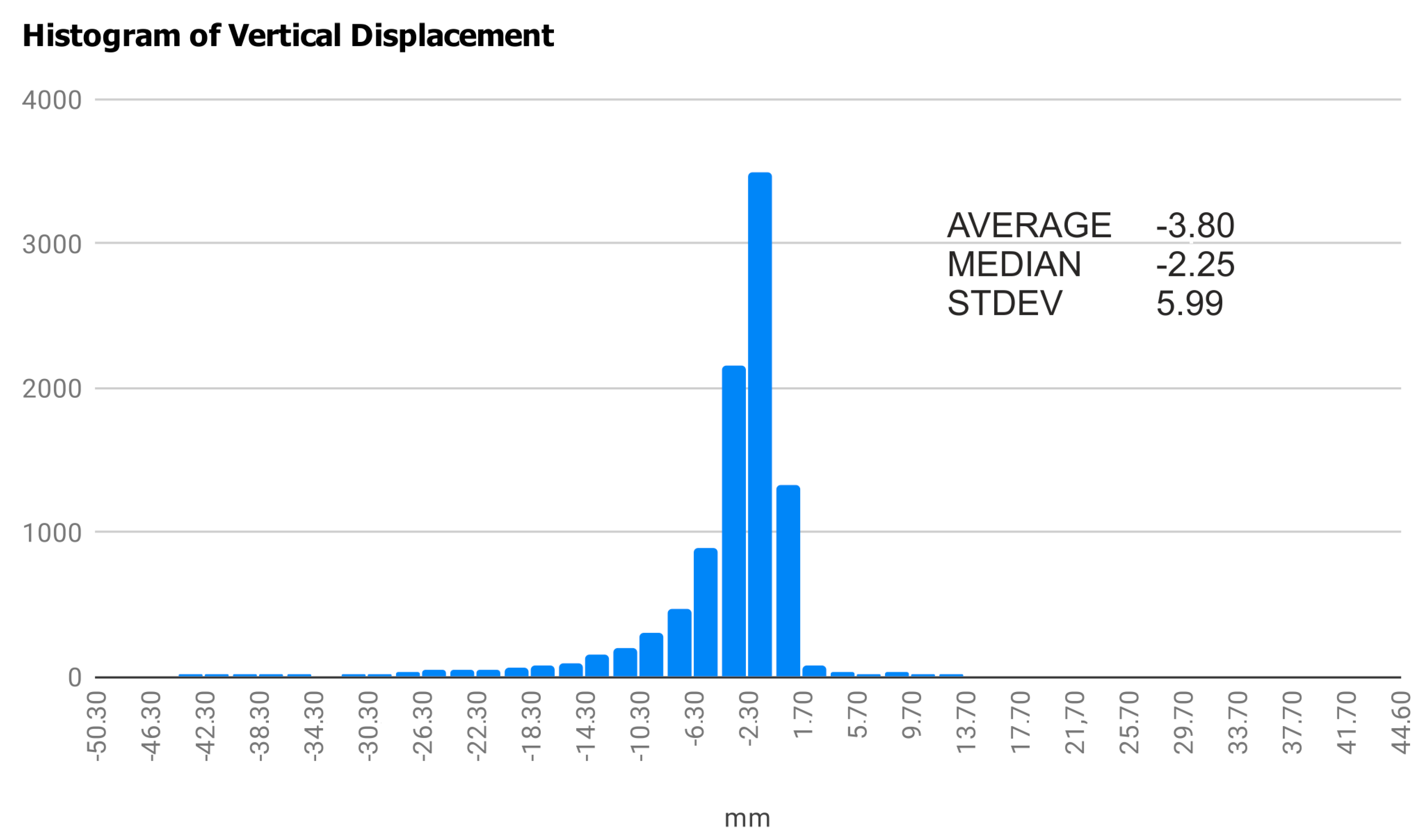
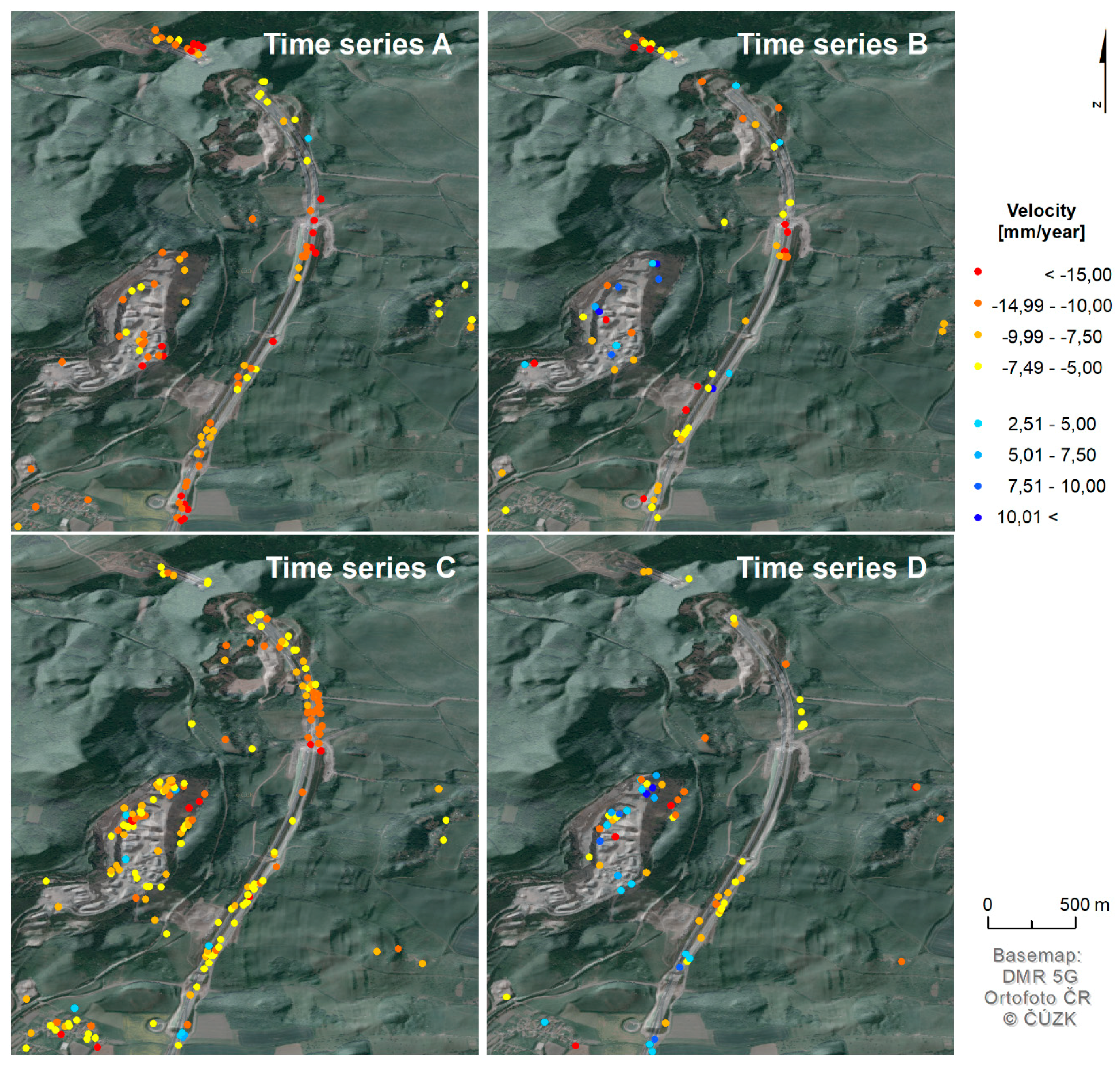
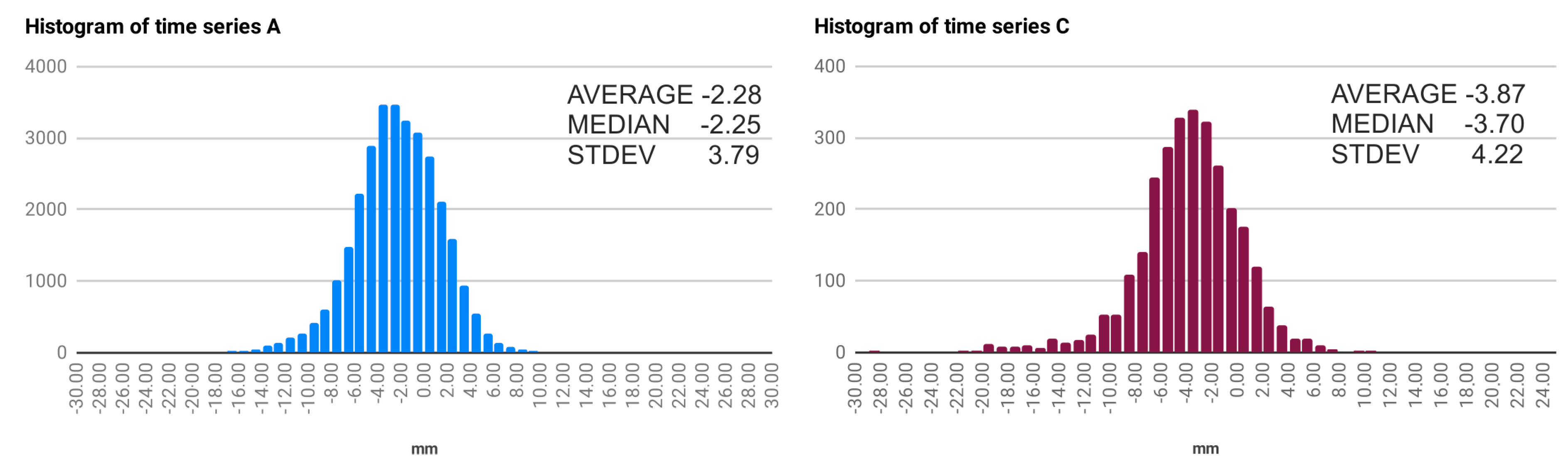
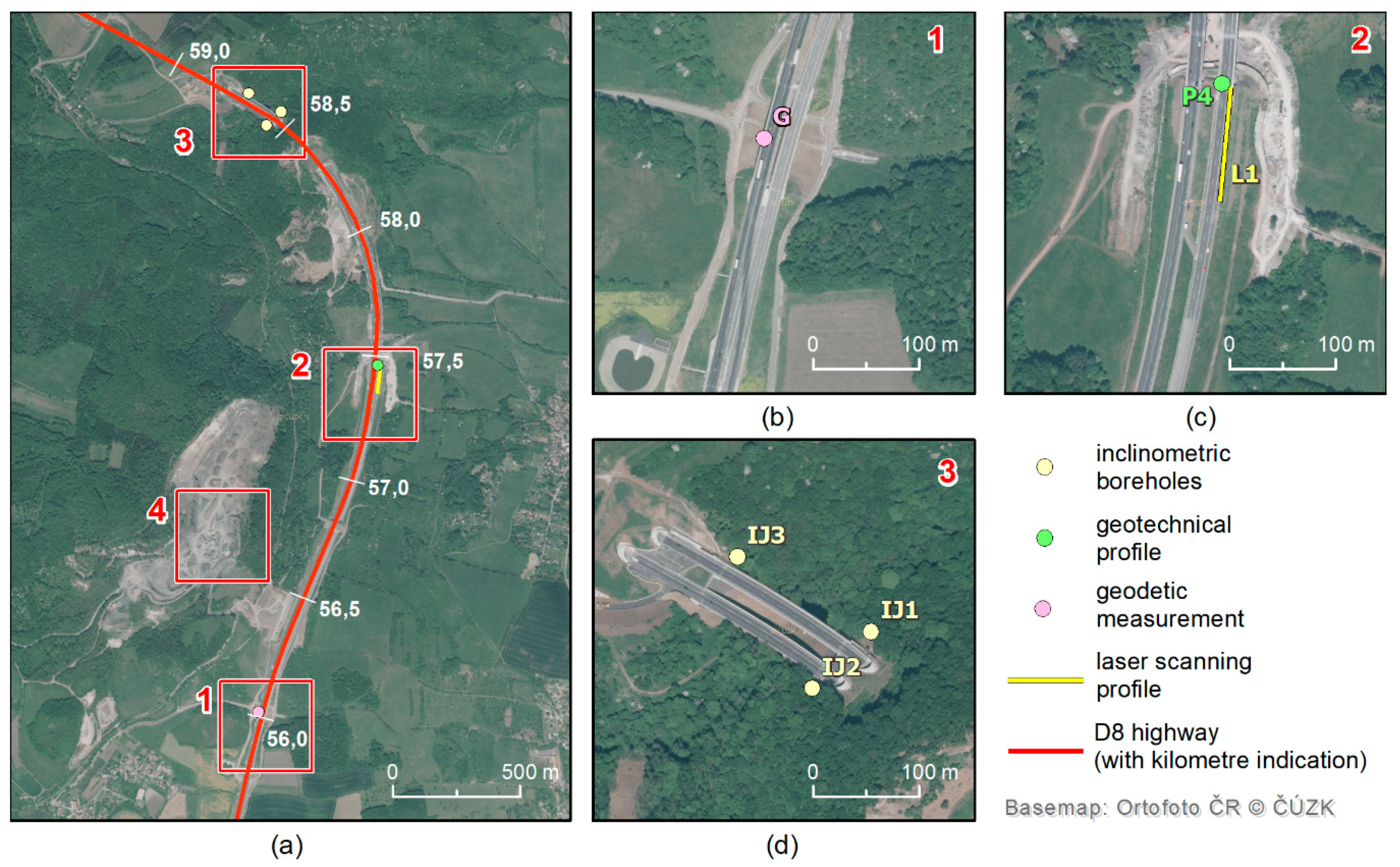
Abstract

Share and Cite
Fárová, K.; Jelének, J.; Kopačková-Strnadová, V.; Kycl, P. Comparing DInSAR and PSI Techniques Employed to Sentinel-1 Data to Monitor Highway Stability: A Case Study of a Massive Dobkovičky Landslide, Czech Republic. Remote Sens. 2019, 11, 2670. https://doi.org/10.3390/rs11222670
Fárová K, Jelének J, Kopačková-Strnadová V, Kycl P. Comparing DInSAR and PSI Techniques Employed to Sentinel-1 Data to Monitor Highway Stability: A Case Study of a Massive Dobkovičky Landslide, Czech Republic. Remote Sensing. 2019; 11(22):2670. https://doi.org/10.3390/rs11222670
Chicago/Turabian StyleFárová, Kateřina, Jan Jelének, Veronika Kopačková-Strnadová, and Petr Kycl. 2019. "Comparing DInSAR and PSI Techniques Employed to Sentinel-1 Data to Monitor Highway Stability: A Case Study of a Massive Dobkovičky Landslide, Czech Republic" Remote Sensing 11, no. 22: 2670. https://doi.org/10.3390/rs11222670
APA StyleFárová, K., Jelének, J., Kopačková-Strnadová, V., & Kycl, P. (2019). Comparing DInSAR and PSI Techniques Employed to Sentinel-1 Data to Monitor Highway Stability: A Case Study of a Massive Dobkovičky Landslide, Czech Republic. Remote Sensing, 11(22), 2670. https://doi.org/10.3390/rs11222670