Article

A Comprehensive Clear-Sky Database for the Development of Land Surface Temperature Algorithms
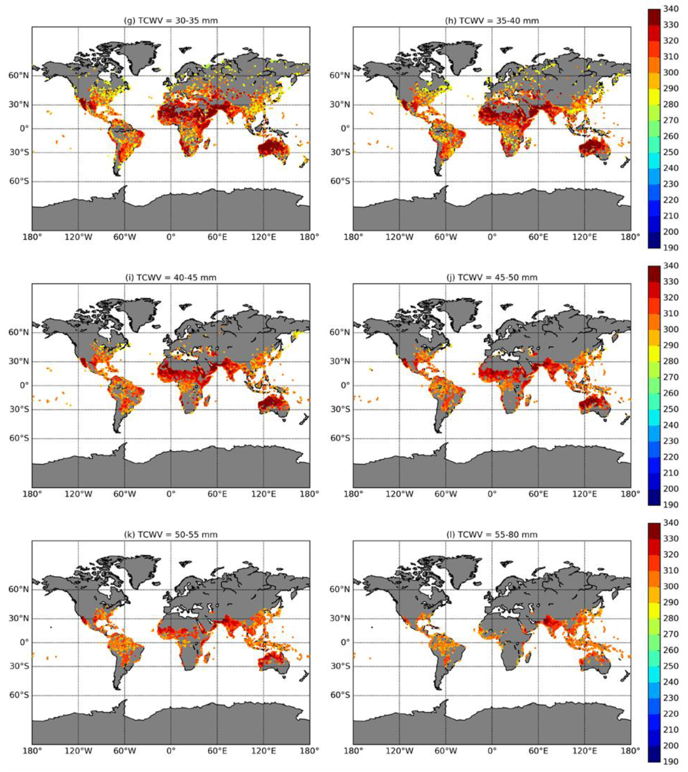
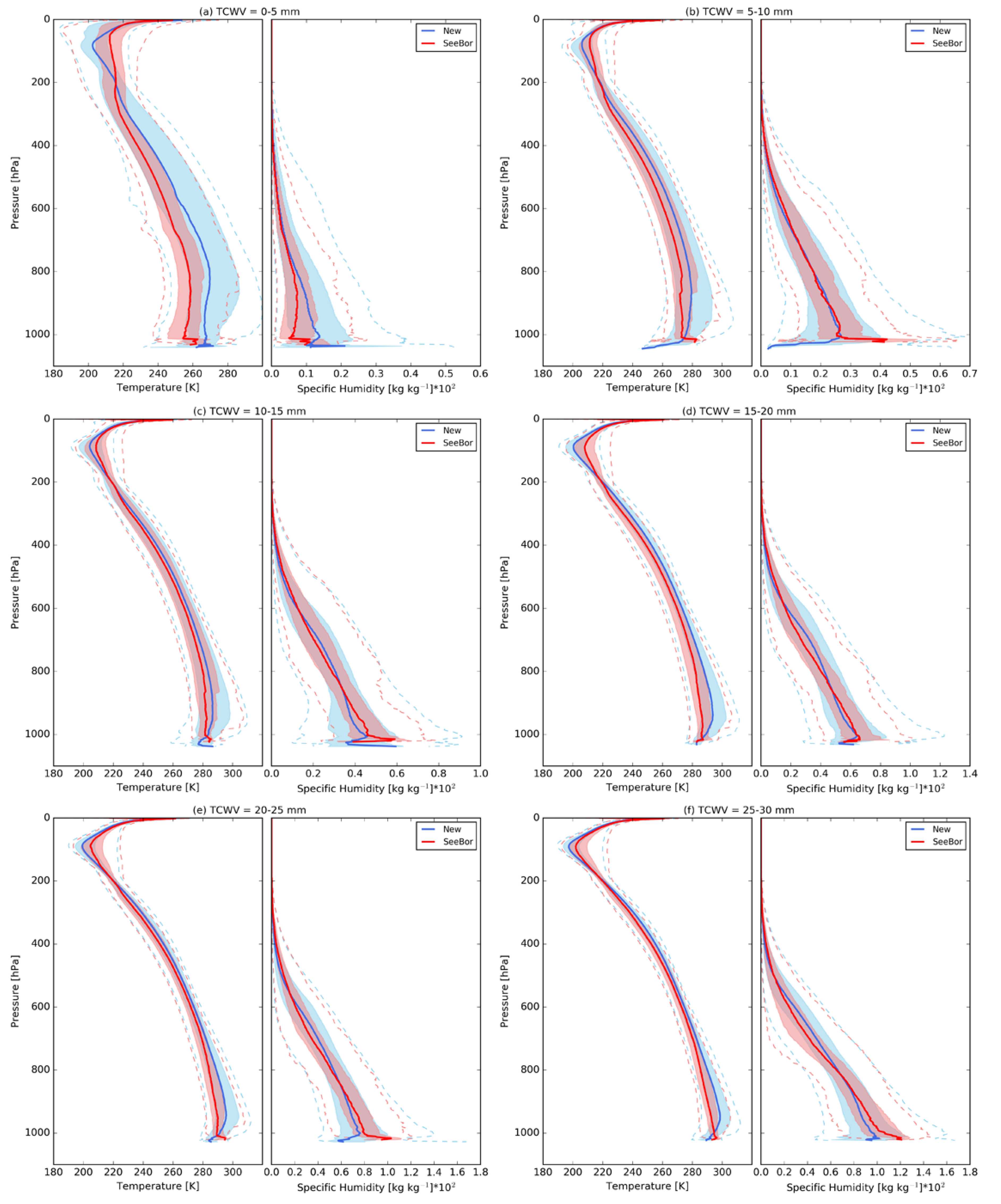
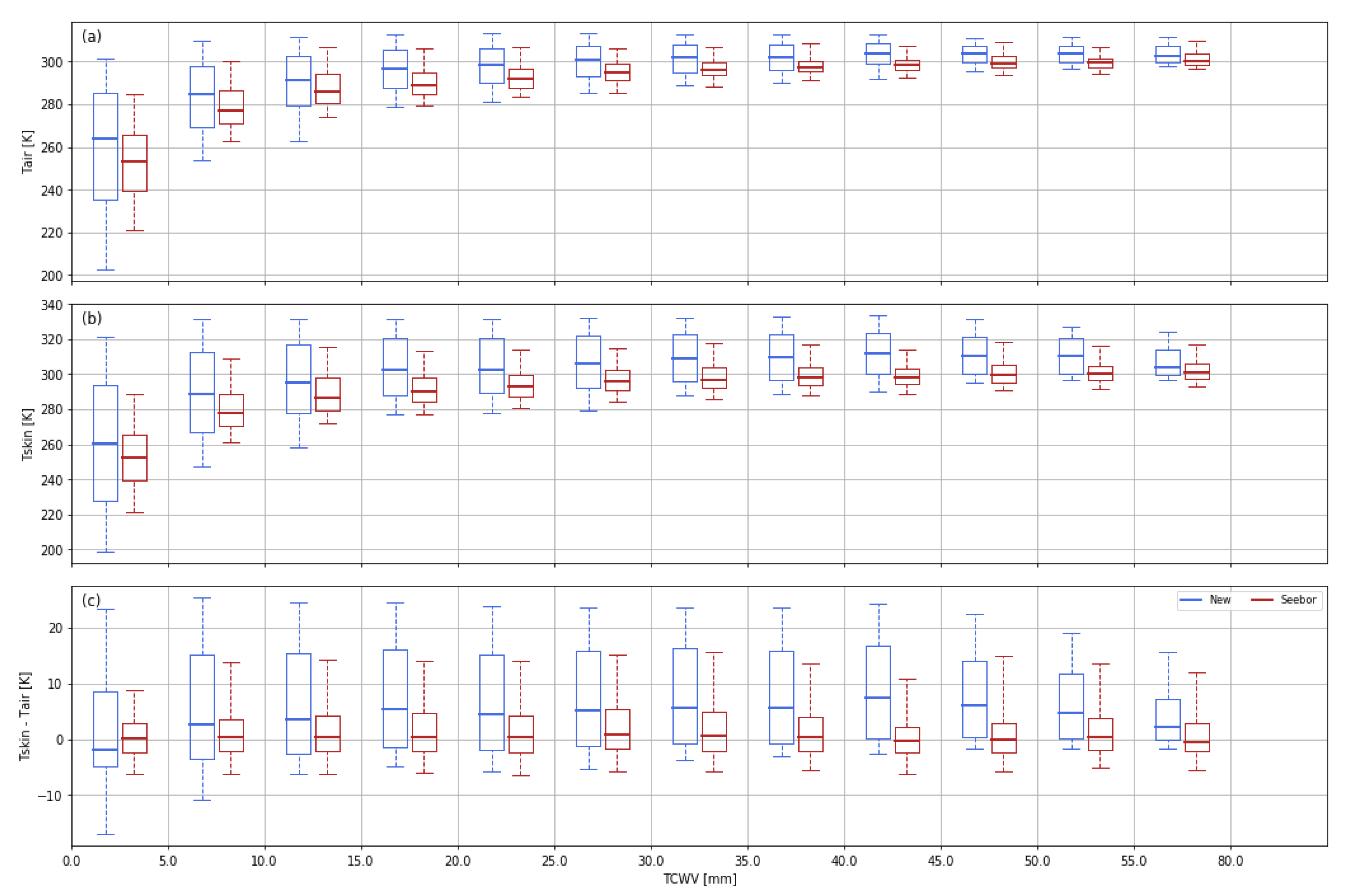
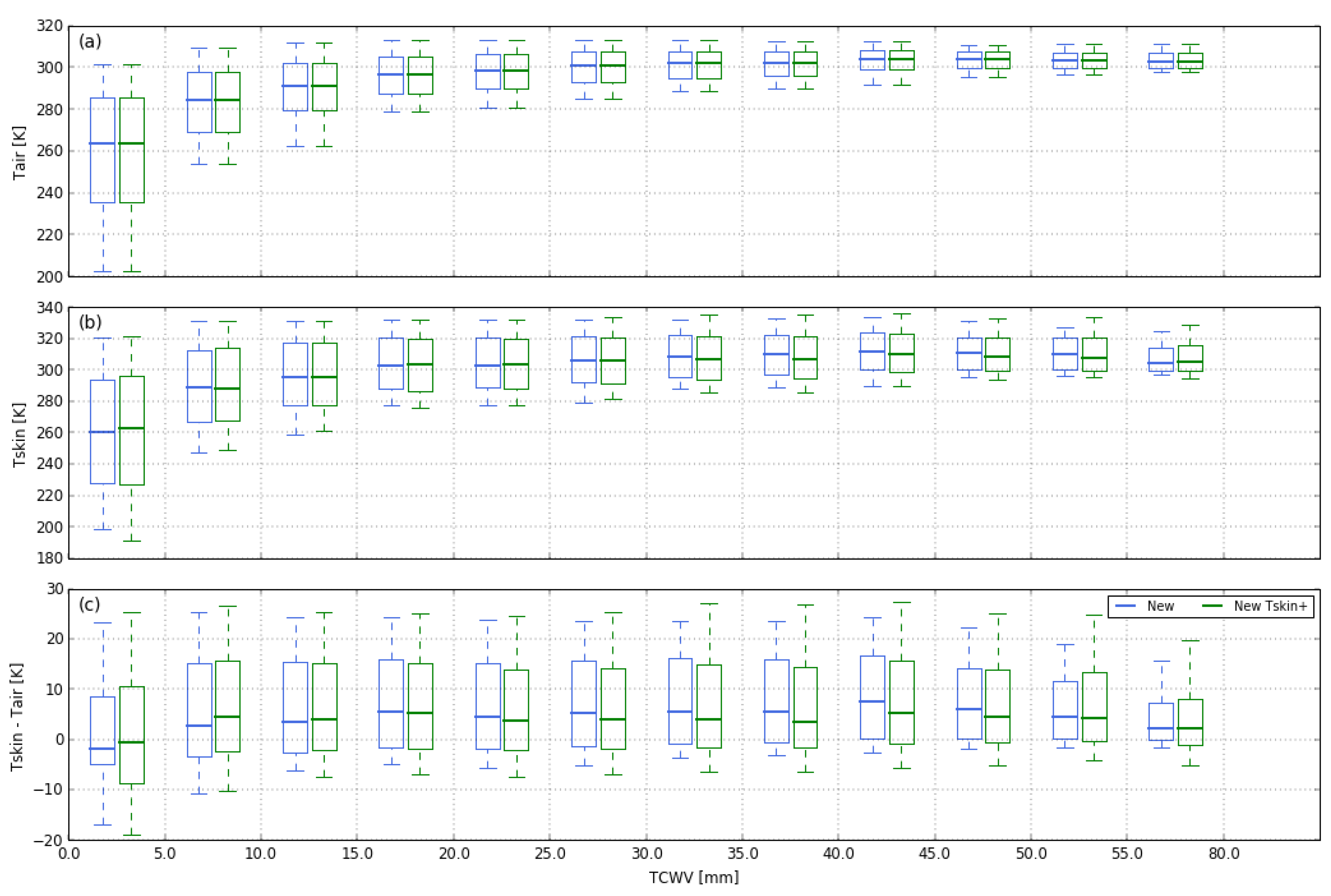
by
Sofia L. Ermida
1,2,* and
Isabel F. Trigo
1,2
1
Instituto Português do Mar e da Atmosfera (IPMA), 1749-077 Lisboa, Portugal
2
Instituto Dom Luiz (IDL), Faculdade de Ciências, Universidade de Lisboa, 1749-016 Lisboa, Portugal
*
Author to whom correspondence should be addressed.
Remote Sens. 2022, 14(10), 2329; https://doi.org/10.3390/rs14102329
Submission received: 15 February 2022 / Revised: 25 March 2022 / Accepted: 6 May 2022 / Published: 11 May 2022
(This article belongs to the Special Issue Remote Sensing Monitoring of Land Surface Temperature (LST) II)

Abstract

Land surface temperature is linked to a wide range of surface processes. Given the increased development of earth observation systems, a large effort has been put into advancing land surface temperature retrieval algorithms from remote sensors. Due to the very limited number of reliable in situ observations matching the spatial scales of satellite observations, algorithm development relies on synthetic databases, which then constitute a crucial part of algorithm development. Here we provide a database of atmospheric profiles and respective surface conditions that can be used to train and verify algorithms for land surface temperature retrieval, including machine learning techniques. The database was built from ERA5 data resampled through a dissimilarity criterion applied to the temperature and specific humidity profiles. This criterion aims to obtain regular distributions of these variables, ensuring a good representation of all atmospheric conditions. The corresponding vertical profiles of ozone and relevant surface and vertically integrated variables are also included in the dataset. Information on the surface conditions (i.e., temperature and emissivity) was complemented with data from a wide array of satellite products, enabling a more realistic surface representation. The dataset is freely available online at Zenodo.
Keywords: land surface temperature; calibration database; training database; atmospheric profiles; algorithm calibration land surface temperature; calibration database; training database; atmospheric profiles; algorithm calibration

