Next Issue
Volume 97, Eurosensors 2023
Previous Issue
Volume 95, AHRG Meeting 2022
 
 
proceedings-logo

Journal Browser

Journal Browser

Proceedings, 2024, UQ 2022

Una Quantum 2022: Open Source Technologies for Cultural Heritage, Cultural Activities and Tourism

Rome, Italy | 15–16 December 2022

Volume Editors:
Gabriele Ciccone, University of Rome Tor Vergata, Italy
Giuseppe Guarino, University of Bologna, Italy

Number of Papers: 17
  • Issues are regarded as officially published after their release is announced to the table of contents alert mailing list.
  • You may sign up for e-mail alerts to receive table of contents of newly released issues.
  • PDF is the official format for papers published in both, html and pdf forms. To view the papers in pdf format, click on the "PDF Full-text" link, and use the free Adobe Reader to open them.
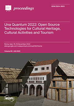
Cover Story (view full-size image): On 15 and 16 December 2022, the Sala della Fortuna of the National Etruscan Museum at Villa Giulia in Rome hosted the second edition of the conference Una Quantum 2022: Open Source Technologies for [...] Read more.
Order results
Result details
Select all
Export citation of selected articles as:

Other

8 pages, 1653 KiB  
Proceeding Paper
Spatial Archaeology: Remote Sensing for the Study and Preservation of Cultural Heritage through Open Data and FLOSS Tools
by Giuseppe Guarino and Alessia Brucato
Proceedings 2024, 96(1), 1; https://doi.org/10.3390/proceedings2024096001 - 01 Mar 2024
Viewed by 486
Abstract
This paper focuses on a preliminary space-based detection protocol to identify proxy indicators useful to assess a specific threat to the archaeological heritage: quarry development. This research used diverse open-access satellite repositories offered by space programs such as Copernicus and, as case studies, [...] Read more.
This paper focuses on a preliminary space-based detection protocol to identify proxy indicators useful to assess a specific threat to the archaeological heritage: quarry development. This research used diverse open-access satellite repositories offered by space programs such as Copernicus and, as case studies, analyzed two inland highland sites in Sicily (Italy). All images were processed with filters, algorithms, and routines in free Open-Source software such as QGIS 3.34.0 and cloud computing platforms like Google Earth Engine. The results of the classification were validated with statistical accuracy techniques. Full article
Show Figures

Figure 1

8 pages, 10273 KiB  
Proceeding Paper
Discovering and Recording Archaeological Features during a Survey Using an Unmanned Aerial Vehicle and QField: Application and Integration for Studying the Countryside Surrounding Perugia, Umbria (Italy)
by Alessia Mandorlo
Proceedings 2024, 96(1), 2; https://doi.org/10.3390/proceedings2024096002 - 04 Mar 2024
Viewed by 323
Abstract
One of the uses of Unmanned Aerial Vehicles (UAVs)—also known as drones—in archaeology is aerial reconnaissance, and they are usually used to detect and record the features of archaeological sites. This article focuses on the application and integration of drones with surveys supported [...] Read more.
One of the uses of Unmanned Aerial Vehicles (UAVs)—also known as drones—in archaeology is aerial reconnaissance, and they are usually used to detect and record the features of archaeological sites. This article focuses on the application and integration of drones with surveys supported using a mobile GIS (QField). The research results presented herein concern an area of the northeastern countryside of the city of Perugia, in the Upper Tiber Valley. Field walking was carried out in 2020/2021. The information contained in this article has been organized and elaborated in a GIS environment (Qgis) to produce archaeological cartography. Full article
Show Figures

Figure 1

9 pages, 214 KiB  
Proceeding Paper
Resources, Opportunities and Limits of Data and Open Source Tools Used in Preventive Archaeology
by Alessandro Vanzetti and Sara Marino
Proceedings 2024, 96(1), 3; https://doi.org/10.3390/proceedings2024096003 - 07 Mar 2024
Viewed by 544
Abstract
Open resources are increasingly used in preventive archaeology, following a more general trend in society, with a useful and effective impact for this task. In fact, on the one hand, we are witnessing the definition of standards increasingly devoted to open source access [...] Read more.
Open resources are increasingly used in preventive archaeology, following a more general trend in society, with a useful and effective impact for this task. In fact, on the one hand, we are witnessing the definition of standards increasingly devoted to open source access by the direct decision of the Ministry of Culture, effective both at a central and peripheral level, in order to guarantee standardization and interoperability in data management. On the other hand, in the preliminary archaeological risk assessment phase, the use of contextual data—cartography, remote images, datasets, etc.—which increasingly populate the open source repositories of the web, is necessary, but not always obvious to recover. The use of open source resources in preventive archaeology must be improved, as sometimes they are employed at an insufficient definition. What are the opportunities ahead, but also the main limitations that have not yet been overcome? Full article
4 pages, 170 KiB  
Proceeding Paper
SH.AR.P.P. (SHared ARcheological Platform for Prehistory): New Perspectives for the Project
by Claudia Sabbini, Varinia Nardi, Saverio Giulio Malatesta and Luca Di Bianco
Proceedings 2024, 96(1), 4; https://doi.org/10.3390/proceedings2024096004 - 13 Mar 2024
Viewed by 297
Abstract
SH.AR.P.P. is a project conceived by the Digilab Research Centre of Sapienza University as a tool against the fragmentation of archaeological data for inquiry and the generalized public disregard toward the prehistory of the Italian Peninsula in favor of more recent and impressive [...] Read more.
SH.AR.P.P. is a project conceived by the Digilab Research Centre of Sapienza University as a tool against the fragmentation of archaeological data for inquiry and the generalized public disregard toward the prehistory of the Italian Peninsula in favor of more recent and impressive evidence. This article reports updates on the project since its presentation, focusing on technical solutions to widespread issues featuring open-access tools, database building, sharing raw data at different levels, and user-friendliness for both developers and final users. Full article
5 pages, 1731 KiB  
Proceeding Paper
Integrated Digital Survey: The Roman Amphitheater of Suasa (Castelleone di Suasa, AN)
by Francesca Bindelli and Alessandro Campedelli
Proceedings 2024, 96(1), 5; https://doi.org/10.3390/proceedings2024096005 - 13 Mar 2024
Viewed by 253
Abstract
This paper discusses an experience developed as part of the 2021 Topographic Survey Workshop, organized by the Department of Cultural Heritage of Ravenna (University of Bologna) in the Roman city of Suasa (Castelleone di Suasa, AN), during which the potential of integrating photogrammetric [...] Read more.
This paper discusses an experience developed as part of the 2021 Topographic Survey Workshop, organized by the Department of Cultural Heritage of Ravenna (University of Bologna) in the Roman city of Suasa (Castelleone di Suasa, AN), during which the potential of integrating photogrammetric and laser scanner surveys was explored in order to geometrically and morphologically characterize the remains of the Roman amphitheater. Full article
Show Figures

Figure 1

5 pages, 793 KiB  
Proceeding Paper
A Workflow for the 3D Reconstruction of a Late Antique Villa: The Case Study of the Villa Dei Vetti
by Francesco D’Antoni
Proceedings 2024, 96(1), 6; https://doi.org/10.3390/proceedings2024096006 - 13 Mar 2024
Viewed by 282
Abstract
In recent years, 3D reconstruction has become an indispensable tool for archaeological research. 3D modeling software makes it possible to bring together and visualize different interpretative hypotheses simultaneously and to pose new questions that otherwise would not have emerged. The aim of this [...] Read more.
In recent years, 3D reconstruction has become an indispensable tool for archaeological research. 3D modeling software makes it possible to bring together and visualize different interpretative hypotheses simultaneously and to pose new questions that otherwise would not have emerged. The aim of this paper is to expose the process that, starting from the acquisition of the raw data, led to the volumetric reconstruction of a hexagonal-shaped building and a private bath belonging to the pars urbana of the villa of the Vetti, a Late Antique residential complex identified in the municipality of Capraia and Limite (Florence, Italy). Full article
Show Figures

Figure 1

6 pages, 1748 KiB  
Proceeding Paper
The Enhancement of Mummies as a Pull Factor for the Audience: An Analysis between Brand Management and Territorial Tourism Promotion in Italy
by Roberta Manzollino, Laura Leopardi, Edoardo Baiocchi and Saverio Giulio Malatesta
Proceedings 2024, 96(1), 7; https://doi.org/10.3390/proceedings2024096007 - 13 Mar 2024
Viewed by 270
Abstract
Human mummies can often emotionally impact several people and affect the enhancement of territories. A new audience was born through the evolution of cultural tourism, as an example, in the case of the pop culture or fandom market, where tourism flows are aimed [...] Read more.
Human mummies can often emotionally impact several people and affect the enhancement of territories. A new audience was born through the evolution of cultural tourism, as an example, in the case of the pop culture or fandom market, where tourism flows are aimed at the research of specific emotional experiences that are concentrated on literature or cinematic interests. Another revolution in the tourist industry is connected to the disputable case of dark tourism when the concept of travel meets the death topic. Human mummification catches both the abovementioned topics, and it may assign new forms and scopes in a typical schematic of geographic contests in territory enhancement. Full article
Show Figures

Figure 1

3 pages, 401 KiB  
Proceeding Paper
AI and Custom Marketing for Cultural Initiatives in Regional Projects: Perspectives on the Territorial Integration of Communities with Tourism
by Mariflora Caruso, Laura Leopardi and Saverio Giulio Malatesta
Proceedings 2024, 96(1), 8; https://doi.org/10.3390/proceedings2024096008 - 13 Mar 2024
Viewed by 285
Abstract
This poster delves into the integration of Artificial Intelligence (AI) with both the marketing and cultural heritage realms. By examining case studies, we elucidate AI’s pivotal role in personalizing consumer experiences within marketing. In the domain of cultural heritage, AI is instrumental in [...] Read more.
This poster delves into the integration of Artificial Intelligence (AI) with both the marketing and cultural heritage realms. By examining case studies, we elucidate AI’s pivotal role in personalizing consumer experiences within marketing. In the domain of cultural heritage, AI is instrumental in crafting bespoke experiences, such as the “Hermes—a trip as you like it” project. By utilizing AI algorithms, this initiative tailors customized itineraries for visitors based on data analysis and user input. This approach aims to predict and meet individual preferences, redefining engagement and outreach strategies in cultural settings. Full article
Show Figures

Figure 1

7 pages, 192 KiB  
Proceeding Paper
Digitization of Archival Data and Metadata in Archaeology: The Case of Ancona
by Eleonora Iacopini
Proceedings 2024, 96(1), 9; https://doi.org/10.3390/proceedings2024096009 - 11 Mar 2024
Viewed by 243
Abstract
During the development of the digital archaeological map of the city of Ancona, in the Marche region, around 12,000 files were digitized relating to the documents associated with the individual archaeological contexts, coming from the administrative archive, the historical archive, the drawing archive, [...] Read more.
During the development of the digital archaeological map of the city of Ancona, in the Marche region, around 12,000 files were digitized relating to the documents associated with the individual archaeological contexts, coming from the administrative archive, the historical archive, the drawing archive, excavation diaries, and all of the scientific documentation associated with them. Given the amount of data and their importance from an information point of view, to prevent them from remaining as “silent” documents, it was envisaged to associate each of them with a metadata system based on the Dublin Core Metadata Initiative (DCMI) standard. Full article
7 pages, 219 KiB  
Proceeding Paper
Digital Humanities and Artificial Intelligence: An Accelerationist Perspective of the Future
by Mariflora Caruso and Alessandro Spadaro
Proceedings 2024, 96(1), 10; https://doi.org/10.3390/proceedings2024096010 - 14 Mar 2024
Viewed by 334
Abstract
Data science, deep learning, artificial intelligence, and automation processes are becoming increasingly central in most research fields and promise significant developments in each of them. For some time now, their paradigms have also entered the field of digital humanities and archaeology. However, there [...] Read more.
Data science, deep learning, artificial intelligence, and automation processes are becoming increasingly central in most research fields and promise significant developments in each of them. For some time now, their paradigms have also entered the field of digital humanities and archaeology. However, there is still a lack of ethical and disciplinary reflection among scholars and professionals about the current state of the art and the consequences it is already having, and especially the ones it could have in the future. This contribution aims to create a moment of reflection and proposals in this regard. Full article
10 pages, 8997 KiB  
Proceeding Paper
Using QGIS as an Ideal Workspace for Archaeogeography: A Case Study on Castronovo di Sicilia
by Gabriele Ciccone
Proceedings 2024, 96(1), 11; https://doi.org/10.3390/proceedings2024096011 - 12 Mar 2024
Viewed by 234
Abstract
During the Ph.D. project titled Flying off-site: new investigation methodologies for the analysis of historical landscapes, QGIS was used as a workspace for the archaeogeographical analysis of the territory of Castronovo di Sicilia (PA). The interaction between native applications and plug-ins developed by [...] Read more.
During the Ph.D. project titled Flying off-site: new investigation methodologies for the analysis of historical landscapes, QGIS was used as a workspace for the archaeogeographical analysis of the territory of Castronovo di Sicilia (PA). The interaction between native applications and plug-ins developed by third parties showed that this software is the ideal environment for a complete archaeogeographical analysis, as it can integrate archaeological and geographical information of different types. The possibility of using a single software not only reduces research costs and time but also allows for new data to be obtained and a holistic approach to be applied to analyzed landscape Full article
Show Figures

Figure 1

8 pages, 5879 KiB  
Proceeding Paper
How Far Down? Interdisciplinary Discussions and Multimodal Investigations to Understand the Potential of Multispectral Remote Sensing
by Filippo Materazzi
Proceedings 2024, 96(1), 12; https://doi.org/10.3390/proceedings2024096012 - 19 Mar 2024
Viewed by 352
Abstract
“How far down can it see?” is one of the typical questions when it comes to UAV multispectral remote sensing for archaeology. Since the identification of buried remains is indirect through cropmarks observation, we asked ourselves how deep cropmarks can reveal the buried [...] Read more.
“How far down can it see?” is one of the typical questions when it comes to UAV multispectral remote sensing for archaeology. Since the identification of buried remains is indirect through cropmarks observation, we asked ourselves how deep cropmarks can reveal the buried remains by analysing the complex relationship they have with vegetation. A selected number of contexts of the pre-Roman cities from Falerii and Veii have been studied through agronomic analysis on the one hand and GPR and stratigraphic excavation on the other. The results confirmed the effectiveness of this methodology for land survey, and not only do they demonstrate the ability to identify remains at a greater depth than might have been expected, but they have also made evident the difficulties of environmental analysis, which is crucial at the start of any remote sensing campaign, as well as in the subsequent study of anomalies. Full article
Show Figures

Figure 1

5 pages, 957 KiB  
Proceeding Paper
X-ray Analysis, Photogrammetry and Virtual Reality for the Study and Enhancement of Archaeological Contexts: A Case Study from the Necropolis of Crustumerium
by Roberta Manzollino, Saverio Giulio Malatesta, Paolo Rosati, Marco Raoul Marini, Marcello Colapietro and Ombretta Tarquini
Proceedings 2024, 96(1), 13; https://doi.org/10.3390/proceedings2024096013 - 20 Mar 2024
Viewed by 405
Abstract
In this paper, we present the application of established methodologies to innovatively investigate a soil block containing a human skeleton and metal artefacts (VII century BC) from the necropolis of Crustumerium near Rome. The chemical composition was investigated using X-ray analysis, and digital [...] Read more.
In this paper, we present the application of established methodologies to innovatively investigate a soil block containing a human skeleton and metal artefacts (VII century BC) from the necropolis of Crustumerium near Rome. The chemical composition was investigated using X-ray analysis, and digital acquisition was conducted for dissemination and enhancement purposes. This case study aims to show how the combination of virtual techniques (i.e., virtual anthropology and virtual reality) and X-ray imaging (XRI) can be useful tools for the study and communication of both ancient human remains and archaeological artefacts, especially when it is not possible to move and handle a fragile one. Full article
Show Figures

Figure 1

8 pages, 5530 KiB  
Proceeding Paper
Opening Up the Sea: A Novel Methodological Approach to Display Mediterranean Shoreline Evolution
by Augusto Palombini, Giulio Lucarini, Paolo Rosati and Crescenzo Violante
Proceedings 2024, 96(1), 14; https://doi.org/10.3390/proceedings2024096014 - 25 Mar 2024
Viewed by 353
Abstract
This paper presents a methodological proposal in order to use marine geology data on sea level change through time, to reach an effective display of shoreline evolution in a form easily suitable by archaeologists, taking into account the need of reliable DEMs and [...] Read more.
This paper presents a methodological proposal in order to use marine geology data on sea level change through time, to reach an effective display of shoreline evolution in a form easily suitable by archaeologists, taking into account the need of reliable DEMs and hypothetical ancient sea surfaces. The technical aspects and steps of the process are explained, so as to present a possible approach proposal for any area or chronological phase exclusively on the basis of open source software and freely available data. Full article
Show Figures

Figure 1

8 pages, 1550 KiB  
Proceeding Paper
Archaeobotany and Bioanthropology: The Potential of VR and 3D Printing in the Enhancement of Archaeological Organic Remains
by Roberta Manzollino, Giulia Chellini, Paola La Torre, Saverio Giulio Malatesta, Marco Raoul Marini and Claudia Moricca
Proceedings 2024, 96(1), 15; https://doi.org/10.3390/proceedings2024096015 - 27 Mar 2024
Viewed by 406
Abstract
The term bioarchaeology refers to the study of archaeological remains of organic origin, including human and botanical remains, which are highly informative for reconstructing past human–environment relationships. However, they are not very tangible, either because of ethical issues or their reduced size. Using [...] Read more.
The term bioarchaeology refers to the study of archaeological remains of organic origin, including human and botanical remains, which are highly informative for reconstructing past human–environment relationships. However, they are not very tangible, either because of ethical issues or their reduced size. Using novel technologies, such as modeling, 3D printing, and virtual reality, these remains have been made accessible, manipulable, and inclusive. The objective of this work is the technological enhancement of bioarchaeological remains through the development of an innovative, non-destructive, non-invasive, and reproducible protocol. In this way, more effective dissemination of the information obtained from studying these materials is possible, making them more accessible to different audiences. Full article
Show Figures

Figure 1

2715 KiB  
Proceeding Paper
The Website of the Archaeological Museum in Collelongo (AQ)—An Example of Sustainable Technological Development
by Priamo Antonio Manna, Eloisa Casadei, Martina Frau and Valerio De Luca
Proceedings 2024, 96(1), 16; https://doi.org/10.3390/proceedings2024096016 - 20 Mar 2024
Viewed by 194
Abstract
The project, developed by a team of Una Quantum, consists of the digital renovation of the Archaeological Civic Museum of the Municipality of Collelongo (AQ) through the realisation of its website. The action plan aimed to highlight the essential role of open software [...] Read more.
The project, developed by a team of Una Quantum, consists of the digital renovation of the Archaeological Civic Museum of the Municipality of Collelongo (AQ) through the realisation of its website. The action plan aimed to highlight the essential role of open software and open workflow in the field of cultural heritage research and management, focusing on the use of programmes for 3D reconstruction, the creation of virtual tours and GIS (geographical information system) and WebGIS software (LeafletJS V.1.7.1). The website is structured using a modern and dynamic user-friendly interface which is subdivided into three main sections: the virtual tour, the online catalogue and web maps. Full article
Show Figures

Figure 1

9 pages, 1145 KiB  
Proceeding Paper
Reverse Archaeology: A New Method
by Paolo Rosati
Proceedings 2024, 96(1), 17; https://doi.org/10.3390/proceedings2024096017 - 17 Apr 2024
Viewed by 236
Abstract
Reverse Archaeology is a digital method useful for rebuilding an old excavation from its documentation. It mainly involves passing data from analogical sheets to digital feature/tables or from older sources to new and open-source formats. The idea for this paper came from the [...] Read more.
Reverse Archaeology is a digital method useful for rebuilding an old excavation from its documentation. It mainly involves passing data from analogical sheets to digital feature/tables or from older sources to new and open-source formats. The idea for this paper came from the Una Quantum 2021 conference, specifically from the writing of the paper presented with Agnese Vacca at that same conference. What will be presented in this paper is a new assessment, with some other examples and a larger theoretical support, toward the creation of a community and a practical manual. Full article
Back to TopTop