Next Issue
Volume 13, February
Previous Issue
Volume 12, December


Land, Volume 13, Issue 1 (January 2024) – 123 articles

Cover Story (view full-size image): 
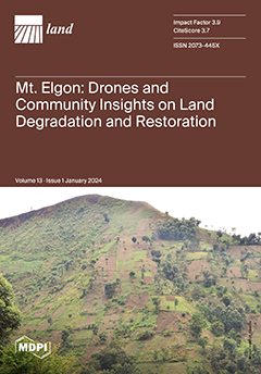
Natural landscapes are susceptible to rapidly and slowly occurring environmental changes due to human–land interactions. We employed drone mapping and community insights (household surveys (n = 499), FGDs, and interviews) to assess land use changes, degradation, and restoration in Mount Elgon, Uganda, from 2020 to 2023. Results show that agriculture and planted forest were dominant, replacing tropical high forest, bushland, and grassland. Smallholder subsistence farming is leading to degradation (soil erosion, landslides, and encroachment). Trenches were the most widely adopted restoration measure, though they varied by location and crop type. Trenches, grass strips, and afforestation are adopted for restoration. Diversified livelihoods and collaboration are crucial for enforcing conservation in Mt. Elgon. View this paper
  • Issues are regarded as officially published after their release is announced to the table of contents alert mailing list.
  • You may sign up for e-mail alerts to receive table of contents of newly released issues.
  • PDF is the official format for papers published in both, html and pdf forms. To view the papers in pdf format, click on the "PDF Full-text" link, and use the free Adobe Reader to open them.
Order results
Result details
Section
Select all
Export citation of selected articles as:
22 pages, 7532 KiB  
Article
Evaluating Spatial Coverage of the Greater Sage-Grouse Umbrella to Conserve Sagebrush-Dependent Species Biodiversity within the Wyoming Basins
by Cameron L. Aldridge, D. Joanne Saher, Julie A. Heinrichs, Adrian P. Monroe, Matthias Leu and Steve E. Hanser
Land 2024, 13(1), 123; https://doi.org/10.3390/land13010123 - 22 Jan 2024
Viewed by 1194
Abstract
Biodiversity is threatened due to land-use change, overexploitation, pollution, and anthropogenic climate change, altering ecosystem functioning around the globe. Protecting areas rich in biodiversity is often difficult without fully understanding and mapping species’ ecological niche requirements. As a result, the umbrella species concept [...] Read more.
Biodiversity is threatened due to land-use change, overexploitation, pollution, and anthropogenic climate change, altering ecosystem functioning around the globe. Protecting areas rich in biodiversity is often difficult without fully understanding and mapping species’ ecological niche requirements. As a result, the umbrella species concept is often applied, whereby conservation of a surrogate species is used to indirectly protect species that occupy similar ecological communities. One such species is the greater sage-grouse (Centrocercus urophasianus), which has been used as an umbrella to conserve other species within the sagebrush (Artemisia spp.) ecosystem. Sagebrush-steppe ecosystems within the United States have experienced drastic loss, fragmentation, and degradation of remaining habitat, threatening sagebrush-dependent fauna, resulting in west-wide conservation efforts to protect sage-grouse habitats, and presumably other sagebrush wildlife. We evaluated the effectiveness of the greater sage-grouse umbrella to conserve biodiversity using data-driven spatial occupancy and abundance models for seven sagebrush-dependent (obligate or associated) species across the greater Wyoming Basins Ecoregional Assessment (WBEA) area (345,300 km2) and assessed overlap with predicted sage-grouse occurrence. Predicted sage-grouse habitat from empirical models only partially (39–58%) captured habitats identified by predicted occurrence models for three sagebrush-obligate songbirds and 60% of biodiversity hotspots (richness of 4–6 species). Sage-grouse priority areas for conservation only captured 59% of model-predicted sage-grouse habitat, and only slightly fewer (56%) biodiversity hotspots. We suggest that the greater sage-grouse habitats may be partially effective as an umbrella for the conservation of sagebrush-dependent species within the sagebrush biome, and management actions aiming to conserve biodiversity should directly consider the explicit mapping of resource requirements for other taxonomic groups. Full article
Show Figures

Figure 1

15 pages, 11349 KiB  
Article
Spatial Optimization and Temporal Changes in the Ecological Network: A Case Study of Wanning City, China
by Shisi Zou, Rong Fan and Jian Gong
Land 2024, 13(1), 122; https://doi.org/10.3390/land13010122 - 22 Jan 2024
Viewed by 825
Abstract
Ecological networks serve as vital tools for safeguarding biodiversity and ensuring regional ecological stability. This study, conducted in Wanning City, employs minimum-area threshold analysis to pinpoint crucial ecological sources while extracting potential ecological corridors using the minimum cumulative resistance model. Our investigation delves [...] Read more.
Ecological networks serve as vital tools for safeguarding biodiversity and ensuring regional ecological stability. This study, conducted in Wanning City, employs minimum-area threshold analysis to pinpoint crucial ecological sources while extracting potential ecological corridors using the minimum cumulative resistance model. Our investigation delves into the ecological network’s elements and structural transformations within Wanning City, spanning the period from 2000 to 2020, and assesses the priorities for ecological network preservation. The findings of our research reveal noteworthy spatial disparities in the distribution of ecological sources across Wanning City. Furthermore, the ecological corridors display sparse patterns in the north and denser patterns in the south. Over the two decades from 2000 to 2020, Wanning’s ecological resources exhibited a discernible trend of contraction and fragmentation, accompanied by an uneven spatial distribution. The average path length of the ecological corridors has increased, indicative of reduced biological flow efficiency. Correspondingly, the structural accessibility of the ecological network has decreased, signifying a decline in landscape connectivity. Based on our analysis, we propose an ecological protection and restoration framework denoted as “One Belt, Four Sources, Eight districts, multiple corridors, and multiple points”. Therefore, with the Shangxi–Jianling, Liulianling, Nanlin, and Jiexin nature reserves as the core area, and Houan Town, Damao Town, Changfeng Town, and Liji Town as the key restoration areas, we have proposed an ecological protection and restoration pattern. Full article
Show Figures

Figure 1

15 pages, 6642 KiB  
Article
Spatial Optimization Based on the Trade-Off between Ecosystem Conservation and Opportunity Cost of Tarim National Park in Xinjiang, China
by Xinyuan Zhang, Lu Zhang and Zhiming Zhang
Land 2024, 13(1), 121; https://doi.org/10.3390/land13010121 - 22 Jan 2024
Viewed by 659
Abstract
National parks (NPs) are the flagship protected areas in China’s conservation network and play a key role in the ecological protection of core objects and important natural landscapes. However, the shortage of spatial optimization methods based on quantitative indicators has limited the spatially [...] Read more.
National parks (NPs) are the flagship protected areas in China’s conservation network and play a key role in the ecological protection of core objects and important natural landscapes. However, the shortage of spatial optimization methods based on quantitative indicators has limited the spatially explicit identification of national parks. Therefore, in this study, we selected the main area of the Tarim River (MTR) in Xinjiang as an example to optimize the spatial boundary of a national park. We constructed an evaluation system based on representativeness, ecological importance, and the foundation of the existing protected area. Subsequently, we comprehensively employed a species distribution model to simulate the habitat of the primary conservation targets. Additionally, we spatially optimized the region using an integer linear model, considering multiple scenarios. The results of this study show that fewer than 30% of the existing protected areas in the MTR protect conservation objects. Using different protection objects and quantitative goals, the spatial optimization results for the eight protection scenarios show that the most effective national park establishment scenario covers a total area of 15,009.3 km2, which is 8157.5 km2 more than the protected area already in place and would include the Tarim Populus National Nature Reserve and Luntai Tarim Populus Forest Park. The opportunity cost to be paid for protection according to this boundary is approximately USD 115.14 million. The protection ratios of each protection object for the expanded park are more than 50%, which is 27.7% higher than the protection effect produced by the existing protected area, so we recommend that Tarim National Park be set up on the basis of this boundary. Full article
Show Figures

Figure 1

15 pages, 2166 KiB  
Article
A Structural Analysis of the Economic Impact of Tourism and the Perspective of Tourism Providers in Kuélap, Peru
by Franklin Omar Zavaleta Chavez Arroyo, Alex Javier Sánchez Pantaleón, Carlos Enrique Aldea Roman, Rosse Marie Esparza-Huamanchumo and José Álvarez-García
Land 2024, 13(1), 120; https://doi.org/10.3390/land13010120 - 22 Jan 2024
Viewed by 1623
Abstract
Tourism boosts the regional economy and encompasses various sectors that determine its potential, promoting economic, environmental and social development by generating the creation of small and medium-sized enterprises and employment, thus improving people’s quality of life. In this context, an analysis of the [...] Read more.
Tourism boosts the regional economy and encompasses various sectors that determine its potential, promoting economic, environmental and social development by generating the creation of small and medium-sized enterprises and employment, thus improving people’s quality of life. In this context, an analysis of the structural changes in the number of visitors to the Kuélap archaeological site in the region of Amazonas, Peru was conducted. The closure of the Kuélap Monumental Archaeological Zone was selected as the object of analysis since the Kuélap archaeological site constitutes the most prominent tourist resource in the department of Amazonas and is the main attraction for tourists to visit. This study was carried out by using an analytical and descriptive approach, with a non-experimental longitudinal and cross-sectional design. Data from the Ministry of Foreign Trade and Tourism (MINCETUR) were used, and the perspective of tourism providers by means of a survey applied to a sample of 83 entrepreneurs in Chachapoyas, Tingo and La Malca was analysed. The results show that the implementation of cable cars in Kuélap has had a positive impact of 54% on sales and employment, while the COVID-19 pandemic has had a negative impact of 81%. On the other hand, the closure of the archaeological site has had a negative impact of 52%. Any negative impact on the Kuélap archaeological site resulted in a slowdown in the regional economy. In conclusion, from the point of view of visitor records and the perspective of tourism providers regarding structural changes, social impact is reflected in different economic sectors and, therefore, in the development of the local and regional economy. It is essential to consider these aspects when making decisions and developing strategies to promote tourism in the region in order to improve the quality of life of its residents (social, economic and cultural well-being). Full article
(This article belongs to the Section Land, Biodiversity, and Human Wellbeing)
Show Figures

Figure 1

25 pages, 1036 KiB  
Article
Spatial Spillover Effects of “New Farmers” on Diffusion of Sustainable Agricultural Practices: Evidence from China
by Min Liu, Taiyang Zhong and Xiao Lyu
Land 2024, 13(1), 119; https://doi.org/10.3390/land13010119 - 22 Jan 2024
Cited by 1 | Viewed by 1009
Abstract
Sustainable agricultural development has been the policy priority for countries with limited natural resources. New farmers’ emergence and growth have not only helped to address the labor crisis in agriculture to some extent, but they have also improved, integrated, and expanded the agricultural [...] Read more.
Sustainable agricultural development has been the policy priority for countries with limited natural resources. New farmers’ emergence and growth have not only helped to address the labor crisis in agriculture to some extent, but they have also improved, integrated, and expanded the agricultural sectors. However, less attention has been paid to the performance of new farmers in adopting sustainable agricultural practices and the related spatial effects. Also, few studies have combined the composite adoption intensity of sustainable agricultural practices with the effects of various specific measures. Therefore, this study constructed the Tobit MLE spatial cross-section regression models to empirically study a sample of 174 farmers. We attempted to analyze the impact of the new farmers group on the diffusion of sustainable agricultural practices as well as farmers’ influence on various sorts of sustainable agricultural practices. The results show that new farmers greatly enhanced the adoption of sustainable agricultural practices, as evidenced by the fact that their adoption level was 69.9% greater than that of traditional farmers. However, they had statistically significant negative spillover effects on their neighboring farmers. For the composite adoption intensity of sustainable agricultural practices, there were also statistically significant negative spillover effects. Additionally, there were notable disparities among the factors influencing farmers’ decisions to adopt various types of sustainable agricultural practices and the spatial effects of those adoptions, particularly in the farm size, the number of plots, and the variety of marketing methods employed by farmers. Therefore, measures need to be proposed to address the barriers to the implementation and diffusion of various types of sustainable agricultural practices. This would increase farmers’ willingness to adopt sustainable agricultural practices and the effectiveness of their motivation to neighboring farmers. Full article
(This article belongs to the Section Water, Energy, Land and Food (WELF) Nexus)
Show Figures

Figure 1

21 pages, 10311 KiB  
Article
Spatio-Temporal Relationship between Land Use Carbon Emissions and Ecosystem Service Value in Guanzhong, China
by Ruijie Zhang, Kanhua Yu and Pingping Luo
Land 2024, 13(1), 118; https://doi.org/10.3390/land13010118 - 22 Jan 2024
Viewed by 841
Abstract
In the context of escalating global concerns for “carbon neutrality and peak carbon” and the urgent need for ecological conservation, deciphering the spatiotemporal interactions between carbon emissions and the ecosystem service value (ESV) in relation to land use changes becomes critically significant. Identifying [...] Read more.
In the context of escalating global concerns for “carbon neutrality and peak carbon” and the urgent need for ecological conservation, deciphering the spatiotemporal interactions between carbon emissions and the ecosystem service value (ESV) in relation to land use changes becomes critically significant. Identifying areas to bolster ecosystem services and curtail carbon emissions, especially within the Guanzhong urban agglomeration, is crucial for advancing sustainable and low-carbon regional development. The study focuses on the urban agglomeration of Guanzhong, using land use and socio-economic data from three periods between 2010 and 2020. Methods such as grid analysis and bivariate spatial autocorrelation models are employed to explore the temporal and spatial evolution characteristics and interaction patterns of carbon emissions and ESV in relation to land use. The findings reveal: (1) during 2010–2020, the Guanzhong urban agglomeration experienced varied transitions in land use types, marked by a significant net decrease in arable land and net increases in grasslands and urban construction areas. (2) The ESV in the Guanzhong urban agglomeration witnessed a consistent rise, exhibiting a spatial distribution pattern with higher values in the southwest and lower in the northeast. Among the categorized ecosystem service functions, services related to hydrological and climate regulation stood out. (3) The Guanzhong urban agglomeration observed an average annual growth rate of 5.03% in carbon emissions due to land use, with a spatial trend that was higher in the center and tapered towards the periphery. Predominant carbon sources included arable lands and urban construction areas, while forests accounted for 94% of carbon sequestration. (4) A pronounced negative correlation between the ESV and carbon emissions was discerned in Guanzhong. Regions with a stronger correlation were primarily centered in Guanzhong, notably around Xi’an and Baoji. The results emphasize the pivotal role of the primary sector’s qualitative development in harmonizing the ESV and carbon emission dynamics in the Guanzhong urban agglomeration. This research provides valuable insights for optimizing land resource management, aligned with the rural revitalization strategy, streamlining carbon dynamics, bolstering ESV, augmenting carbon sequestration efficiency, and guiding ecological spatial planning. Full article
(This article belongs to the Section Land Environmental and Policy Impact Assessment)
Show Figures

Figure 1

17 pages, 4773 KiB  
Article
How Semi-Urbanisation Drives Expansion of Rural Construction Land in China: A Rural-Urban Interaction Perspective
by Yang Wang, Chengchao Zuo and Mengke Zhu
Land 2024, 13(1), 117; https://doi.org/10.3390/land13010117 - 21 Jan 2024
Viewed by 900
Abstract
The expansion of rural construction land in China has led to ecological consequences under the context of rural depopulation, despite government land use controls. While previous studies have investigated the local factors contributing to the expansion of rural construction land, the semi-urbanisation of [...] Read more.
The expansion of rural construction land in China has led to ecological consequences under the context of rural depopulation, despite government land use controls. While previous studies have investigated the local factors contributing to the expansion of rural construction land, the semi-urbanisation of urban immigrants distant from rural areas has received less attention. To better understand the connections between the semi-urbanisation in the urban areas and the construction land expansion in rural areas, this study constructed a network/spatial lag of N/X (N/SLX) model that incorporated the network lagged term of the socio-economic traits of semi-urbanised migrants to analyse how urban semi-urbanisation influenced rural construction land. Our findings suggest that both the income of rural-urban migrants and the difficulty of obtaining urban household registration are positively correlated with the expanding extent of rural construction land. Conversely, the living expenses of migrants and city economic development are negatively correlated with that of rural construction land. Considering our findings, we propose that policies facilitating the settlement and integration of rural out-migrants into cities and proceeding urbanisation based on county towns are crucial to curb the inefficient expansion of rural construction land. Full article
Show Figures

Figure 1

19 pages, 694 KiB  
Systematic Review
European Permanent Grasslands: A Systematic Review of Economic Drivers of Change, Including a Detailed Analysis of the Czech Republic, Spain, Sweden, and UK
by John Elliott, Sophie Tindale, Samantha Outhwaite, Fiona Nicholson, Paul Newell-Price, Novieta H. Sari, Erik Hunter, Pedro Sánchez-Zamora, Shan Jin, Rosa Gallardo-Cobos, Simona Miškolci and Lynn J. Frewer
Land 2024, 13(1), 116; https://doi.org/10.3390/land13010116 - 21 Jan 2024
Viewed by 1550
Abstract
Permanent grasslands (PG) feature in the European rural landscape and represent a major agricultural production resource. They support multiple non-provisioning ecosystem services (ES), including climate regulation, flood control, biodiversity, and pollination. PG are at risk of loss or degradation due to agricultural land [...] Read more.
Permanent grasslands (PG) feature in the European rural landscape and represent a major agricultural production resource. They support multiple non-provisioning ecosystem services (ES), including climate regulation, flood control, biodiversity, and pollination. PG are at risk of loss or degradation due to agricultural land use and land management changes. The objective of this systematic review is to identify the main economic influences shaping management and maintenance of PG, and the risks and opportunities for delivery of a range of ES. A total of 51 papers were included. Relevant policy interventions and economic drivers are identified in relation to how they shape the management of EU grasslands over time and across farming systems, countries, or biogeographic zones. A high reliance on public payments from the EU Common Agricultural Policy (CAP), with uneven impact on mitigating PG losses and associated ES provisions, was identified, which needs to be considered in relation to ongoing CAP reform. There is a gap in the literature regarding economic tipping points for change. Future research needs to identify and map ES provisions by PG along with trade-offs and synergies, and link this to policy. There are substantive challenges to maintaining Europe’s PG area and management, which must be addressed through EU-wide instruments. Full article
(This article belongs to the Special Issue Implications for Land System Governance for Sustainability)
Show Figures

Figure 1

13 pages, 2250 KiB  
Article
Green Roofs Affect the Floral Abundance and Phenology of Four Flowering Plant Species in the Western United States
by Kyle Michael Ruszkowski and Jennifer McGuire Bousselot
Land 2024, 13(1), 115; https://doi.org/10.3390/land13010115 - 21 Jan 2024
Viewed by 1184
Abstract
This study investigates the potential for green roofs to support pollinator diversity and abundance in urban ecosystems through the altered floral phenology and floral abundance of plants. Floral phenology and the floral abundance of green roof plants are compared to plants grown at [...] Read more.
This study investigates the potential for green roofs to support pollinator diversity and abundance in urban ecosystems through the altered floral phenology and floral abundance of plants. Floral phenology and the floral abundance of green roof plants are compared to plants grown at grade on the Front Range in Fort Collins, Colorado, and how these changes may affect pollinator biodiversity in urban ecosystems. An independent block design is employed, within one green roof and one ground-level garden, approximately 120 m apart, with replicate plants of 4 species in each garden. Pollinator observations were made weekly during the bloom period for each species. Blue vane traps were used to passively measure pollinator diversity along a transect between the green roof sites and the sites at grade. The total number of flowers per plant is variable between site types, depending on the plant species. However, all species of plants tested bloomed earlier when grown on the green roof than when grown at grade. Pollinator abundance and diversity were low at both site locations. Green roofs may provide foraging opportunities earlier in the season in temperate regions, which can extend the duration of floral foraging opportunities when supported by green infrastructure at grade. Full article
(This article belongs to the Special Issue Green Roofs in Arid and Semi-arid Climates)
Show Figures

Figure 1

16 pages, 2758 KiB  
Article
A Proposed Methodology for Determining the Economically Optimal Number of Sample Points for Carbon Stock Estimation in the Canadian Prairies
by Preston Thomas Sorenson, Jeremy Kiss and Angela Bedard-Haughn
Land 2024, 13(1), 114; https://doi.org/10.3390/land13010114 - 20 Jan 2024
Viewed by 868
Abstract
Soil organic carbon (SOC) sequestration assessment requires accurate and effective tools for measuring baseline SOC stocks. An emerging technique for estimating baseline SOC stocks is predictive soil mapping (PSM). A key challenge for PSM is determining sampling density requirements, specifically, determining the economically [...] Read more.
Soil organic carbon (SOC) sequestration assessment requires accurate and effective tools for measuring baseline SOC stocks. An emerging technique for estimating baseline SOC stocks is predictive soil mapping (PSM). A key challenge for PSM is determining sampling density requirements, specifically, determining the economically optimal number of samples for predictive soil mapping for SOC stocks. In an attempt to answer this question, data were used from 3861 soil organic carbon samples collected as part of routine agronomic soil testing from a 4702 ha farming operation in Saskatchewan, Canada. A predictive soil map was built using all the soil data to calculate the total carbon stock for the entire study area. The dataset was then subset using conditioned Latin hypercube sampling (cLHS), both conventional and stratified by slope position, to determine the total carbon stocks with the following sampling densities (points per ha): 0.01, 0.05, 0.1, 0.2, 0.3, 0.4, 0.5, 0.6, 0.7, and 0.8. A nonlinear error function was then fit to the data, and the optimal number of samples was determined based on the number of samples that minimized soil data costs and the value of the soil carbon stock prediction error. The stratified cLHS required fewer samples to achieve the same level of accuracy compared to conventional cLHS, and the optimal number of samples was more sensitive to carbon price than sampling costs. Overall, the optimal sampling density ranged from 0.025 to 0.075 samples per hectare. Full article
(This article belongs to the Section Land Innovations – Data and Machine Learning)
Show Figures

Figure 1

25 pages, 5644 KiB  
Article
Residential Micro-Segregation and Social Capital in Lima, Peru
by Fernando Calderón-Figueroa
Land 2024, 13(1), 113; https://doi.org/10.3390/land13010113 - 20 Jan 2024
Viewed by 1197
Abstract
This article addresses the bidirectional relationship between residential micro-segregation, in the form of built barriers to mobility, and social capital. I engage with two bodies of the literature. On the one hand, I critique a widespread top-down model of residential segregation. This model [...] Read more.
This article addresses the bidirectional relationship between residential micro-segregation, in the form of built barriers to mobility, and social capital. I engage with two bodies of the literature. On the one hand, I critique a widespread top-down model of residential segregation. This model suggests that higher-status groups drive segregation through direct (e.g., secluded neighbourhoods) and indirect (e.g., by funnelling housing demand) measures. On the other hand, I provide evidence of the bounding effects of segregation on social capital. While some scholars suggest residential homogeneity favours social capital, others argue that benefits occur within privileged neighbourhoods. The effects of segregation on social capital are less clear at lower scales and in highly unequal Global South cities. My argument is twofold. First, I uncover the dynamics of segregation below the neighbourhood scale. I use the notion of horizontal micro-segregation to identify the social and spatial conditions associated with a higher concentration of street-level segregating infrastructure. My methodological approach draws on data for all residential blocks in Lima, Peru (N = 99,685). I find that suburban-inspired urban design is positively associated with micro-segregating infrastructure, upon controlling for other factors such as socioeconomic status, density, and urbanization age of each block. Second, I provide evidence of the bounding effects of segregation on social capital. Using ten waves of the Lima Cómo Vamos survey (2010–2019), I show that micro-segregating infrastructure is associated with higher trust in neighbours and lower civic engagement. These findings indicate that exposure to segregation affects social capital within and across secluded neighbourhoods throughout the socioeconomic spectrum. Full article
(This article belongs to the Special Issue Urban Micro-Segregation)
Show Figures

Figure 1

31 pages, 9551 KiB  
Article
Complex Methodology for Spatial Documentation of Geomorphological Changes and Geohazards in the Alpine Environment
by Ľudovít Kovanič, Patrik Peťovský, Branislav Topitzer and Peter Blišťan
Land 2024, 13(1), 112; https://doi.org/10.3390/land13010112 - 19 Jan 2024
Viewed by 836
Abstract
The alpine environment with a high degree of nature protection is characterized by complete non-intervention. The processes and phenomena occurring in it are exclusively of a natural origin. Related geohazards are threatening the safety of people’s movement. They arise as a result of [...] Read more.
The alpine environment with a high degree of nature protection is characterized by complete non-intervention. The processes and phenomena occurring in it are exclusively of a natural origin. Related geohazards are threatening the safety of people’s movement. They arise as a result of a combination of meteorological, hydrological, and geological–morphological factors permanently operating in the country. Therefore, the prevention of fatal events is limited to monitoring and predicting changes in selected objects where we expect change. Changes in the shape and dimension, or the object’s deformation, can be documented using geodetic and photogrammetric measurements. Our research focuses on monitoring a rock talus cone in High Tatras, Slovakia, at an altitude of 1700 m above sea level (ASL), created mainly due to erosion and seasonal torrential rains. To monitor changes in selected objects, we used mass non-contact methods of terrestrial laser scanning (TLS), UAS photogrammetry based on the principle of structure-from-motion–multi-view stereo (SfM–MVS), and airborne laser scanning (ALS). From the selective measurement methods, spatial measurement by a total station (TS) and height measurement based on the principle of precise leveling were used in the monitoring deformation network on a stand-alone boulder. The research results so far analyze and evaluate the possibilities, limits, effectiveness, and accuracy of the measurement and data processing methods used. As a result, we propose a complex methodology for monitoring similar phenomena in alpine environments. Full article
(This article belongs to the Special Issue Geospatial Data for Landscape Change)
Show Figures

Figure 1

24 pages, 4092 KiB  
Article
The Coupling Coordination and Influencing Factors of Urbanization and Ecological Resilience in the Yangtze River Delta Urban Agglomeration, China
by Qiaoli Chang, Yuying Sha and Yi Chen
Land 2024, 13(1), 111; https://doi.org/10.3390/land13010111 - 19 Jan 2024
Cited by 2 | Viewed by 815
Abstract
Twenty-six cities in the Yangtze River Delta urban agglomeration were taken as the research object, and this study comprehensively evaluated urbanization quality and ecological resilience from 2005 to 2020. On this basis, the spatiotemporal evolution characteristics and main influencing factors of the coupling [...] Read more.
Twenty-six cities in the Yangtze River Delta urban agglomeration were taken as the research object, and this study comprehensively evaluated urbanization quality and ecological resilience from 2005 to 2020. On this basis, the spatiotemporal evolution characteristics and main influencing factors of the coupling relationship between urbanization and ecological resilience were systematically explored using a coupling coordination model and panel Tobit regression model. The results can be summarized as follows: (1) from 2005 to 2020, the quality of urbanization in the Yangtze River Delta urban agglomeration continued to grow, the level of ecological resilience grew slowly and fluctuated, and the development among municipalities tended to be balanced. (2) The overall coupling coordination degree of urbanization and ecological resilience showed a continuous increasing trend, and the coupling coordination type changed from basic coupling coordination to good coupling coordination. The number of cities with lagging urbanization quality decreased significantly; spatially, the gap in the coupling coordination degree between municipalities narrowed, and the cities with good coupling gradually clustered. (3) The results of the panel Tobit regression showed that the differences in the spatial evolution of coupling coordination mainly resulted from the interaction of drivers such as real utilized foreign capital, per capita GDP, carbon emission intensity, the proportion of science and technology expenditure to fiscal expenditure, the ratio of per capita disposable income of urban and rural residents, fixed asset investment in municipal utility construction, and the index of ecological land area ratio. In the future, the coupling coordination degree of urbanization and ecological resilience should be improved based on the type of coupling coordination according to local conditions, and the seven influencing factors should be carefully examined to accelerate the high-quality integrated development of the Yangtze River Delta. Full article
Show Figures

Figure 1

24 pages, 8293 KiB  
Article
Spatial and Temporal Variation Characteristics of Ecological Environment Quality in China from 2002 to 2019 and Influencing Factors
by Junjie Li, Xiangbin Peng, Ruomei Tang, Jing Geng, Zipeng Zhang, Dong Xu and Tingting Bai
Land 2024, 13(1), 110; https://doi.org/10.3390/land13010110 - 19 Jan 2024
Viewed by 837
Abstract
Since the beginning of the new century, there has been a notable enhancement in China’s ecological environment quality (EEQ), a development occurring in tandem with climate change and the extensive ecological restoration projects (ERPs) undertaken in the country. However, comprehensive insights into the [...] Read more.
Since the beginning of the new century, there has been a notable enhancement in China’s ecological environment quality (EEQ), a development occurring in tandem with climate change and the extensive ecological restoration projects (ERPs) undertaken in the country. However, comprehensive insights into the spatial and temporal characteristics of China’s EEQ, and its responses to both climate change and human activities over the past two decades, have remained largely elusive. In this study, we harnessed a combination of multi-source remote-sensing data and reanalysis data. We employed Theil–Sen median trend analysis, multivariate regression residual analysis, and the Hurst index to examine the impacts and changing patterns of climatic factors and human activities on China’s EEQ during the past two decades. Furthermore, we endeavored to forecast the future trajectory of EEQ. Our findings underscore a significant improvement in EEQ across most regions of China between 2002 and 2019, with the most pronounced enhancements observed in the Loess Plateau, Northeast China, and South China. This transformation can be attributed to the combined influence of climatic factors and human activities, which jointly accounted for alterations in EEQ across 78.25% of China’s geographical expanse. Human activities (HA) contributed 3.93% to these changes, while climatic factors (CC) contributed 17.79%. Additionally, our projections indicate that EEQ is poised to continue improving in 56.70% of China’s territory in the foreseeable future. However, the Loess Plateau, Tarim Basin, and Inner Mongolia Plateau are anticipated to experience a declining trend. Consequently, within the context of global climate change, the judicious management of human activities emerges as a critical imperative for maintaining EEQ in China. This study, bridging existing gaps in the literature, furnishes a scientific foundation for comprehending the evolving dynamics of EEQ in China and informs the optimization of management policies in this domain. Full article
(This article belongs to the Special Issue Applying Earth Observation Data for Urban Land-Use Change Mapping)
Show Figures

Figure 1

54 pages, 22631 KiB  
Article
Spatial Analysis Model for the Evaluation of the Territorial Adequacy of the Urban Process in Coastal Areas
by Federico B. Galacho-Jiménez and Sergio Reyes-Corredera
Land 2024, 13(1), 109; https://doi.org/10.3390/land13010109 - 19 Jan 2024
Viewed by 743
Abstract
Coastal spaces are shaped by human activity. Approaching their urban spaces allows us to analyse the concepts of structure, growth, and management. Highlighting the problems associated with these concepts can lead to intensive scientific analysis and provide solid research methods. This paper focuses [...] Read more.
Coastal spaces are shaped by human activity. Approaching their urban spaces allows us to analyse the concepts of structure, growth, and management. Highlighting the problems associated with these concepts can lead to intensive scientific analysis and provide solid research methods. This paper focuses on the study of how the process of territorial occupation takes place and the urban forms it generates on the Spanish Mediterranean coast. It is based on the consideration that the process of territorial occupation is deficient in its territorial adequacy. To analyse this, a methodology is proposed that addresses processes of analysis at different scales: dynamics of changes in land use, the study of the morphologies of urban development with spatial analysis tools, and the adaptation of urban processes to the characteristics of the spaces that support them with multi-criteria evaluation techniques and GIS (Geographical Information Systems). The results are specified in five degrees of suitability of the occupation of the territory. Two conclusions can be observed: first, urban planning gives rise to forms of occupation that follow a similar pattern in the twenty areas studied, and second, the suitability of the urban process is not governed by planning based on precepts of suitability and environmental logic but by a weakness of the adapted planning methods. Full article
Show Figures

Figure 1

23 pages, 3858 KiB  
Article
Understanding Resource Recycling and Land Management to Upscale Zero-Tillage Potato Cultivation in the Coastal Indian Sundarbans
by Rupak Goswami, Riya Roy, Dipjyoti Gangopadhyay, Poulami Sen, Kalyan Roy, Sukamal Sarkar, Sanchayeeta Misra, Krishnendu Ray, Marta Monjardino and Mohammed Mainuddin
Land 2024, 13(1), 108; https://doi.org/10.3390/land13010108 - 19 Jan 2024
Viewed by 1040
Abstract
Upscaling sustainable intensification (SI) technologies is crucial to enhancing the resilience of fragile farming systems and vulnerable livelihoods of smallholder farmers. It is also critical to shape the future land-use and land-cover changes in a region. Zero-tillage potato cultivation (ZTPC), introduced as an [...] Read more.
Upscaling sustainable intensification (SI) technologies is crucial to enhancing the resilience of fragile farming systems and vulnerable livelihoods of smallholder farmers. It is also critical to shape the future land-use and land-cover changes in a region. Zero-tillage potato cultivation (ZTPC), introduced as an SI intervention in parts of the Indian Sundarbans, has demonstrated promises of rapid upscaling, and thus, changes in the seasonal land-use pattern in the region. This study aims to understand the socioecological complexity of farming systems to comprehend how the nascent stage of ZTPC thrives at the farm level and what preconditions are necessary to upscale them. The objectives are to analyse the farm resource recycling pattern in ZTPC, and map and simulate its system’s complexity to strategize ZTPC upscaling in the region. The analysis of farm resource recycling data reveals that ZTPC stability hinges on managing trade-offs in resource allocations, specifically involving straw, organic manure, sweet water, and family labour. The decision to manage such trade-offs depends on farm type characterizations by their landholdings, distance from the homestead, pond, and cattle ownership, competing crops, and family composition. Using a semiquantitative systems model developed through fuzzy cognitive mapping, the study underscores the significance of effective training, input support, enterprise diversification by introducing livestock, timely tuber supply, access to critical irrigation, and capacity building of local institutions as the essential preconditions to sustain and upscale ZTPC. This research contributes a systems perspective to predict agricultural land use within technology transfer initiatives, providing insights into how farm- and extra-farm factors influence resource allocations for ZTPC. Public extension offices must understand the trade-offs associated with straw, organic matter, and harvested water and design differentiated supports for different farm types. The most compelling interventions to upscale ZTPC includes farm diversification by introducing livestock through institutional convergence, pragmatic agroforestry initiatives to enhance on-farm biomass and fuel production, building awareness and integrating alternative energy use to save straw and cow dung, building social capital to ensure access to sweet irrigation water, and developing and/or strengthening farmer collectives to ensure the supply of quality tuber and marketing of farm produce. Full article
(This article belongs to the Special Issue Agricultural Land Management to Meet Future Global Food Demand)
Show Figures

Figure 1

20 pages, 445 KiB  
Article
Study of the Impact of Rural Land Transfer on the Status of Women in Rural Households
by Mingyong Hong, Donglai Zhou and Lei Lou
Land 2024, 13(1), 107; https://doi.org/10.3390/land13010107 - 19 Jan 2024
Viewed by 804
Abstract
While the status of rural women in the family has undergone changes, rural land transfer has brought about transformations in both rural production and daily life. This paper adopts the perspective of rural land transfer, follows the research track of Marx and Engels’s [...] Read more.
While the status of rural women in the family has undergone changes, rural land transfer has brought about transformations in both rural production and daily life. This paper adopts the perspective of rural land transfer, follows the research track of Marx and Engels’s theory of women, and based on the theoretical research of the changes in the status of modern women in the family, constructs a framework for analyzing the status of women in rural families. Drawing on the data from the 2014 China Family Panel Studies (CFPS2014), this article utilizes OLS (Ordinary Least Square) and ordered logit models to explore the impact of rural land transfer on the status of women in rural households. The study reveals the following findings: Initially, rural land transfer-out improves women’s household decision-making power and enhances the status of women in rural households. The reliability of these results is further confirmed through robustness tests and endogeneity discussions. Secondly, the heterogeneity analysis indicates that the transfer of agricultural land promotes the status of women in rural households in nonmajor grain-producing areas more than women in major grain-producing areas. The reason is that women in major grain-producing areas lack off-farm employment opportunities compared with women in non-major grain-producing areas and the main grain producing areas may have a strong patriarchal cultural atmosphere. Thirdly, the analysis of mechanisms indicates that rural land transfer-out improves the status of women in rural households by augmenting their independent income. Conversely, rural land transfer-in increases women’s private labor and decreases their independent income without promoting their family status. The study sheds light on rural women’s empowerment, the improvement of intra-household bargaining power, and the comprehensive development of rural women. The conclusion of this paper provides a new understanding and some recommendations for us to explore the change of rural women’s status in the family. Full article
(This article belongs to the Special Issue Gender and Land)
Show Figures

Figure 1

17 pages, 3863 KiB  
Article
Establishing an Ecological Network to Enhance Forest Connectivity in South Korea’s Demilitarized Zone
by Chi Hong Lim
Land 2024, 13(1), 106; https://doi.org/10.3390/land13010106 - 18 Jan 2024
Viewed by 757
Abstract
This investigation delineated an ecological network within South Korea’s Demilitarized Zone (DMZ) to enhance ecosystem functionality, with a focus on forest landscape connectivity. The study employed spatial autocorrelation analysis and the minimum cumulative resistance model to identify key source patches. These patches are [...] Read more.
This investigation delineated an ecological network within South Korea’s Demilitarized Zone (DMZ) to enhance ecosystem functionality, with a focus on forest landscape connectivity. The study employed spatial autocorrelation analysis and the minimum cumulative resistance model to identify key source patches. These patches are vital for maintaining connectivity across various topographies and land uses in the DMZ. Morphological spatial pattern analysis in the DMZ’s forest area showed a variation in forest patch types. The core class, less affected by external influences, was more prevalent in the eastern part. In contrast, the edge class, influenced by different environmental boundaries, was dominant in the western part. A 452.36 km long ecological network was constructed, serving as an essential corridor linking habitats of endangered species. This network covers a total forest area of 730.17 km2, which includes an existing forest protection area of 165.84 km2 (22.7%). The study also identified 564.33 km2 (77.3%) of previously non-designated forest regions as potential conservation areas. This aims to significantly increase forest connectivity within the DMZ. The research highlights the effectiveness of spatial planning tools in promoting ecosystem integrity in politically sensitive and restricted-access areas. Full article
(This article belongs to the Section Landscape Ecology)
Show Figures

Figure 1

23 pages, 27971 KiB  
Article
Research on the Coupling Co-ordination between Quality of County-Level New Urbanization and Ecosystem Service Value in Shaanxi Province
by Qingsong Ni, Xue Ma, Ruiming Duan, Yan Liang and Peng Cui
Land 2024, 13(1), 105; https://doi.org/10.3390/land13010105 - 18 Jan 2024
Viewed by 710
Abstract
Rapid urbanization has significantly impacted the structure of ecosystem services, accelerating the pressure on natural resources and ecological space. The clarification of the interdependent relationship between new-type urbanization (NTU) and ecosystem services (ESs) has contributed to ecological conservation and high-quality co-ordinated development, in [...] Read more.
Rapid urbanization has significantly impacted the structure of ecosystem services, accelerating the pressure on natural resources and ecological space. The clarification of the interdependent relationship between new-type urbanization (NTU) and ecosystem services (ESs) has contributed to ecological conservation and high-quality co-ordinated development, in contrast to traditional urbanization. This study focuses on the counties in Shaanxi Province as the research subjects, develops a new urbanization evaluation model for county-level areas, and utilizes Section data at the county level in Shaanxi Province for the years 2000, 2010, and 2020. (To analyze land cover change, we selected four data periods: 1990, 2000, 2010, and 2020, to capture significant spatial trends.) This study employed the comparative analysis method and the Coupled Co-ordination Model (CCDM) to assess the correlation between traditional urbanization and the value of ecosystem services, as well as between new urbanization and the value of ecosystem services. Additionally, the study utilizes the ArcGIS platform to analyze the spatiotemporal characteristics of the two types of urbanization evolution and the spatiotemporal relationship between urbanization and ecosystem co-ordination. The study findings suggest the following: (1) a “low-level coordination” coupling relationship exists between traditional and new urbanization in county-level areas of Shaanxi Province and the value of ecosystem services. (2) The coupling co-ordination of traditional and new urbanization with the value of ecosystem services shows a spread of low-value areas in space, leading to a pattern of low disorder assimilation and significant spatial aggregation. (3) From 2000 to 2020, traditional and new urbanization in various counties of Shaanxi Province consistently exhibited a steady increase, with spatial patterns of “Guanzhong region > Northern Shaanxi region > Southern Shaanxi region”. Both types of urbanization have displayed a “low-level coupling” with ecosystem services. (4) During the same period, the new urbanization index in different counties of Shaanxi Province showed a steady increase, demonstrating an advantage of Guanzhong. Its impact on the ecosystem was significantly weaker than that of traditional urbanization. (5) The development of new urbanization can be more effectively co-ordinated with ecosystem services compared to traditional urbanization. However, currently, its co-ordination with the ecosystem service system is relatively poor. The study’s results suggest that enhancing new urbanization from multiple dimensions is beneficial for promoting the integrated coherence between urbanization development and ecosystem service systems. Full article
Show Figures

Figure 1

6 pages, 223 KiB  
Editorial
Sustainable Rural Development: Strategies, Good Practices and Opportunities (Second Edition)
by Ana Nieto Masot and José Luis Gurría Gascón
Land 2024, 13(1), 104; https://doi.org/10.3390/land13010104 - 17 Jan 2024
Viewed by 871
Abstract
In 2021, a book entitled “Sustainable Rural Development: Strategies, Good Practices and Opportunities” was launched as a compilation of 16 papers and published in a Special Issue of the journal Land [...] Full article
14 pages, 1379 KiB  
Article
Agricultural Production Efficiency and Ecological Transformation Efficiency in the Yangtze River Economic Belt
by Gui Jin, Han Yu, Dawei He and Baishu Guo
Land 2024, 13(1), 103; https://doi.org/10.3390/land13010103 - 17 Jan 2024
Viewed by 784
Abstract
Measuring the agricultural production efficiency (APE) and the ecological transformation efficiency (ETE) is key to agricultural modernization and regional ecological civilization construction. Based on the agricultural input–output dataset of the Yangtze River Economic Belt (YREB) from 2000 to 2015, we use the panel [...] Read more.
Measuring the agricultural production efficiency (APE) and the ecological transformation efficiency (ETE) is key to agricultural modernization and regional ecological civilization construction. Based on the agricultural input–output dataset of the Yangtze River Economic Belt (YREB) from 2000 to 2015, we use the panel stochastic frontier analysis (SFA) to measure the APE and ETE to explore the spatiotemporal patterns of regional APE and ETE from the geographical perspective. We rely on the quantitative association characteristics to explore the key threshold of ecological economic development in agriculture. The results show that: (1) In the study period, the APE increased from 0.2993 to 0.5495, indicating that the cumulative growth of the whole period was 83.60%, and the high-value units gradually changed from point distribution to spatial distribution; (2) Although the ETE of the YREB increased from 2000 to 2015, the proportion of the first-class species was still only 7.26% in 2015, and the inverted U-shaped polarization distribution characteristics of the high-efficiency cities and the band-like structure of global decision-making units were formed at the same time; (3) The improvement of ETE has obvious segment distribution and threshold crossing characteristics, and the APE is equal to 0.661, which is the threshold for high-speed growth and low-speed growth of ETE. The research framework, spatiotemporal rules and key thresholds have reference value for agricultural modernization and ecological civilization construction. Full article
Show Figures

Figure 1

12 pages, 4374 KiB  
Article
Detecting Floral Resource Availability Using Small Unmanned Aircraft Systems
by Nicholas V. Anderson, Steven L. Petersen, Robert L. Johnson, Tyson J. Terry and Val J. Anderson
Land 2024, 13(1), 99; https://doi.org/10.3390/land13010099 - 16 Jan 2024
Cited by 1 | Viewed by 667
Abstract
Floral resources for native pollinators that live in wildland settings are diverse and vary across and within growing seasons. Understanding floral resource dynamics and management is becoming increasingly important as honeybee farms seek public land for summer pasture. Small Unmanned Aircraft Systems (sUASs) [...] Read more.
Floral resources for native pollinators that live in wildland settings are diverse and vary across and within growing seasons. Understanding floral resource dynamics and management is becoming increasingly important as honeybee farms seek public land for summer pasture. Small Unmanned Aircraft Systems (sUASs) present a viable approach for accurate broad floristic surveys and present an additional solution to more traditional alternative methods of vegetation assessment. This methodology was designed as a simplified approach using tools frequently available to land managers. The images of three subalpine meadows were captured from a DJI Phantom 4 Pro drone platform three times over the growing season in 2019 in Sanpete County, Utah. The images were composited using Pix4D software 4.5.6 and classified using a simple supervised approach in ENVI 4.8 and ArcGIS Pro 2.4.3 These same meadows were assessed using two traditional ocular methods of vegetation cover–meter-squared quadrats and macroplot estimation. The areas assessed with these methods were compared side by side with their classified counterparts from drone imagery. Classified images were not only found to be highly accurate when detecting overall floral cover and floral color groups (76–100%), but they were also strongly correlated with quadrat estimations, suggesting that these methods used in tandem may be a conducive strategy toward increased accuracy and efficiency when determining floral cover at broad spatial scales. Full article
Show Figures

Figure 1

22 pages, 3630 KiB  
Article
Anthropogenic Impacts Allowed for the Invasion of Understory Species, Affecting the Sustainability of Management Practices in Southern Patagonia
by Yamina Micaela Rosas, Pablo Luis Peri, Juan Manuel Cellini, María V. Lencinas, Sebastian Kepfer Rojas, Inger Kappel Schmidt, Sebastián Pechar, Marcelo Daniel Barrera and Guillermo J. Martínez Pastur
Land 2024, 13(1), 102; https://doi.org/10.3390/land13010102 - 16 Jan 2024
Viewed by 763
Abstract
Forest management aims to preserve integrity and ecosystem resilience. Conservation and species invasion patterns must be determined in managed landscapes. The objectives of this study were to identify proxies that allowed plant species invasion (natives and exotics) and define thresholds of human impacts [...] Read more.
Forest management aims to preserve integrity and ecosystem resilience. Conservation and species invasion patterns must be determined in managed landscapes. The objectives of this study were to identify proxies that allowed plant species invasion (natives and exotics) and define thresholds of human impacts to improve management. We also wanted to identify indicator species for different impacts and environments. A total of 165 plots were measured in Nothofagus antarctica forests and associated open lands (dry and wet grasslands) in Tierra del Fuego (Argentina). We found differences in the studied variables across the landscape and among different uses and impacts. Human impacts influence land types, emphasizing the importance of managing intensities. Indicator plant species allowed for the identification of potential ecological thresholds related to human impacts and the establishment of species linked to ecological and economic degradation, e.g., Bolax gummifera and Azorella trifurcata (cushion plants) were associated with high grazing pressure in grasslands and fires in forested areas, while Rumex acetosella and Achillea millefolium (erect herbs), typically associated with forested areas, were related to high harvesting pressures and fire impacts. These findings contribute to our understanding of the long-term effects of some human impacts (e.g., harvesting and ranching) and allow us to define variables of monitoring and indicator species for each impact type. Full article
(This article belongs to the Special Issue Adaptive Sustainable Forest Management to Actual Societal Challenges)
Show Figures

Figure 1

20 pages, 5433 KiB  
Article
Metropolitan Expansion and Migrant Population: Correlation Patterns and Influencing Factors in Chengdu, China
by Junfeng Wang, Shaoyao Zhang, Wei Deng and Qianli Zhou
Land 2024, 13(1), 101; https://doi.org/10.3390/land13010101 - 16 Jan 2024
Viewed by 1150
Abstract
The ongoing urban spatial transformation contributes to a more intricate and varied spatiotemporal correlation pattern between metropolitan expansion and the migrant population. In this study, the coupled coordination model (CCD) is applied to enable the quantification of the spatiotemporal correlation index of metropolitan [...] Read more.
The ongoing urban spatial transformation contributes to a more intricate and varied spatiotemporal correlation pattern between metropolitan expansion and the migrant population. In this study, the coupled coordination model (CCD) is applied to enable the quantification of the spatiotemporal correlation index of metropolitan expansion and migrant population from 2010 to 2020. Moreover, various correlation patterns are identified in this research, and the multiscale geographical weighted regression model (MGWR) is employed to examine the spatiotemporal heterogeneity of the influencing factors that contribute to this correlation. The research findings reveal the following insights: (1) The built-up areas increased twofold between 2010 and 2020, with an evident tendency toward southward expansion. In addition, population migration indicates slow migration in the inner metropolitan area and accelerated migration in the outer metropolitan area. The correlation between metropolitan expansion and migrant population follows a central–peripheral layer pattern that is characterized by a low-high-low progression. (2) While the balanced development of public services has somewhat decreased the differentiation patterns observed, the adjustments made to economic growth, employment, and residential markets have intensified the differentiation of spatiotemporal correlation characteristics between the metropolitan expansion and migrant population. (3) This study demonstrates that the Chengdu metropolitan area is transitioning from a rapid development stage driven by structuralism to a human-oriented new urbanization stage. This shift is evident through the clear stage pattern and central–peripheral layer features observed. Through the scientific planning of industry and public service layouts, the promotion of integration employment, residential markets, and the facilitation of urban–rural transformation can be achieved. Implementing these strategies can elevate the standard of human-oriented urban spatial governance, achieve coordinated and balanced development between built-up and residential spaces, and advance the high-quality, sustainable, and inclusive development of metropolitan areas. Full article
(This article belongs to the Special Issue Future Urban Land Expansion in China)
Show Figures

Figure 1

15 pages, 10095 KiB  
Article
Tourism-Led Change of the City Centre
by José Fernandes, Pedro Chamusca, Rubén Lois, Helena Madureira, Juliano Mattos and Jorge Pinto
Land 2024, 13(1), 100; https://doi.org/10.3390/land13010100 - 16 Jan 2024
Viewed by 1289
Abstract
In multicentric and increasingly complex urban regions, a city centre reinvents itself. In the case of Porto, tourism was essential for its “Baixa” renaissance. A relevant increase in visitors meant also a dramatic increase in real estate prices and significant land-use change. In [...] Read more.
In multicentric and increasingly complex urban regions, a city centre reinvents itself. In the case of Porto, tourism was essential for its “Baixa” renaissance. A relevant increase in visitors meant also a dramatic increase in real estate prices and significant land-use change. In field interviews, retailers noticed a “new life” before COVID-19 arrived, remarking on the positive role of tourism on urban rehabilitation and the economic viability of companies, and the negative effects for residents and traditional shops, directed to the common resident. In this article, we present and discuss its main effects in this exceptional area in Portugal’s second city. We also discuss tourism dependency and the challenge of sustainability in a high-density context, defending public policies oriented for a “city with tourists” that replaces the current construction of a “city of tourists”. Full article
Show Figures

Figure 1

21 pages, 6411 KiB  
Article
Spatial-Temporal Dynamics of Urban Green Spaces in Response to Rapid Urbanization and Urban Expansion in Tunis between 2000 and 2020
by Khouloud Ben Messaoud, Yunda Wang, Peiyi Jiang, Zidi Ma, Kaiqi Hou and Fei Dai
Land 2024, 13(1), 98; https://doi.org/10.3390/land13010098 - 15 Jan 2024
Cited by 1 | Viewed by 1215
Abstract
Over the past two decades, the rate of urbanization has increased significantly worldwide, with more than half of the population already living in cities; this trend continues in numerous countries and regions. Tunisia is a North African country with a rich history and [...] Read more.
Over the past two decades, the rate of urbanization has increased significantly worldwide, with more than half of the population already living in cities; this trend continues in numerous countries and regions. Tunisia is a North African country with a rich history and diverse cultural heritage. In Greater Tunis, its capital city, urbanization has accelerated since 1960. Rapid urbanization has increased the demand for grey infrastructure and led to changes in land-use patterns and the destruction of the environment. This study aims to understand and depict the relationship between urban expansion and the green infrastructure in the Greater Tunis area. This study uses land-use data, administrative boundaries vector data, and Google satellite imagery datasets to calculate and analyze the changes in the land use transfer matrix and landscape pattern index of built-up land and green spaces in the Tunisian capital for three periods: 2000, 2010, and 2020. We found that the expansion of built-up areas in Tunis has increased from 8.8% in 2000 to 12.1% in 2020, and changes in green spaces have decreased from 23% in 2000 to 20.9% in 2020. Without planning guidelines, the layout of green spaces has become more fragmented and disorganized. For this reason, we provide programs and suggestions for building a complete ecological network of green spaces in order to provide references and lessons for related studies and cities facing the same problems. Full article
(This article belongs to the Special Issue Sustainable Land-Use Dynamics and Green Infrastructure Mapping)
Show Figures

Figure 1

18 pages, 2659 KiB  
Article
Optimizing Land Use for Carbon Neutrality: Integrating Photovoltaic Development in Lingbao, Henan Province
by Xiaohuan Xie, Haifeng Deng, Shengyuan Li and Zhonghua Gou
Land 2024, 13(1), 97; https://doi.org/10.3390/land13010097 - 15 Jan 2024
Viewed by 843
Abstract
This study aims to examine the impact of land use variations on carbon emissions by incorporating the development of photovoltaics as a scenario. To meet this end, we investigate the carbon emissions fluctuations resulting from different development scenarios: natural development, low-carbon strategies, and [...] Read more.
This study aims to examine the impact of land use variations on carbon emissions by incorporating the development of photovoltaics as a scenario. To meet this end, we investigate the carbon emissions fluctuations resulting from different development scenarios: natural development, low-carbon strategies, and widespread adoption of photovoltaic technology. We identify important influencing factors related to these changes and utilize multi-objective optimization and the PLUS model to simulate land use patterns in Lingbao City projected for 2035, with a focus on achieving carbon neutrality. Through multiple scenarios, we analyze differences in carbon emissions, economic benefits, ecological impacts, and land use allocations. Our findings demonstrate that the photovoltaic scenario leads to a substantial 3500-ton reduction in carbon emissions and boosts overall benefits by RMB 85 million compared to the low-carbon scenario. This highlights the significant role of photovoltaic systems inefficient land utilization, meeting carbon emission targets, and generating economic gains. This research explores the relationship between land use alterations and carbon emissions, aiming to achieve ambitious carbon reduction objectives by integrating photovoltaic applications across diverse land types. It provides fresh perspectives for examining urban land utilization and strategies to reduce carbon emissions. Full article
(This article belongs to the Special Issue Agricultural Land Use and Rural Development)
Show Figures

Figure 1

21 pages, 16061 KiB  
Article
Regional Ecological Security Assessment Based on the Pressure–State–Response Framework: The Demonstration Zone of Yangtze River Delta as an Example
by Enhui Ren, Wenpeng Lin, Bo Li, Yue Jiang, Yuxun Zhang and Yan Yu
Land 2024, 13(1), 96; https://doi.org/10.3390/land13010096 - 15 Jan 2024
Viewed by 737
Abstract
Ecological security is related to human well-being, is closely linked to a region’s sustainable development, and is an essential cornerstone of any national security system. The Demonstration Zone of Green and Integrated Ecological Development (DZGIED) of the Yangtze River Delta is a critical [...] Read more.
Ecological security is related to human well-being, is closely linked to a region’s sustainable development, and is an essential cornerstone of any national security system. The Demonstration Zone of Green and Integrated Ecological Development (DZGIED) of the Yangtze River Delta is a critical point in implementing the integrated development strategy of the Yangtze River Delta. This paper used the Pressure–State–Response (PSR) framework to evaluate the regional ecological security (RES) in the DZGIED based on multi-source remote sensing and GIS data. And the analysis was conducted from the overall and administrative division perspective. The results show that (1) from 2000 to 2020, the ecological security of the DZGIED shows a slight decline overall. The RES decreased from 0.60 to 0.53. The RES level is kept above the critical security level and needs further improvement. (2) Significant differences in the RES across townships, with more pronounced changes in extreme values. The ecological security status of more than 80% of the townships shows solid positive spatial correlations. The ecological security of the DZGIED is more critical to the central area. (3) Human disturbance is the most important factor causing the decline in ecological security and the impact of environmental safety on the central area is more enormous. (4) The ecological security state of the DZGIED shows an improving trend, but it is still necessary to promote the construction of various demonstration projects. This paper aims to ensure the sustainable development of the DZGIED in the future and to provide guidance for policy formulation on ecological safety in the DZGIED from the perspective of administrative divisions. It also provides a reference for small-scale regional ecological safety evaluation studies such as townships. Full article
(This article belongs to the Section Land Environmental and Policy Impact Assessment)
Show Figures

Figure 1

19 pages, 13001 KiB  
Article
Global Drought-Wetness Conditions Monitoring Based on Multi-Source Remote Sensing Data
by Wei Wei, Jiping Wang, Libang Ma, Xufeng Wang, Binbin Xie, Junju Zhou and Haoyan Zhang
Land 2024, 13(1), 95; https://doi.org/10.3390/land13010095 - 15 Jan 2024
Cited by 1 | Viewed by 988
Abstract
Drought is a common hydrometeorological phenomenon and a pervasive global hazard. To monitor global drought-wetness conditions comprehensively and promptly, this research proposed a spatial distance drought index (SDDI) which was constructed by four drought variables based on multisource remote sensing (RS) data, including [...] Read more.
Drought is a common hydrometeorological phenomenon and a pervasive global hazard. To monitor global drought-wetness conditions comprehensively and promptly, this research proposed a spatial distance drought index (SDDI) which was constructed by four drought variables based on multisource remote sensing (RS) data, including the normalized difference vegetation index (NDVI), land surface temperature (LST), soil moisture (SM), and precipitation (P), using the spatial distance model (SDM). The results showed that the consistent area of SDDI with the 1-month and 3-month standardized precipitation-evapotranspiration index (SPEI1 and SPEI3), and the self-calibrating Palmer drought severity index (scPSDI) accounted for 85.5%, 87.3%, and 85.1% of the global land surface area, respectively, indicating that the index can be used to monitor global drought-wetness conditions. Over the past two decades (2001–2020), a discernible spatial distribution pattern has emerged in global drought-wetness conditions. This pattern was characterized by the extreme drought mainly distributed deep within the continent, surrounded by expanding moderate drought, mild drought, and no drought areas. On the annual scale, the global drought-wetness conditions exhibited an upward trend, while on the seasonal and monthly scales, it fluctuated steadily within a certain cycle. Through this research, we found that the sensitive areas of drought-wetness conditions were mainly found on the east coast of Australia, the Indus Basin of the Indian Peninsula, the Victoria and Katanga Plateau areas of Africa, the Mississippi River Basin of North America, the eastern part of the Brazilian Plateau and the Pampas Plateau of South America. Full article
Show Figures

Figure 1

6 pages, 204 KiB  
Editorial
Spatial Planning and Land-Use Management
by Eduardo Gomes, Eduarda Marques da Costa and Patrícia Abrantes
Land 2024, 13(1), 94; https://doi.org/10.3390/land13010094 - 15 Jan 2024
Viewed by 1704
Abstract
Preserving natural and semi-natural areas has become a crucial consideration for policymakers, with several drivers recognized as pivotal forces that shape landscapes globally [...] Full article
(This article belongs to the Special Issue Spatial Planning and Land-Use Management)
Previous Issue
Next Issue
Back to TopTop