Next Issue
Volume 2, September
Previous Issue
Volume 2, March


Drones, Volume 2, Issue 2 (June 2018) – 10 articles

Cover Story (view full-size image): 
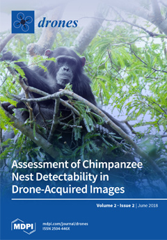
Chimpanzees are one of our closest cousins, and are at risk of extinction. Accurate surveys are crucial to allocating conservation efforts to where they are most needed. However, the extent and topography of the area in need of monitoring represent logistical challenges. Here we explored drone applications as a cost- and time-efficient alternative to ground surveys. We evaluated drone performance for chimpanzee nest detection and assessed the factors that influence detectability. An average of 10% of the nests spotted from the ground were detected from the air, with improved nest detection in imagery with higher spatial resolution. We argue that while this approach still requires complimentary validation from ground surveys, the rapid pace of technological improvement suggests drones as a promising application in the near future. View this paper.
  • Issues are regarded as officially published after their release is announced to the table of contents alert mailing list.
  • You may sign up for e-mail alerts to receive table of contents of newly released issues.
  • PDF is the official format for papers published in both, html and pdf forms. To view the papers in pdf format, click on the "PDF Full-text" link, and use the free Adobe Reader to open them.
Order results
Result details
Section
Select all
Export citation of selected articles as:
20 pages, 1472 KiB  
Article
Modeling, Trim Analysis, and Trajectory Control of a Micro-Quadrotor with Wings
by Jeremy Dawkins and Levi DeVries
Drones 2018, 2(2), 21; https://doi.org/10.3390/drones2020021 - 05 Jun 2018
Cited by 7 | Viewed by 6040
Abstract
This paper presents the modeling, control design, and efficiency analysis of a micro-quadrotor aerial vehicle with airfoils. We derive the equations of motion for a micro-quadrotor (length 0.15 m and mass 0.03 kg) outfitted with two symmetric airfoils that generate lift during forward [...] Read more.
This paper presents the modeling, control design, and efficiency analysis of a micro-quadrotor aerial vehicle with airfoils. We derive the equations of motion for a micro-quadrotor (length 0.15 m and mass 0.03 kg) outfitted with two symmetric airfoils that generate lift during forward transit. A trim analysis is presented to determine nominal flight conditions. Analysis of the model facilitates design of a controller that stabilizes the modified quadrotor through transitions from hover to forward fixed-wing flight. The performance of the design and control approach is analyzed through a series of typical flight profile simulations. The controller is able to track a velocity trajectory in the presence of aerodynamic uncertainties. The simulations are also used to determine the efficiency of the aircraft compared to a standard quadrotor. Results suggest that, during forward flight, the airfoils result in up to a 35% energy savings depending on the aspect ratio and forward speed of the vehicle. Added airfoil weight, however, causes a 45% energy loss during hover. These results indicate that the neutral benefit speed is in the range 3–5 m/s depending on the aspect ratio of the airfoil, which is suggestive of mission flight profiles that best utilize the added benefit of airfoils on a micro-quadrotor. Full article
Show Figures

Figure 1

15 pages, 2423 KiB  
Article
Accuracy and Optimal Altitude for Physical Habitat Assessment (PHA) of Stream Environments Using Unmanned Aerial Vehicles (UAV)
by Ângela Maria Klein Hentz, Paul J. Kinder, Jason A. Hubbart and Elliott Kellner
Drones 2018, 2(2), 20; https://doi.org/10.3390/drones2020020 - 28 May 2018
Cited by 9 | Viewed by 5820
Abstract
Physical Habitat Assessments (PHA) are useful to characterize and monitor stream and river habitat conditions, but can be costly and time-consuming. Alternative methods for data collection are getting attention, such as Unmanned Aerial Vehicles (UAV). The objective of this work was to evaluate [...] Read more.
Physical Habitat Assessments (PHA) are useful to characterize and monitor stream and river habitat conditions, but can be costly and time-consuming. Alternative methods for data collection are getting attention, such as Unmanned Aerial Vehicles (UAV). The objective of this work was to evaluate the accuracy of UAV-based remote sensing techniques relative to ground-based PHA measurements, and to determine the influence of flight altitude on those accuracies. A UAV quadcopter equipped with an RGB camera was flown at the altitudes of 30.5 m, 61.0 m, 91.5 m and 122.0 m, and the metrics wetted width (Ww), bankfull width (Wbf) and distance to water (Dw) were compared to field PHA. The UAV-PHA method generated similar values to observed PHA values, but underestimated distance to water, and overestimated wetted width. Bankfull width provided the largest RMSE (25–28%). No systematic error patterns were observed considering the different flight altitudes, and results indicated that all flight altitudes investigated can be reliably used for PHA measurements. However, UAV flight at 61 m provided the most accurate results (CI = 0.05) considering all metrics. All UAV parameters over all altitudes showed significant correlation with observed PHA data, validating the use of UAV-based remote sensing for PHA. Full article
Show Figures

Figure 1

14 pages, 2826 KiB  
Article
Development and Testing of a Low-Cost Instrumentation Platform for Fixed-Wing UAV Performance Analysis
by Tulio Dapper e Silva, Vinicius Cabreira and Edison Pignaton De Freitas
Drones 2018, 2(2), 19; https://doi.org/10.3390/drones2020019 - 21 May 2018
Cited by 3 | Viewed by 5765
Abstract
The flight data of a fixed-wing Unmanned Aerial Vehicle (UAV) can be evaluated by its designers in order to analyze its performance, to validate the project criteria and to make new decisions based on the data analyses. In this paper, the authors propose [...] Read more.
The flight data of a fixed-wing Unmanned Aerial Vehicle (UAV) can be evaluated by its designers in order to analyze its performance, to validate the project criteria and to make new decisions based on the data analyses. In this paper, the authors propose the development of a low-cost instrumentation platform capable of collecting the following data: airspeed, orientation and altitude of the airplane, and the current drained by the electric system. Moreover, this paper presents the use of a telemetry system in order to display the flight conditions to the pilot. The system contains a variety of sensors, which were chosen based on their price, applicability and ease of use. After a test flight had been performed, the collected measurements were plotted and analyzed. Having the flight data, a set of flight characteristics might be observed. Full article
Show Figures

Figure 1

16 pages, 55216 KiB  
Article
Unmanned Aerial Vehicles (UAV) Photogrammetry in the Conservation of Historic Places: Carleton Immersive Media Studio Case Studies
by Alex Federman, Sujan Shrestha, Mario Santana Quintero, Davide Mezzino, John Gregg, Shawn Kretz and Christian Ouimet
Drones 2018, 2(2), 18; https://doi.org/10.3390/drones2020018 - 18 May 2018
Cited by 17 | Viewed by 8065
Abstract
The increasing commercialization of unmanned aerial vehicles (UAVs) has opened the possibility of performing low-cost aerial image acquisition for the documentation of cultural heritage sites through UAV photogrammetry. This paper presents two case studies that illustrate the use of the DJI Phantom 4 [...] Read more.
The increasing commercialization of unmanned aerial vehicles (UAVs) has opened the possibility of performing low-cost aerial image acquisition for the documentation of cultural heritage sites through UAV photogrammetry. This paper presents two case studies that illustrate the use of the DJI Phantom 4 normal UAV for aerial image acquisition, and the results that can be achieved using those images. A general workflow procedure of oblique image capturing and data processing of large data sets has been illustrated in the Prince of Wales Fort case study to create photogrammetric models and to generate orthophotos for condition assessment applications. The second case study provides insight on the possibility of using UAVs for post-disaster documentation when the accessibility and the availability of high cost equipment is of major concern. The results that were obtained from UAV photogrammetry of Nyatapola Temple and Bhairabnath Temple in Taumadhi Square in Nepal, which were damaged by the 2015 Gorkha earthquake, are presented and discussed. Full article
Show Figures

Figure 1

17 pages, 5945 KiB  
Article
Assessment of Chimpanzee Nest Detectability in Drone-Acquired Images
by Noémie Bonnin, Alexander C. Van Andel, Jeffrey T. Kerby, Alex K. Piel, Lilian Pintea and Serge A. Wich
Drones 2018, 2(2), 17; https://doi.org/10.3390/drones2020017 - 23 Apr 2018
Cited by 40 | Viewed by 9813
Abstract
As with other species of great apes, chimpanzee numbers have declined over the past decades. Proper conservation of the remaining chimpanzees requires accurate and frequent data on their distribution and density. In Tanzania, 75% of the chimpanzees live at low densities on land [...] Read more.
As with other species of great apes, chimpanzee numbers have declined over the past decades. Proper conservation of the remaining chimpanzees requires accurate and frequent data on their distribution and density. In Tanzania, 75% of the chimpanzees live at low densities on land outside national parks and little is known about their distribution, density, behavior or ecology. Given the sheer scale of chimpanzee distribution across western Tanzania (>20,000 km2), we need new methods that are time and cost efficient while providing precise and accurate data across broad spatial scales. Scientists have recently demonstrated the usefulness of drones for detecting wildlife, including apes. Whilst direct observation of chimpanzees is unlikely given their elusiveness, we investigated the potential of drones to detect chimpanzee nests in the Issa valley, western Tanzania. Between 2015 and 2016, we tested and compared the capabilities of two fixed-wing drones. We surveyed twenty-two plots (50 × 500 m) in gallery forests and miombo woodlands to compare nest observations from the ground with those from the air. We performed mixed-effects logistic regression models to evaluate the impact of image resolution, seasonality, vegetation type, nest height and color on nest detectability. An average of 10% of the nests spotted from the ground were detected from the air. From the factors tested, only image resolution significantly influenced nest detectability in drone-acquired images. We discuss the potential, but also the limitations, of this technology for determining chimpanzee distribution and density and to provide guidance for future investigations on the use of drones for ape population surveys. Combining traditional and novel technological methods of surveying allows more accurate collection of data on animal distribution and habitat connectivity that has important implications for ape conservation in an increasingly anthropogenically-disturbed landscape. Full article
(This article belongs to the Special Issue Drones for Biodiversity Conservation and Ecological Monitoring)
Show Figures

Figure 1

14 pages, 32606 KiB  
Article
Use of UAV-Borne Spectrometer for Land Cover Classification
by Sowmya Natesan, Costas Armenakis, Guy Benari and Regina Lee
Drones 2018, 2(2), 16; https://doi.org/10.3390/drones2020016 - 20 Apr 2018
Cited by 38 | Viewed by 9957
Abstract
Unmanned aerial vehicles (UAV) are being used for low altitude remote sensing for thematic land classification using visible light and multi-spectral sensors. The objective of this work was to investigate the use of UAV equipped with a compact spectrometer for land cover classification. [...] Read more.
Unmanned aerial vehicles (UAV) are being used for low altitude remote sensing for thematic land classification using visible light and multi-spectral sensors. The objective of this work was to investigate the use of UAV equipped with a compact spectrometer for land cover classification. The UAV platform used was a DJI Flamewheel F550 hexacopter equipped with GPS and Inertial Measurement Unit (IMU) navigation sensors, and a Raspberry Pi processor and camera module. The spectrometer used was the FLAME-NIR, a near-infrared spectrometer for hyperspectral measurements. RGB images and spectrometer data were captured simultaneously. As spectrometer data do not provide continuous terrain coverage, the locations of their ground elliptical footprints were determined from the bundle adjustment solution of the captured images. For each of the spectrometer ground ellipses, the land cover signature at the footprint location was determined to enable the characterization, identification, and classification of land cover elements. To attain a continuous land cover classification map, spatial interpolation was carried out from the irregularly distributed labeled spectrometer points. The accuracy of the classification was assessed using spatial intersection with the object-based image classification performed using the RGB images. Results show that in homogeneous land cover, like water, the accuracy of classification is 78% and in mixed classes, like grass, trees and manmade features, the average accuracy is 50%, thus, indicating the contribution of hyperspectral measurements of low altitude UAV-borne spectrometers to improve land cover classification. Full article
Show Figures

Figure 1

18 pages, 3574 KiB  
Article
Vision-Based Autonomous Landing of a Quadrotor on the Perturbed Deck of an Unmanned Surface Vehicle
by Riccardo Polvara, Sanjay Sharma, Jian Wan, Andrew Manning and Robert Sutton
Drones 2018, 2(2), 15; https://doi.org/10.3390/drones2020015 - 14 Apr 2018
Cited by 39 | Viewed by 9254
Abstract
Autonomous landing on the deck of an unmanned surface vehicle (USV) is still a major challenge for unmanned aerial vehicles (UAVs). In this paper, a fiducial marker is located on the platform so as to facilitate the task since it is possible to [...] Read more.
Autonomous landing on the deck of an unmanned surface vehicle (USV) is still a major challenge for unmanned aerial vehicles (UAVs). In this paper, a fiducial marker is located on the platform so as to facilitate the task since it is possible to retrieve its six-degrees of freedom relative-pose in an easy way. To compensate interruption in the marker’s observations, an extended Kalman filter (EKF) estimates the current USV’s position with reference to the last known position. Validation experiments have been performed in a simulated environment under various marine conditions. The results confirmed that the EKF provides estimates accurate enough to direct the UAV in proximity of the autonomous vessel such that the marker becomes visible again. Using only the odometry and the inertial measurements for the estimation, this method is found to be applicable even under adverse weather conditions in the absence of the global positioning system. Full article
Show Figures

Figure 1

11 pages, 465 KiB  
Article
A Novel Approach for Brushless DC Motors Characterization in Drones Based on Chaos
by Ramon L. V. Medeiros, Jorge Gabriel G. S. Ramos, Tiago P. Nascimento, Abel C. Lima Filho and Alisson V. Brito
Drones 2018, 2(2), 14; https://doi.org/10.3390/drones2020014 - 10 Apr 2018
Cited by 13 | Viewed by 6527
Abstract
A novel technique named Signal Analysis based on Chaos using Density of Maxima (SAC-DM) is presented to analyze Brushless Direct Current (BLDC) motors behavior. These motors are vastly used in electric vehicles, especially in Drones. The proposed approach is compared with the traditional [...] Read more.
A novel technique named Signal Analysis based on Chaos using Density of Maxima (SAC-DM) is presented to analyze Brushless Direct Current (BLDC) motors behavior. These motors are vastly used in electric vehicles, especially in Drones. The proposed approach is compared with the traditional Fast-Fourier Transform (FFT) and the experiments analyzing a BLDC motor of a drone demonstrates similar results but computationally simpler than that. The main contribution of this technique is the possibility to analyze signals in time domain, instead of the frequency domain. It is possible to identify working and faulty behavior with less computational resources than the traditional approach. Full article
Show Figures

Figure 1

17 pages, 5814 KiB  
Article
Development of Small UAS Beyond-Visual-Line-of-Sight (BVLOS) Flight Operations: System Requirements and Procedures
by Scott Xiang Fang, Siu O’Young and Luc Rolland
Drones 2018, 2(2), 13; https://doi.org/10.3390/drones2020013 - 09 Apr 2018
Cited by 32 | Viewed by 9421
Abstract
Due to safety concerns of integrating small unmanned aircraft systems (UAS) into non-segregated airspace, aviation authorities have required a set of detect and avoid (DAA) systems to be equipped on small UAS for beyond-visual-line-of-sight (BVLOS) flight operations in civil airspace. However, the development [...] Read more.
Due to safety concerns of integrating small unmanned aircraft systems (UAS) into non-segregated airspace, aviation authorities have required a set of detect and avoid (DAA) systems to be equipped on small UAS for beyond-visual-line-of-sight (BVLOS) flight operations in civil airspace. However, the development of small UAS DAA systems also requires BVLOS flights for testing and validation. To mitigate operational risks for small UAS BVLOS flight operations, this paper proposes to initially test small UAS DAA systems in BVLOS flights in a restricted airspace with additional safety features. Later, this paper further discusses the operating procedures and emergency action plans for small UAS BVLOS flight operations. The testing results show that these safety systems developed can help improve operational safety for small UAS BVLOS flight operations. Full article
Show Figures

Graphical abstract

14 pages, 83000 KiB  
Article
Debitage and Drones: Classifying and Characterising Neolithic Stone Tool Production in the Shetland Islands Using High Resolution Unmanned Aerial Vehicle Imagery
by William Megarry, Conor Graham, Bernard Gilhooly, Brendan O’Neill, Rob Sands, Astrid Nyland and Gabriel Cooney
Drones 2018, 2(2), 12; https://doi.org/10.3390/drones2020012 - 22 Mar 2018
Cited by 10 | Viewed by 5995
Abstract
The application of high-resolution imagery from unmanned aerial vehicles (UAV) to classify the spatial extent and morphological character of ground and polished stone tool production at quarry sites in the Shetland Islands is explored in this paper. These sites are manifest as dense [...] Read more.
The application of high-resolution imagery from unmanned aerial vehicles (UAV) to classify the spatial extent and morphological character of ground and polished stone tool production at quarry sites in the Shetland Islands is explored in this paper. These sites are manifest as dense concentrations of felsite and artefacts clearly visible on the surface of the landscape. Supervised classification techniques are applied to map material extents in detail, while a topological analysis of surface rugosity derived from an image-based modelling (IBM) generated high-resolution elevation model is used to remotely assess the size and morphology of the material. While the approach is unable to directly characterize felsite as debitage, it successfully captured size and morphology, key indicators of archaeological activity. It is proposed that the classification of red, green and blue (RGB) imagery and rugosity analysis derived from IBM from UAV collected photographs can remotely provide data on stone quarrying processes and can act as an invaluable decision support tool for more detailed targeted field characterisation, especially on large sites where material is spread over wide areas. It is suggested that while often available, approaches like this are largely under-utilized, and there is considerable added value to be gained from a more in-depth study of UAV imagery and derived datasets. Full article
(This article belongs to the Special Issue (Re)Defining the Archaeological Use of UAVs)
Show Figures

Figure 1

Previous Issue
Next Issue
Back to TopTop