Next Issue
Volume 12, December
Previous Issue
Volume 12, October


Geosciences, Volume 12, Issue 11 (November 2022) – 38 articles

Cover Story (view full-size image): 
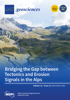
View of river networks in the High Tinée Valley (SW French Alps). In the lower picture, rivers cut deeply through the Mesozoic marl sedimentary cover and merge together at the contact with the crystalline basement. This study compares geochronological approaches to tectonic deformation and uplift, combined with dating river incisions, attempting to link the long-standing tectonic evolution of a mountain belt to its erosive signal. The comparison between the various geochronological approaches provides insights into the geomorphology of the chain resulting from ongoing slow strike-slip tectonics related to the rotation of Apulia. View this paper
  • Issues are regarded as officially published after their release is announced to the table of contents alert mailing list.
  • You may sign up for e-mail alerts to receive table of contents of newly released issues.
  • PDF is the official format for papers published in both, html and pdf forms. To view the papers in pdf format, click on the "PDF Full-text" link, and use the free Adobe Reader to open them.
Order results
Result details
Section
Select all
Export citation of selected articles as:
30 pages, 24245 KiB  
Article
Dynamics of Two Caldera-Forming Eruptions (Banda Besar and Naira) in the Marine Conservation Zone of Banda, Maluku, Indonesia
by Indranova Suhendro, Bachtiar W. Mutaqin, Dyan Primana Sobaruddin, Lestari Agustiningtyas, Hanik Humaida, Muh Aris Marfai and Danang Sri Hadmoko
Geosciences 2022, 12(11), 428; https://doi.org/10.3390/geosciences12110428 - 21 Nov 2022
Cited by 1 | Viewed by 2556
Abstract
This is the first study discussing the dynamics of two caldera-forming eruptions in the Banda volcanic complex (BVC) in the marine conservation zone of Banda, Maluku, Indonesia. The first and second caldera episodes are, hereafter, termed as Banda Besar and Naira, respectively. The [...] Read more.
This is the first study discussing the dynamics of two caldera-forming eruptions in the Banda volcanic complex (BVC) in the marine conservation zone of Banda, Maluku, Indonesia. The first and second caldera episodes are, hereafter, termed as Banda Besar and Naira, respectively. The formation of Banda Besar caldera (ca. 8 × 7 km) ejected homogeneous rhyolitic magmas (bulk-rock, 73.1–73.8 wt.% SiO2) in the following three stages: (1) sub-Plinian (BB-5a), (2) intra-sub-Plinian flow (BB-5b), and (3) caldera collapse (BB-5c and BB-5d). The BB-5a stage produced a reversely graded white pumice fall layer with moderate lithics (2–11%), which originated from a sub-Plinian eruption with an estimated plume height of 22–23 km. Subsequently, intensive erosion of wall rock (13–25%) causes conduit enlargement, leading to the partial collapse of the eruption columns, forming intra-sub-Plinian flow deposits (BB-5b). It is likely that conduit size surpassed the minimum threshold value for a buoyant plume during the final phase of the second stage, causing the complete formation of a pumice-rich pyroclastic density current (PDC) during the early-third stage (BB-5c). Finally, the evacuation of voluminous magma from the reservoir yields the first caldera collapse during the late-third stage, producing a lithic-dominated PDC with minor pumices (BB-5d). The formation of the Naira caldera (ca. 3 × 3 km) ejected homogeneous dacitic magmas (bulk-rock, 66.2–67.2 wt.% SiO2) in the following three stages: (1) early sub-Plinian (N-2a and 2b), (2) late sub-Plinian (N-2c, 2d, 2e), and (3) caldera collapse (N-2f). This research distinguishes the sub-Plinian into two stages on the basis of different vent locations (assumed from the isopach map). In particular, this research suggests that the early sub-Plinian stage (N-2a and 2b) erupted from the northern vent, producing 14 and 8 km eruption plume heights, respectively. Additionally, the late sub-Plinian stage (N-2c, 2d, 2e) was generated from a newly-formed conduit located in the relatively southern position, producing 12–17, 9, and 6 km eruption plume heights, respectively. Conduit enlargement is expected to occur during at both sub-Plinian stages, as lithic portions are considerably high (10–72%) and ultimately generate PDCs during the third stage (caldera collapse; N-2f). Because most of the erupted materials (for both caldera-forming eruptions) are emplaced in the ocean, estimating the erupted volume becomes difficult. However, with the assumption that the caldera dimension represents the erupted volume of magma (Vmagma), and that the total erupted volume (Vtotal) is a summation of Vmagma and the now-vanished pre-caldera island (Vvanished, represented by average lithic fractions), the first and second caldera might produce (at least) 35.2 and 2.4 km3 of erupted materials, scaling them as VEI (volcano explosivity index) 6 and 5, respectively. That VEI is more than enough to initiate a secondary hazard in the form of tsunamis triggered by volcanic activities. Full article
(This article belongs to the Special Issue Present and Past Submarine Volcanic Activity II)
Show Figures

Figure 1

14 pages, 2892 KiB  
Article
Application of Non-Reflective Boundary Conditions in Three-Dimensional Numerical Simulations of Free-Surface Flow Problems
by Andrey Kozelkov, Andrey Kurkin, Dmitry Utkin, Elena Tyatyushkina, Vadim Kurulin and Dmitry Strelets
Geosciences 2022, 12(11), 427; https://doi.org/10.3390/geosciences12110427 - 21 Nov 2022
Cited by 2 | Viewed by 1820
Abstract
This paper considers the issue of using non-reflective boundaries for surface wave simulations within the framework of three-dimensional Navier–Stokes equations. We distinguish a wave damping approach among the known implementations of non-reflective boundary conditions in surface wave simulations. The approach employs a sponge [...] Read more.
This paper considers the issue of using non-reflective boundaries for surface wave simulations within the framework of three-dimensional Navier–Stokes equations. We distinguish a wave damping approach among the known implementations of non-reflective boundary conditions in surface wave simulations. The approach employs a sponge boundary layer to dampen incident waves. In this paper, we describe implementations of this approach on unstructured meshes. We also present the calibration of free parameters, the values of which control wave damping efficiency and the amplitude of reflected waves. Comparison of the results obtained at different types of distribution for the free parameter was conducted. The implemented wave damping approach was tested by simulating a solitary wave propagating in a water tank. We demonstrate the use of damping non-reflective boundary conditions for the case of a wave traveling across the surface of a real body of water near Sakhalin Island while considering its bathymetry. Full article
(This article belongs to the Special Issue Interdisciplinary Geosciences Perspectives of Tsunami Volume 4)
Show Figures

Graphical abstract

23 pages, 18370 KiB  
Article
Probabilistic Forecasts of Flood Inundation Maps Using Surrogate Models
by Andre D. L. Zanchetta and Paulin Coulibaly
Geosciences 2022, 12(11), 426; https://doi.org/10.3390/geosciences12110426 - 21 Nov 2022
Viewed by 1593
Abstract
The use of data-driven surrogate models to produce deterministic flood inundation maps in a timely manner has been investigated and proposed as an additional component for flood early warning systems. This study explores the potential of such surrogate models to forecast multiple inundation [...] Read more.
The use of data-driven surrogate models to produce deterministic flood inundation maps in a timely manner has been investigated and proposed as an additional component for flood early warning systems. This study explores the potential of such surrogate models to forecast multiple inundation maps in order to generate probabilistic outputs and assesses the impact of including quantitative precipitation forecasts (QPFs) in the set of predictors. The use of a k-fold approach for training an ensemble of flood inundation surrogate models that replicate the behavior of a physics-based hydraulic model is proposed. The models are used to forecast the inundation maps resulting from three out-of-the-dataset intense rainfall events both using and not using QPFs as a predictor, and the outputs are compared against the maps produced by a physics-based hydrodynamic model. The results show that the k-fold ensemble approach has the potential to capture the uncertainties related to the process of surrogating a hydrodynamic model. Results also indicate that the inclusion of the QPFs has the potential to increase the sharpness, with the tread-off also increasing the bias of the forecasts issued for lead times longer than 2 h. Full article
Show Figures

Figure 1

20 pages, 22663 KiB  
Article
Enhancing the Identification and Mapping of Fluvial Terraces Combining Geomorphological Field Survey with Land-Surface Quantitative Analysis
by Giulia Iacobucci, Daniela Piacentini and Francesco Troiani
Geosciences 2022, 12(11), 425; https://doi.org/10.3390/geosciences12110425 - 18 Nov 2022
Cited by 2 | Viewed by 1833
Abstract
A methodological approach to refining the identification and mapping of fluvial terraces has been applied, combining geomorphological field surveys with the computation and assessment of different morphometric parameters (local, statistical, and object-oriented), derived from a high-resolution digital terrain model (DTM) obtained from a [...] Read more.
A methodological approach to refining the identification and mapping of fluvial terraces has been applied, combining geomorphological field surveys with the computation and assessment of different morphometric parameters (local, statistical, and object-oriented), derived from a high-resolution digital terrain model (DTM) obtained from a LiDAR survey. The mid-sector floodplain of the Misa River basins was taken as a valid example of the main river valleys draining the northern Marche Apennines (Italy) and was considered an ideal site to test a combination of different geomorphological techniques for enhancing fluvial terraces’ detection and mapping. In this area, late Pleistocene–Holocene fluvial terraces are well exposed, and their geomorphological and geochronological characteristics have largely already been studied. However, a reliable distinction of the different Holocene terrace levels, including a detailed geomorphological mapping of different terrace features, is still lacking due to the very complex terrace geometry and the lack of good-quality deposit outcrops. Land-surface quantitative (LSQ) analysis has been coupled with the available outcomes of previous studies and ad-hoc geomorphological field surveys to enhance the identification and mapping of fluvial terraces. The results of this work provided information for the discernment of terrace remnants belonging to the full-glacial fill terrace generation (late Pleistocene) as well as reconstruction of the terrace top–surface, and can be used to distinguish the inner terrace limits coinciding with the margin of the floodplain. It has also been possible to identify and delimit the late Pleistocene terrace from a staircase of three younger strath terraces formed during the Holocene. The results of this study demonstrated that the investigation of fluvial landforms, at different scales, can strongly benefit from the integration of field surveys and quantitative geomorphic analysis based on high-resolution digital topographic datasets. In particular, the integration of LSQ analysis with ground-truth geomorphological data can be dramatically helpful for the identification and mapping of fluvial terraces. Full article
(This article belongs to the Topic Advances in Environmental Remote Sensing)
Show Figures

Graphical abstract

20 pages, 5629 KiB  
Article
Machine-Learning Applications in Geosciences: Comparison of Different Algorithms and Vegetation Classes’ Importance Ranking in Wildfire Susceptibility
by Andrea Trucchia, Hamed Izadgoshasb, Sara Isnardi, Paolo Fiorucci and Marj Tonini
Geosciences 2022, 12(11), 424; https://doi.org/10.3390/geosciences12110424 - 18 Nov 2022
Cited by 3 | Viewed by 1976
Abstract
Susceptibility mapping represents a modern tool to support forest protection plans and to address fuel management. With the present work, we continue with a research framework developed in a pioneristic study at the local scale for Liguria (Italy) and recently adapted to the [...] Read more.
Susceptibility mapping represents a modern tool to support forest protection plans and to address fuel management. With the present work, we continue with a research framework developed in a pioneristic study at the local scale for Liguria (Italy) and recently adapted to the national scale. In these previous works, a random-forest-based modeling workflow was developed to assess susceptibility to wildfires under the influence of a number of environmental predictors. The main novelties and contributions of the present study are: (i) we compared models based on random forest, multi-layer perceptron, and support vector machine, to estimate their prediction capabilities; (ii) we used a more accurate vegetation map as predictor, allowing us to evaluate the impacts of different types of local and neighboring vegetation on wildfires’ occurrence; (iii) we improved the selection of the testing dataset, in order to take into account the temporal variability of the burning seasons. Wildfire susceptibility maps were finally created based on the output probabilistic predicted values from the three machine-learning algorithms. As revealed with random forest, vegetation is so far the most important predictor variable; the marginal effect of each type of vegetation was then evaluated and discussed. Full article
(This article belongs to the Special Issue Feature Papers of Natural Hazards in 2022)
Show Figures

Graphical abstract

10 pages, 3668 KiB  
Article
The Model of Cohesionless Sediment Blowout with an Increase in the Methane Flow Rate
by Polina M. Shpak, Sergey B. Turuntaev, Mariia A. Trimonova, Aliya A. Tairova, Georgiy V. Belyakov and Nikita A. Iudochkin
Geosciences 2022, 12(11), 423; https://doi.org/10.3390/geosciences12110423 - 17 Nov 2022
Cited by 1 | Viewed by 1218
Abstract
Dissociation of methane hydrates in the Arctic permafrost may lead to explosive gas emission. Methane blowout may be triggered by increasing gas flow rate at a certain depth. The mechanism of rock failure and blowout under the effect of pressurized gas was studied [...] Read more.
Dissociation of methane hydrates in the Arctic permafrost may lead to explosive gas emission. Methane blowout may be triggered by increasing gas flow rate at a certain depth. The mechanism of rock failure and blowout under the effect of pressurized gas was studied numerically and in laboratory experiments. The problem was formulated for the unsteady flow of compressed gas depending on the flow rate at a given depth, and pore gas pressure variations were calculated as a function of depth and time. The model parameters were chosen with reference to field data. According to the model, the input of gas to friable material at an increasing rate may lead to gas blowout and density loss propagating downward as the gas pressure exceeds the overburden pressure at some depth. The laboratory system was of the type of a Hele-Shaw cell, with small glass balls as friable material confined between two glass panels. The results of physical modeling and calculations show good agreement. Full article
(This article belongs to the Special Issue Permafrost and Gas Hydrate Response to Ground Temperature Rising)
Show Figures

Figure 1

14 pages, 5248 KiB  
Article
Numerical Simulations of Large Martian Impact Ripples
by Hezi Yizhaq, Jasper F. Kok, Simone Silvestro, Lior Saban and Itzhak Katra
Geosciences 2022, 12(11), 422; https://doi.org/10.3390/geosciences12110422 - 17 Nov 2022
Cited by 1 | Viewed by 1399
Abstract
Ripples made from unimodal fine sands can grow much larger on Mars than on Earth, reaching wavelengths of 1–3 m and heights exceeding 1 dm. Smaller decimeter-wavelength ripples can be superimposed on them. Classification and origins of these bedforms have been debated. They [...] Read more.
Ripples made from unimodal fine sands can grow much larger on Mars than on Earth, reaching wavelengths of 1–3 m and heights exceeding 1 dm. Smaller decimeter-wavelength ripples can be superimposed on them. Classification and origins of these bedforms have been debated. They have been interpreted as analogous to subaqueous ripples on Earth, or as aeolian impact ripples with a range of grain sizes that reach large maximum sizes on Mars. This study uses a mathematical model to evaluate the formation of large Martian ripples as aeolian impact ripples to further investigate this hypothesis. The model parameters were computed using COMSALT for 100 µm grains under shear velocity of 0.65 m/s, which is a reasonable shear velocity for sand transport on Mars according to recent estimations of threshold Martian winds. The numerical experiments utilize a large grid 8 m long. Experiments also evaluate the development of secondary small ripples between the large ripples from random perturbations. The numerical simulations show the evolution of ripple wavelength and height. According to the results, the time scale for the formation of the large ripples is about 2–3 years, which is a much longer time scale compared to terrestrial impact ripples. Small secondary ripples develop only if the space between the large ripples is sufficiently large. Full article
(This article belongs to the Special Issue Dune Migration on Mars)
Show Figures

Figure 1

29 pages, 42401 KiB  
Article
Evaluation of Boulder Characteristics for Improved Boulder Detection Based on Machine Learning Techniques
by Signe Schilling Hansen, Verner Brandbyge Ernstsen, Mikkel Skovgaard Andersen, Zyad Al-Hamdani, Ramona Baran, Manfred Niederwieser, Frank Steinbacher and Aart Kroon
Geosciences 2022, 12(11), 421; https://doi.org/10.3390/geosciences12110421 - 16 Nov 2022
Viewed by 1534
Abstract
Detailed maps of the seabed and knowledge of its habitats are critical for a wide range of tasks, such as sustainable development, and environmental protection. Boulders on the seabed form an important environment for ecosystems, but the detection of them is challenging. In [...] Read more.
Detailed maps of the seabed and knowledge of its habitats are critical for a wide range of tasks, such as sustainable development, and environmental protection. Boulders on the seabed form an important environment for ecosystems, but the detection of them is challenging. In this study, we aim to improve the understanding of boulder predictors and to determine connections between predictors and boulder environments on different spatial scales. The Relief-F filter feature selection algorithm was used on four 30 m × 30 m areas in Rødsand lagoon, containing one boulder each, to determine the most relevant predictors. The predictors could be divided into four groups detecting different boulder characteristics: colour contrast, height, boulder boundaries, and spherical geometry. Twelve different types of boulder environments were evaluated. Bare, spherical boulders on sandy seabeds can be predicted from all four predictor groups. It is not possible to detect non-spherical boulders on seabed covered by vegetation. The best predictors for boulder detection depend on the shape and size of the boulder and the surrounding sediment and vegetation. The predictors were evaluated on a larger 400 × 2500 m area. When up-scaling the boulder detection area, larger seabed structures may affect the results. Therefore, knowledge about these structures can be used to remove errors and uncertainties from machine learning input data. Full article
Show Figures

Figure 1

16 pages, 16618 KiB  
Article
On the Evaluation of the SAR-Based Copernicus Snow Products in the French Alps
by Fatima Karbou, Guillaume James, Mathieu Fructus and Florence Marti
Geosciences 2022, 12(11), 420; https://doi.org/10.3390/geosciences12110420 - 15 Nov 2022
Cited by 3 | Viewed by 1429
Abstract
We perform a first evaluation of the Copernicus pan-European wet snow products in mountainous terrain in the French Alps. Mountains are very challenging due to the complexity of the terrain and the multiple interactions between soil, snow and atmosphere that can impact the [...] Read more.
We perform a first evaluation of the Copernicus pan-European wet snow products in mountainous terrain in the French Alps. Mountains are very challenging due to the complexity of the terrain and the multiple interactions between soil, snow and atmosphere that can impact the snowpack state. We focused on the evaluation of the Sentinel-1 derived SAR Wet Snow (SWS) product with the use of Sentinel-2 derived Fractional Snow Cover (FSC) products for the evaluation during wet snow periods. Comparisons were also made with snowpack reanalyses from the Crocus model. We showed that melt lines computed from the SWS product at the scale of massifs show realistic variations in elevation, orientation and season supported by comparisons with some snow variables as simulated by the Crocus model. We developed a new score, which is particularly suitable for mountain products and allows a very useful comparison of satellite products of different ground resolutions. We show that for melting periods, Sentinel-1 and Sentinel-2 snow cover probability curves calculated at the scale of a mountain range are very close for altitudes below 2000 m with RMS errors lower than 0.2. We also illustrate how the generated probability curves can be used to infer highly relevant information on the extent of snow by altitude and on its melting process evolution by connecting information from Sentinel-2 and Sentinel-1 (taking into account morning and evening orbits). Full article
(This article belongs to the Special Issue Mountain Glaciers, Permafrost, and Snow)
Show Figures

Graphical abstract

17 pages, 6928 KiB  
Article
Formation of Metastability of Pore Gas Hydrates in Frozen Sediments: Experimental Evidence
by Evgeny Chuvilin, Dinara Davletshina, Boris Bukhanov, Aliya Mukhametdinova and Vladimir Istomin
Geosciences 2022, 12(11), 419; https://doi.org/10.3390/geosciences12110419 - 14 Nov 2022
Cited by 3 | Viewed by 1819
Abstract
The Arctic permafrost and zones of hydrate stability may evolve to the conditions that allow gas hydrates to remain metastable for a long time due to self-preservation within 150 m depths. The behavior of relict (metastable) gas hydrates in frozen sediments is controlled [...] Read more.
The Arctic permafrost and zones of hydrate stability may evolve to the conditions that allow gas hydrates to remain metastable for a long time due to self-preservation within 150 m depths. The behavior of relict (metastable) gas hydrates in frozen sediments is controlled externally by pressure and temperature and internally by the properties of hydrate particles and sediments. The sensitivity of the dissociation and self-preservation of pore gas hydrates to different factors is investigated in laboratory experiments. The observations focus on time-dependent changes in methane hydrate saturation in frozen sand samples upon the pressure dropping below phase equilibrium in the gas–hydrate–ice system. The preservation of pore gas hydrates in these conditions mainly depends on the initial hydrate and ice saturation, clay contents and mineralogy, salinity, and texture of sediments, which affect the size, shape, and structure distortion of hydrate inclusions. The self-preservation mechanism works well at high initial contents of pore ice and hydrate, low salinity, relatively low percentages of clay particles, temperatures below −4 °C, and below-equilibrium pressures. Nuclear magnetic resonance (NMR) measurements reveal considerable amounts of unfrozen pore water in frozen sediments that may hold for several days after the pressure drop, which controls the dissociation and self-preservation processes. Metastable gas hydrates in frozen sand may occupy up to 25% of the pore space, and their dissociation upon permafrost thawing and pressure drops may release up to 16 m3 of methane into the atmosphere per 1 m3 of hydrate-bearing permafrost. Full article
(This article belongs to the Special Issue Permafrost and Gas Hydrate Response to Ground Temperature Rising)
Show Figures

Figure 1

14 pages, 4694 KiB  
Article
Frasassi Caves and Surroundings: A Special Vehicle for the Geoeducation and Dissemination of the Geological Heritage in Italy
by Piero Farabollini and Fabrizio Bendia
Geosciences 2022, 12(11), 418; https://doi.org/10.3390/geosciences12110418 - 12 Nov 2022
Cited by 5 | Viewed by 1923
Abstract
One of the most fascinating aspects of the work of geologist lies in knowing how to read the physical landscape as an expression of the geological and geomorphological phenomena that shaped the Earth’s relief over time. The necessity to disseminate these vast areas [...] Read more.
One of the most fascinating aspects of the work of geologist lies in knowing how to read the physical landscape as an expression of the geological and geomorphological phenomena that shaped the Earth’s relief over time. The necessity to disseminate these vast areas of knowledges and skills starts from here, with the aim to enhance the concept of geodiversity and to raise awareness for its protection and promotion. This work aims to share some examples of projects realized following the subscription of agreement between different public authorities in the Apennine territory of Marche Region in Italy, such as the Geology Section of the University of Camerino (MC), “Consorzio Frasassi” (which manages the underground karst complex of Frasassi caves) and municipality of Genga (AN), where Frasassi caves are located. Thanks to this partnership, our research group realized didactic geological notebooks for school groups visiting the caves and interactive museum laboratories in 3D, showing the geological evolution of the area. This sharing of knowledge will contribute to educate communities about the importance of the geological heritage. At the same time, this project can serve as motivation to establishing the same type of collaborations in those territories where similar projects can be replicated. Full article
Show Figures

Figure 1

26 pages, 12690 KiB  
Review
Why Engineers Should Not Attempt to Quantify GSI
by Beverly Yang and Davide Elmo
Geosciences 2022, 12(11), 417; https://doi.org/10.3390/geosciences12110417 - 11 Nov 2022
Cited by 9 | Viewed by 5108
Abstract
In the past decade, there has been an increasing trend of digitalizing rock engineering processes. However, this process has not been accompanied by a critical analysis of the very same empirical methods that many complex numerical and digital methods are founded upon. As [...] Read more.
In the past decade, there has been an increasing trend of digitalizing rock engineering processes. However, this process has not been accompanied by a critical analysis of the very same empirical methods that many complex numerical and digital methods are founded upon. As engineers, we are taught to use and trust numbers. Indeed, we would not be able to define the factor of the safety of a structure without numbers. However, what happens when those numbers are nothing but numerical descriptions of qualitative assessments? In this paper we present a critical review of the many attempts presented in the literature to quantify GSI (geological strength index). To the authors’ knowledge, this paper represents the first time that all the different GSI tables and quantification methods that have been proposed over the past two decades are collated and compared critically. In our critique, we argue against the paradigm whereby the quantification process adds the experience factor for inexperienced engineers. Furthermore, we discuss the limitations of the notion that GSI quantification methods could transform subjectivity into objectivity since the parameters under considerations are not quantitative measurements. Relying on empirically defined quantitative equivalences raises important questions, particularly when these quantitative equivalences are being used to define so-called accurate rock mass classification input for design purposes. Full article
(This article belongs to the Collection New Advances in Geotechnical Engineering)
Show Figures

Figure 1

17 pages, 6407 KiB  
Article
The Molecular Weight Distribution of Occluded Hydrocarbon Gases in the Khibiny Nepheline–Syenite Massif (Kola Peninsula, NW Russia) in Relation to the Problem of Their Origin
by Valentin A. Nivin, Vyacheslav V. Pukha, Olga D. Mokrushina and Julia A. Mikhailova
Geosciences 2022, 12(11), 416; https://doi.org/10.3390/geosciences12110416 - 11 Nov 2022
Viewed by 1396
Abstract
The origin of hydrogen–hydrocarbon gases present in the rocks of the Khibiny massif in unusually high concentrations has been the subject of many years of discussion. To assess the role of potential mechanisms and relative time of formation of gases occluded in inclusions [...] Read more.
The origin of hydrogen–hydrocarbon gases present in the rocks of the Khibiny massif in unusually high concentrations has been the subject of many years of discussion. To assess the role of potential mechanisms and relative time of formation of gases occluded in inclusions in minerals, the molecular weight distribution of C1–C5 alkanes in the main rock types of the Khibiny massif was studied. For this purpose, the occluded gases were extracted from rocks by mechanical grinding and their composition was analyzed on a gas chromatograph. It is established that the molecular weight distribution of occluded hydrocarbon gases in the Khibiny massif corresponds to the classical Anderson–Schulz–Flory distribution. In addition, the slopes of the linear relationships are relatively steep. This indicates a predominantly abiogenic origin of the occluded gases of the Khibiny massif. At the same time, a small proportion of biogenic hydrocarbons is present and is associated with the influence of meteoric waters. It was also found that in the Khibiny massif, the proportion of relatively high-temperature gases decreases towards the Main foidolite Ring in the following sequence: foyaite and khibinite–trachytoid khibinite–rischorrite and lyavochorrite–foidolites and apatite–nepheline ores. In the same sequence, an increase in the proportion of heavy hydrocarbons and the increasing role of oxidation and condensation reactions in the transformation of hydrocarbons occurs. Full article
Show Figures

Figure 1

26 pages, 5339 KiB  
Article
Surface Water and Groundwater Suitability for Irrigation Based on Hydrochemical Analysis in the Lower Mayurakshi River Basin, India
by Susmita Ghosh, Biplab Sarkar, Aznarul Islam, Pravat Kumar Shit, Adolfo Quesada-Román and Harun Al Rasid Gazi
Geosciences 2022, 12(11), 415; https://doi.org/10.3390/geosciences12110415 - 10 Nov 2022
Cited by 6 | Viewed by 2086
Abstract
The present work investigates the hydrochemical properties of the surface and groundwater of the Mayurakshi River Basin (India) for assessing their irrigation suitability with respect to irrigation hazards. The study involves 72 water samples classified as 48 surface water samples (pre-monsoon: 24; post-monsoon: [...] Read more.
The present work investigates the hydrochemical properties of the surface and groundwater of the Mayurakshi River Basin (India) for assessing their irrigation suitability with respect to irrigation hazards. The study involves 72 water samples classified as 48 surface water samples (pre-monsoon: 24; post-monsoon: 24) and 24 groundwater samples (pre-monsoon:12; post-monsoon: 12). Regarding the specific irrigation hazard, percent of sodium and soluble sodium percentage have demonstrated the groundwater vulnerability to sodium while the surface water is observed to be free from this kind of hazard. Similar findings have also been retained for magnesium hazard and the potential salinity hazard. Moreover, regarding the seasonality of the hazards, the post-monsoon season has depicted a higher level of irrigation hazards compared to the pre-monsoon season. The study found that the general evolution of groundwater hydrochemistry and the suitability of water for irrigation are principally governed by carbonate weathering, sand mining, stone crushing, and the development of brick kiln industries. Our methodology can be a good example for similar contexts, especially in developing and tropical countries. Full article
(This article belongs to the Collection Early Career Scientists’ (ECS) Contributions to Geosciences)
Show Figures

Figure 1

13 pages, 948 KiB  
Article
Large-Scale Accessibility as a New Perspective for Geoheritage Assessment
by Yuri A. Fedorov, Anna V. Mikhailenko and Dmitry A. Ruban
Geosciences 2022, 12(11), 414; https://doi.org/10.3390/geosciences12110414 - 10 Nov 2022
Cited by 2 | Viewed by 1313
Abstract
The exploitation of geoheritage resources depends on their accessibility. The latter is usually established for geosites, whereas reaching the areas where geosites concentrate also deserves attention. Here, a novel, multi-criteria, score-based approach for assessing the large-scale accessibility of geoheritage-rich areas is proposed. The [...] Read more.
The exploitation of geoheritage resources depends on their accessibility. The latter is usually established for geosites, whereas reaching the areas where geosites concentrate also deserves attention. Here, a novel, multi-criteria, score-based approach for assessing the large-scale accessibility of geoheritage-rich areas is proposed. The study takes into account various information about external and internal public transportation, road infrastructure, local services (including accommodation opportunities), and general settings. This approach is applied to the Russian South, where there are three geoheritage-rich areas, namely Lower Don, Abrau, and Mountainous Adygeya. Using new criteria, these areas differ by their large-scale accessibility, which is excellent in Lower Don and moderate in Abrau and Mountainous Adygeya. It is established that the co-occurrence of geoheritage-rich areas and popular tourist destinations does not guarantee excellent accessibility. The findings of the present study seem to be important for the development of optimal geoheritage resources policy, as well as for planning research and educational activities, such as the currently realized geochemical investigations and the regular field educational campaigns in the Russian South. Full article
Show Figures

Figure 1

8 pages, 238 KiB  
Article
Computing Elastic Moduli of Igneous Rocks Using Modal Composition and Effective Medium Theory
by Saeed Aligholi and Manoj Khandelwal
Geosciences 2022, 12(11), 413; https://doi.org/10.3390/geosciences12110413 - 10 Nov 2022
Viewed by 1308
Abstract
Elastic constants of rock materials are the basic parameters required for modeling the response of rock materials under mechanical loads. Experimental tests for determining these properties are expensive, time-consuming and suffer from a high uncertainty due to both experimental limitations and the heterogeneous [...] Read more.
Elastic constants of rock materials are the basic parameters required for modeling the response of rock materials under mechanical loads. Experimental tests for determining these properties are expensive, time-consuming and suffer from a high uncertainty due to both experimental limitations and the heterogeneous nature of rock materials. To avoid such experimental difficulties, in this paper a method is suggested for determining elastic constants of rock materials by determining their porosity and modal composition and employing effective medium theory. The Voigt–Reuss–Hill average is used to determine effective elastic constants of the studied igneous rocks according to the elastic moduli of their mineral constituents. Then, the effect of porosity has been taken into account by considering rock as a two-phase material, and the Kuster–Toksoz formulation is used for providing a close estimation of different moduli. The solutions are provided for different isotropic igneous rocks. This sustainable method avoids destructive tests and the usage of energy for performing time-consuming and expensive tests and requires simple equipment. Full article
(This article belongs to the Section Geomechanics)
25 pages, 7323 KiB  
Article
Multidecadal Trend Analysis of Armenian Mountainous Grassland and Its Relationship to Climate Change Using Multi-Sensor NDVI Time-Series
by Vahagn Muradyan, Shushanik Asmaryan, Grigor Ayvazyan and Fabio Dell’Acqua
Geosciences 2022, 12(11), 412; https://doi.org/10.3390/geosciences12110412 - 10 Nov 2022
Cited by 2 | Viewed by 1716
Abstract
This paper presents a comprehensive analysis of links between satellite-measured vegetation vigor and climate variables in Armenian mountain grassland ecosystems in the years 1984–2018. NDVI is derived from MODIS and LANDSAT data, temperature and precipitation data are from meteorological stations. Two study sites [...] Read more.
This paper presents a comprehensive analysis of links between satellite-measured vegetation vigor and climate variables in Armenian mountain grassland ecosystems in the years 1984–2018. NDVI is derived from MODIS and LANDSAT data, temperature and precipitation data are from meteorological stations. Two study sites were selected, representing arid and semi-arid grassland vegetation types, respectively. Various trend estimators including Mann–Kendall (MK) and derivatives were combined for vegetation change analysis at different time scales. Results suggest that temperature and precipitation had negative and positive impacts on vegetation growth, respectively, in both areas. NDVI-to-precipitation correlation was significant but with an apparent time-lag effect that was further investigated. No significant general changes were observed in vegetation along the observed period. Further comparisons between results from corrected and uncorrected data led us to conclude that MODIS and LANDSAT data with BRDF, topographic and atmospheric corrections applied are best suited for analyzing relationships between NDVI and climatic factors for the 2000–2018 period in grassland at a very local scale; however, in the absence of correction tools and information, uncorrected data can still provide meaningful results. Future refinements will include removal of anthropogenic impact, and deeper investigation of time-lag effects of climatic factors on vegetation dynamics. Full article
Show Figures

Figure 1

26 pages, 4997 KiB  
Review
On the Rarity and Peculiarity of the Early Toarcian (Lower Jurassic) Leukadiellinae Ammonites—Systematic Review and Insights on the Interplay of Environmental Stress, Evolution and Biodiversity
by Domenico Ridente
Geosciences 2022, 12(11), 411; https://doi.org/10.3390/geosciences12110411 - 9 Nov 2022
Cited by 1 | Viewed by 1692
Abstract
The subfamily Leukadiellinae Macchioni and Venturi, 2000 includes the two rare genera Leukadiella Renz, 1913 and Renziceras Arkell, 1953. Genus Leukadiella is characterised by ornamental and structural features unusual to the family Hildoceratidae Hyatt, 1867; for this reason, it has been occasionally grouped [...] Read more.
The subfamily Leukadiellinae Macchioni and Venturi, 2000 includes the two rare genera Leukadiella Renz, 1913 and Renziceras Arkell, 1953. Genus Leukadiella is characterised by ornamental and structural features unusual to the family Hildoceratidae Hyatt, 1867; for this reason, it has been occasionally grouped with other “odd” representatives of this family, as, for instance, Frechiella Prinz, 1904 and Paroniceras Bonarelli, 1893. While Renziceras comprises only one species, the eleven species currently recognised within Leukadiella show a noticeably discontinuous variability field; together with rarity of findings, the interpretation of this variability represents a renowned obstacle to their classification and phylogenetic reconstruction. Following an analysis of the morphological characters commonly used for defining Leukadiella species, a revised taxonomic scheme is herein proposed. Two clusters of characters are defined, based on which two morphologically distinct groups of species are distinguished, referred to as Helenae Group and Ionica Group. The genus name Leukadiella is maintained for species of the Helenae Group, which are restricted via synonymy to Leukadiella helenae Renz, 1913 and Leukadiella jeanneti Renz, 1927. The new genus name Neoleukadiella gen. nov. is proposed for species of the Ionica Group, which, by analogous limitation, are Neoleukadiella ionica Renz and Renz, 1946 and Neoleukadiella gallitellii Pinna, 1965. The reduction in the number of species from eleven to four is consistent with their rarity and limited paleogeographic distribution. The closely related Renziceras is considered the direct progenitor of Leukadiella; in turn, the Apennine genus Cingolites Sassaroli and Venturi, 2010 is proposed as transitional between Hildaites Buckman, 1921 and Renziceras. Conversely, the progenitor of Neoleukadiella remains uncertain, although a possible relationship between Leukadiella and Neoleukadiella species is tentatively traced. Finally, some challenging assumptions are made by emphasizing the role of environmental stress in controlling developmental dynamics that may drive striking phenotypic modification, of the kind observed in the Leukadiellinae species. Full article
(This article belongs to the Special Issue Jurassic Paleoenvironments)
Show Figures

Graphical abstract

11 pages, 2590 KiB  
Review
Shoreline Change Analysis along Rivers and Deltas: A Systematic Review and Bibliometric Analysis of the Shoreline Study Literature from 2000 to 2021
by Munshi Khaledur Rahman, Thomas W. Crawford and Md Sariful Islam
Geosciences 2022, 12(11), 410; https://doi.org/10.3390/geosciences12110410 - 8 Nov 2022
Cited by 6 | Viewed by 2150
Abstract
Globally, coastal zones, rivers and riverine areas, and deltas carry enormous values for ecosystems, socio-economic, and environmental perspectives. These often highly populated areas are generally significantly different from interior hinterlands in terms of population density, economic activities, and geophysical and ecological processes. Geospatial [...] Read more.
Globally, coastal zones, rivers and riverine areas, and deltas carry enormous values for ecosystems, socio-economic, and environmental perspectives. These often highly populated areas are generally significantly different from interior hinterlands in terms of population density, economic activities, and geophysical and ecological processes. Geospatial technologies are widely used by scholars from multiple disciplines to understand the dynamic nature of shoreline changes globally. In this paper, we conduct a systematic literature review to identify and interpret research patterns and themes related to shoreline change detection from 2000 to 2021. Two databases, Web of Science and Scopus, were used to identify articles that investigate shoreline change analysis using geospatial technique such as remote sensing and GIS analysis capabilities (e.g., the Digital Shoreline Analysis System (DSAS). Between the years 2000 and 2021, we initially found 1622 articles, which were inspected for suitability, leading to a final set of 905 articles for bibliometric analysis. For systematic analysis, we used Rayyan—a web-based platform used for screening literature. For bibliometric network analysis, we used the CiteSpace, Rayyan, and VOSviewer software. The findings of this study indicate that the majority of the literature originated in the USA, followed by India. Given the importance of protecting the communities living in the riverine areas, coastal zones, and delta regions, it is necessary to ask new research questions and apply cutting-edge tools and technology, such as machine learning approach and GeoAI, to fill the research gaps on shoreline change analysis. Such approaches could include, but are not limited to, centimeter level accuracy with high-resolution satellite imagery, the use of unmanned aerial vehicles (UAV), and point cloud data for both local and global level shoreline change and analysis. Full article
(This article belongs to the Special Issue Shoreline Dynamics and Beach Erosion, 2nd Edition)
Show Figures

Figure 1

5 pages, 236 KiB  
Editorial
A Special Issue of Geosciences: Cutting Edge Earth Sciences—Three Decades of Cosmogenic Nuclides
by Naki Akçar, Susan Ivy-Ochs and Fritz Schlunegger
Geosciences 2022, 12(11), 409; https://doi.org/10.3390/geosciences12110409 - 5 Nov 2022
Viewed by 1146
Abstract
What we know is a drop, what we don’t know is an ocean [...] Full article
(This article belongs to the Special Issue Cutting Edge Earth Sciences: Three Decades of Cosmogenic Nuclides)
4 pages, 189 KiB  
Editorial
Perspectives on Environment and Human Health: An Editorial
by Paula Marinho-Reis, Jane A. Entwistle, Andrew S. Hursthouse and Alex G. Stewart
Geosciences 2022, 12(11), 408; https://doi.org/10.3390/geosciences12110408 - 5 Nov 2022
Viewed by 955
Abstract
Human health and wellbeing are intimately linked to the state of the environment [...] Full article
(This article belongs to the Special Issue Perspectives on Environment and Human Health)
25 pages, 8745 KiB  
Article
Characterization of Upper Jurassic Organic-Rich Caprock Shales in the Norwegian Continental Shelf
by Md Jamilur Rahman, James Ronald Johnson, Manzar Fawad and Nazmul Haque Mondol
Geosciences 2022, 12(11), 407; https://doi.org/10.3390/geosciences12110407 - 4 Nov 2022
Cited by 1 | Viewed by 1788
Abstract
Characterizing the top seal integrity of organic-rich caprock shale is critical in hydrocarbon exploration and fluid storage sites assessment because the caprock acts as a barrier to the low-density upward migrating fluids. This study investigated the geomechanical properties of the Upper Jurassic caprock [...] Read more.
Characterizing the top seal integrity of organic-rich caprock shale is critical in hydrocarbon exploration and fluid storage sites assessment because the caprock acts as a barrier to the low-density upward migrating fluids. This study investigated the geomechanical properties of the Upper Jurassic caprock shales of various basins from the Norwegian Continental Shelf. Usually, paleo-deposition and diagenesis vary from basin to basin, which influences the geomechanical properties of caprock shale; hence, the seal integrity. Fourteen (14) wells from four (4) different basins within the Norwegian Continental Shelf were analyzed to evaluate the effects of various processes acting on caprock properties. Comparative mineralogy-based caprock properties were also investigated. We include a thorough review of the distribution of organic and inorganic components utilizing SEM and 3D microtomography as they relate to the development and propagation of microfractures. Five (5) wells from three (3) basins contain measured shear sonic logs. These wells were used for petrophysics and rock physics analysis. Three elastic properties-based brittleness indices were estimated and compared. The percentage of different mineral fractions of the studied wells varied significantly between the studied basins, which is also reflected in the mineralogical brittleness indices evaluation. Irrespective of the studied basins, relative changes in caprock properties between wells have been observed. The Young’s Modulus–Poisson’s ratio-based empirical equation underestimated the brittleness indices compared with mineralogy- and acoustic properties-based brittleness estimation. A better match has been observed between the mineralogy- and acoustic properties-based brittleness indices. However, as both methods have limitations, an integrated approach is recommended to evaluate the brittleness indices. Brittleness indices are a qualitative assessment of the top seal; hence, further investigation is required to quantify sealing integrity. Full article
(This article belongs to the Section Geomechanics)
Show Figures

Figure 1

15 pages, 2989 KiB  
Article
Assessing Community Perceptions on Urban Flood Resilience in Sri Lanka
by Vindya Hewawasam and Kenichi Matsui
Geosciences 2022, 12(11), 406; https://doi.org/10.3390/geosciences12110406 - 4 Nov 2022
Cited by 2 | Viewed by 2379
Abstract
Urban communities’ perceptions about flood disasters can help better understand the resilience level of specific communities. This paper examines community-specific flood resilience by looking at Sri Lanka’s most flood-prone areas: the Kolonnawa and Kaduwela divisional secretariat divisions of Colombo. We conducted field surveys [...] Read more.
Urban communities’ perceptions about flood disasters can help better understand the resilience level of specific communities. This paper examines community-specific flood resilience by looking at Sri Lanka’s most flood-prone areas: the Kolonnawa and Kaduwela divisional secretariat divisions of Colombo. We conducted field surveys and a questionnaire survey among 120 community members. The collected questionnaire data were then analyzed partly by conducting multiple regression analyses. The results of our research identify varied perceptions about flood vulnerability and resilience by the community. Overall, our respondents regarded flood incidents as a high-risk disaster to their livelihoods, but some communities appeared to have higher coping strategies than others within the same administrative division. The respondents generally perceived that proximity to flood sources would increase flood vulnerability and frequency. Compared to other communities, Sedawatta community experienced most frequent floods, and 93% lived within 100 m from the river. The respondents had taken measures to mitigate floods mostly by elevating houses. Through multiple regression analyses, we found that education, income, household structure, distance to flood sources, and flood frequency had significant correlations with flood resilience and vulnerability in varying degrees by community. In conclusion, we argue that government flood management policies focus more on community-specific needs. Full article
(This article belongs to the Special Issue Flood Risk Reduction)
Show Figures

Figure 1

15 pages, 2958 KiB  
Article
Investigation of Virtual Bimrocks to Estimate 3D Volumetric Block Proportions from 1D Boring Measurements
by Maria Lia Napoli, Lorenzo Milan, Monica Barbero and Edmund Medley
Geosciences 2022, 12(11), 405; https://doi.org/10.3390/geosciences12110405 - 4 Nov 2022
Cited by 4 | Viewed by 1611
Abstract
Serious deficiencies in ground characterization, analysis and design at engineering works can occur when working with bimrocks (block-in-matrix rocks) and bimsoils (block-in-matrix soils). Since the 1990s, serious technical problems at engineering works performed in bimrocks/bimsoils spurred practical research, which revealed that the behavior [...] Read more.
Serious deficiencies in ground characterization, analysis and design at engineering works can occur when working with bimrocks (block-in-matrix rocks) and bimsoils (block-in-matrix soils). Since the 1990s, serious technical problems at engineering works performed in bimrocks/bimsoils spurred practical research, which revealed that the behavior of these geomaterials is directly related to the volumetric block proportions (VBPs). However, the way that VBPs can be confidently and correctly estimated remains an ongoing critical issue that still frustrates designers, contractors and owners. Stereological techniques can be applied to overcome this challenge by inferring 3D block contents from in situ 1D and 2D measurements, but the estimates have often been demonstrated to be erroneous. This paper presents findings from a computer-aided reinvestigation, revalidation and extension of Medley’s work of 1997 and subsequent researchers to provide approachable yet statistically robust methods to limit the uncertainty associated with estimates of 3D VBPs generated from 1D boring/scanline measurements. To this aim, a specialized Matlab code was created and virtual drilling programs were performed through 3D computer-generated bimrock models. Supported by extensive statistical-based investigations, a design chart is provided that updates and extends Medley’s 1999 chart relating uncertainty in estimates of VBP as a function of total boring/scanline lengths. Full article
(This article belongs to the Section Geomechanics)
Show Figures

Figure 1

18 pages, 4216 KiB  
Article
Integrated Characterization and Analysis of a Slow-Moving Landslide Using Geotechnical and Geophysical Methods
by Michael Kiernan, Mengwei Xuan, Jack Montgomery and J. Brian Anderson
Geosciences 2022, 12(11), 404; https://doi.org/10.3390/geosciences12110404 - 2 Nov 2022
Viewed by 1521
Abstract
Slope failures in roadway embankments are common occurrences and can lead to traffic disruptions and large costs to repair damage. In areas with high-plasticity clays, special attention must be paid to characterizing both the stratigraphy and the potential for strength loss. This study [...] Read more.
Slope failures in roadway embankments are common occurrences and can lead to traffic disruptions and large costs to repair damage. In areas with high-plasticity clays, special attention must be paid to characterizing both the stratigraphy and the potential for strength loss. This study demonstrates the use of an integrated site characterization approach, which seeks to utilize results from geotechnical and geophysical tests to understand the behavior of a landslide in west Alabama. The timing and mechanism of the initial failure causing the preexisting shear plane at this site are not known. Results from electrical resistivity and seismic geophysical tests are integrated with information from borings and index tests to develop a representative cross-section for the landslide, and torsional ring shear results are used to measure the drained fully softened and residual strengths. Both the limit equilibrium (LEM) and strength reduction method (SRM) analyses are used to examine possible failure mechanisms. The results show good agreement between noncircular LEM and SRM analyses and indicate that the initial failure was likely due to undrained loading of the clay. Analyses utilizing the residual drained strength envelopes produce FS values significantly lower than 1 indicating the slope to be unstable when soil on the failure plane exists at the residual state. Sensitivity analyses suggest that the combined effect of lowering the water table and strength recovery may explain the intermittent nature of movements. Full article
(This article belongs to the Special Issue Landslide Characteristics and Susceptibility Assessment)
Show Figures

Figure 1

20 pages, 11182 KiB  
Article
Vs30 Structure of Almeria City (SE Spain) Using SPAC and MASW Methods and Proxy Correlations
by Fernando López, Manuel Navarro, Pedro Martínez-Pagán, Antonio García-Jerez, Jaruselsky Pérez-Cuevas and Takahisa Enomoto
Geosciences 2022, 12(11), 403; https://doi.org/10.3390/geosciences12110403 - 31 Oct 2022
Cited by 1 | Viewed by 1393
Abstract
The topographic slope method is an innovative, fast and very low-cost technique for estimating the average S-wave velocity in the upper 30 m (Vs30) based on the relationship between this quantity and the slope of the ground, obtained using a Digital [...] Read more.
The topographic slope method is an innovative, fast and very low-cost technique for estimating the average S-wave velocity in the upper 30 m (Vs30) based on the relationship between this quantity and the slope of the ground, obtained using a Digital Elevation Model (DEM). The method is based on the good linear correlations log(Vs30)–log(slope) found experimentally, which, ideally, should be determined for each region. If measured Vs30 data are not available to carry out this fitting for the study area, correlations from other areas could be used, although the reliability of the estimated Vs30 results would be lower. In this article, Vs30 observations are made for the city of Almeria, using Spatial Autocorrelation Surveys (SPAC) and Multichannel Analysis of Surface Waves (MASW), obtaining two types of fitting: (a) linear relationship log(Vs30)–log(slope); and (b) considering additional dependence on geological units. The reliability, evaluated by Multiple R-Squared (MRS), varies between 79.2% in the first case and 87.0% in the second, lowering the mean absolute values of the residuals at the observation points in the first case from 40.0 m/s to 29.0 m/s. Using a more generic correlation obtained for other areas of the world, the mean absolute residuals increase to 74.7 m/s. Full article
(This article belongs to the Section Natural Hazards)
Show Figures

Figure 1

53 pages, 25420 KiB  
Review
Provenance, Age, and Tectonic Settings of Rock Complexes (Transangarian Yenisey Ridge, East Siberia): Geochemical and Geochronological Evidence
by Igor I. Likhanov
Geosciences 2022, 12(11), 402; https://doi.org/10.3390/geosciences12110402 - 29 Oct 2022
Cited by 6 | Viewed by 1709
Abstract
The tectonic evolution of the Siberian Cratonic margins offers important clues for global paleogeographic reconstructions, particularly with regard to the complex geological history of Central Asia and Precambrian supercontinents Columbia/Nuna and Rodinia and its subsequent breakup with the opening of the Paleo-Asian Ocean. [...] Read more.
The tectonic evolution of the Siberian Cratonic margins offers important clues for global paleogeographic reconstructions, particularly with regard to the complex geological history of Central Asia and Precambrian supercontinents Columbia/Nuna and Rodinia and its subsequent breakup with the opening of the Paleo-Asian Ocean. Here, we present an overview of geochemical, petrological, and geochronological data from a suite of various rocks to clarify the age, tectonic settings, and nature of their protolith, with an emphasis on understanding the tectonic history of the Yenisey Ridge fold-and-thrust belt at the western margin of the Siberian Craton. These pre-Grenville, Grenville, and post-Grenville episodes of regional crustal evolution are correlated with the synchronous successions and similar style of rocks along the Arctic margin of Nuna-Columbia and Rodinia and support the possible spatial proximity of Siberia and North Atlantic cratons (Laurentia and Baltica) over a long period ~1.4–0.55 Ga. Full article
(This article belongs to the Section Structural Geology and Tectonics)
Show Figures

Figure 1

17 pages, 4512 KiB  
Article
Comparing the Accuracy of sUAS Navigation, Image Co-Registration and CNN-Based Damage Detection between Traditional and Repeat Station Imaging
by Andrew C. Loerch, Douglas A. Stow, Lloyd L. Coulter, Atsushi Nara and James Frew
Geosciences 2022, 12(11), 401; https://doi.org/10.3390/geosciences12110401 - 28 Oct 2022
Cited by 2 | Viewed by 1289
Abstract
The application of ultra-high spatial resolution imagery from small unpiloted aerial systems (sUAS) can provide valuable information about the status of built infrastructure following natural disasters. This study employs three methods for improving the value of sUAS imagery: (1) repeating the positioning of [...] Read more.
The application of ultra-high spatial resolution imagery from small unpiloted aerial systems (sUAS) can provide valuable information about the status of built infrastructure following natural disasters. This study employs three methods for improving the value of sUAS imagery: (1) repeating the positioning of image stations over time using a bi-temporal imaging approach called repeat station imaging (RSI) (compared here against traditional (non-RSI) imaging), (2) co-registration of bi-temporal image pairs, and (3) damage detection using Mask R-CNN, a convolutional neural network (CNN) algorithm applied to co-registered image pairs. Infrastructure features included roads, buildings, and bridges, with simulated cracks representing damage. The accuracies of platform navigation and camera station positioning, image co-registration, and resultant Mask R-CNN damage detection were assessed for image pairs, derived with RSI and non-RSI acquisition. In all cases, the RSI approach yielded the highest accuracies, with repeated sUAS navigation accuracy within 0.16 m mean absolute error (MAE) horizontally and vertically, image co-registration accuracy of 2.2 pixels MAE, and damage detection accuracy of 83.7% mean intersection over union. Full article
(This article belongs to the Special Issue Mapping and Assessing Natural Disasters Using GIScience Technologies)
Show Figures

Figure 1

10 pages, 1830 KiB  
Article
Centennial-Scale Climatic Oscillations during the Dansgaard–Oeschger 14 Revealed by Stalagmite Isotopic Records from Shouyuangong Cave, Southern China
by Shushuang Liu, Zhenqiu Zhang, Xiumin Zhai, Jianshun Chen, Yuanhai Zhang, Ping Long and Zhiqiang Chen
Geosciences 2022, 12(11), 400; https://doi.org/10.3390/geosciences12110400 - 27 Oct 2022
Viewed by 1736
Abstract
During the last glacial, Dansgaard–Oeschger (DO) events are mostly characterized by moderate and shorter fluctuations. Here, we present the three-year-resolution stalagmite isotopic record from Shouyuangong Cave (SYG), southern China, revealing a detailed history of Asian summer monsoon (ASM) and local environmental changes during [...] Read more.
During the last glacial, Dansgaard–Oeschger (DO) events are mostly characterized by moderate and shorter fluctuations. Here, we present the three-year-resolution stalagmite isotopic record from Shouyuangong Cave (SYG), southern China, revealing a detailed history of Asian summer monsoon (ASM) and local environmental changes during the middle and late period of DO 14. During this period, the SYG1 δ18O is characterized by the persistence of centennial-scale oscillations. These centennial δ18O enrichment excursions are clearly mirrored in the δ13C signal. This correlation suggests that changes in soil CO2 production at this site are closely correlated with centennial-scale ASM variability. Furthermore, power spectrum analysis shows that δ18O and δ13C display the common periodicities consistent with solar activity cycles, implicating a control of solar activity on the ASM and soil humidity. Particularly, weak solar activity generally corresponds to weak ASM and a decline in soil CO2 production. One possible link between them is that external forcing controls the ASM intensity via the thermal contrast between the ocean and land. Subsequently, the balance of soil moisture co-varies with the hydrological responses. Finally, the soil CO2 production is further amplified by ecological effect. Full article
(This article belongs to the Special Issue Climate Variations at Millennial Timescales)
Show Figures

Figure 1

20 pages, 16510 KiB  
Article
Crustal Structure Beneath the Arabian Shield Based on the Receiver Function Method
by Saleh Ismail Qaysi, Andrei Ivanov, Ivan Koulakov, Nassir Al Arifi, Sami El Khrepy and Andrey Jakovlev
Geosciences 2022, 12(11), 399; https://doi.org/10.3390/geosciences12110399 - 27 Oct 2022
Cited by 1 | Viewed by 2438
Abstract
Arabian Shield occupying the western part of the Arabian Peninsula is an area where strong heterogeneities in crustal structures are associated with several factors, such as an ongoing rifting process in the Red Sea basin, massive recent effusive volcanism in several large basaltic [...] Read more.
Arabian Shield occupying the western part of the Arabian Peninsula is an area where strong heterogeneities in crustal structures are associated with several factors, such as an ongoing rifting process in the Red Sea basin, massive recent effusive volcanism in several large basaltic fields (harrats), as well as traces of complex tectonic evolution of this area in Precambrian due to the accretion of several terrains. Geophysical studies of the crust give important information to identify the roles of these and other factors. Receiver function is one of the most robust and relatively inexpensive tools to derive the depths of the major interfaces, of which Moho is the most important, as well as mean velocity parameters in the crust. Based on the H-k stacking method, we have determined the Moho depths and the mean Vp/Vs ratios below a number of seismic stations distributed on the Arabian Shield. As in most of previous studies, we have identified a gradual increase of the crustal thickness from 25 km in the coastal areas of the Red Sea to ~40 km in the eastern margin of the shield. The crustal thickness distribution appears to be consistent with seismic velocity anomalies derived at 30 km depth in the tomography model by (El Khrepy, 2021). For the Vp/Vs ratio, we observe strong variations over the entire study area, and in some cases even between stations located close to each other. This is especially clear in areas of recent magmatism, such as in Harrats Lunayyir and Rahat, where stations with high Vp/Vs ratios correspond to zones with fresh monogenic cones and historical magmatic activity. Full article
(This article belongs to the Section Geophysics)
Show Figures

Figure 1

Previous Issue
Next Issue
Back to TopTop