Topic Editors

Perception, Robotics, and Intelligent Machines Research Group (PRIME), Department of Computer Science, Université de Moncton, Moncton, NB E1A 3E9, Canada
Department of Geomatics Engineering, University of Calgary, 2500 University Dr. NW, Calgary, AB T2N 1N4, Canada

AI for Natural Disasters Detection, Prediction and Modeling

Abstract submission deadline
25 April 2025
Manuscript submission deadline
25 July 2025
Viewed by
1546

Topic Information

Dear Colleagues,

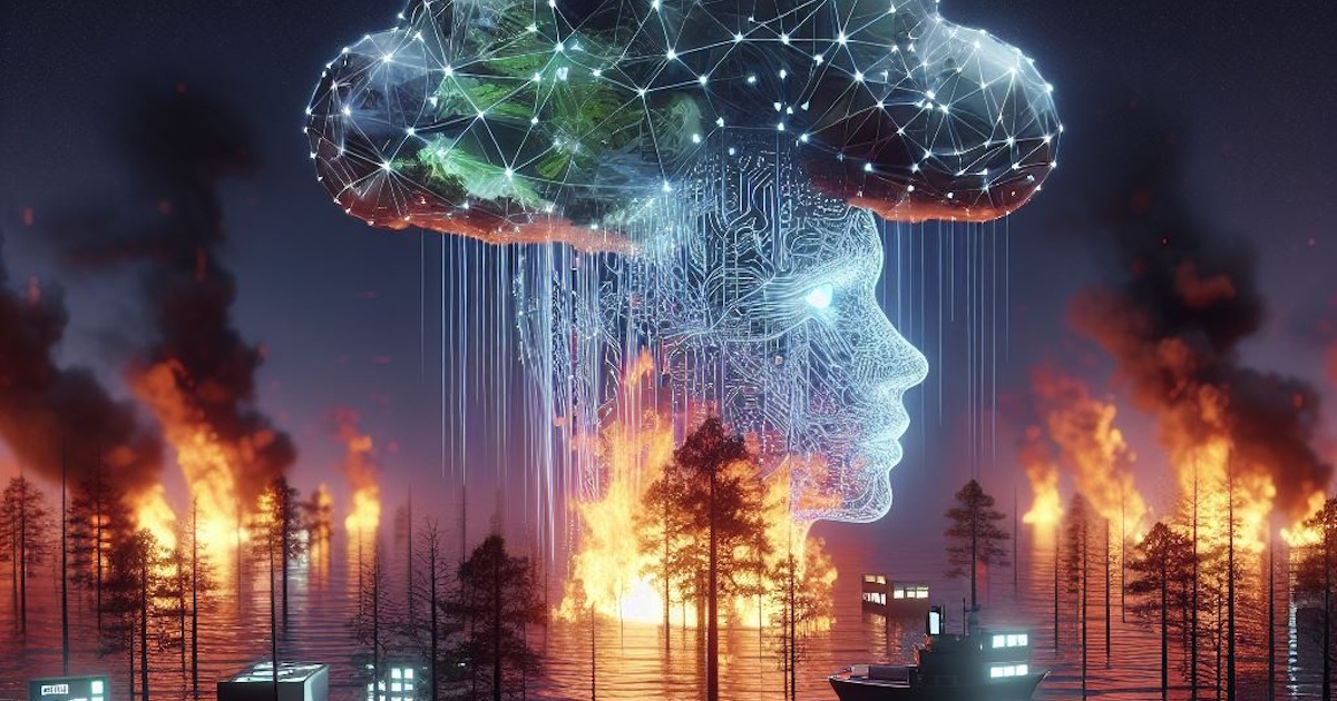
In recent years, we have witnessed escalating climate change and its increasing impact on global ecosystems, human lives, and the world economy. This situation calls for advanced tools that can leverage artificial intelligence (AI) for the early detection, prediction, and modeling of natural disasters. The increasing frequency and intensity of events such as wildfires, flooding, storms, and other catastrophic incidents necessitate innovative approaches for mitigation and response. This call for papers invites contributions that address the critical aspects of this interesting field, focusing on the integration of AI methodologies with remote sensing data. We encourage submissions that span a wide range of topics, including reviews of state-of-the-art AI applications for natural disaster management, risk assessment and hazard prediction; the use of AI to detect and track specific events; modeling techniques employing AI; and the development of advanced forecasting models utilizing AI methodologies.

The aim of this call is to bring together researchers and experts from various areas to foster collaborative efforts in developing cutting-edge solutions that will enhance our ability to anticipate, understand, and respond to the increasing challenges posed by natural disasters in an era of climate change.

Dr. Moulay A. Akhloufi
Dr. Mozhdeh Shahbazi
Topic Editors

Keywords

  • AI for natural disasters
  • forest fires, flooding, storms, earthquakes
  • forest monitoring, environmental monitoring, natural risks
  • forecasting models, mitigation, and response
  • earth observation, remote sensing
  • multispectral, hyperspectral, LiDAR, photogrammetry
  • machine learning, deep learning, data fusion, image processing
  • mapping, modelling, digital twins

Participating Journals

Journal Name Impact Factor CiteScore Launched Year First Decision (median) APC
AI
ai
3.1 7.2 2020 20.8 Days CHF 1600 Submit
Big Data and Cognitive Computing
BDCC
3.7 7.1 2017 18.2 Days CHF 1800 Submit
Fire
fire
3.0 3.1 2018 15 Days CHF 2400 Submit
GeoHazards
geohazards
- 2.6 2020 20.7 Days CHF 1000 Submit
Remote Sensing
remotesensing
4.2 8.3 2009 23 Days CHF 2700 Submit

Preprints.org is a multidiscipline platform providing preprint service that is dedicated to sharing your research from the start and empowering your research journey.

MDPI Topics is cooperating with Preprints.org and has built a direct connection between MDPI journals and Preprints.org. Authors are encouraged to enjoy the benefits by posting a preprint at Preprints.org prior to publication:

  1. Immediately share your ideas ahead of publication and establish your research priority;
  2. Protect your idea from being stolen with this time-stamped preprint article;
  3. Enhance the exposure and impact of your research;
  4. Receive feedback from your peers in advance;
  5. Have it indexed in Web of Science (Preprint Citation Index), Google Scholar, Crossref, SHARE, PrePubMed, Scilit and Europe PMC.

Published Papers (3 papers)

Order results
Result details
Journals
Select all
Export citation of selected articles as:
22 pages, 1891 KiB  
Article
Fire-RPG: An Urban Fire Detection Network Providing Warnings in Advance
by Xiangsheng Li and Yongquan Liang
Fire 2024, 7(7), 214; https://doi.org/10.3390/fire7070214 - 26 Jun 2024
Viewed by 169
Abstract
Urban fires are characterized by concealed ignition points and rapid escalation, making the traditional methods of detecting early stage fire accidents inefficient. Thus, we focused on the features of early stage fire accidents, such as faint flames and thin smoke, and established a [...] Read more.
Urban fires are characterized by concealed ignition points and rapid escalation, making the traditional methods of detecting early stage fire accidents inefficient. Thus, we focused on the features of early stage fire accidents, such as faint flames and thin smoke, and established a dataset. We found that these features are mostly medium-sized and small-sized objects. We proposed a model based on YOLOv8s, Fire-RPG. Firstly, we introduced an extra very small object detection layer to enhance the detection performance for early fire features. Next, we optimized the model structure with the bottleneck in GhostV2Net, which reduced the computational time and the parameters. The Wise-IoUv3 loss function was utilized to decrease the harmful effects of low-quality data in the dataset. Finally, we integrated the low-cost yet high-performance RepVGG block and the CBAM attention mechanism to enhance learning capabilities. The RepVGG block enhances the extraction ability of the backbone and neck structures, while CBAM focuses the attention of the model on specific size objects. Our experiments showed that Fire-RPG achieved an mAP of 81.3%, an improvement of 2.2%. In addition, Fire-RPG maintained high detection performance across various fire scenarios. Therefore, our model can provide timely warnings and accurate detection services. Full article
15 pages, 3788 KiB  
Article
Wildfire Susceptibility Prediction Based on a CA-Based CCNN with Active Learning Optimization
by Qiuping Yu, Yaqin Zhao, Zixuan Yin and Zhihao Xu
Fire 2024, 7(6), 201; https://doi.org/10.3390/fire7060201 - 16 Jun 2024
Viewed by 323
Abstract
Wildfires cause great losses to the ecological environment, economy, and people’s safety and belongings. As a result, it is crucial to establish wildfire susceptibility models and delineate fire risk levels. It has been proven that the use of remote sensing data, such as [...] Read more.
Wildfires cause great losses to the ecological environment, economy, and people’s safety and belongings. As a result, it is crucial to establish wildfire susceptibility models and delineate fire risk levels. It has been proven that the use of remote sensing data, such as meteorological and topographical data, can effectively predict and evaluate wildfire susceptibility. Accordingly, this paper converts meteorological and topographical data into fire-influencing factor raster maps for wildfire susceptibility prediction. The continuous convolutional neural network (CCNN for short) based on coordinate attention (CA for short) can aggregate different location information into channels of the network so as to enhance the feature expression ability; moreover, for different patches with different resolutions, the improved CCNN model does not need to change the structural parameters of the network, which improves the flexibility of the network application in different forest areas. In order to reduce the annotation of training samples, we adopt an active learning method to learn positive features by selecting high-confidence samples, which contributes to enhancing the discriminative ability of the network. We use fire probabilities output from the model to evaluate fire risk levels and generate the fire susceptibility map. Taking Chongqing Municipality in China as an example, the experimental results show that the CA-based CCNN model has a better classification performance; the accuracy reaches 91.7%, and AUC reaches 0.9487, which is 5.1% and 2.09% higher than the optimal comparative method, respectively. Furthermore, if an accuracy of about 86% is desired, our method only requires 50% of labeled samples and thus saves about 20% and 40% of the labeling efforts compared to the other two methods, respectively. Ultimately, the proposed model achieves the balance of high prediction accuracy and low annotation cost and is more helpful in classifying fire high warning zones and fire-free zones. Full article
Show Figures

Figure 1

12 pages, 3871 KiB  
Article
Multitemporal Dynamics of Fuels in Forest Systems Present in the Colombian Orinoco River Basin Forests
by Walter Garcia-Suabita, Mario José Pacheco and Dolors Armenteras
Fire 2024, 7(6), 171; https://doi.org/10.3390/fire7060171 - 21 May 2024
Viewed by 487
Abstract
In Colombia’s Orinoco, wildfires have a profound impact on ecosystem dynamics, particularly affecting savannas and forest–savanna transitions. Human activities have disrupted the natural fire regime, leading to increased wildfire frequency due to changes in land use, deforestation, and climate change. Despite extensive research [...] Read more.
In Colombia’s Orinoco, wildfires have a profound impact on ecosystem dynamics, particularly affecting savannas and forest–savanna transitions. Human activities have disrupted the natural fire regime, leading to increased wildfire frequency due to changes in land use, deforestation, and climate change. Despite extensive research on fire monitoring and prediction, the quantification of fuel accumulation, a critical factor in fire incidence, remains inadequately explored. This study addresses this gap by quantifying dead organic material (detritus) accumulation and identifying influencing factors. Using Brown transects across forests with varying fire intensities, we assessed fuel loads and characterized variables related to detritus accumulation over time. Employing factor analysis, principal components analysis, and a generalized linear mixed model, we determined the effects of various factors. Our findings reveal significant variations in biomass accumulation patterns influenced by factors such as thickness, wet and dry mass, density, gravity, porosity, and moisture content. Additionally, a decrease in fuel load over time was attributed to increased precipitation from three La Niña events. These insights enable more accurate fire predictions and inform targeted forest management strategies for fire prevention and mitigation, thereby enhancing our understanding of fire ecology in the Orinoco basin and guiding effective conservation practices. Full article
Show Figures

Figure 1

Back to TopTop