Next Issue
Volume 11, March-2
Previous Issue
Volume 11, February-2
 
 
remotesensing-logo

Journal Browser

Journal Browser

Remote Sens., Volume 11, Issue 5 (March-1 2019) – 129 articles

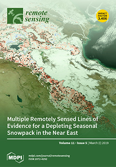
Cover Story (view full-size image): The snow-fed basins of the Near East are experiencing a decline in terrestrial water storage. The full observational record of the GRACE satellite gravimetry shows a clear, declining trend over the higher elevations of four river basins. We used several remote sensors (MODIS, AMSR-E, AMSR2) and the outputs of ERA5 reanalysis to understand the relationship between water storage anomalies and snowpack. MODIS products point toward a significant, declining trend in montane snowpack in this region. The reduction in snow cover duration positively correlated with the GRACE water storage decline and peak snow water equivalent from ERA5. The reanalysis data provided several hints as to the possible drivers of snowpack depletion. We propose that pressure on the water towers of the Near East may increase with continued snowpack depletion in this semi-arid region. View this paper.
  • Issues are regarded as officially published after their release is announced to the table of contents alert mailing list.
  • You may sign up for e-mail alerts to receive table of contents of newly released issues.
  • PDF is the official format for papers published in both, html and pdf forms. To view the papers in pdf format, click on the "PDF Full-text" link, and use the free Adobe Reader to open them.
Order results
Result details
Section
Select all
Export citation of selected articles as:
15 pages, 9203 KiB  
Article
Mapping Agricultural Landuse Patterns from Time Series of Landsat 8 Using Random Forest Based Hierarchial Approach
by Sajid Pareeth, Poolad Karimi, Mojtaba Shafiei and Charlotte De Fraiture
Remote Sens. 2019, 11(5), 601; https://doi.org/10.3390/rs11050601 - 12 Mar 2019
Cited by 31 | Viewed by 7378
Abstract
Increase in irrigated area, driven by demand for more food production, in the semi-arid regions of Asia and Africa is putting pressure on the already strained available water resources. To cope and manage this situation, monitoring spatial and temporal dynamics of the irrigated [...] Read more.
Increase in irrigated area, driven by demand for more food production, in the semi-arid regions of Asia and Africa is putting pressure on the already strained available water resources. To cope and manage this situation, monitoring spatial and temporal dynamics of the irrigated area land use at basin level is needed to ensure proper allocation of water. Publicly available satellite data at high spatial resolution and advances in remote sensing techniques offer a viable opportunity. In this study, we developed a new approach using time series of Landsat 8 (L8) data and Random Forest (RF) machine learning algorithm by introducing a hierarchical post-processing scheme to extract key Land Use Land Cover (LULC) types. We implemented this approach for Mashhad basin in Iran to develop a LULC map at 15 m spatial resolution with nine classes for the crop year 2015/2016. In addition, five irrigated land use types were extracted for three crop years—2013/2014, 2014/2015, and 2015/2016—using the RF models. The total irrigated area was estimated at 1796.16 km2, 1581.7 km2 and 1578.26 km2 for the cropping years 2013/2014, 2014/2015 and 2015/2016, respectively. The overall accuracy of the final LULC map was 87.2% with a kappa coefficient of 0.85. The methodology was implemented using open data and open source libraries. The ability of the RF models to extract key LULC types at basin level shows the usability of such approaches for operational near real time monitoring. Full article
(This article belongs to the Special Issue Multitemporal Land Cover and Land Use Mapping)
Show Figures

Figure 1

16 pages, 3630 KiB  
Article
Toward Content-Based Hyperspectral Remote Sensing Image Retrieval (CB-HRSIR): A Preliminary Study Based on Spectral Sensitivity Functions
by Olfa Ben-Ahmed, Thierry Urruty, Noël Richard and Christine Fernandez-Maloigne
Remote Sens. 2019, 11(5), 600; https://doi.org/10.3390/rs11050600 - 12 Mar 2019
Cited by 14 | Viewed by 4709
Abstract
With the emergence of huge volumes of high-resolution Hyperspectral Images (HSI) produced by different types of imaging sensors, analyzing and retrieving these images require effective image description and quantification techniques. Compared to remote sensing RGB images, HSI data contain hundreds of spectral bands [...] Read more.
With the emergence of huge volumes of high-resolution Hyperspectral Images (HSI) produced by different types of imaging sensors, analyzing and retrieving these images require effective image description and quantification techniques. Compared to remote sensing RGB images, HSI data contain hundreds of spectral bands (varying from the visible to the infrared ranges) allowing profile materials and organisms that only hyperspectral sensors can provide. In this article, we study the importance of spectral sensitivity functions in constructing discriminative representation of hyperspectral images. The main goal of such representation is to improve image content recognition by focusing the processing on only the most relevant spectral channels. The underlying hypothesis is that for a given category, the content of each image is better extracted through a specific set of spectral sensitivity functions. Those spectral sensitivity functions are evaluated in a Content-Based Image Retrieval (CBIR) framework. In this work, we propose a new HSI dataset for the remote sensing community, specifically designed for Hyperspectral remote sensing retrieval and classification. Exhaustive experiments have been conducted on this dataset and on a literature dataset. Obtained retrieval results prove that the physical measurements and optical properties of the scene contained in the HSI contribute in an accurate image content description than the information provided by the RGB image presentation. Full article
(This article belongs to the Special Issue Image Retrieval in Remote Sensing)
Show Figures

Graphical abstract

16 pages, 11163 KiB  
Article
Long-Term Land Cover Dynamics (1986–2016) of Northeast China Derived from a Multi-Temporal Landsat Archive
by Yuanyuan Zhao, Duole Feng, Le Yu, Yuqi Cheng, Meinan Zhang, Xiaoxuan Liu, Yidi Xu, Lei Fang, Zhiliang Zhu and Peng Gong
Remote Sens. 2019, 11(5), 599; https://doi.org/10.3390/rs11050599 - 12 Mar 2019
Cited by 36 | Viewed by 4790
Abstract
Northeast China is a major grain production area, an ecological important forest area, and the largest old industrial base which is now suffering from economic growth slowdown and brain drain. Accurate and long-term dynamic land cover maps are highly demanded for many regional [...] Read more.
Northeast China is a major grain production area, an ecological important forest area, and the largest old industrial base which is now suffering from economic growth slowdown and brain drain. Accurate and long-term dynamic land cover maps are highly demanded for many regional applications. In this study, we developed a set of continuous annual land cover mapping product at 30 m resolution using multi-temporal Landsat images. The maps in year 2000 and 2015 were tested using another independent validation dataset and the overall accuracies were 80.69% and 88.38%, respectively. The accuracies of the maps were improved by the integration of multi-temporal Landsat images and post-classification strategies. We found a general trend that the total area of land that experienced a change in land cover each year increased over time. The area change of each land cover type is also detected. The area of forests was 3.92 × 10 5 km 2 in 1986, fluctuated under fire disturbance, but declined in a quite high rate over the period of 1989 to 2006, and finally stayed relatively stable in area around 3.58 × 10 5 km 2 . The expansion of croplands was the leading land cover change from 1986 to 2000, and then the total area of croplands slightly declined under the Grain to Green Project of China, while shrublands, grasslands and wetlands began to increase. The area of impervious surfaces increased by more than 502% during the last three decades, and about 73% of the new built-up area was converted from croplands. We also demonstrated the our maps could capture the important land cover conversion processes, such as urbanization, forest logging activities, and agricultural expansion. Full article
Show Figures

Figure 1

26 pages, 11684 KiB  
Article
On the Potential of RST-FLOOD on Visible Infrared Imaging Radiometer Suite Data for Flooded Areas Detection
by Teodosio Lacava, Emanuele Ciancia, Mariapia Faruolo, Nicola Pergola, Valeria Satriano and Valerio Tramutoli
Remote Sens. 2019, 11(5), 598; https://doi.org/10.3390/rs11050598 - 12 Mar 2019
Cited by 6 | Viewed by 3610
Abstract
Timely and continuous information about flood spatiotemporal evolution are fundamental to ensure an effective implementation of the relief and rescue operations in case of inundation events. In this framework, satellite remote sensing may provide a valuable contribution provided that robust data analysis methods [...] Read more.
Timely and continuous information about flood spatiotemporal evolution are fundamental to ensure an effective implementation of the relief and rescue operations in case of inundation events. In this framework, satellite remote sensing may provide a valuable contribution provided that robust data analysis methods are implemented and suitable data, in terms of spatial, spectral and temporal resolutions, are employed. In this paper, the Robust Satellite Techniques (RST) approach, a satellite-based differential approach, already applied at detecting flooded areas (and therefore christened RST-FLOOD) with good results on different polar orbiting optical sensors (i.e., Advanced Very High Resolution Radiometer – AVHRR – and Moderate Resolution Imaging Spectroradiometer – MODIS), has been fully implemented on time series of Suomi National Polar-orbiting Partnership (Suomi-NPP-SNPP) Visible Infrared Imaging Radiometer Suite (VIIRS) data. The flooding event affecting the Metaponto Plain in Basilicata and Puglia regions (southern Italy) in December 2013 was selected as a case study and investigated by analysing five years (only December month) of VIIRS Imagery bands at 375 m spatial resolution. The achieved results clearly indicate the potential of the proposed approach, especially when compared with a satellite-based high resolution map of flooded area, as well as with the official flood hazard map of the area and the outputs of a recent published VIIRS-based method. Both flood extent and dynamics have been recognized with good reliability during the investigated period, with only a residual 11.5% of possible false positives over an inundated area extent of about 73 km2. In addition, a flooded area of about 18 km2 was found outside the hazard map, suggesting it requires updating to better manage flood risk and prevent future damages. Finally, the achieved results indicate that medium-resolution optical data, if analysed with robust methodologies like RST-FLOOD, can be suitable for detecting and monitoring floods also in case of small hydrological basins. Full article
(This article belongs to the Section Remote Sensing in Geology, Geomorphology and Hydrology)
Show Figures

Graphical abstract

17 pages, 3408 KiB  
Article
Fully Convolutional Networks and Geographic Object-Based Image Analysis for the Classification of VHR Imagery
by Nicholus Mboga, Stefanos Georganos, Tais Grippa, Moritz Lennert, Sabine Vanhuysse and Eléonore Wolff
Remote Sens. 2019, 11(5), 597; https://doi.org/10.3390/rs11050597 - 12 Mar 2019
Cited by 52 | Viewed by 5695
Abstract
Land cover Classified maps obtained from deep learning methods such as Convolutional neural networks (CNNs) and fully convolutional networks (FCNs) usually have high classification accuracy but with the detailed structures of objects lost or smoothed. In this work, we develop a methodology based [...] Read more.
Land cover Classified maps obtained from deep learning methods such as Convolutional neural networks (CNNs) and fully convolutional networks (FCNs) usually have high classification accuracy but with the detailed structures of objects lost or smoothed. In this work, we develop a methodology based on fully convolutional networks (FCN) that is trained in an end-to-end fashion using aerial RGB images only as input. Skip connections are introduced into the FCN architecture to recover high spatial details from the lower convolutional layers. The experiments are conducted on the city of Goma in the Democratic Republic of Congo. We compare the results to a state-of-the art approach based on a semi-automatic Geographic object image-based analysis (GEOBIA) processing chain. State-of-the art classification accuracies are obtained by both methods whereby FCN and the best baseline method have an overall accuracy of 91.3% and 89.5% respectively. The maps have good visual quality and the use of an FCN skip architecture minimizes the rounded edges that is characteristic of FCN maps. Additional experiments are done to refine FCN classified maps using segments obtained from GEOBIA generated at different scale and minimum segment size. High OA of up to 91.5% is achieved accompanied with an improved edge delineation in the FCN maps, and future work will involve explicitly incorporating boundary information from the GEOBIA segmentation into the FCN pipeline in an end-to-end fashion. Finally, we observe that FCN has a lower computational cost than the standard patch-based CNN approach especially at inference. Full article
(This article belongs to the Special Issue Object Based Image Analysis for Remote Sensing)
Show Figures

Graphical abstract

18 pages, 6496 KiB  
Article
Surface Parameters Retrieval from Fully Bistatic Radar Scattering Data
by Ying Yang, Kun-Shan Chen and Guofei Shang
Remote Sens. 2019, 11(5), 596; https://doi.org/10.3390/rs11050596 - 12 Mar 2019
Cited by 5 | Viewed by 6073
Abstract
Fully bistatic radar scattering from rough surfaces is of vital importance in terrain remote sensing, but results in bulky data volume. The scattering is dependent on physical parameters of the media and is controlled by the radar observation geometry. Together, the two sets [...] Read more.
Fully bistatic radar scattering from rough surfaces is of vital importance in terrain remote sensing, but results in bulky data volume. The scattering is dependent on physical parameters of the media and is controlled by the radar observation geometry. Together, the two sets of parameters determine the scattering patterns in a bistatic plane confined by incident and polar angles in both incident and scattering directions. For radar remote sensing, it is desirable to infer surface parameters of interest, with satisfactory accuracy, from large volumes of measured data sets. This is essentially a task of data mining. In this paper, we present model-generated bistatic radar scattering data, followed by a sensitivity analysis, to identify a suitable configuration in terms of parameter inversion from fully bistatic measurements by a Kalman filter-trained dynamic learning neural network (DLNN). Results indicate that with bistatic observation, superior retrieval performance (as compared to backscattering observation) can be readily achieved. Full article
(This article belongs to the Special Issue Radar Imaging Theory, Techniques, and Applications)
Show Figures

Graphical abstract

22 pages, 15348 KiB  
Article
Estimating Rangeland Forage Production Using Remote Sensing Data from a Small Unmanned Aerial System (sUAS) and PlanetScope Satellite
by Han Liu, Randy A. Dahlgren, Royce E. Larsen, Scott M. Devine, Leslie M. Roche, Anthony T. O’ Geen, Andy J.Y. Wong, Sarah Covello and Yufang Jin
Remote Sens. 2019, 11(5), 595; https://doi.org/10.3390/rs11050595 - 12 Mar 2019
Cited by 27 | Viewed by 7518
Abstract
Rangelands cover ~23 million hectares and support a $3.4 billion annual cattle industry in California. Large variations in forage production from year to year and across the landscape make grazing management difficult. We here developed optimized methods to map high-resolution forage production using [...] Read more.
Rangelands cover ~23 million hectares and support a $3.4 billion annual cattle industry in California. Large variations in forage production from year to year and across the landscape make grazing management difficult. We here developed optimized methods to map high-resolution forage production using multispectral remote sensing imagery. We conducted monthly flights using a Small Unmanned Aerial System (sUAS) in 2017 and 2018 over a 10-ha deferred grazing rangeland. Daily maps of NDVI at 30-cm resolution were first derived by fusing monthly 30-cm sUAS imagery and more frequent 3-m PlanetScope satellite observations. We estimated aboveground net primary production as a product of absorbed photosynthetically active radiation (APAR) derived from NDVI and light use efficiency (LUE), optimized as a function of topography and climate stressors. The estimated forage production agreed well with field measurements having a R2 of 0.80 and RMSE of 542 kg/ha. Cumulative NDVI and APAR were less correlated with measured biomass ( R 2 = 0.68). Daily forage production maps captured similar seasonal and spatial patterns compared to field-based biomass measurements. Our study demonstrated the utility of aerial and satellite remote sensing technology in supporting adaptive rangeland management, especially during an era of climatic extremes, by providing spatially explicit and near-real-time forage production estimates. Full article
Show Figures

Graphical abstract

20 pages, 14748 KiB  
Article
A Single Shot Framework with Multi-Scale Feature Fusion for Geospatial Object Detection
by Shuo Zhuang, Ping Wang, Boran Jiang, Gang Wang and Cong Wang
Remote Sens. 2019, 11(5), 594; https://doi.org/10.3390/rs11050594 - 12 Mar 2019
Cited by 33 | Viewed by 5530
Abstract
With the rapid advances in remote-sensing technologies and the larger number of satellite images, fast and effective object detection plays an important role in understanding and analyzing image information, which could be further applied to civilian and military fields. Recently object detection methods [...] Read more.
With the rapid advances in remote-sensing technologies and the larger number of satellite images, fast and effective object detection plays an important role in understanding and analyzing image information, which could be further applied to civilian and military fields. Recently object detection methods with region-based convolutional neural network have shown excellent performance. However, these two-stage methods contain region proposal generation and object detection procedures, resulting in low computation speed. Because of the expensive manual costs, the quantity of well-annotated aerial images is scarce, which also limits the progress of geospatial object detection in remote sensing. In this paper, on the one hand, we construct and release a large-scale remote-sensing dataset for geospatial object detection (RSD-GOD) that consists of 5 different categories with 18,187 annotated images and 40,990 instances. On the other hand, we design a single shot detection framework with multi-scale feature fusion. The feature maps from different layers are fused together through the up-sampling and concatenation blocks to predict the detection results. High-level features with semantic information and low-level features with fine details are fully explored for detection tasks, especially for small objects. Meanwhile, a soft non-maximum suppression strategy is put into practice to select the final detection results. Extensive experiments have been conducted on two datasets to evaluate the designed network. Results show that the proposed approach achieves a good detection performance and obtains the mean average precision value of 89.0% on a newly constructed RSD-GOD dataset and 83.8% on the Northwestern Polytechnical University very high spatial resolution-10 (NWPU VHR-10) dataset at 18 frames per second (FPS) on a NVIDIA GTX-1080Ti GPU. Full article
(This article belongs to the Section Remote Sensing Image Processing)
Show Figures

Figure 1

25 pages, 10576 KiB  
Article
Automatic Detection of Open and Vegetated Water Bodies Using Sentinel 1 to Map African Malaria Vector Mosquito Breeding Habitats
by Andy Hardy, Georgina Ettritch, Dónall E. Cross, Pete Bunting, Francis Liywalii, Jacob Sakala, Andrew Silumesii, Douglas Singini, Mark Smith, Tom Willis and Chris J. Thomas
Remote Sens. 2019, 11(5), 593; https://doi.org/10.3390/rs11050593 - 12 Mar 2019
Cited by 64 | Viewed by 9965
Abstract
Providing timely and accurate maps of surface water is valuable for mapping malaria risk and targeting disease control interventions. Radar satellite remote sensing has the potential to provide this information but current approaches are not suitable for mapping African malarial mosquito aquatic habitats [...] Read more.
Providing timely and accurate maps of surface water is valuable for mapping malaria risk and targeting disease control interventions. Radar satellite remote sensing has the potential to provide this information but current approaches are not suitable for mapping African malarial mosquito aquatic habitats that tend to be highly dynamic, often with emergent vegetation. We present a novel approach for mapping both open and vegetated water bodies using serial Sentinel-1 imagery for Western Zambia. This region is dominated by the seasonally inundated Upper Zambezi floodplain that suffers from a number of public health challenges. The approach uses open source segmentation and machine learning (extra trees classifier), applied to training data that are automatically derived using freely available ancillary data. Refinement is implemented through a consensus approach and Otsu thresholding to eliminate false positives due to dry flat sandy areas. The results indicate a high degree of accuracy (mean overall accuracy 92% st dev 3.6) providing a tractable solution for operationally mapping water bodies in similar large river floodplain unforested environments. For the period studied, 70% of the total water extent mapped was attributed to vegetated water, highlighting the importance of mapping both open and vegetated water bodies for surface water mapping. Full article
Show Figures

Graphical abstract

21 pages, 16509 KiB  
Article
Mapping Pure Mangrove Patches in Small Corridors and Sandbanks Using Airborne Hyperspectral Imagery
by Cheng-Chien Liu, Tsai-Wen Hsu, Hui-Lin Wen and Kung-Hwa Wang
Remote Sens. 2019, 11(5), 592; https://doi.org/10.3390/rs11050592 - 12 Mar 2019
Cited by 8 | Viewed by 4008
Abstract
Taijiang National Park (TNP) of Taiwan is the northernmost geographical position of mangrove habitats in the Northern Hemisphere. Instead of occupying a vast region with a single species, the mangroves in TNP are usually mingled with other plants in a narrow corridor along [...] Read more.
Taijiang National Park (TNP) of Taiwan is the northernmost geographical position of mangrove habitats in the Northern Hemisphere. Instead of occupying a vast region with a single species, the mangroves in TNP are usually mingled with other plants in a narrow corridor along the water or in groups on a small sandbank. The multi-spectral images acquired from the spaceborne platforms are therefore limited in mapping the abundance and distribution of the mangrove species in TNP. We report the work of mapping pure mangrove patches in small corridors and sandbanks in TNP using airborne Compact Airborne Spectrographic Imager (CASI) hyperspectral imagery. Bu considering the similarity of spectral reflectance among three species of mangrove and other plants, we followed the concept of supervised classification to select a few training areas with known mangrove trees, where the training areas are determined from the detailed map of mangrove distribution derived from the field investigation. The Hourglass hyperspectral analysis technique was employed to identify the endmembers of pure mangrove in the training areas. The results are consistent with the current distribution of mangrove trees, and the remarkable feature of a “mangrove desert” highlights a fact that biodiversity can be easily and quickly destroyed if no protection is provided. Some remnant patches located by this research are very important to the management of mangrove trees. Full article
(This article belongs to the Special Issue Remote Sensing of Mangroves)
Show Figures

Figure 1

4 pages, 171 KiB  
Editorial
Google Earth Engine Applications
by Onisimo Mutanga and Lalit Kumar
Remote Sens. 2019, 11(5), 591; https://doi.org/10.3390/rs11050591 - 12 Mar 2019
Cited by 253 | Viewed by 25319
Abstract
The Google Earth Engine (GEE) is a cloud computing platform designed to store and process huge data sets (at petabyte-scale) for analysis and ultimate decision making [...] Full article
(This article belongs to the Collection Google Earth Engine Applications)
11 pages, 3920 KiB  
Article
Deriving High Spatial-Resolution Coastal Topography From Sub-meter Satellite Stereo Imagery
by Luís Pedro Almeida, Rafael Almar, Erwin W. J. Bergsma, Etienne Berthier, Paulo Baptista, Erwan Garel, Olusegun A. Dada and Bruna Alves
Remote Sens. 2019, 11(5), 590; https://doi.org/10.3390/rs11050590 - 12 Mar 2019
Cited by 53 | Viewed by 8098
Abstract
High spatial resolution coastal Digital Elevation Models (DEMs) are crucial to assess coastal vulnerability and hazards such as beach erosion, sedimentation, or inundation due to storm surges and sea level rise. This paper explores the possibility to use high spatial-resolution Pleiades (pixel size [...] Read more.
High spatial resolution coastal Digital Elevation Models (DEMs) are crucial to assess coastal vulnerability and hazards such as beach erosion, sedimentation, or inundation due to storm surges and sea level rise. This paper explores the possibility to use high spatial-resolution Pleiades (pixel size = 0.7 m) stereoscopic satellite imagery to retrieve a DEM on sandy coastline. A 40-km coastal stretch in the Southwest of France was selected as a pilot-site to compare topographic measurements obtained from Pleiades satellite imagery, Real Time Kinematic GPS (RTK-GPS) and airborne Light Detection and Ranging System (LiDAR). The derived 2-m Pleiades DEM shows an overall good agreement with concurrent methods (RTK-GPS and LiDAR; correlation coefficient of 0.9), with a vertical Root Mean Squared Error (RMS error) that ranges from 0.35 to 0.48 m, after absolute coregistration to the LiDAR dataset. The largest errors (RMS error > 0.5 m) occurred in the steep dune faces, particularly at shadowed areas. This work shows that DEMs derived from sub-meter satellite imagery capture local morphological features (e.g., berm or dune shape) on a sandy beach, over a large spatial domain. Full article
(This article belongs to the Special Issue Applications of Remote Sensing in Coastal Areas)
Show Figures

Graphical abstract

17 pages, 4719 KiB  
Article
Using the Himawari-8 AHI Multi-Channel to Improve the Calculation Accuracy of Outgoing Longwave Radiation at the Top of the Atmosphere
by Bu-Yo Kim and Kyu-Tae Lee
Remote Sens. 2019, 11(5), 589; https://doi.org/10.3390/rs11050589 - 11 Mar 2019
Cited by 13 | Viewed by 4770
Abstract
In this study, Himawari-8 Advanced Himawari Imager (AHI) longwave channel data that is sensitive to clouds and absorption gas were used to improve the accuracy of the algorithm used to calculate outgoing longwave radiation (OLR) at the top of the atmosphere. A radiative [...] Read more.
In this study, Himawari-8 Advanced Himawari Imager (AHI) longwave channel data that is sensitive to clouds and absorption gas were used to improve the accuracy of the algorithm used to calculate outgoing longwave radiation (OLR) at the top of the atmosphere. A radiative transfer model with a variety of atmospheric conditions was run using Garand vertical profile data as input data. The results of the simulation showed that changes in AHI channels 8, 12, 15, and 16, which were used to calculate OLR, were sensitive to changes in cloud characteristics (cloud optical thickness and cloud height) and absorption gases (water vapor, O3, CO2, aerosol optical thickness) in the atmosphere. When compared to long-term analysis OLR data from 2017, as recorded by the Cloud and Earth’s Radiant Energy System (CERES), the OLR calculated in this study had an annual mean bias of 2.28 Wm−2 and a root mean square error (RMSE) of 11.03 Wm−2. The new calculation method mitigated the problem of overestimations in OLR in mostly cloudy and overcast regions and underestimated OLR in cloud-free desert regions. It is also an improvement over the result from the existing OLR calculation algorithm, which uses window and water vapor channels. Full article
(This article belongs to the Section Atmospheric Remote Sensing)
Show Figures

Graphical abstract

21 pages, 1974 KiB  
Article
Identification of the Best Hyperspectral Indices in Estimating Plant Species Richness in Sandy Grasslands
by Yu Peng, Min Fan, Lan Bai, Weiguo Sang, Jinchao Feng, Zhixin Zhao and Ziye Tao
Remote Sens. 2019, 11(5), 588; https://doi.org/10.3390/rs11050588 - 11 Mar 2019
Cited by 21 | Viewed by 4879
Abstract
Numerous spectral indices have been developed to assess plant diversity. However, since they are developed in different areas and vegetation type, it is difficult to make a comprehensive comparison among these indices. The primary objective of this study was to explore the optimum [...] Read more.
Numerous spectral indices have been developed to assess plant diversity. However, since they are developed in different areas and vegetation type, it is difficult to make a comprehensive comparison among these indices. The primary objective of this study was to explore the optimum spectral indices that can predict plant species richness across different communities in sandy grassland. We use 7339 spectral indices (7217 we developed and 122 that were extracted from literature) to predict plant richness using a two-year dataset of plant species and spectra information at 270 plots. For this analysis, we employed cluster analysis, correlation analysis, and stepwise linear regression. The spectral variability within the 420–480 nm and 760–900 nm ranges, the first derivative value at the sensitive bands, and the normalized difference at narrow spectral ranges correlated well with plant species richness. Within the 7339 indices that were investigated, the first-order derivative values at 606 and 583 nm, the reflectance combinations on red bands: (R802 − R465)/(R802 + R681) and (R750 − R550)/(R750 + R550) showed a stable performance in both the independent calibration and validation datasets (R2 > 0.27, p < 0.001, RMSE < 1.7). They can be regarded as the best spectral indices to estimate plant species richness in sandy grasslands. In addition to these spectral variation indices, the first derivative values or the normalized difference of the sensitive bands also reflect plant diversity. These results can help to improve the estimation of plant diversity using satellite-based airborne and hand-held hyperspectral sensors. Full article
(This article belongs to the Section Remote Sensing in Agriculture and Vegetation)
Show Figures

Graphical abstract

10 pages, 3341 KiB  
Technical Note
Automatic Estimation of Urban Waterlogging Depths from Video Images Based on Ubiquitous Reference Objects
by Jingchao Jiang, Junzhi Liu, Changxiu Cheng, Jingzhou Huang and Anke Xue
Remote Sens. 2019, 11(5), 587; https://doi.org/10.3390/rs11050587 - 11 Mar 2019
Cited by 27 | Viewed by 3591
Abstract
Video supervision equipment, which is readily available in most cities, can record the processes of urban floods in video form. Ubiquitous reference objects, which often appear in videos, can be used to indicate urban waterlogging depths. This makes video images a valuable data [...] Read more.
Video supervision equipment, which is readily available in most cities, can record the processes of urban floods in video form. Ubiquitous reference objects, which often appear in videos, can be used to indicate urban waterlogging depths. This makes video images a valuable data source for obtaining waterlogging depths. However, the urban waterlogging information contained in video images has not been effectively mined and utilized. In this paper, we present a method to automatically estimate urban waterlogging depths from video images based on ubiquitous reference objects. First, reference objects from video images are detected during the flooding and non-flooding periods using an object detection model with a convolutional neural network (CNN). Then, waterlogging depths are estimated using the height differences between the detected reference objects in these two periods. A case study is used to evaluate the proposed method. The results show that our proposed method could effectively mine and utilize urban waterlogging depth information from video images. This method has the advantages of low economic cost, acceptable accuracy, high spatiotemporal resolution, and wide coverage. It is feasible to promote this proposed method within cities to monitor urban floods. Full article
Show Figures

Graphical abstract

18 pages, 3783 KiB  
Article
A Workflow to Estimate Topographic and Volumetric Changes and Errors in Channel Sedimentation after Disturbance
by Samira Nourbakhshbeidokhti, Alicia M. Kinoshita, Anne Chin and Joan L. Florsheim
Remote Sens. 2019, 11(5), 586; https://doi.org/10.3390/rs11050586 - 11 Mar 2019
Cited by 32 | Viewed by 5755
Abstract
Light Detection and Ranging (LiDAR) methods, such as ground-based Terrestrial Laser Scanning (TLS), have enabled collection of high-resolution point clouds of elevation data to calculate changes in fluvial systems after disturbance, but are often accompanied by uncertainty and errors. This paper reviews and [...] Read more.
Light Detection and Ranging (LiDAR) methods, such as ground-based Terrestrial Laser Scanning (TLS), have enabled collection of high-resolution point clouds of elevation data to calculate changes in fluvial systems after disturbance, but are often accompanied by uncertainty and errors. This paper reviews and compares TLS analysis methods and develops a workflow to estimate topographic and volumetric changes in channel sedimentation after disturbance. Four analytic methods to estimate topographic and volumetric changes were compared by quantifying the uncertainty in TLS-derived products: Digital Elevation Model (DEM) of difference (DOD), Cloud to Cloud (C2C), Cloud to Mesh (C2M), and Multiple Model to Model Cloud Comparison (M3C2). Mean errors across surfaces within each dataset contributed to a propagation error of 0.015–0.016 m and 0.017–0.018 m for the point clouds and derived DEMs, respectively. The estimated error of the total volumetric change implied increased errors in the conversion of point clouds into a surface by C2M and DOD; whereas C2C and M3C2 were generally simpler, efficient, and accurate techniques for evaluating topographic changes. The comparison of methods to analyze TLS data will contribute to applications of remote sensing of hydro-geomorphic processes in stream channels after disturbance. The workflow presented also aids in estimating uncertainties inherent in data collection and analytic methods for topographic and volumetric change analysis. Full article
(This article belongs to the Section Remote Sensing in Geology, Geomorphology and Hydrology)
Show Figures

Graphical abstract

20 pages, 17033 KiB  
Article
Characterizing and Monitoring Ground Settlement of Marine Reclamation Land of Xiamen New Airport, China with Sentinel-1 SAR Datasets
by Xiaojie Liu, Chaoying Zhao, Qin Zhang, Chengsheng Yang and Jing Zhang
Remote Sens. 2019, 11(5), 585; https://doi.org/10.3390/rs11050585 - 11 Mar 2019
Cited by 43 | Viewed by 5607
Abstract
Artificial lands or islands reclaimed from the sea due to their vast land spaces and air are suitable for the construction of airports, harbors, and industrial parks, which are convenient for human and cargo transportation. However, the settlement process of reclamation foundation is [...] Read more.
Artificial lands or islands reclaimed from the sea due to their vast land spaces and air are suitable for the construction of airports, harbors, and industrial parks, which are convenient for human and cargo transportation. However, the settlement process of reclamation foundation is a problem of public concern, including soil consolidation and water recharge. Xiamen New Airport, one of the largest international airports in China, has been under construction on marine reclamation land for three years. At present, the airport has reached the second phase of construction, occupying 15.33 km2. The project will last about twenty years. To investigate the temporal and spatial evolution of ground settlement associated with land reclamation, Sentinel-1 synthetic aperture radar (SAR) data, including intensity images and phase measurements, were considered. A total of 82 SAR images acquired by C-band Sentinel-1 satellite covering the time period from August 2015 to October 2018 were collected. First, the spatial evolution process of land reclamation was analyzed by exploring the time series of SAR image intensity maps. Then, the small baseline subset InSAR (SBAS–InSAR) technique was used to retrieve ground deformation information over the past three years for the first time since land reclamation. Results suggest that the reclaimed land experienced remarkable subsidence, especially after the second phase of land reclamation. Furthermore, 26 ground settlement areas (i.e., 0.015% of the whole area) associated with land reclamation were uncovered over an area of more than 1200 km2 of the Xiamen coastal area from January 2017 to October 2018. This study offers important guidance for the next phase of land reclamation and the future construction of Xiamen New Airport. Full article
(This article belongs to the Special Issue Applications of Remote Sensing in Coastal Areas)
Show Figures

Graphical abstract

13 pages, 6770 KiB  
Article
Significant Wave Height Estimation from Space-Borne Cyclone-GNSS Reflectometry
by Qin Peng and Shuanggen Jin
Remote Sens. 2019, 11(5), 584; https://doi.org/10.3390/rs11050584 - 11 Mar 2019
Cited by 25 | Viewed by 4526
Abstract
The significant wave height (SWH) of the sea is an important parameter and plays an important role in the prediction of waves and ocean dynamics. However, traditional methods, e.g., buoys or traditional remote sensing techniques such as X-band radar image have small measurement [...] Read more.
The significant wave height (SWH) of the sea is an important parameter and plays an important role in the prediction of waves and ocean dynamics. However, traditional methods, e.g., buoys or traditional remote sensing techniques such as X-band radar image have small measurement range and high cost. Recently, Global Navigation Satellite System-Reflectometry (GNSS-R) has provided a new opportunity to estimate the SWH, especially the space-borne Cyclone-GNSS (CYGNSS) launched on December 15, 2016. The GNSS-R uses the GNSS-reflected signal received by the receiver to invert ground physical parameters with all-weather, global fast coverage, high resolution, high precision, high long-term stability, rich signal sources, passive detection, and strong concealment. In this paper, the global ocean significant wave height is estimated using space-borne CYGNSS GNSS-R data for the first time though the relationship between the square root of the signal-to-noise ratio (SNR) data of CYGNSS delayed Doppler map (DDM) and the SWH. Then, the estimated significant wave height is compared with the satellite altimeter and buoy data. Compared with the AVISO SWH observation, the standard deviation value reaches 0.3080 m and the correlation coefficient reaches 0.9473 m. The correlation coefficient with the buoy SWH observation is 0.9539 m and the standard deviation is 0.2761 m. The SWH estimations from CYGNSS can provide important support in ocean shipping development, marine environmental protection, marine disaster warning and forecasting. Full article
(This article belongs to the Section Ocean Remote Sensing)
Show Figures

Graphical abstract

18 pages, 5841 KiB  
Article
Entrance Pupil Irradiance Estimating Model for a Moon-Based Earth Radiation Observatory Instrument
by Wentao Duan, Shaopeng Huang and Chenwei Nie
Remote Sens. 2019, 11(5), 583; https://doi.org/10.3390/rs11050583 - 10 Mar 2019
Cited by 16 | Viewed by 3890
Abstract
A Moon-based Earth radiation observatory (MERO) could provide a longer-term continuous measurement of radiation exiting the Earth system compared to current satellite-based observatories. In order to parameterize the detector for such a newly-proposed MERO, the evaluation of the instrument’s entrance pupil irradiance (EPI) [...] Read more.
A Moon-based Earth radiation observatory (MERO) could provide a longer-term continuous measurement of radiation exiting the Earth system compared to current satellite-based observatories. In order to parameterize the detector for such a newly-proposed MERO, the evaluation of the instrument’s entrance pupil irradiance (EPI) is of great importance. The motivation of this work is to build an EPI estimating model for a simplified single-pixel MERO instrument. The rationale of this model is to sum the contributions of every location in the MERO-viewed region on the Earth’s top of atmosphere (TOA) to the MERO sensor’s EPI, taking into account the anisotropy in the longwave radiance at the Earth TOA. Such anisotropy could be characterized by the TOA anisotropic factors, which can be derived from the Clouds and the Earth’s Radiant Energy System (CERES) angular distribution models (ADMs). As an application, we estimated the shortwave (SW) (0.3–5 µm) and longwave (LW) (5–200 µm) EPIs for a hypothetic MERO instrument located at the Apollo 15 landing site. Results show that the SW EPI varied from 0 to 0.065 W/m2, while the LW EPI ranged between 0.061 and 0.075 W/m2 from 1 to 29 October, 2017. We also utilized this model to predict the SW and LW EPIs for any given location within the MERO-deployable region (region of 80.5°W–80.5°E and 81.5°S–81.5°N on the nearside of the Moon) for the future 18.6 years from October 2017 to June 2036. Results suggest that the SW EPI will vary between 0 and 0.118 W/m2, while the LW EPI will range from 0.056 to 0.081 W/m2. Though the EPI estimating model in this study was built for a simplistic single-pixel instrument, it could eventually be extended and improved in order to estimate the EPI for a multi-pixel MERO sensor. Full article
(This article belongs to the Special Issue Earth Radiation Budget)
Show Figures

Graphical abstract

19 pages, 5553 KiB  
Article
Estimation of Cargo Handling Capacity of Coastal Ports in China Based on Panel Model and DMSP-OLS Nighttime Light Data
by Aoshuang Liu, Ye Wei, Bailang Yu and Wei Song
Remote Sens. 2019, 11(5), 582; https://doi.org/10.3390/rs11050582 - 10 Mar 2019
Cited by 9 | Viewed by 4620
Abstract
The cargo handling capacity of a port is the most basic and important indicator of port size. Based on the Defense Meteorological Satellite Program-Operational Linescan System (DMSP-OLS) nighttime light data and panel model, this study attempts to estimate the cargo handling capacity of [...] Read more.
The cargo handling capacity of a port is the most basic and important indicator of port size. Based on the Defense Meteorological Satellite Program-Operational Linescan System (DMSP-OLS) nighttime light data and panel model, this study attempts to estimate the cargo handling capacity of 28 coastal ports in China using satellite remote sensing. The study confirmed that there is a very close correlation between DMSP-OLS nighttime light data and the cargo handling capacity of the ports. Based on this correlation, the panel data model was established for remote sensing-based estimation of cargo handling capacity at the port and port group scales. The test results confirm that the nighttime light data can be used to accurately estimate the cargo handling capacity of Chinese ports, especially for the Yangtze River Delta Port Group, Pearl River Delta Port Group, Southeast Coastal Port Group, and Southwest Coastal Port Group that possess huge cargo handling capacities. The high accuracy of the model reveals that the remote sensing analysis method can make up for the lack of statistical data to a certain extent, which helps to scientifically analyze the spatiotemporal dynamic changes of coastal ports, provides a strong basis for decision-making regarding port development, and more importantly provides a convenient estimation method for areas that have long lacked statistical data on cargo handling capacity. Full article
(This article belongs to the Special Issue Remote Sensing Based Fine-Scale Urban Thermal Environment)
Show Figures

Graphical abstract

12 pages, 14777 KiB  
Letter
Scattering Characterization of Obliquely Oriented Buildings from PolSAR Data Using Eigenvalue-Related Model
by Sinong Quan, Boli Xiong, Deliang Xiang, Canbin Hu and Gangyao Kuang
Remote Sens. 2019, 11(5), 581; https://doi.org/10.3390/rs11050581 - 10 Mar 2019
Cited by 15 | Viewed by 3029
Abstract
Scattering characterization of obliquely oriented buildings (OOBs) from polarimetric synthetic aperture radar (PolSAR) data is challenging since the general double-bounce scattering does not support their dominant scattering mechanism. In this paper, a physical scattering model combining the eigenvalues of coherency matrix is proposed [...] Read more.
Scattering characterization of obliquely oriented buildings (OOBs) from polarimetric synthetic aperture radar (PolSAR) data is challenging since the general double-bounce scattering does not support their dominant scattering mechanism. In this paper, a physical scattering model combining the eigenvalues of coherency matrix is proposed to characterize the scattering of OOBs. The coherency matrix is first operated by eigenvalue decomposition and a refined OOB descriptor is presented based on these eigenvalues. Considering the actual proportions of co-polarization and cross-polarization components, the descriptor is then adopted to modify the matrix elements of the well-known cross scattering model, thus introducing the OOB scattering model. Finally, strategies of model parameter solution are designed and the involved decomposition is complete accordingly. The proposed method is tested on spaceborne and airborne PolSAR data and the results confirm its effectiveness, which clearly call for further research and application. Full article
(This article belongs to the Section Remote Sensing Image Processing)
Show Figures

Graphical abstract

19 pages, 14252 KiB  
Article
Damage Detection and Analysis of Urban Bridges Using Terrestrial Laser Scanning (TLS), Ground-Based Microwave Interferometry, and Permanent Scatterer Interferometry Synthetic Aperture Radar (PS-InSAR)
by Xianglei Liu, Peipei Wang, Zhao Lu, Kai Gao, Hui Wang, Chiyu Jiao and Xuedong Zhang
Remote Sens. 2019, 11(5), 580; https://doi.org/10.3390/rs11050580 - 09 Mar 2019
Cited by 33 | Viewed by 5021
Abstract
This paper presents a practical framework for urban bridge damage detection and analysis by using three key techniques: terrestrial laser scanning (TLS), ground-based microwave interferometry, and permanent scatterer interferometry synthetic aperture radar (PS-InSAR). The proposed framework was tested on the Beishatan Bridge in [...] Read more.
This paper presents a practical framework for urban bridge damage detection and analysis by using three key techniques: terrestrial laser scanning (TLS), ground-based microwave interferometry, and permanent scatterer interferometry synthetic aperture radar (PS-InSAR). The proposed framework was tested on the Beishatan Bridge in Beijing, China. Firstly, a Digital Surface Model (DSM) of the lower surface of the bridge was constructed based on the point cloud generated by using TLS to obtain the potential damage area. Secondly, the dynamic time-series displacement of the potential damage area was acquired by ground-based microwave interferometry, and the Extreme-Point Symmetric Mode Decomposition (ESMD) method was applied to detect damages by the use of signal decomposition and instantaneous frequency calculation. Lastly, the PS-InSAR technique was applied to obtain the surface deformation around Beishatan Bridge by using COSMO-SkyMed images with a ground resolution of 3 m × 3 m, and finally, we analyzed the causes of bridge damage. The experimental results showed that the proposed framework can effectively obtain the potential damage area of the bridge by the DSM from the point cloud by TLS and further judge whether the bridge was damaged by the ESMD method, based on the time-series displacement data. The results also showed that the subway shield construction may be the reason for damage to Beishatan Bridge. Full article
(This article belongs to the Special Issue Remote Sensing for Monitoring Infrastructure Deformation)
Show Figures

Graphical abstract

25 pages, 4164 KiB  
Article
Operational Soil Moisture from ASCAT in Support of Water Resources Management
by Khidir Abdalla Kwal Deng, Salim Lamine, Andrew Pavlides, George P. Petropoulos, Prashant K. Srivastava, Yansong Bao, Dionissios Hristopulos and Vasileios Anagnostopoulos
Remote Sens. 2019, 11(5), 579; https://doi.org/10.3390/rs11050579 - 09 Mar 2019
Cited by 18 | Viewed by 4104
Abstract
This study provides the results of an extensive investigation of the Advanced Scaterometter (ASCAT) surface soil moisture global operational product accuracy across three continents (United States of America (USA), Europe, and Australia). ASCAT predictions of surface soil moisture were compared against near concurrent [...] Read more.
This study provides the results of an extensive investigation of the Advanced Scaterometter (ASCAT) surface soil moisture global operational product accuracy across three continents (United States of America (USA), Europe, and Australia). ASCAT predictions of surface soil moisture were compared against near concurrent in situ measurements from the FLUXNET observational network. A total of nine experimental sites were used to assess the accuracy of ASCAT Surface Soil Moisture (ASCAT SSM) predictions for two complete years of observations (2010, 2011). Results showed a generally reasonable agreement between the ASCAT product and the in situ soil moisture measurements in the 0–5 cm soil moisture layer. The Root Mean Square Error (RMSE) was below 0.135 m3 m−3 at all of the sites. With a few exceptions, Pearson’s correlation coefficient was above 45%. Grassland, shrublands, and woody savanna land cover types exhibited satisfactory agreement in all the sites analyzed (RMSE ranging from 0.05 to 0.13 m3 m−3). Seasonal performance was tested, but no definite conclusion can be made with statistical significance at this time, as the seasonal results varied from continent to continent and from year to year. However, the satellite and in situ measurements for Needleleaf forests were practically uncorrelated (R = −0.11 and −0.04). ASCAT predictions overestimated the observed values at all of the sites in Australia. A positive bias of approximately 0.05 m3 m−3 was found with respect to the observed values that were in the range 0–0.3 m3 m−3. Better agreement was observed for the grassland sites in most cases (RMSE ranging from 0.09 to 0.10 m3 m−3 and R from 0.46 to 0.90). Our results provide supportive evidence regarding the potential value of the ASCAT global operational product for meso-scale studies and the relevant practical applications. A key contribution of this study is a comprehensive evaluation of ASCAT product soil moisture estimates at different sites around the globe. These sites represent a variety of climatic, environmental, biome, and topographical conditions. Full article
(This article belongs to the Special Issue Recent Advances in Satellite Derived Global Land Product Validation)
Show Figures

Graphical abstract

12 pages, 2959 KiB  
Technical Note
Multi-Channel Optical Receiver for Ground-Based Topographic Hyperspectral Remote Sensing
by Sean E. Salazar and Richard A. Coffman
Remote Sens. 2019, 11(5), 578; https://doi.org/10.3390/rs11050578 - 09 Mar 2019
Cited by 4 | Viewed by 4379
Abstract
Receiver design is integral to the development of a new remote sensor. An effective receiver delivers backscattered light to the detector while optimizing the signal-to-noise ratio at the desired wavelengths. Towards the goal of effective receiver design, a multi-channel optical receiver was developed [...] Read more.
Receiver design is integral to the development of a new remote sensor. An effective receiver delivers backscattered light to the detector while optimizing the signal-to-noise ratio at the desired wavelengths. Towards the goal of effective receiver design, a multi-channel optical receiver was developed to collect range-resolved, backscattered energy for simultaneous hyperspectral and differential absorption spectrometry (LAS) measurements. The receiver is part of a new, ground-based, multi-mode lidar instrument for remote characterization of soil properties. The instrument, referred to as the soil observation laser absorption spectrometer (SOLAS), was described previously in the literature. A detailed description of the multi-channel receiver of the SOLAS is presented herein. The hyperspectral channel receives light across the visible near-infrared (VNIR) to shortwave infrared (SWIR) spectrum (350–2500 nm), while the LAS channel was optimized for detection in a narrower portion of the near-infrared range (820–850 nm). The range-dependent field of view for each channel is presented and compared with the beam evolution of the SOLAS instrument transmitter. Laboratory-based testing of each of the receiver channels was performed to determine the effectiveness of the receiver. Based on reflectance spectra collected for four soil types, at distances of 20, 35, and 60 m from the receiver, reliable hyperspectral measurements were gathered, independent of the range to the target. Increased levels of noise were observed at the edges of the VNIR and SWIR detector ranges, which were attributed to the lack of sensitivity of the instrument in these regions. The suitability of the receiver design, for the collection of both hyperspectral and LAS measurements at close-ranges, is documented herein. Future development of the instrument will enable the combination of long-range, ground-based hyperspectral measurements with the LAS measurements to correct for absorption, due to atmospheric water vapor. The envisioned application for the instrument includes the rapid characterization of bare or vegetated soils and minerals, such as are present in mine faces and tailings, or unstable slopes. Full article
Show Figures

Figure 1

16 pages, 3425 KiB  
Article
A Remote Sensing Based Integrated Approach to Quantify the Impact of Fluvial and Pluvial Flooding in an Urban Catchment
by Manoranjan Muthusamy, Monica Rivas Casado, Gloria Salmoral, Tracy Irvine and Paul Leinster
Remote Sens. 2019, 11(5), 577; https://doi.org/10.3390/rs11050577 - 08 Mar 2019
Cited by 36 | Viewed by 7060
Abstract
Pluvial (surface water) flooding is often the cause of significant flood damage in urban areas. However, pluvial flooding is often overlooked in catchments which are historically known for fluvial floods. In this study, we present a conceptual remote sensing based integrated approach to [...] Read more.
Pluvial (surface water) flooding is often the cause of significant flood damage in urban areas. However, pluvial flooding is often overlooked in catchments which are historically known for fluvial floods. In this study, we present a conceptual remote sensing based integrated approach to enhance current practice in the estimation of flood extent and damage and characterise the spatial distribution of pluvial and fluvial flooding. Cockermouth, a town which is highly prone to flooding, was selected as a study site. The flood event caused by named storm Desmond in 2015 (5-6/12/2015) was selected for this study. A high resolution digital elevation model (DEM) was produced from a composite digital surface model (DSM) and a digital terrain model (DTM) obtained from the Environment Agency. Using this DEM, a 2D flood model was developed in HEC-RAS (v5) 2D for the study site. Simulations were carried out with and without pluvial flooding. Calibrated models were then used to compare the fluvial and combined (pluvial and fluvial) flood damage areas for different land use types. The number of residential properties affected by both fluvial and combined flooding was compared using a combination of modelled results and data collected from Unmanned Aircraft Systems (UAS). As far as the authors are aware, this is the first time that remote sensing data, hydrological modelling and flood damage data at a property level have been combined to differentiate between the extent of flooding and damage caused by fluvial and pluvial flooding in the same event. Results show that the contribution of pluvial flooding should not be ignored, even in a catchment where fluvial flooding is the major cause of the flood damages. Although the additional flood depths caused by the pluvial contribution were lower than the fluvial flood depths, the affected area is still significant. Pluvial flooding increased the overall number of affected properties by 25%. In addition, it increased the flood depths in a number of properties that were identified as being affected by fluvial flooding, in some cases by more than 50%. These findings show the importance of taking pluvial flooding into consideration in flood management practices. Further, most of the data used in this study was obtained via remote sensing methods, including UAS. This demonstrates the merit of developing a remote sensing based framework to enhance current practices in the estimation of both flood extent and damage. Full article
(This article belongs to the Special Issue Remote Sensing of Hydrological Extremes)
Show Figures

Graphical abstract

17 pages, 5539 KiB  
Article
Trends in Woody and Herbaceous Vegetation in the Savannas of West Africa
by Julius Y. Anchang, Lara Prihodko, Armel T. Kaptué, Christopher W. Ross, Wenjie Ji, Sanath S. Kumar, Brianna Lind, Mamadou A. Sarr, Abdoul A. Diouf and Niall P. Hanan
Remote Sens. 2019, 11(5), 576; https://doi.org/10.3390/rs11050576 - 08 Mar 2019
Cited by 27 | Viewed by 5204
Abstract
We assess 32 years of vegetation change in the West African Sudano-Sahelian region following the drought events of the 1970s and 1980s. Change in decadal mean rain use efficiency is used to diagnose trends in woody vegetation that is expected to respond more [...] Read more.
We assess 32 years of vegetation change in the West African Sudano-Sahelian region following the drought events of the 1970s and 1980s. Change in decadal mean rain use efficiency is used to diagnose trends in woody vegetation that is expected to respond more slowly to post-drought rainfall gains, while change in the slope of the productivity–rainfall relationship is used to infer changing herbaceous conditions between early and late periods of the time series. The linearity/non-linearity of the productivity–rainfall relationship and its impact on the interpretation of overall greening trends, and specific woody and herbaceous vegetation trends, is also examined. Our results show a mostly positive association between productivity and rainfall (69% of pixels), which can be best described as linear (32%) or saturating (37%). Choosing the ‘best’ model at a specific location using Akaike Information Criterion has no discernible effect on the interpretation of overall greening or herbaceous trends, but does influence the detection of trends in woody vegetation. We conclude that widespread recovery in woody vegetation is responsible for the post-drought greening phenomenon reported elsewhere for the Sahel and Sudanian sub-regions. Meanwhile, trends in herbaceous vegetation are less pronounced, with no consistent indication towards either herbaceous degradation or recovery. Full article
(This article belongs to the Special Issue Approaches for Monitoring Land Degradation with Remote Sensing)
Show Figures

Graphical abstract

20 pages, 3800 KiB  
Article
Evaluating the Performance of a Random Forest Kernel for Land Cover Classification
by Azar Zafari, Raul Zurita-Milla and Emma Izquierdo-Verdiguier
Remote Sens. 2019, 11(5), 575; https://doi.org/10.3390/rs11050575 - 08 Mar 2019
Cited by 35 | Viewed by 9246 | Correction
Abstract
The production of land cover maps through satellite image classification is a frequent task in remote sensing. Random Forest (RF) and Support Vector Machine (SVM) are the two most well-known and recurrently used methods for this task. In this paper, we evaluate the [...] Read more.
The production of land cover maps through satellite image classification is a frequent task in remote sensing. Random Forest (RF) and Support Vector Machine (SVM) are the two most well-known and recurrently used methods for this task. In this paper, we evaluate the pros and cons of using an RF-based kernel (RFK) in an SVM compared to using the conventional Radial Basis Function (RBF) kernel and standard RF classifier. A time series of seven multispectral WorldView-2 images acquired over Sukumba (Mali) and a single hyperspectral AVIRIS image acquired over Salinas Valley (CA, USA) are used to illustrate the analyses. For each study area, SVM-RFK, RF, and SVM-RBF were trained and tested under different conditions over ten subsets. The spectral features for Sukumba were extended by obtaining vegetation indices (VIs) and grey-level co-occurrence matrices (GLCMs), the Salinas dataset is used as benchmarking with its original number of features. In Sukumba, the overall accuracies (OAs) based on the spectral features only are of 81.34 % , 81.08 % and 82.08 % for SVM-RFK, RF, and SVM-RBF. Adding VI and GLCM features results in OAs of 82 % , 80.82 % and 77.96 % . In Salinas, OAs are of 94.42 % , 95.83 % and 94.16 % . These results show that SVM-RFK yields slightly higher OAs than RF in high dimensional and noisy experiments, and it provides competitive results in the rest of the experiments. They also show that SVM-RFK generates highly competitive results when compared to SVM-RBF while substantially reducing the time and computational cost associated with parametrizing the kernel. Moreover, SVM-RFK outperforms SVM-RBF in high dimensional and noisy problems. RF was also used to select the most important features for the extended dataset of Sukumba; the SVM-RFK derived from these features improved the OA of the previous SVM-RFK by 2%. Thus, the proposed SVM-RFK classifier is as at least as good as RF and SVM-RBF and can achieve considerable improvements when applied to high dimensional data and when combined with RF-based feature selection methods. Full article
(This article belongs to the Special Issue Remote Sensing in Support of Transforming Smallholder Agriculture)
Show Figures

Graphical abstract

14 pages, 4618 KiB  
Article
Population Mapping with Multisensor Remote Sensing Images and Point-Of-Interest Data
by Xuchao Yang, Tingting Ye, Naizhuo Zhao, Qian Chen, Wenze Yue, Jiaguo Qi, Biao Zeng and Peng Jia
Remote Sens. 2019, 11(5), 574; https://doi.org/10.3390/rs11050574 - 08 Mar 2019
Cited by 64 | Viewed by 7949
Abstract
Fine-resolution population distribution mapping is necessary for many purposes, which cannot be met by aggregated census data due to privacy. Many approaches utilize ancillary data that are related to population density, such as nighttime light imagery and land use, to redistribute the population [...] Read more.
Fine-resolution population distribution mapping is necessary for many purposes, which cannot be met by aggregated census data due to privacy. Many approaches utilize ancillary data that are related to population density, such as nighttime light imagery and land use, to redistribute the population from census to finer-scale units. However, most of the ancillary data used in the previous studies of population modeling are environmental data, which can only provide a limited capacity to aid population redistribution. Social sensing data with geographic information, such as point-of-interest (POI), are emerging as a new type of ancillary data for urban studies. This study, as a nascent attempt, combined POI and multisensor remote sensing data into new ancillary data to aid population redistribution from census to grid cells at a resolution of 250 m in Zhejiang, China. The accuracy of the results was assessed by comparing them with WorldPop. Results showed that our approach redistributed the population with fewer errors than WorldPop, especially at the extremes of population density. The approach developed in this study—incorporating POI with multisensor remotely sensed data in redistributing the population onto finer-scale spatial units—possessed considerable potential in the era of big data, where a substantial volume of social sensing data is increasingly being collected and becoming available. Full article
Show Figures

Graphical abstract

32 pages, 7118 KiB  
Article
Impact of the Revisit of Thermal Infrared Remote Sensing Observations on Evapotranspiration Uncertainty—A Sensitivity Study Using AmeriFlux Data
by Pierre C. Guillevic, Albert Olioso, Simon J. Hook, Joshua B. Fisher, Jean-Pierre Lagouarde and Eric F. Vermote
Remote Sens. 2019, 11(5), 573; https://doi.org/10.3390/rs11050573 - 08 Mar 2019
Cited by 21 | Viewed by 4755
Abstract
Thermal infrared remote sensing observations have been widely used to provide useful information on surface energy and water stress for estimating evapotranspiration (ET). However, the revisit time of current high spatial resolution (<100 m) thermal infrared remote sensing systems, sixteen days for Landsat [...] Read more.
Thermal infrared remote sensing observations have been widely used to provide useful information on surface energy and water stress for estimating evapotranspiration (ET). However, the revisit time of current high spatial resolution (<100 m) thermal infrared remote sensing systems, sixteen days for Landsat for example, can be insufficient to reliably derive ET information for water resources management. We used in situ ET measurements from multiple Ameriflux sites to (1) evaluate different scaling methods that are commonly used to derive daytime ET estimates from time-of-day observations; and (2) quantify the impact of different revisit times on ET estimates at monthly and seasonal time scales. The scaling method based on a constant evaporative ratio between ET and the top-of-atmosphere solar radiation provided slightly better results than methods using the available energy, the surface solar radiation or the potential ET as scaling reference fluxes. On average, revisit time periods of 2, 4, 8 and 16 days resulted in ET uncertainties of 0.37, 0.55, 0.73 and 0.90 mm per day in summer, which represented 13%, 19%, 23% and 31% of the monthly average ET calculated using the one-day revisit dataset. The capability of a system to capture rapid changes in ET was significantly reduced for return periods higher than eight days. The impact of the revisit on ET depended mainly on the land cover type and seasonal climate, and was higher over areas with high ET. We did not observe significant and systematic differences between the impacts of the revisit on monthly ET estimates that are based on morning or afternoon observations. We found that four-day revisit scenarios provided a significant improvement in temporal sampling to monitor surface ET reducing by around 40% the uncertainty of ET products derived from a 16-day revisit system, such as Landsat for instance. Full article
(This article belongs to the Special Issue Advances in the Remote Sensing of Terrestrial Evaporation)
Show Figures

Graphical abstract

19 pages, 5307 KiB  
Article
Retrieving Corn Canopy Leaf Area Index from Multitemporal Landsat Imagery and Terrestrial LiDAR Data
by Wei Su, Jianxi Huang, Desheng Liu and Mingzheng Zhang
Remote Sens. 2019, 11(5), 572; https://doi.org/10.3390/rs11050572 - 08 Mar 2019
Cited by 24 | Viewed by 4906
Abstract
Leaf angle is a critical structural parameter for retrieving canopy leaf area index (LAI) using the PROSAIL model. However, the traditional method using default leaf angle distribution in the PROSAIL model does not capture the phenological dynamics of canopy growth. This study presents [...] Read more.
Leaf angle is a critical structural parameter for retrieving canopy leaf area index (LAI) using the PROSAIL model. However, the traditional method using default leaf angle distribution in the PROSAIL model does not capture the phenological dynamics of canopy growth. This study presents a LAI retrieval method for corn canopies using PROSAIL model with leaf angle distribution functions referred from terrestrial laser scanning points at four phenological stages during the growing season. Specifically, four inferred maximum-probability leaf angles were used in the Campbell ellipsoid leaf angle distribution function of PROSAIL. A Lookup table (LUT) is generated by running the PROSAIL model with inferred leaf angles, and the cost function is minimized to retrieve LAI. The results show that the leaf angle distribution functions are different for the corn plants at different phenological growing stages, and the incorporation of derived specific corn leaf angle distribution functions distribute the improvement of LAI retrieval using the PROSAIL model. This validation is done using in-situ LAI measurements and MODIS LAI in Baoding City, Hebei Province, China, and compared with the LAI retrieved using default leaf angle distribution function at the same time. The root-mean-square error (RMSE) between the retrieved LAI on 4 September 2014, using the modified PROSAIL model and the in-situ measured LAI was 0.31 m2/m2, with a strong and significant correlation (R2 = 0.82, residual range = 0 to 0.6 m2/m2, p < 0.001). Comparatively, the accuracy of LAI retrieved results using default leaf angle distribution is lower, the RMSE of which is 0.56 with R2 = 0.76 and residual range = 0 to 1.0 m2/m2, p < 0.001. This validation reveals that the introduction of inferred leaf angle distributions from TLS data points can improve the LAI retrieval accuracy using the PROSAIL model. Moreover, the comparations of LAI retrieval results on 10 July, 26 July, 19 August and 4 September with default and inferred corn leaf angle distribution functions are all compared with MODIS LAI products in the whole study area. This validation reveals that improvement exists in a wide spatial range and temporal range. All the comparisons demonstrate the potential of the modified PROSAIL model for retrieving corn canopy LAI from Landsat imagery by inferring leaf orientation from terrestrial laser scanning data. Full article
Show Figures

Graphical abstract

Previous Issue
Next Issue
Back to TopTop