Topic Editors

1. International Research Center of Big Data for Sustainable Development, Beijing 100094, China
2. Key Laboratory of Digital Earth Science, Aerospace Information Research Institute, Chinese Academy of Sciences, Beijing 100094, China
1. State Key Laboratory of Remote Sensing Science, Aerospace Information Research Institute, Chinese Academy of Sciences, Beijing 100101, China
2. Department of Geoscience and Remote Sensing, Faculty of Civil Engineering and Geosciences, Delft University of Technology, 2628 Delft, The Netherlands
Department of Geography, The University of Hong Kong, Hong Kong 999077, China
Dr. Paola De Salvo
Group on Earth Observations (GEO) Secretariat Geneva, Geneva, Switzerland
Department of Information & Communication Technologies, School of Engineering and Technology (SET), AIT Asian Institute of Technology, 58 Moo 9, Km. 42, Paholyothin Highway, Klong Luang, Pathum Thani 12120, Thailand
Associate Professor of Applied Remote Sensing—Earth Observation Group, Department of Physics and Technology, UiT the Arctic University of Norway, 9019 Tromsø, Norway
School of Mathematical Sciences, Tongji University, Shanghai 201804, China
Prof. Dr. Xiyan Sun
Guangxi Key Laboratory of Precision Navigation Technology and Application, Guilin University of Electronic Technology, Guilin, China

Digital Environment Technology for Supporting Regional Sustainable Development

Abstract submission deadline
closed (30 September 2023)
Manuscript submission deadline
closed (31 December 2023)
Viewed by
18517

Topic Information

Dear Colleagues, 

The processes of the environment exert an immense and profound influence on all human productions and life. The undeniable effects of global warming on international and regional environments, such as water, land and atmosphere, energy style, and economic activities, call for innovative science and technology to mitigate its influences.

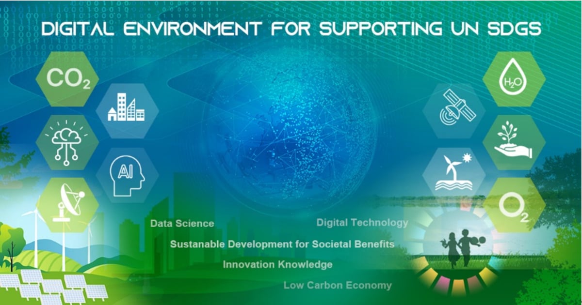
The world is currently undergoing sci-tech revolutions and industrial transformations on a larger scale and in greater depth than ever before. As a frontier of science and technology, digital technology is key to meeting the challenges of society, environment, and economy, which is also a vital element for achieving the United Nations Sustainable Development Goals (UN SDGs). Digital technologies, such as earth observations, data science, big data, and artificial intelligence, are integrating into every aspect of society.

The Earth's environment is sensitively impacted by and responds to climate actions, especially south Asian regions with rich hydrometeorological events, snow-ice-covered plateaus, and the Earth's poles. The scientific and decision-making concerns in these areas include: natural physical environmental changes; the interactions between climate actions and the environment; the strategies for climate actions to construct a future society–environment nexus; and how digital technologies, e.g., remote sensing, big data, communication, navigation, and ICT can assist the implementation of environmental assessments.

Digital Environment Technology (DET) employs frontier digital technology, including Big Earth Data, artificial intelligence, aerospace technology, big data, and data science to address the challenges raised by the changes in the Earth's environment, assist in global development and address the UN SDGs.

This Topic aims to deepen and advance our present understanding of essential regional environmental variables and their observations; novel data technology; high value-added data implementation; spatial–temporal variations; international data sharing and data management principles; the impact and interaction between climate actions and the environment; strategies for climate change mitigation and adaption based on the interaction between climate action and environment in a changing world and encouraging the sharing of cutting-edge methodologies and successful practices.

This Topic also welcomes technologies, methods, data, tools, platforms, and systems associated with the above issues. Contributions may be related to remote sensing, in-situ observation, and reanalysis or forecast modeling about the environment.

Papers may also be related to, but not limited to, the following topics:

  • Conceptual development of digital environment technology;
  • Implementation of environment essential variables by earth observations, AI and data-driven methods;
  • Value-added dataset publication about society, the economy, and the environment;
  • Distributions, patterns, and spatial–temporal variations of environmental variables;
  • Data science and data sharing aspects of data interoperability;
  • Exercises on international data sharing and management principles;
  • Applications and impact of big data on water security, disaster mitigation, food security, land and coast management, energy and green economy, etc.;
  • Big earth data supporting UN SDGs, especially data and innovative technology used to support SDGs 6, 7,12, 13, 14, and 15;
  • Technologies, methods, tools, and platforms associated with the above issues.

Prof. Dr. Yubao Qiu
Prof. Dr. Massimo Menenti
Dr. Hongsheng Zhang 
Dr. Paola De Salvo  
Dr. Salvatore Gonario Pasquale Virdis
Dr. Andrea Marinoni
Prof. Dr. Dunhui Xiao
Prof. Dr. Xiyan Sun
Topic Editors

Keywords

  • climate actions
  • remote sensing
  • data science
  • AI
  • environment
  • digital commons

Participating Journals

Journal Name Impact Factor CiteScore Launched Year First Decision (median) APC
AI
ai
- - 2020 20.8 Days CHF 1600
Land
land
3.9 3.7 2012 14.8 Days CHF 2600
Remote Sensing
remotesensing
5.0 7.9 2009 23 Days CHF 2700
Sustainability
sustainability
3.9 5.8 2009 18.8 Days CHF 2400
Water
water
3.4 5.5 2009 16.5 Days CHF 2600

Preprints.org is a multidiscipline platform providing preprint service that is dedicated to sharing your research from the start and empowering your research journey.

MDPI Topics is cooperating with Preprints.org and has built a direct connection between MDPI journals and Preprints.org. Authors are encouraged to enjoy the benefits by posting a preprint at Preprints.org prior to publication:

  1. Immediately share your ideas ahead of publication and establish your research priority;
  2. Protect your idea from being stolen with this time-stamped preprint article;
  3. Enhance the exposure and impact of your research;
  4. Receive feedback from your peers in advance;
  5. Have it indexed in Web of Science (Preprint Citation Index), Google Scholar, Crossref, SHARE, PrePubMed, Scilit and Europe PMC.

Published Papers (10 papers)

Order results
Result details
Journals
Select all
Export citation of selected articles as:
17 pages, 3313 KiB  
Article
Evaluation and Analysis of the County-Level Sustainable Development Process in Guangxi, China in 2014–2020
by Lanqing Shao, Guoqiang Jia, Yubao Qiu and Jianming Liu
Sustainability 2024, 16(4), 1641; https://doi.org/10.3390/su16041641 - 16 Feb 2024
Viewed by 862
Abstract
Sustainable development has become a scientific and decision-making consensus in countries and regions around the world. The current research on sustainable development mainly focuses on urban areas with a high level of economic development and intensive land use. Small-scale research, especially for underdeveloped [...] Read more.
Sustainable development has become a scientific and decision-making consensus in countries and regions around the world. The current research on sustainable development mainly focuses on urban areas with a high level of economic development and intensive land use. Small-scale research, especially for underdeveloped areas, is required to reveal the spatial patterns and differences within administrative units. This study focuses on 1241 towns in Guangxi to assess the sustainable development process and variations at the township scale from 2014 to 2020 by using the entropy method, the coupled coordination degree method, and cluster analysis. The results show that the average sustainable development goal composite index (SDGCI) of towns in Guangxi is around 0.12, and their overall sustainable development level is low. The SDGCI of towns in the central region shows an increasing trend, while that in the northern and southern regions shows a decreasing trend. Then, the SDGs are divided into three systems, namely people, planet, and prosperity. The prosperity system contributes the most to the overall SDGCI, and the low values of the people and planet systems are the reason for the low level of sustainable development in Guangxi. The coupling degree of the SDGCI among the three systems is at a high level, and the level of coupling coordination degree is good, which indicates high consistency and close linkage of the towns in Guangxi when pursuing the SDGs. The results of hierarchical cluster analysis show that towns in Guangxi can be divided into three categories to adapt to different features based on SDGCI values. The assessment of SDG process in towns in Guangxi could guide local governments to refine their development policy, formulate and adjust development strategies in a targeted manner, and promote balanced and sustainable development under townships. Full article
Show Figures

Figure 1

15 pages, 916 KiB  
Article
Configuration of Conditions Leading to High National Innovation Competitiveness: A Fuzzy Set Qualitative Comparative Analysis Approach
by Maping Zhang, Zongjun Wang and Xue Wang
Sustainability 2023, 15(18), 13698; https://doi.org/10.3390/su151813698 - 14 Sep 2023
Viewed by 976
Abstract
Under the conditions of economic integration and globalization, the importance of national innovation competitiveness is rapidly increasing. In order to study what combination of conditions can generate higher national innovation competitiveness, this study proposes an improved integrated framework for national innovation competitiveness and [...] Read more.
Under the conditions of economic integration and globalization, the importance of national innovation competitiveness is rapidly increasing. In order to study what combination of conditions can generate higher national innovation competitiveness, this study proposes an improved integrated framework for national innovation competitiveness and it examines the allocation conditions that affect the innovation competitiveness of countries with different income levels using data from the Global Competitiveness Report 2019. This research finds that, first, the means of achieving high innovation competitiveness output are more diversified for high-income and upper-middle-income countries, with countries at these two economic levels achieving high innovation competitiveness output in three scenarios. Second, lower-middle-income countries have a more homogeneous configuration for achieving high innovation competitiveness outputs, with only one scenario, which still holds after a series of robustness tests. Third, for high-income countries, commercialization is a key element affecting their innovation competitiveness enhancement. The study not only bridges the gap between existing theories and research methods but also provides a useful reference for countries at different levels of economic development to improve their innovation competitiveness. Full article
Show Figures

Figure 1

25 pages, 4516 KiB  
Article
Unveiling the Role of Zoos in Smart Cities: A Quantitative Analysis of the Degree of Smartness in Kyoto City Zoo
by Yuxuan Lin, Ruochen Yang, Ryosuke Shimoda, Zheng Xian and Shuhao Liu
Land 2023, 12(9), 1747; https://doi.org/10.3390/land12091747 - 08 Sep 2023
Viewed by 904
Abstract
The rapid pace of urbanization and the emergence of social challenges, including an aging population and increased labor costs resulting from the COVID-19 pandemic, have underscored the urgency to explore smart city solutions. Within these technologically advanced urban environments, zoos have assumed a [...] Read more.
The rapid pace of urbanization and the emergence of social challenges, including an aging population and increased labor costs resulting from the COVID-19 pandemic, have underscored the urgency to explore smart city solutions. Within these technologically advanced urban environments, zoos have assumed a pivotal role that extends beyond their recreational functions. They face labor cost challenges and ecological considerations while actively contributing to wildlife conservation, environmental education, and scientific research. Zoos foster a connection with nature, promote biodiversity awareness, and offer a valuable space for citizens, thereby directly supporting the pillars of sustainability, public engagement, and technological innovation in smart cities. This study employs a quantitative analysis to assess the alignment between smart projects and the distinctive characteristics of Kyoto Zoo. Through questionnaires, we collected feedback on performance and importance, and subsequently employed the analytic hierarchy process and the fuzzy integrated evaluation method to obtain quantitative results. The findings reveal the high level of intelligence exhibited by Kyoto Zoo, and the analysis provides insightful guidance that can be applied to other urban facilities. At the same time, we compared Kyoto Zoo with Ueno Zoo to see the difference in intellectualization achievements in different contexts in terms of data and systems. Full article
Show Figures

Figure 1

17 pages, 8747 KiB  
Article
Extraction and Spatiotemporal Evolution Analysis of Impervious Surface and Surface Runoff in Main Urban Region of Hefei City, China
by Gang Fang, Han Li, Jie Dong, Hanyang Teng, Renato Dan A. Pablo II and Yin Zhu
Sustainability 2023, 15(13), 10537; https://doi.org/10.3390/su151310537 - 04 Jul 2023
Cited by 2 | Viewed by 727
Abstract
The biophysical composition index (BCI)-based linear spectral mixture model (LSMM) is used in this study to extract the impervious surface (IS), vegetation, and soil coverage of the main urban region (MUR) of Hefei City over the 2001–2021 period. In addition, the Soil Conservation [...] Read more.
The biophysical composition index (BCI)-based linear spectral mixture model (LSMM) is used in this study to extract the impervious surface (IS), vegetation, and soil coverage of the main urban region (MUR) of Hefei City over the 2001–2021 period. In addition, the Soil Conservation Service-Curve Number (SCS-CN) model is first applied to simulate the surface runoff (SR) in the MUR of Hefei City over the past 21 years, then assessed for simulation accuracy using typical waterlogging points in the study area. On this basis, the spatiotemporal evolution of IS and SR and their relationships in the MUR of Hefei City are investigated and discussed in this study. The obtained results showed that (1) the root-mean-square error (RMSE), mean absolute error (MAE), and systematic error (SE) values of the BCI index-based LSMM are smaller than those of the LSMM, demonstrating a higher extraction accuracy of urban IS extraction of the BCI index-based LSMM. (2) The IS area of the MUR of Hefei City exhibits an increasing trend from 107.555 km2 in 2001 to 387.660 km2 in 2021. In addition, the change rate and change intensity values indicate an increasing–decreasing–increasing trend. The highest change rate and change intensity values are 24.839 km2/year and 23.094%, respectively, and were observed in the 2001–2005 period. (3) The simulated SR (165–195 mm) in the MUR of Hefei City demonstrates an increasing trend in the 2001–2021 period at a rainfall intensity value of 200 mm/d. In addition, the simulated SR amount in the central area exhibits slight changes, while that in the surrounding areas shows substantial variations. (4) The distribution of IS and SR in the MUR of Hefei City reveals strong directional variations, which are all affected by geographical conditions. The IS coverage and SR show high positive correlation coefficients in different years. (5) The present study provides primary data for effective urban planning, water resources management and regulation, and disaster prevention and mitigation in Hefei City, as well as a scientific reference for future studies on urban IS, SR, and their quantitative relationships in other regions. Full article
Show Figures

Figure 1

13 pages, 3069 KiB  
Article
Monitoring and Assessing Urbanization Progress in Thailand between 2000 and 2020 Using SDG Indicator 11.3.1
by Roshan Bhandari, Wenchao Xue, Salvatore G. P. Virdis, Ekbordin Winijkul, Thi Phuoc Lai Nguyen and Suraj Joshi
Sustainability 2023, 15(12), 9794; https://doi.org/10.3390/su15129794 - 19 Jun 2023
Cited by 2 | Viewed by 2533
Abstract
Urbanization, generally across developing countries, is accelerating at an ever-increasing pace along with population growth. The growth of built-up space is often disproportionate with the population growth rate, creating multiple stresses to the environment and hindering sustainable development. To account for this disproportionality, [...] Read more.
Urbanization, generally across developing countries, is accelerating at an ever-increasing pace along with population growth. The growth of built-up space is often disproportionate with the population growth rate, creating multiple stresses to the environment and hindering sustainable development. To account for this disproportionality, the SDG 11.3.1 indicator “Ratio of land consumption rate (LCR) to Population growth rate (PGR)” was developed to achieve SDG 11 and its integrated SDGs. This study assessed the variations in the LCR, PGR, and LCRPGR from 2000~2020, taking four different intervals of 5 years across Thailand, its provinces and regions by adopting the methodology recommended by UN-Habitat. A combined approach of remote sensing and statistical analysis was employed for assessing urban land use efficiency, the growth of built-up space and the relationship between the LCR and PGR in temporal as well as spatial dimensions. It was found that urban expansion is disproportionate with the PGR in most of the provinces and during a majority of the time intervals with the average LCRPGR of 0.70 (2000~2005), 1.6 (2005~2010), 0.40 (2010~2015) and 1.12 (2015~2020). Some of the studied periods (2005~2010 and 2015~2020) were dominated by the increasing built-up space in Thai provinces and regions as compared to the population growth rate, leading to higher per capita land consumption, and some experienced greater population growth, and rising urban compactness, while a few provinces tended towards stability, which was influenced by demographic factors and economic development. The average annual growth rate of built-up areas has declined in recent years across all the regions of Thailand. Further, this study is pivotal for urban planners and policymakers to promote more sustainable growth in Thai provinces and regions. Full article
Show Figures

Graphical abstract

18 pages, 10283 KiB  
Article
Inversion and Validation of FY-4A Official Land Surface Temperature Product
by Lixin Dong, Shihao Tang, Fuzhou Wang, Michael Cosh, Xianxiang Li and Min Min
Remote Sens. 2023, 15(9), 2437; https://doi.org/10.3390/rs15092437 - 05 May 2023
Cited by 7 | Viewed by 1517
Abstract
The thermal infrared data of Fengyun 4A (FY-4A) geostationary meteorological satellite can be used to retrieve hourly land surface temperature (LST). In this paper, seven candidate algorithms are compared and evaluated. The Ulivieri (1985) algorithm is determined to be optimal for the algorithm [...] Read more.
The thermal infrared data of Fengyun 4A (FY-4A) geostationary meteorological satellite can be used to retrieve hourly land surface temperature (LST). In this paper, seven candidate algorithms are compared and evaluated. The Ulivieri (1985) algorithm is determined to be optimal for the algorithm of FY-4A LST official products. The refined algorithm coefficients for distinguishing dry and moist atmosphere were established for daytime and nighttime, respectively. Then, FY-4A LST official products under clear-sky conditions are produced. The validation results show that: (1) Compared with in-situ measured LST data at the HeBi crop measurement network, the root mean square errors (RMSE) were 2.139 and 2.447 K. Compared with in-situ measured LST data at Naqu alpine meadow site of Tibet plateau, the RMSE was 2.86 K. (2) When compared with the MODIS LST product, the RMSE was 1.64, 2.17, 2.6, and 1.73 K in March, July, October, and December, respectively. By the bias long-time change at a single site, RMSE of the XLHT (city) and GZH (desert) sites were 2.735 and 2.97 K, respectively. Overall, the preferred algorithm exhibits good accuracy and meets the required accuracy of the FY-4A mission. Full article
Show Figures

Figure 1

16 pages, 726 KiB  
Article
Why Do Donors Donate? A Study on Donation-Based Crowdfunding in Malaysia
by Mohd Khairy Kamarudin, Nur Izzati Mohamad Norzilan, Fatin Nur Ainaa Mustaffa, Masyitah Khidzir, Suhaili Alma’amun, Nasrul Hisyam Nor Muhamad, Mohd Fauzi Abu-Hussin, Nurul Izzah Noor Zainan, Abdul Hafiz Abdullah and Abdul Basit Samat-Darawi
Sustainability 2023, 15(5), 4301; https://doi.org/10.3390/su15054301 - 28 Feb 2023
Cited by 3 | Viewed by 2358
Abstract
This study employed the Stimulus–Organism–Response (S-O-R) framework to investigate how social support and quality of the community affect the purpose to donate through donation-based crowdfunding. The online poll generated 359 responses, and the data were statistically analysed using the partial least square structural [...] Read more.
This study employed the Stimulus–Organism–Response (S-O-R) framework to investigate how social support and quality of the community affect the purpose to donate through donation-based crowdfunding. The online poll generated 359 responses, and the data were statistically analysed using the partial least square structural equation modelling (PLS-SEM) approach. Path coefficient analysis is also applied to figure out the outcomes of the relationships between the components. The results showed that service and system quality greatly influenced the donors’ trust towards the donation-based crowdfunding. In addition, statistics showed that trust, quality of services, information value, and emotional support played a substantial role in explaining the donation purposes. The results could help donation-based crowdfunding platforms to enhance their success rate of donation campaigns. This study also provided a management application for each relationship and suggested helpful measures in attracting potential donors and retaining them. Full article
Show Figures

Figure 1

22 pages, 7487 KiB  
Article
Evaluation of Global Land Use–Land Cover Data Products in Guangxi, China
by Xuan Hao, Yubao Qiu, Guoqiang Jia, Massimo Menenti, Jiangming Ma and Zhengxin Jiang
Remote Sens. 2023, 15(5), 1291; https://doi.org/10.3390/rs15051291 - 26 Feb 2023
Cited by 5 | Viewed by 2967
Abstract
Land use–land cover (LULC) is an important feature for ecological environment research, land resource management and evaluation. Although global high-resolution LULC data sets are booming, their regional performances were still evaluated in limited regions. To demonstrate the local applicability of global LULC data [...] Read more.
Land use–land cover (LULC) is an important feature for ecological environment research, land resource management and evaluation. Although global high-resolution LULC data sets are booming, their regional performances were still evaluated in limited regions. To demonstrate the local applicability of global LULC data products, six emerging LULC data products were evaluated and compared in Guangxi, China. The six products used are European Space Agency GlobCover (ESAGC), ESRI Land Use–Land Cover (ESRI–LULC), Finer Resolution Observation and Monitoring of Global Land Cover (FROM–GLC), the China Land Cover Dataset (CLCD), the Global Land Cover product with Fine Classification System at 30 m (GLC_FCS30) and GlobeLand30 (GLC30). Reference data were obtained from the local government statistical yearbook and high-resolution remote sensing images on Google Earth. The results showed that CLCD, ESRI–LULC and GLC30 were found to agree well with the forest reference data, with the highest correlation coefficient of 0.999. For the cropland areas, GLC30, CLCD and ESAGC agreed well with the reference data, and the highest correlation coefficient was 0.957. Combined with the comparison with the high-resolution images obtained by Google Earth, we finally concluded that ESAGC, CLCD and GLC30 can best represent the LULCs in Guangxi. Furthermore, the spatial consistency analysis showed that three or more products identified the same LULC type as high as 96.98% of the area. We suggest that majority voting might be applied to global LULC products to provide fused products with better performances on a regional or local scale to avoid the error caused by a single data product. Full article
Show Figures

Figure 1

15 pages, 1340 KiB  
Article
Fostering the Implementation of Nature Conservation Measures in Agricultural Landscapes: The NatApp
by Frauke Geppert, Sonoko D. Bellingrath-Kimura and Ioanna Mouratiadou
Sustainability 2023, 15(4), 3030; https://doi.org/10.3390/su15043030 - 07 Feb 2023
Cited by 2 | Viewed by 2029
Abstract
Large-scale, high-input, and intensified agriculture poses threats to sustainable agroecosystems and their inherent biodiversity. The EU Common Agricultural Policy (CAP) covers a great number of nature conservation programs (Agri-Environment and Climate Measures, AECM) aiming to encourage sustainable agriculture. Currently, farmers are not encouraged [...] Read more.
Large-scale, high-input, and intensified agriculture poses threats to sustainable agroecosystems and their inherent biodiversity. The EU Common Agricultural Policy (CAP) covers a great number of nature conservation programs (Agri-Environment and Climate Measures, AECM) aiming to encourage sustainable agriculture. Currently, farmers are not encouraged to broadly implement these measures due to the lack of structured information, overly complicated and unclear application procedures, and a high risk of sanctions. In addition, the current structures are associated with time-consuming monitoring and control procedures for the paying agencies. Digital technologies can offer valuable assistance to circumvent relevant barriers and limitations and support a broader uptake of AECM. NatApp is a digital tool that supports and guides farmers through the complete process of choosing, applying, implementing, and documenting AECM on their fields in accordance with legal requirements in Germany. We introduce the concept of NatApp and analyze how it can simplify and encourage the uptake and implementation of AECM. This study identifies its unique features for the provision of information and documentation opportunities compared with other digital farming tools focused on sustainable agriculture and outline how it can support farmers to actively contribute to more sustainable agriculture. Full article
Show Figures

Figure 1

18 pages, 4086 KiB  
Article
Horizontal Geolocation Error Evaluation and Correction on Full-Waveform LiDAR Footprints via Waveform Matching
by Yifang Xu, Sheng Ding, Peimin Chen, Hailong Tang, Hongkai Ren and Huabing Huang
Remote Sens. 2023, 15(3), 776; https://doi.org/10.3390/rs15030776 - 29 Jan 2023
Cited by 6 | Viewed by 1682
Abstract
The geolocation accuracy of spaceborne LiDAR (Light Detection And Ranging) data is important for quantitative forest inventory. Geolocation errors in Global Ecosystem Dynamics Investigation (GEDI) footprints are almost unavoidable because of the instability of orbital parameter estimation and GNSS (Global Navigation Satellite Systems) [...] Read more.
The geolocation accuracy of spaceborne LiDAR (Light Detection And Ranging) data is important for quantitative forest inventory. Geolocation errors in Global Ecosystem Dynamics Investigation (GEDI) footprints are almost unavoidable because of the instability of orbital parameter estimation and GNSS (Global Navigation Satellite Systems) positioning accuracy. This study calculates the horizontal geolocation error of multiple temporal GEDI footprints using a waveform matching method, which compares original GEDI waveforms with the corresponding simulated waveforms from airborne LiDAR point clouds. The results show that the GEDI footprint geolocation error varies from 3.04 m to 65.03 m. In particular, the footprints from good orbit data perform better than those from weak orbit data, while the nighttime and daytime footprints perform similarly. After removing the system error, the average waveform similarity coefficient of multi-temporal footprints increases obviously in low-waveform-similarity footprints, especially in weak orbit footprints. When the waveform matching effect is measured using the threshold of the waveform similarity coefficient, the waveform matching method can significantly improve up to 32% of the temporal GEDI footprint datasets from a poor matching effect to a good matching effect. In the improvement of the ratio of individual footprint waveform similarity, the mean value of the training set and test set is about two thirds, but the variance in the test set is large. Our study first quantifies the geolocation error of the newest version of GEDI footprints (Version 2). Future research should focus on the improvement of the detail of the waveform matching method and the combination of the terrain matching method with GEDI waveform LiDAR. Full article
Show Figures

Figure 1

Back to TopTop