Next Issue
Volume 16, July-2
Previous Issue
Volume 16, June-2
 
 
remotesensing-logo

Journal Browser

Journal Browser

Remote Sens., Volume 16, Issue 13 (July-1 2024) – 255 articles

Cover Story (view full-size image): 
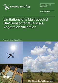
Optical satellite data products (e.g., Sentinel-2, PlanetScope, Landsat) require proper validation across diverse ecosystems. This work assesses the spectral reflectance accuracy of a UAV-mounted multispectral MicaSense Altum against spectroradiometer, UAV-hyperspectral, and satellite data by using the manufacturer-provided panel-based reflectance conversion technique for atmospheric correction at the Mer Bleue peatland supersite near Ottawa, Canada. The Altum was assessed based on band-level pair-wise comparisons and common vegetation indices, which revealed differences between the Altum and the other data requiring careful consideration of its use for this purpose in peatlands. View this paper
  • Issues are regarded as officially published after their release is announced to the table of contents alert mailing list.
  • You may sign up for e-mail alerts to receive table of contents of newly released issues.
  • PDF is the official format for papers published in both, html and pdf forms. To view the papers in pdf format, click on the "PDF Full-text" link, and use the free Adobe Reader to open them.
Order results
Result details
Section
Select all
Export citation of selected articles as:
19 pages, 424 KiB  
Article
An Adaptive Radar Target Detection Method Based on Alternate Estimation in Power Heterogeneous Clutter
by Daipeng Xiao, Weijian Liu , Hui Chen, Hao Li and Binbin Li
Remote Sens. 2024, 16(13), 2508; https://doi.org/10.3390/rs16132508 - 8 Jul 2024
Viewed by 383
Abstract
Multichannel radars generally need to utilize a certain amount of training samples to estimate the covariance matrix of clutter for target detection. Due to factors such as severe terrain fluctuations and complex electromagnetic environments, the training samples usually have different statistical characteristics from [...] Read more.
Multichannel radars generally need to utilize a certain amount of training samples to estimate the covariance matrix of clutter for target detection. Due to factors such as severe terrain fluctuations and complex electromagnetic environments, the training samples usually have different statistical characteristics from the data to be detected. One of the most common scenarios is that all data have the same clutter covariance matrix structure, while different data have different power mismatches, called power heterogeneous characteristics. For detection problems in the power heterogeneous clutter environments, we propose detectors based on alternate estimation, using the generalized likelihood ratio test (GLRT) criterion, Rao criterion, Wald criterion, Gradient criterion, and Durbin criterion. Monte Carlo simulation experiments and real data indicate that the detector based on the Rao criterion has the highest probability of detection (PD). Furthermore, when signal mismatch occurs, the detector based on the GLRT criterion has the best selectivity, while the detector based on the Durbin criterion has the most robust detection performance. Full article
(This article belongs to the Section Engineering Remote Sensing)
Show Figures

Figure 1

26 pages, 12605 KiB  
Article
Active Bidirectional Self-Training Network for Cross-Domain Segmentation in Remote-Sensing Images
by Zhujun Yang, Zhiyuan Yan, Wenhui Diao, Yihang Ma, Xinming Li and Xian Sun
Remote Sens. 2024, 16(13), 2507; https://doi.org/10.3390/rs16132507 - 8 Jul 2024
Viewed by 282
Abstract
Semantic segmentation with cross-domain adaptation in remote-sensing images (RSIs) is crucial and mitigates the expense of manually labeling target data. However, the performance of existing unsupervised domain adaptation (UDA) methods is still significantly impacted by domain bias, leading to a considerable gap compared [...] Read more.
Semantic segmentation with cross-domain adaptation in remote-sensing images (RSIs) is crucial and mitigates the expense of manually labeling target data. However, the performance of existing unsupervised domain adaptation (UDA) methods is still significantly impacted by domain bias, leading to a considerable gap compared to supervised trained models. To address this, our work focuses on semi-supervised domain adaptation, selecting a small subset of target annotations through active learning (AL) that maximize information to improve domain adaptation. Overall, we propose a novel active bidirectional self-training network (ABSNet) for cross-domain semantic segmentation in RSIs. ABSNet consists of two sub-stages: a multi-prototype active region selection (MARS) stage and a source-weighted class-balanced self-training (SCBS) stage. The MARS approach captures the diversity in labeled source data by introducing multi-prototype density estimation based on Gaussian mixture models. We then measure inter-domain similarity to select complementary and representative target samples. Through fine-tuning with the selected active samples, we propose an enhanced self-training strategy SCBS, designed for weighted training on source data, aiming to avoid the negative effects of interfering samples. We conduct extensive experiments on the LoveDA and ISPRS datasets to validate the superiority of our method over existing state-of-the-art domain-adaptive semantic segmentation methods. Full article
(This article belongs to the Special Issue Geospatial Artificial Intelligence (GeoAI) in Remote Sensing)
Show Figures

Figure 1

22 pages, 5844 KiB  
Article
Intelligent RCS Extrapolation Technology of Target Inspired by Physical Mechanism Based on Scattering Center Model
by Fang-Yin Zhu, Shui-Rong Chai, Li-Xin Guo, Zhen-Xiang He and Yu-Feng Zou
Remote Sens. 2024, 16(13), 2506; https://doi.org/10.3390/rs16132506 - 8 Jul 2024
Viewed by 276
Abstract
In this paper, a technology named SCM−ANN combining physical scattering mechanisms and artificial intelligence is proposed to realize radar cross-section (RCS) extrapolation of non-cooperative conductor targets with higher efficiency. Firstly, an adaptive scattering center (SC) extraction algorithm is used to construct the scattering [...] Read more.
In this paper, a technology named SCM−ANN combining physical scattering mechanisms and artificial intelligence is proposed to realize radar cross-section (RCS) extrapolation of non-cooperative conductor targets with higher efficiency. Firstly, an adaptive scattering center (SC) extraction algorithm is used to construct the scattering center model (SCM) for non-cooperative targets from radar echoes in the low-frequency band (LFB). Secondly, an artificial neural network (ANN) is constructed to capture the nonlinear relationship between the real LFB echoes and those reconstructed from the SCM. Finally, the SCM is used to reconstruct echoes in the high-frequency band (HFB), and these reconstructions, together with the trained ANN, optimize the extrapolated HFB RCS. For the SCM−ANN technology, physical mechanistic modes are used for trend prediction, and artificial intelligence is used for regression optimization based on trend prediction. Simulation results show that the proposed method can achieve a 50% frequency extrapolation range, with an average prediction error reduction of up to 40% compared with the traditional scheme. By incorporating physical mechanisms, this proposed approach offers improved accuracy and an extended extrapolation range compared with the RCS extrapolation techniques relying solely on numerical prediction. Full article
Show Figures

Figure 1

21 pages, 10569 KiB  
Article
Interactions and Conflicts between Urbanization and Greenness: A Case Study from Nanjing, China
by Shengjie Yang, Liang Zhong, Yunqiao Zhou, Bin Sun, Rui Wang, Zhengguo Sun and Jianlong Li
Remote Sens. 2024, 16(13), 2505; https://doi.org/10.3390/rs16132505 - 8 Jul 2024
Viewed by 286
Abstract
Urbanization is rapidly occupying green spaces, making it crucial to understand implicit conflicts between urbanization and greenness. This study proposes an ecological greenness index (EGI) and a comprehensive urbanization index (CUI) and selects Nanjing, a megacity in China, as the study area to [...] Read more.
Urbanization is rapidly occupying green spaces, making it crucial to understand implicit conflicts between urbanization and greenness. This study proposes an ecological greenness index (EGI) and a comprehensive urbanization index (CUI) and selects Nanjing, a megacity in China, as the study area to research the spatial and temporal evolutionary trends of the EGI and CUI in the context of land use/land cover (LULC) changes from 2000 to 2020. Meanwhile, the conflicts and complex interaction characteristics of the EGI and CUI are discussed from both static and dynamic perspectives, and their driving mechanisms are investigated by combining specific indicators. The results demonstrate that over the past 20 years, LULC in Nanjing was dominated by cultivated land, forest land, and artificial surfaces. The encroachment of artificial surfaces on green space was strengthened, resulting in a decrease in the proportion of cultivated land from 70.09% in 2000 to 58.00% in 2020. The CUI increased at a change rate of 0.6%/year, while the EGI showed significant browning (change rate: −0.23%/year), mainly concentrated within the main urban boundaries. The relationship between the CUI and EGI made the leap from “primary coordination” to “moderate coordination”, but there remains a risk of further deterioration of the decoupling relationship between the CUI and ecological pressures. The multi-year average contribution of the CUI to the EGI was 49.45%. Urbanization activities that dominate changes in greenness have changed over time, reflecting the timing of urban conflict management. The results provide important insights for urban ecological health monitoring and management. Full article
Show Figures

Figure 1

29 pages, 26115 KiB  
Article
DCP-Net: A Distributed Collaborative Perception Network for Remote Sensing Semantic Segmentation
by Zhechao Wang, Peirui Cheng, Shujing Duan, Kaiqiang Chen, Zhirui Wang, Xinming Li and Xian Sun
Remote Sens. 2024, 16(13), 2504; https://doi.org/10.3390/rs16132504 - 8 Jul 2024
Viewed by 208
Abstract
Collaborative perception enhances onboard perceptual capability by integrating features from other platforms, effectively mitigating the compromised accuracy caused by a restricted observational range and vulnerability to interference. However, current implementations of collaborative perception overlook the prevalent issues of both limited and low-reliability communication, [...] Read more.
Collaborative perception enhances onboard perceptual capability by integrating features from other platforms, effectively mitigating the compromised accuracy caused by a restricted observational range and vulnerability to interference. However, current implementations of collaborative perception overlook the prevalent issues of both limited and low-reliability communication, as well as misaligned observations in remote sensing. To address this problem, this article presents an innovative distributed collaborative perception network (DCP-Net) specifically designed for remote sensing applications. Firstly, a self-mutual information match module is proposed to identify collaboration opportunities and select suitable partners. This module prioritizes critical collaborative features and reduces redundant transmission for better adaptation to weak communication in remote sensing. Secondly, a related feature fusion module is devised to tackle the misalignment between local and collaborative features due to the multiangle observations, improving the quality of fused features for the downstream task. We conduct extensive experiments and visualization analyses using three semantic segmentation datasets, namely Potsdam, iSAID, and DFC23. The results demonstrate that DCP-Net outperforms the existing collaborative perception methods comprehensively, improving mIoU by 2.61% to 16.89% at the highest collaboration efficiency and achieving state-of-the-art performance. Full article
(This article belongs to the Special Issue Geospatial Artificial Intelligence (GeoAI) in Remote Sensing)
Show Figures

Figure 1

19 pages, 11216 KiB  
Article
Remote Sensing Guides Management Strategy for Invasive Legumes on the Central Plateau, New Zealand
by Paul G. Peterson, James D. Shepherd, Richard L. Hill and Craig I. Davey
Remote Sens. 2024, 16(13), 2503; https://doi.org/10.3390/rs16132503 (registering DOI) - 8 Jul 2024
Viewed by 200
Abstract
Remote sensing was used to map the invasion of yellow-flowered legumes on the Central Plateau of New Zealand to inform weed management strategy. The distributions of Cytisus scoparius (broom), Ulex europaeus (gorse) and Lupinus arboreus (tree lupin) were captured with high-resolution RGB photographs [...] Read more.
Remote sensing was used to map the invasion of yellow-flowered legumes on the Central Plateau of New Zealand to inform weed management strategy. The distributions of Cytisus scoparius (broom), Ulex europaeus (gorse) and Lupinus arboreus (tree lupin) were captured with high-resolution RGB photographs of the plants while flowering. The outcomes of herbicide operations to control C. scoparius and U. europaeus over time were also assessed through repeat photography and change mapping. A grid-square sampling tool previously developed by Manaaki Whenua—Landcare Research was used to help transfer data rapidly from photography to maps using manual classification. Artificial intelligence was trialled and ruled out because the number of false positives could not be tolerated. Future actions to protect the natural values and vistas of the Central Plateau from legume invasion were identified. While previous control operations have mostly targeted large, highly visible legume patches, the importance of removing outlying plants to prevent the establishment of new seed banks and slow spread has been underestimated. Outliers not only establish new, large, long-lived seed banks in previously seed-free areas, but they also contribute more to range expansion than larger patches. Our C. scoparius and U. europaeus change mapping confirms and helps to visualise the establishment and expansion of uncontrolled outliers. The power of visualizing weed control strategies through remote sensing has supported recommendations to improve outlier control to achieve long-term, sustainable landscape-scale suppression of invasive legumes. Full article
(This article belongs to the Special Issue Remote Sensing for Management of Invasive Species)
Show Figures

Figure 1

22 pages, 17793 KiB  
Article
An Inverse Modeling Approach for Retrieving High-Resolution Surface Fluxes of Greenhouse Gases from Measurements of Their Concentrations in the Atmospheric Boundary Layer
by Iuliia Mukhartova, Andrey Sogachev, Ravil Gibadullin, Vladislava Pridacha, Ibragim A. Kerimov and Alexander Olchev
Remote Sens. 2024, 16(13), 2502; https://doi.org/10.3390/rs16132502 - 8 Jul 2024
Viewed by 301
Abstract
This study explores the potential of using Unmanned Aircraft Vehicles (UAVs) as a measurement platform for estimating greenhouse gas (GHG) fluxes over complex terrain. We proposed and tested an inverse modeling approach for retrieving GHG fluxes based on two-level measurements of GHG concentrations [...] Read more.
This study explores the potential of using Unmanned Aircraft Vehicles (UAVs) as a measurement platform for estimating greenhouse gas (GHG) fluxes over complex terrain. We proposed and tested an inverse modeling approach for retrieving GHG fluxes based on two-level measurements of GHG concentrations and airflow properties over complex terrain with high spatial resolution. Our approach is based on a three-dimensional hydrodynamic model capable of determining the airflow parameters that affect the spatial distribution of GHG concentrations within the atmospheric boundary layer. The model is primarily designed to solve the forward problem of calculating the steady-state distribution of GHG concentrations and fluxes at different levels over an inhomogeneous land surface within the model domain. The inverse problem deals with determining the unknown surface GHG fluxes by minimizing the difference between measured and modeled GHG concentrations at two selected levels above the land surface. Several numerical experiments were conducted using surrogate data that mimicked UAV observations of varying accuracies and density of GHG concentration measurements to test the robustness of the approach. Our primary modeling target was a 6 km2 forested area in the foothills of the Greater Caucasus Mountains in Russia, characterized by complex topography and mosaic vegetation. The numerical experiments show that the proposed inverse modeling approach can effectively solve the inverse problem, with the resulting flux distribution having the same spatial pattern as the required flux. However, the approach tends to overestimate the mean value of the required flux over the domain, with the maximum errors in flux estimation associated with areas of maximum steepness in the surface topography. The accuracy of flux estimates improves as the number of points and the accuracy of the concentration measurements increase. Therefore, the density of UAV measurements should be adjusted according to the complexity of the terrain to improve the accuracy of the modeling results. Full article
(This article belongs to the Special Issue Remote Sensing of the Terrestrial Carbon Cycle)
Show Figures

Figure 1

22 pages, 18492 KiB  
Article
Exploring Long-Term Persistence in Sea Surface Temperature and Ocean Parameters via Detrended Cross-Correlation Approach
by Gyuchang Lim and Jong-Jin Park
Remote Sens. 2024, 16(13), 2501; https://doi.org/10.3390/rs16132501 - 8 Jul 2024
Viewed by 188
Abstract
Long-term cross-correlational structures are examined for pairs of sea surface temperature anomalies (SSTAs) and advective forcing parameters and sea surface height anomalies (SSHAs) and current velocity anomalies (CVAs) in the East/Japan Sea (EJS); all these satellite datasets were collected between 1993 and 2023. [...] Read more.
Long-term cross-correlational structures are examined for pairs of sea surface temperature anomalies (SSTAs) and advective forcing parameters and sea surface height anomalies (SSHAs) and current velocity anomalies (CVAs) in the East/Japan Sea (EJS); all these satellite datasets were collected between 1993 and 2023. By utilizing newly modified detrended cross-correlation analysis algorithms, incorporating local linear trend and local fluctuation level of an SSTA, the analyses were performed on timescales of 400–3000 days. Long-term cross-correlations between SSTAs and SSHAs are strongly persistent over nearly the entire EJS; the strength of persistence is stronger during rising trends and low fluctuations of SSTAs, while anti-persistent behavior appears during high fluctuations of SSTAs. SSTA-CVA pairs show high long-term persistence only along main current pathways: the zonal currents for the Subpolar Front and the meridional currents for the east coast of Korea. SSTA-CVA pairs also show negative long-term persistent behaviors in some spots located near the coasts of Korea and Japan: the zonal currents for the eastern coast of Korea and the meridional currents for the western coast of Japan; these behaviors seem to be related to the coastal upwelling phenomena. Further, these persistent characteristics are more conspicuous in the recent decades (2008~2023) rather than in the past (1993~2008). Full article
Show Figures

Figure 1

34 pages, 27641 KiB  
Article
Forty-Year Fire History Reconstruction from Landsat Data in Mediterranean Ecosystems of Algeria following International Standards
by Mostefa E. Kouachi, Amin Khairoun, Aymen Moghli, Souad Rahmani, Florent Mouillot, M. Jaime Baeza and Hassane Moutahir
Remote Sens. 2024, 16(13), 2500; https://doi.org/10.3390/rs16132500 - 8 Jul 2024
Viewed by 236
Abstract
Algeria, the main fire hotspot on the southern rim of the Mediterranean Basin, lacks a complete fire dataset with official fire perimeters, and the existing one contains inconsistencies. Preprocessed global and regional burned area (BA) products provide valuable insights into fire patterns, characteristics, [...] Read more.
Algeria, the main fire hotspot on the southern rim of the Mediterranean Basin, lacks a complete fire dataset with official fire perimeters, and the existing one contains inconsistencies. Preprocessed global and regional burned area (BA) products provide valuable insights into fire patterns, characteristics, and dynamics over time and space, and into their impact on climate change. Nevertheless, they exhibit certain limitations linked with their inherent spatio-temporal resolutions as well as temporal and geographical coverage. To address the need for reliable BA information in Algeria, we systematically reconstructed, validated, and analyzed a 40-year (1984–2023) BA product (NEALGEBA; North Eastern ALGeria Burned Area) at 30 m spatial resolution in the typical Mediterranean ecosystems of this region, following international standards. We used Landsat data and the BA Mapping Tools (BAMTs) in the Google Earth Engine (GEE) to map BAs. The spatial validation of NEALGEBA, performed for 2017 and 2021 using independent 10 m spatial resolution Sentinel-2 reference data, showed overall accuracies > 98.10%; commission and omission errors < 8.20%; Dice coefficients > 91.90%; and relative biases < 3.44%. The temporal validation, however, using MODIS and VIIRS active fire hotspots, emphasized the limitation of Landsat-based BA products in temporal fire reporting accuracy terms. The intercomparison with five readily available BA products for 2017, by using the same validation process, demonstrated the overall outperformance of NEALGEBA. Furthermore, our BA product exhibited the highest correspondence with the ground-based BA estimates. NEALGEBA currently represents the most continuous and reliable time series of BA history at fine spatial resolution for NE Algeria, offering a significant contribution to further national and international fire hazard and impact assessments and acts as a reference dataset for contextualizing future weather extremes, such as the 2023 exceptional heat wave, which we show not to have led to the most extreme fire year over the last four decades. Full article
(This article belongs to the Topic Application of Remote Sensing in Forest Fire)
Show Figures

Figure 1

25 pages, 3093 KiB  
Article
An Adaptive Noisy Label-Correction Method Based on Selective Loss for Hyperspectral Image-Classification Problem
by Zina Li, Xiaorui Yang, Deyu Meng and Xiangyong Cao
Remote Sens. 2024, 16(13), 2499; https://doi.org/10.3390/rs16132499 - 8 Jul 2024
Viewed by 284
Abstract
Due to the intricate terrain and restricted resources, hyperspectral image (HSI) datasets captured in real-world scenarios typically contain noisy labels, which may seriously affect the classification results. To address this issue, we work on a universal method that rectifies the labels first and [...] Read more.
Due to the intricate terrain and restricted resources, hyperspectral image (HSI) datasets captured in real-world scenarios typically contain noisy labels, which may seriously affect the classification results. To address this issue, we work on a universal method that rectifies the labels first and then trains the classifier with corrected labels. In this study, we relax the common assumption that all training data are potentially corrupted and instead posit the presence of a small set of reliable data points within the training set. Under this framework, we propose a novel label-correction method named adaptive selective loss propagation algorithm (ASLPA). Firstly, the spectral–spatial information is extracted from the hyperspectral image and used to construct the inter-pixel transition probability matrix. Secondly, we construct the trusted set with the known clean data and estimate the proportion of accurate labels within the untrusted set. Then, we enlarge the trusted set according to the estimated proportion and identify an adaptive number of samples with lower loss values from the untrusted set to supplement the trusted set. Finally, we conduct label propagation based on the enlarged trusted set. This approach takes full advantage of label information from the trusted and untrusted sets, and moreover the exploitation on the untrusted set can adjust adaptively according to the estimated noise level. Experimental results on three widely used HSI datasets show that our proposed ASLPA method performs better than the state-of-the-art label-cleaning methods. Full article
(This article belongs to the Special Issue Deep Transfer Learning for Remote Sensing II)
Show Figures

Figure 1

18 pages, 18089 KiB  
Communication
High-Resolution PM10 Estimation Using Satellite Data and Model-Agnostic Meta-Learning
by Yue Yang, Jan Cermak, Xu Chen, Yunping Chen and Xi Hou
Remote Sens. 2024, 16(13), 2498; https://doi.org/10.3390/rs16132498 - 8 Jul 2024
Viewed by 245
Abstract
Characterizing the spatial distribution of particles smaller than 10 μm (PM10) is of great importance for air quality management yet is very challenging because of the sparseness of air quality monitoring stations. In this study, we use a model-agnostic meta-learning-trained artificial [...] Read more.
Characterizing the spatial distribution of particles smaller than 10 μm (PM10) is of great importance for air quality management yet is very challenging because of the sparseness of air quality monitoring stations. In this study, we use a model-agnostic meta-learning-trained artificial neural network (MAML-ANN) to estimate the concentrations of PM10 at 60 m × 60 m spatial resolution by combining satellite-derived aerosol optical depth (AOD) with meteorological data. The network is designed to regress from the predictors at a specific time to the ground-level PM10 concentration. We utilize the ANN model to capture the time-specific nonlinearity among aerosols, meteorological conditions, and PM10, and apply MAML to enable the model to learn the nonlinearity across time from only a small number of data samples. MAML is also employed to transfer the knowledge learned from coarse spatial resolution to high spatial resolution. The MAML-ANN model is shown to accurately estimate high-resolution PM10 in Beijing, with coefficient of determination of 0.75. MAML improves the PM10 estimation performance of the ANN model compared with the baseline using pre-trained initial weights. Thus, MAML-ANN has the potential to estimate particulate matter estimation at high spatial resolution over other data-sparse, heavily polluted, and small regions. Full article
Show Figures

Figure 1

18 pages, 14889 KiB  
Article
Random Forest Model-Based Inversion of Aerosol Vertical Profiles in China Using Orbiting Carbon Observatory-2 Oxygen A-Band Observations
by Xiao-Qing Zhou, Hai-Lei Liu, Min-Zheng Duan, Bing Chen and Sheng-Lan Zhang
Remote Sens. 2024, 16(13), 2497; https://doi.org/10.3390/rs16132497 - 8 Jul 2024
Viewed by 240
Abstract
Aerosol research is important for the protection of the ecological environment, the improvement of air quality, and as a response to climate change. In this study, a random forest (RF) estimation model of aerosol optical depth (AOD) and extinction coefficient vertical profiles was, [...] Read more.
Aerosol research is important for the protection of the ecological environment, the improvement of air quality, and as a response to climate change. In this study, a random forest (RF) estimation model of aerosol optical depth (AOD) and extinction coefficient vertical profiles was, respectively, established using Orbiting Carbon Observatory-2 (OCO-2) oxygen-A band (O2 A-band) data from China and its surrounding areas in 2016, combined with geographical information (longitude, latitude, and elevation) and viewing angle data. To address the high number of OCO-2 O2 A-band channels, principal component analysis (PCA) was employed for dimensionality reduction. The model was then applied to estimate the aerosol extinction coefficients for the region in 2017, and its validity was verified by comparing the estimated values with the Cloud-Aerosol Lidar Infrared Pathfinder Satellite Observations (CALIPSO) Level 2 extinction coefficients. In the comprehensive analysis of overall performance, an AOD model was initially constructed using variables, achieving a correlation coefficient (R) of 0.676. Subsequently, predictions for aerosol extinction coefficients were generated, revealing a satisfactory agreement between the predicted and the actual values in the vertical direction, with an R of 0.535 and a root mean square error (RMSE) of 0.107 km−1. Of the four seasons of the year, the model performs best in autumn (R = 0.557), while its performance was relatively lower in summer (R = 0.442). Height had a significant effect on the model, with both R and RMSE decreasing as height increased. Furthermore, the accuracy of aerosol profile inversion shows a dependence on AOD, with a better accuracy when AOD is less than 0.3 and RMSE can be less than 0.06 km−1. Full article
Show Figures

Figure 1

21 pages, 9399 KiB  
Article
SA3Det: Detecting Rotated Objects via Pixel-Level Attention and Adaptive Labels Assignment
by Wenyong Wang, Yuanzheng Cai, Zhiming Luo, Wei Liu, Tao Wang and Zuoyong Li
Remote Sens. 2024, 16(13), 2496; https://doi.org/10.3390/rs16132496 - 8 Jul 2024
Viewed by 314
Abstract
Remote sensing of rotated objects often encounters numerous small and dense objects. To tackle small-object neglect and inaccurate angle predictions in elongated objects, we propose SA3Det, a novel method employing Pixel-Level Attention and Adaptive Labels Assignment. First, we introduce a self-attention module that [...] Read more.
Remote sensing of rotated objects often encounters numerous small and dense objects. To tackle small-object neglect and inaccurate angle predictions in elongated objects, we propose SA3Det, a novel method employing Pixel-Level Attention and Adaptive Labels Assignment. First, we introduce a self-attention module that learns dense pixel-level relations between features extracted by the backbone and neck, effectively preserving and exploring the spatial relationships of potential small objects. We then introduce an adaptive label assignment strategy that refines proposals by assigning labels based on loss, enhancing sample selection during training. Additionally, we designed an angle-sensitive module that enhances angle prediction by learning rotational feature maps and incorporating multi-angle features. These modules significantly enhance detection accuracy and yield high-quality region proposals. Our approach was validated by experiments on the DOTA and HRSC2016 datasets, demonstrating that SA3Det achieves mAPs of 76.31% and 89.4%, respectively. Full article
Show Figures

Figure 1

20 pages, 5997 KiB  
Article
Adaptive Nighttime-Light-Based Building Stock Assessment Framework for Future Environmentally Sustainable Management
by Zhiwei Liu, Jing Guo, Ruirui Zhang, Yuya Ota, Sota Nagata, Hiroaki Shirakawa and Hiroki Tanikawa
Remote Sens. 2024, 16(13), 2495; https://doi.org/10.3390/rs16132495 - 8 Jul 2024
Viewed by 289
Abstract
The accumulation of artificially built environment stock during urbanization processes has been actively involved in altering the material and energy use pattern of human societies. Therefore, an accurate assessment of built environment stock can provide insights for decision makers to implement appropriate environmentally [...] Read more.
The accumulation of artificially built environment stock during urbanization processes has been actively involved in altering the material and energy use pattern of human societies. Therefore, an accurate assessment of built environment stock can provide insights for decision makers to implement appropriate environmentally sustainable retrofitting strategies. This study presents a building stock estimation enhancement framework (BSEEF) that leverages nighttime light (NTL) to accurately assess and spatially map building stocks. By innovatively integrating a region classification module with a hybrid region-specified self-optimization module, BSEEF adaptively enhances the estimation accuracy across diverse urban landscapes. A comparative case study of Japan demonstrated that BSEEF significantly outperformed a traditional linear regression model, with improvements ranging from 1.81% to 16.75% across different metrics used for assessment, providing more accurate building stock estimates. BSEEF enhances environment/sustainability studies by enabling precise spatial analysis of built environment stocks, offering a versatile and robust framework that adapts to technological changes and achieves superior accuracy without extensive reliance on complex datasets. These advances will make BSEEF an indispensable tool in strategic planning for urban development, promoting sustainable and resilient communities globally. Full article
Show Figures

Figure 1

14 pages, 5362 KiB  
Article
Impact of Plasma Bubbles on OTHR Shortwave Propagation in Different Backgrounds
by Xin Ma, Peng Guo, Ding Yang, Mengjie Wu and Hengyi Yue
Remote Sens. 2024, 16(13), 2494; https://doi.org/10.3390/rs16132494 - 8 Jul 2024
Viewed by 215
Abstract
Plasma bubbles represent notable ionospheric irregularities primarily observed in low latitudes, characterized by plasma depletions exhibiting large spatial scales, which can make a significant impact on the propagation of OTHR (over-the-horizon radar) waves. Firstly, we constructed a three-dimensional model of plasma bubbles, which [...] Read more.
Plasma bubbles represent notable ionospheric irregularities primarily observed in low latitudes, characterized by plasma depletions exhibiting large spatial scales, which can make a significant impact on the propagation of OTHR (over-the-horizon radar) waves. Firstly, we constructed a three-dimensional model of plasma bubbles, which is modulated by Gaussian function distribution in the horizontal direction, and then we analyzed the impact of EPBs (Equatorial Plasma Bubbles) on the ray path of OTHR shortwaves. When radio waves propagate through EPBs with different RMS ΔN/N, there is a significant difference in the propagation path of OTHR waves. For the EPB with an RMS ΔN/N of 75%, radio waves exhibit more pronounced refraction than those with lower RMS values, the focusing effect of radio waves is more obvious, and the focusing point is relatively lower. In terms of different seasons, OTHR shortwaves propagating through EPBs exhibit different degrees of refraction. In addition, radio waves show the effect of inward focusing in different seasons: the focusing effect is the most pronounced in spring, followed by autumn, then summer, and the weakest in winter. For different solar activities, the impact of EPBs on OTHR shortwaves is more significant in the high-solar-activity year. Full article
Show Figures

Figure 1

17 pages, 842 KiB  
Article
2D3D-DescNet: Jointly Learning 2D and 3D Local Feature Descriptors for Cross-Dimensional Matching
by Shuting Chen, Yanfei Su, Baiqi Lai, Luwei Cai, Chengxi Hong, Li Li, Xiuliang Qiu, Hong Jia and Weiquan Liu
Remote Sens. 2024, 16(13), 2493; https://doi.org/10.3390/rs16132493 - 8 Jul 2024
Viewed by 228
Abstract
The cross-dimensional matching of 2D images and 3D point clouds is an effective method by which to establish the spatial relationship between 2D and 3D space, which has potential applications in remote sensing and artificial intelligence (AI). In this paper, we propose a [...] Read more.
The cross-dimensional matching of 2D images and 3D point clouds is an effective method by which to establish the spatial relationship between 2D and 3D space, which has potential applications in remote sensing and artificial intelligence (AI). In this paper, we propose a novel multi-task network, 2D3D-DescNet, to learn 2D and 3D local feature descriptors jointly and perform cross-dimensional matching of 2D image patches and 3D point cloud volumes. The 2D3D-DescNet contains two branches with which to learn 2D and 3D feature descriptors, respectively, and utilizes a shared decoder to generate the feature maps of 2D image patches and 3D point cloud volumes. Specifically, the generative adversarial network (GAN) strategy is embedded to distinguish the source of the generated feature maps, thereby facilitating the use of the learned 2D and 3D local feature descriptors for cross-dimensional retrieval. Meanwhile, a metric network is embedded to compute the similarity between the learned 2D and 3D local feature descriptors. Finally, we construct a 2D-3D consistent loss function to optimize the 2D3D-DescNet. In this paper, the cross-dimensional matching of 2D images and 3D point clouds is explored with the small object of the 3Dmatch dataset. Experimental results demonstrate that the 2D and 3D local feature descriptors jointly learned by 2D3D-DescNet are similar. In addition, in terms of 2D and 3D cross-dimensional retrieval and matching between 2D image patches and 3D point cloud volumes, the proposed 2D3D-DescNet significantly outperforms the current state-of-the-art approaches based on jointly learning 2D and 3D feature descriptors; the cross-dimensional retrieval at TOP1 on the 3DMatch dataset is improved by over 12%. Full article
(This article belongs to the Special Issue Point Cloud Processing with Machine Learning)
Show Figures

Figure 1

20 pages, 78594 KiB  
Article
Underwater Side-Scan Sonar Target Detection: YOLOv7 Model Combined with Attention Mechanism and Scaling Factor
by Xin Wen, Jian Wang, Chensheng Cheng, Feihu Zhang and Guang Pan
Remote Sens. 2024, 16(13), 2492; https://doi.org/10.3390/rs16132492 - 8 Jul 2024
Viewed by 255
Abstract
Side-scan sonar plays a crucial role in underwater exploration, and the autonomous detection of side-scan sonar images is vital for detecting unknown underwater environments. However, due to the complexity of the underwater environment, the presence of a few highlighted areas on the targets, [...] Read more.
Side-scan sonar plays a crucial role in underwater exploration, and the autonomous detection of side-scan sonar images is vital for detecting unknown underwater environments. However, due to the complexity of the underwater environment, the presence of a few highlighted areas on the targets, blurred feature details, and difficulty in collecting data from side-scan sonar, achieving high-precision autonomous target recognition in side-scan sonar images is challenging. This article addresses this problem by improving the You Only Look Once v7 (YOLOv7) model to achieve high-precision object detection in side-scan sonar images. Firstly, given that side-scan sonar images contain large areas of irrelevant information, this paper introduces the Swin-Transformer for dynamic attention and global modeling, which enhances the model’s focus on the target regions. Secondly, the Convolutional Block Attention Module (CBAM) is utilized to further improve feature representation and enhance the neural network model’s accuracy. Lastly, to address the uncertainty of geometric features in side-scan sonar target features, this paper innovatively incorporates a feature scaling factor into the YOLOv7 model. The experiment initially verified the necessity of attention mechanisms in the public dataset. Subsequently, experiments on our side-scan sonar (SSS) image dataset show that the improved YOLOv7 model has 87.9% and 49.23% in its average accuracy (mAP0.5) and (mAP0.5:0.95), respectively. These results are 9.28% and 8.41% higher than the YOLOv7 model. The improved YOLOv7 algorithm proposed in this paper has great potential for object detection and the recognition of side-scan sonar images. Full article
(This article belongs to the Special Issue Advancement in Undersea Remote Sensing II)
Show Figures

Figure 1

21 pages, 13934 KiB  
Article
A Robust Tie-Points Matching Method with Regional Feature Representation for Synthetic Aperture Radar Images
by Yifan Zhang, Yan Zhu, Liqun Liu, Xun Du, Kun Han, Junhui Wu, Zhiqiang Li, Lingshuai Kong and Qiwei Lin
Remote Sens. 2024, 16(13), 2491; https://doi.org/10.3390/rs16132491 - 8 Jul 2024
Viewed by 303
Abstract
The precise tie-points (TPs) on synthetic aperture radar (SAR) images are a critical cornerstone in the global digital elevation model (DEM) and digital ortho map (DOM) production process. While there are abundant studies on SAR TPs matching, improvement opportunities persist in large areas. [...] Read more.
The precise tie-points (TPs) on synthetic aperture radar (SAR) images are a critical cornerstone in the global digital elevation model (DEM) and digital ortho map (DOM) production process. While there are abundant studies on SAR TPs matching, improvement opportunities persist in large areas. The correspondences have pixel-level errors during geocoding, which result in misalignment between global products. Consequently, this paper proposed a robust method for SAR images TPs matching, which consists of three key steps: (1) interest point extraction based on the dynamic Harris area entropy (DHAE) grid; (2) adaptive determination of template size; (3) normalized cross correlation (NCC) template matching. DHAE is a regional texture information grid based on the SAR-Harris map, and it is achieved through dynamic block division. Generating the DHAE grid over SAR images enables the extraction of interest points that have regional feature representation and distribution uniformity. A variable-size matching template is adaptively determined based on DHAE to enhance template quality while maintaining computational efficiency. Subsequently, the NCC algorithm is employed to find subpixel-precise correspondences. The proposed method is applied on TPs matching in 57 Terra-SAR images, which cover a large geographical area. Furthermore, the overlapping area is partitioned into five segments according to different coverage types. The experimental results demonstrate that the proposed method outperforms other template matching methods. For all coverage types, the proposed method exhibits high-precision sub-pixel results that reach up to 38.64% in terms of the relative positioning error (RPE), particularly in texture-weak and large areas. Full article
Show Figures

Figure 1

19 pages, 16533 KiB  
Article
Observed Retrogressive Thaw Slump Evolution in the Qilian Mountains
by Xingyun Liu, Xiaoqing Peng, Yongyan Zhang, Oliver W. Frauenfeld, Gang Wei, Guanqun Chen, Yuan Huang, Cuicui Mu and Jun Du
Remote Sens. 2024, 16(13), 2490; https://doi.org/10.3390/rs16132490 - 7 Jul 2024
Viewed by 520
Abstract
Climate warming can lead to permafrost degradation, potentially resulting in slope failures such as retrogressive thaw slumps (RTSs). The formation of and changes in RTSs could exacerbate the degradation of permafrost and the environment in general. The mechanisms of RTS progression and the [...] Read more.
Climate warming can lead to permafrost degradation, potentially resulting in slope failures such as retrogressive thaw slumps (RTSs). The formation of and changes in RTSs could exacerbate the degradation of permafrost and the environment in general. The mechanisms of RTS progression and the potential consequences on the analogous freeze–thaw cycle are not well understood, owing partly to necessitating field work under harsh conditions and with high costs. Here, we used multi-source remote sensing and field surveys to quantify the changes in an RTS on Eboling Mountain in the Qilian Mountain Range in west-central China. Based on optical remote sensing and SBAS-InSAR measurements, we analyzed the RTS evolution and the underlying drivers, combined with meteorological observations. The RTS expanded from 56 m2 in 2015 to 4294 m2 in 2022, growing at a rate of 1300 m2/a to its maximum in 2018 and then decreasing. Changes in temperature and precipitation play a dominant role in the evolution of the RTS, and the extreme weather in 2016 may also be a primary contributor to the accelerated growth, with an average deformation of −8.3 mm during the thawing period, which decreased slope stability. The RTS evolved more actively during the thawing and early freezing process, with earthquakes having potentially contributed further to RTS evolution. We anticipate that the rate of RTS evolution is likely to increase in the coming years. Full article
Show Figures

Figure 1

19 pages, 9845 KiB  
Article
Delineation of Intermittent Rivers and Ephemeral Streams Using a Hybrid Method
by Ning Wang, Fang Chen, Bo Yu, Haiying Zhang, Huichen Zhao and Lei Wang
Remote Sens. 2024, 16(13), 2489; https://doi.org/10.3390/rs16132489 - 7 Jul 2024
Viewed by 469
Abstract
Intermittent rivers and ephemeral streams are crucial for the water cycle and ecosystem services, yet they are often neglected by managers and researchers, especially in headwater areas. This oversight has caused a lack of comprehensive basemaps for these vital river systems. In headwater [...] Read more.
Intermittent rivers and ephemeral streams are crucial for the water cycle and ecosystem services, yet they are often neglected by managers and researchers, especially in headwater areas. This oversight has caused a lack of comprehensive basemaps for these vital river systems. In headwater regions, water bodies are typically sparse and disconnected, with narrow and less distinct channels. Therefore, we propose a novel hybrid method that integrates topographic data and remote sensing imagery to delineate river networks. Our method reestablishes connectivity among sparsely distributed water bodies through topographic pairs, enhances less distinct channel features using the gamma function, and converts topographic and water indices data into a weighted graph to determine optimal channels with the A* algorithm. The topographic and water indices data are derived from the Multi-Error-Removed Improved-Terrain DEM (MERIT DEM) and an average composite of the Modified Normalized Difference Water Index (MNDWI), respectively. In the upper Lancang-Mekong River basin, our method outperformed five publicly available DEM datasets, achieving over 91% positional accuracy within a 30 m buffer. This hybrid method enhances positional accuracy and effectively connects sparse water bodies in headwater areas, offering promising applications for delineating intermittent rivers and ephemeral streams and providing baseline information for these river systems. Full article
Show Figures

Figure 1

21 pages, 9076 KiB  
Article
Satellite Remote Sensing False Forest Fire Hotspot Excavating Based on Time-Series Features
by Haifeng Wang, Gui Zhang, Zhigao Yang, Haizhou Xu, Feng Liu and Shaofeng Xie
Remote Sens. 2024, 16(13), 2488; https://doi.org/10.3390/rs16132488 - 7 Jul 2024
Viewed by 325
Abstract
Satellite remote sensing has become an important means of forest fire monitoring because it has the advantages of wide coverage, few ground constraints and high dynamics. When utilizing satellites for forest fire hotspot monitoring, two types of ground hotspots, agricultural and other fire [...] Read more.
Satellite remote sensing has become an important means of forest fire monitoring because it has the advantages of wide coverage, few ground constraints and high dynamics. When utilizing satellites for forest fire hotspot monitoring, two types of ground hotspots, agricultural and other fire hotspots can be ruled out through ground object features. False forest fire hotspots within forested areas must be excluded for a more accurate distinction between forest fires and non-forest fires. This study utilizes spatio-temporal data along with time-series classification to excavate false forest fire hotspots exhibiting temporal characteristics within forested areas and construct a dataset of such false forest fire hotspots, thereby achieving a more realistic forest fire dataset. Taking Hunan Province as the research object, this study takes the satellite ground hotspots in the forests of Hunan Province as the suspected forest fire hotspot dataset and excludes the satellite ground hotspots in the forests such as fixed heat sources, periodic heat sources and recurring heat sources which are excavated. The validity of these methods and results was then analyzed. False forest fire hotspots, from satellite ground hotspots extracted from 2019 to 2023 Himawari-8/9 satellite images, closely resemble the official release of actual forest fires data and the accuracy rate in the actual forest fire monitoring is 95.12%. This validates that the method employed in this study can improve the accuracy of satellite-based forest fire monitoring. Full article
Show Figures

Figure 1

23 pages, 8260 KiB  
Article
Studying the Aerosol Effect on Deep Convective Clouds over the Global Oceans by Applying Machine Learning Techniques on Long-Term Satellite Observation
by Xuepeng Zhao, James Frech, Michael J. Foster and Andrew K. Heidinger
Remote Sens. 2024, 16(13), 2487; https://doi.org/10.3390/rs16132487 - 7 Jul 2024
Viewed by 318
Abstract
Long-term (1982–2019) satellite climate data records (CDRs) of aerosols and clouds, reanalysis data of meteorological fields, and machine learning techniques are used to study the aerosol effect on deep convective clouds (DCCs) over the global oceans from a climatological perspective. Our analyses are [...] Read more.
Long-term (1982–2019) satellite climate data records (CDRs) of aerosols and clouds, reanalysis data of meteorological fields, and machine learning techniques are used to study the aerosol effect on deep convective clouds (DCCs) over the global oceans from a climatological perspective. Our analyses are focused on three latitude belts where DCCs appear more frequently in the climatology: the northern middle latitude (NML), tropical latitude (TRL), and southern middle latitude (SML). It was found that the aerosol effect on marine DCCs may be detected only in NML from long-term averaged satellite aerosol and cloud observations. Specifically, cloud particle size is more susceptible to the aerosol effect compared to other cloud micro-physical variables (e.g., cloud optical depth). The signature of the aerosol effect on DCCs can be easily obscured by meteorological covariances for cloud macro-physical variables, such as cloud cover and cloud top temperature (CTT). From a machine learning analysis, we found that the primary aerosol effect (i.e., the aerosol effect without meteorological feedbacks and covariances) can partially explain the aerosol convective invigoration in CTT and that meteorological feedbacks and covariances need to be included to accurately capture the aerosol convective invigoration. From our singular value decomposition (SVD) analysis, we found the aerosol effects in the three leading principal components (PCs) may explain about one third of the variance of satellite-observed cloud variables and significant positive or negative trends are only observed in the lead PC1 of cloud and aerosol variables. The lead PC1 component is an effective mode for detecting the aerosol effect on DCCs. Our results are valuable for the evaluation and improvement of aerosol-cloud interactions in the long-term climate simulations of global climate models. Full article
Show Figures

Figure 1

24 pages, 15151 KiB  
Article
Polar Sea Ice Monitoring Using HY-2B Satellite Scatterometer and Scanning Microwave Radiometer Measurements
by Tao Zeng, Lijian Shi, Yingni Shi, Dunwang Lu and Qimao Wang
Remote Sens. 2024, 16(13), 2486; https://doi.org/10.3390/rs16132486 - 6 Jul 2024
Viewed by 457
Abstract
The Ku band microwave scatterometer (SCA) and scanning microwave radiometer (SMR) onboard HaiYang-2B (HY-2B) can simultaneously supply active and passive microwave observations over the polar region. In this paper, a polar ice water discrimination model and Arctic sea-ice-type classification model based on the [...] Read more.
The Ku band microwave scatterometer (SCA) and scanning microwave radiometer (SMR) onboard HaiYang-2B (HY-2B) can simultaneously supply active and passive microwave observations over the polar region. In this paper, a polar ice water discrimination model and Arctic sea-ice-type classification model based on the support vector machine (SVM) method were established and used to produce a daily sea ice extent dataset from 2019 to 2021 with data from SCA and SMR. First, suitable scattering and radiation parameters are chosen as input data for the discriminant model. Then, the sea ice extent was obtained based on the monthly ice water discrimination model, and finally, the ice over the Arctic was classified into multiyear ice (MYI) and first-year ice (FYI). The 3-year ice extent and MYI extent products were consistent with the similar results of the National Snow and Ice Data Center (NSIDC) and Ocean and Sea Ice Satellite Application Facility (OSISAF). Using the OSISAF similar product as validation data, the overall accuracies (OAs) of ice/water discrimination and FYI/MYI discrimination are 99% and 97%, respectively. Compared with the high spatial resolution classification results of the Moderate Resolution Imaging Spectroradiometer (MODIS) and SAR, the OAs of ice/water discrimination and FYI/MYI discrimination are 96% and 86%, respectively. In conclusion, the SAC and SMR of HY-2B have been verified for monitoring polar sea ice, and the sea ice extent and sea-ice-type products are promising for integration into long-term sea ice records. Full article
(This article belongs to the Special Issue Recent Advances in Sea Ice Research Using Satellite Data)
Show Figures

Figure 1

22 pages, 9950 KiB  
Article
Sparse-to-Dense Point Cloud Registration Based on Rotation-Invariant Features
by Tianjiao Ma, Guangliang Han, Yongzhi Chu and Hong Ren
Remote Sens. 2024, 16(13), 2485; https://doi.org/10.3390/rs16132485 - 6 Jul 2024
Viewed by 322
Abstract
Point cloud registration is a critical problem because it is the basis of many 3D vision tasks. With the popularity of deep learning, many scholars have focused on leveraging deep neural networks to address the point cloud registration problem. However, many of these [...] Read more.
Point cloud registration is a critical problem because it is the basis of many 3D vision tasks. With the popularity of deep learning, many scholars have focused on leveraging deep neural networks to address the point cloud registration problem. However, many of these methods are still sensitive to partial overlap and differences in density distribution. For this reason, herein, we propose a method based on rotation-invariant features and using a sparse-to-dense matching strategy for robust point cloud registration. Firstly, we encode raw points as superpoints with a network combining KPConv and FPN, and their associated features are extracted. Then point pair features of these superpoints are computed and embedded into the transformer to learn the hybrid features, which makes the approach invariant to rigid transformation. Subsequently, a sparse-to-dense matching strategy is designed to address the registration problem. The correspondences of superpoints are obtained via sparse matching and then propagated to local dense points and, further, to global dense points, the byproduct of which is a series of transformation parameters. Finally, the enhanced features based on spatial consistency are repeatedly fed into the sparse-to-dense matching module to rebuild reliable correspondence, and the optimal transformation parameter is re-estimated for final alignment. Our experiments show that, with the proposed method, the inlier ratio and registration recall are effectively improved, and the performance is better than that of other point cloud registration methods on 3DMatch and ModelNet40. Full article
Show Figures

Figure 1

25 pages, 19977 KiB  
Article
Different Vegetation Covers Leading to the Uncertainty and Consistency of ET Estimation: A Case Study Assessment with Extended Triple Collocation
by Xiaoxiao Li, Huaiwei Sun, Yong Yang, Xunlai Sun, Ming Xiong, Shuo Ouyang, Haichen Li, Hui Qin and Wenxin Zhang
Remote Sens. 2024, 16(13), 2484; https://doi.org/10.3390/rs16132484 - 6 Jul 2024
Viewed by 388
Abstract
Accurate and reliable estimation of actual evapotranspiration (AET) is essential for various hydrological studies, including drought prediction, water resource management, and the analysis of atmospheric–terrestrial carbon exchanges. Gridded AET products offer potential for application in ungauged areas, but their uncertainties may be significant, [...] Read more.
Accurate and reliable estimation of actual evapotranspiration (AET) is essential for various hydrological studies, including drought prediction, water resource management, and the analysis of atmospheric–terrestrial carbon exchanges. Gridded AET products offer potential for application in ungauged areas, but their uncertainties may be significant, making it difficult to identify the best products for specific regions. While in situ data directly estimate gridded ET products, their applicability is limited in ungauged areas that require FLUXNET data. This paper employs an Extended Triple Collocation (ETC) method to estimate the uncertainty of Global Land Evaporation Amsterdam Model (GLEAM), Famine Early Warning Systems Network (FLDAS), and Maximum Entropy Production (MEP) AET product without requiring prior information. Subsequently, a merged ET product is generated by combining ET estimates from three original products. Furthermore, the study quantifies the uncertainty of each individual product across different vegetation covers and then compares three original products and the Merged ET with data from 645 in situ sites. The results indicate that GLEAM covers the largest area, accounting for 39.1% based on the correlation coefficient criterion and 39.9% based on the error variation criterion. Meanwhile, FLDAS and MEP exhibit similar performance characteristics. The merged ET derived from the ETC method demonstrates the ability to mitigate uncertainty in ET estimates in North American (NA) and European (EU) regions, as well as tundra, forest, grassland, and shrubland areas. This merged ET could be effectively utilized to reduce uncertainty in AET estimates from multiple products for ungauged areas. Full article
Show Figures

Figure 1

20 pages, 6437 KiB  
Article
Prediction of Deformation in Expansive Soil Landslides Utilizing AMPSO-SVR
by Zi Chen, Guanwen Huang and Yongzhi Zhang
Remote Sens. 2024, 16(13), 2483; https://doi.org/10.3390/rs16132483 - 6 Jul 2024
Viewed by 265
Abstract
A non-periodic “step-like” variation in displacement is exhibited owing to the repeated instability of expansive soil landslides. The dynamic prediction of deformation for expansive soil landslides has become a challenge in actual engineering for disaster prevention and mitigation. Therefore, a support vector regression [...] Read more.
A non-periodic “step-like” variation in displacement is exhibited owing to the repeated instability of expansive soil landslides. The dynamic prediction of deformation for expansive soil landslides has become a challenge in actual engineering for disaster prevention and mitigation. Therefore, a support vector regression prediction (AMPSO-SVR) model based on adaptive mutation particle swarm optimization is proposed, which is suitable for small samples of data. The shallow displacement is decomposed into a trend component and fluctuating component by complete ensemble empirical mode decomposition with adaptive noise (CEEMDAN), and the trend displacement is predicted by cubic polynomial fitting. In this paper, the multiple disaster-inducing factors of expansive landslides and the time hysteresis effect between displacement and its influencing factors are fully considered, and the crucial influencing factors which eliminate the time lag effect and state factors are input into the model to predict the fluctuation displacement. Monitoring data in the Ningming area of China are employed for the model validation. The predicted results are compared with those of the traditional model. The model performance is evaluated through indicators such as the goodness of fit R2 and root mean square error RMSE. The results show that the prediction RMSE of the new model for three monitoring stations can reach 2.6 mm, 6.6 mm, and 2.5 mm, respectively. Compared with the common Grid search support vector regression (GS-SVR), the Particle Swarm Optimization Support Vector Regression (PSO-SVR) and Back Propagation Neural Network (BPNN) models have average improvements of 58.4%, 38.1%, and 25.2% respectively. The goodness of fit R2 is superior to 0.99 in the new method. The proposed model can effectively be deployed for the displacement prediction of non-periodic stepped expansive soil landslides driven by multiple influencing factors, providing a reference idea for the deformation prediction of expansive soil landslides. Full article
(This article belongs to the Special Issue Advances in Multi-GNSS Technology and Applications)
Show Figures

Figure 1

17 pages, 3542 KiB  
Technical Note
Pseudopolar Format Matrix Description of Near-Range Radar Imaging and Fractional Fourier Transform
by Lilong Zou, Ying Li and Amir M. Alani
Remote Sens. 2024, 16(13), 2482; https://doi.org/10.3390/rs16132482 - 6 Jul 2024
Viewed by 344
Abstract
Near-range radar imaging (NRRI) has evolved into a vital technology with diverse applications spanning fields such as remote sensing, surveillance, medical imaging and non-destructive testing. The Pseudopolar Format Matrix (PFM) has emerged as a promising technique for representing radar data in a compact [...] Read more.
Near-range radar imaging (NRRI) has evolved into a vital technology with diverse applications spanning fields such as remote sensing, surveillance, medical imaging and non-destructive testing. The Pseudopolar Format Matrix (PFM) has emerged as a promising technique for representing radar data in a compact and efficient manner. In this paper, we present a comprehensive PFM description of near-range radar imaging. Furthermore, this paper also explores the integration of the Fractional Fourier Transform (FrFT) with PFM for enhanced radar signal analysis. The FrFT—a powerful mathematical tool for signal processing—offers unique capabilities in analysing signals with time-frequency localization properties. By combining FrFT with PFM, we have achieved significant advancements in radar imaging, particularly in dealing with complex clutter environments and improving target detection accuracy. Meanwhile, this paper highlights the imaging matrix form of FrFT under the PFM, emphasizing the potential for addressing challenges encountered in near-range radar imaging. Finally, numerical simulation and real-world scenario measurement imaging results verify optimized accuracy and computational efficiency with the fusion of PFM and FrFT techniques, paving the way for further innovations in near-range radar imaging applications. Full article
(This article belongs to the Special Issue State-of-the-Art and Future Developments: Short-Range Radar)
Show Figures

Figure 1

24 pages, 21182 KiB  
Article
Effects of Climate Change and Human Activities on Runoff in the Upper Reach of Jialing River, China
by Weizhao Shi, Yi He and Yiting Shao
Remote Sens. 2024, 16(13), 2481; https://doi.org/10.3390/rs16132481 - 6 Jul 2024
Viewed by 265
Abstract
In recent years, the runoff of numerous rivers has experienced substantial changes owing to the dual influences of climate change and human activities. This study focuses on the Lixian hydrological station’s controlled basin, located in the upper reaches of the Jialing River in [...] Read more.
In recent years, the runoff of numerous rivers has experienced substantial changes owing to the dual influences of climate change and human activities. This study focuses on the Lixian hydrological station’s controlled basin, located in the upper reaches of the Jialing River in China. The objective is to assess and quantify the impacts of human activities and climate change on runoff variations. This study analyzed runoff variations from 1960 to 2016 and employed the Soil and Water Assessment Tool (SWAT) model, the long short-term memory (LSTM) model, and eight Budyko framework formulations to assess factors influencing runoff. Additionally, it used the patch-generating land use simulation (PLUS) and SWAT models to simulate future runoff scenarios under various conditions. The results indicate the following. (1) The study area has witnessed a significant decline in runoff (p < 0.01), while potential evapotranspiration shows a significant upward trend (p < 0.01). Precipitation displays a nonsignificant decreasing trend (p > 0.1). An abrupt change point in runoff occurred in 1994, dividing the study period into baseline and change periods. (2) The Budyko results reveal that human activities contributed 50% to 60% to runoff changes. According to the SWAT and LSTM models, the contribution rates of human activities are 63.21% and 52.22%, respectively. Human activities are thus identified as the predominant factor in the decline in runoff. (3) Human activities primarily influence runoff through land cover changes. Conservation measures led to a notable increase in forested areas from 1990 to 2010, representing the most significant change among land types. (4) Future land use scenarios suggest that the highest simulated runoff occurs under a comprehensive development scenario, while the lowest is observed under an ecological conservation scenario. Among the 32 future climate scenarios, runoff increases significantly with a 10% increase in precipitation and decreases substantially with a 15% reduction in precipitation. These findings underscore the significant impact of human activities and climate change on runoff variations in the upper reaches of the Jialing River, highlighting the importance of incorporating both factors in water resource management and planning. Full article
(This article belongs to the Special Issue Monitoring Ecohydrology with Remote Sensing)
Show Figures

Figure 1

28 pages, 16344 KiB  
Article
Operational Forest-Fire Spread Forecasting Using the WRF-SFIRE Model
by Manish P. Kale, Sri Sai Meher, Manoj Chavan, Vikas Kumar, Md. Asif Sultan, Priyanka Dongre, Karan Narkhede, Jitendra Mhatre, Narpati Sharma, Bayvesh Luitel, Ningwa Limboo, Mahendra Baingne, Satish Pardeshi, Mohan Labade, Aritra Mukherjee, Utkarsh Joshi, Neelesh Kharkar, Sahidul Islam, Sagar Pokale, Gokul Thakare, Shravani Talekar, Mukunda-Dev Behera, D. Sreshtha, Manoj Khare, Akshara Kaginalkar, Naveen Kumar and Parth Sarathi Royadd Show full author list remove Hide full author list
Remote Sens. 2024, 16(13), 2480; https://doi.org/10.3390/rs16132480 - 6 Jul 2024
Viewed by 669
Abstract
In the present research, the open-source WRF-SFIRE model has been used to carry out surface forest fire spread forecasting in the North Sikkim region of the Indian Himalayas. Global forecast system (GFS)-based hourly forecasted weather model data obtained through the National Centers for [...] Read more.
In the present research, the open-source WRF-SFIRE model has been used to carry out surface forest fire spread forecasting in the North Sikkim region of the Indian Himalayas. Global forecast system (GFS)-based hourly forecasted weather model data obtained through the National Centers for Environmental Prediction (NCEP) at 0.25 degree resolution were used to provide the initial conditions for running WRF-SFIRE. A landuse–landcover map at 1:10,000 scale was used to define fuel parameters for different vegetation types. The fuel parameters, i.e., fuel depth and fuel load, were collected from 23 sample plots (0.1 ha each) laid down in the study area. Samples of different categories of forest fuels were measured for their wet and dry weights to obtain the fuel load. The vegetation specific surface area-to-volume ratio was referenced from the literature. The atmospheric data were downscaled using nested domains in the WRF model to capture fire–atmosphere interactions at a finer resolution (40 m). VIIRS satellite sensor-based fire alert (375 m spatial resolution) was used as ignition initiation point for the fire spread forecasting, whereas the forecasted hourly weather data (time synchronized with the fire alert) were used for dynamic forest-fire spread forecasting. The forecasted burnt area (1.72 km2) was validated against the satellite-based burnt area (1.07 km2) obtained through Sentinel 2 satellite data. The shapes of the original and forecasted burnt areas matched well. Based on the various simulation studies conducted, an operational fire spread forecasting system, i.e., Sikkim Wildfire Forecasting and Monitoring System (SWFMS), has been developed to facilitate firefighting agencies to issue early warnings and carry out strategic firefighting. Full article
(This article belongs to the Special Issue Vegetation Fires, Greenhouse Gas Emissions and Climate Change)
Show Figures

Figure 1

27 pages, 25257 KiB  
Article
A Study on the Object-Based High-Resolution Remote Sensing Image Classification of Crop Planting Structures in the Loess Plateau of Eastern Gansu Province
by Rui Yang, Yuan Qi, Hui Zhang, Hongwei Wang, Jinlong Zhang, Xiaofang Ma, Juan Zhang and Chao Ma
Remote Sens. 2024, 16(13), 2479; https://doi.org/10.3390/rs16132479 - 6 Jul 2024
Viewed by 402
Abstract
The timely and accurate acquisition of information on the distribution of the crop planting structure in the Loess Plateau of eastern Gansu Province, one of the most important agricultural areas in Western China, is crucial for promoting fine management of agriculture and ensuring [...] Read more.
The timely and accurate acquisition of information on the distribution of the crop planting structure in the Loess Plateau of eastern Gansu Province, one of the most important agricultural areas in Western China, is crucial for promoting fine management of agriculture and ensuring food security. This study uses multi-temporal high-resolution remote sensing images to determine optimal segmentation scales for various crops, employing the estimation of scale parameter 2 (ESP2) tool and the Ratio of Mean Absolute Deviation to Standard Deviation (RMAS) model. The Canny edge detection algorithm is then applied for multi-scale image segmentation. By incorporating crop phenological factors and using the L1-regularized logistic regression model, we optimized 39 spatial feature factors—including spectral, textural, geometric, and index features. Within a multi-level classification framework, the Random Forest (RF) classifier and Convolutional Neural Network (CNN) model are used to classify the cropping patterns in four test areas based on the multi-scale segmented images. The results indicate that integrating the Canny edge detection algorithm with the optimal segmentation scales calculated using the ESP2 tool and RMAS model produces crop parcels with more complete boundaries and better separability. Additionally, optimizing spatial features using the L1-regularized logistic regression model, combined with phenological information, enhances classification accuracy. Within the OBIC framework, the RF classifier achieves higher accuracy in classifying cropping patterns. The overall classification accuracies for the four test areas are 91.93%, 94.92%, 89.37%, and 90.68%, respectively. This paper introduced crop phenological factors, effectively improving the extraction precision of the shattered agricultural planting structure in the Loess Plateau of eastern Gansu Province. Its findings have important application value in crop monitoring, management, food security and other related fields. Full article
Show Figures

Figure 1

Previous Issue
Next Issue
Back to TopTop