Next Issue
Volume 12, August
Previous Issue
Volume 12, June


Climate, Volume 12, Issue 7 (July 2024) – 19 articles

Cover Story (view full-size image): 
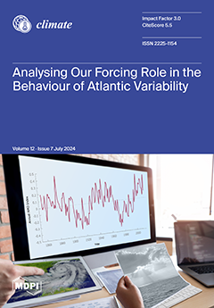
In recent years, there has been intense scientific debate as to whether the Atlantic Multidecadal Oscillation (AMO) is a genuine representation of a natural variability of climate or is substantially driven by external factors. In this study, we perform an analysis of the influence of natural and anthropogenic forcings on the AMO behaviour by means of two data-driven methods: a linear Granger causality analysis and a nonlinear extension of this method. Our results show that natural forcings do not have any causal role in relation to AMO in both linear and nonlinear analyses. Instead, a certain influence of anthropogenic forcing is found in a linear framework. This is a further hint that our forcing role is important, and sometimes even natural variability may not really be natural. View this paper
  • Issues are regarded as officially published after their release is announced to the table of contents alert mailing list.
  • You may sign up for e-mail alerts to receive table of contents of newly released issues.
  • PDF is the official format for papers published in both, html and pdf forms. To view the papers in pdf format, click on the "PDF Full-text" link, and use the free Adobe Reader to open them.
Order results
Result details
Section
Select all
Export citation of selected articles as:
20 pages, 2881 KiB  
Article
Combining E-Scores with Scenario Analysis to Evaluate the Impact of Transition Risk on Corporate Client Performance
by Rudolf van der Walt, Gary van Vuuren, Janette Larney, Tanja Verster and Helgard Raubenheimer
Climate 2024, 12(7), 107; https://doi.org/10.3390/cli12070107 - 19 Jul 2024
Viewed by 530
Abstract
Scenario analysis is a comprehensive approach to assess the impact of climate-related transition risk on businesses. Environmental, social, and governance (ESG) scores are popular tools with financial institutions (FI’s) for green-scoring practices and since they characterise a company’s performance from an ESG perspective, [...] Read more.
Scenario analysis is a comprehensive approach to assess the impact of climate-related transition risk on businesses. Environmental, social, and governance (ESG) scores are popular tools with financial institutions (FI’s) for green-scoring practices and since they characterise a company’s performance from an ESG perspective, they have been criticised for enabling “greenwashing” when used within the context of climate risk. Commercially available ESG scores are also available for listed entities, while FI counterparties are often unlisted. This study develops a methodology for creating in-house environmental scores (E-scores), which are then used to effectively choose appropriate transition pathways to be used in company-specific forward-looking scenario analysis. Such scenario analysis can be used to forecast the company’s financial position, including the cost of its greenhouse gas (GHG) emissions, and quantify the impact of transition climate risk on specified metrics. The choice of metrics depends on what the results of the analysis are used for. Two metrics are identified for being useful for risk management and credit decisions: future profitability and weighted average carbon intensity. Finally, the study demonstrates how this process can be implemented with a practical worked example, using only publicly available data. Full article
(This article belongs to the Special Issue Modeling and Forecasting of Climate Risks)
Show Figures

Figure 1

18 pages, 1550 KiB  
Article
Developing an Audit Framework for Local Flood Risk Management Strategies: Is Increasing Surface Water Flood Risk in England Being Adequately Managed?
by Andrew Russell, Adam James McCue and Aakash Dipak Patel
Climate 2024, 12(7), 106; https://doi.org/10.3390/cli12070106 - 18 Jul 2024
Viewed by 477
Abstract
Here, we investigate whether England’s 152 local flood risk management strategies (LFRMSs) satisfy minimal legislative criteria and address the growing surface water flood (SWF) risk caused by climate change. A systematic audit was used to assess the alignment of the LFRMSs with national [...] Read more.
Here, we investigate whether England’s 152 local flood risk management strategies (LFRMSs) satisfy minimal legislative criteria and address the growing surface water flood (SWF) risk caused by climate change. A systematic audit was used to assess the alignment of the LFRMSs with national climate change legislation and other relevant national strategies. An objective method to identify inclusion of a range of factors that good strategies should include was applied. LFRMSs are mostly meeting their minimum statutory requirements. However, there is a widespread issue across most LFRMSs regarding inadequate consideration of increasing SWF risk from climate changes, which highlights the need for enhanced LFRMSs by improved planning and climate change adaptation plans. There is some evidence of good practice within the LFRMS portfolio, which is discussed in the context of the ongoing LFRMS update process. Beyond England, there are implications for developing FRM processes at a local level that can be objectively assessed against national requirements. Communities in England face inadequately managed SWF risk in the future because of the range in plan quality across the LFRMSs. This research contributes to the ongoing examination of the full suite of 152 LFRMSs and, therefore, builds towards a complete assessment of the SWF management approach in England. This will help inform local climate change adaptation strategies that cater to the escalating threat of SWF due to climate change. Full article
(This article belongs to the Special Issue Advances of Flood Risk Assessment and Management)
Show Figures

Figure 1

15 pages, 2583 KiB  
Article
Unraveling the Intricate Links between the Dwindling Aral Sea and Climate Variability during 2002–2017
by Timur Berdimbetov, Buddhi Pushpawela, Nikita Murzintcev, Sahibjamal Nietullaeva, Khusen Gafforov, Asiya Tureniyazova and Dauranbek Madetov
Climate 2024, 12(7), 105; https://doi.org/10.3390/cli12070105 - 18 Jul 2024
Viewed by 445
Abstract
The Aral Sea is an indispensable component of the socio-economic progress of Central Asia but has undergone substantial ecological transformations over the last few decades, primarily due to global warming and human activities. Among these changes, the basin area has decreased, and water [...] Read more.
The Aral Sea is an indispensable component of the socio-economic progress of Central Asia but has undergone substantial ecological transformations over the last few decades, primarily due to global warming and human activities. Among these changes, the basin area has decreased, and water levels have dropped. This paper focuses on a comprehensive analysis of the spatial variation of key climate parameters, such as temperature, precipitation, and potential evapotranspiration over the Aral Sea. Moreover, we examined the transformation of seasonal water areas in the Aral Sea during the growing and non-growing seasons between 2002 and 2017 and the influence of climate and human factors on these changes using Landsat satellite data. Our results indicate that the western section of the Aral Sea has experienced a reduction in water area by 2.41 km2 and 1.83 km2 during the warm (R2 = 0.789) and cold (R2 = 0.744) seasons, respectively, over the investigated period. The decrease in lake water volume during the warm season can be attributed to local climate variations, as a strong negative correlation exists between seasonal water storage change and temperature (potential evapotranspiration). The correlation analysis shows that the water change in the northern part of the Aral Sea during the growing season has a significant positive correlation with temperature (R = 0.52) and an insignificant negative correlation with precipitation (R = −0.22). On the contrary, in the west and east parts of the Aral Sea, there is a significant negative correlation with temperature (R = −0.71 and −0.62) and a high positive correlation with precipitation (R = 0.71 and 0.55) during the growing season. Full article
Show Figures

Figure 1

19 pages, 3649 KiB  
Article
Analysis of Climate Risk in Panama’s Urban Areas
by Michelle A. Ruíz and Yazmin L. Mack-Vergara
Climate 2024, 12(7), 104; https://doi.org/10.3390/cli12070104 - 17 Jul 2024
Viewed by 489
Abstract
To mitigate the effects of climate change and increase the resilience of cities, climate risks in urban areas are crucial issues to be addressed. This study analyzes the risks, vulnerability, capacity, degree of exposure, and characteristics of the threats to Panama’s urban areas [...] Read more.
To mitigate the effects of climate change and increase the resilience of cities, climate risks in urban areas are crucial issues to be addressed. This study analyzes the risks, vulnerability, capacity, degree of exposure, and characteristics of the threats to Panama’s urban areas that result from climate change. Data from DesInventar—a conceptual and methodological tool developed for the construction of databases regarding losses, damages, or effects caused by emergencies or disasters—were analyzed. The main current impacts are floods, landslides, and extreme winds in that order. From 1933 to 2019, Panama recorded 1903 flood reports, 625 landslide reports, and numerous extreme wind events. The affected population totaled 527,394 people, with 101,738 homes impacted. The most affected provinces are Panama, Panama Oeste, and Chiriquí, based on the number of reports. It is expected that in the future, the current effects will increase, and the country’s energy and water security will be put at risk. Strategies to address climate change include enhancing early warning systems and investing in climate-resilient infrastructure. Key measures involve developing public policies for renewable energy and sustainable transportation, preserving ecosystems, and financial mechanisms to support a transition to a sustainable economy. Full article
Show Figures

Figure 1

17 pages, 2627 KiB  
Article
Spatial and Temporal Evolution of Seasonal Sea Ice Extent of Hudson Strait, Canada, 1971–2018
by Slawomir Kowal, William A. Gough and Kenneth Butler
Climate 2024, 12(7), 103; https://doi.org/10.3390/cli12070103 - 15 Jul 2024
Viewed by 464
Abstract
The temporal and spatial variation in seasonal sea ice in Hudson Strait is examined using time series and spatial clustering analyses. For the period from 1971 to 2018, a time series of sea ice breakup and freeze-up dates and ice-free season length at [...] Read more.
The temporal and spatial variation in seasonal sea ice in Hudson Strait is examined using time series and spatial clustering analyses. For the period from 1971 to 2018, a time series of sea ice breakup and freeze-up dates and ice-free season length at twenty-four grid points were generated from sea ice charts derived from satellite and other data. These data were analyzed temporally and spatially. The temporal analyses indicated an unambiguous response to a warming climate with statistically significant earlier breakup dates, later freeze-up dates, and longer ice-free seasons, that were statistically linked to coincident regional surface air temperatures. The rate of change in freeze-up dates and ice-free season length was particularly strong in the early 2000s and less so in the 2010s. There was evidence that breakup date behaviour was not only coincident with regional temperatures but likely with temperature and ice conditions of the previous year. Later freeze-up dates were directly linked to earlier breakup dates using detrended time series. Spatial clustering analysis on the Hudson Strait gridded sea ice data revealed distinctive signatures for Ungava Bay, Frobisher Bay, and for grid points close to the shore and a clear linkage to the underlying circulation of Hudson Strait. Full article
Show Figures

Figure 1

14 pages, 1801 KiB  
Article
Auto-Machine-Learning Models for Standardized Precipitation Index Prediction in North–Central Mexico
by Rafael Magallanes-Quintanar, Carlos E. Galván-Tejada, Jorge Isaac Galván-Tejada, Hamurabi Gamboa-Rosales, Santiago de Jesús Méndez-Gallegos and Antonio García-Domínguez
Climate 2024, 12(7), 102; https://doi.org/10.3390/cli12070102 - 12 Jul 2024
Viewed by 624
Abstract
Certain impacts of climate change could potentially be linked to alterations in rainfall patterns, including shifts in rainfall intensity or drought occurrences. Hence, predicting droughts can provide valuable assistance in mitigating the detrimental consequences associated with water scarcity, particularly in agricultural areas or [...] Read more.
Certain impacts of climate change could potentially be linked to alterations in rainfall patterns, including shifts in rainfall intensity or drought occurrences. Hence, predicting droughts can provide valuable assistance in mitigating the detrimental consequences associated with water scarcity, particularly in agricultural areas or densely populated urban regions. Employing predictive models to calculate drought indices can be a useful method for the effective characterization of drought conditions. This study applied an Auto-Machine-Learning approach to deploy Artificial Neural Network models, aiming to predict the Standardized Precipitation Index in four regions of Zacatecas, Mexico. Climatological time-series data spanning from 1979 to 2020 were utilized as predictive variables. The best models were found using performance metrics that yielded a Mean Squared Error, Mean Absolute Error, and Coefficient of Determination ranging from 0.0296 to 0.0388, 0.1214 to 0.1355, and 0.9342 to 0.9584, respectively, for the regions under study. As a result, the Auto-Machine-Learning approach successfully developed and tested Artificial Neural Network models that exhibited notable predictive capabilities when estimating the monthly Standardized Precipitation Index within the study region. Full article
Show Figures

Figure 1

32 pages, 10344 KiB  
Review
An Analysis of Romania’s Energy Strategy: Perspectives and Developments since 2020
by Alexandru-Mihai Bulmez, Alin-Ionuț Brezeanu, George Dragomir, Ovidiu-Mircea Talabă and Gabriel Năstase
Climate 2024, 12(7), 101; https://doi.org/10.3390/cli12070101 - 9 Jul 2024
Viewed by 549
Abstract
Earth’s climate cannot be ignored any longer. Policies are vital in order to mitigate the negative effects of climate change. The energy crisis created by the Russo-Ukrainian war in Europe and COVID-19 pandemic affected the EU and its member states. The focus is [...] Read more.
Earth’s climate cannot be ignored any longer. Policies are vital in order to mitigate the negative effects of climate change. The energy crisis created by the Russo-Ukrainian war in Europe and COVID-19 pandemic affected the EU and its member states. The focus is more than ever on its energy policies and independence. The EU revised the energy strategy in response to the regional conflict, and it sped up all the processes for energetic independence from other countries outside of the EU. This benefited the climate change policies the most, as all the measures involved reducing energy consumption and increasing renewables, thus contributing to reducing greenhouse gas emissions. As a member state of the EU, Romania is committed to complying with EU regulations. With a high degree of energy independence compared with the other EU members, Romania plans to become a regional energy provider and modernize the energy infrastructure internally as a response to the regional conflict. The measures that the EU and Romania implemented after the conflict started in 2022 have come to fruition, and the effects are becoming visible a year later. This study aims to study the energy strategy of Romania in correlation with the EU strategy in the turbulent period of pandemics and conflict between 2019 and 2023, with the latest available data. Full article
(This article belongs to the Section Policy, Governance, and Social Equity)
Show Figures

Figure 1

16 pages, 1735 KiB  
Review
Taking Stock of Recent Progress in Livelihood Vulnerability Assessments to Climate Change in the Developing World
by Atoofa Zainab and Kalim U. Shah
Climate 2024, 12(7), 100; https://doi.org/10.3390/cli12070100 - 8 Jul 2024
Viewed by 702
Abstract
Over the past few decades, the use of vulnerability assessments has grown substantially to support rural communities in developing countries. These studies aim to help these communities achieve their livelihood goals, such as sustainable resource use and adaptation to global changes, by evaluating [...] Read more.
Over the past few decades, the use of vulnerability assessments has grown substantially to support rural communities in developing countries. These studies aim to help these communities achieve their livelihood goals, such as sustainable resource use and adaptation to global changes, by evaluating their susceptibility to climate change impacts. This systematic review critically examines the extensive body of literature on Livelihood Vulnerability Index (LVI) assessments related to climate change impacts in developing countries. By synthesizing findings from various studies, this review highlights patterns and methodologies used to understand the effects of climate change on vulnerable populations. Key focus areas include geographical distribution, methodological approaches, and the frameworks utilized in vulnerability assessments. The review identifies prominent frameworks, such as the LVI and LVI-IPCC, which integrate indicators of sensitivity, exposure, and adaptive capacity to evaluate climate risks. Findings reveal a concentration of studies in Asia and Africa, with a strong emphasis on agricultural and coastal ecosystems. Methodologically, there is a notable reliance on stratified random sampling to accurately capture community and household-level vulnerabilities. A detailed comparative analysis of the LVI, LVI-IPCC, and Sustainable Livelihood Framework (SLF) is also presented, highlighting their characteristics, benefits, and limitations. The review underscores the need for methodological refinements to better address temporal and regional variations in vulnerability. It concludes with recommendations for future research, integrating broader climate scenarios, exploring sectoral interdependencies, and adopting dynamic approaches to enhance the accuracy and applicability of vulnerability assessments. Full article
Show Figures

Figure 1

21 pages, 7895 KiB  
Article
Simulating Climatic Patterns and Their Impacts on the Food Security Stability System in Jammu, Kashmir and Adjoining Regions, India
by Aaqib Ashraf Bhat, Saurabh Kumar Gupta, Suraj Kumar Singh, Gowhar Meraj, Pankaj Kumar, Shruti Kanga, Saurabh Singh and Bhartendu Sajan
Climate 2024, 12(7), 99; https://doi.org/10.3390/cli12070099 - 7 Jul 2024
Viewed by 746
Abstract
This study investigated the historical climate data and future projections under the SSP5-8.5 scenario for Jammu, Kashmir (J&K), and its adjoining regions in India. Agriculture is a critical economic pillar of this region, making it highly vulnerable to climate change. This study focused [...] Read more.
This study investigated the historical climate data and future projections under the SSP5-8.5 scenario for Jammu, Kashmir (J&K), and its adjoining regions in India. Agriculture is a critical economic pillar of this region, making it highly vulnerable to climate change. This study focused on temperature and precipitation trends. Statistical analysis and modeling methods, including cloud computing, were employed to predict changes and assess their impact on agricultural productivity and water resources. The results indicated that by 2100, the mean maximum and minimum temperatures are projected to increase by approximately 2.90 °C and 2.86 °C, respectively. Precipitation variability is expected to rise, with a mean increase of 2.64 × 10⁻⁶ mm per day. These changes have significant consequences for crop yield, water stress, and ecosystem dynamics. An analysis of Gross Primary Productivity (GPP) as a proxy for agricultural productivity using linear regression revealed a concerning trend. Although the total GPP of the study area remained stable over time, it declined by −570 g yr−1 in 2010, coinciding with a 1 °C temperature rise. Projections based on the expected 3 °C temperature increase by 2100 suggest a total GPP loss of −2500 g yr−1. These findings highlight the urgent need for proactive adaptation measures, including sustainable agricultural practices, improved water management, and enhanced socioeconomic infrastructure, to mitigate the impact of climate change and ensure long-term resilience and food security in the region. Full article
(This article belongs to the Special Issue Advances of Flood Risk Assessment and Management)
Show Figures

Figure 1

27 pages, 3990 KiB  
Review
Navigating the Uncertain Terrain: Venezuela’s Future Using the Shared Socioeconomic Pathways Framework—A Systematic Review
by Isaias Lescher Soto, Alicia Villamizar, Barlin O. Olivares, María Eugenia Gutiérrez and Gustavo J. Nagy
Climate 2024, 12(7), 98; https://doi.org/10.3390/cli12070098 - 6 Jul 2024
Viewed by 1133
Abstract
We investigate Venezuela’s potential “futures” under Shared Socioeconomic Pathways (SSPs) through a systematic literature review, including systematic mapping and thematic analysis of 50 scientific articles. We categorised the SSP scenarios into two generational categories and classified the outcomes into positive, negative, and neutral [...] Read more.
We investigate Venezuela’s potential “futures” under Shared Socioeconomic Pathways (SSPs) through a systematic literature review, including systematic mapping and thematic analysis of 50 scientific articles. We categorised the SSP scenarios into two generational categories and classified the outcomes into positive, negative, and neutral futures. Under first-generation SSP scenarios, increasing poverty could be reversed, and the country’s economic growth could be stimulated by adopting unambitious climate measures. However, second-generation SSP scenarios paint a more challenging picture. They suggest that Venezuela could face heat waves, droughts, an increase in diseases, loss of biodiversity, and an increase in invasive species and pests during the remainder of the 21st century as a direct consequence of climate change. Venezuela’s geographic and topographic diversity could exacerbate these impacts of climate change. For instance, coastal areas could be at risk of sea-level rise and increased storm surges, while mountainous regions could experience more frequent and intense rainfall, leading to landslides and flash floods. The urgency of conducting additional research on the factors that could influence the severity of climate change’s impact, considering Venezuela’s geographic and topographic diversity, cannot be overstated. We also identified the critical need to explore alternative paths to move away from the current extractive development model. The potential actions in this regard could be instrumental in aligning the country with global adaptation and mitigation commitments. Full article
Show Figures

Figure 1

11 pages, 8368 KiB  
Article
Shifts in Climatic Influences on Radial Growth of Scots Pine in the Central Scandinavian Mountains with an Evident Transition in the 1970s
by Ulrika Gomm, Emilia Bromfält, Selma Kling and Qiong Zhang
Climate 2024, 12(7), 97; https://doi.org/10.3390/cli12070097 - 4 Jul 2024
Viewed by 563
Abstract
Radial growth of trees, as reflected by tree ring width, serves as a vital proxy for past climate conditions, offering insights into climate dynamics over centennial and millennial time scales. Traditionally, in the high altitudes and latitudes of the central Scandinavian Mountains, summer [...] Read more.
Radial growth of trees, as reflected by tree ring width, serves as a vital proxy for past climate conditions, offering insights into climate dynamics over centennial and millennial time scales. Traditionally, in the high altitudes and latitudes of the central Scandinavian Mountains, summer temperatures, particularly in July, have significantly influenced the radial growth of Scots pine. This research aims to reassess the climatic determinants of Scots pine radial growth in Jämtland, central Scandinavian Mountains, by incorporating a refined analysis that considers temperature, precipitation, and snow depth, and their correlations with tree growth over time. Using a dynamic moving window heatmap correlation analysis, this study revisits a Scots pine chronology to explore the evolving climatic influences on radial growth. This approach allows for the identification of temporal shifts in growth-limiting factors. We observe a notable transition in the 1970s, marking a shift where water availability, rather than temperature, emerges as a critical limiting factor for radial growth at both the beginning and the end of the growing season. This shift is reflective of the broader global trend of decreasing tree growth response to increasing temperatures in the latter half of the 20th century, underscoring the significant impact of ongoing climate change on forest ecosystems. The results highlight the necessity for adaptive forest management strategies that consider the changing dynamics of climatic influences on tree growth. Furthermore, our study contributes to the broader understanding of forest growth patterns in the face of climate change, with substantial implications for ecological research and forest management. Full article
(This article belongs to the Section Climate and Environment)
Show Figures

Figure 1

15 pages, 8036 KiB  
Article
Global Warming Impacts on Southeast Australian Coastally Trapped Southerly Wind Changes
by Lance M. Leslie, Milton Speer and Shuang Wang
Climate 2024, 12(7), 96; https://doi.org/10.3390/cli12070096 - 1 Jul 2024
Viewed by 660
Abstract
Coastally trapped southerly wind changes are prominent during southeast Australia’s warm season (spring and summer). These abrupt, often gale force, wind changes are known locally as Southerly Busters (SBs) when their wind speeds reach 15 m/s. They move northwards along the coast, often [...] Read more.
Coastally trapped southerly wind changes are prominent during southeast Australia’s warm season (spring and summer). These abrupt, often gale force, wind changes are known locally as Southerly Busters (SBs) when their wind speeds reach 15 m/s. They move northwards along the coast, often producing very large temperature drops. SBs exceeding 21 m/s are severe SBs (SSBs). SBs have both positive and negative impacts. They bring relief from oppressively hot days but can cause destructive wind damage, worsen existing bushfires, and endanger aviation and marine activities. This study assesses the impacts of global warming (GW) and associated climate change on SBs and SSBs, using observational data from 1970 to 2022. Statistical analyses determine significant trends in annual frequency counts of SBs and SSBs, particularly during the accelerated GW period from the early–mid-1990s. It was found that the annual combined count of SBs and SSBs had increased, with SSBs dominating from 1970 to 1995, but SB frequencies exceeded SSBs from 1996 to 2023. The ascendency of SB frequencies over SSBs since 1996 is explained by the impact of GW on changes in global and local circulation patterns. Case studies exemplify how these circulation changes have increased annual frequencies of SBs, SSBs, and their combined total. Full article
(This article belongs to the Special Issue Coastal Hazards under Climate Change)
Show Figures

Figure 1

19 pages, 6338 KiB  
Article
Small Municipalities in the Amazon under the Risk of Future Climate Change
by Everaldo B. de Souza, Brenda C. S. Silva, Emilene M. F. Serra, Melgris J. Becerra Ruiz, Alan C. Cunha, Paulo J. P. O. Souza, Luciano P. Pezzi, Edson J. P. da Rocha, Adriano M. L. Sousa, João de Athaydes Silva, Jr., Alexandre M. C. do Carmo, Douglas B. S. Ferreira, Aline M. M. Lima, Flavio A. A dos Santos, Bergson C. Moraes, Maria de L. P. Ruivo, Peter M. Toledo and Tercio Ambrizzi
Climate 2024, 12(7), 95; https://doi.org/10.3390/cli12070095 - 29 Jun 2024
Viewed by 636
Abstract
The focus of this work is on small municipalities (population below 50 thousand inhabitants) that cover around 87% of the territory of the Brazilian Legal Amazon (BLA). Based on a comprehensive integrated analysis approach using the three components hazard (climate extremes from CMIP6 [...] Read more.
The focus of this work is on small municipalities (population below 50 thousand inhabitants) that cover around 87% of the territory of the Brazilian Legal Amazon (BLA). Based on a comprehensive integrated analysis approach using the three components hazard (climate extremes from CMIP6 future scenarios), exposure (directly affected population), and vulnerability (subdimensions of susceptibility and coping/adaptive capacity by using multidimensional indicators), the latter two using current datasets provided by the official Census IBGE 2022, we document a quantitative assessment of the risk R of natural disasters in the BLA region. We evidenced a worrying and imminent intensification of the curve of R in most Amazonian municipalities over the next two 25-year periods. The overall results of the highest proportions of R (total municipalities affected) pointed out the Amazonas, Roraima, Pará, and Maranhão as the main states, presenting projected categories of R high in the near future (2015 to 2039) and very high in the far future (2040 to 2064). The detailed assessment of the susceptibility and coping/adaptive capacity allowed us to elucidate the principal indicators that aggravate the degree of vulnerability: economy, the precariousness of urban infrastructure, medical services, communication, and urban mobility, whose combined factors, unfortunately, reveal a widespread poverty profile along the small Amazonian municipalities. Our scientific findings can assist decision makers in targeted strategies planning and public policies to minimize and mitigate ongoing and future climate change. Full article
Show Figures

Figure 1

27 pages, 10897 KiB  
Article
Historic Changes and Future Projections in Köppen–Geiger Climate Classifications in Major Wine Regions Worldwide
by Cristina Andrade, André Fonseca, João A. Santos, Benjamin Bois and Gregory V. Jones
Climate 2024, 12(7), 94; https://doi.org/10.3390/cli12070094 - 27 Jun 2024
Viewed by 592
Abstract
A valuable tool for comprehending and characterizing climate patterns on a global scale is the Köppen–Geiger climate classification system. When it comes to wine production, the climate of a region plays an essential role in determining whether specific grape varieties can be cultivated, [...] Read more.
A valuable tool for comprehending and characterizing climate patterns on a global scale is the Köppen–Geiger climate classification system. When it comes to wine production, the climate of a region plays an essential role in determining whether specific grape varieties can be cultivated, largely determining the style of wine that can be made, and influencing the consistency of overall wine quality. In this study, the application of the Köppen–Geiger classification system to the latest Coupled Model Intercomparison Project (CMIP6) experiments has been explored. To establish a baseline for the historical period (1970–2000), the WorldClim dataset was used alongside a selection of an ensemble of 14 Global Climate Models. The evaluation of climate variability across winemaking regions is conducted by considering future climate projections from 2041 to 2060, which are based on different anthropogenic radiative forcing scenarios (Shared Socioeconomic Pathways, SSP2–4.5, and SSP5–8.5). The results are the most comprehensive documentation of both the historical climate classifications for most wine regions worldwide and the potential changes in these classifications in the future. General changes in climate types are projected to occur largely in a significant shift from a warm summer climate to a hot summer climate in temperate and dry zones worldwide (climate types C and B, respectively). This shift poses challenges for grape cultivation and wine production. The grape development process can be significantly affected by high temperatures, which could result in early ripening and changes in the grape berry’s aromatic compounds. As regions transition and experience different climates, wine producers are required to adapt their vineyard management strategies by implementing suitable measures that can effectively counter the detrimental impacts of abiotic stresses on grape quality and vineyard health. These adaptation measures may include changes in canopy and soil management, using different variety-clone-rootstock combinations, adopting irrigation methods, or shifting into other microclimatic zones, among other effective techniques. To ensure long-term sustainability, wine producers must consider the climatic change projections that are specific to their region, allowing them to make more informed decisions about vineyard management practices, reducing risks, and ultimately making the wine industry more resilient and adaptive to the ongoing effects of climate change. Full article
Show Figures

Figure 1

18 pages, 21201 KiB  
Article
Geospatial Analysis of Flood Susceptibility in Nigeria’s Vulnerable Coastal States: A Detailed Assessment and Mitigation Strategy Proposal
by Muhammad Bello, Saurabh Singh, Suraj Kumar Singh, Vikas Pandey, Pankaj Kumar, Gowhar Meraj, Shruti Kanga and Bhartendu Sajan
Climate 2024, 12(7), 93; https://doi.org/10.3390/cli12070093 - 27 Jun 2024
Viewed by 564
Abstract
This study employs advanced geospatial analytical techniques to evaluate the vulnerability of Nigeria’s coastal states and their constituent local government areas to flood hazards, which represent a critical and escalating risk within the coastal hazard paradigm intensified by climate change phenomena. The study’s [...] Read more.
This study employs advanced geospatial analytical techniques to evaluate the vulnerability of Nigeria’s coastal states and their constituent local government areas to flood hazards, which represent a critical and escalating risk within the coastal hazard paradigm intensified by climate change phenomena. The study’s objective is to utilize geospatial data to delineate and quantify the intensity and distribution of flood susceptibility, thus establishing a foundational framework for developing comprehensive disaster management strategies in response to the challenges posed by climate variability. The research uses satellite imagery and geographic information system (GIS)-based hydrological modeling to delineate regions susceptible to flooding, synthesizing topographical and hydrological data to stratify areas into discrete flood susceptibility categories. The findings indicate that the Delta coastal State of Nigeria contains extensive medium to high-risk flood zones spanning 8304.57 km2. While the Bayelsa coastal State of Nigeria presents critical areas at high to very high flood risk, encompassing 5506.61 km2 at high risk and 1826.88 km2 at very high risk, this highlights the urgent necessity for immediate and strategic mitigation measures. This research highlights the critical importance of geospatial technology in shaping disaster management and enhancing community resilience against increasing flood frequencies. As Nigeria’s coastal regions face escalating flood susceptibility, advanced geospatial methods are vital for assessing and mitigating these climate-induced threats, contributing to climate-resilient planning and aligning with Sustainable Development Goal 13: Climate Action. The study’s geospatial approach delivers precise flood risk evaluations and guides targeted mitigation efforts, marking significant progress in managing coastal hazards in a changing climate. Full article
(This article belongs to the Special Issue Coastal Hazards under Climate Change)
Show Figures

Figure 1

18 pages, 10092 KiB  
Article
Quantifying Drought Impacts Based on the Reliability–Resiliency–Vulnerability Framework over East Africa
by Hassen Babaousmail, Brian Odhiambo Ayugi, Zulfiqar Hammad, Donnata Alupot, Kokou Romaric Posset, Richard Mumo and Adharsh Rajasekar
Climate 2024, 12(7), 92; https://doi.org/10.3390/cli12070092 - 27 Jun 2024
Viewed by 682
Abstract
Drought poses a significant threat to water resources in East Africa, necessitating a comprehensive assessment of its impacts for effective mitigation strategies. This study utilizes two global gridded SPEI datasets to analyze drought characteristics (i.e., frequency, duration, and severity) in East Africa from [...] Read more.
Drought poses a significant threat to water resources in East Africa, necessitating a comprehensive assessment of its impacts for effective mitigation strategies. This study utilizes two global gridded SPEI datasets to analyze drought characteristics (i.e., frequency, duration, and severity) in East Africa from 1981 to 2021. To estimate the sustainability of water resources over the region, the study employed the Reliability–Resiliency–Vulnerability framework (RRV) that aggregates the drought characteristics (i.e., frequency, duration, and severity). Drought is deemed to have occurred when the SPEI value falls below −1, so the threshold for water demand (RRV) is also computed at a threshold level of −1. The findings indicate pronounced changes in drought patterns across East Africa, with evidence of varying degrees of recovery and resilience in different regions. Employing the RRV framework over the East Africa region to determine how the region can cope with the effects of drought revealed a median range of RRV of 0.61 to 0.80, indicating a sustainable situation during the study period. This indicates that despite the recorded drought incidences, the water catchments of lakes, rivers, and major water towers are not threatened and, thus, less vulnerable. Although certain regions exhibit declining resilience and vulnerability to drought impacts, there is a need for targeted mitigation measures and policy interventions to safeguard water resources. Full article
Show Figures

Figure 1

27 pages, 5948 KiB  
Article
Assessment of Modeled Mean Radiant Temperature in Hot and Dry Environments: A Case Study in Saudi Arabia
by Ali Alzahrani and Mohamed Gadi
Climate 2024, 12(7), 91; https://doi.org/10.3390/cli12070091 - 27 Jun 2024
Viewed by 404
Abstract
Envi-met is the most-used simulation tool to assess outdoor thermal comfort in urban microclimates. Considering reported disparities between modeled and observed mean radiant temperature (MRT), failing to accurately predict the MRT may have a negative impact on the conclusions drawn by urban designers [...] Read more.
Envi-met is the most-used simulation tool to assess outdoor thermal comfort in urban microclimates. Considering reported disparities between modeled and observed mean radiant temperature (MRT), failing to accurately predict the MRT may have a negative impact on the conclusions drawn by urban designers and policy makers. Therefore, this study aims to validate the Envi-met model’s efficiency for predicting MRT in the hot arid climate of Mecca city. Sensitivity analyses were conducted to investigate the settings and inputs of Envi-met, including two- and six-directional methods for calculating MRT, shortwave radiation projection factors, Indexed View Sphere (IVS), Advanced Canopy Radiation Transfer (ACRT), and the localization of materials and vegetation. Two statistical metrics (RMSE and MAE) were employed to assess Envi-met’s performance for the two evaluation points. Envi-met produced the best results with the 6-directional, ƒp-RayM (in winter) and ƒp-City (in summer), IVS on and ACRT on mode, and localized soil condition, materials, and vegetation inputs. An analysis of the modeled MRT results illustrated that error magnitudes were decreased significantly as a result of sufficient settings and inputs; for example, RMSE was improved by 2.31 and 8.48 K in the winter and summer open site results, respectively, and by 7.30 K in the summer under-tree site. Overall, the results of winter and summer analyses demonstrate average RMSE of 4.99 K and MAE of 4.02 K. The findings illustrate that substantial enhancement of model performance can be achieved through the use of proper settings and inputs. Full article
Show Figures

Figure 1

11 pages, 536 KiB  
Article
On the Unforced or Forced Nature of the Atlantic Multidecadal Oscillation: A Linear and Nonlinear Causality Analysis
by Umberto Triacca and Antonello Pasini
Climate 2024, 12(7), 90; https://doi.org/10.3390/cli12070090 - 26 Jun 2024
Viewed by 1178
Abstract
In recent years, there has been intense debate in the literature as to whether the Atlantic Multidecadal Oscillation (AMO) is a genuine representation of natural climate variability or is substantially driven by external factors. Here, we perform an analysis of the influence of [...] Read more.
In recent years, there has been intense debate in the literature as to whether the Atlantic Multidecadal Oscillation (AMO) is a genuine representation of natural climate variability or is substantially driven by external factors. Here, we perform an analysis of the influence of external (natural and anthropogenic) forcings on the AMO behaviour by means of a linear Granger causality analysis and by a nonlinear extension of this method. Our results show that natural forcings do not have any causal role on AMO in both linear and nonlinear analyses. Instead, a certain influence of anthropogenic forcing is found in a linear framework. Full article
Show Figures

Figure 1

35 pages, 863 KiB  
Review
Climate Change and Human Health in the Arctic: A Review
by Elena A. Grigorieva
Climate 2024, 12(7), 89; https://doi.org/10.3390/cli12070089 - 22 Jun 2024
Viewed by 1387
Abstract
Over recent decades, the Arctic has begun facing a range of climate-related challenges, from rising temperatures to melting ice caps and permafrost thaw, with significant implications for ecosystems and human well-being. Addressing the health impacts of these issues requires a comprehensive approach, integrating [...] Read more.
Over recent decades, the Arctic has begun facing a range of climate-related challenges, from rising temperatures to melting ice caps and permafrost thaw, with significant implications for ecosystems and human well-being. Addressing the health impacts of these issues requires a comprehensive approach, integrating scientific research, community engagement, and policy interventions. This study conducts a literature review to assess the effects of climate change on human health in northern latitudes and to compile adaptation strategies from the Arctic countries. A literature search was performed between January and April 2024 for papers published after 2000, using the electronic databases Web of Science, Pubmed, Science Direct, Scopus, Google Scholar, and eLibrary.RU, with specific questions formulated to direct the search: (i) What are the climate changes? (ii) How does climate change affect human health? (iii) What adaptation measures and policies are required? The key phrases “climate change”, “human health”, “adaptation practices”, and “Arctic” were employed for searching. Ultimately, 56 relevant studies were identified, reviewing health risks such as infectious diseases, mental health issues, and diseases connected with extreme weather events; wildfires and their associated pollution; permafrost degradation; pure water; and food quality. The paper also examines mitigation and adaptation strategies at all levels of governance, emphasizing the need for international cooperation and policy action to combat negative health outcomes, investments in healthcare infrastructure, emergency preparedness, and public health education. Incorporating diverse perspectives, including Indigenous knowledge, Community-Based Adaptation, EcoHealth and One Health approaches, is crucial for effectively addressing the health risks associated with climate change. In conclusion, the paper proposes adaptation strategies to mitigate the health impacts of climate change in the Arctic. Full article
(This article belongs to the Special Issue Climate Impact on Human Health)
Show Figures

Figure 1

Previous Issue
Next Issue
Back to TopTop