


-
The Reliability of SBR System During COVID-19 and Its Impact on Water Quality of a Small Flysch River in Protected Areas -
Scales and Sustainability: The Politics of Riverine Landscape Governance in Chiang Mai, Thailand -
Low-Cost, Sustainable Materials and 3D-Printed Systems for Wastewater Treatment and Reuse in Rural Communities: A Critical Review
Journal Description
Water
Water
is a peer-reviewed, open access journal on water science and technology, including the ecology and management of water resources, published semimonthly online by MDPI. Water collaborates with the Stockholm International Water Institute (SIWI). In addition, the American Institute of Hydrology (AIH), Polish Limnological Society (PLS) and Japanese Society of Physical Hydrology (JSPH) are affiliated with Water and their members receive a discount on the article processing charges.
- Open Access— free for readers, with article processing charges (APC) paid by authors or their institutions.
- High Visibility: indexed within Scopus, SCIE (Web of Science), Ei Compendex, GEOBASE, GeoRef, PubAg, AGRIS, CAPlus / SciFinder, Inspec, and other databases.
- Journal Rank: JCR - Q2 (Water Resources) / CiteScore - Q1 (Aquatic Science)
- Rapid Publication: manuscripts are peer-reviewed and a first decision is provided to authors approximately 17.7 days after submission; acceptance to publication is undertaken in 2.8 days (median values for papers published in this journal in the first half of 2026).
- Recognition of Reviewers: reviewers who provide timely, thorough peer-review reports receive vouchers entitling them to a discount on the APC of their next publication in any MDPI journal, in appreciation of the work done.
- Companion journals for Water include: Hydropower and Freshwater.
- Journal Clusters of Water Resources: Water, Journal of Marine Science and Engineering, Hydrology, Resources, Oceans, Limnological Review, Coasts and Hydropower.
Impact Factor:
3.5 (2025);
5-Year Impact Factor:
3.6 (2025)
Latest Articles
Multidimensional Rainfall Risk for Hydropower Dam Safety from Extreme-Weighted CMIP6 Ensembles Across the Mekong Basin
Water 2026, 18(16), 2013; https://doi.org/10.3390/w18162013 - 17 Aug 2026
Abstract
Climate change affects the intensity of extreme rainfall, which is an important factor for design flood assessment and dam safety, particularly in the monsoon region of Southeast Asia and the Mekong Basin, where seasonal rainfall variability is high and there are many hydropower
[...] Read more.
Climate change affects the intensity of extreme rainfall, which is an important factor for design flood assessment and dam safety, particularly in the monsoon region of Southeast Asia and the Mekong Basin, where seasonal rainfall variability is high and there are many hydropower dams that are vulnerable to changes in extreme rainfall. This study developed a framework for assessing design rainfall and probable maximum precipitation (PMP) under climate change for three dam catchments of different sizes in Thailand and Lao PDR, namely the Ubolrat Dam, the Nam Theun 1, and the Nam Kong 3 Dam. The framework connects the bias correction of GCM data from 10 CMIP6 models using CMhyd, extreme-focused model selection with catchment-specific ranking, and the construction of the top-three ensemble median, through to the analysis of the return period, DDF, IDF, PMP, and extreme rainfall trends under the SSP2–4.5 and SSP5–8.5 scenarios. The results show that the suitable models are catchment-specific and that each catchment has a different risk profile under SSP5–8.5. The Ubolrat Dam shows a 63.20% increase in the 100-year 1-day rainfall, the Nam Theun 1 shows a 40.64% increase in the 100-year 7-day rainfall, while the Nam Kong 3 has the highest PMP value and the steepest Rx7day trend at 18.03 mm per decade. The results indicate that the assessment of extreme rainfall risk must consider magnitude, variability, and trend together, and the outputs can serve as input data for the assessment of PMF and hydropower dam safety under future climate variability.
Full article
(This article belongs to the Section Water and Climate Change)
Open AccessArticle
Runoff Evolution and Its Attribution to Climatic Variability and Anthropogenic Influences in the Source Region of the Yellow River, China
by
Zeyu Xu, Zhenyang Liu, Shuai Wang, Yongxin Ni and Jianwei Wang
Water 2026, 18(16), 2012; https://doi.org/10.3390/w18162012 - 17 Aug 2026
Abstract
This study investigated the long-term evolution and driving mechanisms of runoff in the Source Region of the Yellow River (SRYR) using runoff records from 1960 to 2020. An integrated framework combining the Soil and Water Assessment Tool (SWAT) model, statistical analyses, and scenario
[...] Read more.
This study investigated the long-term evolution and driving mechanisms of runoff in the Source Region of the Yellow River (SRYR) using runoff records from 1960 to 2020. An integrated framework combining the Soil and Water Assessment Tool (SWAT) model, statistical analyses, and scenario simulations was developed to identify runoff evolution patterns, quantify the contributions of climatic variability and anthropogenic influences mainly represented by land-use change within the attribution framework, and evaluate runoff responses to environmental changes. The results showed that runoff exhibited distinct stage-wise characteristics, with an initial decline followed by gradual recovery, and 1987 was identified as the primary change point. Mean annual runoff during the impact period decreased by 10.07% compared with the baseline period, while the updated runoff record through 2020 revealed a gradual recovery trend during the most recent decade. The SWAT model showed satisfactory performance during calibration and validation, supporting runoff attribution analysis. Climatic variability was the dominant contributor to runoff variation, accounting for 66.73% of the observed runoff change, whereas anthropogenic influences mainly represented by land-use change accounted for 33.27%. This climatic contribution represents the combined effects of observed climatic conditions, including long-term trends and internal variability, rather than the isolated effect of anthropogenic climate change. Scenario simulations indicated that runoff was more sensitive to precipitation than temperature changes. A 10% increase and decrease in precipitation resulted in runoff changes of 20.47% and −16.54%, respectively, while a 1 °C increase and decrease in temperature caused changes of −3.28% and 3.04%, respectively. Land-use change affected runoff mainly by modifying runoff generation and routing processes, but its influence was weaker than that of climatic variability. These findings improve understanding of runoff evolution and controlling mechanisms in alpine headwater basins.
Full article
(This article belongs to the Special Issue Advances in Sustainable Water Resources Management and Water–Energy Nexus)
Open AccessArticle
Integration of Hydro–Wind–PV Power Under Cold-Wave Conditions
by
Zixi Sang, Jingjing Lian and Xianxun Wang
Water 2026, 18(16), 2011; https://doi.org/10.3390/w18162011 - 17 Aug 2026
Abstract
With the growing risks posed by extreme weather, such as cold waves, to the secure operation of power systems integrated with large-scale wind and PV power, conventional multi-energy complementary modes fail to cope with the drastic output fluctuations in renewable resources. In this
[...] Read more.
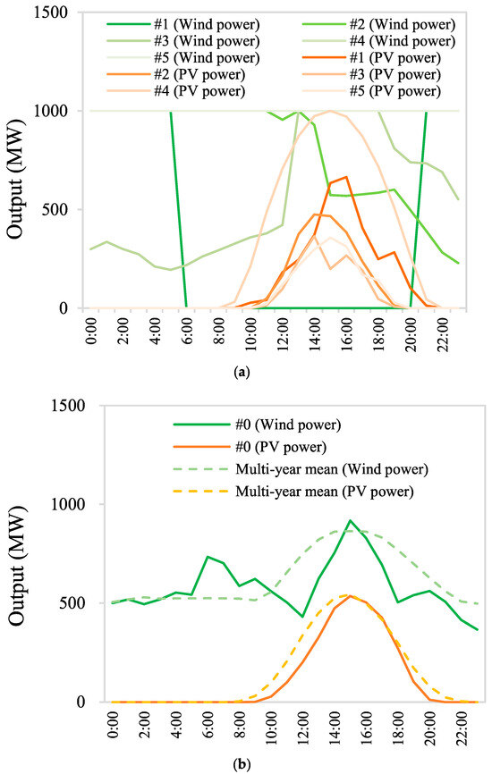
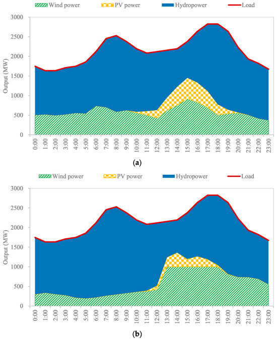
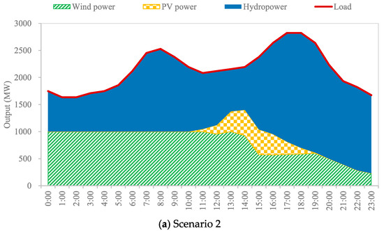
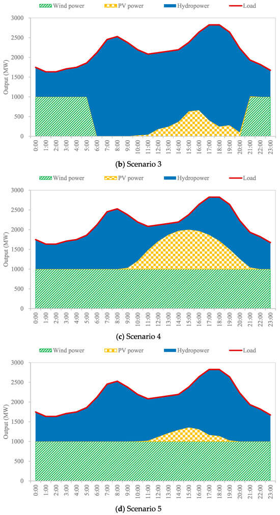
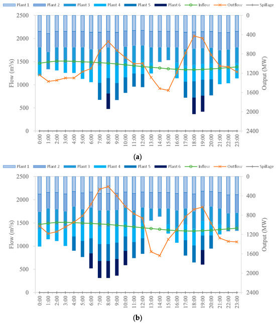
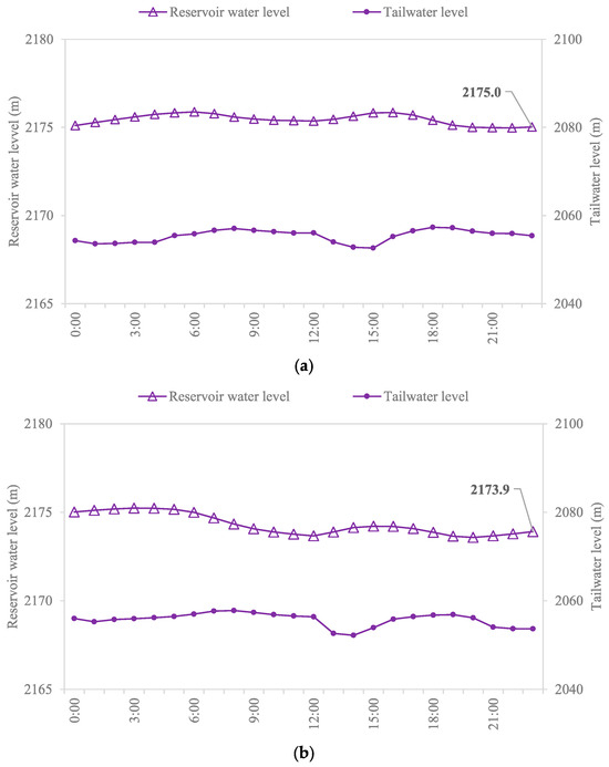
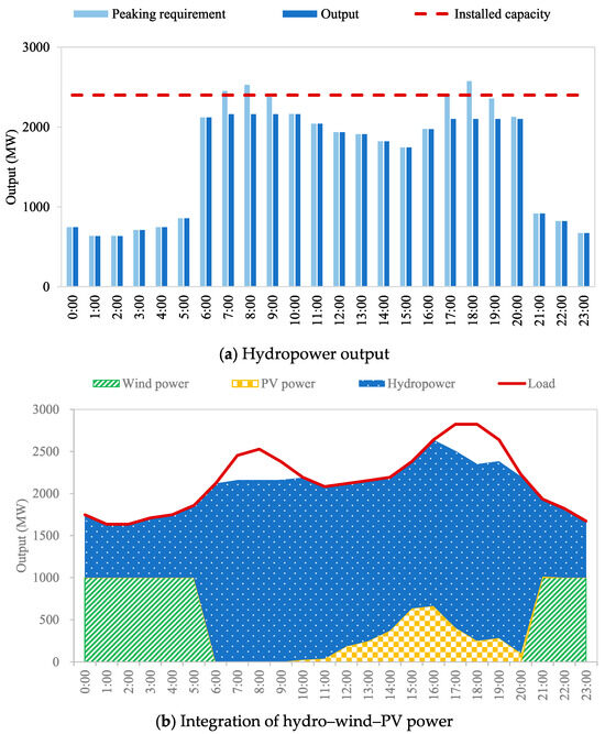
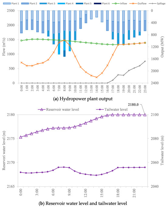
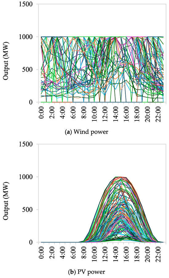
With the growing risks posed by extreme weather, such as cold waves, to the secure operation of power systems integrated with large-scale wind and PV power, conventional multi-energy complementary modes fail to cope with the drastic output fluctuations in renewable resources. In this study, a hydro–wind–PV joint-optimized scheduling model is established to quantify the compensation requirement of wind–PV power output fluctuations and to optimize the hydropower compensatory regulation, aiming to clarify the actual effects and inherent limitations of hydropower under cold-wave scenarios. Based on 86-year hourly operational simulation data of a practical virtual case in northwest China, the main simulation results, limited to a daily time horizon with five statistically extracted scenarios, are as follows: First, cold-wave events significantly raise the peak shaving and compensation pressure of hydropower, with the maximum fluctuation amplitude of new energy output reaching 86.76%. Second, compared with conventional operating conditions, hydropower can satisfy the above compensation demand, whereas the reservoir water level deviates from the normal range by −2.2–3.0 m after scheduling, which leads to water consumption or effective storage occupation of reservoirs. Third, restricted by the hydropower installed capacity and reservoir regulation constraints, the power deficit of 1962 MWh and water spillage of 10.59 million m3 cannot be completely resolved. This study can provide theoretical support for analyzing wind–PV fluctuation risks and revealing the multi-energy coupling operation mechanism in cold-wave environments.
Full article
(This article belongs to the Special Issue Security and Management of Water and Renewable Energy)
►▼
Show Figures

Figure 1
Open AccessArticle
Assessment of p-Xylene Migration Behaviour in Unsaturated Soil Systems: A 3-D Sand Flow Chamber Study
by
Yin Jiang, Yong Huang, Yue Su, Kehan Miao, Jie Zhang, Huan Shen and Liang Shen
Water 2026, 18(16), 2010; https://doi.org/10.3390/w18162010 - 17 Aug 2026
Abstract
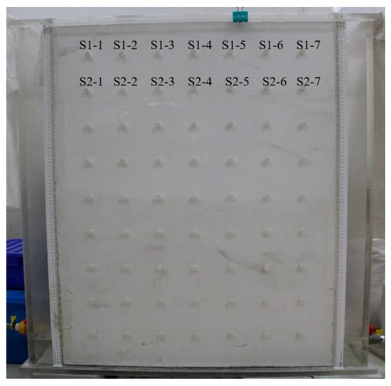
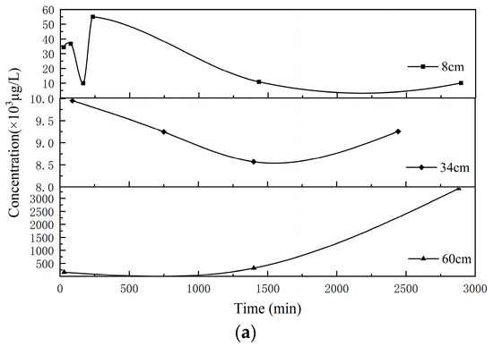
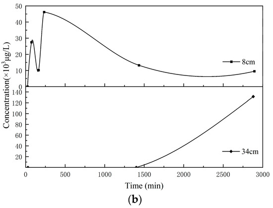
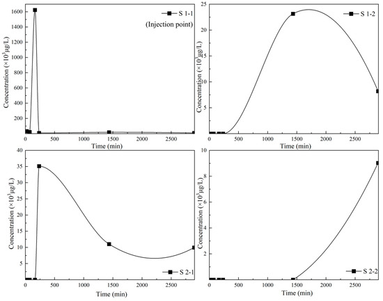
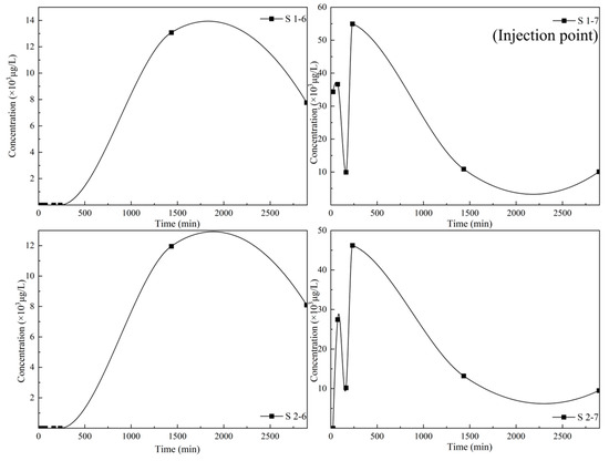
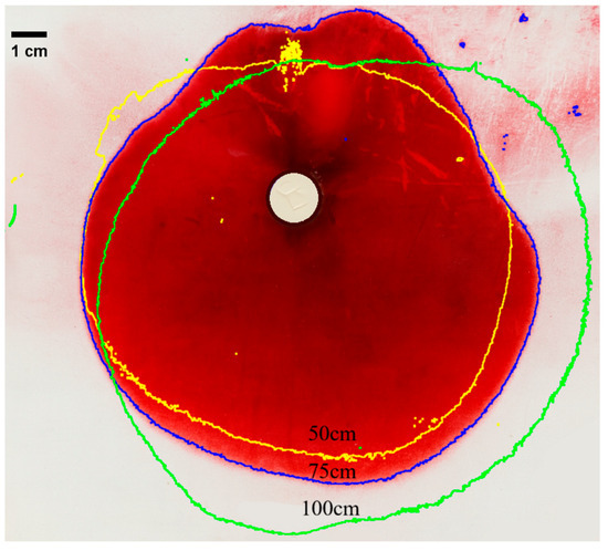
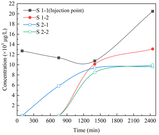
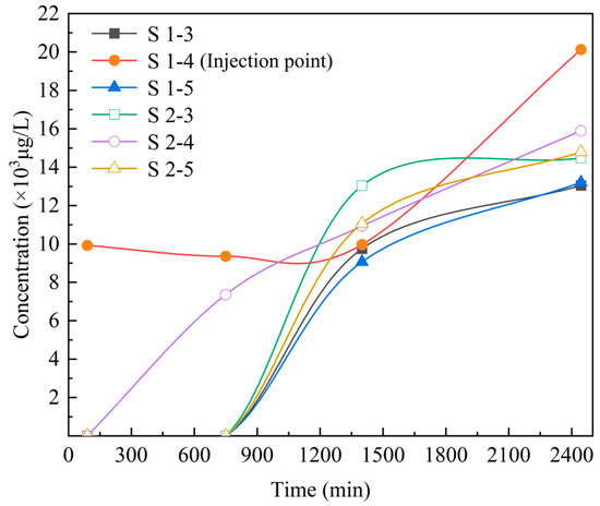
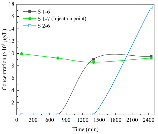
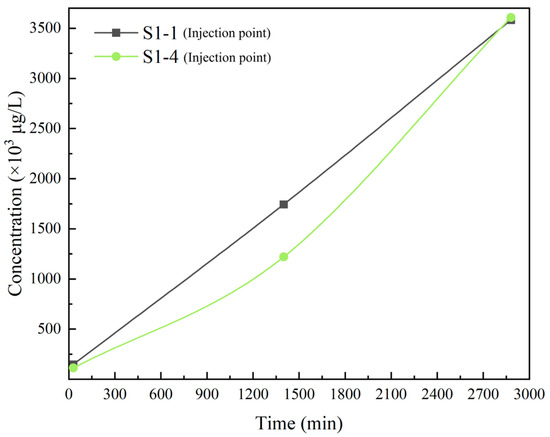
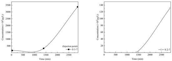
The influence of soil water content and contaminant injection pressure on the migration behaviour of p-Xylene (one of the organic pollutants in Benzene Toluene Ethylbenzene & Xylene) is investigated in the unsaturated zone using the controlled laboratory sandbox experiments. The results show that,
[...] Read more.
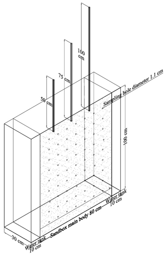
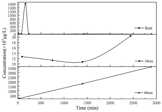
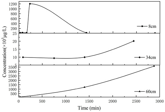
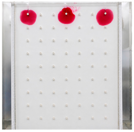
The influence of soil water content and contaminant injection pressure on the migration behaviour of p-Xylene (one of the organic pollutants in Benzene Toluene Ethylbenzene & Xylene) is investigated in the unsaturated zone using the controlled laboratory sandbox experiments. The results show that, at equivalent migration distances, higher soil water content leads to longer migration durations and reduces transport velocities, whereas greater injection pressure promotes faster contaminant movement. These findings highlight the governing role of water saturation in the water–oil–gas three-phase system, in which increased water content decreases the relative permeability of the oil phase and retards capillary-driven BTEX transport. Unlike many previous studies in which contaminants commonly migrate downward toward the groundwater table, the BTEX in this study did not reach the water table and exhibited partial upward migration. Overall, the results provide experimental-scale insight into key mechanisms governing BTEX transport in unsaturated sandy media and serve as a reference for improving predictions of contaminant fate and migration pathways in field settings.
Full article
(This article belongs to the Section Soil and Water)
►▼
Show Figures

Figure 1
Open AccessArticle
Efficient Removal of Tartrazine from Aqueous Solutions Using Eco-Friendly Aqueous Two-Phase Systems (ATPSs)
by
Andrés Felipe Chamorro, Jhon César Escobar Grueso and Yhors Ciro
Water 2026, 18(16), 2009; https://doi.org/10.3390/w18162009 - 17 Aug 2026
Abstract
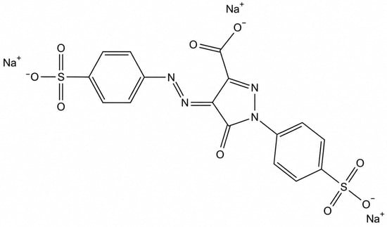
Synthetic dyes are widely used in industry; however, their release into the environment without adequate treatment poses serious risks because of their toxicity and adverse effects on human health and aquatic ecosystems. Although conventional methods are effective, they are often costly and have
[...] Read more.
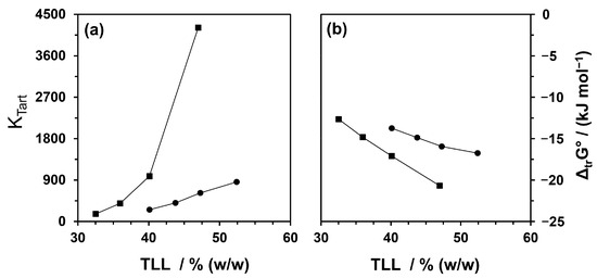
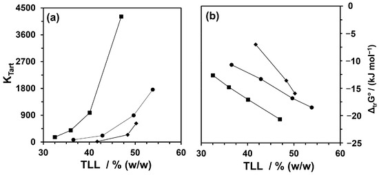
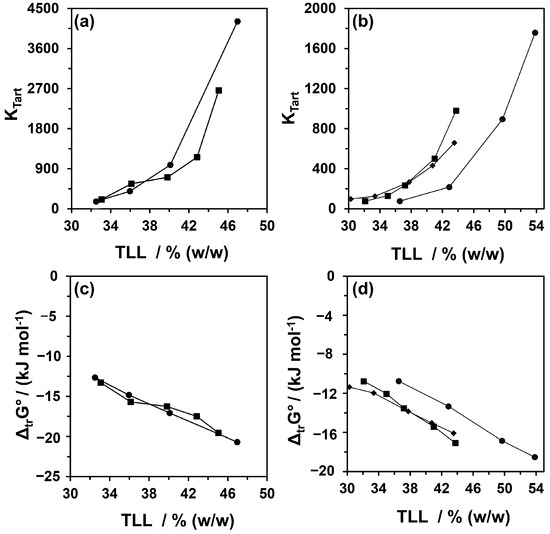
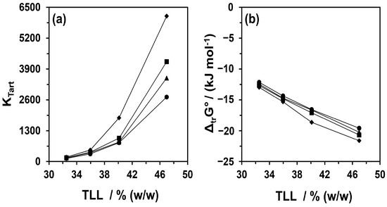
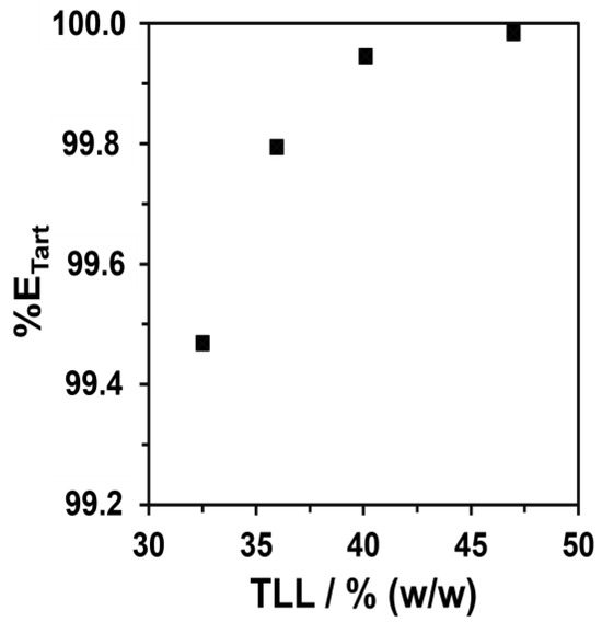
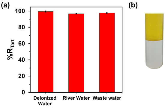
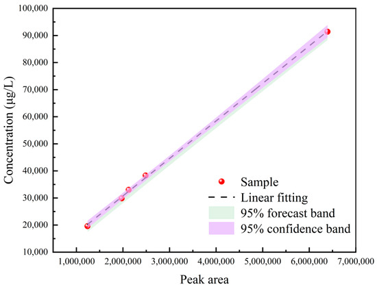
Synthetic dyes are widely used in industry; however, their release into the environment without adequate treatment poses serious risks because of their toxicity and adverse effects on human health and aquatic ecosystems. Although conventional methods are effective, they are often costly and have limited sustainability. In this context, ATPSs are proposed as an environmentally friendly alternative aligned with the principles of green chemistry, offering an efficient and cost-effective route. In this study, Tartrazine (Tart), an azo model dye, was used to evaluate the efficiency of an ATPS formed by PEG + salt + H2O. The effects of the cation and anion nature, PEG molar mass, and pH on Tart partitioning were investigated by determining the partition coefficient of Tart (KTart) and the Gibbs free energy of transfer (ΔtrG°). The PEG 1500 + Na2SO4 + H2O ATPS at pH 3.0 exhibited the best performance among the systems evaluated, with a spontaneous transfer process evidenced by ΔtrG° values as low as −21.62 kJ mol−1. The extraction efficiency exceeded 99%, and the ATPS was successfully applied to the removal of Tart from river water and wastewater samples, demonstrating high performance and considerable potential as an alternative technology for the removal of this dye from industrial aqueous solutions.
Full article
(This article belongs to the Special Issue Advanced Wastewater Treatment for Sustainable Pollution Control)
►▼
Show Figures

Figure 1
Open AccessArticle
GA–SQP Hybrid Optimization Control Strategy for Hydropower Units Oriented to Multiple Operating Conditions Under Isolated Grid Mode
by
Fanglin Wang, Feng Gu, Ke Kang, Xingmao Li, Fujing Long, Jiayi Dong, Xiaoqiang Tan and Chaoshun Li
Water 2026, 18(16), 2008; https://doi.org/10.3390/w18162008 - 17 Aug 2026
Abstract
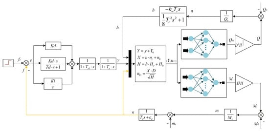
Hydropower units operating in isolated grids are characterized by low rotational inertia and weak damping, making it difficult to balance rapid frequency regulation and overshoot suppression. To address this issue, this paper proposes a GA–SQP hybrid optimization control strategy for multiple operating conditions
[...] Read more.
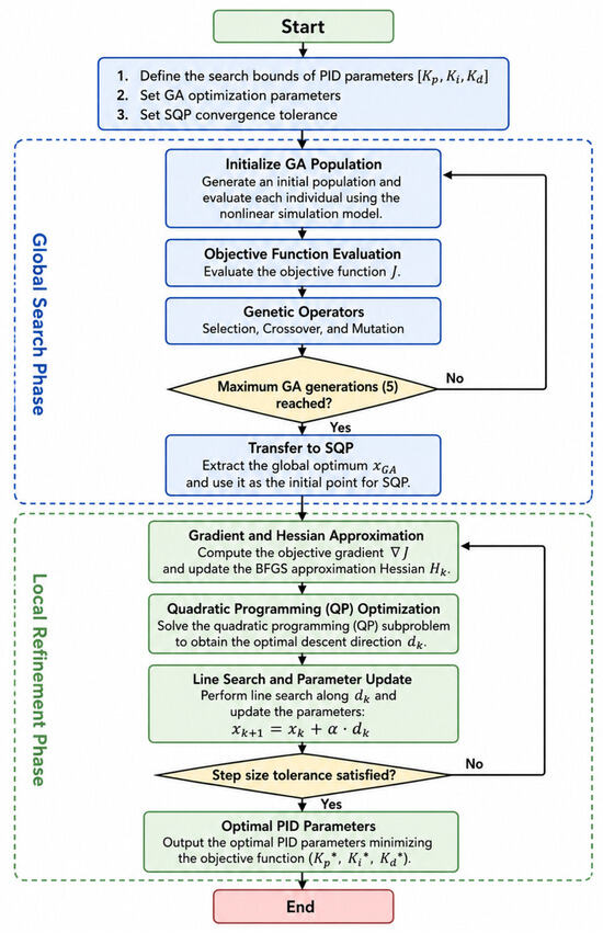
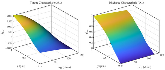
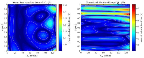
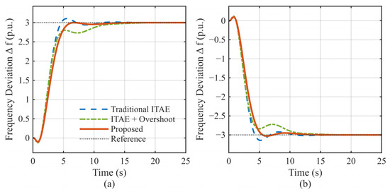
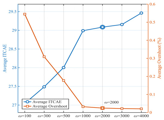
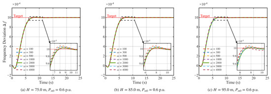
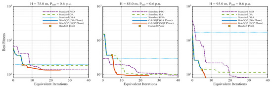
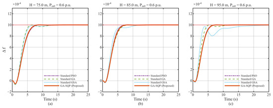
Hydropower units operating in isolated grids are characterized by low rotational inertia and weak damping, making it difficult to balance rapid frequency regulation and overshoot suppression. To address this issue, this paper proposes a GA–SQP hybrid optimization control strategy for multiple operating conditions based on a high-fidelity nonlinear dynamic model. Deep feedforward neural networks are first employed to reconstruct the nonlinear torque and discharge characteristics of the hydro-turbine, providing smooth and continuously differentiable mappings for subsequent gradient-based optimization. An improved performance index combining the Integral of Time-Cubed Absolute Error (ITCAE) with a transient overshoot penalty is then formulated to suppress long-tail errors and prioritize smooth responses with reduced transient overshoot. A two-stage optimization framework is further developed, in which the Genetic Algorithm (GA) performs global exploration to identify a promising parameter region, followed by Sequential Quadratic Programming (SQP) for high-precision local refinement. Comparative simulations under low-, rated-, and high-head high-load conditions show that the proposed strategy achieves higher optimization accuracy with fewer iterative resources. Within the investigated operating range, the optimized controller maintains a very low overshoot level while preserving satisfactory response speed, effectively improving the balance between rapidity and stability in isolated-grid frequency regulation.
Full article
(This article belongs to the Special Issue Research Status of Operation and Management of Hydropower Station, 2nd Edition)
►▼
Show Figures

Figure 1
Open AccessArticle
Contrasting Hydropower Development Strategies in Central Asia’s Water–Energy–Food Nexus Through Spatially Explicit System Dynamics Modelling
by
Sara Pérez Pérez, Raquel López Fernández, Iván Ramos-Diez, Patricia Osuna Fuentes, Daniel S. Hayes and Jan De Keyser
Water 2026, 18(16), 2007; https://doi.org/10.3390/w18162007 - 17 Aug 2026
Abstract
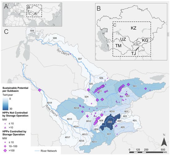
Central Asia faces increasing pressure on transboundary water, energy and food systems, particularly in the Aral Sea Basin, where hydropower, agriculture and downstream water availability are closely linked. This study applies a spatially disaggregated Water–Energy–Food (WEF) Nexus System Dynamics Model under combined climate–socioeconomic
[...] Read more.
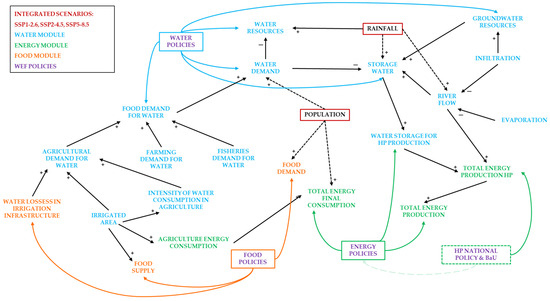
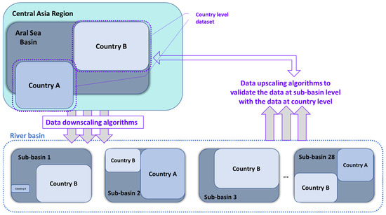
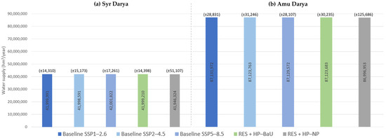
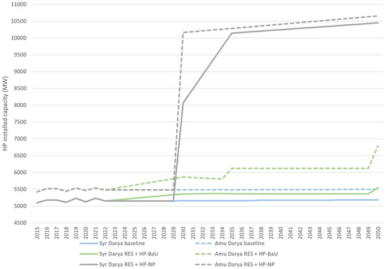
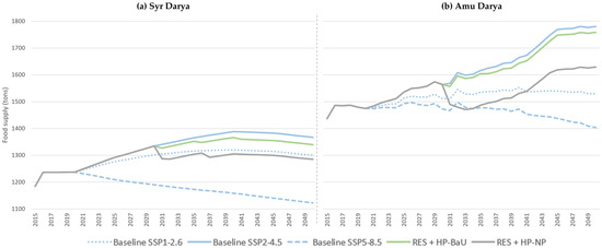
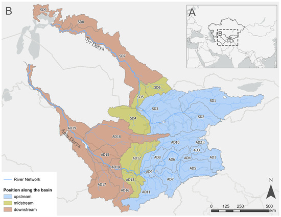
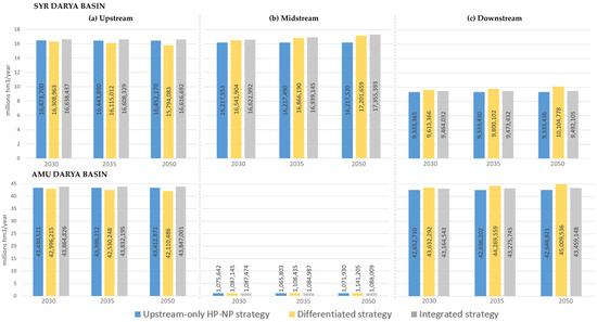
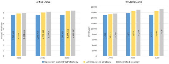
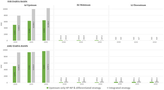
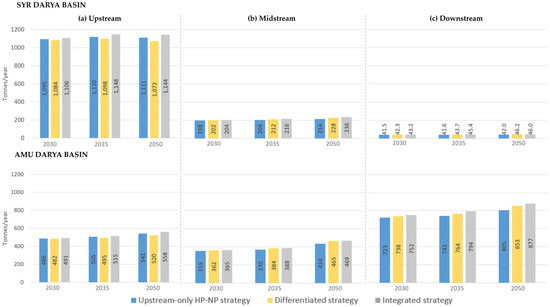
Central Asia faces increasing pressure on transboundary water, energy and food systems, particularly in the Aral Sea Basin, where hydropower, agriculture and downstream water availability are closely linked. This study applies a spatially disaggregated Water–Energy–Food (WEF) Nexus System Dynamics Model under combined climate–socioeconomic scenarios (SSP1-2.6, SSP2-4.5 and SSP5-8.5) to assess hydropower development and policy pathways at basin and sub-basin scales in the Amu Darya and Syr Darya basins during 2015–2050. At basin scale, mean annual water supply remains stable across scenarios, at approximately 42 and 87 million hm3/year, respectively. Under national hydropower plans, installed capacity nearly doubles by 2050, reaching 10.45 and 10.65 GW, respectively. Food supply is more sensitive to climate–socioeconomic pathways than to hydropower expansion, with 2050 values ranging from 1120 to 1370 tonnes in the Syr Darya and 1405 to 1780 tonnes in the Amu Darya. Spatial simulations show that upstream-only development concentrates energy gains, whereas integrated basin-wide planning delivers more balanced WEF outcomes and the highest Aral Sea inflows, reaching 8.41 million hm3/year and 17,319 hm3/year, respectively. Persistent Amu Darya trade-offs underscore the need for transboundary coordination in reservoir operation, irrigation planning and downstream-flow safeguards. Spatial disaggregation reveals trade-offs concealed by basin-scale averages.
Full article
(This article belongs to the Special Issue Advanced Perspectives on the Water–Energy–Food Nexus)
►▼
Show Figures

Figure 1
Open AccessArticle
Evaluating Infiltration Ponds for Flood Mitigation and Aquifer Recharge in an Urban Area
by
Neliswa Pretty Mthethwa, András Makó, Tamás Magyar, Péter Tamás Nagy, Bence Decsi, Hilda Hernádi and Zsolt Kozma
Water 2026, 18(16), 2006; https://doi.org/10.3390/w18162006 - 17 Aug 2026
Abstract
Climate change and rapid urbanisation increasingly threaten urban water security and grey infrastructure, calling for adaptive stormwater strategies to mitigate hydroclimatic extremes. This study evaluates the hydrologic performance of decentralised infiltration ponds functioning as natural/small water retention measures in the regional recharge zone
[...] Read more.
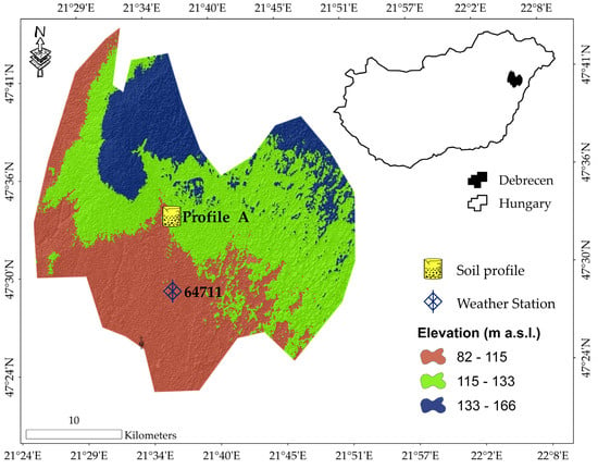
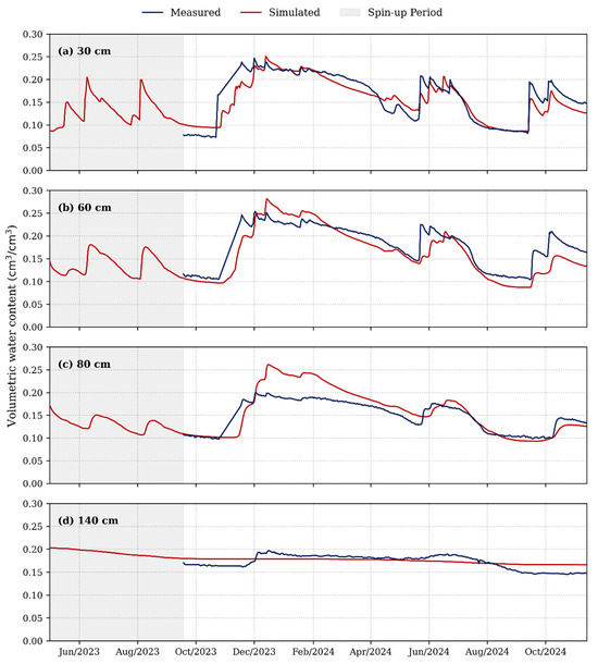
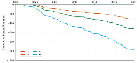
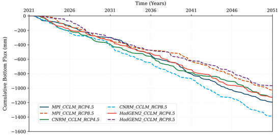
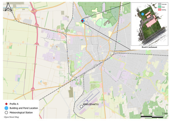
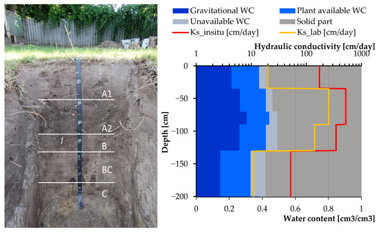
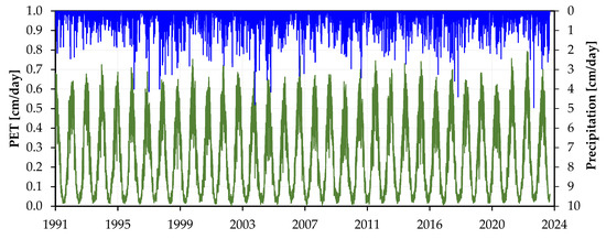
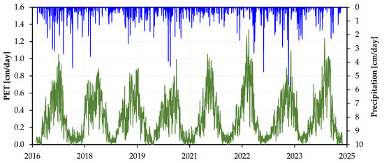
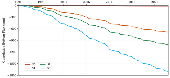
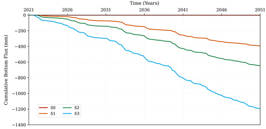
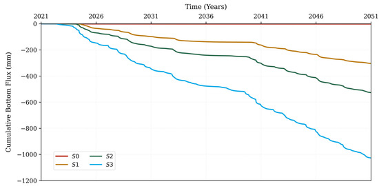
Climate change and rapid urbanisation increasingly threaten urban water security and grey infrastructure, calling for adaptive stormwater strategies to mitigate hydroclimatic extremes. This study evaluates the hydrologic performance of decentralised infiltration ponds functioning as natural/small water retention measures in the regional recharge zone of the Nyírség region, Debrecen, Hungary. Using a sensor-calibrated Hydrus-1D model, we simulated a no-intervention baseline against three pond sizes across historical and mid-century regional climate model projections. While the baseline scenario yielded negligible deep percolation across all scenarios, the smallest infiltration pond resulted in increased vertical moisture flux. The infiltration pond simulation improved ET/PET ratios and increased root zone saturation, improving urban vegetation health and evaporative cooling. All the pond designs attenuated and stored runoff without overspilling. Emission pathway sensitivity showed different responses driven by regional climate scenarios; temperature-driven evaporative offsets dominated under moderate warming, whereas extreme precipitation intensity increased infiltration gains under higher emissions. These findings support infiltration ponds as resilient, dual-purpose measures for mitigating regional water table decline while providing local flood protection under changing climate futures.
Full article
(This article belongs to the Section Urban Water Management)
►▼
Show Figures

Figure 1
Open AccessArticle
HarmonicFormer: Cross-Phase Harmonic Modeling for Efficient Long-Term Water Quality Forecasting
by
Canjia Zhang, Jiajun Zhou, Yanchun Liang, Chunfu Zhang, Adriano Tavares and Jing Bai
Water 2026, 18(16), 2005; https://doi.org/10.3390/w18162005 - 16 Aug 2026
Abstract
Water quality time series exhibit multi-scale periodicities, including daily and weekly cycles, driven by solar radiation, tidal forcing, and seasonal variation. Existing deep learning methods typically rely on patch-based attention or adaptive period decomposition, which suffer from parameter redundancy and high computational cost
[...] Read more.
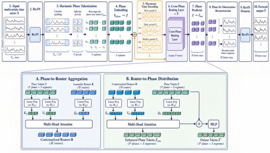
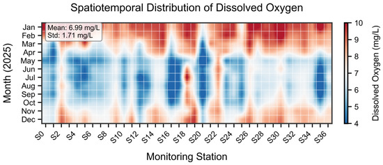
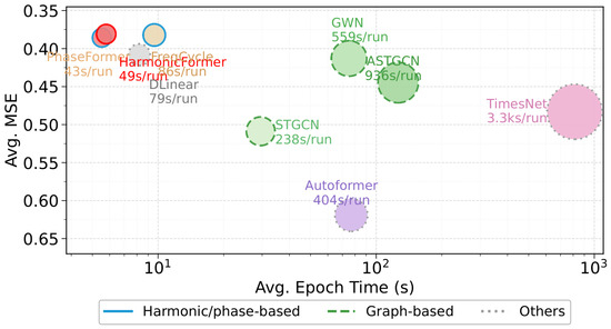
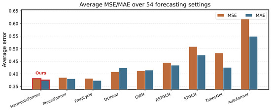
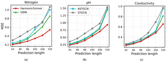
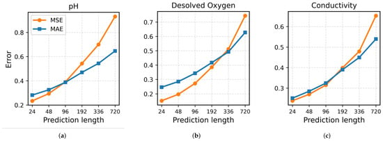
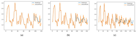
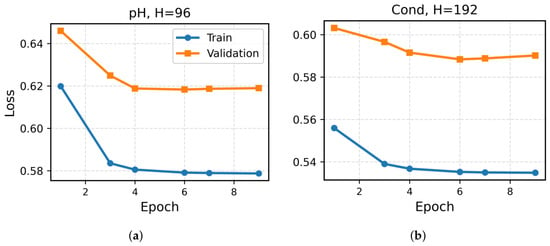
Water quality time series exhibit multi-scale periodicities, including daily and weekly cycles, driven by solar radiation, tidal forcing, and seasonal variation. Existing deep learning methods typically rely on patch-based attention or adaptive period decomposition, which suffer from parameter redundancy and high computational cost while failing to explicitly align with physical periodicities. To address this challenge, we propose HarmonicFormer, which restructures sequences into phase-period matrices, explicitly injects multi-scale periodic priors via harmonic temporal encoding, and achieves linear-complexity interactions through a lightweight cross-phase routing mechanism. Evaluated on hourly data from 37 monitoring stations in the Pearl River Basin (2020–2026) across nine water quality parameters and six forecast horizons, HarmonicFormer achieves the lowest average MSE of 0.3809 and MAE of 0.3753 over 54 experimental configurations, while maintaining high training efficiency and significantly reducing long-term error accumulation. Ablation studies confirm the effectiveness of harmonic encoding, reversible instance normalization, and key hyperparameters. This work offers an efficient and reliable explicit-periodicity modeling approach for water quality forecasting in the Pearl River Basin. Although the model currently adopts a fixed period length, future work can further enhance its generalization capability by introducing adaptive period discovery mechanisms.
Full article
(This article belongs to the Section New Sensors, New Technologies and Machine Learning in Water Sciences)
►▼
Show Figures

Figure 1
Open AccessArticle
Adaptive Interwoven Deep Learning Framework for Extracting Fragmented Water Bodies in Complex Hydrological Environments: Application in Myanmar
by
Thant Zin Tun, Zhihao Wei, Kebin Jia and Sien Li
Water 2026, 18(16), 2004; https://doi.org/10.3390/w18162004 - 16 Aug 2026
Abstract
Monitoring complex river networks in Myanmar is challenging due to the high spatial heterogeneity and fragmentation of surface water bodies. Accurate identification of surface water resources is therefore essential for water resource management and for improving preparedness against climate change–induced hydrological hazards. To
[...] Read more.
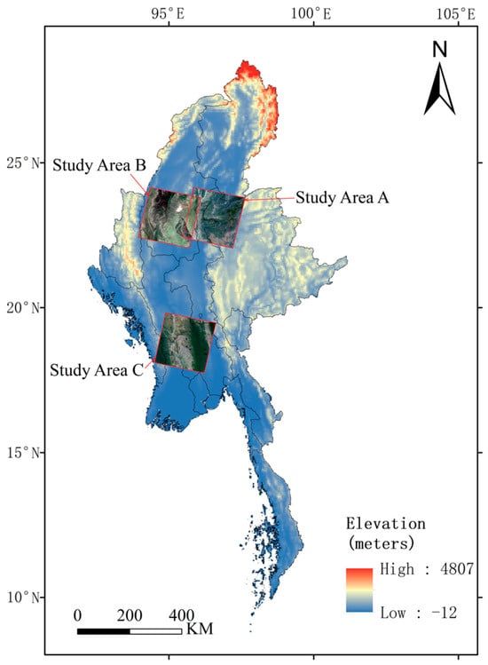
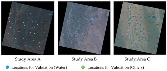
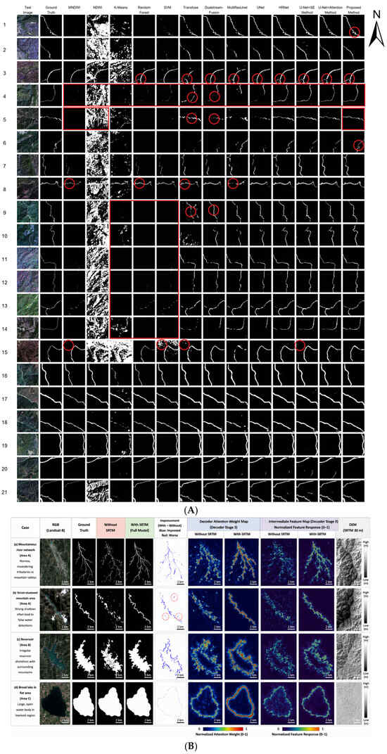
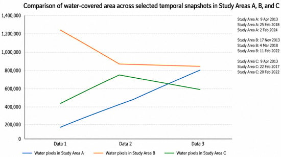
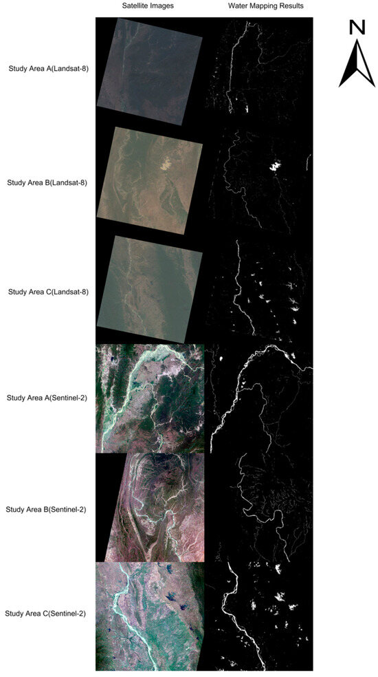
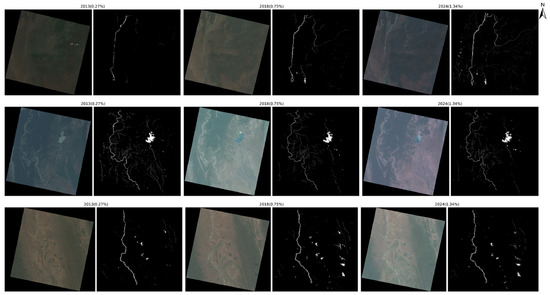
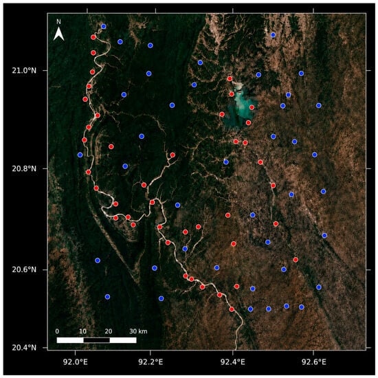
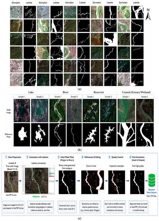
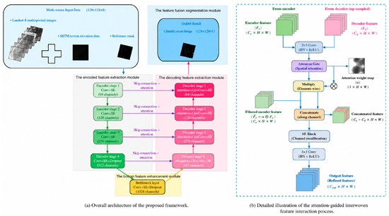
Monitoring complex river networks in Myanmar is challenging due to the high spatial heterogeneity and fragmentation of surface water bodies. Accurate identification of surface water resources is therefore essential for water resource management and for improving preparedness against climate change–induced hydrological hazards. To address this problem, this study proposes an adaptive interwoven deep learning–based segmentation framework that jointly utilizes multispectral reflectance information and topographic elevation data to enhance the extraction of fragmented water bodies. The framework is designed to coordinate feature interaction across spectral, spatial, and topographic dimensions by integrating channel-wise feature recalibration and attention-guided feature modulation within the encoding–decoding architecture. Experimental results demonstrate that the proposed method outperforms several traditional water index–based approaches, conventional machine learning algorithms and deep learning models. Across five independent training runs, the proposed framework achieves an average precision of 91.0%, recall of 93.5%, and F1 score of 92.3% (95% confidence interval: 91.8–93.0), demonstrating stable performance for fragmented water-body extraction. Cross-site experiments across three within-country study areas further demonstrate the spatial transferability and robustness of the proposed framework across diverse hydrological conditions within Myanmar. Overall, the proposed approach provides a reliable solution for fragmented water body extraction under heterogeneous hydrological conditions within Myanmar.
Full article
(This article belongs to the Section Hydrology)
►▼
Show Figures

Figure 1
Open AccessArticle
Observed and Projected Monthly Precipitation Distribution Shifts as Hydroclimatic Indicators for Regional Water-Resource Assessment Using PRISM and NEX-GDDP-CMIP6
by
Temel Temiz and Osman Sonmez
Water 2026, 18(16), 2003; https://doi.org/10.3390/w18162003 - 16 Aug 2026
Abstract
Monthly precipitation distributions provide screening-level hydroclimatic information relevant to regional water-resource assessment that is not captured by annual or seasonal means alone. This study evaluates observed and projected shifts in monthly precipitation distributions across the nine NOAA Climate Regions of the contiguous United
[...] Read more.
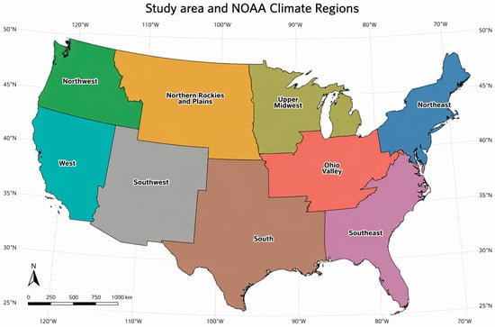
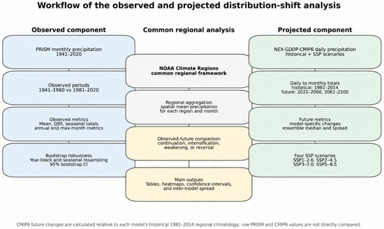
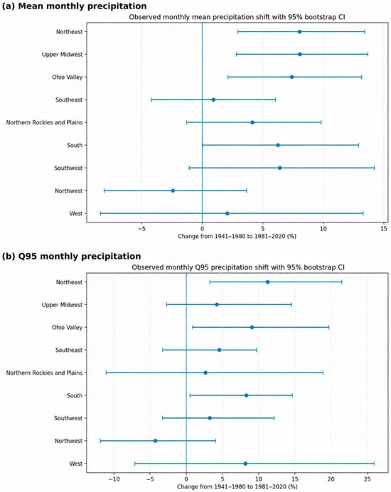
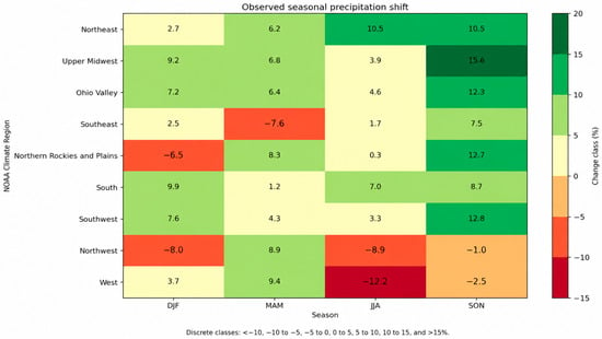
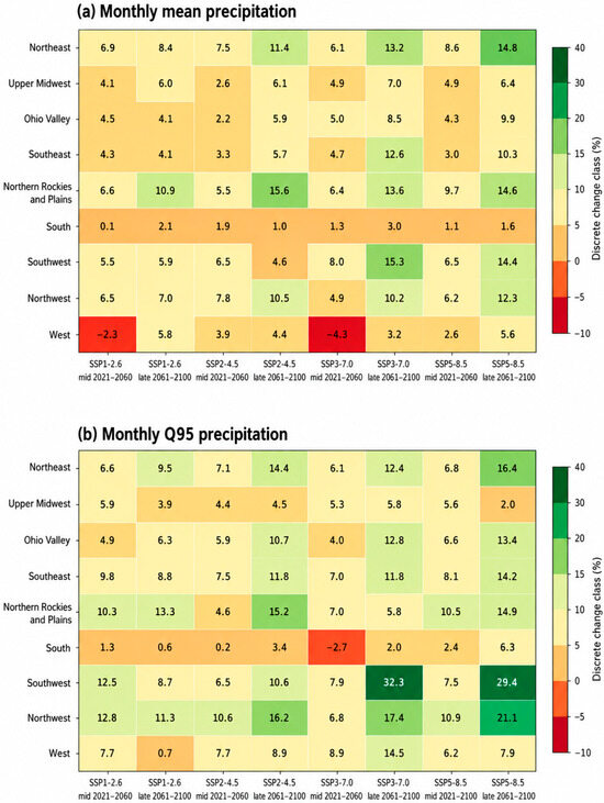
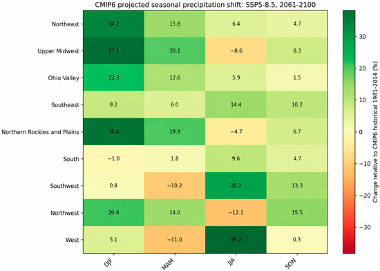
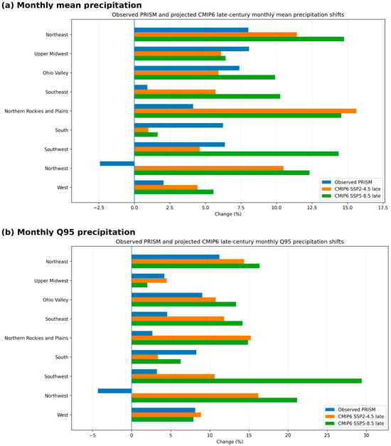
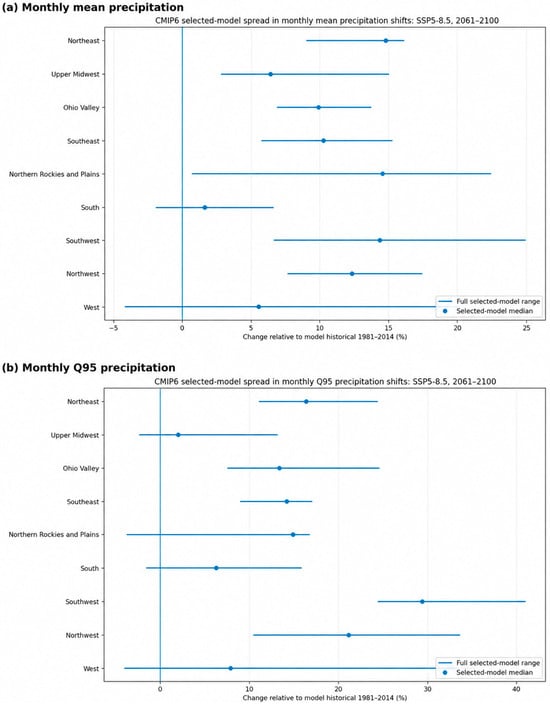
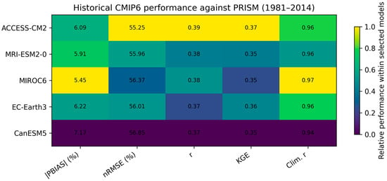
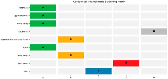
Monthly precipitation distributions provide screening-level hydroclimatic information relevant to regional water-resource assessment that is not captured by annual or seasonal means alone. This study evaluates observed and projected shifts in monthly precipitation distributions across the nine NOAA Climate Regions of the contiguous United States using PRISM observations and NEX-GDDP-CMIP6 projections. Observed changes were assessed using PRISM monthly precipitation for 1941–2020 by comparing 1941–1980 with 1981–2020, with sensitivity tests using 1981–2014 and an alternative bootstrap block length. Future changes were evaluated using five NEX-GDDP-CMIP6 models under four SSP scenarios, relative to each model’s 1981–2014 historical reference. To strengthen the statistical and water-resource interpretation, the analysis additionally evaluates historical CMIP6 performance against PRISM, tests explicit hypotheses using permutation/bootstrap procedures with Benjamini–Hochberg false-discovery-rate control, and introduces a categorical Hydroclimatic Screening Matrix. The selected models reproduced the regional monthly climatological cycle well, with monthly climatology correlations of 0.943–0.969 and monthly climatology Kling–Gupta Efficiency values of 0.834–0.886, although raw monthly time-series skill was lower. Observed PRISM results show robust mean increases in the Northeast, Upper Midwest, and Ohio Valley, while monthly Q95 increased robustly in the Northeast and South. Future projections indicate broad late-century increases in monthly mean and upper-tail precipitation, especially under SSP5-8.5. Statistical testing showed that late-century SSP5-8.5 projected changes fell outside the empirical PRISM historical-change envelope in 14 of 18 region-metric pairs, whereas upper-tail amplification was not FDR-significant across regions. The Hydroclimatic Screening Matrix identifies aligned planning-relevant signals, emerging upper-tail concerns, seasonal-storage follow-up priorities, and directional-uncertainty cases. These results support precipitation-based screening for identifying where detailed hydrologic impact modeling may be warranted, without treating monthly precipitation metrics as direct runoff, recharge, reservoir-operation, or flood-risk estimates. The observational endpoint of 2020 was selected to form two equal 40-year periods, thereby keeping the sample lengths balanced for distributional comparisons.
Full article
(This article belongs to the Section Water Resources Management, Policy and Governance)
►▼
Show Figures

Figure 1
Open AccessArticle
Heterogeneity-Aware Multi-Step Chlorophyll-a Forecasting for Marine Water Quality Monitoring Using a Multi-Scale Spatio-Temporal Mixture-of-Experts Network
by
Qianfan Dai, Xiaoyu He, Xiulin Geng and Qiaoli Zhuang
Water 2026, 18(16), 2002; https://doi.org/10.3390/w18162002 - 16 Aug 2026
Abstract
Chlorophyll-a concentration (Chl-a) is a key indicator of marine water quality, phytoplankton biomass, and aquatic ecosystem status. Multi-step forecasting is challenging because Chl-a dynamics exhibit regional heterogeneity, multi-scale variability, and complex spatial dependence. Existing models often optimize domain-averaged errors, which can mask unstable
[...] Read more.
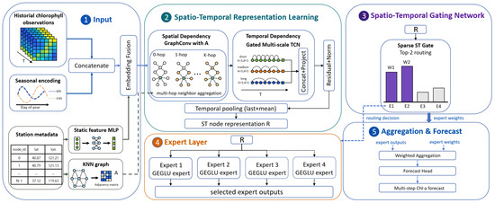
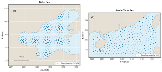
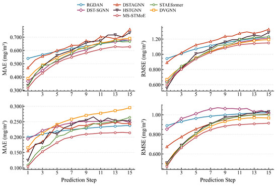
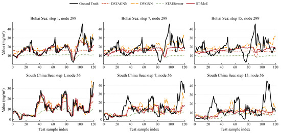
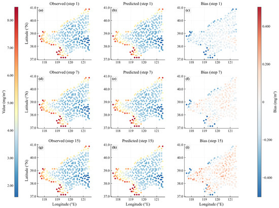
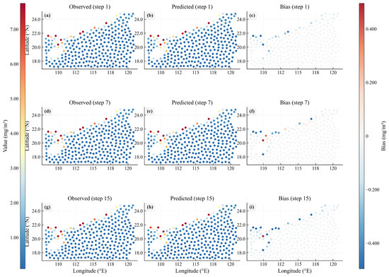
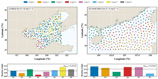
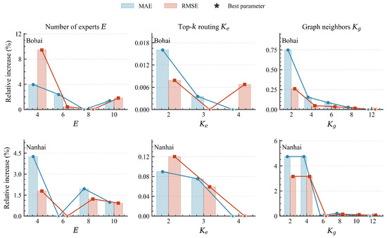
Chlorophyll-a concentration (Chl-a) is a key indicator of marine water quality, phytoplankton biomass, and aquatic ecosystem status. Multi-step forecasting is challenging because Chl-a dynamics exhibit regional heterogeneity, multi-scale variability, and complex spatial dependence. Existing models often optimize domain-averaged errors, which can mask unstable node-level predictions at high-variability nodes. We propose MS-STMoE, a heterogeneity-aware multi-scale spatio-temporal mixture-of-experts framework. It uses a Haversine-distance-based K-nearest-neighbor graph, gated multi-scale temporal convolutions with seasonal encoding to model short-term and periodic variations, and node-level sparse top-k routing that assigns differentiated expert pathways to nodes with distinct dynamics based on recent-state, temporal-mean, temporal-change, and node-prior features. Using 30-day histories to forecast the next 15 days, experiments on 300 Bohai Sea and 265 South China Sea nodes show that MS-STMoE achieves the lowest average MAE and RMSE among six recent spatio-temporal baselines. Compared with the best baseline, MAE and RMSE decrease by 5.6% and 2.7%, respectively, in the Bohai Sea, and by 11.0% and 5.0%, respectively, in the South China Sea. Step-wise and node-wise analyses indicate improved medium-to-late-horizon accuracy and modest, region-dependent reductions in high-error node tails, supporting more reliable region-aware short- to medium-term water quality monitoring.
Full article
(This article belongs to the Section Water Quality and Contamination)
►▼
Show Figures

Figure 1
Open AccessArticle
Assessment of Nutrient Impacts on Surface Water Quality in the Polissia Region Using Intelligent Data Analysis
by
Nataliia Dziubanovska, Nina Szczepanik-Scislo, Maksym Soroka, Oksana Desyatnyuk, Leonid Bytsyura, Łukasz Ścisło, Olha Ukhan and Anatoliy Sachenko
Water 2026, 18(16), 2001; https://doi.org/10.3390/w18162001 - 15 Aug 2026
Abstract
In crisis times, traditional models of water quality assessment and water resources management lose their effectiveness. In the current conditions of local climate change, accidental pollution, emergencies or military operations, there is an urgent need to transition from traditional descriptive hydrochemical monitoring toward
[...] Read more.
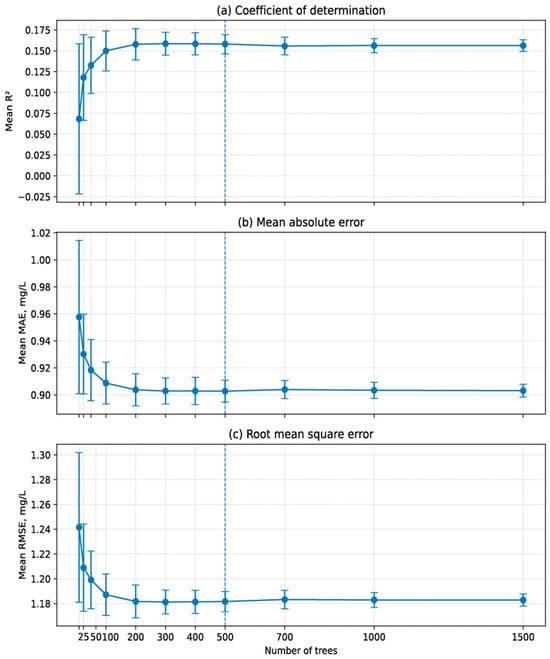
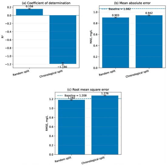
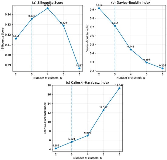
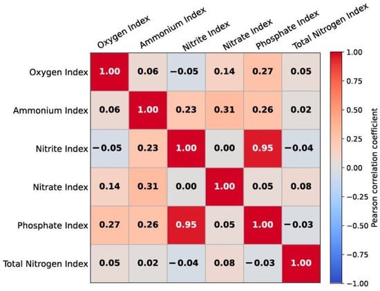
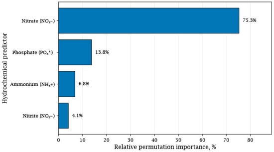
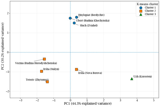
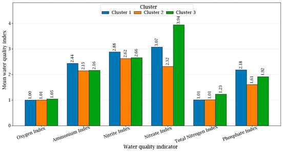
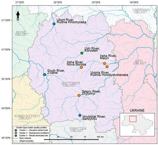
In crisis times, traditional models of water quality assessment and water resources management lose their effectiveness. In the current conditions of local climate change, accidental pollution, emergencies or military operations, there is an urgent need to transition from traditional descriptive hydrochemical monitoring toward intelligent analysis of spatial-temporal datasets. In this paper, the integrated approach combining spatial cluster analysis, GIS-based visualization, and machine learning is proposed for assessing the surface water quality under conditions of limited and incomplete hydrochemical monitoring data. A geospatial assessment of nutrient impacts on surface water quality was conducted using 192 hydrochemical observations collected during the 2024–2025 monitoring period at eight state monitoring stations located in the basins of the Teteriv, Uzh, Irsha, Ubort, Sluch, Hnylopiat, and Voznia rivers, Polissia, Ukraine. Permutation feature importance analysis based on the Random Forest model showed that nitrate concentration accounted for approximately 75% of the total relative importance, whereas phosphate concentration contributed approximately 14%, indicating that these variables were the most informative predictors among the investigated hydrochemical parameters. The latter parameters are associated with dissolved oxygen variability among the analyzed hydrochemical parameters. According to the results of this study, three interpretable groups of monitoring stations were formed: Cluster 1, representing moderate water quality with increased nutrient pressure, Cluster 2, representing comparatively favourable background conditions, and Cluster 3, representing a nitrate-dominated hydrochemical type. The Random Forest model demonstrated limited predictive performance (R2 = 0.154), indicating that nutrient-related variables alone explain only a small proportion of dissolved oxygen variability. Hence, additional factors, including hydrological conditions, water temperature, organic matter decomposition, biological productivity, and catchment-specific characteristics, also play an important role in shaping oxygen dynamics. The spatial visualization of cluster membership showed that geographical location alone does not fully determine the surface water quality patterns in Ukrainian Polissia. Instead, the local catchment characteristics and land-use conditions appear to exert a stronger influence on the formation of nutrient-related water quality differences. The authors propose to employ the spatial cluster analysis and machine learning as a basic supporting tool for the transition from retrospective interpretation of hydrochemical monitoring data to predictive and adaptive water resources management. The integration of geospatial analysis and machine learning provides a practical decision-support framework for the early detection of anomalies, identification of potential pollution sources, and prioritization of river sub-basins for implementing nature-based solutions.
Full article
(This article belongs to the Section New Sensors, New Technologies and Machine Learning in Water Sciences)
►▼
Show Figures

Figure 1
Open AccessArticle
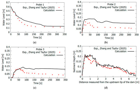
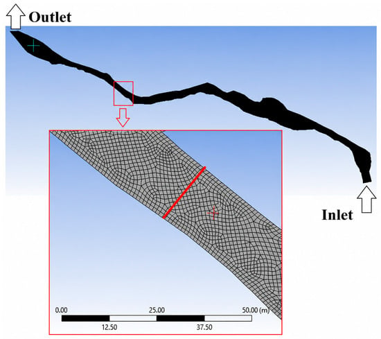
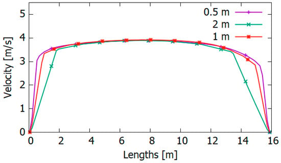
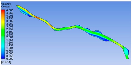
Numerical Simulation of Sediment Transport and Morphological Evolution in the Talas River Using a Non-Newtonian Model
by
Yeldos Zhandaulet, Alexandr Neftissov, Gokmen Tayfur, Perizat Omarova, Ilyas Kazambayev and Lalita Kirichenko
Water 2026, 18(16), 2000; https://doi.org/10.3390/w18162000 - 15 Aug 2026
Abstract
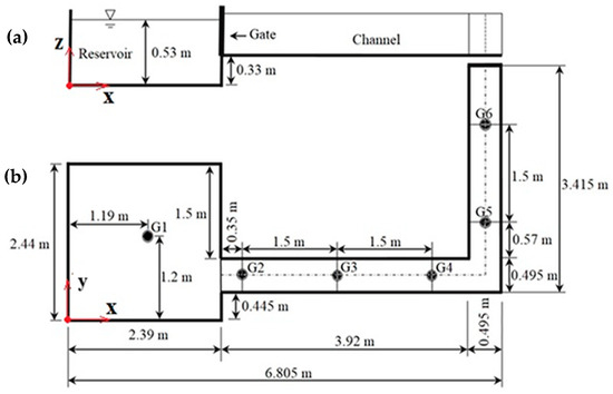
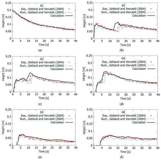
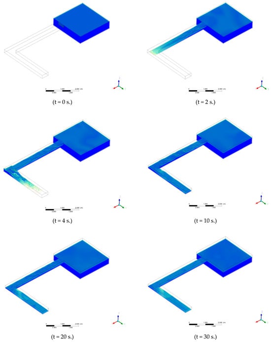
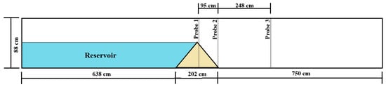
Changes in river channel morphology under the influence of natural and anthropogenic factors pose a serious threat to the stability of aquatic ecosystems and water resource use, especially in regions with limited hydrological information. This study presents, for the first time, a three-dimensional
[...] Read more.
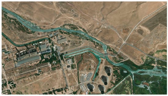
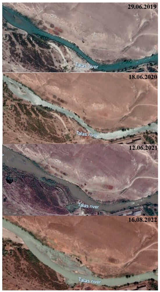
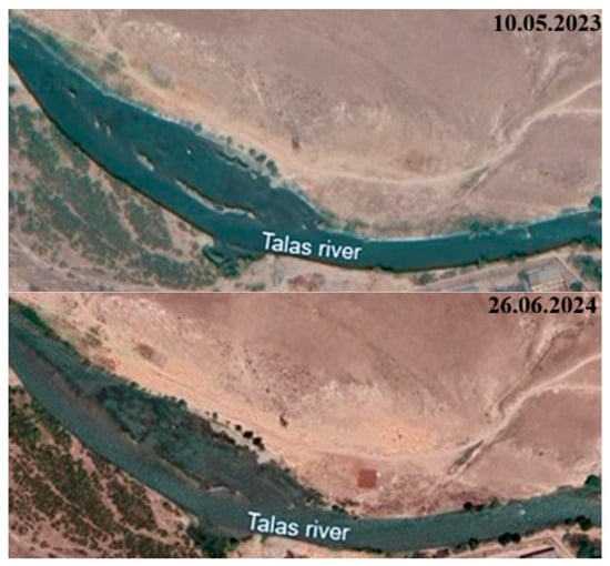
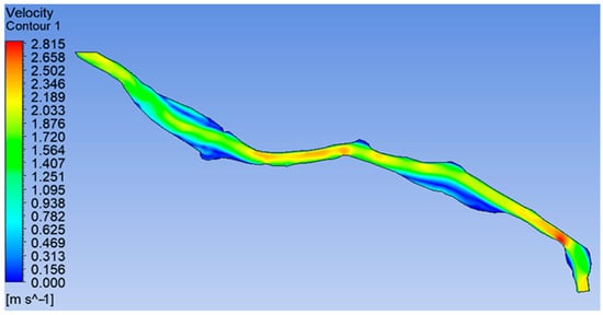
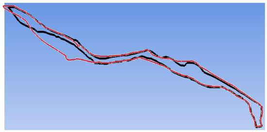
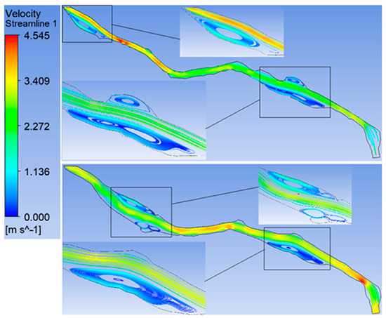
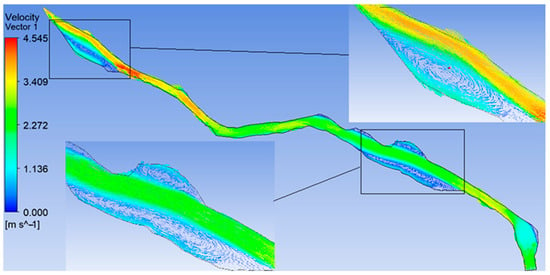
Changes in river channel morphology under the influence of natural and anthropogenic factors pose a serious threat to the stability of aquatic ecosystems and water resource use, especially in regions with limited hydrological information. This study presents, for the first time, a three-dimensional numerical investigation of channel processes in the Talas River (Kazakhstan), employing the Volume of Fluid (VOF) method for free-surface flow simulation and a non-Newtonian model for sediment transport and riverbed morphodynamics. To verify the developed mathematical model, experimental data on the flow in the L-shaped channel and Earthfill dam break were used, which provided high reliability of the calculated results. The calculations showed a significant increase in the channel area in the studied section of the Talas River (from 41,334.92 m2 to 56,890.17 m2) for the period from 2019 to 2024, mainly due to the intensification of the dynamics of currents and the formation of additional vortex zones with a diameter of 50 to 200 m. It was found that in places of local flow acceleration, water velocity increased up to 4.5 m/s, leading to bank erosion and channel widening, whereas after redistribution of channel flows, the maximum velocity decreased to 2.8 m/s, ensuring stabilisation of morphological changes. The results of the study underline the need for an integrated approach to river morphodynamics management using numerical modelling to predict channel changes, minimise flood risks and optimise the use of water resources. The presented computational approach can be adapted to analyse hydrodynamic processes in other poorly studied river systems, which significantly expands its scientific and practical value.
Full article
(This article belongs to the Special Issue Advances in Sediment Dynamics: Mechanisms, Modeling and Management in Transitional Environments)
►▼
Show Figures

Figure 1
Open AccessArticle
Effects of Different Microplastics on Antibiotic Resistance Genes and Bacterial Communities in Sediments from Four Major Sea Areas in China
by
Peng Zhang, Jia Yu, Meijun Bao, Tianlun Han, Zhe Zhang, Shuai Zhang, Wanzhong Wang, Sijia Liang and Yan Zhou
Water 2026, 18(16), 1999; https://doi.org/10.3390/w18161999 - 14 Aug 2026
Abstract
Microplastics (MPs) can accumulate antibiotic resistance genes (ARGs) in seawater, but their effects on sediment resistomes and microbial communities across different marine sediments remain poorly understood. A 30-day incubation experiment using polyethylene (PE), polyethylene terephthalate (PET), and polyvinyl chloride (PVC) MPs and composite
[...] Read more.
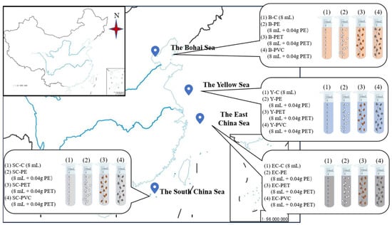
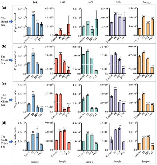
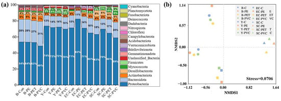
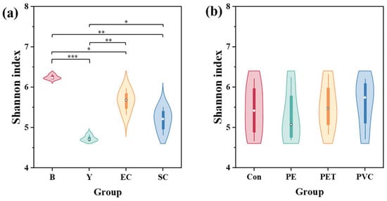
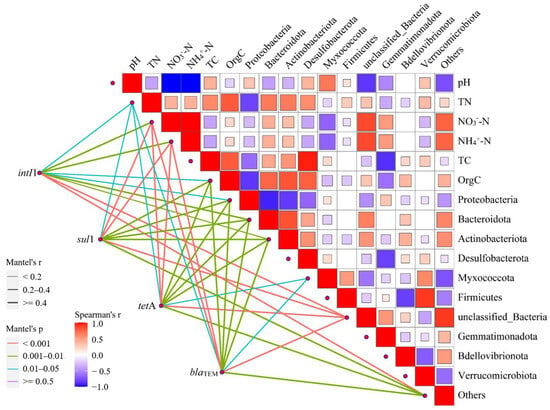
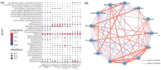
Microplastics (MPs) can accumulate antibiotic resistance genes (ARGs) in seawater, but their effects on sediment resistomes and microbial communities across different marine sediments remain poorly understood. A 30-day incubation experiment using polyethylene (PE), polyethylene terephthalate (PET), and polyvinyl chloride (PVC) MPs and composite sediments from four marginal seas of China was conducted. PE exposure significantly increased nearly all the abundances of intI1, sul1, tetA, and blaTEM in all four sediment sources (Bohai, Yellow, East China, and South China Seas), whereas PET and PVC produced sediment-dependent responses. PE-associated biofilms may provide protective niches that favor bacterial growth and ARG enrichment, while PET and PVC may exert inhibitory effects in some sediments. MP exposure was also associated with shifts in bacterial community composition and alpha diversity. Co-occurrence analysis identified Alcanivorax, Methylophaga, and Brevirhabdus as potential hosts associated with all target genes, whereas Idiomarina showed potential associations with tetA and blaTEM. Overall, the results indicate that MP effects on sediment ARGs and bacterial communities depend on both polymer type and sediment characteristics. Because the experiment used a high MP loading and carbon supplementation, further studies at environmentally relevant concentrations are needed to evaluate the ecological implications.
Full article
(This article belongs to the Section Oceans and Coastal Zones)
►▼
Show Figures

Figure 1
Open AccessArticle
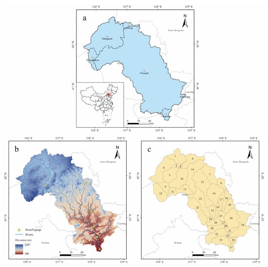
Hydrological Drought Modeling Under the Impact of Climate Change in the Luanhe River Basin: A Prediction Study
by
Wentao Jing, Liwen Shang, Xinpo Xu, Yang Li, Mingxuan Yi, Lingxiao Meng and Dongming Zhang
Water 2026, 18(16), 1998; https://doi.org/10.3390/w18161998 - 14 Aug 2026
Abstract
Against the backdrop of climate change and compounded by human activities, increasing water scarcity has triggered a series of drought disasters, which have already severely impacted both ecological environments and socioeconomic production. The SWAT model, recognized for its strong portability and superior spatial
[...] Read more.
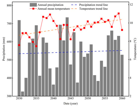
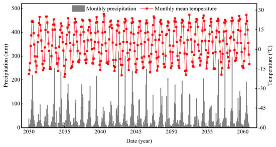
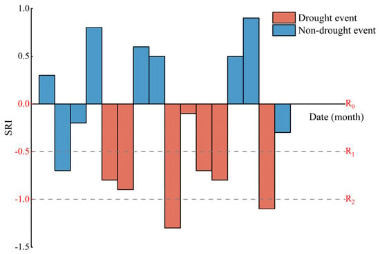
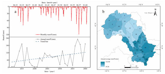
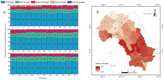
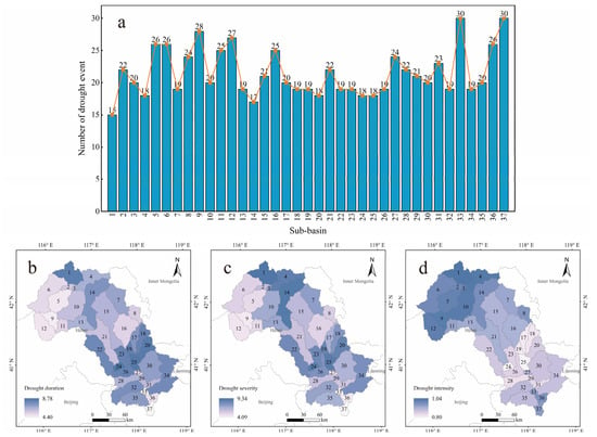
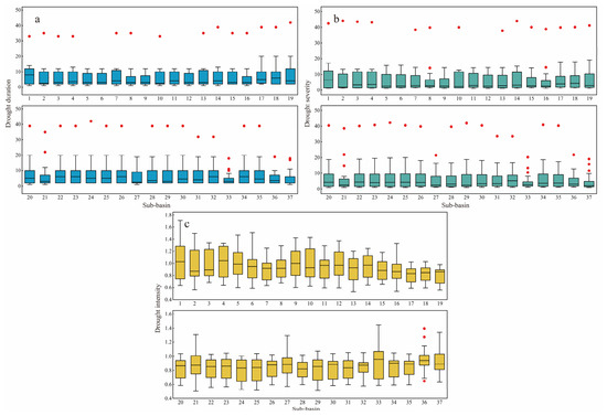
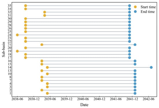
Against the backdrop of climate change and compounded by human activities, increasing water scarcity has triggered a series of drought disasters, which have already severely impacted both ecological environments and socioeconomic production. The SWAT model, recognized for its strong portability and superior spatial heterogeneity, has gained widespread acceptance in fields such as hydrology and environmental science, and is extensively applied in hydrological simulation studies across large-scale river basins. Hydrological models of the study area can be constructed in the SWAT model to simulate changes in hydrological variables by conducting spatial discretization, parameter specification, and boundary condition definition. Standardized drought index can effectively reflect the spatiotemporal variations in drought disasters, holding significant importance for clarifying and predicting drought characteristics. This study took the Luanhe River Basin as the research area, constructed a watershed hydrological model based on SWAT, and projected changes in the basin’s hydrological processes for the period 2030–2060. Based on the model’s projected data, we calculated drought indices and extracted drought events for the basin. The results indicate the following: (1) During the simulation period, only 30% of the years in the Luanhe River basin had annual runoff above the long-term average, with a range of 228.18 mm. The range of mean annual runoff across sub-basins was 173.32 mm. Drought and uneven water resource allocation over both spatial and temporal scales coexisted, and this issue is expected to intensify under future climate warming and drying. (2) The mid-reaches of the Luanhe River are more prone to drought compared to the upper reaches for its higher water demand. However, due to a stronger capacity for ecological restoration, droughts there are mostly of low intensity in the mid-reaches. In contrast, the upper reaches experience more periods classified as severe or extreme drought, and the drought events encountered are generally more intense than those in the mid-reaches. (3) The method proposed in this study can screen extreme drought events based on outliers in the characteristic values of drought events. Taking the simulation from this study as an illustration, anomalies in drought event characteristic values suggest a potential basin-scale, prolonged extreme drought event in the Luanhe River Basin from June 2038 to July 2042. Proactive drought prevention policies should be formulated for this period. The findings of this study provide guiding significance and practical value for drought assessment, risk management, and policy application in the Luanhe River Basin. This study methodologically combines hydrological model predictions with drought event responses, providing a novel method for predicting basin-scale drought conditions and issuing early warnings for extreme drought events.
Full article
(This article belongs to the Special Issue Advances in the Relationship Between Climate Change and Runoff in Watershed)
►▼
Show Figures

Figure 1
Open AccessArticle
Submarine Groundwater Discharge as a Driver of Biogeochemical Processes in Methane Seep Sediments
by
Darya Purgina, Yuliya Moiseeva, Tatyana Malakhova, Andrey Toropov, Andrey Grinko, Tatyana Polivanova, Eva Ugolkova, Andrey Budnikov and Elena Gershelis
Water 2026, 18(16), 1997; https://doi.org/10.3390/w18161997 - 14 Aug 2026
Abstract
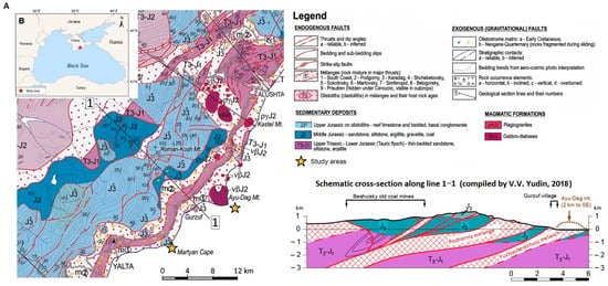
Submarine groundwater discharge (SGD) is an important pathway of dissolved matter transport to coastal ecosystems, yet its identification in methane seep environments remains challenging because chemical signals are modified by sedimentary biogeochemical processes. This study evaluated hydrochemical tracers of SGD in methane seep
[...] Read more.
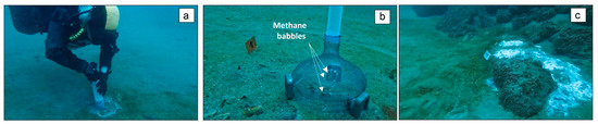
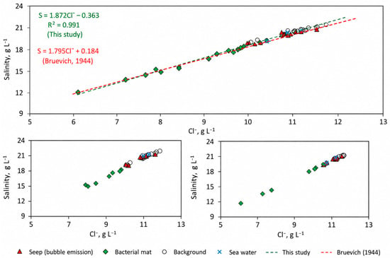
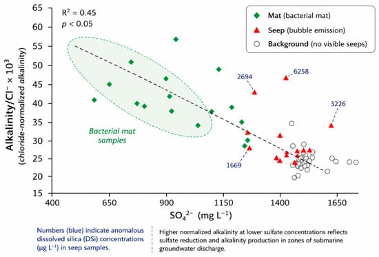
Submarine groundwater discharge (SGD) is an important pathway of dissolved matter transport to coastal ecosystems, yet its identification in methane seep environments remains challenging because chemical signals are modified by sedimentary biogeochemical processes. This study evaluated hydrochemical tracers of SGD in methane seep sites, bacterial mat areas, and background sediments along the southern coast of Crimea (Black Sea). The studied settings exhibited distinct water chemical characteristics. Chloride concentrations decreased from 10.6 to 11.2 g L−1 in background waters, to 8.7–9.3 g L−1 in bacterial mat pore waters and to 7.7 g L−1 in sediment–water interface waters, indicating the presence of a low-salinity water component. Dissolved silica increased by approximately one order of magnitude relative to background values at methane-associated sites. Methane concentrations ranged from 0.025 to 1058 μM, with the highest values occurring in bacterial mat areas. These zones were further characterized by sulfate depletion (down to 0.9 g L−1), elevated normalized alkalinity, ammonium concentrations reaching 8000 μg L−1, high sulfide contents, and low dissolved Fe concentrations consistent with iron sulfide precipitation. The results demonstrate that no single hydrochemical parameter is sufficient to identify SGD in methane-affected coastal sediments. Instead, the combined use of conservative tracers (Cl− and DSi) and reactive constituents (SO42−, alkalinity, NH4+, HS−, TDFe, and Mn2+) provides a robust hydrochemical framework for recognizing groundwater influence and evaluating associated biogeochemical transformations.
Full article
(This article belongs to the Section Oceans and Coastal Zones)
►▼
Show Figures

Figure 1
Open AccessArticle
Study on Seawater Intrusion in a Coastal Aquifer Under Climate Change and Sea-Level Rise
by
Guangping Xu, Zhao Liu, Jiawen Wan, Hengguang Liu, Chihang Wei, Peiyuan Lin and Luwen Zhuang
Water 2026, 18(16), 1996; https://doi.org/10.3390/w18161996 - 14 Aug 2026
Abstract
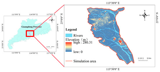
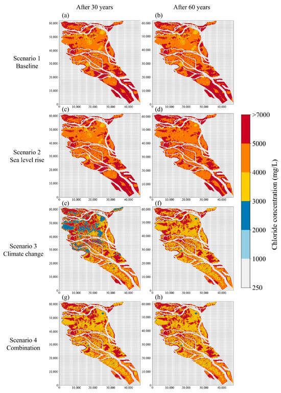
Climate change and sea-level rise are expected to intensify groundwater salinization in coastal aquifers, yet their relative contributions remain insufficiently quantified. This study developed a MODFLOW–SEAWAT model to compare the combined impacts of future precipitation change and sea-level rise on groundwater salinization in
[...] Read more.
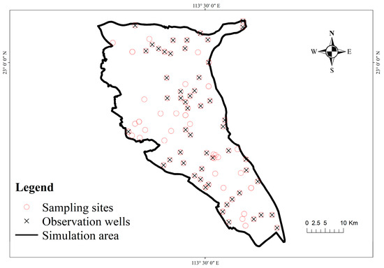
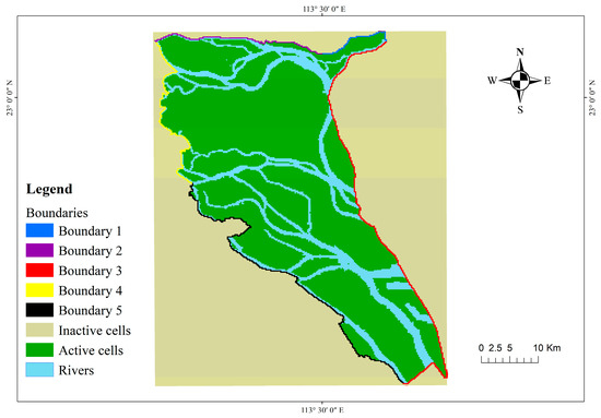
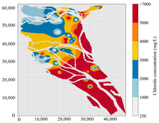
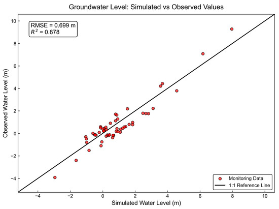
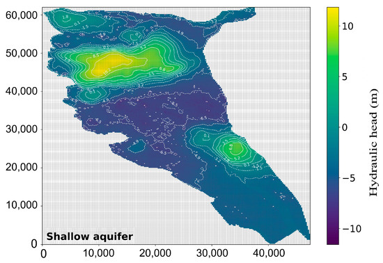
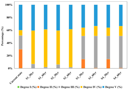
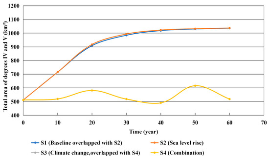
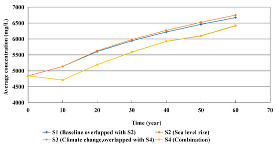
Climate change and sea-level rise are expected to intensify groundwater salinization in coastal aquifers, yet their relative contributions remain insufficiently quantified. This study developed a MODFLOW–SEAWAT model to compare the combined impacts of future precipitation change and sea-level rise on groundwater salinization in a representative coastal aquifer of the Pearl River Delta (PRD), China. The groundwater-flow component was calibrated using heads from 54 observation wells (R2 = 0.878, RMSE = 0.699 m), and the initial salinity field was constructed and spatially evaluated using chloride concentrations from 142 sampling sites. Four scenarios, including baseline, sea-level rise, future precipitation (SSP5-8.5), and their combination, were simulated over 30- and 60-year periods. The scenario comparison indicates that sea-level rise alone slightly increases groundwater salinity, whereas the selected SSP5-8.5 precipitation series produces a stronger response through recharge and freshwater dilution. Under the SSP5-8.5 scenario, the combined area of high-salinity groundwater (Degrees IV and V) after 60 years decreases by approximately 50% compared with the baseline scenario. The combined scenario exhibits salinization patterns similar to those of the precipitation scenario, indicating that precipitation change has a stronger influence than sea-level rise under the selected scenario and hydrogeological conditions of the PRD. These findings suggest that targeted artificial recharge in recharge-sensitive inland transition zones could help mitigate groundwater salinization and support climate adaptation in coastal regions.
Full article
(This article belongs to the Special Issue Techniques for Coastal Aquifer Management and Seawater Intrusion Characterization)
►▼
Show Figures

Figure 1
Open AccessArticle
Influence of Natural-Fracture Connectivity on Hydraulic-Fracture Propagation in Shale Reservoirs
by
Huan Zhao, Jiahao Kong, Liang Ge, Zhitao Xu, Ruixia Yuan, Xinyuan Ji, Chenghao Ding, Yuan Gao and Wei Li
Water 2026, 18(16), 1995; https://doi.org/10.3390/w18161995 - 14 Aug 2026
Abstract
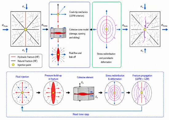
Natural-fracture connectivity substantially influences hydraulic-fracture interaction with pre-existing discontinuities, but its quantitative role in fracture-network propagation remains insufficiently constrained. In this study, a coupled LEFM–cohesive-zone hydraulic-fracture propagation model was developed by combining crack-tip deflection criteria, traction-separation damage evolution and fluid–solid coupling. True triaxial
[...] Read more.
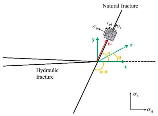
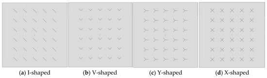
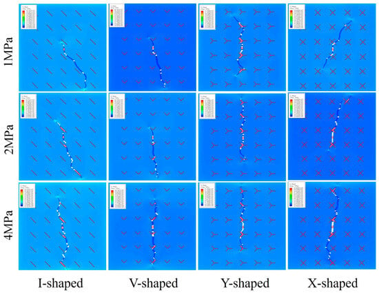
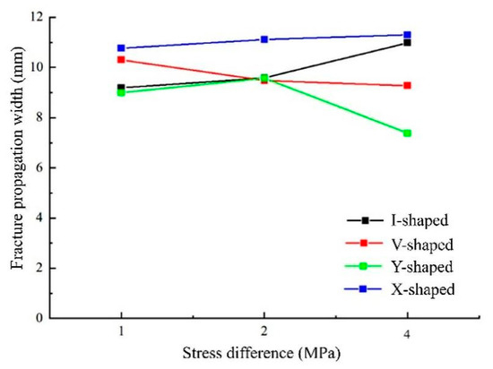
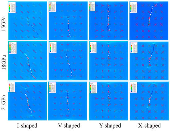
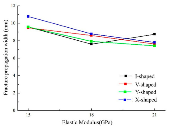
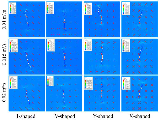
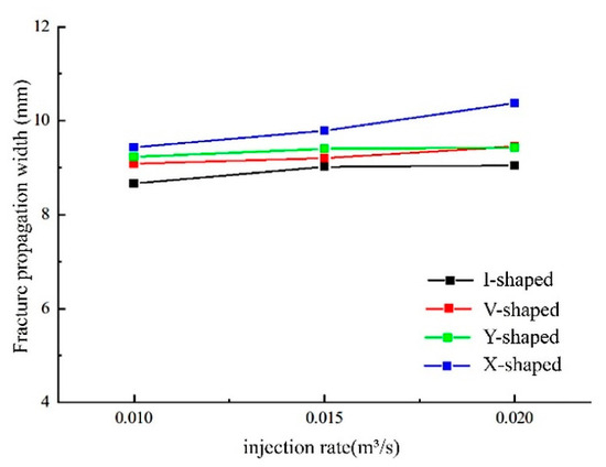
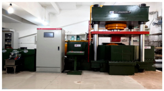
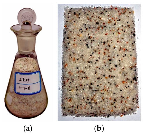
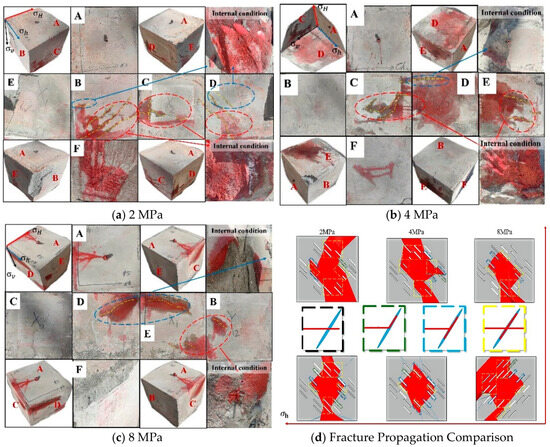
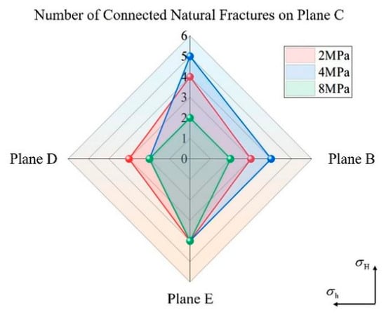
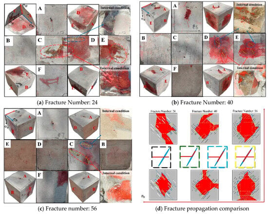
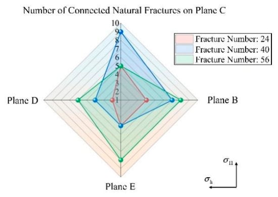
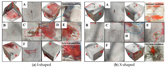
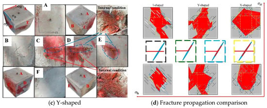
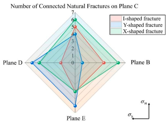
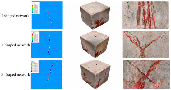
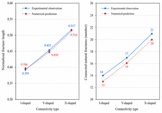
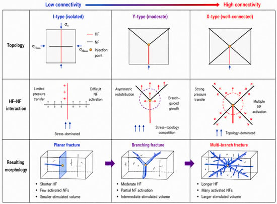
Natural-fracture connectivity substantially influences hydraulic-fracture interaction with pre-existing discontinuities, but its quantitative role in fracture-network propagation remains insufficiently constrained. In this study, a coupled LEFM–cohesive-zone hydraulic-fracture propagation model was developed by combining crack-tip deflection criteria, traction-separation damage evolution and fluid–solid coupling. True triaxial hydraulic-fracturing experiments were conducted on artificial fracture networks with I-, V-, Y- and X-shaped connectivity elements to evaluate the model response. The results show that connected natural fractures redirect hydraulic fractures under low horizontal stress differences, producing deflection angles of 30–50 degrees. When the stress difference exceeds 4 MPa, fracture growth becomes more strongly aligned with the maximum principal stress direction. In the true triaxial tests, the total number of connected natural fractures increased from 14 in the I-shaped network to 17 and 21 in the Y- and X-shaped networks, corresponding to increases of 21.4% and 50.0%, respectively. X-shaped networks showed the strongest sensitivity to stress difference and injection rate, while higher elastic modulus reduced fracture width and promoted longer, narrower fractures. Scale-normalized comparisons based on image-derived experimental measurements showed that the predicted propagation length, fracture width and connected-fracture number followed the experimental trend from I-shaped to Y-shaped and X-shaped networks, with relative errors within 7.1% and a mean absolute percentage error of 4.8%. These findings suggest that fracture topology strongly influences pressure transmission and multidirectional activation in the tested models, whereas field-scale extrapolation requires three-dimensional validation and transport analysis.
Full article
(This article belongs to the Section Hydrogeology)
►▼
Show Figures

Figure 1
Open AccessArticle
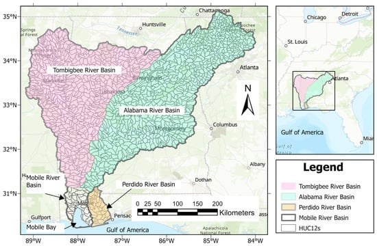
Investigating Hydrologic Alteration Under Historical and Future Scenarios in the Mobile River and Perdido River Basins Using the Cubist Algorithm
by
Sabahattin Isik, Rachel L. Dubose and Victor L. Roland II
Water 2026, 18(16), 1994; https://doi.org/10.3390/w18161994 - 14 Aug 2026
Abstract
This study investigates the impacts of human activities and climate variability on hydrologic alterations in the Mobile River and Perdido River Basins of Alabama. The research uses a machine learning approach, specifically cubist models, to quantify and predict changes in flow duration curves
[...] Read more.
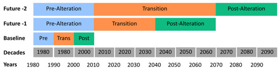
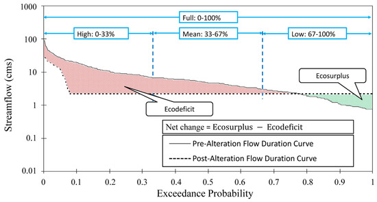
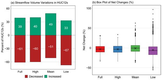
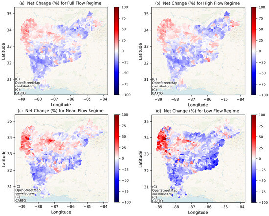
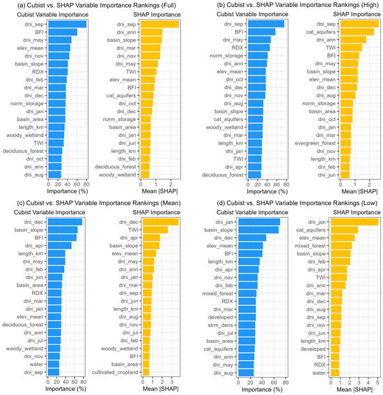
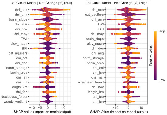
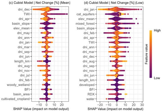
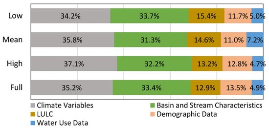
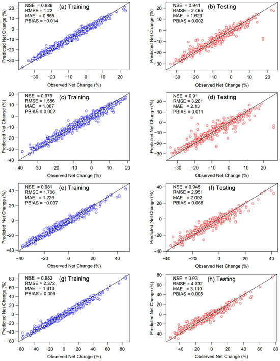
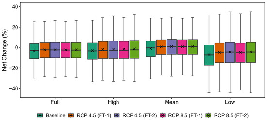
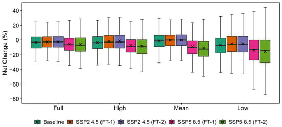
This study investigates the impacts of human activities and climate variability on hydrologic alterations in the Mobile River and Perdido River Basins of Alabama. The research uses a machine learning approach, specifically cubist models, to quantify and predict changes in flow duration curves (FDCs) under both historical (1980–2009) and future climate scenarios. Future climate projections include the Representative Concentration Pathways (RCP 4.5 and RCP 8.5) and the Shared Socioeconomic Pathways (SSP2 4.5 and SSP5 8.5), evaluated for two future periods: 1980–2069 and 1980–2099. The models incorporate a wide range of covariates, including basin geomorphology, aquifer characteristics, land cover, water storage, environmental factors, solar radiation, census data, and water use data. Under the baseline period (1980–2009), most level 12 hydrologic unit codes (HUC12s) in both basins showed alterations, with substantial differences observed between pre- and post-alteration FDCs. The model performance varied, with a Nash–Sutcliffe Efficiency between 0.91 and 0.95 for testing and between 0.98 and 0.99 for training during the baseline period. Future projections under the RCP 4.5 and RCP 8.5 scenarios generally differed significantly from baseline conditions across all flow regimes (p < 0.05). In contrast, SSP2 4.5 showed comparatively limited statistical significance, while SSP5 8.5 exhibited significant departures from baseline conditions across all flow regimes, reflecting the greater influence of high-emissions climate forcing on projected hydrologic alterations. Overall, the RCP scenarios projected more widespread statistically significant changes than the corresponding SSP scenarios at the same forcing level, particularly when comparing RCP4.5 with SSP2-4.5, while both RCP8.5 and SSP5-8.5 consistently indicated greater hydrologic alterations than their moderate-emissions counterparts. These findings highlight the importance of considering different flow regimes when assessing the impacts of climate variability on streamflow. This study contributes to the understanding of hydrologic alterations in the Mobile River and Perdido River Basins, providing insights for water resource management and ecological conservation efforts in the region.
Full article
(This article belongs to the Section Hydrology)
►▼
Show Figures

Figure 1
Journal Menu
► ▼ Journal Menu-
- Water Home
- Aims & Scope
- Editorial Board
- Reviewer Board
- Topical Advisory Panel
- Early Career Editorial Board
- Instructions for Authors
- Special Issues
- Topics
- Sections
- Article Processing Charge
- Indexing & Archiving
- Editor’s Choice Articles
- Most Cited & Viewed
- Journal Statistics
- Journal History
- Journal Awards
- Society Collaborations
- Conferences
- Editorial Office
Journal Browser
► ▼ Journal BrowserHighly Accessed Articles
Latest Books
E-Mail Alert
News
Topics
Topic in
Applied Sciences, Clean Technol., Energies, Membranes, Polymers, Sustainability, Water
New Advances in Membrane Technology and Its Contribution to Sustainability
Topic Editors: Patricia Luis Alconero, Bart Van der BruggenDeadline: 12 September 2026
Topic in
Agriculture, Climate, Energies, Land, Water
Energy, Environment and Climate Policy Analysis
Topic Editors: Xiaoqian Song, Jiajie LiDeadline: 30 September 2026
Topic in
Clean Technol., Materials, Molecules, Recycling, Water, Nanomaterials, Catalysts
Advanced Composites for Waste Valorization and Pollutant Degradation
Topic Editors: Iwona Kuzniarska-Biernacka, Ana Sofia MestreDeadline: 31 October 2026
Topic in
Applied Sciences, Hydrology, JMSE, Water, Eng
Hydraulic Engineering and Modelling
Topic Editors: Guohua Zhang, Feng Xiong, Xiaobo ZhangDeadline: 30 November 2026
Conferences
Special Issues
Special Issue in
Water
Optimization of Reservoir Operations
Guest Editors: Hu Hu, Zhe Yang, Ziyu DingDeadline: 20 August 2026
Special Issue in
Water
Sustainable Water Management in Agricultural Irrigation
Guest Editor: Dat Q TranDeadline: 20 August 2026
Special Issue in
Water
Advances in Biological Technologies for Drinking and Wastewater Treatment, 2nd Edition
Guest Editors: Alejandro Gonzalez-Martinez, Barbara Muñoz-Palazon, Alejandro Rodriguez-SanchezDeadline: 20 August 2026
Special Issue in
Water
Water-Related Landslide Hazard Process and Its Triggering Events—2nd Edition
Guest Editor: Wei LiuDeadline: 20 August 2026