


-
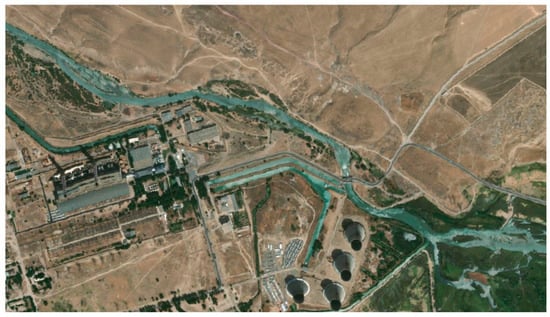
The Reliability of SBR System During COVID-19 and Its Impact on Water Quality of a Small Flysch River in Protected Areas -
Scales and Sustainability: The Politics of Riverine Landscape Governance in Chiang Mai, Thailand -
Low-Cost, Sustainable Materials and 3D-Printed Systems for Wastewater Treatment and Reuse in Rural Communities: A Critical Review
Journal Description
Water
Water
is a peer-reviewed, open access journal on water science and technology, including the ecology and management of water resources, published semimonthly online by MDPI. Water collaborates with the Stockholm International Water Institute (SIWI). In addition, the American Institute of Hydrology (AIH), Polish Limnological Society (PLS) and Japanese Society of Physical Hydrology (JSPH) are affiliated with Water and their members receive a discount on the article processing charges.
- Open Access— free for readers, with article processing charges (APC) paid by authors or their institutions.
- High Visibility: indexed within Scopus, SCIE (Web of Science), Ei Compendex, GEOBASE, GeoRef, PubAg, AGRIS, CAPlus / SciFinder, Inspec, and other databases.
- Journal Rank: JCR - Q2 (Water Resources) / CiteScore - Q1 (Aquatic Science)
- Rapid Publication: manuscripts are peer-reviewed and a first decision is provided to authors approximately 17.7 days after submission; acceptance to publication is undertaken in 2.8 days (median values for papers published in this journal in the first half of 2026).
- Recognition of Reviewers: reviewers who provide timely, thorough peer-review reports receive vouchers entitling them to a discount on the APC of their next publication in any MDPI journal, in appreciation of the work done.
- Companion journals for Water include: Hydropower and Freshwater.
- Journal Clusters of Water Resources: Water, Journal of Marine Science and Engineering, Hydrology, Resources, Oceans, Limnological Review, Coasts and Hydropower.
Impact Factor:
3.5 (2025);
5-Year Impact Factor:
3.6 (2025)
Latest Articles
Assessment of Nutrient Impacts on Surface Water Quality in the Polissia Region Using Intelligent Data Analysis
Water 2026, 18(16), 2001; https://doi.org/10.3390/w18162001 (registering DOI) - 15 Aug 2026
Abstract
In crisis times, traditional models of water quality assessment and water resources management lose their effectiveness. In the current conditions of local climate change, accidental pollution, emergencies or military operations, there is an urgent need to transition from traditional descriptive hydrochemical monitoring toward
[...] Read more.
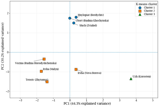
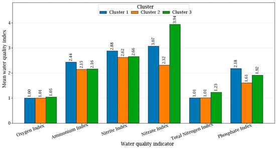
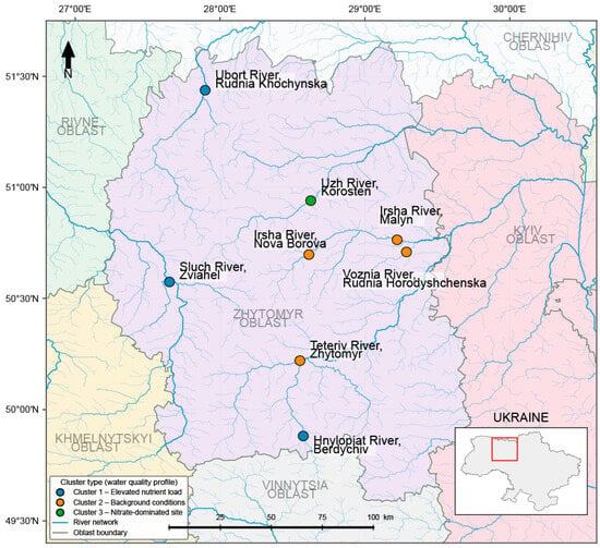
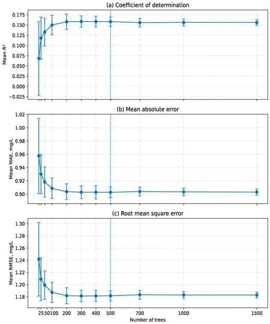
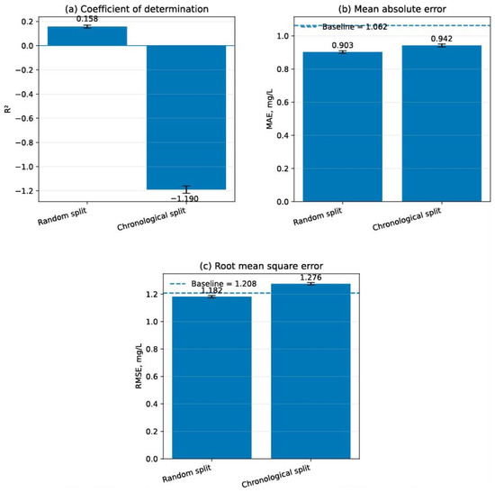
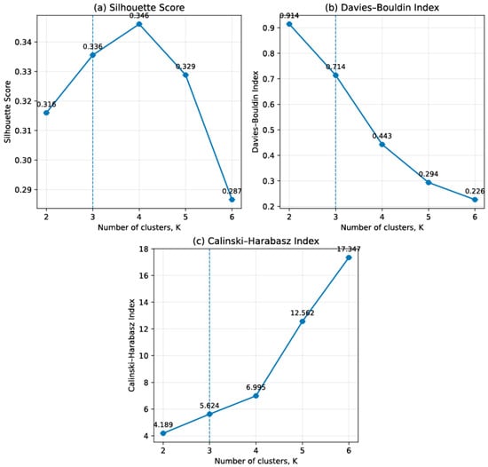
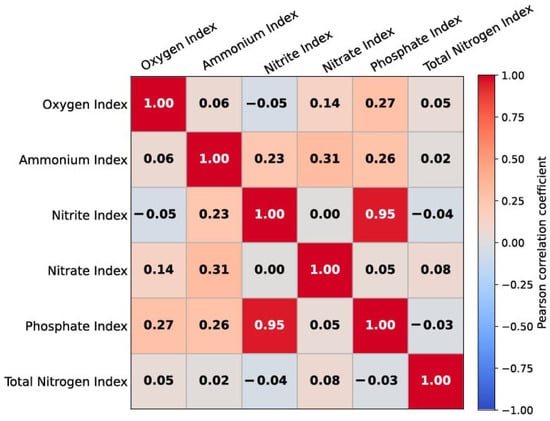
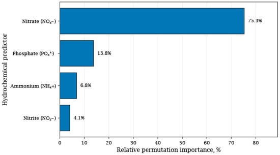
In crisis times, traditional models of water quality assessment and water resources management lose their effectiveness. In the current conditions of local climate change, accidental pollution, emergencies or military operations, there is an urgent need to transition from traditional descriptive hydrochemical monitoring toward intelligent analysis of spatial-temporal datasets. In this paper, the integrated approach combining spatial cluster analysis, GIS-based visualization, and machine learning is proposed for assessing the surface water quality under conditions of limited and incomplete hydrochemical monitoring data. A geospatial assessment of nutrient impacts on surface water quality was conducted using 192 hydrochemical observations collected during the 2024–2025 monitoring period at eight state monitoring stations located in the basins of the Teteriv, Uzh, Irsha, Ubort, Sluch, Hnylopiat, and Voznia rivers, Polissia, Ukraine. Permutation feature importance analysis based on the Random Forest model showed that nitrate concentration accounted for approximately 75% of the total relative importance, whereas phosphate concentration contributed approximately 14%, indicating that these variables were the most informative predictors among the investigated hydrochemical parameters. The latter parameters are associated with dissolved oxygen variability among the analyzed hydrochemical parameters. According to the results of this study, three interpretable groups of monitoring stations were formed: Cluster 1, representing moderate water quality with increased nutrient pressure, Cluster 2, representing comparatively favourable background conditions, and Cluster 3, representing a nitrate-dominated hydrochemical type. The Random Forest model demonstrated limited predictive performance (R2 = 0.154), indicating that nutrient-related variables alone explain only a small proportion of dissolved oxygen variability. Hence, additional factors, including hydrological conditions, water temperature, organic matter decomposition, biological productivity, and catchment-specific characteristics, also play an important role in shaping oxygen dynamics. The spatial visualization of cluster membership showed that geographical location alone does not fully determine the surface water quality patterns in Ukrainian Polissia. Instead, the local catchment characteristics and land-use conditions appear to exert a stronger influence on the formation of nutrient-related water quality differences. The authors propose to employ the spatial cluster analysis and machine learning as a basic supporting tool for the transition from retrospective interpretation of hydrochemical monitoring data to predictive and adaptive water resources management. The integration of geospatial analysis and machine learning provides a practical decision-support framework for the early detection of anomalies, identification of potential pollution sources, and prioritization of river sub-basins for implementing nature-based solutions.
Full article
(This article belongs to the Section New Sensors, New Technologies and Machine Learning in Water Sciences)
►
Show Figures
Open AccessArticle
Numerical Simulation of Sediment Transport and Morphological Evolution in the Talas River Using a Non-Newtonian Model
by
Yeldos Zhandaulet, Alexandr Neftissov, Gokmen Tayfur, Perizat Omarova, Ilyas Kazambayev and Lalita Kirichenko
Water 2026, 18(16), 2000; https://doi.org/10.3390/w18162000 (registering DOI) - 15 Aug 2026
Abstract
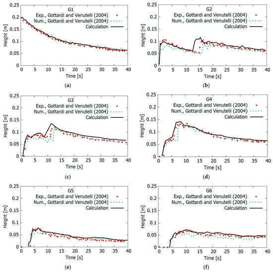
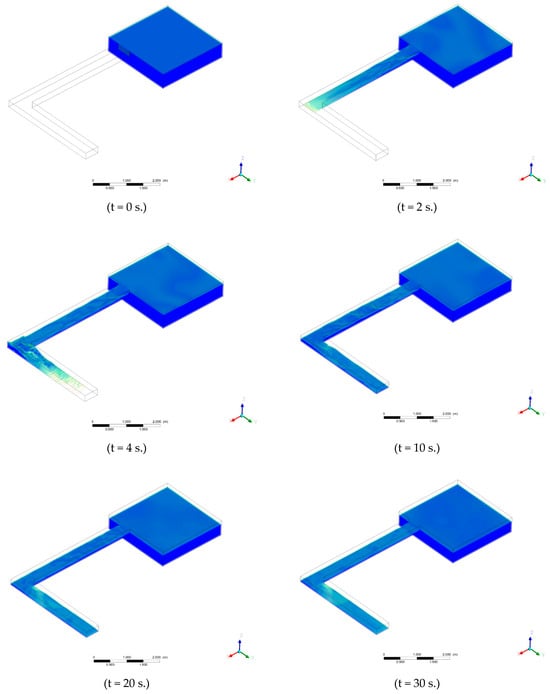
Changes in river channel morphology under the influence of natural and anthropogenic factors pose a serious threat to the stability of aquatic ecosystems and water resource use, especially in regions with limited hydrological information. This study presents, for the first time, a three-dimensional
[...] Read more.
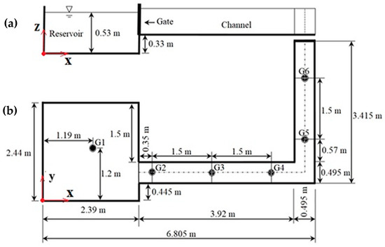
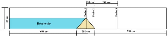
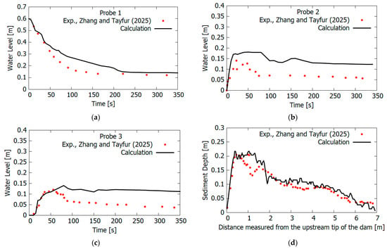
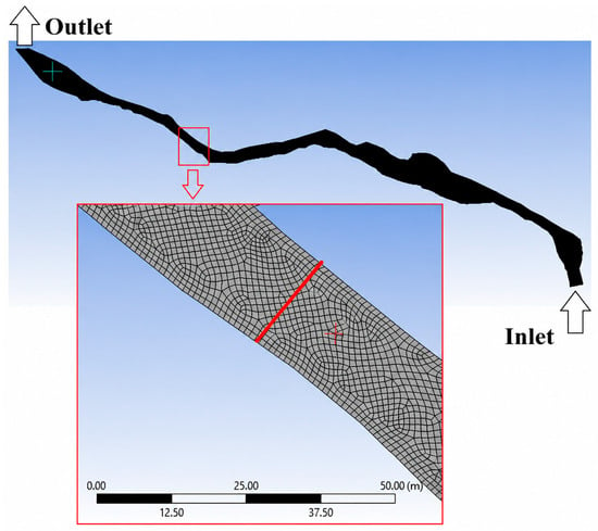
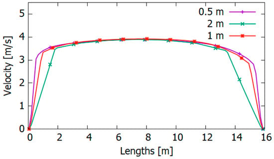
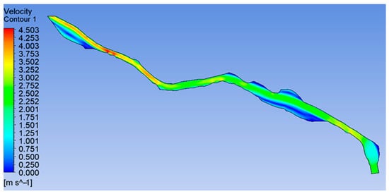
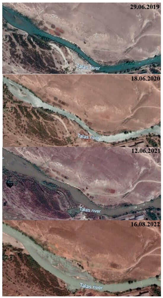
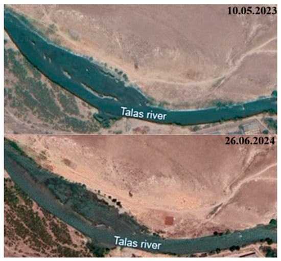
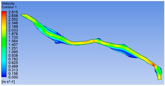
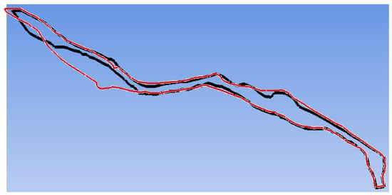
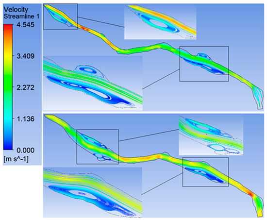
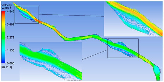
Changes in river channel morphology under the influence of natural and anthropogenic factors pose a serious threat to the stability of aquatic ecosystems and water resource use, especially in regions with limited hydrological information. This study presents, for the first time, a three-dimensional numerical investigation of channel processes in the Talas River (Kazakhstan), employing the Volume of Fluid (VOF) method for free-surface flow simulation and a non-Newtonian model for sediment transport and riverbed morphodynamics. To verify the developed mathematical model, experimental data on the flow in the L-shaped channel and Earthfill dam break were used, which provided high reliability of the calculated results. The calculations showed a significant increase in the channel area in the studied section of the Talas River (from 41,334.92 m2 to 56,890.17 m2) for the period from 2019 to 2024, mainly due to the intensification of the dynamics of currents and the formation of additional vortex zones with a diameter of 50 to 200 m. It was found that in places of local flow acceleration, water velocity increased up to 4.5 m/s, leading to bank erosion and channel widening, whereas after redistribution of channel flows, the maximum velocity decreased to 2.8 m/s, ensuring stabilisation of morphological changes. The results of the study underline the need for an integrated approach to river morphodynamics management using numerical modelling to predict channel changes, minimise flood risks and optimise the use of water resources. The presented computational approach can be adapted to analyse hydrodynamic processes in other poorly studied river systems, which significantly expands its scientific and practical value.
Full article
(This article belongs to the Special Issue Advances in Sediment Dynamics: Mechanisms, Modeling and Management in Transitional Environments)
►▼
Show Figures

Figure 1
Open AccessArticle
Effects of Different Microplastics on Antibiotic Resistance Genes and Bacterial Communities in Sediments from Four Major Sea Areas in China
by
Peng Zhang, Jia Yu, Meijun Bao, Tianlun Han, Zhe Zhang, Shuai Zhang, Wanzhong Wang, Sijia Liang and Yan Zhou
Water 2026, 18(16), 1999; https://doi.org/10.3390/w18161999 - 14 Aug 2026
Abstract
Microplastics (MPs) can accumulate antibiotic resistance genes (ARGs) in seawater, but their effects on sediment resistomes and microbial communities across different marine sediments remain poorly understood. A 30-day incubation experiment using polyethylene (PE), polyethylene terephthalate (PET), and polyvinyl chloride (PVC) MPs and composite
[...] Read more.
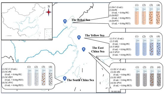
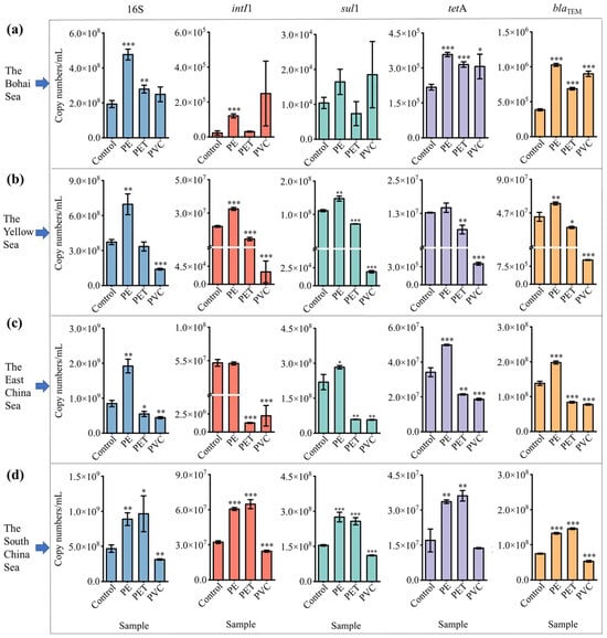
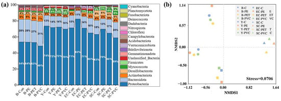
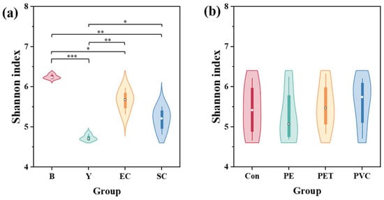
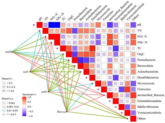
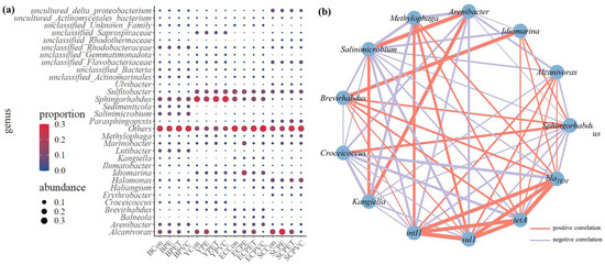
Microplastics (MPs) can accumulate antibiotic resistance genes (ARGs) in seawater, but their effects on sediment resistomes and microbial communities across different marine sediments remain poorly understood. A 30-day incubation experiment using polyethylene (PE), polyethylene terephthalate (PET), and polyvinyl chloride (PVC) MPs and composite sediments from four marginal seas of China was conducted. PE exposure significantly increased nearly all the abundances of intI1, sul1, tetA, and blaTEM in all four sediment sources (Bohai, Yellow, East China, and South China Seas), whereas PET and PVC produced sediment-dependent responses. PE-associated biofilms may provide protective niches that favor bacterial growth and ARG enrichment, while PET and PVC may exert inhibitory effects in some sediments. MP exposure was also associated with shifts in bacterial community composition and alpha diversity. Co-occurrence analysis identified Alcanivorax, Methylophaga, and Brevirhabdus as potential hosts associated with all target genes, whereas Idiomarina showed potential associations with tetA and blaTEM. Overall, the results indicate that MP effects on sediment ARGs and bacterial communities depend on both polymer type and sediment characteristics. Because the experiment used a high MP loading and carbon supplementation, further studies at environmentally relevant concentrations are needed to evaluate the ecological implications.
Full article
(This article belongs to the Section Oceans and Coastal Zones)
►▼
Show Figures

Figure 1
Open AccessArticle
Hydrological Drought Modeling Under the Impact of Climate Change in the Luanhe River Basin: A Prediction Study
by
Wentao Jing, Liwen Shang, Xinpo Xu, Yang Li, Mingxuan Yi, Lingxiao Meng and Dongming Zhang
Water 2026, 18(16), 1998; https://doi.org/10.3390/w18161998 - 14 Aug 2026
Abstract
Against the backdrop of climate change and compounded by human activities, increasing water scarcity has triggered a series of drought disasters, which have already severely impacted both ecological environments and socioeconomic production. The SWAT model, recognized for its strong portability and superior spatial
[...] Read more.
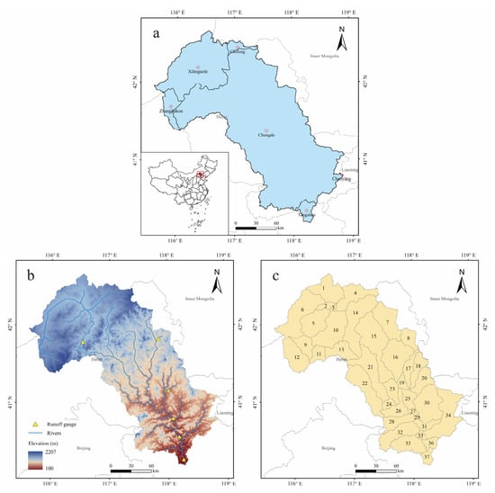
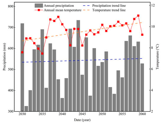
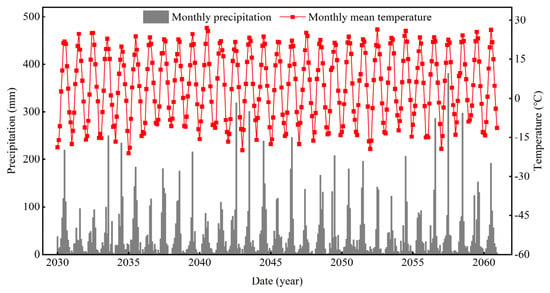
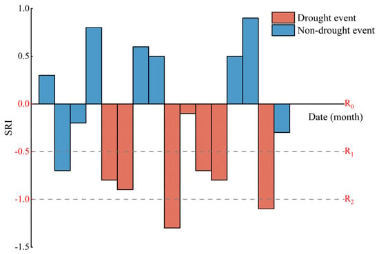
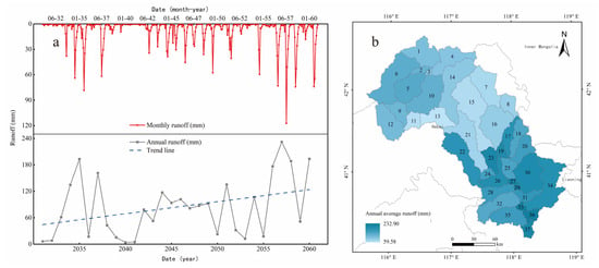
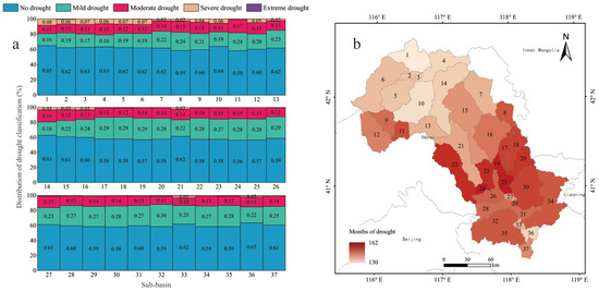
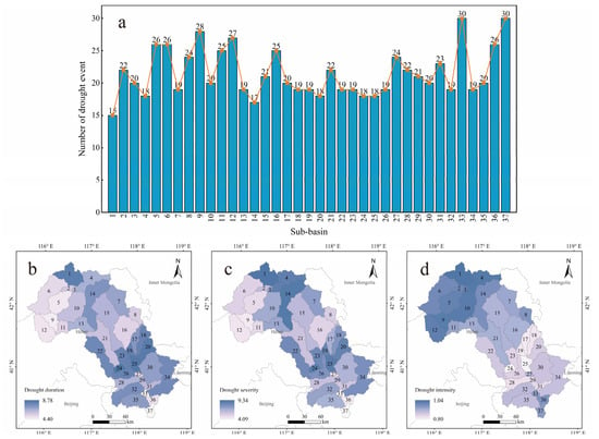
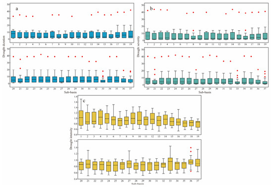
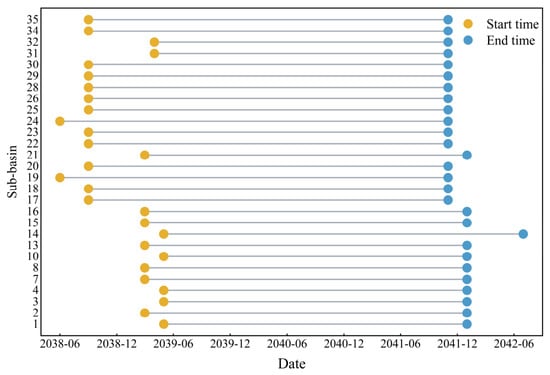
Against the backdrop of climate change and compounded by human activities, increasing water scarcity has triggered a series of drought disasters, which have already severely impacted both ecological environments and socioeconomic production. The SWAT model, recognized for its strong portability and superior spatial heterogeneity, has gained widespread acceptance in fields such as hydrology and environmental science, and is extensively applied in hydrological simulation studies across large-scale river basins. Hydrological models of the study area can be constructed in the SWAT model to simulate changes in hydrological variables by conducting spatial discretization, parameter specification, and boundary condition definition. Standardized drought index can effectively reflect the spatiotemporal variations in drought disasters, holding significant importance for clarifying and predicting drought characteristics. This study took the Luanhe River Basin as the research area, constructed a watershed hydrological model based on SWAT, and projected changes in the basin’s hydrological processes for the period 2030–2060. Based on the model’s projected data, we calculated drought indices and extracted drought events for the basin. The results indicate the following: (1) During the simulation period, only 30% of the years in the Luanhe River basin had annual runoff above the long-term average, with a range of 228.18 mm. The range of mean annual runoff across sub-basins was 173.32 mm. Drought and uneven water resource allocation over both spatial and temporal scales coexisted, and this issue is expected to intensify under future climate warming and drying. (2) The mid-reaches of the Luanhe River are more prone to drought compared to the upper reaches for its higher water demand. However, due to a stronger capacity for ecological restoration, droughts there are mostly of low intensity in the mid-reaches. In contrast, the upper reaches experience more periods classified as severe or extreme drought, and the drought events encountered are generally more intense than those in the mid-reaches. (3) The method proposed in this study can screen extreme drought events based on outliers in the characteristic values of drought events. Taking the simulation from this study as an illustration, anomalies in drought event characteristic values suggest a potential basin-scale, prolonged extreme drought event in the Luanhe River Basin from June 2038 to July 2042. Proactive drought prevention policies should be formulated for this period. The findings of this study provide guiding significance and practical value for drought assessment, risk management, and policy application in the Luanhe River Basin. This study methodologically combines hydrological model predictions with drought event responses, providing a novel method for predicting basin-scale drought conditions and issuing early warnings for extreme drought events.
Full article
(This article belongs to the Special Issue Advances in the Relationship Between Climate Change and Runoff in Watershed)
►▼
Show Figures

Figure 1

Open AccessArticle
Submarine Groundwater Discharge as a Driver of Biogeochemical Processes in Methane Seep Sediments
by
Darya Purgina, Yuliya Moiseeva, Tatyana Malakhova, Andrey Toropov, Andrey Grinko, Tatyana Polivanova, Eva Ugolkova, Andrey Budnikov and Elena Gershelis
Water 2026, 18(16), 1997; https://doi.org/10.3390/w18161997 - 14 Aug 2026
Abstract
Submarine groundwater discharge (SGD) is an important pathway of dissolved matter transport to coastal ecosystems, yet its identification in methane seep environments remains challenging because chemical signals are modified by sedimentary biogeochemical processes. This study evaluated hydrochemical tracers of SGD in methane seep
[...] Read more.
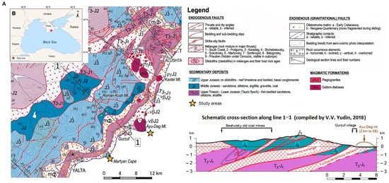
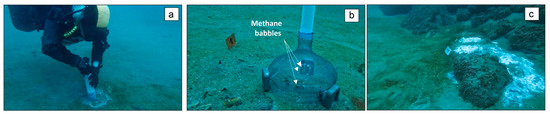
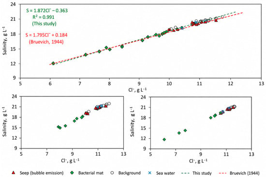
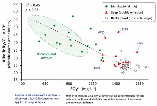
Submarine groundwater discharge (SGD) is an important pathway of dissolved matter transport to coastal ecosystems, yet its identification in methane seep environments remains challenging because chemical signals are modified by sedimentary biogeochemical processes. This study evaluated hydrochemical tracers of SGD in methane seep sites, bacterial mat areas, and background sediments along the southern coast of Crimea (Black Sea). The studied settings exhibited distinct water chemical characteristics. Chloride concentrations decreased from 10.6 to 11.2 g L−1 in background waters, to 8.7–9.3 g L−1 in bacterial mat pore waters and to 7.7 g L−1 in sediment–water interface waters, indicating the presence of a low-salinity water component. Dissolved silica increased by approximately one order of magnitude relative to background values at methane-associated sites. Methane concentrations ranged from 0.025 to 1058 μM, with the highest values occurring in bacterial mat areas. These zones were further characterized by sulfate depletion (down to 0.9 g L−1), elevated normalized alkalinity, ammonium concentrations reaching 8000 μg L−1, high sulfide contents, and low dissolved Fe concentrations consistent with iron sulfide precipitation. The results demonstrate that no single hydrochemical parameter is sufficient to identify SGD in methane-affected coastal sediments. Instead, the combined use of conservative tracers (Cl− and DSi) and reactive constituents (SO42−, alkalinity, NH4+, HS−, TDFe, and Mn2+) provides a robust hydrochemical framework for recognizing groundwater influence and evaluating associated biogeochemical transformations.
Full article
(This article belongs to the Section Oceans and Coastal Zones)
►▼
Show Figures

Figure 1
Open AccessArticle
Study on Seawater Intrusion in a Coastal Aquifer Under Climate Change and Sea-Level Rise
by
Guangping Xu, Zhao Liu, Jiawen Wan, Hengguang Liu, Chihang Wei, Peiyuan Lin and Luwen Zhuang
Water 2026, 18(16), 1996; https://doi.org/10.3390/w18161996 - 14 Aug 2026
Abstract
Climate change and sea-level rise are expected to intensify groundwater salinization in coastal aquifers, yet their relative contributions remain insufficiently quantified. This study developed a MODFLOW–SEAWAT model to compare the combined impacts of future precipitation change and sea-level rise on groundwater salinization in
[...] Read more.
Climate change and sea-level rise are expected to intensify groundwater salinization in coastal aquifers, yet their relative contributions remain insufficiently quantified. This study developed a MODFLOW–SEAWAT model to compare the combined impacts of future precipitation change and sea-level rise on groundwater salinization in a representative coastal aquifer of the Pearl River Delta (PRD), China. The groundwater-flow component was calibrated using heads from 54 observation wells (R2 = 0.878, RMSE = 0.699 m), and the initial salinity field was constructed and spatially evaluated using chloride concentrations from 142 sampling sites. Four scenarios, including baseline, sea-level rise, future precipitation (SSP5-8.5), and their combination, were simulated over 30- and 60-year periods. The scenario comparison indicates that sea-level rise alone slightly increases groundwater salinity, whereas the selected SSP5-8.5 precipitation series produces a stronger response through recharge and freshwater dilution. Under the SSP5-8.5 scenario, the combined area of high-salinity groundwater (Degrees IV and V) after 60 years decreases by approximately 50% compared with the baseline scenario. The combined scenario exhibits salinization patterns similar to those of the precipitation scenario, indicating that precipitation change has a stronger influence than sea-level rise under the selected scenario and hydrogeological conditions of the PRD. These findings suggest that targeted artificial recharge in recharge-sensitive inland transition zones could help mitigate groundwater salinization and support climate adaptation in coastal regions.
Full article
(This article belongs to the Special Issue Techniques for Coastal Aquifer Management and Seawater Intrusion Characterization)
Open AccessArticle
Influence of Natural-Fracture Connectivity on Hydraulic-Fracture Propagation in Shale Reservoirs
by
Huan Zhao, Jiahao Kong, Liang Ge, Zhitao Xu, Ruixia Yuan, Xinyuan Ji, Chenghao Ding, Yuan Gao and Wei Li
Water 2026, 18(16), 1995; https://doi.org/10.3390/w18161995 - 14 Aug 2026
Abstract
Natural-fracture connectivity substantially influences hydraulic-fracture interaction with pre-existing discontinuities, but its quantitative role in fracture-network propagation remains insufficiently constrained. In this study, a coupled LEFM–cohesive-zone hydraulic-fracture propagation model was developed by combining crack-tip deflection criteria, traction-separation damage evolution and fluid–solid coupling. True triaxial
[...] Read more.
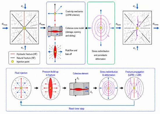
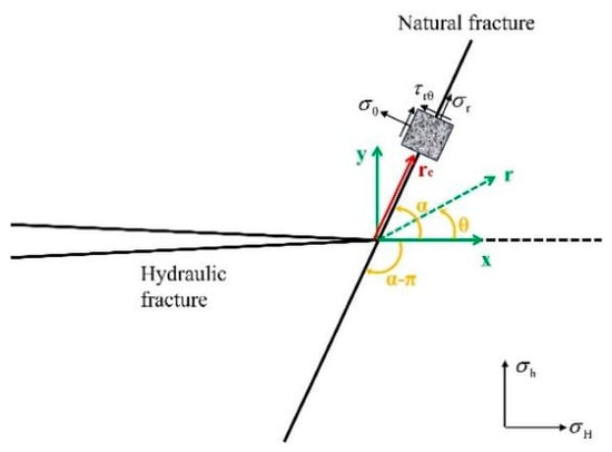
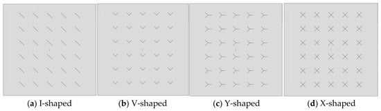
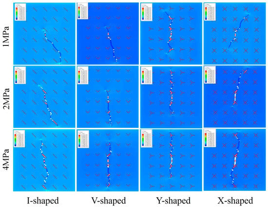
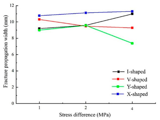
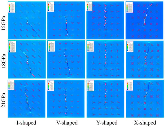
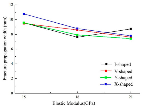
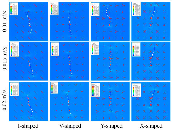
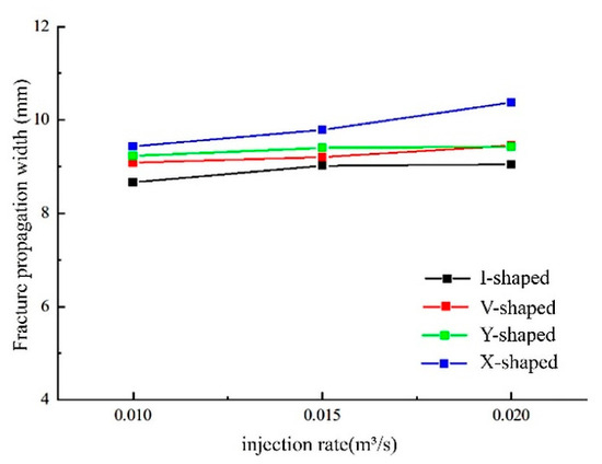
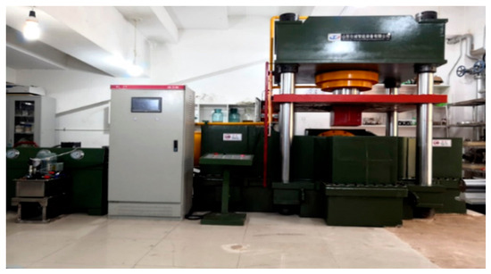
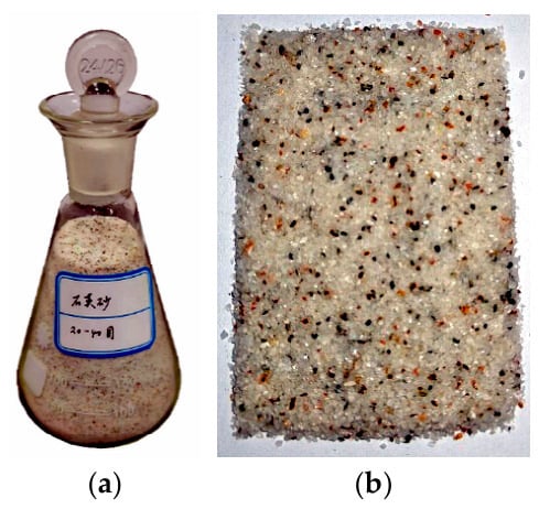
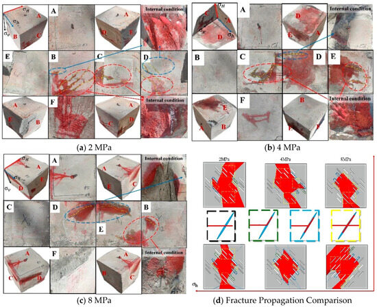
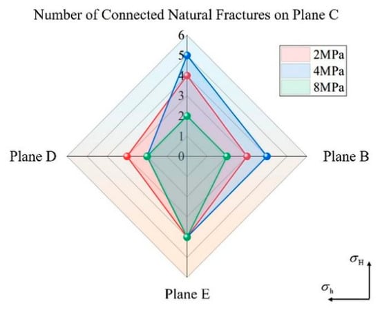
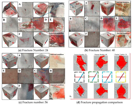
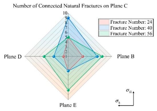
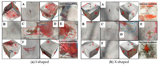
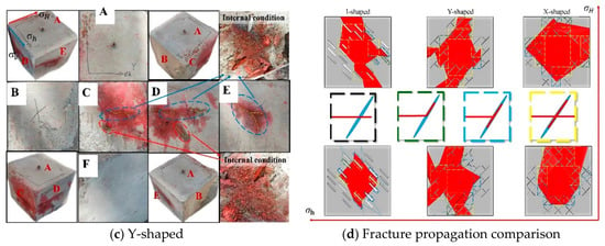
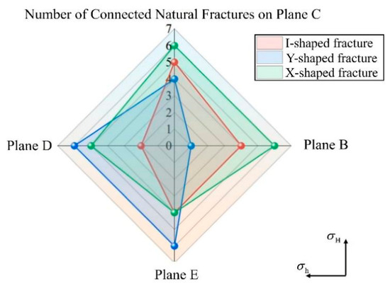
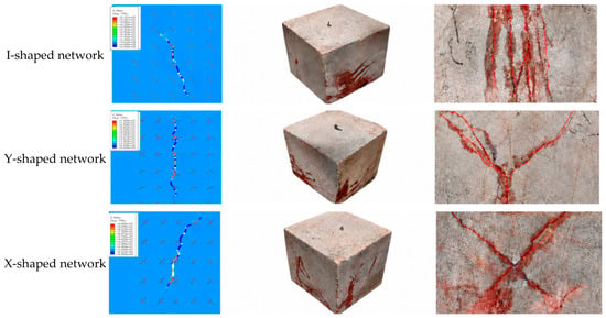
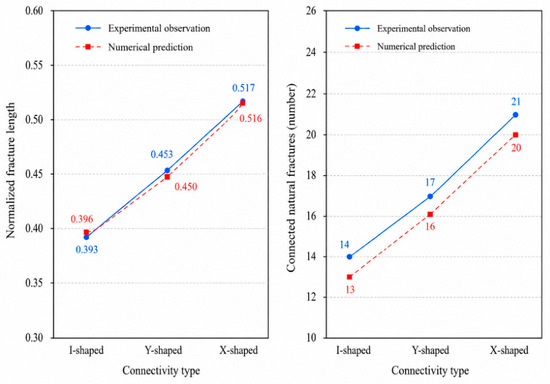
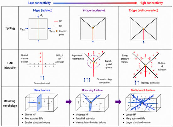
Natural-fracture connectivity substantially influences hydraulic-fracture interaction with pre-existing discontinuities, but its quantitative role in fracture-network propagation remains insufficiently constrained. In this study, a coupled LEFM–cohesive-zone hydraulic-fracture propagation model was developed by combining crack-tip deflection criteria, traction-separation damage evolution and fluid–solid coupling. True triaxial hydraulic-fracturing experiments were conducted on artificial fracture networks with I-, V-, Y- and X-shaped connectivity elements to evaluate the model response. The results show that connected natural fractures redirect hydraulic fractures under low horizontal stress differences, producing deflection angles of 30–50 degrees. When the stress difference exceeds 4 MPa, fracture growth becomes more strongly aligned with the maximum principal stress direction. In the true triaxial tests, the total number of connected natural fractures increased from 14 in the I-shaped network to 17 and 21 in the Y- and X-shaped networks, corresponding to increases of 21.4% and 50.0%, respectively. X-shaped networks showed the strongest sensitivity to stress difference and injection rate, while higher elastic modulus reduced fracture width and promoted longer, narrower fractures. Scale-normalized comparisons based on image-derived experimental measurements showed that the predicted propagation length, fracture width and connected-fracture number followed the experimental trend from I-shaped to Y-shaped and X-shaped networks, with relative errors within 7.1% and a mean absolute percentage error of 4.8%. These findings suggest that fracture topology strongly influences pressure transmission and multidirectional activation in the tested models, whereas field-scale extrapolation requires three-dimensional validation and transport analysis.
Full article
(This article belongs to the Section Hydrogeology)
►▼
Show Figures

Figure 1

Open AccessArticle
Investigating Hydrologic Alteration Under Historical and Future Scenarios in the Mobile River and Perdido River Basins Using the Cubist Algorithm
by
Sabahattin Isik, Rachel L. Dubose and Victor L. Roland II
Water 2026, 18(16), 1994; https://doi.org/10.3390/w18161994 - 14 Aug 2026
Abstract
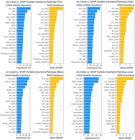
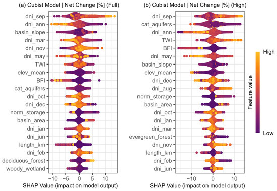
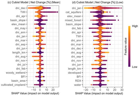
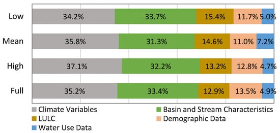
This study investigates the impacts of human activities and climate variability on hydrologic alterations in the Mobile River and Perdido River Basins of Alabama. The research uses a machine learning approach, specifically cubist models, to quantify and predict changes in flow duration curves
[...] Read more.
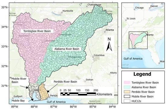
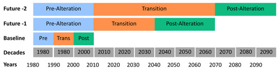
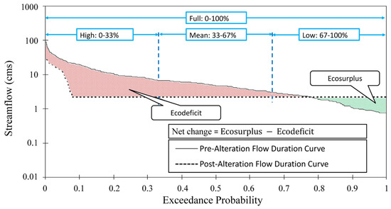
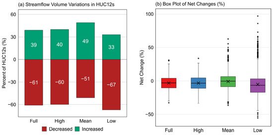
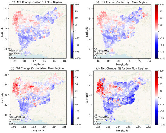
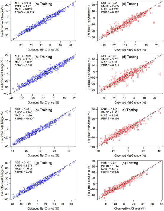
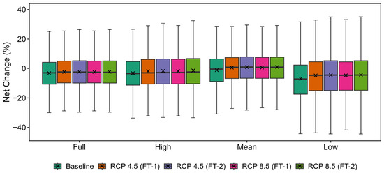
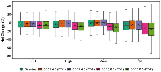
This study investigates the impacts of human activities and climate variability on hydrologic alterations in the Mobile River and Perdido River Basins of Alabama. The research uses a machine learning approach, specifically cubist models, to quantify and predict changes in flow duration curves (FDCs) under both historical (1980–2009) and future climate scenarios. Future climate projections include the Representative Concentration Pathways (RCP 4.5 and RCP 8.5) and the Shared Socioeconomic Pathways (SSP2 4.5 and SSP5 8.5), evaluated for two future periods: 1980–2069 and 1980–2099. The models incorporate a wide range of covariates, including basin geomorphology, aquifer characteristics, land cover, water storage, environmental factors, solar radiation, census data, and water use data. Under the baseline period (1980–2009), most level 12 hydrologic unit codes (HUC12s) in both basins showed alterations, with substantial differences observed between pre- and post-alteration FDCs. The model performance varied, with a Nash–Sutcliffe Efficiency between 0.91 and 0.95 for testing and between 0.98 and 0.99 for training during the baseline period. Future projections under the RCP 4.5 and RCP 8.5 scenarios generally differed significantly from baseline conditions across all flow regimes (p < 0.05). In contrast, SSP2 4.5 showed comparatively limited statistical significance, while SSP5 8.5 exhibited significant departures from baseline conditions across all flow regimes, reflecting the greater influence of high-emissions climate forcing on projected hydrologic alterations. Overall, the RCP scenarios projected more widespread statistically significant changes than the corresponding SSP scenarios at the same forcing level, particularly when comparing RCP4.5 with SSP2-4.5, while both RCP8.5 and SSP5-8.5 consistently indicated greater hydrologic alterations than their moderate-emissions counterparts. These findings highlight the importance of considering different flow regimes when assessing the impacts of climate variability on streamflow. This study contributes to the understanding of hydrologic alterations in the Mobile River and Perdido River Basins, providing insights for water resource management and ecological conservation efforts in the region.
Full article
(This article belongs to the Section Hydrology)
►▼
Show Figures

Figure 1

Open AccessArticle
Evaluating Glycerol as an Alternative Carbon Source for Denitrification in Land-Based Salmon Recirculating Aquaculture Systems
by
Live Aareskjold Salte, Odd Ivar Lekang and Sebastian Marcus Strauch
Water 2026, 18(16), 1993; https://doi.org/10.3390/w18161993 - 14 Aug 2026
Abstract
Heterotrophic denitrification is increasingly used in land-based recirculating aquaculture systems (RASs) to remove nitrate and minimise new-water demand, but the carbon sources traditionally used—methanol and acetic acid—raise safety, corrosion, and cost concerns. This study evaluated glycerol as an alternative external carbon source in
[...] Read more.
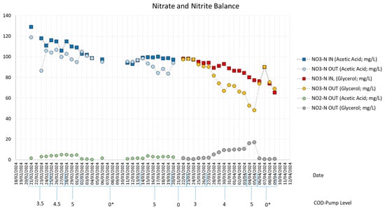
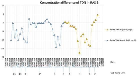
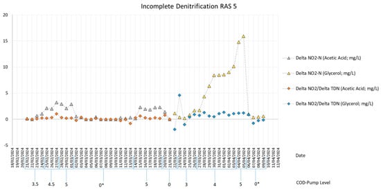
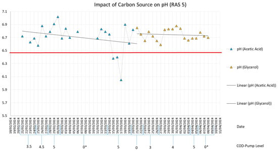
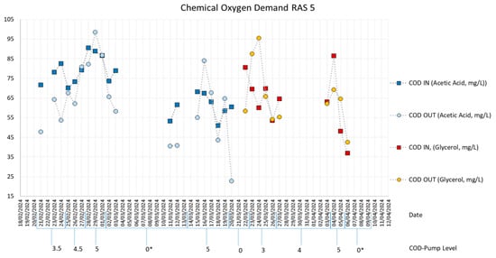
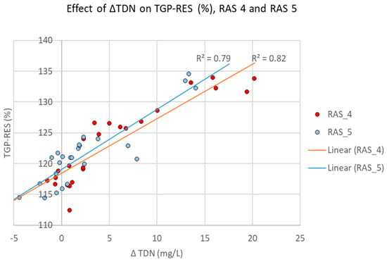
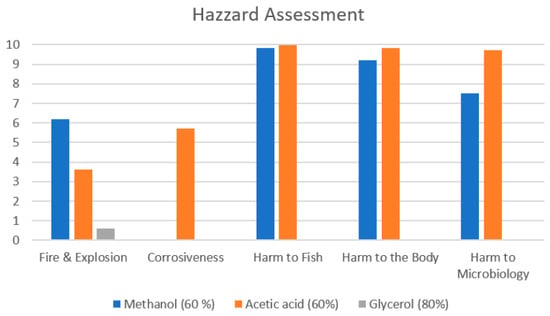
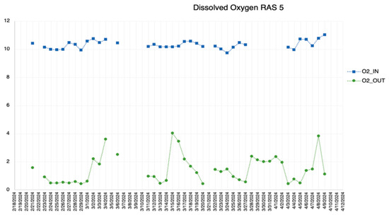
Heterotrophic denitrification is increasingly used in land-based recirculating aquaculture systems (RASs) to remove nitrate and minimise new-water demand, but the carbon sources traditionally used—methanol and acetic acid—raise safety, corrosion, and cost concerns. This study evaluated glycerol as an alternative external carbon source in a commercial land-based Atlantic salmon RAS in Norway. Trials in two identical post-smolt systems with integrated denitrification bioreactors compared glycerol (80%) against acetic acid for denitrification performance, nitrite accumulation, pH stability, carbon-source consumption, cost, and hazard profile. Glycerol achieved similar or higher apparent total dissolved nitrogen (TDN) removal than acetic acid and, once the biofilm had acclimated, was completely consumed. It maintained a stable outlet pH (≥6.5), avoiding the enzyme inhibition seen when acetic acid depressed pH, and proved about 1.5 times more cost-effective (≈NOK 66 vs. 97 per kg TDN removed). A standardised hazard assessment ranked glycerol as the safest option for flammability, toxicity, and corrosiveness. TDN removal correlated strongly with dissolved nitrogen gas saturation at the bioreactor outlet (r2 = 0.79–0.82), indicating that total gas pressure monitoring is a promising, low-cost proxy for performance. Nitrite accumulation per unit of nitrogen removed was, however, about three times higher under glycerol (≈1 mg NO2-N per mg TDN) than under acetic acid (≈0.3 mg NO2-N per mg TDN), and the nine-day glycerol phase was too short to establish whether this resolves or persists as the biofilm matures. Subject to routine nitrite monitoring in the fish tanks, glycerol is a cost-effective, low-hazard, and pH-stable alternative to acetic acid for nitrate removal in salmon RASs.
Full article
(This article belongs to the Section Water, Agriculture and Aquaculture)
►▼
Show Figures

Figure 1

Open AccessArticle
Geometry-Based Description for Hydrogen Bond Organization in Small Water Clusters Derived from Spectroscopic and Quantum Chemical Data
by
Ignat Ignatov, Yordan G. Marinov, Georgi Gluhchev and Paunka Vassileva
Water 2026, 18(16), 1992; https://doi.org/10.3390/w18161992 - 14 Aug 2026
Abstract
Hydrogen-bond organization plays a central role in determining the structure and properties of water from molecular to macroscopic scales. In this study, we propose a geometry-based descriptor for small hydrogen-bonded water clusters, (H2O)n, with n = 2–6. The central
[...] Read more.
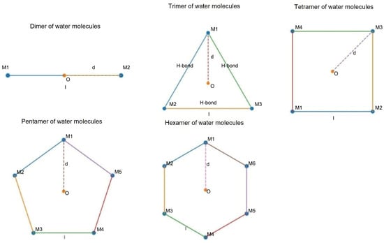
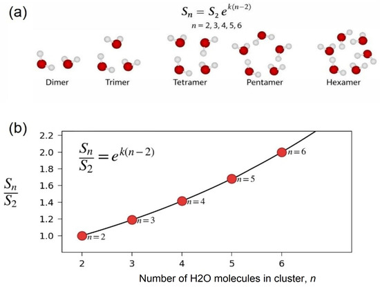
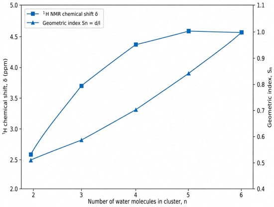
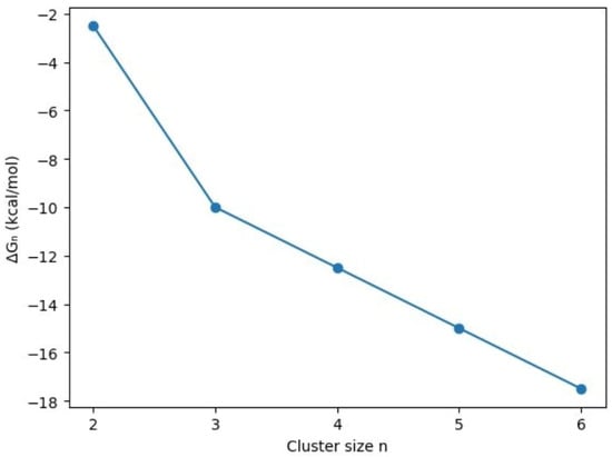
Hydrogen-bond organization plays a central role in determining the structure and properties of water from molecular to macroscopic scales. In this study, we propose a geometry-based descriptor for small hydrogen-bonded water clusters, (H2O)n, with n = 2–6. The central element of the proposed geometric framework is the dimensionless geometric index, Sn = d/l, where d is the center-to-molecule distance in a cluster configuration and l is the nearest-neighbor O···O distance associated with hydrogen-bonded water molecules. The geometric descriptor is not intended to replace quantum-chemical calculations or to provide a direct measurement of hydrogen-bond energy, lifetime, or number. Instead, it provides a compact geometric framework for describing the structural organization of small hydrogen-bonded water clusters. The obtained geometric trend is compared with selected Nuclear Magnetic Resonance (NMR), Møller–Plesset perturbation theory (MP2), and radial distribution function data as complementary qualitative and semi-quantitative references. The proposed geometric index Sn = was further compared with MP2 quantum-chemical O···O distances for (H2O)n clusters, n = 2–6, using the oxygen atoms as structural nodes of the hydrogen-bonded motifs. This comparison showed that the exponential increase in Sn is consistent with the characteristic O···O donor–acceptor length scale of approximately 2.8 Å, linking the geometric framework with calculated molecular geometries. Over the limited interval n = 2–6, the geometric index Sn increases monotonically and nonlinearly with cluster size. The quantum-chemical reference data previously reported in our study, comprising GIAO-DFT-calculated 1H chemical shifts obtained for MP2-optimized water-cluster geometries, show a rapid nonlinear increase from the dimer to the pentamer, followed by the onset of saturation in the pentamer–hexamer range. The semi-empirical stabilization parameter evaluated in the present study indicates increasing relative stabilization, with a reduced incremental change around n ≈ 4–5. The qualitative consistency of these size-dependent trends supports the use of Sn as a compact geometric descriptor of hydrogen-bond organization in small water clusters, without interpreting it as a direct quantitative measure or mechanistic framework of hydrogen-bond cooperativity. Importantly, liquid water is not treated as a system of closed cyclic clusters; cyclic motifs are used only as frameworked geometric reference configurations for small hydrogen-bonded aggregates. The geometric trend is qualitatively compared with selected quantum-chemical, spectroscopic, and radial distribution function data and should be regarded as an empirical geometric approximation over the limited interval n = 2–6. These findings indicate that geometric, spectroscopic, and quantum-chemical descriptors reflect related, but not identical, aspects of hydrogen-bond organization. The proposed approach links cluster geometry, O···O intermolecular distances, and hydrogen-bond connectivity in a simplified geometric description.
Full article
(This article belongs to the Special Issue Reactions of Hydrogen with Inorganic and Organic Molecules in Aqueous Media)
►▼
Show Figures

Figure 1
Open AccessArticle
Salix integra Root Reinforcement in Canal Slopes: Direct Shear, FracRoot, and Deterministic Stability Assessment
by
Jose Luis Chavez-Torres, Kunyong Zhang and Camila Nickole Fernandez-Morocho
Water 2026, 18(16), 1991; https://doi.org/10.3390/w18161991 - 14 Aug 2026
Abstract
Vegetation-based nature-based solutions can improve shallow slope stability, yet transferring root-scale measurements to slope-scale assessment remains difficult. This study reanalyzes archived mechanical and engineering data for Salix integra used on an ecological canal embankment in northern Jiangsu Province, China. The dataset comprises 36
[...] Read more.
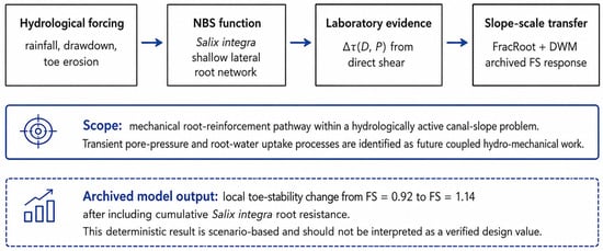
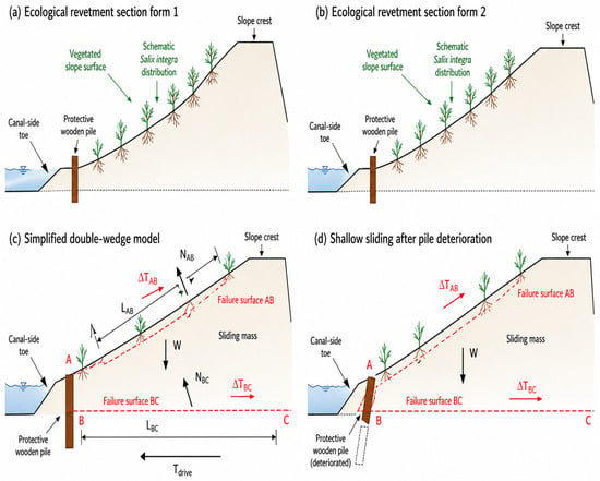
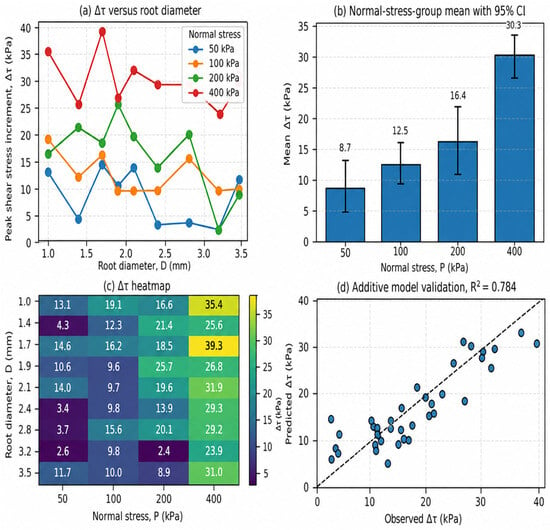
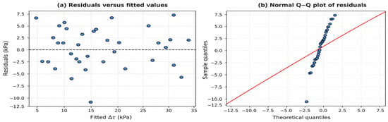
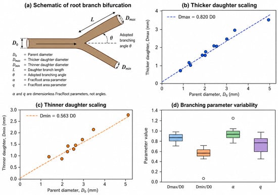
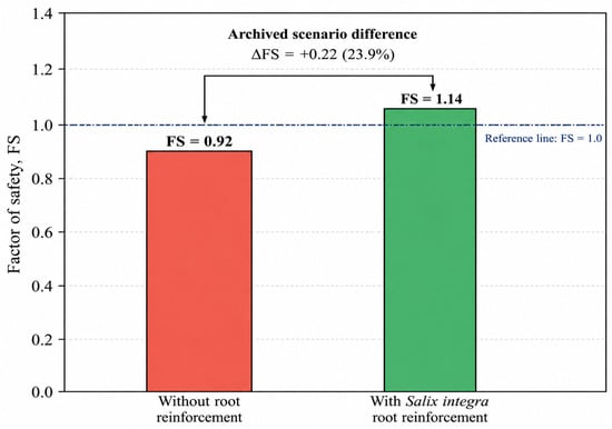
Vegetation-based nature-based solutions can improve shallow slope stability, yet transferring root-scale measurements to slope-scale assessment remains difficult. This study reanalyzes archived mechanical and engineering data for Salix integra used on an ecological canal embankment in northern Jiangsu Province, China. The dataset comprises 36 peak shear stress increments from constrained single-root direct shear tests conducted at four normal stresses and nine root-diameter classes, together with ten bifurcation records used for FracRoot reconstruction. Peak shear stress increment, Δτ, ranged from 2.41 to 39.28 kPa. Normal stress was the strongest statistical predictor within the clamped-end test configuration (r = 0.849, p < 0.001), whereas root diameter showed no significant unadjusted effect. The preserved FracRoot relationships were Dmax = 0.820D0 and Dmin = 0.563D0. An archived deterministic double-wedge calculation reported a factor-of-safety change from 0.92 to 1.14 after inclusion of aggregate root resistance. Because the separate unreinforced peak values, complete shear records, direct field root-depth measurements, planting geometry, and segment-level root-intersection calculations were not preserved, the statistical analysis is restricted to archived increments and the stability result is interpreted as an illustrative scenario rather than a verified design value. The novelty lies in transparently linking archived root-scale testing, branching architecture, and local slope-stability assessment while defining the evidence required for reproducible field-scale validation.
Full article
(This article belongs to the Special Issue Hillslope Hydrology and Slope Stability: A Nature-Based Solution (NBS) Approach)
►▼
Show Figures

Figure 1

Open AccessArticle
Geochemical Variations and Chemical Weathering History of Holocene Coastal Sediments in the Western Bohai Bay
by
Zhen-Ping Cao, Lizhu Tian, Yunzhuang Hu, Changfu Fan, Yongsheng Chen and Fu Wang
Water 2026, 18(16), 1990; https://doi.org/10.3390/w18161990 - 14 Aug 2026
Abstract
Geochemical proxies in coastal sediments are widely applied to reconstruct past climatic and environmental changes, yet their sensitivity to climate versus localized depositional processes remains debated in dynamic land–sea interfaces. Here, we present major, trace, and rare earth element (REE) data from two
[...] Read more.
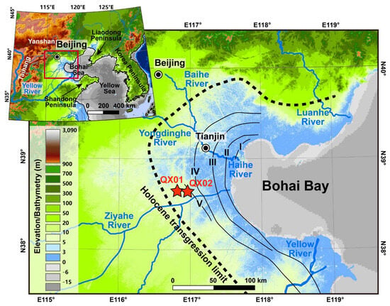
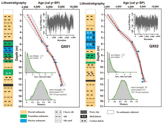
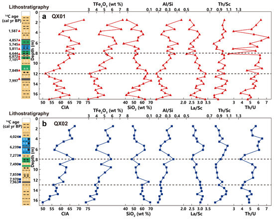
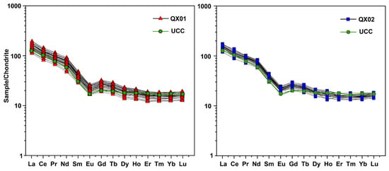
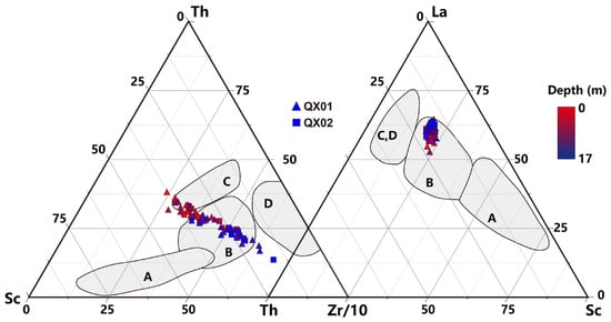
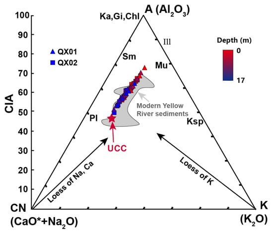
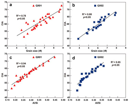
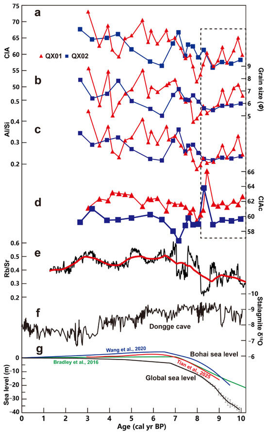
Geochemical proxies in coastal sediments are widely applied to reconstruct past climatic and environmental changes, yet their sensitivity to climate versus localized depositional processes remains debated in dynamic land–sea interfaces. Here, we present major, trace, and rare earth element (REE) data from two Holocene sediment cores (QX01 and QX02) from the western coast of Bohai Bay to decouple provenance, weathering, and hydrodynamic controls. Provenance-sensitive trace element ratios (La/Sc and Th/Sc) and REE fractionation patterns indicate exceptional source stability dominated by the Yellow River and adjacent cratonic catchments throughout the Holocene, eliminating provenance shifts as a confounding variable. Since ~8 ka, an overarching upward increase in raw chemical index of alteration (CIA), accompanied by increasing Al/Si ratios and grain sizes, broadly aligned with the warm and humid Holocene Climate Optimum. Crucially, a highly significant linear relationship between grain size, Al/Si and CIA (R2 > 0.78) demonstrates that raw CIA variations were decisively modulated by sea-level-driven hydrodynamic sorting during the Holocene transgression, which shifted the depositional setting from high-energy fluvial regimes to low-energy marine settings, preferentially trapping fine-grained, clay-hosted aluminosilicates with inherently high CIA values. During the late Holocene (~5 ka to present), stabilizing sea-level conditions shifted the raw records into an elevated plateau punctuated by high-frequency fluctuations and localized geochemical anomalies, reflecting a dynamic interface sensitive to episodic fluvial floods or tidal/storm reworking that periodically introduced coarser, quartz-rich detritus. The resulting sorting-corrected CIAC removes the transgressive clay-trapping artifact and reveals a broad, subdued weathering plateau between ~8 ka and 4 ka BP, consisting with previous Chinese Loess Plateau weathering intensity. These findings highlight that in dynamic marginal-marine sinks, raw silicate weathering indices reflect physical sorting overprints, and hydrodynamic detrending is essential to extract genuine continental paleoclimate signals.
Full article
(This article belongs to the Special Issue Long-Term Coastal Evolution and Morphodynamics: Ecosystem Protection and Coastal Safety, 2nd Edition)
►▼
Show Figures

Figure 1
Open AccessArticle
Identifying Thresholds of Resilience Dimensions for Alternative Regimes of Flood-Control Facilities: A Conceptual Framework
by
Yoonsung Shin, Samuel Park and Jeryang Park
Water 2026, 18(16), 1989; https://doi.org/10.3390/w18161989 - 14 Aug 2026
Abstract
Climate change and aging infrastructure are undermining the resilience of urban flood management systems, reducing their reliability and increasing the likelihood of systemic failure that may culminate in regime shifts. This study develops a conceptual and practitioner-oriented screening framework based on a quantitative
[...] Read more.
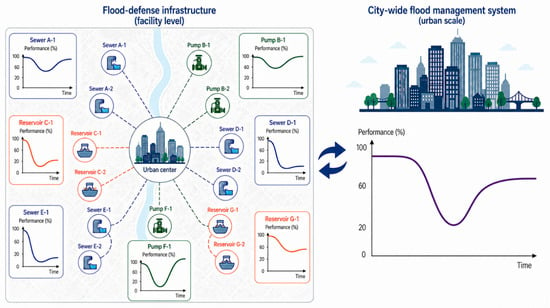
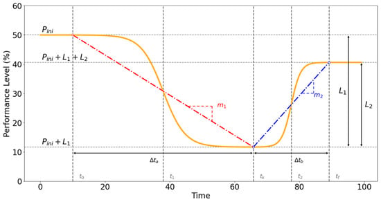
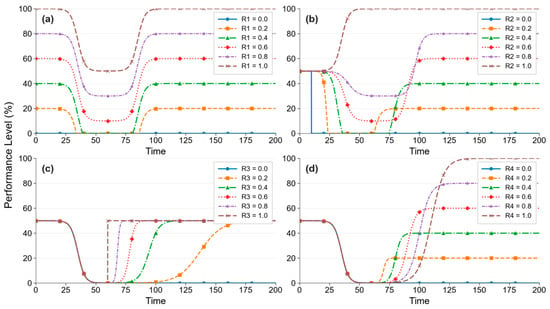
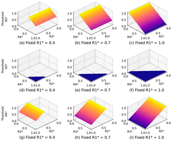
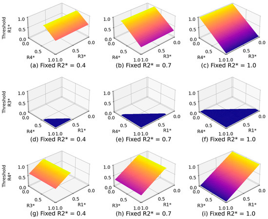
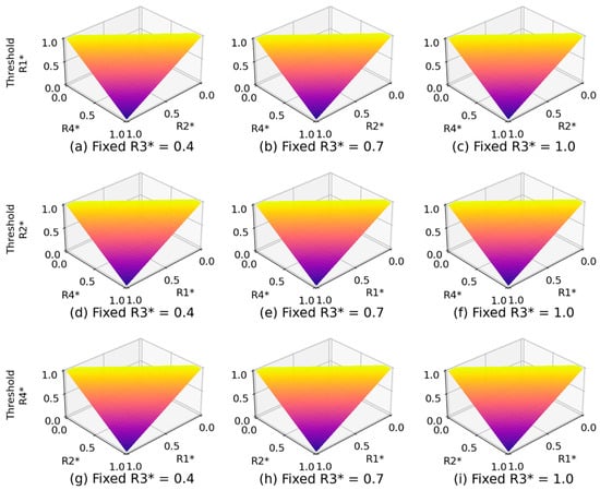
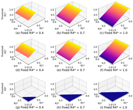
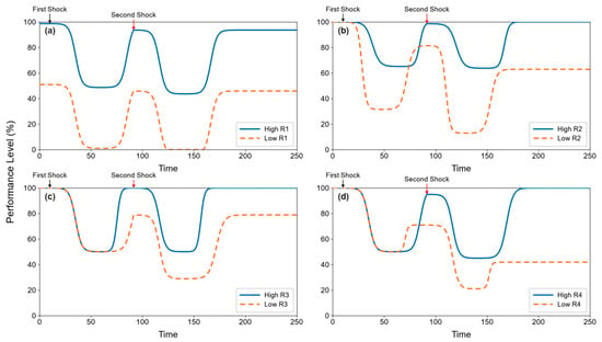
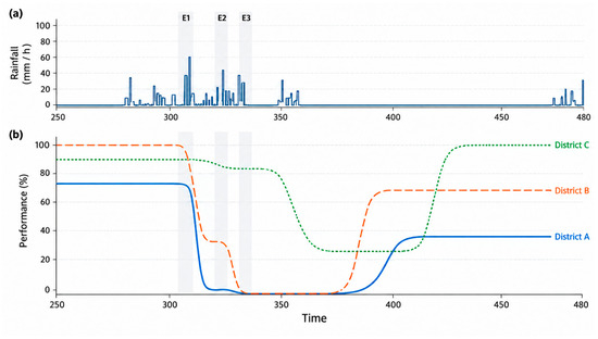
Climate change and aging infrastructure are undermining the resilience of urban flood management systems, reducing their reliability and increasing the likelihood of systemic failure that may culminate in regime shifts. This study develops a conceptual and practitioner-oriented screening framework based on a quantitative mathematical model to examine facility-level resilience and identify threshold conditions that may trigger regime transitions under external disturbances and varying pre-disturbance facility conditions. The framework adopts the composite sigmoid function (CSF) to capture nonlinear performance trajectories of infrastructure systems. Building on this model, this study extends its application by developing a parameterization scheme directly linked to four resilience dimensions: robustness, redundancy, rapidity, and resourcefulness (4Rs), which can be derived from field investigations or expert surveys. The normalized 4R scores are mapped to the CSF parameters, thereby converting static resilience assessment results into degradation and recovery curves. To search for threshold conditions, a parametric analysis was conducted by systematically varying the 4R values across their defined ranges. Rather than indicating a single universal threshold value, the results revealed critical threshold regions formed by specific combinations of the 4R dimensions. Lower robustness reduced the initial performance buffer, and low redundancy accelerated and extended performance degradation, while insufficient rapidity and resourcefulness delayed or limited recovery, increasing the likelihood of transition into an alternative degraded regime. For example, even when R1 and R2 were set to relatively high normalized values of 0.90, and R3 was set to its maximum value of 1.00, full recovery could not be achieved when R4 decreased below approximately 0.20. An illustrative application was conducted using preliminary 4R assessment results for flood-control facilities in three districts of Seoul, Korea. The model-derived trajectories were qualitatively compared with reported historical vulnerability patterns. While this comparison was intended as a contextual assessment rather than an event-specific empirical validation, our framework supports comparative, scenario-based screening of potentially vulnerable facilities for preliminary maintenance and investment prioritization.
Full article
(This article belongs to the Special Issue Global Perspective on Hydrology and Water Resources Management in Complex Urban Areas)
►▼
Show Figures

Figure 1

Open AccessArticle
Biological Community and Ecosystem Responses to Dam Removal in a Mountain River
by
Xingyuan She, Bo Li, Shufeng He, Wei Jiang, Ruxia Qiao, Xia Zhang and Bixin Chen
Water 2026, 18(16), 1988; https://doi.org/10.3390/w18161988 - 14 Aug 2026
Abstract
Dam removal is a direct measure to restore river connectivity, but the assessment of its ecological effects has long been constrained by the lack of continuous monitoring data across multiple trophic levels. Based on eight years (2017–2024) of continuous field monitoring data from
[...] Read more.
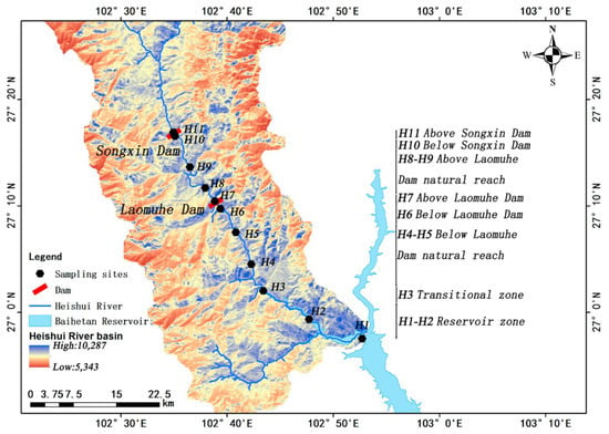
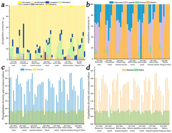
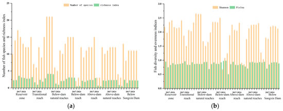
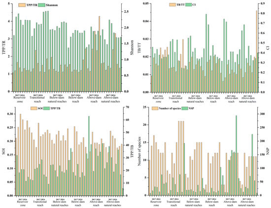
Dam removal is a direct measure to restore river connectivity, but the assessment of its ecological effects has long been constrained by the lack of continuous monitoring data across multiple trophic levels. Based on eight years (2017–2024) of continuous field monitoring data from the Heishui River, a first-order tributary of the Jinsha River, this study systematically analyzed the spatiotemporal dynamics of phytoplankton, zooplankton, and fish communities before and after the removal of the Laomuhe Dam. Ecopath models were constructed annually for six ecological units to quantitatively assess the restructuring effect of dam removal on the structure and function of the aquatic food web. The results showed that: (1) Plankton communities were highly sensitive to the disturbance of dam removal. In the early stage after dam removal (2019), the diversity of phytoplankton and zooplankton across the whole river suffered a cliff-like decline; the Shannon index of zooplankton in the former reservoir area plummeted from 3.06 to 0.81. During the recovery period, diatoms and rotifers acted as pioneer groups for phytoplankton and zooplankton, respectively, and were the first to recover. By 2024, the proportion of copepods rose to the highest level during the study period, and the dominant group of the community shifted from rotifers to copepods. (2) Fish communities responded rapidly and positively to the restoration of connectivity. In the upstream reach adjacent to the dam site, the number of species increased from 3 before dam removal to 12 afterward; in the downstream reach, it increased from 2 to 15, with diversity index increases of 172% and 246%, respectively. (3) Ecopath model analysis revealed a recovery pattern of “structure first, function delayed” in the food web—species number and community composition could be re-established shortly after connectivity restoration, but the recovery of functional indicators such as the system omnivory index (SOI) and energy transfer efficiency (total primary production/total respiration, TPP/TR) lagged significantly behind. By the end of the study period, the upstream dewatered reach had not yet reached the level of the natural reference reach, and the downstream recovery rate and degree were better than those upstream. This study provides comprehensive time-series evidence for the long-term response of aquatic ecosystems to low-head dam removal and offers valuable references for guiding adaptive management of mountain rivers after dam removal.
Full article
(This article belongs to the Section Biodiversity and Functionality of Aquatic Ecosystems)
►▼
Show Figures

Figure 1

Open AccessArticle
Deciphering Multi-Scale Impacts of Urban Morphology on Flooding for Climate-Resilient Planning: An Explainable AI Approach
by
Feng Wang, Daxing Zuo, Jian Zhou, Maochuan Hu, Yong Jie Wong and Min Yu
Water 2026, 18(16), 1987; https://doi.org/10.3390/w18161987 - 14 Aug 2026
Abstract
Urban flooding is shaped by urban morphology, but the inferred relationships can change with the spatial units used to represent flooding and urban form. Existing studies often report results for a selected spatial configuration, leaving unclear whether predictive performance and identified dominant predictors
[...] Read more.
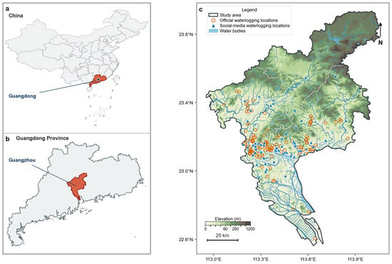
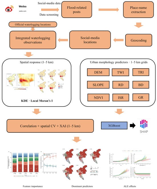
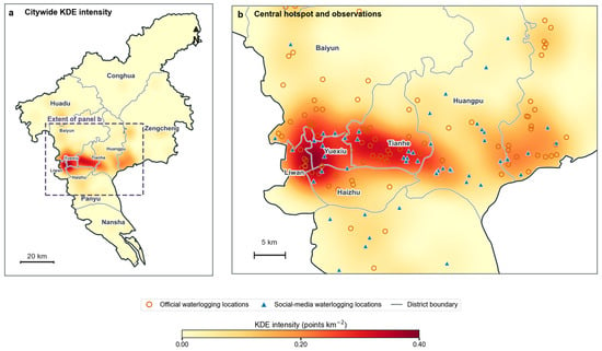
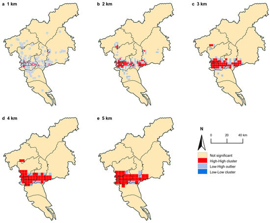
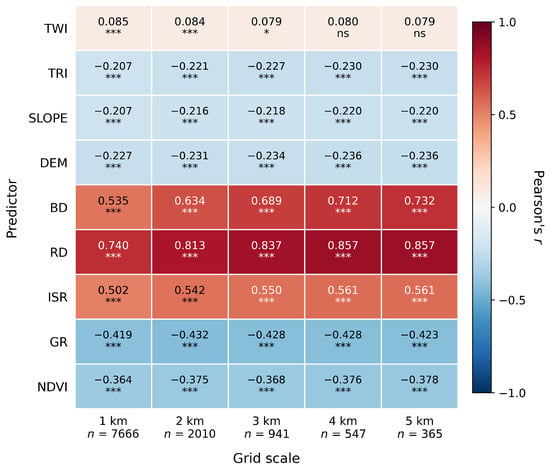
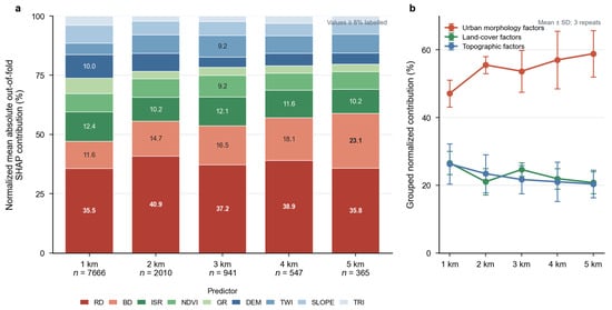
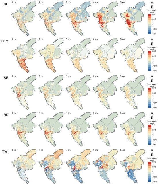
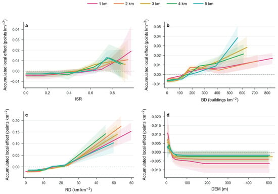
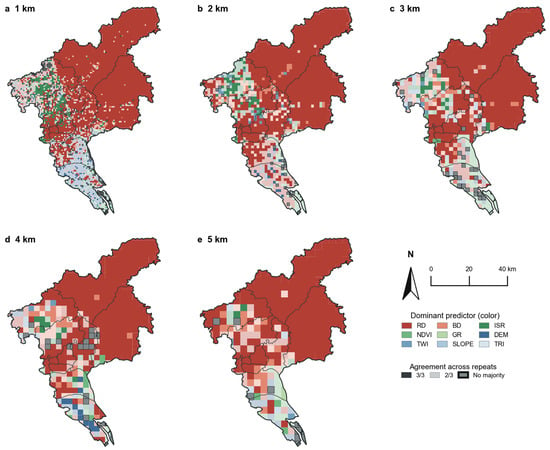
Urban flooding is shaped by urban morphology, but the inferred relationships can change with the spatial units used to represent flooding and urban form. Existing studies often report results for a selected spatial configuration, leaving unclear whether predictive performance and identified dominant predictors remain robust when analytical scale, grid placement, and spatially separated validation are varied. Using the 22 May 2020 Guangzhou storm as an event-specific case, this study evaluates the robustness of multi-scale morphology–flood associations to these spatial analytical choices. The analysis integrated 119 unique official waterlogging locations with 67 geocoded social-media locations. After removing four cross-source matches within 100 m, 182 unique observations were used to construct a kernel density response surface and examine 1–5 km analytical grids. Spatial autocorrelation, repeated nested geographic cross-validation of XGBoost, out-of-fold SHAP attribution, and accumulated local effects (ALEs) were used to quantify scale-dependent patterns. Global Moran’s I increased from 0.125 at 1 km to 0.524 at 4 km and decreased to 0.479 at 5 km (all permutation p < 0.001). Mean spatially validated R2 ranged from 0.483 to 0.610, with the highest R2 and lowest RMSE at 4 km, although residual spatial autocorrelation remained. Road density was the largest individual SHAP contributor at every scale (35.54–40.89%). ALE indicated broad positive associations for road density, building density, and impervious surface ratio and a negative association for elevation, without supporting universal sharp thresholds. These event-specific results show that analytical scale and grid placement should be reported explicitly when morphology-based evidence is used for flood screening and climate-resilient planning.
Full article
(This article belongs to the Section Urban Water Management)
►▼
Show Figures

Figure 1
Open AccessArticle
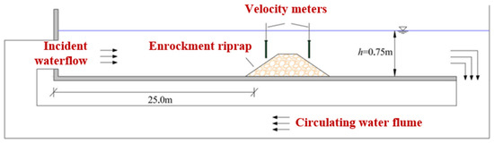
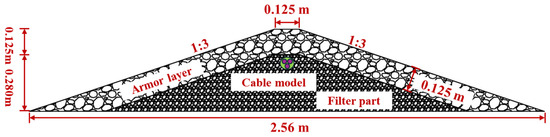
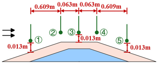
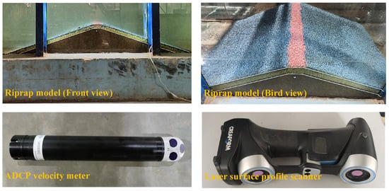
Numerical Study on the Stability of a Riprap for Submarine Cables and the Protective Solution Under Waterflow Incidence
by
Songsong Yu, Yadong Wang, Erxian Zeng, Heng Feng and Zhen Liu
Water 2026, 18(16), 1986; https://doi.org/10.3390/w18161986 - 13 Aug 2026
Abstract
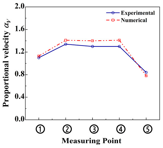
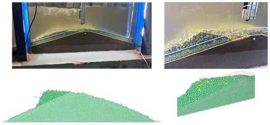
This study presents a numerical investigation into riprap stability for submarine cable protection under high-speed incident waterflow conditions. A coupled CFD-DEM numerical model, implemented within the ANSYS 2024 R1 platform, was developed and validated against controlled laboratory experiments. The stability of the riprap
[...] Read more.
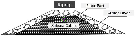
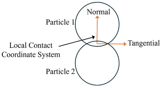
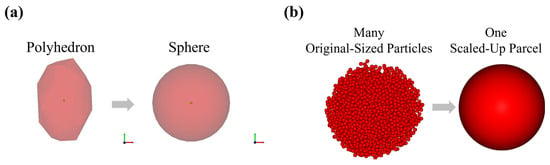
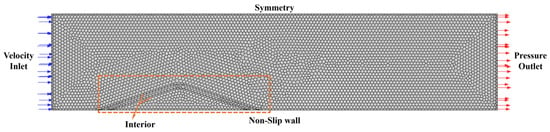
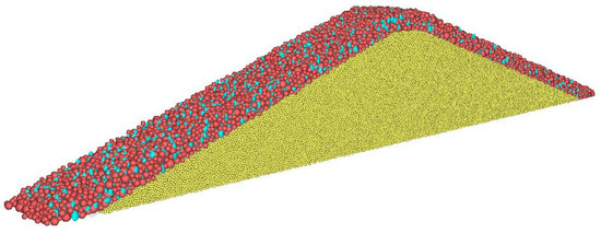
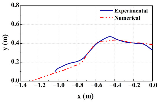
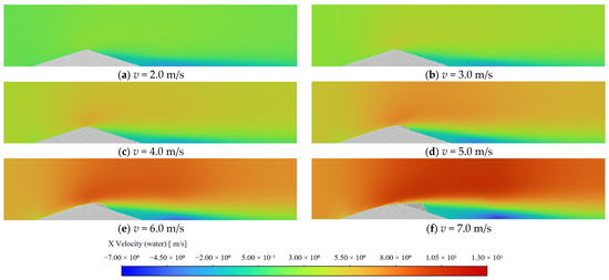
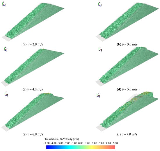
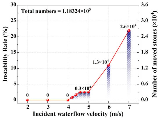
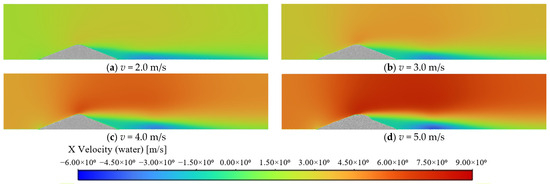
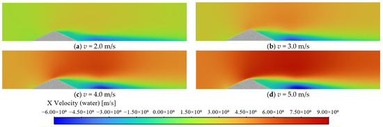
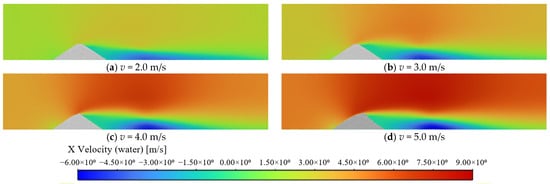
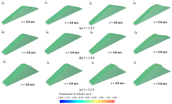
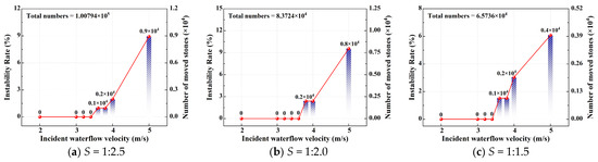
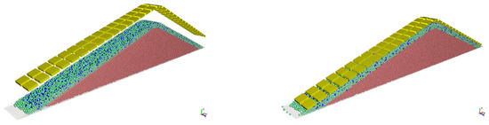
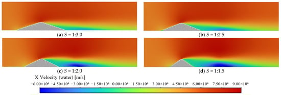
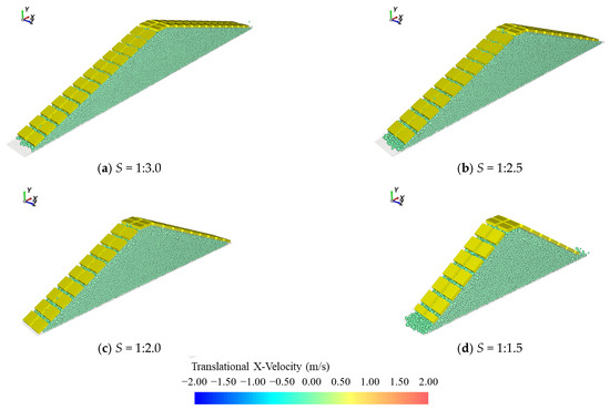
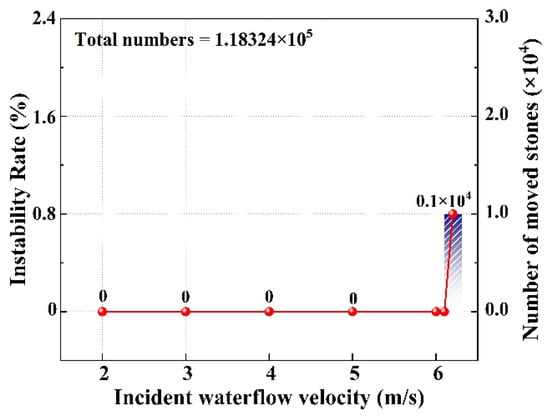
This study presents a numerical investigation into riprap stability for submarine cable protection under high-speed incident waterflow conditions. A coupled CFD-DEM numerical model, implemented within the ANSYS 2024 R1 platform, was developed and validated against controlled laboratory experiments. The stability of the riprap was systematically evaluated across a range of incident waterflow velocities and slope ratios. Numerical results show that localized high-velocity waterflow regions—characterized by intense shear stress—are the predominant destabilizing mechanism governing riprap failure. Elevated incident waterflow velocity intensified localized hydrodynamic disturbances over the riprap top and upstream-facing slope, triggering incipient motion, stone detachment, and subsequent transport of surface armor rocks. As the riprap slope became steeper, the threshold waterflow velocity for instability decreased from 4.2 m/s to 3.6 m/s. Furthermore, interconnecting plates—deployed as an active protective solution—suppress flow-induced erosion over the riprap surface and mitigate localized instability, thereby enhancing global structural stability.
Full article
(This article belongs to the Special Issue Advanced Fluid Mechanics in Hydraulic Engineering: Turbulence, Multiphase Flows, and Sediment Dynamics)
►▼
Show Figures

Figure 1
Open AccessArticle
Optimization of the Symbiotic System Between Sulfate-Reducing Bacteria and Sulfide-Oxidizing Bacteria and Study on the Mechanism of Repairing Acidic Mine Drainage
by
Yangyang Jiang, Junzhen Di, Yicheng Sun and Shengxia Huang
Water 2026, 18(16), 1985; https://doi.org/10.3390/w18161985 - 13 Aug 2026
Abstract
Acidic mine drainage (AMD) rich in heavy metals and sulfates causes severe environmental hazards. SRB and SOB are ideal remediation strains, yet their microaerophilic symbiotic metabolism and metabolite characteristics remain ambiguous. This study explores their symbiotic metabolic mechanisms, optimizing culture parameters via response
[...] Read more.
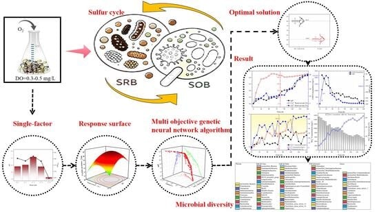
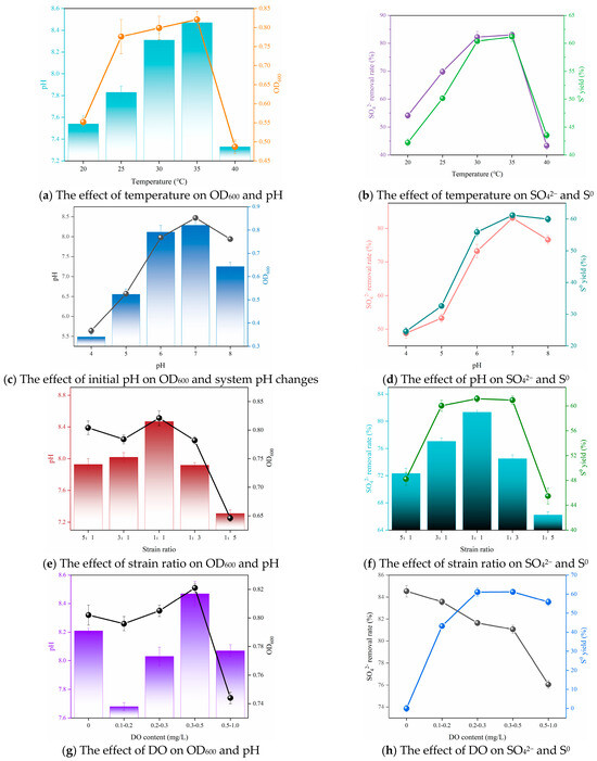
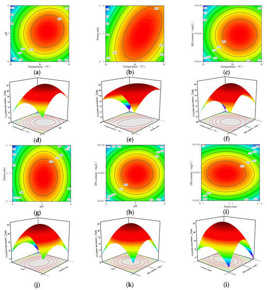
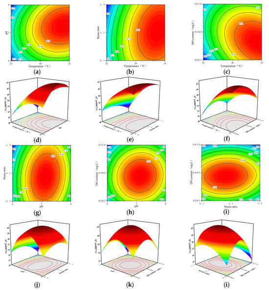
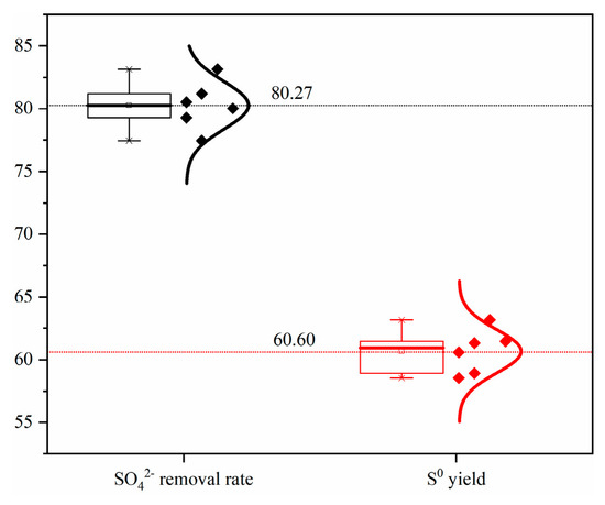
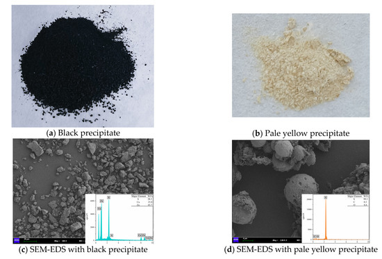
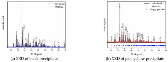
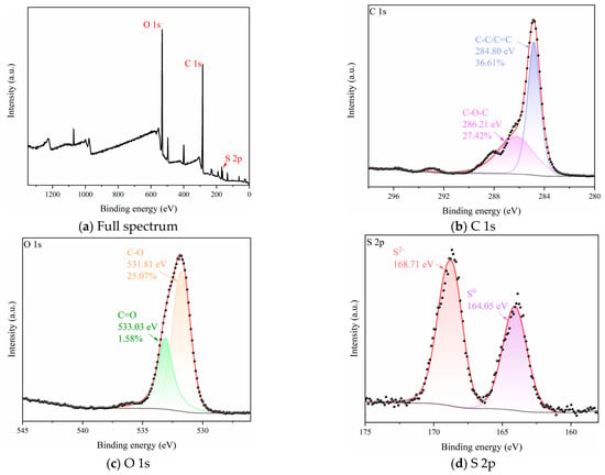
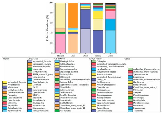
Acidic mine drainage (AMD) rich in heavy metals and sulfates causes severe environmental hazards. SRB and SOB are ideal remediation strains, yet their microaerophilic symbiotic metabolism and metabolite characteristics remain ambiguous. This study explores their symbiotic metabolic mechanisms, optimizing culture parameters via response surface methodology and multi-objective genetic neural network algorithms. The optimal conditions are 32.60 °C, pH = 7.20, strain ratio at 1:1 and DO = 0.3–0.5 mg/L, achieving 80.27% sulfate removal and 60.60% elemental sulfur production. Under optimized microaerobic symbiosis, Cu2+, Zn2+ and sulfate removal rates reach 90.16%, 80.59% and 63.97%, with a S0 yield of 64.67%. SEM-EDS, XRD, XPS, and microbial diversity analysis verify that heavy metals are eliminated as metal sulfide precipitates, and most of the sulfate transforms into recyclable elemental sulfur.
Full article
(This article belongs to the Section Wastewater Treatment and Reuse)
►▼
Show Figures

Graphical abstract
Open AccessArticle
Rooftop Rainwater Retention Potential in Former Agricultural Areas Under a Changing Climate: A True Orthophoto-Based Assessment of a Suburbanizing Polish Village
by
Tomasz Oberski, Renata Ďuračiová and Mohammad M. Jaber
Water 2026, 18(16), 1984; https://doi.org/10.3390/w18161984 - 13 Aug 2026
Abstract
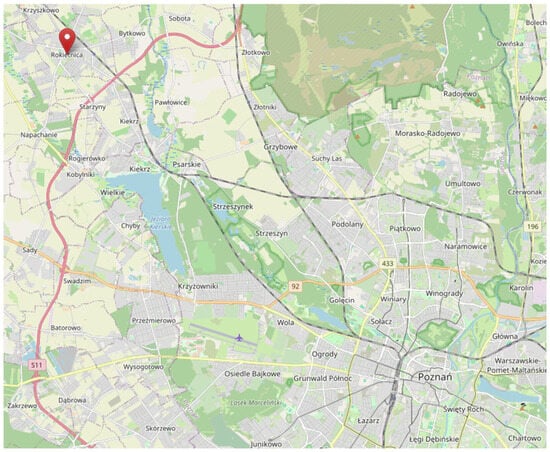
Rapid conversion of agricultural land into low-density housing reshapes local water balances at a time when climate change is intensifying hydrological extremes in Central Europe. This study evaluates the rooftop rainwater harvesting (RWH) potential of a newly urbanized housing estate in Rokietnica (Greater
[...] Read more.
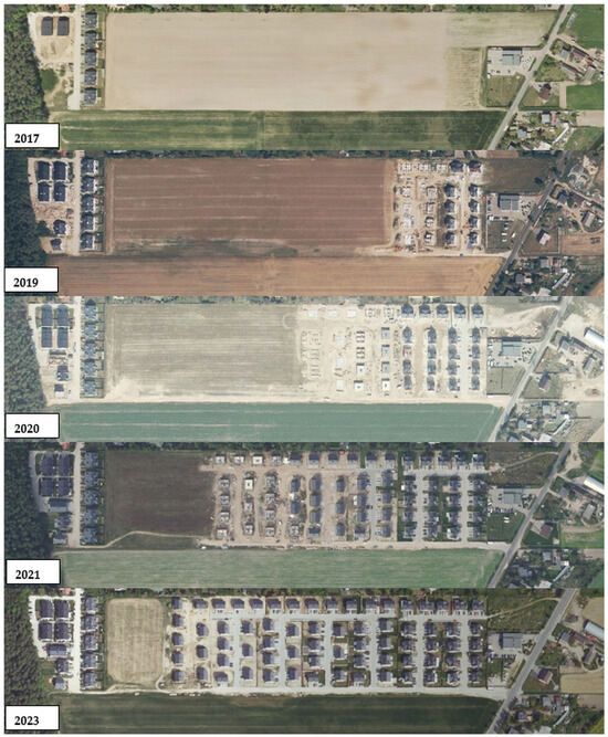
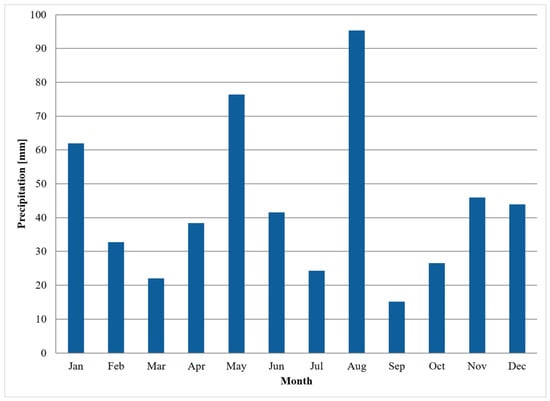
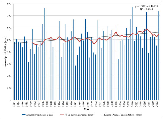
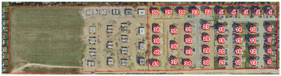
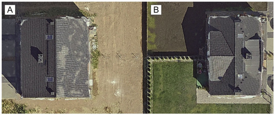
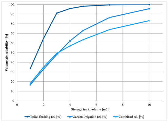
Rapid conversion of agricultural land into low-density housing reshapes local water balances at a time when climate change is intensifying hydrological extremes in Central Europe. This study evaluates the rooftop rainwater harvesting (RWH) potential of a newly urbanized housing estate in Rokietnica (Greater Poland Voivodeship, Poland) using a publicly available true orthophoto (5 cm ground sampling distance) as a reliable geometric data source. Roof footprints of 41 single-family buildings (5305 m2 in total) were manually vectorized in QGIS and combined with monthly precipitation recorded at the nearest meteorological station (Złotniki) in a simplified volumetric model (V = A × R × C, with C = 0.95). To place the single reference year (2021) in its climatic context, the full 72-year precipitation record (1952–2023) was analyzed using the Mann–Kendall test and Sen’s slope estimator. The results indicate a harvestable volume of approximately 2642 m3 in 2021 (53–73 m3 per building; mean 64 m3), with May and August jointly accounting for almost one-third of the annual total. Annual precipitation at Złotniki exhibits a statistically significant increasing trend (+1.29 mm yr−1; p = 0.028) concentrated in winter and early spring, while summer totals remain trendless but highly variable. A monthly storage simulation driven by the recent 30-year record (1994–2023) shows that summer garden irrigation, the dominant practical application of harvested rainwater in Polish households, is considerably harder to meet from the roof alone than year-round indoor non-potable uses: a 5 m3 tank covers approximately 73% of the seasonal demand of a 100 m2 garden plot, while a 3–5 m3 tank would theoretically secure 91–98% of toilet-flushing demand for a four-person household. Under Poland’s national rainwater co-financing scheme (formerly “Moja Woda,” active 2020–2024, succeeded by “Mikroretencja” from June 2026), simple payback periods of roughly 3–7 years make household installations financially defensible. The findings suggest that true orthophotos enable rapid, low-cost RWH assessments in dynamically developing suburbs, and that storage sizing should anticipate the ongoing seasonal redistribution of precipitation under climate change. To our knowledge, this is the first study to combine free national true-orthophoto imagery, a 72-year Mann–Kendall trend analysis, and a subsidy-linked storage-reliability simulation within a single suburban rainwater-harvesting assessment.
Full article
(This article belongs to the Section Urban Water Management)
►▼
Show Figures

Figure 1
Open AccessArticle
Analysis and Characterization of Sludge Produced by Natural Extract-Facilitated Electrocoagulation for Hardness Removal
by
Neali Valencia-Espinoza, Brenda S. Morales-Verdin, Daniel M. Paredes-Molina, Fabricio G. Mendez-Landin, James McGree, Alain R. Picos-Benítez, Patricio J. Espinoza-Montero, Alejandro Vega-Rios, Ashantha Goonetilleke, Locksley F. Castañeda, Erick R. Bandala and Oscar M. Rodriguez-Narvaez
Water 2026, 18(16), 1983; https://doi.org/10.3390/w18161983 - 13 Aug 2026
Abstract
This study focused on the generation and characterization of sludge produced by electrocoagulation (EC) combined with Moringa oleifera seed extract (MOSE) to remove water hardness. First, an experimental data set was generated and used as the baseline data for mathematical modeling to identify
[...] Read more.
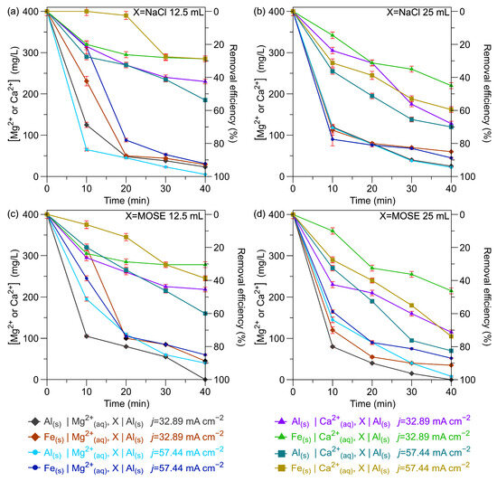
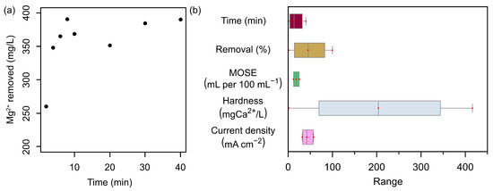
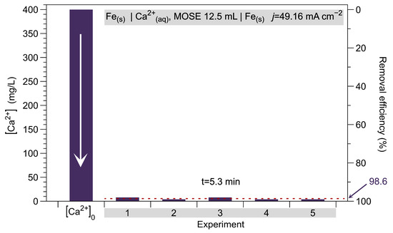
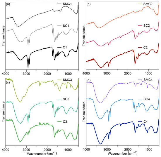
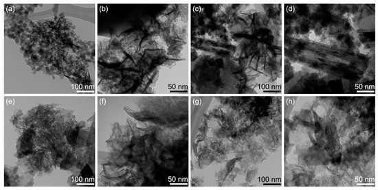
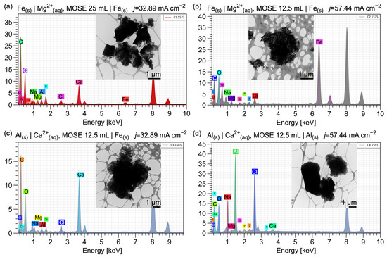
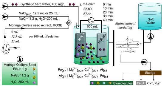
This study focused on the generation and characterization of sludge produced by electrocoagulation (EC) combined with Moringa oleifera seed extract (MOSE) to remove water hardness. First, an experimental data set was generated and used as the baseline data for mathematical modeling to identify the effects of different parameters on Ca2+ and Mg2+ ion hardness removal. Then, using the generated data set, operational conditions were optimized using neural networks integrated with a genetic algorithm, resulting in the selection of Fe electrodes, 12.5 mL of MOSE per 100 mL of water, a current density (j) of 49.16 mA cm−2, and a reaction time of 5.3 min, considering Ca2+ ions as the sample contaminant. Additionally, machine learning analysis identified contaminant type, reaction time, and cathode material as the most influential variables affecting sludge formation, with optimal conditions identified for both Ca2+ and Mg2+ ion systems. For all the mathematical models, experimental validation was performed. The MOSE extract was characterized for the presence of proteins, polyphenols, flavonoids, and polysaccharides, which provide functional groups that promote aggregation and floc development. Sludge characterization by FT-IR, TGA, and TEM revealed the formation of organic–inorganic hybrid matrices composed of biomolecules interacting with electrochemically generated Fe3+ and Al3+ species, as well as Ca2+ and Mg2+ ions. These results highlight the role of plant-derived biomolecules in modulating the sludge structure and composition, providing insight into the mechanisms of sludge formation and the implications for handling and valorization of EC-based water treatment systems.
Full article
(This article belongs to the Section Wastewater Treatment and Reuse)
►▼
Show Figures

Figure 1
Open AccessArticle
Multi-Year Variation Characteristics and Driving Forces of Groundwater Levels in the Yibin Area, Southern Sichuan, China
by
Xiaobo Lv, Bin Liu, Jibin Chen, Kailong Wang and Jingwen Kang
Water 2026, 18(16), 1982; https://doi.org/10.3390/w18161982 - 13 Aug 2026
Abstract
To support groundwater protection and sustainable utilization in southern Sichuan, this study aims to clarify the multi-year variation characteristics of groundwater levels (GWLs) and identify their main driving factors in the Yibin region. In this paper, 2019–2024 GWL monitoring records, hydrometeorological data, and
[...] Read more.
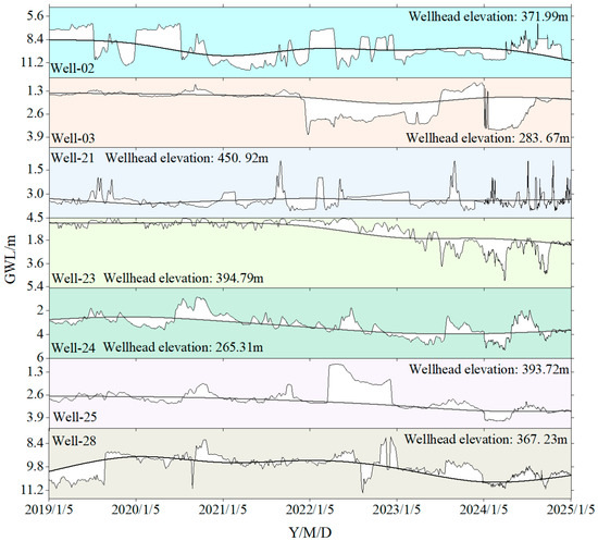
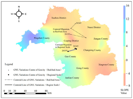
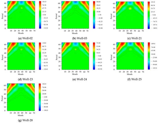
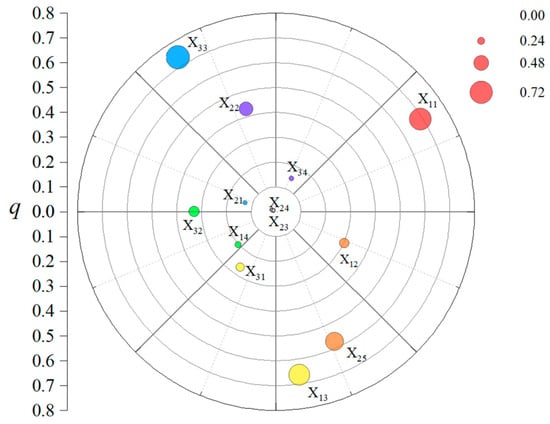
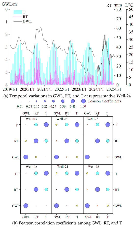
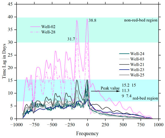
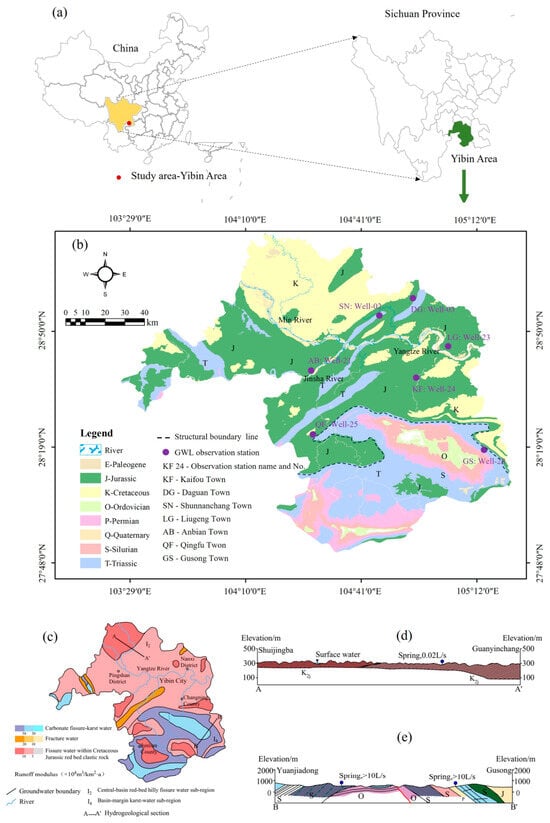
To support groundwater protection and sustainable utilization in southern Sichuan, this study aims to clarify the multi-year variation characteristics of groundwater levels (GWLs) and identify their main driving factors in the Yibin region. In this paper, 2019–2024 GWL monitoring records, hydrometeorological data, and multi-source geospatial datasets were integrated. Trend analysis, centroid migration modeling, continuous wavelet transform, Geodetector, and Fast Fourier Transform-based cross-correlation analysis were used to examine GWL dynamics and their controlling factors. The results show that GWL depth exhibits a distinct “shallow-northwest to deep-southeast” pattern, which is closely associated with regional aquifer lithology and hydrogeological conditions, with the most pronounced fluctuations occurring in the northwest. From 2019 to 2024, GWLs showed multi-scale periodic oscillations, with dominant periods of 50–64 months. GWLs in the red-bed region showed a continuous and slow decline, whereas those in the carbonate rock region remained relatively stable with a slight decreasing trend. Among the 13 hydrometeorological, geographic, and human activity factors, cropland area and precipitation had the strongest individual explanatory power. Their interactions with other factors produced nonlinear or bi-factor enhancement effects. The sustained expansion of cropland, together with declining precipitation, suggests that the observed phased and gradual decline in GWLs during 2019–2024 may be associated with a combined climate–human activity forcing mechanism. Annual GWL peaks were weakly and positively correlated with rainfall and temperature, while the lag between rainfall infiltration and GWL response varied with lithology.
Full article
(This article belongs to the Section Hydrogeology)
►▼
Show Figures

Figure 1
Journal Menu
► ▼ Journal Menu-
- Water Home
- Aims & Scope
- Editorial Board
- Reviewer Board
- Topical Advisory Panel
- Early Career Editorial Board
- Instructions for Authors
- Special Issues
- Topics
- Sections
- Article Processing Charge
- Indexing & Archiving
- Editor’s Choice Articles
- Most Cited & Viewed
- Journal Statistics
- Journal History
- Journal Awards
- Society Collaborations
- Conferences
- Editorial Office
Journal Browser
► ▼ Journal BrowserHighly Accessed Articles
Latest Books
E-Mail Alert
News
Topics
Topic in
Applied Sciences, Clean Technol., Energies, Membranes, Polymers, Sustainability, Water
New Advances in Membrane Technology and Its Contribution to Sustainability
Topic Editors: Patricia Luis Alconero, Bart Van der BruggenDeadline: 12 September 2026
Topic in
Agriculture, Climate, Energies, Land, Water
Energy, Environment and Climate Policy Analysis
Topic Editors: Xiaoqian Song, Jiajie LiDeadline: 30 September 2026
Topic in
Clean Technol., Materials, Molecules, Recycling, Water, Nanomaterials, Catalysts
Advanced Composites for Waste Valorization and Pollutant Degradation
Topic Editors: Iwona Kuzniarska-Biernacka, Ana Sofia MestreDeadline: 31 October 2026
Topic in
Applied Sciences, Hydrology, JMSE, Water, Eng
Hydraulic Engineering and Modelling
Topic Editors: Guohua Zhang, Feng Xiong, Xiaobo ZhangDeadline: 30 November 2026
Conferences
Special Issues
Special Issue in
Water
Agricultural Water Management—Coupling Hydrological and Crop Models
Guest Editors: Yunfei Wang, Danyang YuDeadline: 15 August 2026
Special Issue in
Water
Smart Design and Management of Water Distribution Systems
Guest Editors: Xiao Zhou, Shipeng ChuDeadline: 20 August 2026
Special Issue in
Water
Sustainable Water Management in Agricultural Irrigation
Guest Editor: Dat Q TranDeadline: 20 August 2026
Special Issue in
Water
Water-Related Landslide Hazard Process and Its Triggering Events—2nd Edition
Guest Editor: Wei LiuDeadline: 20 August 2026