Next Issue
Volume 8, March
Previous Issue
Volume 8, January


Geosciences, Volume 8, Issue 2 (February 2018) – 45 articles

Cover Story (view full-size image): 
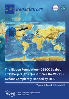
Despite many of years of research effort, only a small fraction of the world ocean’s seafloor has been mapped, greatly limiting our ability to explore and understand critical ocean and seafloor processes. This paper describes a new international project, called Seabed 2030, sponsored by the Nippon Foundation and GEBCO, with the objective of advancing the complete mapping of the world ocean by 2030. Seabed 2030 envisages the establishment of two consolidated agencies: comprehensively distributed regional data assembly and coordination centers (RDACCs) and a Global Data Assembly and Coordination Center (GDACC). The RDACCs will retrieve from their respective regions existing data that are not yet public, making them available through public databases, while the GDACC will integrate the regional grids into a global grid that will be accessible to users worldwide.View this paper.
  • Issues are regarded as officially published after their release is announced to the table of contents alert mailing list.
  • You may sign up for e-mail alerts to receive table of contents of newly released issues.
  • PDF is the official format for papers published in both, html and pdf forms. To view the papers in pdf format, click on the "PDF Full-text" link, and use the free Adobe Reader to open them.
Order results
Result details
Section
Select all
Export citation of selected articles as:
19 pages, 2954 KiB  
Technical Note
Examples of Application of GASAKe for Predicting the Occurrence of Rainfall-Induced Landslides in Southern Italy
by Oreste Terranova, Stefano Luigi Gariano, Pasquale Iaquinta, Valeria Lupiano, Valeria Rago and Giulio Iovine
Geosciences 2018, 8(2), 78; https://doi.org/10.3390/geosciences8020078 - 24 Feb 2018
Cited by 5 | Viewed by 4432
Abstract
GASAKe is an empirical-hydrological model aimed at forecasting the time of occurrence of landslides. Activations can be predicted of either single landslides or sets of slope movements of the same type in a homogeneous environment. The model requires a rainfall series and [...] Read more.
GASAKe is an empirical-hydrological model aimed at forecasting the time of occurrence of landslides. Activations can be predicted of either single landslides or sets of slope movements of the same type in a homogeneous environment. The model requires a rainfall series and a set of dates of landslide activation as input data. Calibration is performed through genetic algorithms, and allows for determining a family of optimal kernels to weight antecedent rainfall properly. As output, the mobility function highlights critical conditions of slope stability. Based on suitable calibration and validation samples of activation dates, the model represents a useful tool to be integrated in early-warning systems for geo-hydrological risk mitigation purposes. In the present paper, examples of application to three rock slides in Calabria and to cases of soil slips in Campania are discussed. Calibration and validation are discussed, based on independent datasets. Obtained results are either excellent for two of the Calabrian rock slides or just promising for the remaining case studies. The best performances of the model take advantage of an accurate knowledge of the activation history of the landslides, and a proper hydrological characterization of the sites. For such cases, GASAKe could be usefully employed within early-warning systems for geo-hydrological risk mitigation and Civil Protection purposes. Finally, a new release of the model is presently under test: its innovative features are briefly presented. Full article
(This article belongs to the Special Issue Hydrological Hazard: Analysis and Prevention)
Show Figures

Figure 1

11 pages, 3284 KiB  
Article
Simulating the Influence of Buildings on Flood Inundation in Urban Areas
by Riccardo Beretta, Giovanni Ravazzani, Carlo Maiorano and Marco Mancini
Geosciences 2018, 8(2), 77; https://doi.org/10.3390/geosciences8020077 - 24 Feb 2018
Cited by 28 | Viewed by 4596
Abstract
Two-dimensional hydraulic modeling is fundamental to simulate flood events in urban area. Key factors to reach optimal results are detailed information about domain geometry and utility of hydrodynamic models to integrate the full or simplified Saint Venant equations in complex geometry. However, in [...] Read more.
Two-dimensional hydraulic modeling is fundamental to simulate flood events in urban area. Key factors to reach optimal results are detailed information about domain geometry and utility of hydrodynamic models to integrate the full or simplified Saint Venant equations in complex geometry. However, in some cases, detailed topographic datasets that represent the domain geometry are not available, so approximations—such as diffusive wave equation—is introduced whilst representing urban area with an adjusted roughness coefficient. In the present paper, different methods to represent buildings and approximation of the Saint Venant equations are tested by performing experiments on a scale physical model of urban district in laboratory. Simplified methods are tested for simulation of a real flood event which occurred in 2013 in the city of Olbia, Italy. Results show that accuracy of simulating flow depth with a detailed geometry is comparable to the one achieved with an adjusted roughness coefficient. Full article
(This article belongs to the Special Issue Hydrological Hazard: Analysis and Prevention)
Show Figures

Figure 1

24 pages, 8230 KiB  
Article
A Risk-Based Approach to Shelter Resilience following Flood and Typhoon Damage in Rural Philippines
by Victoria Stephenson, Andrew Finlayson and Luisa Miranda Morel
Geosciences 2018, 8(2), 76; https://doi.org/10.3390/geosciences8020076 - 22 Feb 2018
Cited by 15 | Viewed by 12801
Abstract
The Philippines is exposed to numerous typhoons every year, each of which poses a potential threat to livelihoods, shelter, and in some cases life. Flooding caused by such events leads to extensive damage to land and buildings, and the impact on rural communities [...] Read more.
The Philippines is exposed to numerous typhoons every year, each of which poses a potential threat to livelihoods, shelter, and in some cases life. Flooding caused by such events leads to extensive damage to land and buildings, and the impact on rural communities can be severe. The global community is calling for action to address and achieve disaster risk reduction for communities and people exposed to such events. Achieving this requires an understanding of the nature of the risks that flooding and typhoons pose to these communities and their homes. This paper presents the findings from a field based case study assessment of three rural settlements in the Philippines, where typhoons and associated flooding in recent years has caused significant damage to houses and livelihoods, leading to the reconstruction of homes that more often than not reproduce similar structural vulnerabilities as were there before these hazards occurred. This work presents a methodology for risk assessment of such structures profiling the flood and wind hazards and measuring physical vulnerability and the experience of communities affected. The aim of the work is to demonstrate a method for identifying risks in these communities, and seeks to address the challenge faced by practitioners of assisting communities in rebuilding their homes in more resilient ways. The work set out here contributes to the discussion about how best to enable practitioners and communities to achieve the sought for risk reduction and especially highlights the role that geoscience and engineering can have in achieving this ambition. Full article
(This article belongs to the Special Issue Integrated Risk Analysis and Management of Floods)
Show Figures

Figure 1

8 pages, 4622 KiB  
Article
Integrated Study of Lithofacies Identification—A Case Study in X Field, Sabah, Malaysia
by Jia Qi Ngui, Maman Hermana, Deva Ghosh and Wan Ismail Wan Yusof
Geosciences 2018, 8(2), 75; https://doi.org/10.3390/geosciences8020075 - 20 Feb 2018
Cited by 7 | Viewed by 5134
Abstract
Understanding subsurface geology is essential for oil and gas exploration. Seismic facies interpretation is very useful in investigating this concept. The interpretation of the depositional setting of the X Field is achieved by integrating the seismic facies characteristics on 3D seismic data and [...] Read more.
Understanding subsurface geology is essential for oil and gas exploration. Seismic facies interpretation is very useful in investigating this concept. The interpretation of the depositional setting of the X Field is achieved by integrating the seismic facies characteristics on 3D seismic data and well log data. Both the seismic and well log data are widely used in hydrocarbon exploration to map the subsurface, as they complement each other. Well logs yield the vertical resolution of the subsurface geology at the drilled well, whereas seismic data reveal the lateral continuity. The objective of this paper is to demonstrate the integration of 3D seismic data and well log data for lithofacies identification. Interpretation and analysis of lithofacies is carried out through the integration of the characteristics of seismic reflections with well information (logs). Horizons are interpreted based on the variation in seismic reflections on the seismic section, which is caused by the change in geology within seismic sequences. Well logs give detailed information at the points where the wells were drilled. Interpolating between these points and extrapolating away from the points into undrilled areas can be helpful in providing a better geological knowledge of an area. The result of this integrated study depicts the lithofacies in the area. This integrated study will provide a better insight with higher degree of reliability to the facies distribution and depositional setting of the X Field. The geological and geophysical aspects of the field will be documented. Full article
Show Figures

Figure 1

13 pages, 21940 KiB  
Article
Diffraction Enhancement Through Pre-Image Processing: Applications to Field Data, Sarawak Basin, East Malaysia
by Yasir Bashir, Deva Prasad Ghosh, Hammad Tariq Janjuhah and Chow Weng Sum
Geosciences 2018, 8(2), 74; https://doi.org/10.3390/geosciences8020074 - 18 Feb 2018
Cited by 9 | Viewed by 6068
Abstract
The future exploration plans of the industry is to find a small-scale reservoir for possible economic hydrocarbon reserves. These reserves could be illuminated by the super-resolution of full seismic data, including fractured zones, pinch-outs, channel edges, small-scale faults, reflector unconformities, salt flanks, karst, [...] Read more.
The future exploration plans of the industry is to find a small-scale reservoir for possible economic hydrocarbon reserves. These reserves could be illuminated by the super-resolution of full seismic data, including fractured zones, pinch-outs, channel edges, small-scale faults, reflector unconformities, salt flanks, karst, caves and fluid fronts, which are generally known as small scattering objects. However, an imaging approach that includes the diffraction event individually and images it constitutes a new approach for the industry; it is known as diffraction imaging. This paper documents results of a seismic processing procedure conducted to enhance diffractions in Sarawak Basin, using datasets from the Malaysian Basin to which no diffraction processing has been applied. We observed that the diffraction amplitude achieves maximum value when the detector is positioned vertically above the end point of the reflector, but drops off with increasing offset-distance from the point. Furthermore, the rate of attenuation of the diffracted wave energy is greater than that of the normal reflected wave energy in the same medium. In addition, the results indicate that the near offset and far angle stack data provide better diffraction events. In the other hand far offset and near angle stack provides the poor diffraction response. These results were revealed by angle-stacking of near-, mid-, and far-offsets data (4.5, 22.5 and 31.5 degrees) that was conducted to study amplitude and phase change of the diffraction curve. The final imaged data provides better faults definition in the carbonate field data. Full article
Show Figures

Figure 1

13 pages, 5131 KiB  
Article
Miocene Slănic Tuff, Eastern Carpathians, Romania, in the Context of Badenian Salinity Crisis
by Ana-Voica Bojar, Victor Barbu, Artur Wojtowicz, Hans-Peter Bojar, Stanisław Hałas and Octavian G. Duliu
Geosciences 2018, 8(2), 73; https://doi.org/10.3390/geosciences8020073 - 18 Feb 2018
Cited by 12 | Viewed by 4992
Abstract
New geochronological investigations for the Slănic Formation, correlated with previous bio- and lithostratigaphical information, allow for a better succession of events for the Middle Miocene, including the absolute age of the Badenian salinity crisis in the bend sector of the Eastern Carpathians. Within [...] Read more.
New geochronological investigations for the Slănic Formation, correlated with previous bio- and lithostratigaphical information, allow for a better succession of events for the Middle Miocene, including the absolute age of the Badenian salinity crisis in the bend sector of the Eastern Carpathians. Within the green Slănic Tuff, white tuff layers were in evidence. The main element distribution of the white and green tuffs indicates a dacitic composition, with higher SiO2 content for the white tuff. The white tuff has a distinct mineralogical composition with quartz, plagioclase, biotite and clinoptilolite. From such a tuff layer a biotite concentrate gives a 40Ar/39Ar age of 13.7 ± 0.2 Ma. As above these tuff layers discrete levels of gypsum occur, the age documents the beginning of the restrictive circulation and formation of evaporites in this sector of Carpathians during Badenian times. Full article
Show Figures

Figure 1

22 pages, 11742 KiB  
Article
Vadose Zone Modeling in a Small Forested Catchment: Impact of Water Pressure Head Sampling Frequency on 1D-Model Calibration
by Benjamin Belfort, Ivan Toloni, Philippe Ackerer, Solenn Cotel, Daniel Viville and François Lehmann
Geosciences 2018, 8(2), 72; https://doi.org/10.3390/geosciences8020072 - 18 Feb 2018
Cited by 5 | Viewed by 4496
Abstract
The characterization of vadose zone processes is a primary goal for understanding, predicting, and managing water resources. In this study, the issue of soil water monitoring on a vertical profile in the small forested Strengbach catchment (France) is investigated using numerical modeling with [...] Read more.
The characterization of vadose zone processes is a primary goal for understanding, predicting, and managing water resources. In this study, the issue of soil water monitoring on a vertical profile in the small forested Strengbach catchment (France) is investigated using numerical modeling with the long-term sequences 1D-Richards’ equation and parameter estimation through an inverse technique. Three matric potential sensors produce the observation data, and the meteorological data is monitored using an automatic weather station. The scientific questions address the selection of the calibration sequence, the initial starting point for inverse optimization and monitoring frequency used in the inverse procedure. As expected, our results show that the highly variable data period used for the calibration provides better estimations when simulating the long-term sequence. For the starting point of the initial parameters, handmade iterative initial parameters estimation leads to better results than a laboratory analysis or set of ROSETTA parameters. Concerning the frequency of monitoring, weekly and daily datasets provide efficient results compared to hourly data. As reported in other articles, the accuracy of the boundary conditions is important for estimating soil hydraulic parameters and accessing water stored in the layered profile. Full article
(This article belongs to the Special Issue Soil Hydrology and Erosion)
Show Figures

Figure 1

19 pages, 2728 KiB  
Article
A Database for Climatic Conditions around Europe for Promoting GSHP Solutions
by Michele De Carli, Adriana Bernardi, Matteo Cultrera, Giorgia Dalla Santa, Antonino Di Bella, Giuseppe Emmi, Antonio Galgaro, Samantha Graci, Dimitrios Mendrinos, Giulia Mezzasalma, Riccardo Pasquali, Sebastian Pera, Rodolfo Perego and Angelo Zarrella
Geosciences 2018, 8(2), 71; https://doi.org/10.3390/geosciences8020071 - 14 Feb 2018
Cited by 19 | Viewed by 6030
Abstract
Weather plays an important role for energy uses in buildings. For this reason, it is required to define the proper boundary conditions in terms of the different parameters affecting energy and comfort in buildings. They are also the basis for determining the ground [...] Read more.
Weather plays an important role for energy uses in buildings. For this reason, it is required to define the proper boundary conditions in terms of the different parameters affecting energy and comfort in buildings. They are also the basis for determining the ground temperature in different locations, as well as for determining the potential for using geothermal energy. This paper presents a database for climates in Europe that has been used in a freeware tool developed as part of the H2020 research project named “Cheap-GSHPs”. The standard Köppen-Geiger climate classification has been matched with the weather data provided by the ENERGYPLUS and METEONORM software database. The Test Reference Years of more than 300 locations have been considered. These locations have been labelled according to the degree-days for heating and cooling, as well as by the Köppen-Geiger scale. A comprehensive data set of weather conditions in Europe has been created and used as input for a GSHP sizing software, helping the user in selecting the weather conditions closest to the location of interest. The proposed method is based on lapse rates and has been tested at two locations in Switzerland and Ireland. It has been demonstrated as quite valid for the project purposes, considering the spatial distribution and density of available data and the lower computing load, in particular for locations where altitude is the main factor controlling on the temperature variations. Full article
Show Figures

Figure 1

1 pages, 127 KiB  
Erratum
Erratum: Gliß, J.; et al. Pyplis–A Python Software Toolbox for the Analysis of SO2 Camera Images for Emission Rate Retrievals from Point Sources. Geosciences 2017, 7, 134
by Geosciences Editorial Office
Geosciences 2018, 8(2), 70; https://doi.org/10.3390/geosciences8020070 - 13 Feb 2018
Viewed by 2229
Abstract
The Geosciences Editorial Office would like to make the following change to this paper [...] Full article
15 pages, 1643 KiB  
Article
Impact of the Rainfall Duration and Temporal Rainfall Distribution Defined Using the Huff Curves on the Hydraulic Flood Modelling Results
by Nejc Bezak, Mojca Šraj, Simon Rusjan and Matjaž Mikoš
Geosciences 2018, 8(2), 69; https://doi.org/10.3390/geosciences8020069 - 11 Feb 2018
Cited by 32 | Viewed by 5001
Abstract
In the case of ungauged catchments, different procedures can be used to derive the design hydrograph and design peak discharge, which are crucial input data for the design of different hydrotechnical engineering structures, or the production of flood hazard maps. One of the [...] Read more.
In the case of ungauged catchments, different procedures can be used to derive the design hydrograph and design peak discharge, which are crucial input data for the design of different hydrotechnical engineering structures, or the production of flood hazard maps. One of the possible approaches involves using a hydrological model where one can calculate the design hydrograph through the design of a rainfall event. This study investigates the impact of the design rainfall on the combined one-dimensional/two-dimensional (1D/2D) hydraulic modelling results. The Glinščica Stream catchment located in Slovenia (central Europe) is used as a case study. Ten different design rainfall events were compared for 10 and 100-year return periods, where we used Huff curves for the design rainfall event definition. The results indicate that the selection of the design rainfall event should be regarded as an important step, since the hydraulic modelling results for different scenarios differ significantly. In the presented experimental case study, the maximum flooded area extent was twice as large as the minimum one, and the maximum water velocity over flooded areas was more than 10 times larger than the minimum one. This can lead to the production of very different flood hazard maps, and consequently planning very different flood protection schemes. Full article
(This article belongs to the Special Issue Hydrological Hazard: Analysis and Prevention)
Show Figures

Figure 1

14 pages, 2992 KiB  
Article
Ozone Depletion in Tropospheric Volcanic Plumes: From Halogen-Poor to Halogen-Rich Emissions
by Tjarda J. Roberts
Geosciences 2018, 8(2), 68; https://doi.org/10.3390/geosciences8020068 - 10 Feb 2018
Cited by 10 | Viewed by 4616
Abstract
Volcanic halogen emissions to the troposphere undergo a rapid plume chemistry that destroys ozone. Quantifying the impact of volcanic halogens on tropospheric ozone is challenging, only a few observations exist. This study presents measurements of ozone in volcanic plumes from Kīlauea (HI, USA), [...] Read more.
Volcanic halogen emissions to the troposphere undergo a rapid plume chemistry that destroys ozone. Quantifying the impact of volcanic halogens on tropospheric ozone is challenging, only a few observations exist. This study presents measurements of ozone in volcanic plumes from Kīlauea (HI, USA), a low halogen emitter. The results are combined with published data from high halogen emitters (Mt Etna, Italy; Mt Redoubt, AK, USA) to identify controls on plume processes. Ozone was measured during periods of relatively sustained Kīlauea plume exposure, using an Aeroqual instrument deployed alongside Multi-Gas SO2 and H2S sensors. Interferences were accounted for in data post-processing. The volcanic H2S/SO2 molar ratio was quantified as 0.03. At Halema‘uma‘u crater-rim, ozone was close to ambient in the emission plume (at 10 ppmv SO2). Measurements in grounding plume (at 5 ppmv SO2) about 10 km downwind of Pu‘u ‘Ō‘ō showed just slight ozone depletion. These Kīlauea observations contrast with substantial ozone depletion reported at Mt Etna and Mt Redoubt. Analysis of the combined data from these three volcanoes identifies the emitted Br/S as a strong but non-linear control on the rate of ozone depletion. Model simulations of the volcanic plume chemistry highlight that the proportion of HBr converted into reactive bromine is a key control on the efficiency of ozone depletion. This underlines the importance of chemistry in the very near-source plume on the fate and atmospheric impacts of volcanic emissions to the troposphere. Full article
Show Figures

Figure 1

22 pages, 52606 KiB  
Article
Landslides and Subsidence Assessment in the Crati Valley (Southern Italy) Using InSAR Data
by Giuseppe Cianflone, Cristiano Tolomei, Carlo Alberto Brunori, Stephen Monna and Rocco Dominici
Geosciences 2018, 8(2), 67; https://doi.org/10.3390/geosciences8020067 - 10 Feb 2018
Cited by 21 | Viewed by 5749
Abstract
In this work, we map surficial ground deformations that occurred during the years 2004–2010 in the Crati Valley (Southern Italy). The valley is in one of the most seismically active regions of the Italian peninsula, and presents slope instability and widespread landslide phenomena. [...] Read more.
In this work, we map surficial ground deformations that occurred during the years 2004–2010 in the Crati Valley (Southern Italy). The valley is in one of the most seismically active regions of the Italian peninsula, and presents slope instability and widespread landslide phenomena. We measured ground deformations by applying the small baseline subset (SBAS) technique, a multi-temporal synthetic aperture radar interferometry (InSAR) methodology that is used to process datasets of synthetic aperture radar (SAR) images. Ground displacements are only partially visible with the InSAR technique. Visibility depends on the geometry of the acquisition layout, such as the radar acquisition angle view, and the land use. These two factors determine the backscattering of the reflected signal. Most of the ground deformation detected by InSAR can be attributed to the gravitational mass movements of the hillslopes (i.e., landslides), and the subsidence of the quaternary deposits filling the valley. The movements observed along the valley slopes were compared with the available landslide catalog. We also identified another cause of movement in this area, i.e., ground subsidence due to the compaction of the quaternary deposits filling the valley. This compaction can be ascribed to various sources, such as urban population growth and sprawl, industrial water withdrawal, and tectonic activity. Full article
Show Figures

Figure 1

13 pages, 7750 KiB  
Article
Behaviour of Metals during Bioheap Leaching at the Talvivaara Mine, Finland
by Hanna Tuovinen, Mila Pelkonen, Janne Lempinen, Esa Pohjolainen, David Read, Dina Solatie and Jukka Lehto
Geosciences 2018, 8(2), 66; https://doi.org/10.3390/geosciences8020066 - 09 Feb 2018
Cited by 11 | Viewed by 5925
Abstract
Abstract: The behaviour of base metals Ni, Zn, Cu, Co, Fe, and Mn, potentially toxic metals Pb, Cr, and Cd, and the radioactive elements, U and Th, in the Talvivaara mining process, Finland has been studied by tracing metal concentrations from the [...] Read more.
Abstract: The behaviour of base metals Ni, Zn, Cu, Co, Fe, and Mn, potentially toxic metals Pb, Cr, and Cd, and the radioactive elements, U and Th, in the Talvivaara mining process, Finland has been studied by tracing metal concentrations from the black schist ore, through ores subjected to bioheap leaching of varying duration, to pregnant leach solution (PLS), and solid process waste material deposited on site in gypsum waste ponds. It is apparent that Zn, Cu, Co, and Cd are leached from the ore in a similar manner and recovered efficiently in the PLS; however, Ni, though leached, was also found in the gypsum pond at relatively high concentrations. Relatively little Pb is released from the ore, but the small fraction that is mobilised accumulates in the gypsum pond. Of the radioactive constituents, Th is essentially immobile, whereas U is readily leached from the ore, again accumulating in gypsum pond waste. In addition, a laboratory-based sequential leach test was applied to assess the future leaching potential of metals from residual ore and process waste material under different environmental conditions. Full article
Show Figures

Figure 1

12 pages, 2177 KiB  
Article
MinInversion: A Program for Petrophysical Composition Analysis of Geophysical Well Log Data
by Adewale Amosu and Yuefeng Sun
Geosciences 2018, 8(2), 65; https://doi.org/10.3390/geosciences8020065 - 09 Feb 2018
Cited by 11 | Viewed by 5463
Abstract
Knowledge of the composition (mineral and fluid proportions) of rock formation lithologies is important for petrophysical and rock physics analysis. The mineralogy of a rock formation can be estimated by solving a system of linear equations that relate a class of geophysical log [...] Read more.
Knowledge of the composition (mineral and fluid proportions) of rock formation lithologies is important for petrophysical and rock physics analysis. The mineralogy of a rock formation can be estimated by solving a system of linear equations that relate a class of geophysical log measurements to the petrophysical properties of known minerals and fluids. This method is useful for carbonate rocks with complex mineralogies and a wide range of other lithologies. Although this method of linear inversion for rock composition is well known, there are no interactive, open-source programs for routinely estimating rock mineralogy from standard digital geophysical wireline logs. We present an interactive open-source program, MinInversion, for constructing a balanced system of linear equations from digital geophysical logs and estimating the rock mineralogy as an inverse problem. MinInversion makes use of a library of petrophysical properties that can be easily expanded and modified by the users. MinInversion also provides several options for solving the system of linear equations and executing the linear matrix inversion including least squares, LU-decomposition and Moore-Penrose generalized inverse methods. In addition, MinInversion enables the estimation of the joint probability distributions for constituent minerals and measured porosity. The joint probability distributions are useful for revealing and analyzing depositional or diagenetic composition trends that affect porosity. The program introduces ease and flexibility to the problems of rock formation composition analysis and the study of the effects of rock composition on porosity. Full article
Show Figures

Figure 1

15 pages, 7070 KiB  
Article
ENSO Index-Based Insurance for Agricultural Protection in Southern Peru
by Eric Mortensen and Paul Block
Geosciences 2018, 8(2), 64; https://doi.org/10.3390/geosciences8020064 - 09 Feb 2018
Cited by 9 | Viewed by 4404
Abstract
Agricultural operations in southern Peru are particularly vulnerable to climate variability due to water resource scarcity. In general, the response to drier than normal conditions in this region is reactive and fairly limited due to challenges associated with climate forecasting and administrative capacity [...] Read more.
Agricultural operations in southern Peru are particularly vulnerable to climate variability due to water resource scarcity. In general, the response to drier than normal conditions in this region is reactive and fairly limited due to challenges associated with climate forecasting and administrative capacity to distribute resources. To shift this paradigm, we investigate the potential for an El Niño–Southern Oscillation index-based insurance product. The article presents a demonstration of methodology and application for one specific crop in a department of southern Peru. The purpose of this product is to streamline the ability of decision makers to provide financial relief to affected farmers during, and perhaps before, drought; extending the lead-time of the index that is used to trigger product payouts produces results of similar skill to a product trained on concurrent conditions. Issues explored in this work include basis risk, initial endowment requirements, product longevity, and the potential crossover from index-based insurance to forecast-based financing. The ability of such products to mitigate losses during and after drought may be advantageous in Peru and other regions with notable interannual climate variability. Full article
(This article belongs to the Special Issue Drought Monitoring and Prediction)
Show Figures

Figure 1

18 pages, 12812 KiB  
Concept Paper
The Nippon Foundation—GEBCO Seabed 2030 Project: The Quest to See the World’s Oceans Completely Mapped by 2030
by Larry Mayer, Martin Jakobsson, Graham Allen, Boris Dorschel, Robin Falconer, Vicki Ferrini, Geoffroy Lamarche, Helen Snaith and Pauline Weatherall
Geosciences 2018, 8(2), 63; https://doi.org/10.3390/geosciences8020063 - 08 Feb 2018
Cited by 250 | Viewed by 31537
Abstract
Despite many of years of mapping effort, only a small fraction of the world ocean’s seafloor has been sampled for depth, greatly limiting our ability to explore and understand critical ocean and seafloor processes. Recognizing this poor state of our knowledge of ocean [...] Read more.
Despite many of years of mapping effort, only a small fraction of the world ocean’s seafloor has been sampled for depth, greatly limiting our ability to explore and understand critical ocean and seafloor processes. Recognizing this poor state of our knowledge of ocean depths and the critical role such knowledge plays in understanding and maintaining our planet, GEBCO and the Nippon Foundation have joined forces to establish the Nippon Foundation GEBCO Seabed 2030 Project, an international effort with the objective of facilitating the complete mapping of the world ocean by 2030. The Seabed 2030 Project will establish globally distributed regional data assembly and coordination centers (RDACCs) that will identify existing data from their assigned regions that are not currently in publicly available databases and seek to make these data available. They will develop protocols for data collection (including resolution goals) and common software and other tools to assemble and attribute appropriate metadata as they assimilate regional grids using standardized techniques. A Global Data Assembly and Coordination Center (GDACC) will integrate the regional grids into a global grid and distribute to users world-wide. The GDACC will also act as the central focal point for the coordination of common data standards and processing tools as well as the outreach coordinator for Seabed 2030 efforts. The GDACC and RDACCs will collaborate with existing data centers and bathymetric compilation efforts. Finally, the Nippon Foundation GEBCO Seabed 2030 Project will encourage and help coordinate and track new survey efforts and facilitate the development of new and innovative technologies that can increase the efficiency of seafloor mapping and thus make the ambitious goals of Seabed 2030 more likely to be achieved. Full article
(This article belongs to the Special Issue Marine Geomorphometry)
Show Figures

Figure 1

16 pages, 9085 KiB  
Article
Active Tectonics along the South East Offshore Margin of Mt. Etna: New Insights from High-Resolution Seismic Profiles
by Giovanni Barreca, Marta Corradino, Carmelo Monaco and Fabrizio Pepe
Geosciences 2018, 8(2), 62; https://doi.org/10.3390/geosciences8020062 - 08 Feb 2018
Cited by 18 | Viewed by 4813
Abstract
The offshore margin of Mt. Etna has been shaped by Middle Pleistocene to Holocene shortening and extension and, more recently, by gravity-related sliding of the volcanic edifice. These processes have acted contemporaneously although the gravitational component largely prevails over the tectonic one. In [...] Read more.
The offshore margin of Mt. Etna has been shaped by Middle Pleistocene to Holocene shortening and extension and, more recently, by gravity-related sliding of the volcanic edifice. These processes have acted contemporaneously although the gravitational component largely prevails over the tectonic one. In order to investigate this issue, we focused on the main role of active tectonics along the south-eastern offshore of Mt. Etna by means of marine high-resolution seismic data. Seismic profiles revealed post-220 ka sedimentary deposits unconformably overlaying the Lower-Middle Pleistocene Etnean clayey substratum and volcanics of the Basal Tholeiitic phase and the Timpe phase. Offshore Aci Trezza-Catania, the architecture of the sedimentary deposits reflects syn-tectonic deposition occurred into “piggy-back” basin setting. Shortening rate was estimated at ~0.5 mm/a since ~220 ka. Asymmetric folding also involves post Last Glacial Maximum deposits, evidencing that compressional deformation is still active. In the continental slope, a belt of normal faults offset the Lower-Middle Pleistocene Etnean clayey substratum and younger deposits, also producing seafloor ruptures. Thrust and fold structures can be related to the recent migration of the Sicilian chain front, while extensional faults are interpreted as part of a major tectonic boundary located in the Ionian offshore of Sicily. Full article
Show Figures

Figure 1

20 pages, 31555 KiB  
Article
Late Pleistocene Post-Glacial Sea Level Rise and Differential Preservation of Transgressive “Sand Ridge” Deposits in the Adriatic Sea
by Domenico Ridente
Geosciences 2018, 8(2), 61; https://doi.org/10.3390/geosciences8020061 - 08 Feb 2018
Cited by 8 | Viewed by 4614
Abstract
Linear sand bodies with ridged or mounded morphology are commonly referred to as “sand ridges”. Their origin may reflect a great variety of depositional processes and environments, although many examples from modern shelves include near-shore transgressive deposits formed during the last post-glacial sea [...] Read more.
Linear sand bodies with ridged or mounded morphology are commonly referred to as “sand ridges”. Their origin may reflect a great variety of depositional processes and environments, although many examples from modern shelves include near-shore transgressive deposits formed during the last post-glacial sea level rise. These transgressive sand ridges, however, are not present on all the margins drowned during this interval, indicating that local environmental factors contribute to their formation and preservation. Transgressive sand ridges are recognized on the South Adriatic shelf in water depths between 90 and 120 m, where they overlay a major unconformity originated during the last glacial sea level fall and lowstand. In contrast, they are absent on the Central Adriatic shelf, where transgressive deposits above the glacial unconformity fill erosional scours without forming relief on the seafloor. The transgressive sand ridges on the South Adriatic shelf appear roughly elongated parallel to the bathymetric contour and are locally as thick as 15–20 m. Core data indicate an overall coarse-grained composition, with a relevant bioclastic component. Their limited distribution reflects the importance of local variation in shelf morphology and sediment sourcing at the onset of sea level rise. In particular, their deposition and preservation are favored in less subsiding shelf sectors characterized by higher gradients and tectonic relief, where transgressive erosion and reworking of pre-existing lowstand deposits is also more efficient. Full article
Show Figures

Figure 1

13 pages, 3233 KiB  
Article
Fluid Vents, Flank Instability, and Seafloor Processes along the Submarine Slopes of the Somma-Vesuvius Volcano, Eastern Tyrrhenian Margin
by Salvatore Passaro, Marco Sacchi, Stella Tamburrino and Guido Ventura
Geosciences 2018, 8(2), 60; https://doi.org/10.3390/geosciences8020060 - 08 Feb 2018
Cited by 11 | Viewed by 3416
Abstract
We report the geomorphological features of the continental shelf of the Gulf of Naples along the submarine slopes of the Somma-Vesuvius volcanic complex. This area is characterized by seafloor morphologies that are related to mantle degassing. Significant phenomena associated with this process occur. [...] Read more.
We report the geomorphological features of the continental shelf of the Gulf of Naples along the submarine slopes of the Somma-Vesuvius volcanic complex. This area is characterized by seafloor morphologies that are related to mantle degassing. Significant phenomena associated with this process occur. Doming of the seafloor has been detected in the area of Banco della Montagna, whereas a hole-like morphology has formed at Bocca dei Pescatori, likely as a result of a phreatic explosion. Outcropping or partially submerged volcanic bodies are also present as well as two main debris avalanche deposits arising from the main Somma-Vesuvius edifice. A large area characterized by an overall concave external profile and a global sediment wave morphology covers most of the southwestern area of the volcano. Full article
Show Figures

Figure 1

6 pages, 190 KiB  
Editorial
Observing Geohazards from Space
by Francesca Cigna
Geosciences 2018, 8(2), 59; https://doi.org/10.3390/geosciences8020059 - 08 Feb 2018
Cited by 12 | Viewed by 3721
Abstract
With a wide spectrum of imaging capabilities—from optical to radar sensors, low to very high resolution, continental to local scale, single-image to multi-temporal approaches, yearly to sub-daily acquisition repeat cycles—Earth Observation (EO) offers several opportunities for the geoscience community to map and monitor [...] Read more.
With a wide spectrum of imaging capabilities—from optical to radar sensors, low to very high resolution, continental to local scale, single-image to multi-temporal approaches, yearly to sub-daily acquisition repeat cycles—Earth Observation (EO) offers several opportunities for the geoscience community to map and monitor natural and human-induced Earth hazards from space. The Special Issue “Observing Geohazards from Space” of Geosciences gathers 12 research articles on the development, validation, and implementation of satellite EO data, processing methods, and applications for mapping and monitoring of geohazards such as slow moving landslides, ground subsidence and uplift, and active and abandoned mining-induced ground movements. Papers published in this Special Issue provide novel case studies demonstrating how EO and remote sensing data can be used to detect and delineate land instability and geological hazards in different environmental contexts and using a range of spatial resolutions and image processing methods. Remote sensing datasets used in the Special Issue papers encompass satellite imagery from the ERS-1/2, ENVISAT, RADARSAT-1/2, and Sentinel-1 C-band, TerraSAR-X and COSMO-SkyMed X-band, and ALOS L-band SAR missions; Landsat 7, SPOT-5, WorldView-2/3, and Sentinel-2 multi-spectral data; UAV-derived RGB and near infrared aerial photographs; LiDAR surveying; and GNSS positioning data. Techniques that are showcased include, but are not limited to, differential Interferometric SAR (InSAR) and its advanced approaches such as Persistent Scatterers (PS) and Small Baseline Subset (SBAS) methods to estimate ground deformation, Object-Based Image Analysis (OBIA) to identify landslides in high resolution multi-spectral data, UAV and airborne photogrammetry, Structure-from-Motion (SfM) for digital elevation model generation, aerial photo-interpretation, feature extraction, and time series analysis. Case studies presented in the papers focus on landslides, natural and human-induced subsidence, and groundwater management and mining-related ground deformation in many local to regional-scale study areas in Austria, Belgium, Italy, Slovakia, Spain, and the UK. Full article
(This article belongs to the Special Issue Observing Geohazards from Space)
16 pages, 4266 KiB  
Article
Apprehensive Drought Characteristics over Iraq: Results of a Multidecadal Spatiotemporal Assessment
by Maysoun Hameed, Ali Ahmadalipour and Hamid Moradkhani
Geosciences 2018, 8(2), 58; https://doi.org/10.3390/geosciences8020058 - 07 Feb 2018
Cited by 54 | Viewed by 6609
Abstract
Drought is an extreme climate phenomenon that happens slowly and periodically threatens the environmental and socio-economic sectors. Iraq is one of the countries in the Middle East that has been dealing with serious drought-related issues in the 21st century. Here, we investigate meteorological [...] Read more.
Drought is an extreme climate phenomenon that happens slowly and periodically threatens the environmental and socio-economic sectors. Iraq is one of the countries in the Middle East that has been dealing with serious drought-related issues in the 21st century. Here, we investigate meteorological drought across Iraq from 1948 to 2009 at 0.25° spatial resolution. The Standardized Precipitation Evapotranspiration Index (SPEI) has been utilized as a multi-scalar drought index accounting for the effects of temperature variability on drought. Four of the main characteristics of drought including extent, intensity, frequency and duration are studied and the associated spatiotemporal patterns are investigated for each case. Results revealed a significant drought exacerbation over Iraq during the period of 1998–2009. Two significant drought periods of 1998–1999 and 2007–2008 are identified during which severe to extreme droughts covered about 87% and 82% of Iraq, respectively. Analyzing the trends of drought intensity reveals that the central and southwestern parts of Iraq have experienced aggravated intensifying patterns among other regions. In general, droughts are found to be more frequent but shorter at the western, central and southeastern parts of Iraq. Full article
(This article belongs to the Special Issue Drought Monitoring and Prediction)
Show Figures

Figure 1

20 pages, 34738 KiB  
Article
Probabilistic Approach to Provide Scenarios of Earthquake-Induced Slope Failures (PARSIFAL) Applied to the Alcoy Basin (South Spain)
by Salvatore Martino, Simona Battaglia, Josè Delgado, Carlo Esposito, Guido Martini and Cristina Missori
Geosciences 2018, 8(2), 57; https://doi.org/10.3390/geosciences8020057 - 06 Feb 2018
Cited by 12 | Viewed by 4665
Abstract
The PARSIFAL (Probabilistic Approach to pRovide Scenarios of earthquake-Induced slope FAiLures) approach was applied in the basin of Alcoy (Alicante, South Spain), to provide a comprehensive scenario of earthquake-induced landslides. The basin of Alcoy is well known for several historical landslides, mainly represented [...] Read more.
The PARSIFAL (Probabilistic Approach to pRovide Scenarios of earthquake-Induced slope FAiLures) approach was applied in the basin of Alcoy (Alicante, South Spain), to provide a comprehensive scenario of earthquake-induced landslides. The basin of Alcoy is well known for several historical landslides, mainly represented by earth-slides, that involve urban settlement as well as infrastructures (i.e., roads, bridges). The PARSIFAL overcomes several limits existing in other approaches, allowing the concomitant analyses of: (i) first-time landslides (due to both rock-slope failures and shallow earth-slides) and reactivations of existing landslides; (ii) slope stability analyses of different failure mechanisms; (iii) comprehensive mapping of earthquake-induced landslide scenarios in terms of exceedance probability of critical threshold values of co-seismic displacements. Geotechnical data were used to constrain the slope stability analysis, while specific field surveys were carried out to measure jointing and strength conditions of rock masses and to inventory already existing landslides. GIS-based susceptibility analyses were performed to assess the proneness to shallow earth-slides as well as to verify kinematic compatibility to planar or wedge rock-slides and to topples. The experienced application of PARSIFAL to the Alcoy basin: (i) confirms the suitability of the approach at a municipality scale, (ii) outputs the main role of saturation in conditioning slope instabilities in this case study, (iii) demonstrates the reliability of the obtained results respect to the historical data. Full article
(This article belongs to the Special Issue Natural Hazards and Risks Assessment)
Show Figures

Figure 1

18 pages, 1533 KiB  
Article
Induced Plant Accumulation of Lithium
by Laurence Kavanagh, Jerome Keohane, Guiomar Garcia Cabellos, Andrew Lloyd and John Cleary
Geosciences 2018, 8(2), 56; https://doi.org/10.3390/geosciences8020056 - 06 Feb 2018
Cited by 23 | Viewed by 8435
Abstract
Lithium’s (Li) value has grown exponentially since the development of Li-ion batteries. It is usually accessed in one of two ways: hard rock mineral mining or extraction from mineral-rich brines. Both methods are expensive and require a rich source of Li. This paper [...] Read more.
Lithium’s (Li) value has grown exponentially since the development of Li-ion batteries. It is usually accessed in one of two ways: hard rock mineral mining or extraction from mineral-rich brines. Both methods are expensive and require a rich source of Li. This paper examines the potential of agro-mining as an environmentally friendly, economically viable process for extracting Li from low grade ore. Agro-mining exploits an ability found in few plant species, to accumulate substantial amounts of metals in the above ground parts of the plant. Phyto-mined metals are then retrieved from the incinerated plants. Although the actual amount of metal collected from a crop may be low, the process has been shown to be profitable. We have investigated the suitability of several plant species including: Brassica napus and Helianthus annuus, as Li-accumulators under controlled conditions. Large plant trials were carried out with/without chelating agents to encourage Li accumulation. The question we sought to answer was, can any of the plant species investigated accumulate Li at levels high enough to justify using them to agro-mine Li. Results show maximum accumulated levels of >4000 mg/kg Li in some species. Our data suggests that agro-mining of Li is a potentially viable process. Full article
Show Figures

Figure 1

18 pages, 5447 KiB  
Article
Developing a Remotely Sensed Drought Monitoring Indicator for Morocco
by Noureddine Bijaber, Driss El Hadani, Mariam Saidi, Mark D. Svoboda, Brian D. Wardlow, Christopher R. Hain, Calvin Christian Poulsen, Mohammed Yessef and Atmane Rochdi
Geosciences 2018, 8(2), 55; https://doi.org/10.3390/geosciences8020055 - 06 Feb 2018
Cited by 49 | Viewed by 6762
Abstract
Drought is one of the most serious climatic and natural disasters inflicting serious impacts on the socio-economy of Morocco, which is characterized both by low-average annual rainfall and high irregularity in the spatial distribution and timing of precipitation across the country. This work [...] Read more.
Drought is one of the most serious climatic and natural disasters inflicting serious impacts on the socio-economy of Morocco, which is characterized both by low-average annual rainfall and high irregularity in the spatial distribution and timing of precipitation across the country. This work aims to develop a comprehensive and integrated method for drought monitoring based on remote sensing techniques. The main input parameters are derived monthly from satellite data at the national scale and are then combined to generate a composite drought index presenting different severity classes of drought. The input parameters are: Standardized Precipitation Index calculated from satellite-based precipitation data since 1981 (CHIRPS), anomalies in the day-night difference of Land Surface Temperature as a proxy for soil moisture, Normalized Difference Vegetation Index anomalies from Moderate Resolution Imaging Spectroradiometer (MODIS) data and Evapotranspiration anomalies from surface energy balance modeling. All of these satellite-based indices are being used to monitor vegetation condition, rainfall and land surface temperature. The weighted combination of these input parameters into one composite indicator takes into account the importance of the rainfall-based parameter (SPI). The composite drought index maps were generated during the growing seasons going back to 2003. These maps have been compared to both the historical, in situ precipitation data across Morocco and with the historical yield data across different provinces with information being available since 2000. The maps are disseminated monthly to several main stakeholders’ groups including the Ministry of Agriculture and Department of Water in Morocco. Full article
(This article belongs to the Special Issue Drought Monitoring and Prediction)
Show Figures

Figure 1

19 pages, 3746 KiB  
Article
Unconventional Approach for Prevention of Environmental and Related Social Risks: A Geoethic Mission
by Francesca Romana Lugeri, Piero Farabollini, Vittorio Amadio and Roberto Greco
Geosciences 2018, 8(2), 54; https://doi.org/10.3390/geosciences8020054 - 05 Feb 2018
Cited by 12 | Viewed by 4076
Abstract
Some natural events are considered catastrophic for their damaging effects on society; however, many of these effects are due more to inappropriate management of the environment rather than the event itself. In order to prevent the continuation of the occurrence of such pernicious [...] Read more.
Some natural events are considered catastrophic for their damaging effects on society; however, many of these effects are due more to inappropriate management of the environment rather than the event itself. In order to prevent the continuation of the occurrence of such pernicious situations, it is necessary to spread the knowledge of natural mechanisms so that the general public becomes aware of the dynamics that characterize our planet’s balance. To this aim, we argue it is indispensable to find, create and test new methods of communication in order to reach a wide audience in an understandable way. We believe in science popularization as an ethic mission: the proposal is dedicated to those Outdoor Sports that take place in the landscape, considered as an ideal vector of information, as people develop curiosity and motivation to learn about natural history. Our study focuses particularly on cycling because of its popularity as well as for its close ties to the environment. Full article
(This article belongs to the Special Issue Ethics and Geoethics in Geosciences)
Show Figures

Figure 1

11 pages, 26848 KiB  
Review
Review of the Dinosaur Remains from the Middle Jurassic of Scotland, UK
by Neil D. L. Clark
Geosciences 2018, 8(2), 53; https://doi.org/10.3390/geosciences8020053 - 05 Feb 2018
Cited by 7 | Viewed by 5883
Abstract
Dinosaurs are rare from the Middle Jurassic worldwide. The Isle of Skye, is the only place in Scotland thus far to have produced dinosaur remains. These remains consist mainly of footprints, but also several bones and teeth. These Bajocian and Bathonian remains represent [...] Read more.
Dinosaurs are rare from the Middle Jurassic worldwide. The Isle of Skye, is the only place in Scotland thus far to have produced dinosaur remains. These remains consist mainly of footprints, but also several bones and teeth. These Bajocian and Bathonian remains represent an important collection of a basal eusauropod, early examples of non-neosauropod and possible basal titanosauriform eusauropods, and theropod remains that may belong to an early coelurosaur and a possible megalosaurid, basal tyrannosauroid, or dromaeosaurid. The footprints from here also suggest a rich and diverse dinosaur fauna for which further better diagnosable remains are likely to be found. Full article
Show Figures

Figure 1

9 pages, 773 KiB  
Article
A Non-Extensive Statistical Mechanics View on Easter Island Seamounts Volume Distribution
by Filippos Vallianatos
Geosciences 2018, 8(2), 52; https://doi.org/10.3390/geosciences8020052 - 05 Feb 2018
Cited by 4 | Viewed by 3154
Abstract
In the volcanic complex processes, inherent long-range interactions exist suggesting that Non-Extensive Statistical mechanics could be used to describe fundamental properties of the system. Based on the non-extensive Tsallis entropy a frequency-volume distribution function is suggested for the Easter Island-Salas y Gomez seamounts [...] Read more.
In the volcanic complex processes, inherent long-range interactions exist suggesting that Non-Extensive Statistical mechanics could be used to describe fundamental properties of the system. Based on the non-extensive Tsallis entropy a frequency-volume distribution function is suggested for the Easter Island-Salas y Gomez seamounts chain. Our results demonstrate the applicability of fundamental principles of Tsallis entropy to derive the cumulative distribution of seamounts volumes. The work suggests that the processes responsible for hotspot seamount formation are complex and the cumulative frequency-volume distribution of seamounts in the Easter Island/Salas y Gomez Chain (ESC) are well-described by a q-exponential function. The analysis leads to a non-extensive index q = 1.54 in agreement with that presented in other geodynamic or laboratory scale effects. Full article
(This article belongs to the Special Issue Submarine Volcanic Hazards: Ancient and Modern Perspectives)
Show Figures

Figure 1

18 pages, 4973 KiB  
Article
Spatially Distributed Evaluation of ESA CCI Soil Moisture Products in a Northern Boreal Forest Environment
by Jaakko Ikonen, Tuomo Smolander, Kimmo Rautiainen, Juval Cohen, Juha Lemmetyinen, Miia Salminen and Jouni Pulliainen
Geosciences 2018, 8(2), 51; https://doi.org/10.3390/geosciences8020051 - 03 Feb 2018
Cited by 17 | Viewed by 5329
Abstract
Several previous studies have discussed the challenges in remotely sensed soil moisture retrievals over northern boreal environments. However, very few studies have focused solely on an evaluation of these products specifically over these areas. This study provides an in-depth evaluation of the European [...] Read more.
Several previous studies have discussed the challenges in remotely sensed soil moisture retrievals over northern boreal environments. However, very few studies have focused solely on an evaluation of these products specifically over these areas. This study provides an in-depth evaluation of the European Space Agency’s (ESA) Climate Change Initiative (CCI) Soil Moisture (SM) product and its components; ACTIVE and PASSIVE soil moisture retrievals. The performance of a spatially distributed soil moisture model (SAC-SMA) is first validated with in situ observations collected from the Finnish Meteorological Institute’s (FMI) multidisciplinary research center near the town of Sodankylä, in Northern Finland. SAC-SMA model top soil layer moisture estimates are then used for spatially distributed ESA CCI SM product evaluation. The study domain covers an area of 155 km by 140 km. Evaluation is performed for thawed/snow-free periods between 2003 and 2015. The ACTIVE product exhibits high correlations with SAC-SMA soil moisture estimates during most analyzed years. The presence of high inter-pixel soil moisture time series cross-correlation, even between pixels with very different soil/vegetation type distributions, as well as the inconsistent performance between analyzed years, is problematic. The PASSIVE product is able to more consistently capture the trend in soil moisture variation; although the trend is seemingly captured, the rapid response to precipitation events is less accurate. Our results indicate that, in contrast to other previous studies, despite the challenges, the ESA CCI SM products do exhibit reasonably good performance, and that further improvements, even with current Earth Observation methods, may be possible. Full article
(This article belongs to the Special Issue Soil Hydrology and Erosion)
Show Figures

Figure 1

13 pages, 28712 KiB  
Article
Assessing Flood Hazard at River Basin Scale with an Index-Based Approach: The Case of Mouriki, Greece
by Olga Patrikaki, Nerantzis Kazakis, Ioannis Kougias, Thomas Patsialis, Nicolaos Theodossiou and Konstantinos Voudouris
Geosciences 2018, 8(2), 50; https://doi.org/10.3390/geosciences8020050 - 03 Feb 2018
Cited by 26 | Viewed by 8142
Abstract
Defining flood-prone areas is particularly important for policy makers, in order to design mitigation strategies and implement flood risk management planning. The present research applies a multicriteria index method to assess flood hazard areas at a river basin scale, in a geographic information [...] Read more.
Defining flood-prone areas is particularly important for policy makers, in order to design mitigation strategies and implement flood risk management planning. The present research applies a multicriteria index method to assess flood hazard areas at a river basin scale, in a geographic information system (GIS) environment. The developed methodology has been applied for an area in northeastern Greece, by processing information of seven parameters: flow accumulation, distance from the drainage network, elevation, land use, rainfall intensity and geology. The method assigns a relative importance to each of the parameters for the occurrence and magnitude of flooding, and the relevant weight values are defined through an “analytical hierarchy process”. Subsequently, and according to the relative importance of each index, the spatial information is superimposed, resulting in a flood hazard map of the studied region, an area in northern Greece. The obtained results indicate flood-prone zones, with a very high flood hazard mainly occurring at the lowlands in the vicinity of the drainage network. The provided flood hazard map supports planning activities and mitigation plans that are crucial to protect both the agricultural activities and existing infrastructure from future flood events. Full article
(This article belongs to the Special Issue Integrated Risk Analysis and Management of Floods)
Show Figures

Figure 1

24 pages, 8395 KiB  
Article
Semi-Automatic Operational Service for Drought Monitoring and Forecasting in the Tuscany Region
by Ramona Magno, Tiziana De Filippis, Edmondo Di Giuseppe, Massimiliano Pasqui, Leandro Rocchi and Bernardo Gozzini
Geosciences 2018, 8(2), 49; https://doi.org/10.3390/geosciences8020049 - 02 Feb 2018
Cited by 20 | Viewed by 4784
Abstract
A drought-monitoring and forecasting system developed for the Tuscany region was improved in order to provide a semi-automatic, more detailed, timely and comprehensive operational service for decision making, water authorities, researchers and general stakeholders. Ground-based and satellite data from different sources (regional meteorological [...] Read more.
A drought-monitoring and forecasting system developed for the Tuscany region was improved in order to provide a semi-automatic, more detailed, timely and comprehensive operational service for decision making, water authorities, researchers and general stakeholders. Ground-based and satellite data from different sources (regional meteorological stations network, MODIS Terra satellite and CHIRPS/CRU precipitation datasets) are integrated through an open-source, interoperable SDI (spatial data infrastructure) based on PostgreSQL/PostGIS to produce vegetation and precipitation indices that allow following of the occurrence and evolution of a drought event. The SDI allows the dissemination of comprehensive, up-to-date and customizable information suitable for different end-users through different channels, from a web page and monthly bulletins, to interoperable web services, and a comprehensive climate service. The web services allow geospatial elaborations on the fly, and the geo-database can be increased with new input/output data to respond to specific requests or to increase the spatial resolution. Full article
(This article belongs to the Special Issue Drought Monitoring and Prediction)
Show Figures

Figure 1

Previous Issue
Next Issue
Back to TopTop