Next Issue
Volume 8, August
Previous Issue
Volume 8, June


Geosciences, Volume 8, Issue 7 (July 2018) – 45 articles

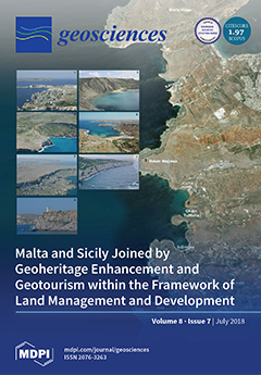
Cover Story (view full-size image): Malta and Sicily share a long history and have unique geological and geomorphological features making them attractive destinations for geotourism in the Mediterranean. A study assessing the rich geoheritage of these islands was carried out. The results provide the necessary knowledge for joint conservation policies and elements to create a link between the two islands through geoheritage appraisal and tourism development. This is crucial in building up an Earth memory that would be key to interpreting future tendencies based on the understanding of recent geohistory. View this paper
  • Issues are regarded as officially published after their release is announced to the table of contents alert mailing list.
  • You may sign up for e-mail alerts to receive table of contents of newly released issues.
  • PDF is the official format for papers published in both, html and pdf forms. To view the papers in pdf format, click on the "PDF Full-text" link, and use the free Adobe Reader to open them.
Order results
Result details
Section
Select all
Export citation of selected articles as:
21 pages, 11617 KiB  
Article
Glacial Geomorphology and Preliminary Glacier Reconstruction in the Jablanica Mountain, Macedonia, Central Balkan Peninsula
by Marjan Temovski, Balázs Madarász, Zoltán Kern, Ivica Milevski and Zsófia Ruszkiczay-Rüdiger
Geosciences 2018, 8(7), 270; https://doi.org/10.3390/geosciences8070270 - 23 Jul 2018
Cited by 14 | Viewed by 5582
Abstract
Although glacial landforms on the Balkan Peninsula have been studied since the 19th century, only scarce data are available about the extent of the former glaciations in the Central Balkan Peninsula, the transition zone between the Mediterranean and Central Europe. Glacial features of [...] Read more.
Although glacial landforms on the Balkan Peninsula have been studied since the 19th century, only scarce data are available about the extent of the former glaciations in the Central Balkan Peninsula, the transition zone between the Mediterranean and Central Europe. Glacial features of the Jablanica Mt. were mapped, described and classified into morphostratigraphic units. A revised glacio-geomorphological map was produced and glacial landforms were assigned to six morphostratigraphic units. Ten primary and two secondary cirques were identified in the upper parts of the studied valleys, while downstream the valleys were steep and glacially shaped with several glacial steps and thresholds. Cirque and valley morphology indicate that subglacial deepening was limited within the cirques and was more intensive in the valley sections during more extensive glacial phases. The largest reconstructed glaciers were 4.6–7 km long, while the last cirque glaciers were only a few hundred meters long. Using morphostratigraphic data, a glacier reconstruction was carried out for the largest mapped glacial extent. On the basis of glacial geomorphology, a former equilibrium-line altitude (ELA) of ~1800 m and glacier cover of 22.6 km2 were estimated during this stage. The local ELA values were compared to the regional ELA record and enabled to tentatively attribute a MIS 6 age for the reconstructed maximum ice extent in the study area. Full article
(This article belongs to the Special Issue Glacial and Geomorphological Cartography)
Show Figures

Figure 1

13 pages, 3711 KiB  
Article
Generation of Persistent Scatterers in Non-Urban Areas: The Role of Microwave Scattering Parameters
by Giovanni Nico, Sérgio C. Oliveira, Joao Catalão and José Luis Zêzere
Geosciences 2018, 8(7), 269; https://doi.org/10.3390/geosciences8070269 - 23 Jul 2018
Cited by 4 | Viewed by 2762
Abstract
In this work, we study the capability of the ground surface to generate Persistent Scatterers (PS) based on the lithology, slope and aspect angles. These properties affect the scattering behavior of the Synthetic Aperture Radar (SAR) signal, the interferometric phase stability and, as [...] Read more.
In this work, we study the capability of the ground surface to generate Persistent Scatterers (PS) based on the lithology, slope and aspect angles. These properties affect the scattering behavior of the Synthetic Aperture Radar (SAR) signal, the interferometric phase stability and, as a consequence, the PS generation. Two-time series of interferometric SAR data acquired by two different SAR sensors in the C-band are processed to generate independent PS datasets. The region north of Lisbon, Portugal, characterized by sparse vegetation and lithology diversity, is chosen as study area. The PS frequency distribution is obtained in terms of lithology, slope and aspect angles. This relationship could be useful to estimate the expected PS density in landslide-prone areas, being lithology, slope and aspect angles important landslide predisposing factors. Full article
(This article belongs to the Special Issue Quantitative Geomorphology)
Show Figures

Figure 1

25 pages, 6306 KiB  
Article
Diffuse Versus Conduit Flow in Coastal Karst Aquifers: The Consequences of Island Area and Perimeter Relationships
by Erik B. Larson and John E. Mylroie
Geosciences 2018, 8(7), 268; https://doi.org/10.3390/geosciences8070268 - 20 Jul 2018
Cited by 19 | Viewed by 4839
Abstract
The majority of limestone islands are made of eogenetic carbonate rock, with intrinsic high porosity and permeability. The freshwater lenses of small islands are dominated by diffuse flow regimes as the island perimeter is everywhere close to the meteoric catchment of the island [...] Read more.
The majority of limestone islands are made of eogenetic carbonate rock, with intrinsic high porosity and permeability. The freshwater lenses of small islands are dominated by diffuse flow regimes as the island perimeter is everywhere close to the meteoric catchment of the island interior. This flow regime produces flank margin caves at the lens margin, where dissolution is enhanced by mixing corrosion, superposition of organic decay horizons and higher flow velocities as the lens thins. The lens interior develops touching-vug flow systems that result in enhanced permeability and lens thinning over time. As islands become larger, the area (meteoric catchment) goes up by the square, but the island perimeter (discharge zone) goes up linearly; diffuse flow becomes inefficient; conduit flow develops to produce traditional epigenic cave systems that discharge the freshwater lens by specific turbulent flow routes, which in turn are fed by diffuse flow in the island interior. Locally, diffuse flow to the island perimeter continues in coastal proximal areas between major conduit flow routes to produce flank margin caves. The Bahamian Archipelago represents a case history in which tectonics is limited, the rocks are entirely eogenetic and the diffuse to conduit flow transition is demonstrated. Full article
Show Figures

Figure 1

17 pages, 3248 KiB  
Article
Impacts of Material Engineering Properties on Slope Wash and Stability in Fine-Grained Bedrock Slopes at Fossil-Bearing Sites, Badlands National Park, South Dakota, USA
by Larry D. Stetler
Geosciences 2018, 8(7), 267; https://doi.org/10.3390/geosciences8070267 - 19 Jul 2018
Cited by 2 | Viewed by 4840
Abstract
Engineering properties of bedrock materials at Badlands National Park were used to develop models for Park managers to assess slope erosion and stability for fossil resource protection. Six fully instrumented sites were used to document slope conditions. Bedrock consisted of Oligocene White River [...] Read more.
Engineering properties of bedrock materials at Badlands National Park were used to develop models for Park managers to assess slope erosion and stability for fossil resource protection. Six fully instrumented sites were used to document slope conditions. Bedrock consisted of Oligocene White River Group rocks. Bulk erosion rates correlated to grain size with silty-sandy materials producing higher mass erosion rates as a function of the silt-to-clay ratio and plastic index. Data indicated that as grain size decreased, plastic index increased leading to a decrease in erodibility. These parameters were used to construct a grain-size proxy, ψ, that was substituted for grain size, D, in Bagnold’s entrainment equation and provided significant improvement in calculation of critical entrainment velocities for fine-grained materials. Hydraulic analyses of slope and pediment surface processes indicated surface roughness was a controlling factor and materials washed from rough steep slopes were effectively transported across smooth low-angle pediments with slope-to-pediment angle ratios of nearly 6:1. Slope stability modeling of ten slopes produced high factors of safety for all slopes, even under saturated conditions and was attributable to clay cohesion. All results were used to construct models that predicted years until net slope erosion equaled 2.5 cm (1 inch). Using these results, Park managers were advised to visit erosion-prone sites on a 1- to 6-year schedule, based on site geology and slope aspect, to adequately protect critical fossil resources from destruction. Full article
(This article belongs to the Special Issue Mechanics of Erosion: Process Response to Change)
Show Figures

Figure 1

20 pages, 7213 KiB  
Review
A Geochemical Overview of Mid-Archaean Metavolcanic Rocks from Southwest Greenland
by Kristoffer Szilas
Geosciences 2018, 8(7), 266; https://doi.org/10.3390/geosciences8070266 - 19 Jul 2018
Cited by 13 | Viewed by 5064
Abstract
The present contribution reviews bulk-rock geochemical data for mid-Archaean (ca. 3075–2840 Ma) metavolcanic rocks from the North Atlantic Craton of southwest Greenland. The data set includes the most recent high quality major and trace element geochemical analyses for ten different supracrustal/greenstone belts in [...] Read more.
The present contribution reviews bulk-rock geochemical data for mid-Archaean (ca. 3075–2840 Ma) metavolcanic rocks from the North Atlantic Craton of southwest Greenland. The data set includes the most recent high quality major and trace element geochemical analyses for ten different supracrustal/greenstone belts in the region. When distilling the data set to only include the least altered metavolcanic rocks, by filtering out obviously altered samples, mafic/ultramafic cumulate rocks, late-stage intrusive sheets (dolerites) and migmatites, the remaining data (N = 427) reveal two fundamentally distinct geochemical suites. The contrasting trends that emerge from the filtered geochemical data set, which best represents the melt compositions for these mid-Archaean metavolcanic rocks are: (1) tholeiitic (mainly basaltic) versus (2) calc-alkaline (mainly andesitic). These two rock suites are effectively separated by their La/Sm ratios (below or above three, respectively). It is demonstrated by geochemical modelling that the two contrasting suites cannot be related by either fractional crystallization or crustal assimilation processes, despite occurring within the same metavolcanic sequences. The tholeiitic basaltic rocks were directly mantle-derived, whereas the petrogenesis of the calc-alkaline andesitic rocks involve a significant (>50%) felsic component. The felsic contribution in the calc-alkaline suite could either represent slab-melt metasomatism of their mantle source, mafic-felsic magma mixing, or very large degrees of partial melting of mafic lower crust. At face value, the occurrence of andesites, and the negative Nb-Ta-Ti-anomalies of both suites, is consistent with a subduction zone setting for the origin of these metavolcanic rocks. However, the latter geochemical feature is inherent to processes involving crustal partial melts, and therefore independent lines of evidence are needed to substantiate the hypothesis that plate tectonic processes were already operating by the mid-Archaean. Full article
(This article belongs to the Special Issue Geology of the Early Earth – Geodynamic Constraints from Cratons)
Show Figures

Graphical abstract

10 pages, 17504 KiB  
Communication
Suspended Sediment Variability at the Solimões and Negro Confluence between May 2013 and February 2014
by Thiago Marinho, Naziano Filizola, Jean-Michel Martinez, Elisa Armijos and André Nascimento
Geosciences 2018, 8(7), 265; https://doi.org/10.3390/geosciences8070265 - 19 Jul 2018
Cited by 6 | Viewed by 3763
Abstract
This study focuses on the confluence of two major rivers of the world, the Solimões River (white waters) and Negro River (black waters). Surface suspended sediment samples (SSC) and spectroradiometer taken along transverse profiles at 500 m intervals over a distance of 10 [...] Read more.
This study focuses on the confluence of two major rivers of the world, the Solimões River (white waters) and Negro River (black waters). Surface suspended sediment samples (SSC) and spectroradiometer taken along transverse profiles at 500 m intervals over a distance of 10 km, as well as satellite images (MODIS) during the hydrological year, were used to follow suspended sediment variability. In January and February, the confluence is dominated by white waters from the Solimões River in the two banks, and in June and July in the right bank by black waters from the Negro River and in the left bank by clear waters from the Solimões River. We found that indirect tools, such as reflectance obtained by spectrometer or MODIS images, can be used to determine surface suspended sediments in a contrasting zone. Full article
Show Figures

Figure 1

20 pages, 2752 KiB  
Article
A Site Amplification Model for Crustal Earthquakes
by M. Abdullah Sandıkkaya and L. Doğan Dinsever
Geosciences 2018, 8(7), 264; https://doi.org/10.3390/geosciences8070264 - 17 Jul 2018
Cited by 11 | Viewed by 4117
Abstract
A global dataset which is composed of more than 20,000 records is used to develop an empirical nonlinear soil amplification model for crustal earthquakes. The model also includes the deep soil effect. The soil nonlinearity is formulated in terms of input rock motion [...] Read more.
A global dataset which is composed of more than 20,000 records is used to develop an empirical nonlinear soil amplification model for crustal earthquakes. The model also includes the deep soil effect. The soil nonlinearity is formulated in terms of input rock motion and soil stiffness. The input rock motion is defined by the pseudo-spectral acceleration at rock site condition (PSArock) which is also modified with between-event residual. Application of PSArock simplifies the usage of the site model by diminishing the need of using the period-dependent correlation coefficients in hazard studies. The soil stiffness is expressed by a Gompertz sigmoid function which restricts the nonlinear effects at both of the very soft soil sites and very stiff soil sites. In order to surpass the effect of low magnitude and long-distant recordings on soil nonlinearity, the nonlinear site coefficients are constrained by using a limited dataset. The coefficients of linear site scaling and deep soil effect are obtained with the full database. The period average of site-variability is found to be 0.43. The sigma decreases with decreasing the soil stiffness or increasing input rock motion. After employing residual analysis, the region-dependent correction coefficients for linear site scaling are also obtained. Full article
Show Figures

Figure 1

15 pages, 1556 KiB  
Review
Hf-Nd Isotopes in Archean Marine Chemical Sediments: Implications for the Geodynamical History of Early Earth and Its Impact on Earliest Marine Habitats
by Sebastian Viehmann
Geosciences 2018, 8(7), 263; https://doi.org/10.3390/geosciences8070263 - 16 Jul 2018
Cited by 2 | Viewed by 4819
Abstract
The Hf-Nd isotope systems are coupled in magmatic systems, but incongruent Hf weathering (‘zircon effect’) of the continental crust leads to a decoupling of the Hf-Nd isotope systems in low-temperature environments during weathering and erosion processes. The Hf-Nd isotope record was recently dated [...] Read more.
The Hf-Nd isotope systems are coupled in magmatic systems, but incongruent Hf weathering (‘zircon effect’) of the continental crust leads to a decoupling of the Hf-Nd isotope systems in low-temperature environments during weathering and erosion processes. The Hf-Nd isotope record was recently dated back from the Cenozoic oceans until the Archean, showing that both isotope systems were already decoupled in seawater 2.7 Ga ago and potentially 3.4 Ga and 3.7 Ga ago. While there might have existed a hydrothermal pathway for Hf into Archean seawater, incongruent Hf weathering of more evolved, zircon-bearing uppermost continental crust that was emerged and available for subaerial weathering accounts for a significant decoupling of Hf-Nd isotopes in the dissolved (<0.2 µm) and suspended (>0.2 µm) fractions of Early Earth’s seawater. These findings contradict the consensus that uppermost Archean continental crust was (ultra)mafic in composition and predominantly submerged. Hence, Hf-Nd isotopes in Archean marine chemical sediments provide the unique potential for future research to trace the emergence of evolved continental crust, which in turn has major implications for the geodynamical evolution of Early Earth and the nutrient flux into the earliest marine habitats on Earth. Full article
(This article belongs to the Special Issue Geology of the Early Earth – Geodynamic Constraints from Cratons)
Show Figures

Graphical abstract

2 pages, 174 KiB  
Editorial
A Special Issue of Geosciences: Groundwater Pollution
by Mastrocicco Micòl and Colombani Nicolò
Geosciences 2018, 8(7), 262; https://doi.org/10.3390/geosciences8070262 - 12 Jul 2018
Cited by 1 | Viewed by 2269
(This article belongs to the Special Issue Groundwater Pollution)
15 pages, 2118 KiB  
Article
Exploring the Impact of Analysis Scale on Landslide Susceptibility Modeling: Empirical Assessment in Northern Peloponnese, Greece
by Christos Polykretis, Antigoni Faka and Christos Chalkias
Geosciences 2018, 8(7), 261; https://doi.org/10.3390/geosciences8070261 - 12 Jul 2018
Cited by 5 | Viewed by 3129
Abstract
The main purpose of this study is to explore the impact of analysis scale on the performance of a quantitative model for landslide susceptibility assessment through empirical analyses in the northern Peloponnese, Greece. A multivariate statistical model like logistic regression (LR) was applied [...] Read more.
The main purpose of this study is to explore the impact of analysis scale on the performance of a quantitative model for landslide susceptibility assessment through empirical analyses in the northern Peloponnese, Greece. A multivariate statistical model like logistic regression (LR) was applied at two different scales (a regional and a more detailed scale). Due to this scale difference, the implementation of the model was based on two landslide inventories representing in a different way the landslide occurrence (as point and polygon features), and two datasets of similar geo-environmental factors characterized by a different size of grid cells (90 m and 20 m). Model performance was tested by a standard validation method like receiver operating characteristics (ROC) analysis. The validation results in terms of accuracy (about 76%) and prediction ability (Area under the Curve (AUC) = 0.84) of the model revealed that the more detailed scale analysis is more appropriate for landslide susceptibility assessment and mapping in the catchment under investigation than the regional scale analysis. Full article
(This article belongs to the Section Natural Hazards)
Show Figures

Figure 1

20 pages, 3909 KiB  
Communication
How Characterization of Particle Size Distribution Pre- and Post-Reaction Provides Mechanistic Insights into Mineral Carbonation
by Aashvi Dudhaiya and Rafael M. Santos
Geosciences 2018, 8(7), 260; https://doi.org/10.3390/geosciences8070260 - 11 Jul 2018
Cited by 9 | Viewed by 6653
Abstract
Mineral carbonation is the conversion of carbon dioxide, in gas form or dissolved in water, to solid carbonates. Materials characterization plays an important role in assessing the potential to use these carbonates in commercial applications, and also aids in understanding fundamental phenomena about [...] Read more.
Mineral carbonation is the conversion of carbon dioxide, in gas form or dissolved in water, to solid carbonates. Materials characterization plays an important role in assessing the potential to use these carbonates in commercial applications, and also aids in understanding fundamental phenomena about the reactions. This paper highlights findings of mechanistic nature made on topics related to mineral carbonation, and that were made possible by assessing particle size, particle size distribution, and other morphological characteristics. It is also shown how particle size data can be used to estimate the weathering rate of carbonated minerals. An extension of the carbonation weathering rate approach is presented, whereby using particle size distribution data it becomes possible to predict the particle size below which full carbonation is obtained, and above which partial carbonation occurs. The paper also overviews the most common techniques to determine the particle size distribution, as well as complementary and alternate techniques. In mineral carbonation research, most techniques have been used as ex situ methods, yet tools that can analyze powders during reaction (in situ and real-time) can provide even more insight into mineral carbonation mechanisms, so researchers are encouraged to adopt such advanced techniques. Full article
(This article belongs to the Special Issue Carbon Sequestration)
Show Figures

Graphical abstract

16 pages, 3772 KiB  
Article
Vegetated Channel Flows: Turbulence Anisotropy at Flow–Rigid Canopy Interface
by Gerardo Caroppi, Paola Gualtieri, Nicola Fontana and Maurizio Giugni
Geosciences 2018, 8(7), 259; https://doi.org/10.3390/geosciences8070259 - 11 Jul 2018
Cited by 21 | Viewed by 4103
Abstract
This laboratory study aimed at investigating the mean and turbulent characteristics of a densely vegetated flow by testing four different submergence ratios. The channel bed was covered by a uniform array of aligned metallic cylinders modeling rigid submerged vegetation. Instantaneous velocities, acquired with [...] Read more.
This laboratory study aimed at investigating the mean and turbulent characteristics of a densely vegetated flow by testing four different submergence ratios. The channel bed was covered by a uniform array of aligned metallic cylinders modeling rigid submerged vegetation. Instantaneous velocities, acquired with a three-component acoustic Doppler velocimeter (ADV), were used to analyze the mean and turbulent flow structure. The heterogeneity of the flow field was described by the distributions of mean velocities, turbulent intensities, skewness, kurtosis, Reynolds stresses, and Eulerian integral scales. The exchange processes at the flow–vegetation interface were explored by applying the turbulence triangle technique, a far less common technique for vegetated flows based on the invariant maps of the anisotropic Reynolds stress tensor. Full article
Show Figures

Figure 1

12 pages, 3253 KiB  
Review
Coastal Karst Groundwater in the Mediterranean: A Resource to Be Preferably Exploited Onshore, Not from Karst Submarine Springs
by Michel Bakalowicz
Geosciences 2018, 8(7), 258; https://doi.org/10.3390/geosciences8070258 - 11 Jul 2018
Cited by 21 | Viewed by 6518
Abstract
Coastal karst aquifers are common in the Mediterranean basin. With their significant potential storage capacity, they are an attractive groundwater resource in areas where the water demand is the most important. They discharge either at the coastal zone or directly into the sea [...] Read more.
Coastal karst aquifers are common in the Mediterranean basin. With their significant potential storage capacity, they are an attractive groundwater resource in areas where the water demand is the most important. They discharge either at the coastal zone or directly into the sea at karst submarine springs (KSMS). Decision makers take an interest in this unconventional groundwater resource and are convinced by companies and research consultancies that KSMS’s should be exploited because they would discharge huge amount of fresh water. Being now well documented, the occurrence of KSMS’s along the Mediterranean coast is discussed in the light of recent geological history favourable to the development of karst. Conduit flow conditions are common, inherited from an intense phase of karstification during the Messinian Crisis of Salinity at the end of Miocene, when the sea level was 1500 to 2500 m below present sea level. From investigations carried out along the coasts of France and the Levant, compared with studies done along other Mediterranean coastlines, it appears that capturing groundwater discharged at KSMS raises different problems which make the operation dicey and expansive. Full article
Show Figures

Figure 1

11 pages, 7361 KiB  
Article
Controls on Deuterium Excess across Asia
by John Bershaw
Geosciences 2018, 8(7), 257; https://doi.org/10.3390/geosciences8070257 - 10 Jul 2018
Cited by 75 | Viewed by 14927
Abstract
Deuterium excess (d-excess) is a second-order stable isotope parameter measured in meteoric water to understand both the source of precipitation and the evolution of moisture during transport. However, the interpretation of d-excess patterns in precipitation is often ambiguous, as changes in moisture source [...] Read more.
Deuterium excess (d-excess) is a second-order stable isotope parameter measured in meteoric water to understand both the source of precipitation and the evolution of moisture during transport. However, the interpretation of d-excess patterns in precipitation is often ambiguous, as changes in moisture source and processes during vapor transport both affect d-excess in non-unique ways. This is particularly true in Asia where continental moisture travels a long distance across diverse environments from unique moisture sources before falling as precipitation. Here, I analyzed published d-excess records from meteoric water throughout Asia to better characterize what influences d-excess values. I conclude that, (1) an increase in d-excess values with elevation up the windward side of mountain ranges and a marked decrease in d-excess into their rain shadows are primarily related to subcloud evaporation as opposed to moisture source mixing; (2) high d-excess values (>10‰) associated with the eastern Mediterranean Sea are lowered across much of Central Asia by the addition of other moisture sources, both oceanic and recycled continental; (3) subcloud evaporation of raindrops is lowering d-excess values of precipitation (<10‰) throughout the relatively arid Tarim Basin, China; and (4) temporal changes in d-excess values of alpine glaciers do reflect spatio-temporal changes in moisture source, as these samples experience minimal variation in subcloud evaporation. Full article
(This article belongs to the Special Issue Isotope Geochemistry)
Show Figures

Figure 1

21 pages, 7117 KiB  
Article
The Majella National Park: An Aspiring UNESCO Geopark
by Elena Liberatoscioli, Giancarlo Boscaino, Silvano Agostini, Adele Garzarella and Etta Patacca Scandone
Geosciences 2018, 8(7), 256; https://doi.org/10.3390/geosciences8070256 - 10 Jul 2018
Cited by 12 | Viewed by 7462
Abstract
Majella National Park is located in the central Apennines (Italy), in a vast mountainous area of about 740 km2. Owing to the complex geological history of the Majella Massif and surrounding areas, it features many different landforms. Woodlands rich in water [...] Read more.
Majella National Park is located in the central Apennines (Italy), in a vast mountainous area of about 740 km2. Owing to the complex geological history of the Majella Massif and surrounding areas, it features many different landforms. Woodlands rich in water characterize the wide tectonic depression of Caramanico, which separates the rounded gentle profile of the Majella to the east from the impervious steep slope of the Morrone Mt. to the west. Bare pitted highlands, like lunar landforms, characterize the top of the Majella (i.e., Femmina Morta Valley) shaped by flowing ice that long ago covered the higher parts of the massif. Sedimentary structures and fossil content recovered in carbonates attest to a long period of sedimentation in warm, shallow-marine environments, revealing that the Majella and the surrounding carbonate mountains looked, approximately from 140 to 7 Ma, like the present-day Bahamas and Persian Gulf. The Park hosts at least 95 geosites, some of which (22) are well-known in the international literature because of their scientific relevance. In addition, its natural and cultural wealth, deeply fused together with geoheritage, preserves several features of national and world rarity. Therefore, the Park Authority decided to put forward its territory as a candidate to become part of the United Nations Educational, Scientific and Cultural Organization (UNESCO) Global Geoparks Network. Full article
(This article belongs to the Special Issue Selected Papers from the “14th European Geoparks Conference”)
Show Figures

Figure 1

22 pages, 8373 KiB  
Article
Morphodynamic Trends of the Ribb River, Ethiopia, Prior to Dam Construction
by Chalachew A. Mulatu, Alessandra Crosato, Michael M. Moges, Eddy J. Langendoen and Michael McClain
Geosciences 2018, 8(7), 255; https://doi.org/10.3390/geosciences8070255 - 09 Jul 2018
Cited by 19 | Viewed by 5944
Abstract
The meandering Ribb River flows in northwest Ethiopia to Lake Tana, the source of the Blue Nile River. The river has already undergone changes due to several human interventions, such as embanking, sand mining, water extraction and lake level regulation for hydropower. At [...] Read more.
The meandering Ribb River flows in northwest Ethiopia to Lake Tana, the source of the Blue Nile River. The river has already undergone changes due to several human interventions, such as embanking, sand mining, water extraction and lake level regulation for hydropower. At present, a dam and a weir are under construction to store and divert water for irrigation. This will strongly alter both water and sediment discharges to the downstream river reaches, causing adjustments to the morphology. Assessing the current morphodynamic trends is the first necessary step to study the future effects and find ways to mitigate them. This paper presents an analysis of the current and past river based on newly collected data, aerial photographs, SPOT and Google Earth images. The riverbed changes are derived from historical staff gauge height analysis. The effects of sediment mining and water extraction are assessed using the theory of morphodynamic equilibrium. The findings of the analysis show a reduction of sediment transport capacity in the downstream direction, which has resulted in intense sediment deposition, resulting in blockage of the Lower River reach and subsequent channel avulsion. The effects of Lake Tana level regulation on the observed processes appear to be minor. Full article
Show Figures

Figure 1

22 pages, 3814 KiB  
Article
Vulnerability and Site Effects in Earthquake Disasters in Armenia (Colombia). I—Site Effects
by Francisco J. Chávez-García, Hugo Monsalve Jaramillo, Marisol Gómez Cano and José J. Vila Ortega
Geosciences 2018, 8(7), 254; https://doi.org/10.3390/geosciences8070254 - 09 Jul 2018
Cited by 9 | Viewed by 4468
Abstract
The city of Armenia, Colombia has been repeatedly subjected to moderate magnitude earthquakes. Damage in that city for the 1999 (Mw6.2) event was disproportionate (maximum observed EMS-92 intensity of IX), even considering the small epicentral distance (18 km). Two main factors have been [...] Read more.
The city of Armenia, Colombia has been repeatedly subjected to moderate magnitude earthquakes. Damage in that city for the 1999 (Mw6.2) event was disproportionate (maximum observed EMS-92 intensity of IX), even considering the small epicentral distance (18 km). Two main factors have been invoked: Site effects and vulnerability of the building stock. We re-analyze available data on site effects, including: Records of aftershocks of the 1999 event, ambient noise records obtained using standalone stations, array records of ambient noise, and available shear wave profiles from seismic cone measurements. We estimate local amplification from spectral ratios of earthquake records relative to a reference site, the horizontal relative to the vertical component (HVSR, Horizontal-to-Vertical Spectral Ratios) of earthquakes and ambient noise records, and ratios of response spectra relative to a reference site or to simulated ground motion. These estimates are compared to amplification functions computed for 1D soil models, inverted from microtremor array observations. Our estimates of site effects for Armenia are therefore robust and bring together results previously available only in internal reports. We show that spectral ratios relative to a reference site may fail to estimate the amplification level. Site effects in Armenia are relatively homogeneous. Although site amplification is very significant and contributed to the observed damage, it does not account for the irregular damage distribution observed in 1999. Full article
Show Figures

Figure 1

19 pages, 9312 KiB  
Article
Malta and Sicily Joined by Geoheritage Enhancement and Geotourism within the Framework of Land Management and Development
by Chiara Cappadonia, Paola Coratza, Valerio Agnesi and Mauro Soldati
Geosciences 2018, 8(7), 253; https://doi.org/10.3390/geosciences8070253 - 09 Jul 2018
Cited by 34 | Viewed by 9260
Abstract
Malta and Sicily, which lie at the centre of the Mediterranean Sea, share a long history and have unique geological and geomorphological features which make them attractive destinations for geotourism. In the framework of an international research project, a study for the identification, [...] Read more.
Malta and Sicily, which lie at the centre of the Mediterranean Sea, share a long history and have unique geological and geomorphological features which make them attractive destinations for geotourism. In the framework of an international research project, a study for the identification, selection and assessment of the rich geological heritage of Malta and Sicily was carried out, aiming to create a geosite network between these islands. Based on the experience and outputs achieved in previous investigations on geoheritage assessment carried out in various morpho-climatic contexts, an integrated methodology was applied for the selection, numerical assessment and ranking of geosites. The selection phase was based on three main criteria—scientific, additional and use values—and led to the establishment of a list of 42 geosites (20 in Malta and 22 in Sicily). Besides being spectacular and attractive for tourists, these sites represent the main geomorphological contexts and the various stages of regional morphogenesis of the study areas. The sites selected were assessed quantitatively and ranked according to management and tourism criteria. The results provide both the necessary basic knowledge for joint conservation actions and policies in Malta and Sicily and the elements for creating a link between Malta and Sicily through geoheritage appraisal and tourism development. Full article
(This article belongs to the Special Issue Geotourism)
Show Figures

Figure 1

22 pages, 8536 KiB  
Article
Development of a General Protocol to Enhance the Hydrological Analysis Techniques for Urban Catchments in Ireland
by Elisa Longo and John Paul Rooney
Geosciences 2018, 8(7), 252; https://doi.org/10.3390/geosciences8070252 - 09 Jul 2018
Cited by 2 | Viewed by 3406
Abstract
The hydrological analysis of urban catchments is a critical consideration for all major civil engineering projects. The purpose of this article is to develop a general protocol to enhance the established techniques for estimating runoff from Irish urban catchments. The chosen case study [...] Read more.
The hydrological analysis of urban catchments is a critical consideration for all major civil engineering projects. The purpose of this article is to develop a general protocol to enhance the established techniques for estimating runoff from Irish urban catchments. The chosen case study is the Rye Water catchment, which is covering two significant urban centres, Maynooth and Leixlip. The findings were compared with the flow data available on the Office of Public Works (OPW) website, to verify the reliability of the proposed approach. The study showed that the methodology described in this paper is applicable to Irish catchments and the protocol, with minor improvements can be adopted in Ireland to support designers in their approach to extreme rainfall events. Full article
(This article belongs to the Special Issue Hydrology of Urban Catchments)
Show Figures

Figure 1

20 pages, 18128 KiB  
Article
The Influence of the Mineralogical Composition of Ultramafic Rocks on Their Engineering Performance: A Case Study from the Veria-Naousa and Gerania Ophiolite Complexes (Greece)
by Panagiota P. Giannakopoulou, Petros Petrounias, Aikaterini Rogkala, Basilios Tsikouras, Panagiotis M. Stamatis, Panagiotis Pomonis and Konstantin Hatzipanagiotou
Geosciences 2018, 8(7), 251; https://doi.org/10.3390/geosciences8070251 - 09 Jul 2018
Cited by 16 | Viewed by 4429
Abstract
This case study investigates the influence of the mineralogical composition of ultramafic rocks derived from two ophiolite complexes from Greece (Veria-Naousa and Gerania) on their mechanical, physical and physicochemical properties. The investigated lithologies include lherzolite, harzburgite, dunite and olivine-orthopyroxenite with variable degrees of [...] Read more.
This case study investigates the influence of the mineralogical composition of ultramafic rocks derived from two ophiolite complexes from Greece (Veria-Naousa and Gerania) on their mechanical, physical and physicochemical properties. The investigated lithologies include lherzolite, harzburgite, dunite and olivine-orthopyroxenite with variable degrees of alteration. The ratio of secondary minerals to primary minerals (SEC/PR) of the studied ultramafic rocks shows good correlations with their physical, physicochemical and mechanical properties, suggesting that alteration has a negative effect on the engineering performance of the ultramafic rocks. Among the secondary minerals, serpentine plays the most critical role in determining the moisture content, the total porosity and hence the soundness of the host rocks, due to its phyllosilicate structure, which allows more water/solutions to be captured. The high percentage of serpentine creates surfaces of weakness, and as a result, it decreases the rock strength. The low microtopography of highly serpentinized rocks results in their reduced mechanical performance. Full article
Show Figures

Figure 1

11 pages, 58003 KiB  
Article
An Essential Tool for Natural Heritage Management: The Geomorphological Map of Valderejo Natural Park
by María José González-Amuchastegui and Enrique Serrano
Geosciences 2018, 8(7), 250; https://doi.org/10.3390/geosciences8070250 - 08 Jul 2018
Cited by 5 | Viewed by 4832
Abstract
This study supports the usefulness of geomorphological mapping as a tool for gaining an understanding of the landscape and assessing natural heritage. Mapping provides an essentially scientific document with great potential for the diffusion of geomorphological knowledge in that it provides a guide [...] Read more.
This study supports the usefulness of geomorphological mapping as a tool for gaining an understanding of the landscape and assessing natural heritage. Mapping provides an essentially scientific document with great potential for the diffusion of geomorphological knowledge in that it provides a guide to the user of natural protected areas as well as serving as a tool for its management regarding geotourist itineraries, geodiversity, and geomorphosites. The example of the Valderejo Natural Park is presented, which is located in Álava (Spain) and whose geomorphology has been mapped following a methodology based on fieldwork, desktop work, and the use of Geographic Information Systems. The map’s applications are presented in the areas of tourism, geotourist maps, and for the assessment of natural heritage, geodiversity, and geomorphosites. Full article
(This article belongs to the Special Issue Glacial and Geomorphological Cartography)
Show Figures

Figure 1

19 pages, 2776 KiB  
Article
Investigating the Sediment Yield Predictability in Some Italian Rivers by Means of Hydro-Geomorphometric Variables
by Sergio Grauso, Francesco Pasanisi, Carlo Tebano, Marcello Grillini and Alessandro Peloso
Geosciences 2018, 8(7), 249; https://doi.org/10.3390/geosciences8070249 - 05 Jul 2018
Cited by 10 | Viewed by 3265
Abstract
In the present work, preliminary results are reported from an ongoing research study aimed at developing an improved prediction model to estimate the sediment yield in Italian ungauged river basins. The statistical correlations between a set of hydro-geomorphometric parameters and suspended sediment yield [...] Read more.
In the present work, preliminary results are reported from an ongoing research study aimed at developing an improved prediction model to estimate the sediment yield in Italian ungauged river basins. The statistical correlations between a set of hydro-geomorphometric parameters and suspended sediment yield (SSY) data from 30 Italian rivers were investigated. The main question is whether such variables are helpful to explain the behavior of fluvial systems in the sediment delivery process. To this aim, a broad set of variables, simply derived from digital cartographic sources and available data records, was utilized in order to take into account all the possible features and processes having some influence on sediment production and conveyance. A stepwise regression analysis pointed out that, among all possibilities, the catchment elevation range (Hr), the density of stream hierarchical anomaly (Da), and the stream channel slope ratio (ΔSs) are significantly linked to the SSY. The derived linear regression model equation was proven to be satisfactory (r2-adjusted = 0.72; F-significance = 5.7 × 10⁻⁸; ME = 0.61), however, the percentage standard error (40%) implies that the model is still affected by some uncertainties. These can be justified, on one hand, by the wide variance and, on the other hand, by the quality of the observed SSY data. Reducing these uncertainties will be the effort in the follow-up of the research. Full article
(This article belongs to the Special Issue Quantitative Geomorphology)
Show Figures

Figure 1

17 pages, 3809 KiB  
Article
Boninites in the ~3.3 Ga Holenarsipur Greenstone Belt, Western Dharwar Craton, India
by Tarun C. Khanna, V. V. Sesha Sai, S. H. Jaffri, A. Keshav Krishna and M. M. Korakoppa
Geosciences 2018, 8(7), 248; https://doi.org/10.3390/geosciences8070248 - 05 Jul 2018
Cited by 5 | Viewed by 4662
Abstract
In this contribution, we present detailed field, petrography, mineral chemistry, and geochemistry of newly identified high-Si high-Mg metavolcanic rocks from the southern part of the ~3.3 Ga Holenarsipur greenstone belt in the western Dharwar craton, India. The rocks occur as conformable bands that [...] Read more.
In this contribution, we present detailed field, petrography, mineral chemistry, and geochemistry of newly identified high-Si high-Mg metavolcanic rocks from the southern part of the ~3.3 Ga Holenarsipur greenstone belt in the western Dharwar craton, India. The rocks occur as conformable bands that were interleaved with the mafic-ultramafic units. The entire volcanic package exhibits uniform foliation pattern, and metamorphosed under greenschist to low grade amphibolite facies conditions. The rocks are extremely fine grained and exhibit relict primary igneous textures. They are composed of orthopyroxene and clinopyroxene phenocrysts with serpentine, talc, and amphibole (altered clinopyroxene). Cr-spinel, rutile, ilmenite, and apatite occur as disseminated minute grains in the groundmass. The mineralogical composition and the geochemical signatures comprising of high SiO2 (~53 wt. %), Mg# (~83), low TiO2 (~0.18 wt. %), and higher than chondritic Al2O3/TiO2 ratio (~26), reversely fractionated heavy rare earth elements (REE) (GdN/YbN ~ 0.8), resulting in concave-up patterns, and positive Zr anomaly, typically resembled with the Phanerozoic boninites. Depletion in the high field strength elements Nb, and Ti relative to Th and the REE in a primitive mantle normalized trace element variation diagram, cannot account for contamination by pre-existing Mesoarchean continental crust present in the study area. The trace element attributes instead suggest an intraoceanic subduction-related tectonic setting for the genesis of these rocks. Accordingly, the Holenarsipur high-Si high-Mg metavolcanic rocks have been identified as boninites. It importantly indicates that the geodynamic process involved in the generation of Archean boninites, was perhaps not significantly different from the widely recognized two-stage melt generation process that produced the Phanerozoic boninites, and hence provides compelling evidence for the onset of Phanerozoic type plate tectonic processes by at least ~3.3 Ga, in the Earth’s evolutionary history. Full article
(This article belongs to the Special Issue Geology of the Early Earth – Geodynamic Constraints from Cratons)
Show Figures

Figure 1

19 pages, 5429 KiB  
Article
Pb Isotope Mapping of Paleoproterozoic Gneisses in the SW Grenville Province: Evidence for a Cryptic Continental Suture
by Gabriel A. Arcuri and Alan P. Dickin
Geosciences 2018, 8(7), 247; https://doi.org/10.3390/geosciences8070247 - 05 Jul 2018
Cited by 5 | Viewed by 4472
Abstract
New whole-rock lead (Pb) isotope analyses are presented in this study for granitoid orthogneisses from the Southwest Grenville Province in Ontario and Western Quebec. These data are used to test the location of a cryptic Archean-Proterozoic suture proposed on the basis of neodymium [...] Read more.
New whole-rock lead (Pb) isotope analyses are presented in this study for granitoid orthogneisses from the Southwest Grenville Province in Ontario and Western Quebec. These data are used to test the location of a cryptic Archean-Proterozoic suture proposed on the basis of neodymium (Nd) isotope mapping. Immediately south of the inferred suture boundary, Pb isotope results show a crustal component derived solely from a juvenile Paleoproterozoic mantle source. These data are distinctly different from the reworked Archean craton to the northwest and strongly support the boundary derived from Nd isotope data. Pb signatures in the Paleoproterozoic crust suggest a southerly increase in magmatic reworking due to intensive plutonism during the late Paleoproterozoic and early Mesoproterozoic periods. The accretion of a juvenile arc to the Archean margin during the Penokean event (ca. 1.85 Ga) would have triggered subduction-zone reversal and the development of a long-lived ensialic arc on the composite margin. This was expressed as a 1.75 Ga Killarnian magmatic event and subsequent early Mesoproterozoic magmatism. This tectonic model for the Southwest Grenville Province shows that its crustal evolution is consistent with the Paleoproterozoic Makkovik-Ketilidian Orogen of Labrador and Southern Greenland. Hence, the application of whole-rock Pb isotope data in conjunction with Nd model ages provides data useful for mapping the extent of crustal terranes of differing age, which is essential for modeling the tectonic evolution of complex ancient accretionary orogens. Full article
(This article belongs to the Special Issue Isotope Geochemistry)
Show Figures

Figure 1

18 pages, 10285 KiB  
Article
Petrographic and Petrophysical Characterization of Detrital Reservoir Rocks for CO2 Geological Storage (Utrillas and Escucha Sandstones, Northern Spain)
by Félix Mateos-Redondo, Timea Kovács and Edgar Berrezueta
Geosciences 2018, 8(7), 246; https://doi.org/10.3390/geosciences8070246 - 03 Jul 2018
Cited by 6 | Viewed by 4537
Abstract
The aim of this article is to provide a qualitative and quantitative description of Lower–Upper Cretaceous detrital rocks (Escucha and Utrillas sandstones) in order to explore their potential use as CO2 reservoirs based on their petrographic and petrophysical characteristics. Optical microscopy (OpM) [...] Read more.
The aim of this article is to provide a qualitative and quantitative description of Lower–Upper Cretaceous detrital rocks (Escucha and Utrillas sandstones) in order to explore their potential use as CO2 reservoirs based on their petrographic and petrophysical characteristics. Optical microscopy (OpM) and scanning electron microscopy (SEM) aided by optical image analysis (OIA) were used to get qualitative and quantitative information about mineralogy, texture and pore network structure. Complementary analyses by X-ray fluorescence (XRF) and X-ray diffraction (XRD) were performed to refine the mineralogical information and to obtain whole rock geochemical data. Furthermore, mercury injection capillary pressure analysis (MICP), the gas permeameter test (GPT) and the hydraulic test (HT) were applied to assess the potential storage capacity and the facility of fluid flow through the rocks. Both of these factors have an outstanding importance in the determination of CO2 reservoir potential. The applied petrophysical and petrographic methods allowed an exhaustive characterization of the samples and a preliminary assessment of their potential as a CO2 reservoir. The studied conglomerates and sandstones have a porosity range of 8–26% with a dominant pore size range of 80–500 μm. The grain skeleton consists of quartz (95%), very minor potassium feldspars (orthoclase) and a small amount of mica (muscovite and chlorite). According to these preliminary results, among the studied varieties, the Escucha sandstones have the most favorable properties for CO2 geological storage at the rock matrix scale. Full article
(This article belongs to the Special Issue Geological Storage of Gases as a Tool for Energy Transition)
Show Figures

Graphical abstract

27 pages, 1809 KiB  
Review
Quantifying Hydrothermal Alteration: A Review of Methods
by Lucie Mathieu
Geosciences 2018, 8(7), 245; https://doi.org/10.3390/geosciences8070245 - 03 Jul 2018
Cited by 65 | Viewed by 15239
Abstract
Hydrothermal alteration is proximal to many base and precious metal deposits, and its products can provide insights into the characteristics of hydrothermal systems. To be useful to exploration geologists and researchers, however, alteration needs to be typified and quantified. Alteration type informs on [...] Read more.
Hydrothermal alteration is proximal to many base and precious metal deposits, and its products can provide insights into the characteristics of hydrothermal systems. To be useful to exploration geologists and researchers, however, alteration needs to be typified and quantified. Alteration type informs on mineralising style (e.g., have we found a porphyry or a volcanogenic massive sulphide deposit?), while quantification of its intensity helps position a sample within the system (e.g., how close are we to the main economic deposit?). Numerous methods—all having their specific advantages and disadvantages—are dedicated to the characterisation of alteration. As alteration is a process that induces chemical and mineralogical changes in rocks, it can be studied using petrological (e.g., mineral recognition in thin sections, mineral chemistry), mineralogical (e.g., alteration indices that use normative minerals), and chemical (e.g., mass balance calculations) approaches. This short review provides an overview of the methods useful to researchers and that are also applicable in an exploration context. Full article
(This article belongs to the Special Issue Dynamics and Kinetics of Melt-Fluid-Rock Interactions)
Show Figures

Figure 1

23 pages, 5365 KiB  
Article
Landscape Classification with Deep Neural Networks
by Daniel Buscombe and Andrew C. Ritchie
Geosciences 2018, 8(7), 244; https://doi.org/10.3390/geosciences8070244 - 02 Jul 2018
Cited by 69 | Viewed by 12297
Abstract
The application of deep learning, specifically deep convolutional neural networks (DCNNs), to the classification of remotely-sensed imagery of natural landscapes has the potential to greatly assist in the analysis and interpretation of geomorphic processes. However, the general usefulness of deep learning applied to [...] Read more.
The application of deep learning, specifically deep convolutional neural networks (DCNNs), to the classification of remotely-sensed imagery of natural landscapes has the potential to greatly assist in the analysis and interpretation of geomorphic processes. However, the general usefulness of deep learning applied to conventional photographic imagery at a landscape scale is, at yet, largely unproven. If DCNN-based image classification is to gain wider application and acceptance within the geoscience community, demonstrable successes need to be coupled with accessible tools to retrain deep neural networks to discriminate landforms and land uses in landscape imagery. Here, we present an efficient approach to train/apply DCNNs with/on sets of photographic images, using a powerful graphical method called a conditional random field (CRF), to generate DCNN training and testing data using minimal manual supervision. We apply the method to several sets of images of natural landscapes, acquired from satellites, aircraft, unmanned aerial vehicles, and fixed camera installations. We synthesize our findings to examine the general effectiveness of transfer learning to landscape-scale image classification. Finally, we show how DCNN predictions on small regions of images might be used in conjunction with a CRF for highly accurate pixel-level classification of images. Full article
Show Figures

Figure 1

11 pages, 4389 KiB  
Article
PHOTOSED—PHOTOgrammetric Sediment Erosion Detection
by Markus Noack, Gerhard Schmid, Felix Beckers, Stefan Haun and Silke Wieprecht
Geosciences 2018, 8(7), 243; https://doi.org/10.3390/geosciences8070243 - 30 Jun 2018
Cited by 5 | Viewed by 4389
Abstract
This work presents a novel high-resolution photogrammetric measuring technique (PHOTOSED) to study in detail the erosion behavior of cohesive sediments, or cohesive/non-cohesive sediment mixtures. PHOTOSED uses a semiconductor laser to project a pseudo-random pattern of light points on a sediment surface and applies [...] Read more.
This work presents a novel high-resolution photogrammetric measuring technique (PHOTOSED) to study in detail the erosion behavior of cohesive sediments, or cohesive/non-cohesive sediment mixtures. PHOTOSED uses a semiconductor laser to project a pseudo-random pattern of light points on a sediment surface and applies the Dense Optical Flow (DOF) algorithm to measure the erosion volume based on displacements of the projected light points during the sediment erosion process. Based on intensive calibration and verification experiments, the accuracy and applicability of the method has been validated for a wide range of erosion volumes, encompassing several orders of magnitude, which is required for investigations of natural sediment mixtures. The high spatial resolution of PHOTOSED is especially designed to detect the substantial variability of erosion rates during exemplary erosion experiments, which allows for further in-depth investigations of the erosion process of cohesive sediments and cohesive/non-cohesive sediment mixtures. Full article
(This article belongs to the Special Issue Laboratory Geosciences: Modelling Surface Processes)
Show Figures

Figure 1

15 pages, 4308 KiB  
Article
Site Characterization by Dynamic In Situ and Laboratory Tests for Liquefaction Potential Evaluation during Emilia Romagna Earthquake
by Antonio Cavallaro, Piera Paola Capilleri and Salvatore Grasso
Geosciences 2018, 8(7), 242; https://doi.org/10.3390/geosciences8070242 - 29 Jun 2018
Cited by 32 | Viewed by 4820
Abstract
To investigate the geotechnical soil properties of Emilia Romagna Region, a large series of in situ tests, laboratory tests and geophysical tests have been performed, particularly at the damaged city of Scortichino—Bondeno. Deep site investigations have been undertaken for the site characterization of [...] Read more.
To investigate the geotechnical soil properties of Emilia Romagna Region, a large series of in situ tests, laboratory tests and geophysical tests have been performed, particularly at the damaged city of Scortichino—Bondeno. Deep site investigations have been undertaken for the site characterization of the soil also along the Burana-Scortichino levee. Borings, Piezocone tests (CPTU) and dynamic in situ tests have been performed. Among them, Multichannel Analysis of Surface Waves test (MASW) and Seismic Dilatometer Marchetti Tests (SDMT) have been also carried out, with the aim to evaluate the soil profile of shear wave velocity (Vs). Resonant Column Tests (RCT) were also performed in laboratory on reconstituted solid cylindrical specimens. The Seismic Dilatometer Marchetti Tests were performed up to a depth of 32 m. The results show a very detailed and stable shear wave profile. The shear wave profiles obtained by SDMT have been compared with other laboratory tests. A comparison between the in situ small shear strain, laboratory shear strain and shear strain obtained by empirical correlations, was also performed. Finally, using the results of SDMT tests, soil liquefaction phenomena have been analyzed with a new procedure based on SDMT, using the soil properties obtained by field and laboratory tests. Full article
Show Figures

Figure 1

24 pages, 9945 KiB  
Article
Experimental Determination of Impure CO2 Alteration of Calcite Cemented Cap-Rock, and Long Term Predictions of Cap-Rock Reactivity
by Julie K. Pearce and Grant K. W. Dawson
Geosciences 2018, 8(7), 241; https://doi.org/10.3390/geosciences8070241 - 29 Jun 2018
Cited by 13 | Viewed by 4242
Abstract
Cap-rock integrity is an important consideration for geological storage of CO2. While CO2 bearing fluids are known to have reactivity to certain rock forming minerals, impurities including acid gases such as SOx, NOx, H2S or O2 may [...] Read more.
Cap-rock integrity is an important consideration for geological storage of CO2. While CO2 bearing fluids are known to have reactivity to certain rock forming minerals, impurities including acid gases such as SOx, NOx, H2S or O2 may be present in injected industrial CO2 streams at varying concentrations, and may induce higher reactivity to cap-rock than pure CO2. Dissolution or precipitation of minerals may modify the porosity or permeability of cap-rocks and compromise or improve the seal. A calcite cemented cap-rock drill core sample (Evergreen Formation, Surat Basin) was experimentally reacted with formation water and CO2 containing SO2 and O2 at 60 °C and 120 bar. Solution pH was quickly buffered by dissolution of calcite cement, with dissolved ions including Ca, Mn, Mg, Sr, Ba, Fe and Si released to solution. Dissolved concentrations of several elements including Ca, Ba, Si and S had a decreasing trend after 200 h. Extensive calcite cement dissolution with growth of gypsum in the formed pore space, and barite precipitation on mineral surfaces were observed after reaction via SEM-EDS. A silica and aluminium rich precipitate was also observed coating grains. Kinetic geochemical modelling of the experimental data predicted mainly calcite and chlorite dissolution, with gypsum, kaolinite, goethite, smectite and barite precipitation and a slight net increase in mineral volume (decrease in porosity). To better approximate the experimental water chemistry it required the reactive surface areas of: (1) calcite cement decreased to 1 cm2/g; and, (2) chlorite increased to 7000 cm2/g. Models were then up-scaled and run for 30 or 100 years to compare the reactivity of calcite cemented, mudstone, siderite cemented or shale cap-rock sections of the Evergreen Formation in the Surat Basin, Queensland, Australia, a proposed target for future large scale CO2 storage. Calcite, siderite, chlorite and plagioclase were the main minerals dissolving. Smectite, siderite, ankerite, hematite and kaolinite were predicted to precipitate, with SO2 sequestered as anhydrite, alunite, and pyrite. Predicted net changes in porosity after reaction with CO2, CO2-SO2 or CO2-SO2-O2 were however minimal, which is favourable for cap-rock integrity. Mineral trapping of CO2 as siderite and ankerite however was only predicted in the CO2 or CO2-SO2 simulations. This indicates a limit on the injected O2 content may be needed to optimise mineral trapping of CO2, the most secure form of CO2 storage. Smectites were predicted to form in all simulations, they have relatively high CO2 sorption capacities and provide additional storage. Full article
(This article belongs to the Special Issue Geological Storage of Gases as a Tool for Energy Transition)
Show Figures

Graphical abstract

Previous Issue
Next Issue
Back to TopTop