Next Issue
Volume 5, February
Previous Issue
Volume 4, September


Fire, Volume 4, Issue 4 (December 2021) – 36 articles

Cover Story (view full-size image): 
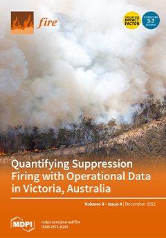
An example of the use of roads for suppression firing in forested areas, this area of the fireground was burned by firefighters as a containment measure. This burning-out operation was captured on the 29th of December 2019 by Ned Dawson while engaged in an air attack with Wayne Rigg on the East Gippsland fires north of Bairnsdale, Australia. A widespread practice that occurs in many areas of the globe, there is limited scientific knowledge about suppression firing. This paper quantifies suppression firing on large fires in Victoria, Australia, which is a first step to integrating this practice within containment probability modelling. View this paper
  • Issues are regarded as officially published after their release is announced to the table of contents alert mailing list.
  • You may sign up for e-mail alerts to receive table of contents of newly released issues.
  • PDF is the official format for papers published in both, html and pdf forms. To view the papers in pdf format, click on the "PDF Full-text" link, and use the free Adobe Reader to open them.
Order results
Result details
Section
Select all
Export citation of selected articles as:
18 pages, 8023 KiB  
Article
Effectiveness of Safety Interventions in Fire Engines to Reduce Potential Airborne Transmission of SARS-CoV-2
by Elmar Bourdon, Thomas Schaefer, Maximilian Kittel, Matthias Raedle and Alexandra Heininger
Fire 2021, 4(4), 98; https://doi.org/10.3390/fire4040098 - 19 Dec 2021
Cited by 1 | Viewed by 3514
Abstract
Physical distancing and wearing a face mask are key interventions to prevent COVID-19. While this remains difficult to practice for millions of firefighters in fire engines responding to emergencies, the delayed forthcoming of evidence on the effectiveness of such safety interventions in this [...] Read more.
Physical distancing and wearing a face mask are key interventions to prevent COVID-19. While this remains difficult to practice for millions of firefighters in fire engines responding to emergencies, the delayed forthcoming of evidence on the effectiveness of such safety interventions in this setting presents a major problem. In this field experimental study, we provided initial evidence to close this gap. We examined total aerosol burden in the cabin of a fire engine whilst manipulating crew size, use of FFP2 respirators and use of SCBA full-face masks during 15-min driving periods. At the same time, we controlled for crew activity and speaking, vehicle speed, cabin ventilation, cabin air temperature, pressure and humidity. Limiting the crew size, using FFP2 respirators and not donning SCBA full-face masks was associated with a reduction of the arithmetic mean of total aerosol burden of up to 49%. This study provided initial evidence on the effectiveness of safety interventions in fire engines to reduce potential airborne transmission of SARS-CoV-2 through aerosols. More research about the physical and the clinical effectiveness of such safety interventions is needed. Full article
Show Figures

Figure 1

18 pages, 2328 KiB  
Concept Paper
What Do the Australian Black Summer Fires Signify for the Global Fire Crisis?
by Rachael H. Nolan, David M. J. S. Bowman, Hamish Clarke, Katharine Haynes, Mark K. J. Ooi, Owen F. Price, Grant J. Williamson, Joshua Whittaker, Michael Bedward, Matthias M. Boer, Vanessa I. Cavanagh, Luke Collins, Rebecca K. Gibson, Anne Griebel, Meaghan E. Jenkins, David A. Keith, Allen P. Mcilwee, Trent D. Penman, Stephanie A. Samson, Mark G. Tozer and Ross A. Bradstockadd Show full author list remove Hide full author list
Fire 2021, 4(4), 97; https://doi.org/10.3390/fire4040097 - 17 Dec 2021
Cited by 46 | Viewed by 17046
Abstract
The 2019–20 Australian fire season was heralded as emblematic of the catastrophic harm wrought by climate change. Similarly extreme wildfire seasons have occurred across the globe in recent years. Here, we apply a pyrogeographic lens to the recent Australian fires to examine the [...] Read more.
The 2019–20 Australian fire season was heralded as emblematic of the catastrophic harm wrought by climate change. Similarly extreme wildfire seasons have occurred across the globe in recent years. Here, we apply a pyrogeographic lens to the recent Australian fires to examine the range of causes, impacts and responses. We find that the extensive area burnt was due to extreme climatic circumstances. However, antecedent hazard reduction burns (prescribed burns with the aim of reducing fuel loads) were effective in reducing fire severity and house loss, but their effectiveness declined under extreme weather conditions. Impacts were disproportionately borne by socially disadvantaged regional communities. Urban populations were also impacted through prolonged smoke exposure. The fires produced large carbon emissions, burnt fire-sensitive ecosystems and exposed large areas to the risk of biodiversity decline by being too frequently burnt in the future. We argue that the rate of change in fire risk delivered by climate change is outstripping the capacity of our ecological and social systems to adapt. A multi-lateral approach is required to mitigate future fire risk, with an emphasis on reducing the vulnerability of people through a reinvigoration of community-level capacity for targeted actions to complement mainstream fire management capacity. Full article
Show Figures

Figure 1

19 pages, 284 KiB  
Article
“Us versus Them;” Local Social Fragmentation and Its Potential Effects on Building Pathways to Adapting to Wildfire
by Mark Billings, Matthew Carroll, Travis Paveglio and Kara Whitman
Fire 2021, 4(4), 96; https://doi.org/10.3390/fire4040096 - 16 Dec 2021
Cited by 6 | Viewed by 3379
Abstract
As the need for wildfire adaptation for human populations in the wildland-urban interface (WUI) intensifies in the face of changes that have increased the number of wildfires that exceed 100 thousand acres, it is becoming more important to come to a better understanding [...] Read more.
As the need for wildfire adaptation for human populations in the wildland-urban interface (WUI) intensifies in the face of changes that have increased the number of wildfires that exceed 100 thousand acres, it is becoming more important to come to a better understanding of social complexity on the WUI landscape. It is just as important to further our understanding of the social characteristics of the individual human settlements that inhabit that landscape and attempt to craft strategies to improve wildfire adaptation that are commensurate with local values, management preferences, and local capabilities. The case study research presented in this article evaluates social characteristics present in a WUI community that faces extreme wildfire risk to both people and property. It explores social processes that impede the ability of community members to work together collectively to solve problems (e.g., wildfire risk) and offers an alternative perspective about the nature of residency status (i.e., full-time and non-full-time) and its role in influencing wildfire mitigation efforts. This article closes with recommendations intended to facilitate collective action and foster community development. Full article
19 pages, 4935 KiB  
Article
The Footprint of Wildfires on Mediterranean Forest Ecosystem Services in Vesuvius National Park
by Roberto Silvestro, Luigi Saulino, Carla Cavallo, Emilia Allevato, Stefania Pindozzi, Elena Cervelli, Paola Conti, Stefano Mazzoleni and Antonio Saracino
Fire 2021, 4(4), 95; https://doi.org/10.3390/fire4040095 - 14 Dec 2021
Cited by 15 | Viewed by 4798
Abstract
Wildfires are one of the most important natural disturbances in vegetation biomes. In recent decades, both the number and severity of fires have significantly increased in Mediterranean forests, frequently resulting in catastrophic events. In this scenario, we aimed to explore the flow of [...] Read more.
Wildfires are one of the most important natural disturbances in vegetation biomes. In recent decades, both the number and severity of fires have significantly increased in Mediterranean forests, frequently resulting in catastrophic events. In this scenario, we aimed to explore the flow of ecosystem services and their related economic value that was disrupted by human-induced megafires in the Mediterranean forest of Vesuvius National Park in the summer of 2017. We adopted an innovative approach by merging two methodologies: an ecological approach to evaluate the status of the forest ecosystem after the wildfires and an economics methodology to estimate the monetary value of the interruption to ecosystem services. Losses related to the following six services were estimated: woody biomass, soil erosion control, habitat maintenance, pollination, carbon stock, and ecotourism. In 2017, 3350 ha of forest (88% of the total forested area of Vesuvius National Park) burnt over a period of 49 days. The total estimated monetary loss amounted to €14.363 M, 56.9% of which comprised of provisioning ecosystem services, while 34.7% encompassed maintenance and regulation services, and 8.5% were so-called cultural services. Suppression costs accounted for 16% of the total estimated economic loss of ecosystem services. Our results provide useful insights for decision-makers when allocating financial resources, suggesting that they should invest in fire prevention rather than fire suppression and post-fire restoration. This explicit valuation of the footprint of the wildfires, although not exhaustive, can also lead to greater awareness among the public regarding the benefits conferred by Mediterranean forest ecosystems. This is the first study to economically evaluate the interruption of ecosystem services after megafires in the Mediterranean basin. Full article
Show Figures

Figure 1

23 pages, 10386 KiB  
Article
Numerical Investigation of the Effect of Sloped Terrain on Wind-Driven Surface Fire and Its Impact on Idealized Structures
by Ali Edalati-nejad, Maryam Ghodrat and Albert Simeoni
Fire 2021, 4(4), 94; https://doi.org/10.3390/fire4040094 - 12 Dec 2021
Cited by 8 | Viewed by 3817
Abstract
In this study, a time-dependent investigation has been conducted to numerically analyze the impact of wind-driven surface fire on an obstacle located on sloped terrain downstream of the fire source. Inclined field with different upslope terrain angles of 0, 10, 20, and 30° [...] Read more.
In this study, a time-dependent investigation has been conducted to numerically analyze the impact of wind-driven surface fire on an obstacle located on sloped terrain downstream of the fire source. Inclined field with different upslope terrain angles of 0, 10, 20, and 30° at various wind-velocities have been simulated by FireFoam, which is a large eddy simulation (LES) solver of the OpenFOAM platform. The numerical data have been validated using the aerodynamic measurements of a full-scale building model in the absence of fire effects. The results underlined the physical phenomena contributing to the impact of varying wind flow and terrain slope near the fire bed on a built area. The findings indicated that under a constant heat release rate and upstream wind velocity, increasing the upslope terrain angle leads to an increase in the higher temperature areas on the ground near the building. It is also found that raising the inclined terrain slope angle from 0 to 30°, results in an increase in the integrated temperature on the surface of the building. Furthermore, by raising the terrain slope from 0 to 30°, the integrated temperature on the ground for the mentioned cases increases by 16%, 10%, and 13%, respectively. Full article
(This article belongs to the Special Issue Wind Fire Interaction and Fire Whirl)
Show Figures

Figure 1

20 pages, 7871 KiB  
Article
Thermal–Mechanical Coupling Evaluation of the Panel Performance of a Prefabricated Cabin-Type Substation Based on Machine Learning
by Xiangsheng Lei, Jinwu Ouyang, Yanfeng Wang, Xinghua Wang, Xiaofeng Zhang, Feng Chen, Chang Xia, Zhen Liu and Cuiying Zhou
Fire 2021, 4(4), 93; https://doi.org/10.3390/fire4040093 - 9 Dec 2021
Cited by 3 | Viewed by 2923
Abstract
The panel performance of a prefabricated cabin-type substation under the impact of fires plays a vital role in the normal operation of the substation. However, current evaluations of the panel performance of substations under fire still focus on fire resistance tests, which seldom [...] Read more.
The panel performance of a prefabricated cabin-type substation under the impact of fires plays a vital role in the normal operation of the substation. However, current evaluations of the panel performance of substations under fire still focus on fire resistance tests, which seldom consider the relationship between fire behavior and the mechanical load of the panel under the impact of fires. Aiming at the complex and uncertain relationship between the thermal and mechanical performance of the substation panel under impact of fires, this paper proposes a machine learning method based on a BP neural network. First, the fire resistance test and the stress test of the panel is carried out, then a machine learning model is established based on the BP neural network. According to the collected data, the model parameters are obtained through a series of training and verification processes. Meanwhile, the correlation between the panel performance and fire resistance was obtained. Finally, related parameters are input into the thermal–mechanical coupling evaluation model for the substation panel performance to evaluate the fire resistance performance of the substation panel. To verify the correctness of the established model, numerical simulation of the fire test and stress test of the panel is conducted, and numerical simulation samples are predicted by the trained model. The results show that the prediction curve of neural network is closer to the real results compared with the numerical simulation, and the established model can accurately evaluate the thermal–mechanical coupling performance of the substation panel under fire. Full article
(This article belongs to the Special Issue Performance-Based Design in Structural Fire Engineering)
Show Figures

Figure 1

28 pages, 7598 KiB  
Article
Long Term Post-Fire Vegetation Dynamics in North-East Mediterranean Ecosystems. The Case of Mount Athos Greece
by Panteleimon Xofis, Peter G. Buckley, Ioannis Takos and Jonathan Mitchley
Fire 2021, 4(4), 92; https://doi.org/10.3390/fire4040092 - 8 Dec 2021
Cited by 10 | Viewed by 3859
Abstract
Fire is an ecological and disturbance factor with a significant historical role in shaping the landscape of fire-prone environments. Despite the large amount of literature regarding post-fire vegetation dynamics, the north-east Mediterranean region is rather underrepresented in the literature. Studies that refer to [...] Read more.
Fire is an ecological and disturbance factor with a significant historical role in shaping the landscape of fire-prone environments. Despite the large amount of literature regarding post-fire vegetation dynamics, the north-east Mediterranean region is rather underrepresented in the literature. Studies that refer to the early post fire years and long term research are rather scarce. The current study is conducted in the socially and geographically isolated peninsula of Mount Athos (Holly Mountain) in northern Greece, and it studies vegetation dynamics over a period of 30 years since the last fire. Field data were collected 11 years since the event and were used to identify the present plant communities in the area, using TWINSPAN, and the factors affecting their distribution using CART. Four Landsat (TM, ETM, OLI) images are employed for the calculation of NDVI, which was found effective in detecting the intercommunity variation in the study area, and it is used for long term monitoring. The study includes four communities, from maquis to forest which are common in the Mediterranean region covering a wide altitudinal range. The results suggest that fire affects the various communities in a different way and their recovery differs significantly. While forest communities recover quickly after fire, maintaining their composition and structure, the maquis communities may need several years before reaching the pre-fire characteristics. The dry climatic conditions of the study area are probably the reason for the slow recovery of the most fire prone communities. Given that climate change is expected to make the conditions even drier in the region, studies like this emphasize the need to adopt measures for controlling wildfires and preventing ecosystem degradation. Full article
Show Figures

Figure 1

17 pages, 7770 KiB  
Article
Residual Stress-Strain Relationship of Scoria Aggregate Concrete with the Addition of PP Fiber after Fire Exposure
by Bin Cai, Yu Tao and Feng Fu
Fire 2021, 4(4), 91; https://doi.org/10.3390/fire4040091 - 5 Dec 2021
Cited by 7 | Viewed by 3414
Abstract
Scoria aggregate concrete (SAC) as new green material has been gradually used in some construction projects for its lightweight and high strength, which can reduce the environmental impact of construction materials. In this paper, the residual mechanical properties and intact compressive stress-strain relationships [...] Read more.
Scoria aggregate concrete (SAC) as new green material has been gradually used in some construction projects for its lightweight and high strength, which can reduce the environmental impact of construction materials. In this paper, the residual mechanical properties and intact compressive stress-strain relationships of polypropylene (PP) fiber-reinforced Scoria aggregate concrete after high-temperature exposure at 20, 200, 400, 600, and 800 °C were investigated. The failure modes of PP fiber-reinforced Scoria aggregate concrete specimens and the effect of high temperatures on the peak stress, secant modulus, and peak strain were obtained. The results showed that the residual compressive strength of heated concrete is significantly reduced when the temperature exceeds 400 °C. The residual strength and residual secant modulus of PP fiber-reinforced Scoria aggregate concrete are significantly higher than those of ordinary concrete. The Scoria aggregate concrete specimens with PP fibers exhibited fewer surface cracks and fewer edge bursts under high temperatures. The residual stress-strain equation of the Scoria aggregate concrete was established by regression analysis, which agreed well with the experimental results. Full article
(This article belongs to the Special Issue Performance-Based Design in Structural Fire Engineering)
Show Figures

Figure 1

17 pages, 2188 KiB  
Article
Hydrological and Meteorological Controls on Large Wildfire Ignition and Burned Area in Northern California during 2017–2020
by Yusuke Hiraga and M. Levent Kavvas
Fire 2021, 4(4), 90; https://doi.org/10.3390/fire4040090 - 25 Nov 2021
Viewed by 3892
Abstract
This study examined the hydrological/meteorological controls on large wildfires > 10,000 acres (40.5 km2) during 2017–2020 in Northern California at spatial and temporal scales of the target wildfires’ occurrence or growth. This study used the following simple indices for analysis: Moisture [...] Read more.
This study examined the hydrological/meteorological controls on large wildfires > 10,000 acres (40.5 km2) during 2017–2020 in Northern California at spatial and temporal scales of the target wildfires’ occurrence or growth. This study used the following simple indices for analysis: Moisture Deficit Index (MDI) computed by dividing vapor pressure deficit by soil moisture, MDIWIND computed by multiplying MDI by horizontal wind speed, and MDIGUST computed by multiplying MDI by wind gust speed. The ignition location MDIWIND and MDIGUST showed larger values on the ignition date in fire-years compared to non-fire-years for most of the target wildfires (95.8% and 91.7%, respectively). The peak timing of MDIGUST, which is to evaluate the integrated effect of dry atmosphere/soil and windy condition, coincided with the ignition date for August Complex Fire 2020, Ranch Fire 2018, Claremont-Bear Fire 2020, and Camp Fire 2018. We also found that August Complex Fire 2020, Claremont-Bear Fire 2020, and Camp Fire 2018 occurred in the areas where MDIGUST became spatially and temporally high. Further, strong relationships were found between burned area sizes of the target wildfires and MDI (R = 0.62, p = 0.002), MDIWIND (R = 0.72, p < 0.001), and MDIGUST (R = 0.68, p < 0.001). Overall, the findings in this study implied the strong effect of dry atmosphere/soil and windy conditions on recent large wildfire activities in Northern California. The findings could contribute to a more temporally and spatially detailed forecast of wildfire risks or a better understanding of wildfires’ occurrence and growth mechanisms. Full article
(This article belongs to the Special Issue Advances in the Assessment of Fire Impacts on Hydrology)
Show Figures

Figure 1

13 pages, 1955 KiB  
Article
Assessing Impact of Multiple Fires on a Tropical Peat Swamp Forest Using High and Very High-Resolution Satellite Images
by Mui-How Phua and Satoshi Tsuyuki
Fire 2021, 4(4), 89; https://doi.org/10.3390/fire4040089 - 25 Nov 2021
Cited by 2 | Viewed by 3162
Abstract
Tropical peat swamp forests, found mainly in Southeast Asia, have been threatened by recurring El Niño fires. Repeated burnings form a complex and heterogeneous landscape comprising a mosaic of burned patches of different fire frequencies, requiring fine-scale assessment to understand their impact. We [...] Read more.
Tropical peat swamp forests, found mainly in Southeast Asia, have been threatened by recurring El Niño fires. Repeated burnings form a complex and heterogeneous landscape comprising a mosaic of burned patches of different fire frequencies, requiring fine-scale assessment to understand their impact. We examined the impact of the El Niño fires of 1998 and 2003 on a tropical peat swamp forest in northern Borneo, with the combined use of high and very high-resolution satellite images. Object-based and pixel-based classifications were compared to classify a QuickBird image. Burned patches of different fire frequencies were derived based on unsupervised classification of the principal components of multitemporal Normalized Difference Water Index (NDWI) data. The results show that the object-based classification was more accurate than the pixel-based classification for generating a detailed land cover map. Fire frequency had a severe impact on the number of burned patches and the residual forest cover. Larger patch area retained more residual forest cover for the burned patches. Forest structure of burned-twice patches was more severely altered compared to burned-once patches. Two burned-once patches had a relatively promising recovery potential by natural regeneration due to higher residual forest cover, a vast number of large trees, and aboveground biomass. Except for the largest patch, rehabilitation seemed inevitable for burned-twice patches. This approach can be applied to assess the impact of multiple fires on other forest types for better post-fire forest management. Full article
(This article belongs to the Special Issue Vegetation Fires, Greenhouse Gas Emissions and Climate Change)
Show Figures

Figure 1

3 pages, 174 KiB  
Viewpoint
Conflagrations and the Wisdom of Aboriginal Sacred Knowledge
by David M. J. S. Bowman
Fire 2021, 4(4), 88; https://doi.org/10.3390/fire4040088 - 24 Nov 2021
Cited by 1 | Viewed by 3511
Abstract
Australian Aboriginal cultures are globally recognised for using patchy and low intensity fires to sustainably manage landscapes and promote biodiversity [...] Full article
24 pages, 6451 KiB  
Article
Detecting and Monitoring Early Post-Fire Sliding Phenomena Using UAV–SfM Photogrammetry and t-LiDAR-Derived Point Clouds
by Georgios Deligiannakis, Aggelos Pallikarakis, Ioannis Papanikolaou, Simoni Alexiou and Klaus Reicherter
Fire 2021, 4(4), 87; https://doi.org/10.3390/fire4040087 - 20 Nov 2021
Cited by 11 | Viewed by 4182
Abstract
Soil changes, including landslides and erosion, are some of the most prominent post-fire effects in Mediterranean ecosystems. Landslide detection and monitoring play an essential role in mitigation measures. We tested two different methodologies in five burned sites with different characteristics in Central Greece. [...] Read more.
Soil changes, including landslides and erosion, are some of the most prominent post-fire effects in Mediterranean ecosystems. Landslide detection and monitoring play an essential role in mitigation measures. We tested two different methodologies in five burned sites with different characteristics in Central Greece. We compared Unmanned Aerial Vehicles (UAV)-derived high-resolution Digital Surface Models and point clouds with terrestrial Light Detection and Ranging (LiDAR)-derived point clouds to reveal new cracks and monitor scarps of pre-existing landslides. New cracks and scarps were revealed at two sites after the wildfire, measuring up to 27 m in length and up to 25 ± 5 cm in depth. Pre-existing scarps in both Kechries sites appeared to be active, with additional vertical displacements ranging from 5–15 ± 5 cm. In addition, the pre-existing landslide in Magoula expanded by 8%. Due to vegetation regrowth, no changes could be detected in the Agios Stefanos pre-existing landslide. This high-spatial-resolution mapping of slope deformations can be used as landslide precursor, assisting prevention measures. Considering the lack of vegetation after wildfires, UAV photogrammetry has great potential for tracing such early landslide indicators and is more efficient for accurately recording soil changes. Full article
(This article belongs to the Special Issue Advances in the Assessment of Fire Impacts on Hydrology)
Show Figures

Figure 1

12 pages, 1599 KiB  
Article
Reduced Combustion Mechanism for Fire with Light Alcohols
by Fekadu Mosisa Wako, Gianmaria Pio and Ernesto Salzano
Fire 2021, 4(4), 86; https://doi.org/10.3390/fire4040086 - 19 Nov 2021
Cited by 3 | Viewed by 3423
Abstract
The need for sustainable energy has incentivized the use of alternative fuels such as light alcohols. In this work, reduced chemistry mechanisms for the prediction of fires (pool fire, tank fire, and flash fire) for two primary alcohols—methanol and ethanol—were developed, aiming to [...] Read more.
The need for sustainable energy has incentivized the use of alternative fuels such as light alcohols. In this work, reduced chemistry mechanisms for the prediction of fires (pool fire, tank fire, and flash fire) for two primary alcohols—methanol and ethanol—were developed, aiming to integrate the detailed kinetic model into the computational fluid dynamics (CFD) model. The model accommodates either the pure reactants and products or other intermediates, including soot precursors (C2H2, C2H4, and C3H3), which were identified via sensitivity and reaction path analyses. The developed reduced mechanism was adopted to predict the burning behavior in a 3D domain and for the estimation of the product distribution. The agreement between the experimental data from the literature and estimations resulting from the analysis performed in this work demonstrates the successful application of this method for the integration of kinetic mechanisms and CFD models, opening to an accurate evaluation of safety scenarios and allowing for the proper design of storage and transportation systems involving light alcohols. Full article
(This article belongs to the Special Issue Advances in Fire and Combustion Safety)
Show Figures

Figure 1

18 pages, 7888 KiB  
Article
Numerical Analysis of Smoke Behavior and Detection of Solid Combustible Fire Developed in Manned Exploration Module Based on Exploration Gravity
by Ter-Ki Hong and Seul-Hyun Park
Fire 2021, 4(4), 85; https://doi.org/10.3390/fire4040085 - 19 Nov 2021
Cited by 3 | Viewed by 3315
Abstract
A fire during manned space exploration can cause serious casualties and disrupt the mission if the initial response is delayed. Therefore, measurement technology that can detect fire in the early stage of ignition is important. There have been a number of works that [...] Read more.
A fire during manned space exploration can cause serious casualties and disrupt the mission if the initial response is delayed. Therefore, measurement technology that can detect fire in the early stage of ignition is important. There have been a number of works that investigate the smoke behaviors in microgravity as the foundation for a reliable method for sensing a fire during spaceflight. For space missions to the outer planets, however, a strategy of detecting smoke as an indicator of fire should be adjusted to cover the fire scenario that can be greatly affected by changes in gravity (microgravity, lunar, Mars, and Earth gravity). Therefore, as a preliminary study on fire detectors of the manned pressurized module, the present study examined the smoke particle behavior and detection characteristics with respect to changes in gravity using numerical analysis. In particular, the effects of the combination of buoyancy and ventilation flow on the smoke particle movement pattern was investigated to further improve the understanding of the fire detection characteristics of the smoke detector, assuming that a fire occurred in different gravity environments inside the pressurized module. To this end, we modeled the internal shape of Destiny and performed a series of numerical analysis using the Fire Dynamics Simulator (FDS). The findings of this study can provide basic data for the design of a fire detection system for manned space exploration modules. Full article
(This article belongs to the Collection Technical Forum for Fire Science Laboratory and Field Methods)
Show Figures

Figure 1

22 pages, 18099 KiB  
Article
Remotely Sensed Fine-Fuel Changes from Wildfire and Prescribed Fire in a Semi-Arid Grassland
by Adam G. Wells, Seth M. Munson, Steven E. Sesnie and Miguel L. Villarreal
Fire 2021, 4(4), 84; https://doi.org/10.3390/fire4040084 - 11 Nov 2021
Cited by 5 | Viewed by 3901 | Correction
Abstract
The spread of flammable invasive grasses, woody plant encroachment, and enhanced aridity have interacted in many grasslands globally to increase wildfire activity and risk to valued assets. Annual variation in the abundance and distribution of fine-fuel present challenges to land managers implementing prescribed [...] Read more.
The spread of flammable invasive grasses, woody plant encroachment, and enhanced aridity have interacted in many grasslands globally to increase wildfire activity and risk to valued assets. Annual variation in the abundance and distribution of fine-fuel present challenges to land managers implementing prescribed burns and mitigating wildfire, although methods to produce high-resolution fuel estimates are still under development. To further understand how prescribed fire and wildfire influence fine-fuels in a semi-arid grassland invaded by non-native perennial grasses, we combined high-resolution Sentinel-2A imagery with in situ vegetation data and machine learning to estimate yearly fine-fuel loads from 2015 to 2020. The resulting model of fine-fuel corresponded to field-based validation measurements taken in the first (R2 = 0.52, RMSE = 218 kg/ha) and last year (R2 = 0.63, RMSE = 196 kg/ha) of this 6-year study. Serial prediction of the fine-fuel model allowed for an assessment of the effect of prescribed fire (average reduction of −80 kg/ha 1-year post fire) and wildfire (−260 kg/ha 1-year post fire) on fuel conditions. Post-fire fine-fuel loads were significantly lower than in unburned control areas sampled just outside fire perimeters from 2015 to 2020 across all fires (t = 1.67, p < 0.0001); however, fine-fuel recovery occurred within 3–5 years, depending upon burn and climate conditions. When coupled with detailed fuels data from field measurements, Sentinel-2A imagery provided a means for evaluating grassland fine-fuels at yearly time steps and shows high potential for extended monitoring of dryland fuels. Our approach provides land managers with a systematic analysis of the effects of fire management treatments on fine-fuel conditions and provides an accurate, updateable, and expandable solution for mapping fine-fuels over yearly time steps across drylands throughout the world. Full article
Show Figures

Figure 1

28 pages, 5454 KiB  
Article
Subpixel Analysis of Primary and Secondary Infrared Emitters with Nighttime VIIRS Data
by Christopher D. Elvidge, Mikhail Zhizhin, Feng Chi Hsu, Tamara Sparks and Tilottama Ghosh
Fire 2021, 4(4), 83; https://doi.org/10.3390/fire4040083 - 7 Nov 2021
Cited by 7 | Viewed by 4190
Abstract
Biomass burning is a coupled exothermic/endothermic system that transfers carbon in several forms to the atmosphere, ultimately leaving mineral ash. The exothermic phases include flaming and smoldering, which produce the heat that drives the endothermic processes. The endothermic components include pre-heating and pyrolysis, [...] Read more.
Biomass burning is a coupled exothermic/endothermic system that transfers carbon in several forms to the atmosphere, ultimately leaving mineral ash. The exothermic phases include flaming and smoldering, which produce the heat that drives the endothermic processes. The endothermic components include pre-heating and pyrolysis, which produce the fuel consumed by flaming and smoldering. These components can be broadly distinguished from each other based on temperature. For several years, we have researched the subpixel analysis of two temperature phases present in fire pixels detected in nighttime VIIRS data. Here, we present the flaming subtractive method, with which we have successfully derived temperatures and source areas for two infrared (IR) emitters and a cooler background. This is developed as an add-on to the existing VIIRS nightfire algorithm version 3 (VNF v.3) which uses Planck curve fitting to calculate temperatures and source areas for a single IR emitter and background. The flaming subtractive method works with data collected in four spectral ranges: near-infrared (NIR), short-wave infrared (SWIR), mid-wave infrared (MWIR) and long-wave infrared (LWIR). With sunlight eliminated, the NIR and SWIR radiances can be fully attributed to the primary IR emitter. The analysis begins with Planck curve modeling for the primary emitter based on the NIR and SWIR radiances, yielding temperature, source area and primary emitter radiances in all spectral bands. The primary emitter radiances are subtracted from each spectral band and then the residual radiance is analyzed for a secondary IR emitter and the background. Spurious results are obtained in pixels lacking a discernable secondary emitter. These misfit pixels revert back to the single IR emitter analysis of VNF v.3. In tests run for two California megafires, we found that the primary emitters straddle the temperature ranges for flaming and smoldering, the exothermic portions of biomass burning, which are apparently commingled on the ground. The secondary emitter temperatures span 350–750 K, corresponding to pre-heating and slow pyrolysis. The natural gas flare test case had few numbers of successful secondary emitter retrievals and a wide range of secondary emitter temperatures. The flaming subtractive analysis is the key addition to VNF version 4, which will commence production later in 2021. In 2022, we will seek validation of the VNF v.4 from nighttime Landsat and other data sources. Full article
Show Figures

Figure 1

28 pages, 6212 KiB  
Article
Assessing Wildfire Exposure to Communities and Protected Areas in Portugal
by Fermin Alcasena, Alan Ager, Yannick Le Page, Paulo Bessa, Carlos Loureiro and Tiago Oliveira
Fire 2021, 4(4), 82; https://doi.org/10.3390/fire4040082 - 2 Nov 2021
Cited by 25 | Viewed by 6440
Abstract
During the 2017 wildfire season in Portugal, unprecedented episodes burned 6% of the country’s area and underscored the need for a long-term comprehensive solution to mitigate future wildfire disasters. In this study, we built and calibrated a national-scale fire simulation system including the [...] Read more.
During the 2017 wildfire season in Portugal, unprecedented episodes burned 6% of the country’s area and underscored the need for a long-term comprehensive solution to mitigate future wildfire disasters. In this study, we built and calibrated a national-scale fire simulation system including the underlying fuels and weather data and used the system to quantify wildfire exposure to communities and natural areas. We simulated 10,000 fire season replicates under extreme weather to generate 1.6 million large wildfire perimeters and estimate annual burn probability and fire intensity at 100 m pixel resolution. These outputs were used to estimate wildfire exposure to buildings and natural areas. The results showed a fire exposure of 10,394 structures per year and that 30% of communities accounted for 82% of the total. The predicted burned area in natural sites was 18,257 ha yr−1, of which 9.8% was protected land where fuel management is not permitted. The main burn probability hotspots were in central and northern regions. We highlighted vital priorities to safeguard the most vulnerable communities and promote landscape management programs at the national level. The results can be useful to inform Portugal’s new national plan under implementation, where decision-making is based on a probabilistic methodology. The core strategies include protecting people and infrastructure and wildfire management. Finally, we discuss the next steps necessary to improve and operationalize the framework developed here. The wildfire simulation modeling approach presented in this study is extensible to other fire-prone Mediterranean regions where predicting catastrophic fires can help anticipate future disasters. Full article
Show Figures

Figure 1

19 pages, 23593 KiB  
Article
Georeferencing Oblique Aerial Wildfire Photographs: An Untapped Source of Fire Behaviour Data
by Henry Hart, Daniel D. B. Perrakis, Stephen W. Taylor, Christopher Bone and Claudio Bozzini
Fire 2021, 4(4), 81; https://doi.org/10.3390/fire4040081 - 22 Oct 2021
Cited by 3 | Viewed by 4440
Abstract
In this study, we investigate a novel application of the photogrammetric monoplotting technique for assessing wildfires. We demonstrate the use of the software program WSL Monoplotting Tool (MPT) to georeference operational oblique aerial wildfire photographs taken during airtanker response in the early stages [...] Read more.
In this study, we investigate a novel application of the photogrammetric monoplotting technique for assessing wildfires. We demonstrate the use of the software program WSL Monoplotting Tool (MPT) to georeference operational oblique aerial wildfire photographs taken during airtanker response in the early stages of fire growth. We located the position of the fire front in georeferenced pairs of photos from five fires taken 31–118 min apart, and calculated the head fire spread distance and head fire rate of spread (HROS). Our example photos were taken 0.7 to 4.7 km from fire fronts, with camera angles of incidence from −19° to −50° to image centre. Using high quality images with detailed landscape features, it is possible to identify fire front positions with high precision; in our example data, the mean 3D error was 0.533 m and the maximum 3D error for individual fire runs was less than 3 m. This resulted in a maximum HROS error due to monoplotting of only ~0.5%. We then compared HROS estimates with predictions from the Canadian Fire Behavior Prediction System, with differences mainly attributed to model error or uncertainty in weather and fuel inputs. This method can be used to obtain observations to validate fire spread models or create new empirical relationships where databases of such wildfire photos exist. Our initial work suggests that monophotogrammetry can provide reproducible estimates of fire front position, spread distance and rate of spread with high accuracy, and could potentially be used to characterize other fire features such as flame and smoke plume dimensions and spotting. Full article
(This article belongs to the Section Fire Science Models, Remote Sensing, and Data)
Show Figures

Figure 1

13 pages, 2067 KiB  
Article
Environmental Influences on Density and Height Growth of Natural Ponderosa Pine Regeneration following Wildfires
by Darcy H. Hammond, Eva K. Strand, Penelope Morgan, Andrew T. Hudak and Beth A. Newingham
Fire 2021, 4(4), 80; https://doi.org/10.3390/fire4040080 - 21 Oct 2021
Cited by 4 | Viewed by 3725
Abstract
Over the past century the size and severity of wildfires, as well as post-fire recovery processes (e.g., seedling establishment), have been altered from historical levels due to management policies and changing climate. Tree seedling establishment and growth drive future overstory tree dynamics after [...] Read more.
Over the past century the size and severity of wildfires, as well as post-fire recovery processes (e.g., seedling establishment), have been altered from historical levels due to management policies and changing climate. Tree seedling establishment and growth drive future overstory tree dynamics after wildfire. Post-fire tree regeneration can be highly variable depending on burn severity, pre-fire forest condition, tree regeneration strategies, and climate; however, few studies have examined how different abiotic and biotic factors impact seedling density and growth and the interactions among those factors. We measured seedling density and height growth in the period 2015–2016 on three wildfires that burned in ponderosa pine (Pinus ponderosa) forests in the period 2000–2007 across broad environmental and burn severity gradients. Using a non-parametric multiplicative regression model, we found that downed woody fuel load, duff depth, and fall precipitation best explained variation in seedling density, while the distance to nearest seed tree, a soil productivity index, duff depth, and spring precipitation as snow best explained seedling height growth. Overall, results highlight the importance of burn severity and post-fire climate in tree regeneration, although the primary factors influencing seedling density and height growth vary. Drier conditions and changes to precipitation seasonality have the potential to influence tree establishment, survival, and growth in post-fire environments, which could lead to significant impacts for long-term forest recovery. Full article
(This article belongs to the Special Issue Effects of Wildfire on Biodiversity)
Show Figures

Figure 1

8 pages, 1430 KiB  
Article
Tree-Ring Based Reconstruction of Historical Fire in an Endangered Ecosystem in the Florida Keys
by Lauren A. Stachowiak, Maegen L. Rochner, Elizabeth A. Schneider, Grant L. Harley, Savannah A. Collins-Key and Hunter A. Bonawitz
Fire 2021, 4(4), 79; https://doi.org/10.3390/fire4040079 - 21 Oct 2021
Viewed by 3459
Abstract
Big Pine Key, Florida, is home to one of Earth’s largest swaths of the critically-endangered dry forests. Known as pine rocklands, this fire-adapted ecosystem must experience regular fire to persist and remain healthy. Pine rocklands are composed of a sole canopy species: the [...] Read more.
Big Pine Key, Florida, is home to one of Earth’s largest swaths of the critically-endangered dry forests. Known as pine rocklands, this fire-adapted ecosystem must experience regular fire to persist and remain healthy. Pine rocklands are composed of a sole canopy species: the South Florida slash pine (Pinus elliottii var. densa), along with a dense understory of various woody and herbaceous species, and minimal surface moisture and soil development. Slash pine record wildfire activity of the surrounding area via fire scars preserved within the annual tree rings formed by the species. Our study used dendrochronology to investigate the fire history of the pine rocklands on Big Pine Key, specifically within and around the National Key Deer Refuge (NKDR) because it is the largest segment of unfragmented pine rockland on the island. We combined the results found within the NKDR with those of a previous study completed in 2011, and incorporated historical documents and reports of prescribed and natural fires through November 2019 into our evaluation of fire history on Big Pine Key. We conclude that prescribed burning practices are vital to truly restore natural fire behavior, and repeated burning on these islands in the future must be prioritized. Full article
Show Figures

Figure 1

23 pages, 2472 KiB  
Article
Mixed-Severity Wildfire as a Driver of Vegetation Change in an Arizona Madrean Sky Island System, USA
by Helen M. Poulos, Michael R. Freiburger, Andrew M. Barton and Alan H. Taylor
Fire 2021, 4(4), 78; https://doi.org/10.3390/fire4040078 - 20 Oct 2021
Cited by 5 | Viewed by 4109
Abstract
Fire is a powerful natural disturbance influencing vegetation patterns across landscapes. Recent transitions from mixed-species forests to post-fire shrublands after severe wildfire is an increasingly prevalent phenomenon in pine-oak and conifer forest ecosystems in southwestern North America. However, we know little about how [...] Read more.
Fire is a powerful natural disturbance influencing vegetation patterns across landscapes. Recent transitions from mixed-species forests to post-fire shrublands after severe wildfire is an increasingly prevalent phenomenon in pine-oak and conifer forest ecosystems in southwestern North America. However, we know little about how variation in fire severity influences other common forest types in the region. In this study, we evaluated fire-induced changes in woody plant community composition and forest structure in Chiricahua Mountains in southeastern Arizona in the United States that hosts a diverse set of vegetation types. Cluster analysis of the pre-fire vegetation data identified three dominant pre-fire vegetation types including juniper woodland, piñon forest, and pine-oak forest. All vegetation types experienced significant tree mortality across a wide range of size classes and species, from forests to shrublands. The magnitude of change within sample plots varied with fire severity, which was mediated by topography. Significant shifts in dominance away from coniferous obligate seeder trees to resprouting hardwoods and other shrubs occurred across all vegetation types in response to the fire. Regeneration from seed can be episodic, but projected increases in aridity and fire frequency may promote continued dominance by hardwoods and fire- and drought-resistant shrub communities, which is a regional forest management concern as wildfire size and severity continue to increase throughout the southwestern USA. Full article
(This article belongs to the Special Issue Effects of Wildfire on Biodiversity)
Show Figures

Figure 1

9 pages, 816 KiB  
Concept Paper
Increasing Pace and Scale of Prescribed Fire via Catastrophe Funds for Liability Relief
by J. Morgan Varner, J. Kevin Hiers, Slaton B. Wheeler, John McGuire, Lenya Quinn-Davidson, William E. Palmer and Laurie Fowler
Fire 2021, 4(4), 77; https://doi.org/10.3390/fire4040077 - 19 Oct 2021
Cited by 5 | Viewed by 4699
Abstract
Increased prescribed burning is needed to provide a diversity of public benefits, including wildfire hazard reduction, improved forest resilience, and biodiversity conservation. Though rare, escaped burns or significant smoke impacts may result in harm to individuals and property. Liability for potential damages reduces [...] Read more.
Increased prescribed burning is needed to provide a diversity of public benefits, including wildfire hazard reduction, improved forest resilience, and biodiversity conservation. Though rare, escaped burns or significant smoke impacts may result in harm to individuals and property. Liability for potential damages reduces the willingness of fire managers to expand the practice, particularly where the wildland–urban interface creates the greatest risk. Across the United States of America, efforts have been made to reduce prescribed fire-related risks through statutory reform, training and certification requirements, and private insurance. An increasing number of states have adopted the liability standard of gross negligence to protect prescribed fire practitioners. When liability relief is tied to best practices or burn manager certification, risk to the public from potential prescribed fire impacts is reduced. Under this model, however, those harmed by prescribed fire may have little legal recourse for compensation from losses. Here, we explore the pairing of a mechanism to compensate losses while limiting liability for practitioners who use best management practices. Specifically, we assess the suitability of using a catastrophe fund in conjunction with adoption of gross negligence standards, modeled after other natural hazards examples. This model could ensure public support and sustain and expand prescribed fire in many fire-prone landscapes. Full article
Show Figures

Figure 1

20 pages, 4906 KiB  
Article
Vegetation Recovery Patterns in Burned Areas Assessed with Landsat 8 OLI Imagery and Environmental Biophysical Data
by Bruno M. Meneses
Fire 2021, 4(4), 76; https://doi.org/10.3390/fire4040076 - 18 Oct 2021
Cited by 14 | Viewed by 4728
Abstract
Vegetation recovery after the large wildfires that occurred in central Portugal in 2017 is assessed in the present study. These wildfires had catastrophic consequences, among which were human losses and a vast extent of forest devastation. Landsat 8 OLI images were used to [...] Read more.
Vegetation recovery after the large wildfires that occurred in central Portugal in 2017 is assessed in the present study. These wildfires had catastrophic consequences, among which were human losses and a vast extent of forest devastation. Landsat 8 OLI images were used to obtain the land use and cover (LUC) classification and to determine the Normalized Burned Ratio index (NBR) for different times. NBR results were used to determine the difference between the NBR (dNBR) before the fire (pre-fire) and after the fire (post-fire), and the results obtained were cross-checked with the LUC. The dNBR results were cross-referenced with biophysical data to identify the characteristics of the most important burned areas in need of vegetative recovery. The results showed the spatial differentiation in vegetation recovery, highlighting different factors in this process, in particular the type of vegetation (the predominant species and bank of seeds available), the biophysical characteristics of burned areas (for example, the soil type in burned areas), the continentality gradient, and the climate conditions. The vegetation recovery was differentiated by time according to the species present in the burned areas pre-fire. In general, shrubland recovery was faster than that of tree species, and the recovery was more marked for species that were regenerated by the rhizomes after fire. The recovery process was also influenced by the season in the study area. It was more efficient in the spring and at the beginning of the summer, highlighting the importance of optimal conditions needed for vegetation regeneration, such as the temperature and precipitation (soil humidity and water availability for growing plants). The results of this research are important to forest planning: the definition of the strategies for the ecosystems’ recovery, the adoption of preventive measures to avoid the occurrence of large wildfires, the modification of anthropogenic practices, etc. Full article
Show Figures

Figure 1

17 pages, 74741 KiB  
Article
A Deep Learning Based Object Identification System for Forest Fire Detection
by Federico Guede-Fernández, Leonardo Martins, Rui Valente de Almeida, Hugo Gamboa and Pedro Vieira
Fire 2021, 4(4), 75; https://doi.org/10.3390/fire4040075 - 17 Oct 2021
Cited by 41 | Viewed by 8452
Abstract
Forest fires are still a large concern in several countries due to the social, environmental and economic damages caused. This paper aims to show the design and validation of a proposed system for the classification of smoke columns with object detection and a [...] Read more.
Forest fires are still a large concern in several countries due to the social, environmental and economic damages caused. This paper aims to show the design and validation of a proposed system for the classification of smoke columns with object detection and a deep learning-based approach. This approach is able to detect smoke columns visible below or above the horizon. During the dataset labelling, the smoke object was divided into three different classes, depending on its distance to the horizon, a cloud object was also added, along with images without annotations. A comparison between the use of RetinaNet and Faster R-CNN was also performed. Using an independent test set, an F1-score around 80%, a G-mean around 80% and a detection rate around 90% were achieved by the two best models: both were trained with the dataset labelled with three different smoke classes and with augmentation; Faster R-CNNN was the model architecture, re-trained during the same iterations but following different learning rate schedules. Finally, these models were tested in 24 smoke sequences of the public HPWREN dataset, with 6.3 min as the average time elapsed from the start of the fire compared to the first detection of a smoke column. Full article
(This article belongs to the Section Fire Science Models, Remote Sensing, and Data)
Show Figures

Figure 1

16 pages, 8604 KiB  
Article
Analysis of Trends in the FireCCI Global Long Term Burned Area Product (1982–2018)
by Gonzalo Otón, José Miguel C. Pereira, João M. N. Silva and Emilio Chuvieco
Fire 2021, 4(4), 74; https://doi.org/10.3390/fire4040074 - 17 Oct 2021
Cited by 12 | Viewed by 3688
Abstract
We present an analysis of the spatio-temporal trends derived from long-term burned area (BA) data series. Two global BA products were included in our analysis, the FireCCI51 (2001–2019) and the FireCCILT11 (1982–2018) datasets. The former was generated from Moderate Resolution Imaging Spectroradiometer (MODIS) [...] Read more.
We present an analysis of the spatio-temporal trends derived from long-term burned area (BA) data series. Two global BA products were included in our analysis, the FireCCI51 (2001–2019) and the FireCCILT11 (1982–2018) datasets. The former was generated from Moderate Resolution Imaging Spectroradiometer (MODIS) 250 m reflectance data, guided by 1 km active fires. The FireCCILT11 dataset was generated from Land Long-Term Data Record data (0.05°), which provides a consistent time series for Advanced Very High Resolution Radiometer images, acquired from the NOAA satellite series. FireCCILT11 is the longest time series of a BA product currently available, making it possible to carry out temporal analysis of long-term trends. Both products were developed under the FireCCI project of the European Space Agency. The two datasets were pre-processed to correct for temporal autocorrelation. Unburnable areas were removed and the lack of the FireCCILT11 data in 1994 was examined to evaluate the impact of this gap on the BA trends. An analysis and comparison between the two BA products was performed using a contextual approach. Results of the contextual Mann-Kendall analysis identified significant trends in both datasets, with very different regional values. The long-term series presented larger clusters than the short-term ones. Africa displayed significant decreasing trends in the short-term, and increasing trends in the long-term data series, except in the east. In the long-term series, Eastern Africa, boreal regions, Central Asia and South Australia showed large BA decrease clusters, and Western and Central Africa, South America, USA and North Australia presented BA increase clusters. Full article
Show Figures

Figure 1

23 pages, 9721 KiB  
Article
Nonlinear Analysis of a Steel Frame Structure Exposed to Post-Earthquake Fire
by Alaa T. Alisawi, Philip E. F. Collins and Katherine A. Cashell
Fire 2021, 4(4), 73; https://doi.org/10.3390/fire4040073 - 15 Oct 2021
Cited by 2 | Viewed by 4009
Abstract
The probability of extreme events such as an earthquake, fire or blast occurring during the lifetime of a structure is relatively low but these events can cause serious damage to the structure as well as to human life. Due to the significant consequences [...] Read more.
The probability of extreme events such as an earthquake, fire or blast occurring during the lifetime of a structure is relatively low but these events can cause serious damage to the structure as well as to human life. Due to the significant consequences for occupant and structural safety, an accurate analysis of the response of structures exposed to these events is required for their design. Some extreme events may occur as a consequence of another hazard, for example, a fire may occur due to the failure of the electrical system of a structure following an earthquake. In such circumstances, the structure is subjected to a multi-hazard loading scenario. A post-earthquake fire (PEF) is one of the major multi-hazard events that is reasonably likely to occur but has been the subject of relatively little research in the available literature. In most international design codes, structures exposed to multi-hazards scenarios such as earthquakes, which are then followed by fires are only analysed and designed for as separate events, even though structures subjected to an earthquake may experience partial damage resulting in a more severe response to a subsequent fire. Most available analysis procedures and design codes do not address the association of the two hazards. Thus, the design of structures based on existing standards may contribute to a significant risk of structural failure. Indeed, a suitable method of analysis is required to investigate the behaviour of structures when exposed to sequential hazards. In this paper, a multi-hazard analysis approach is developed, which considers the damage caused to structures during and after an earthquake through a subsequent thermal analysis. A methodology is developed and employed to study the nonlinear behaviour of a steel framed structure under post-earthquake fire conditions. A three-dimensional nonlinear finite element model of an unprotected steel frame is developed and outlined. Full article
(This article belongs to the Special Issue Performance-Based Design in Structural Fire Engineering)
Show Figures

Figure 1

17 pages, 4936 KiB  
Article
Reconstruction of the Spring Hill Wildfire and Exploration of Alternate Management Scenarios Using QUIC-Fire
by Michael R. Gallagher, Zachary Cope, Daniel Rosales Giron, Nicholas S. Skowronski, Trevor Raynor, Thomas Gerber, Rodman R. Linn and John Kevin Hiers
Fire 2021, 4(4), 72; https://doi.org/10.3390/fire4040072 - 15 Oct 2021
Cited by 4 | Viewed by 3501
Abstract
New physics-based fire behavior models are poised to revolutionize wildland fire planning and training; however, model testing against field conditions remains limited. We tested the ability of QUIC-Fire, a fast-running and computationally inexpensive physics-based fire behavior model to numerically reconstruct a large wildfire [...] Read more.
New physics-based fire behavior models are poised to revolutionize wildland fire planning and training; however, model testing against field conditions remains limited. We tested the ability of QUIC-Fire, a fast-running and computationally inexpensive physics-based fire behavior model to numerically reconstruct a large wildfire that burned in a fire-excluded area within the New York–Philadelphia metropolitan area in 2019. We then used QUIC-Fire as a tool to explore how alternate hypothetical management scenarios, such as prescribed burning, could have affected fire behavior. The results of our reconstruction provide a strong demonstration of how QUIC-Fire can be used to simulate actual wildfire scenarios with the integration of local weather and fuel information, as well as to efficiently explore how fire management can influence fire behavior in specific burn units. Our results illustrate how both reductions of fuel load and specific modification of fuel structure associated with frequent prescribed fire are critical to reducing fire intensity and size. We discuss how simulations such as this can be important in planning and training tools for wildland firefighters, and for avenues of future research and fuel monitoring that can accelerate the incorporation of models like QUIC-Fire into fire management strategies. Full article
Show Figures

Figure 1

23 pages, 837 KiB  
Review
Probability Analysis and Prevention of Offshore Oil and Gas Accidents: Fire as a Cause and a Consequence
by Dejan Brkić and Pavel Praks
Fire 2021, 4(4), 71; https://doi.org/10.3390/fire4040071 - 14 Oct 2021
Cited by 15 | Viewed by 7807
Abstract
Failures during the drilling and exploitation of hydrocarbons that result in catastrophic offshore oil and gas accidents are relatively rare but if they occur the consequences can be catastrophic in terms of loss of life and environmental damage. Therefore, to gain insight into [...] Read more.
Failures during the drilling and exploitation of hydrocarbons that result in catastrophic offshore oil and gas accidents are relatively rare but if they occur the consequences can be catastrophic in terms of loss of life and environmental damage. Therefore, to gain insight into their prevention, the largest major offshore oil and gas accidents, those with more than 10 fatalities or with a large environmental impact, are analyzed in this article. Special attention is placed on fire as a cause and a consequence. Relevant technological and legislative changes and updates regarding safety that have followed such accidents and that can prevent potential future similar misfortunes are evaluated. Two main approaches to safety are compared: (1) the American prescriptive vs. (2) the European goal-oriented approach. The main causes of accidents are tested statistically in respect of failure probability, where the exact confidence limits for the estimated probabilities are computed. The results of the statistical test based on exact confidence intervals show that there is no significant difference between the analysed factors, which describe the main causes of offshore oil and gas accidents. Based on the small but carefully chosen group of 24 of the largest accidents, it can be concluded that there is no evidence of a difference between the categories of the main causes of accidents. Full article
(This article belongs to the Special Issue Advances in Fire and Combustion Safety)
Show Figures

Figure 1

25 pages, 49109 KiB  
Article
Numerical Analysis of Seismic Performances of Post-Fire Scoria Aggregate Concrete Beam-Column Joints
by Bin Cai, Wen-Li Hu and Feng Fu
Fire 2021, 4(4), 70; https://doi.org/10.3390/fire4040070 - 14 Oct 2021
Cited by 4 | Viewed by 2700
Abstract
In order to analyze the post-fire seismic performances of scoria aggregate concrete (SAC) beam-column joints precisely and effectively, one finite element model (FEM) was developed to simulate the seismic behavior of SAC beam-column joints. The FEM consists of two sequential parts: firstly, the [...] Read more.
In order to analyze the post-fire seismic performances of scoria aggregate concrete (SAC) beam-column joints precisely and effectively, one finite element model (FEM) was developed to simulate the seismic behavior of SAC beam-column joints. The FEM consists of two sequential parts: firstly, the heat transfer analysis of the beam-column joints, and then the seismic analysis of the SAC joints by combining the temperature field distribution obtained from the heat transfer analysis with the mechanical properties of the SAC after fire, both of which were implemented in ABAQUS. In order to make the simulation results more accurate, spring elements were applied to simulate the bond–slip behavior with material degradation due to fire damage in the simulation of seismic analysis. Moreover, in order to validate the FEM, the seismic behavior of the natural aggregate concrete (NAC) beam-column joints after fire was simulated with the established FEM, and the simulation results were compared with the available test data. It is proved that the FEM we built was accurate and effective and provided efficient solutions for evaluating the seismic performance of post-fire beam-column joints so that the effects of various parameters, namely, fire time, longitudinal reinforcement ratio, and axial compression ratio on the seismic performance of SAC beam-column joints after fire were investigated in depth, which indicated the increase of axial compression ratio can improve the strength, initial stiffness, and energy dissipation capacity of SAC joints, while the increase of longitudinal reinforcement ratio can increase the strength and stiffness of SAC joints to a small extent, but too high reinforcement ratio will significantly weaken the energy dissipation capacity of SAC joints. Full article
(This article belongs to the Collection Technical Forum for Fire Science Laboratory and Field Methods)
Show Figures

Figure 1

21 pages, 6915 KiB  
Article
Fine-Scale Fire Spread in Pine Straw
by Daryn Sagel, Kevin Speer, Scott Pokswinski and Bryan Quaife
Fire 2021, 4(4), 69; https://doi.org/10.3390/fire4040069 - 10 Oct 2021
Cited by 1 | Viewed by 2596
Abstract
Most wildland and prescribed fire spread occurs through ground fuels, and the rate of spread (RoS) in such environments is often summarized with empirical models that assume uniform environmental conditions and produce a unique RoS. On the other hand, representing the effects of [...] Read more.
Most wildland and prescribed fire spread occurs through ground fuels, and the rate of spread (RoS) in such environments is often summarized with empirical models that assume uniform environmental conditions and produce a unique RoS. On the other hand, representing the effects of local, small-scale variations of fuel and wind experienced in the field is challenging and, for landscape-scale models, impractical. Moreover, the level of uncertainty associated with characterizing RoS and flame dynamics in the presence of turbulent flow demonstrates the need for further understanding of fire dynamics at small scales in realistic settings. This work describes adapted computer vision techniques used to form fine-scale measurements of the spatially and temporally varying RoS in a natural setting. These algorithms are applied to infrared and visible images of a small-scale prescribed burn of a quasi-homogeneous pine needle bed under stationary wind conditions. A large number of distinct fire front displacements are then used statistically to analyze the fire spread. We find that the fine-scale forward RoS is characterized by an exponential distribution, suggesting a model for fire spread as a random process at this scale. Full article
Show Figures

Figure 1

Previous Issue
Next Issue
Back to TopTop