Next Issue
Volume 15, February
Previous Issue
Volume 14, December


Forests, Volume 15, Issue 1 (January 2024) – 220 articles

Cover Story (view full-size image): 
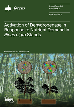
Determining the influence of enzymatic activity on forest productivity is crucial for understanding the function and stability of the forest ecosystem. In a research study conducted in Pinus nigra Mediterranean stands in Central Spain, dehydrogenase enzymes showed higher activity in soils when trees were growing under higher nutrient demands, particularly at young and poor-quality sites (lower Site Index). Dehydrogenase is exclusively present in living microorganisms, mainly in bacteria, playing an important role in the initial stages of the oxidation of organic matter. Therefore, dehydrogenase could serve as an index to elucidate both site quality and stand development in Pinus stands, making it a potential indicator of forest ecosystem development. View this paper
  • Issues are regarded as officially published after their release is announced to the table of contents alert mailing list.
  • You may sign up for e-mail alerts to receive table of contents of newly released issues.
  • PDF is the official format for papers published in both, html and pdf forms. To view the papers in pdf format, click on the "PDF Full-text" link, and use the free Adobe Reader to open them.
Order results
Result details
Section
Select all
Export citation of selected articles as:
17 pages, 5787 KiB  
Article
Two Centuries of Winter Temperature Variability Inferred from Betula ermanii Ring Widths near the Forests/Tundra Ecotone in the Changbai Mountain, China
by Siwen Li, Xiaoyang Cui and Yangao Jiang
Forests 2024, 15(1), 220; https://doi.org/10.3390/f15010220 - 22 Jan 2024
Viewed by 1543
Abstract
In this study, we constructed a ring-width chronology derived from Betula ermanii (BE) near the transitional zone between forests and tundra within the Changbai Mountain (CBM) region. This chronology was established utilizing 55 cores obtained from 30 trees. Our analysis of growth/climate responses [...] Read more.
In this study, we constructed a ring-width chronology derived from Betula ermanii (BE) near the transitional zone between forests and tundra within the Changbai Mountain (CBM) region. This chronology was established utilizing 55 cores obtained from 30 trees. Our analysis of growth/climate responses underscores the pivotal role of the mean maximum winter temperature in influencing radial growth. Drawing upon these growth/climate associations, we reconstructed the mean maximum temperature series for December of the preceding year through January of the current year for the years 1787 and 2005 CE, employing a standardized chronology. During the calibration period (1960–2005), the reconstructed series exhibited an explained variance of 36%. This reconstruction provides crucial insights into historical temperature fluctuations within the study area. Our findings indicate that year-to-year temperature variations did not manifest synchronously along the altitude gradient of Changbai Mountain. Notably, the response to recent winter warming exhibited disparities with the altitude on Changbai Mountain. Specifically, the higher altitude range (1950–2000 m a.s.l.) displayed a response to warming around 1960, the mid-altitude range (765–1188 m a.s.l.) responded around 1975, and the lowest altitude (650 m a.s.l.) responded by 1977. Consequently, the paleotemperature research outcomes from Changbai Mountain alone may not adequately characterize climate change in this region. We recommend future high-resolution temperature records be obtained through sampling at various altitudes to enhance the comprehensiveness of our understanding. Full article
Show Figures

Figure 1

21 pages, 2648 KiB  
Article
Effects of Drought, Phosphorus Fertilization and Provenance on the Growth of Common Beech and Sessile Oak
by Antonia Vukmirović, Željko Škvorc, Saša Bogdan, Daniel Krstonošić, Ida Katičić Bogdan, Tomislav Karažija, Marko Bačurin, Magdalena Brener and Krunoslav Sever
Forests 2024, 15(1), 219; https://doi.org/10.3390/f15010219 - 22 Jan 2024
Viewed by 789
Abstract
The negative impact of drought on plant growth may be modified by the different availability of mineral nutrients and by their adaptation to different local habitat conditions. In this study, we examine the impact of drought, fertilization with phosphorus and provenance, as well [...] Read more.
The negative impact of drought on plant growth may be modified by the different availability of mineral nutrients and by their adaptation to different local habitat conditions. In this study, we examine the impact of drought, fertilization with phosphorus and provenance, as well as their interactions, on the growth and allometric growth relationships between the belowground and aboveground organs of common beech (Fagus sylvatica L.) and sessile oak (Quercus petraea (Matt.) Liebl.). The research was conducted on saplings originating from two mature mixed stands (dry and wet provenances) dominated by these species. In the common garden experiment, saplings were exposed to regular watering and drought in interaction with moderate and high phosphorus concentrations in the growing substrate (achieved by phosphorus fertilization). The obtained results indicate the negative impact of drought and phosphorus fertilization on the growth of both species. In common beech, a negative impact of phosphorus fertilization on the adaptive capacity to drought was demonstrated by unfavorable ratios between fine root mass and the mass of other organs. The sessile oak provenances under the impact of drought showed a different root collar diameter/stem height increment ratio, which indicates their different phenotypic plasticity as a consequence of adaptation to different frequencies of dry periods in their natural habitats. Full article
(This article belongs to the Special Issue Abiotic Stress in Tree Species)
Show Figures

Figure 1

16 pages, 4277 KiB  
Article
Collaborative Utilization of Sentinel-1/2 and DEM Data for Mapping the Soil Organic Carbon in Forested Areas Based on the Random Forest
by Zeqiang Wang, Dongyou Zhang, Xibo Xu, Tingyu Lu and Guanghui Yang
Forests 2024, 15(1), 218; https://doi.org/10.3390/f15010218 - 22 Jan 2024
Viewed by 915
Abstract
Optical remote sensing data are widely used for constructing soil organic carbon (SOC) mapping models. However, it is challenging to map SOC in forested areas because atmospheric water vapor affects the results derived from optical remote sensing data. To address this issue, we [...] Read more.
Optical remote sensing data are widely used for constructing soil organic carbon (SOC) mapping models. However, it is challenging to map SOC in forested areas because atmospheric water vapor affects the results derived from optical remote sensing data. To address this issue, we utilized Sentinel-1, Sentinel-2, and digital elevation model (DEM) data to obtain a comprehensive feature set (including S1-based textural indices, S2-based spectral indices, and DEM-derived indices) to map the SOC content in forested areas. The features set were the predictor variables, and the measured SOC content was the dependent variable. The random forest algorithm was used to establish the SOC model. The ratio of performance to inter-quartile range (RPIQ) was 2.92 when the S2-based spectral indices were used as predictor variables. When the comprehensive feature set was utilized as the model input, the model achieved an RPIQ of 4.13 (R2 = 0.91, root mean square error (RMSE) = 9.18), representing a 41.44% improvement in model accuracy. The average SOC content in the Greater Khingan Mountains was 43.75 g kg−1. The northern and southwestern parts had higher SOC contents (>54.93 g kg−1), while the southeastern and northwestern parts had lower contents (<39.83 g kg−1). This discrepancy was primarily attributed to agricultural activities. The results indicate that using a comprehensive feature set and the random forest algorithm is a reliable approach for estimating the spatial distribution of the SOC content in forested areas and is suitable for forest ecology and carbon management studies. Full article
(This article belongs to the Section Forest Soil)
Show Figures

Figure 1

13 pages, 2629 KiB  
Article
Fire in Focus: Advancing Wildfire Image Segmentation by Focusing on Fire Edges
by Guodong Wang, Fang Wang, Hongping Zhou and Haifeng Lin
Forests 2024, 15(1), 217; https://doi.org/10.3390/f15010217 - 22 Jan 2024
Viewed by 954
Abstract
With the intensification of global climate change and the frequent occurrence of forest fires, the development of efficient and precise forest fire monitoring and image segmentation technologies has become increasingly important. In dealing with challenges such as the irregular shapes, sizes, and blurred [...] Read more.
With the intensification of global climate change and the frequent occurrence of forest fires, the development of efficient and precise forest fire monitoring and image segmentation technologies has become increasingly important. In dealing with challenges such as the irregular shapes, sizes, and blurred boundaries of flames and smoke, traditional convolutional neural networks (CNNs) face limitations in forest fire image segmentation, including flame edge recognition, class imbalance issues, and adapting to complex scenarios. This study aims to enhance the accuracy and efficiency of flame recognition in forest fire images by introducing a backbone network based on the Swin Transformer and combined with an adaptive multi-scale attention mechanism and focal loss function. By utilizing a rich and diverse pre-training dataset, our model can more effectively capture and understand key features of forest fire images. Through experimentation, our model achieved an intersection over union (IoU) of 86.73% and a precision of 91.23%. This indicates that the performance of our proposed wildfire segmentation model has been effectively enhanced. A series of ablation experiments validate the importance of these technological improvements in enhancing model performance. The results show that our approach achieves significant performance improvements in forest fire image segmentation tasks compared to traditional models. The Swin Transformer provides more refined feature extraction capabilities, the adaptive multi-scale attention mechanism helps the model focus better on key areas, and the focal loss function effectively addresses the issue of class imbalance. These innovations make the model more precise and robust in handling forest fire image segmentation tasks, providing strong technical support for future forest fire monitoring and prevention. Full article
(This article belongs to the Special Issue Artificial Intelligence and Machine Learning Applications in Forestry)
Show Figures

Figure 1

24 pages, 22362 KiB  
Article
Global Wildfire Danger Predictions Based on Deep Learning Taking into Account Static and Dynamic Variables
by Yuheng Ji, Dan Wang, Qingliang Li, Taihui Liu and Yu Bai
Forests 2024, 15(1), 216; https://doi.org/10.3390/f15010216 - 22 Jan 2024
Viewed by 1132
Abstract
Climate change will intensify the danger of wildfires, significantly impacting human life. Deep Learning (DL) has been extensively applied in wildfire prediction research. In the realm of wildfire prediction, previous deep learning methods have overlooked the inherent differences between static positional information and [...] Read more.
Climate change will intensify the danger of wildfires, significantly impacting human life. Deep Learning (DL) has been extensively applied in wildfire prediction research. In the realm of wildfire prediction, previous deep learning methods have overlooked the inherent differences between static positional information and dynamic variables. Additionally, most existing deep learning models have not integrated the global system characteristics of the Earth’s features and teleconnection during the learning phase. Here, we propose a static location-aware ConvLSTM (SLA-ConvLSTM) model that is aware of static positional elements and interconnected with global information and teleconnection. The model we propose can discern the influence of dynamic variables across various geographical locations on predictive outcomes. Compared with other deep learning models, our SLA-ConvLSTM model has achieved commendable performance. The outcomes indicate that the collaborative interplay of spatiotemporal features and the extraction of static positional information present a promising technique for wildfire prediction. Moreover, the incorporation of climate indices and global feature variables enhances the predictive capability of the model in wildfire prediction. Full article
(This article belongs to the Special Issue Wildfire Monitoring and Risk Management in Forests)
Show Figures

Figure 1

0 pages, 10240 KiB  
Article
Estimation of Aboveground Biomass for Different Forest Types Using Data from Sentinel-1, Sentinel-2, ALOS PALSAR-2, and GEDI
by Chu Wang, Wangfei Zhang, Yongjie Ji, Armando Marino, Chunmei Li, Lu Wang, Han Zhao and Mengjin Wang
Forests 2024, 15(1), 215; https://doi.org/10.3390/f15010215 - 21 Jan 2024
Cited by 1 | Viewed by 1782 | Correction
Abstract
Forest aboveground biomass (AGB) is integral to the global carbon cycle and climate change study. Local and regional AGB mapping is crucial for understanding global carbon stock dynamics. NASA’s global ecosystem dynamics investigation (GEDI) and combination of multi-source optical and synthetic aperture radar [...] Read more.
Forest aboveground biomass (AGB) is integral to the global carbon cycle and climate change study. Local and regional AGB mapping is crucial for understanding global carbon stock dynamics. NASA’s global ecosystem dynamics investigation (GEDI) and combination of multi-source optical and synthetic aperture radar (SAR) datasets have great potential for local and regional AGB estimation and mapping. In this study, GEDI L4A AGB data and ground sample plots worked as true AGB values to explore their difference for estimating forest AGB using Sentinel-1 (S1), Sentinel-2 (S2), and ALOS PALSAR-2 (PALSAR) data, individually and in their different combinations. The effects of forest types and different true AGB values for validation were investigated in this study, as well. The combination of S1 and S2 performed best in forest AGB estimation with R2 ranging from 0.79 to 0.84 and RMSE ranging from 7.97 to 29.42 Mg/ha, with the ground sample plots used as ground truth data. While for GEDI L4A AGB product working as reference, R2 values range from 0.36 to 0.47 and RMSE values range from 31.41 to 37.50 Mg/ha. The difference between using GEDI L4A and ground sample plot as reference shows obvious dependence on forest types. In summary, optical dataset and its combination with SAR performed better in forest AGB estimation when the average AGB is less than 150 Mg/ha. The AGB predictions from GEDI L4A AGB product used as reference underperformed across the different forest types and study sites. However, GEDI can work as ground truth data source for forest AGB estimation in a certain level of estimation accuracy. Full article
(This article belongs to the Special Issue Computer Application and Deep Learning in Forestry)
Show Figures

Figure 1

14 pages, 2636 KiB  
Article
Tree Diameter at Breast Height (DBH) Estimation Using an iPad Pro LiDAR Scanner: A Case Study in Boreal Forests, Ontario, Canada
by Matthew Guenther, Muditha K. Heenkenda, Dave Morris and Brigitte Leblon
Forests 2024, 15(1), 214; https://doi.org/10.3390/f15010214 - 21 Jan 2024
Cited by 1 | Viewed by 926
Abstract
The aim of this study was to determine whether the iPad Pro 12th generation LiDAR sensor is useful to measure tree diameter at breast height (DBH) in natural boreal forests. This is a follow-up to a previous study that was conducted in a [...] Read more.
The aim of this study was to determine whether the iPad Pro 12th generation LiDAR sensor is useful to measure tree diameter at breast height (DBH) in natural boreal forests. This is a follow-up to a previous study that was conducted in a research forest and identified the optimal method for (DBH) estimation as a circular scanning and fitting ellipses to 4 cm stem cross-sections at breast height. The iPad Pro LiDAR scanner was used to acquire point clouds for 15 sites representing a range of natural boreal forest conditions in Ontario, Canada, and estimate DBH. The secondary objective was to determine if tested stand (species composition, age, density, understory) or tree (species, DBH) factors affected the accuracy of estimated DBH. Overall, estimated DBH values were within 1 cm of actual DBH values for 78 of 133 measured trees (59%). An RMSE of 1.5 cm (8.6%) was achieved. Stand age had a large effect (>0.15) on the accuracy of estimated DBH values, while density, understory, and DBH had moderate effects (0.05–0.14). No trend was identified between accuracy and stand age. Accuracy improved as understory density decreased and as tree DBH increased. Inertial measurement unit (IMU) and positional accuracy errors with the iPad Pro scanner limit the feasibility of using this device for forest inventories. Full article
(This article belongs to the Special Issue Airborne and Terrestrial Laser Scanning in Forests)
Show Figures

Figure 1

22 pages, 13225 KiB  
Article
Mining Social Media Data to Capture Urban Park Visitors’ Perception of Cultural Ecosystem Services and Landscape Factors
by Yaxin Chen, Chuanchun Hong, Yifan Yang, Jiaxin Li, Yu Wang, Tianyu Zheng, Yinke Zhang and Feng Shao
Forests 2024, 15(1), 213; https://doi.org/10.3390/f15010213 - 21 Jan 2024
Viewed by 1262
Abstract
Urban parks not only enhance urban ecology but also play a crucial role in providing cultural ecosystem services (CESs) for the well-being of urban residents. Both artificial and natural landscape factors within parks contribute significantly to the supply of cultural ecosystem services. To [...] Read more.
Urban parks not only enhance urban ecology but also play a crucial role in providing cultural ecosystem services (CESs) for the well-being of urban residents. Both artificial and natural landscape factors within parks contribute significantly to the supply of cultural ecosystem services. To explore public perceptions of landscape factors and CESs, this study focused on 25 urban parks in Hangzhou. Social media data uploaded by park visitors from 2018 to 2023 were collected to establish a corresponding CES indicator framework. Combining computer vision with text mining, we assessed the preferences and correlations between visitor-perceived CESs and park landscape factors. The results indicated that the majority of park visitors perceive CESs (80.00%) with overall satisfaction higher than importance. Among them, aesthetic experiences and recreation showed both high satisfaction and importance. In shared social media photos, arbors (19.01%), herbaceous flowers (8.99%), and groves (8.22%) were frequently presented as landscape factors. The study revealed close correlations between user gender, landscape factors, and perceived CES categories, with females contributing more to the perception of both. There were internal correlations within CES categories, with spiritual services, aesthetic experiences, and recreation showing the most significant associations. Different landscape factors impacted CES categories to varying degrees, and biological landscapes formed by plant and animal factors were considered to provide more CESs. These findings are significant for enhancing the quality of ecological services and biodiversity in parks. Full article
Show Figures

Figure 1

20 pages, 11043 KiB  
Article
An Innovative Approach to Surface Deformation Estimation in Forest Road and Trail Networks Using Unmanned Aerial Vehicle Real-Time Kinematic-Derived Data for Monitoring and Maintenance
by Evangelia Siafali and Petros A. Tsioras
Forests 2024, 15(1), 212; https://doi.org/10.3390/f15010212 - 21 Jan 2024
Viewed by 1443
Abstract
The significant increase in hiking, wood extraction, and transportation activities exerts a notable impact on the environmental balance along trails and forest roads in the form of soil degradation. The aim of this study was to develop a Deformation Classification Model for the [...] Read more.
The significant increase in hiking, wood extraction, and transportation activities exerts a notable impact on the environmental balance along trails and forest roads in the form of soil degradation. The aim of this study was to develop a Deformation Classification Model for the surface of a multi-use trail, as well as to calculate sediment deposition and generate a flood hazard map in a partially forested region. The eBee X mapping Unmanned Aerial Vehicle (UAV) equipped with the senseFly S.O.D.A. 3D camera and Real-Time Kinematic (RTK) technology flew over the study area of 149 ha in Northern Greece at an altitude of 120 m and achieved a high spatial resolution of 2.6 cm. The specific constellation of fixed-wing equipment makes the use of ground control points obsolete, compared to previous, in most cases polycopter-based, terrain deformation research. Employing the same methodology, two distinct classifications were applied, utilizing the Digital Surface Model (DSM) and Digital Elevation Model (DEM) for analysis. The Geolocation Errors and Statistics for Bundle Block Adjustment exhibited a high level of accuracy in the model, with the mean values for each of the three directions (X, Y, Z) being 0.000023 m, −0.000044 m, and 0.000177 m, respectively. The standard deviation of the error in each direction was 0.022535 m, 0.019567 m, and 0.020261 m, respectively. In addition, the Root Mean Square (RMS) error was estimated to be 0.022535 m, 0.019567 m, and 0.020262 m, respectively. A total of 20 and 30 altitude categories were defined at a 4 cm spatial resolution, each assigned specific ranges of values, respectively. The area of each altitude category was quantified in square meters (m2), while the volume of each category was measured in cubic meters (m3). The development of a Deformation Classification Model for the deck of a trail or forest road, coupled with the computation of earthworks and the generation of a flood hazards map, represents an efficient approach that can provide valuable support to forest managers during the planning phase or maintenance activities of hiking trails and forest roads. Full article
(This article belongs to the Special Issue Forest Harvesting and Forest Product Supply Chain)
Show Figures

Figure 1

19 pages, 14298 KiB  
Article
The Consequences of Climate Change in the Brazilian Western Amazon: A New Proposal for a Fire Risk Model in Rio Branco, Acre
by Kennedy da Silva Melo, Rafael Coll Delgado, Marcos Gervasio Pereira and Givanildo Pereira Ortega
Forests 2024, 15(1), 211; https://doi.org/10.3390/f15010211 - 21 Jan 2024
Viewed by 1147
Abstract
The objective of this study was to verify the link between climate change, changes in land use, and the increasing frequency of forest fires in the state of Acre. Recognizing the importance of an accurate assessment of fire risk, we also proposed a [...] Read more.
The objective of this study was to verify the link between climate change, changes in land use, and the increasing frequency of forest fires in the state of Acre. Recognizing the importance of an accurate assessment of fire risk, we also proposed a new fire risk index for the capital Rio Branco, using meteorological data. Validated reanalysis data from 1961 to 2020 extracted for Rio Branco and different land uses were used. Data on fire foci, deforestation, and agricultural crops were also obtained. The new model was based on the Fire Risk Atlantic Forest (FIAF) Index, developed for the Atlantic Forest biome, and was subjected to multiple regression analysis. To validate the new model, projections were calculated using different scenarios from the Intergovernmental Panel on Climate Change (IPCC). The new model, entitled Rio Branco Fire Risk (FIRERBR), revealed an increase in fire risk, especially associated with agriculture, in future scenarios (SSP2-4.5 and SSP5-8.5) from 2023 onward. Rainfall and relative air humidity also showed a reduction in projections, indicating a higher degree of fire danger for the region. Full article
(This article belongs to the Special Issue Forest Fires Prediction and Detection—Volume II)
Show Figures

Figure 1

15 pages, 5332 KiB  
Article
An Efficient and Lightweight Detection Model for Forest Smoke Recognition
by Xiao Guo, Yichao Cao and Tongxin Hu
Forests 2024, 15(1), 210; https://doi.org/10.3390/f15010210 - 21 Jan 2024
Cited by 1 | Viewed by 1187
Abstract
Massive wildfires have become more frequent, seriously threatening the Earth’s ecosystems and human societies. Recognizing smoke from forest fires is critical to extinguishing them at an early stage. However, edge devices have low computational accuracy and suboptimal real-time performance. This limits model inference [...] Read more.
Massive wildfires have become more frequent, seriously threatening the Earth’s ecosystems and human societies. Recognizing smoke from forest fires is critical to extinguishing them at an early stage. However, edge devices have low computational accuracy and suboptimal real-time performance. This limits model inference and deployment. In this paper, we establish a forest smoke database and propose a model for efficient and lightweight forest smoke detection based on YOLOv8. Firstly, to improve the feature fusion capability in forest smoke detection, we fuse a simple yet efficient weighted feature fusion network into the neck of YOLOv8. This also greatly optimizes the number of parameters and computational load of the model. Then, the simple and parametric-free attention mechanism (SimAM) is introduced to address the problem of forest smoke dataset images that may contain complex background and environmental disturbances. The detection accuracy of the model is improved, and no additional parameters are introduced. Finally, we introduce focal modulation to increase the attention to the hard-to-detect smoke and improve the running speed of the model. The experimental results show that the mean average precision of the improved model is 90.1%, which is 3% higher than the original model. The number of parameters and the computational complexity of the model are 7.79 MB and 25.6 GFLOPs (giga floating-point operations per second), respectively, which are 30.07% and 10.49% less than those of the unimproved YOLOv8s. This model is significantly better than other mainstream models in the self-built forest smoke detection dataset, and it also has great potential in practical application scenarios. Full article
(This article belongs to the Section Natural Hazards and Risk Management)
Show Figures

Figure 1

18 pages, 16249 KiB  
Article
Unmanned Aerial Vehicle–Light Detection and Ranging-Based Individual Tree Segmentation in Eucalyptus spp. Forests: Performance and Sensitivity
by Yan Yan, Jingjing Lei, Jia Jin, Shana Shi and Yuqing Huang
Forests 2024, 15(1), 209; https://doi.org/10.3390/f15010209 - 20 Jan 2024
Viewed by 864
Abstract
As an emerging powerful tool for forest resource surveys, the unmanned aerial vehicle (UAV)-based light detection and ranging (LiDAR) sensors provide an efficient way to detect individual trees. Therefore, it is necessary to explore the most suitable individual tree segmentation algorithm and analyze [...] Read more.
As an emerging powerful tool for forest resource surveys, the unmanned aerial vehicle (UAV)-based light detection and ranging (LiDAR) sensors provide an efficient way to detect individual trees. Therefore, it is necessary to explore the most suitable individual tree segmentation algorithm and analyze the sensitivity of the parameter setting to determine the optimal parameters, especially for the Eucalyptus spp. forest, which is one of the most important hardwood plantations in the world. In the study, four methods were employed to segment individual Eucalyptus spp. plantations from normalized point cloud data and canopy height model generated from the original UAV-LiDAR data. And the parameter sensitivity of each segmentation method was analyzed to obtain the optimal parameter setting according to the extraction accuracy. The performance of the segmentation result was assessed by three indices including detection rate, precision, and overall correctness. The results indicated that the watershed algorithm performed better than other methods as the highest overall correctness (F = 0.761) was generated from this method. And the segmentation methods based on the canopy height model performed better than those based on normalized point cloud data. The detection rate and overall correctness of low-density plots were better than high-density plots, while the precision was reversed. Forest structures and individual wood characteristics are important factors influencing the parameter sensitivity. The performance of segmentation was improved by optimizing the key parameters of the different algorithms. With optimal parameters, different segmentation methods can be used for different types of Eucalyptus plots to achieve a satisfying performance. This study can be applied to accurate measurement and monitoring of Eucalyptus plantation. Full article
(This article belongs to the Special Issue Application of Remote Sensing in Vegetation Dynamic and Ecology)
Show Figures

Figure 1

19 pages, 22895 KiB  
Article
Spatiotemporal Distribution Analysis of Spatial Vitality of Specialized Garden Plant Landscapes during Spring: A Case Study of Hangzhou Botanical Garden in China
by Tian Liu, Bingyi Mi, Hai Yan, Zhiyi Bao, Renwu Wu and Shuhan Wang
Forests 2024, 15(1), 208; https://doi.org/10.3390/f15010208 - 20 Jan 2024
Cited by 1 | Viewed by 919
Abstract
Specialized gardens, as integral components of botanical gardens, bear multiple functions, encompassing plant collection and conservation, scientific research, and public education, as well as serving aesthetic and recreational purposes. Their quality profoundly reflects the landscape artistry of botanical gardens, directly influencing the quality [...] Read more.
Specialized gardens, as integral components of botanical gardens, bear multiple functions, encompassing plant collection and conservation, scientific research, and public education, as well as serving aesthetic and recreational purposes. Their quality profoundly reflects the landscape artistry of botanical gardens, directly influencing the quality of visitors’ enjoyment and the overall experience within the botanical garden. This study aims to investigate the spatial vitality of specialized garden plant landscapes, effectively assessing the usage patterns of plant landscape spaces and promoting the optimal utilization of underutilized spaces. Taking Hangzhou Botanical Garden as a case study, considering the warming climate and suitable temperatures in spring, when most plants enter the flowering period and outdoor visitor frequency increases, the primary observational period focuses on spring to measure the spatial vitality of specialized garden plant landscapes. We obtained data through field measurements and on-site observations. Specifically, We measured and recorded information on plant species, quantity, height, crown width, and growth conditions within the plots. Additionally, we employed ground observations and fixed-point photography to document visitor numbers and activity types. We quantified spatial vitality through four indicators: visitor density, space usage intensity, diversity of age group, and richness of activity type. We explored the spatiotemporal distribution patterns of spatial vitality and investigated the relationship between plant landscape characteristics and spatial vitality using variance analysis and correlation analysis. The results indicate that, in spring, the average spatial vitality index of specialized gardens ranks from highest to lowest as follows: Lingfeng Tanmei (1.403), Rosaceae Garden (1.245), Acer and Rhododendron Garden (0.449), and Osmanthus and Crape Myrtle Garden (0.437). Additionally, the spatial vitality of specialized garden plant landscapes in spring is significantly positively correlated with the ornamental period of specialized plants, characteristics of plant viewing, accessible lawn area, spatial accessibility, and spatial enclosure. Therefore, to create vibrant specialized plant landscapes, managers and planners, when engaging in the planning and design of specialized garden plant landscapes, need to fully consider and respect the visual aesthetics and functional needs of visitors. This study will serve as a theoretical reference for subsequent research on the vitality of plant landscape spaces and other small-scale spaces. It will also provide practical guidance for the construction of plant landscapes in specialized gardens within botanical gardens and other urban green spaces. Full article
(This article belongs to the Special Issue Landsenses in Green Spaces)
Show Figures

Figure 1

16 pages, 1994 KiB  
Article
Chemical Composition and FTIR Analysis of Acetylated Turkey Oak and Pannonia Poplar Wood
by Fanni Fodor and Tamás Hofmann
Forests 2024, 15(1), 207; https://doi.org/10.3390/f15010207 - 19 Jan 2024
Viewed by 736
Abstract
In this research, acetylation was applied under industrial conditions to improve the properties of Turkey oak and Pannonia poplar wood. Both species are potential “climate winners” in Hungary, yet they are currently underused due their low durability and poor dimensional stability. The acetylation [...] Read more.
In this research, acetylation was applied under industrial conditions to improve the properties of Turkey oak and Pannonia poplar wood. Both species are potential “climate winners” in Hungary, yet they are currently underused due their low durability and poor dimensional stability. The acetylation modification process may be a suitable method to improve their properties. In order to verify the effectiveness of the process, comparative chemical analyses (cellulose, hemicelluloses, lignin, extractives, ash, buffering capacity, and pH) of the untreated and acetylated heartwood and sapwood were carried out for both species for the first time. Diffuse reflectance infrared Fourier transform (DRIFT) spectroscopy was also used to support the evaluation of the chemical analyses. The weight percent gain was 11.54% for poplar and 0.94% for Turkey oak, indicating poor treatment efficiency for the latter. The cellulose, hemicelluloses, and lignin contents changed significantly in poplar, with the highest change (+81%) induced by acetylating the hemicelluloses. Only the alpha-cellulose content decreased significantly in Turkey oak, presumably due to the degradation of the non-crystalline part of the cellulose. Acetylation may improve the resistance of Pannonia poplar against moisture, weather, decay, and wood-boring insects, but the process parameters need to be optimized in order to prevent degradation and discoloration in poplar. Turkey oak was found to be less suitable for acetylation due to its low permeability and tendency to crack. Full article
(This article belongs to the Special Issue Wood Chemistry in a Changing Global Environment)
Show Figures

Figure 1

14 pages, 3491 KiB  
Article
Invasive Pest and Invasive Host: Where Might Spotted-Wing Drosophila (Drosophila suzukii) and American Black Cherry (Prunus serotina) Cross Paths in Europe?
by Yefu Zhou, Chunhong Wu, Peixiao Nie, Jianmeng Feng and Xiaokang Hu
Forests 2024, 15(1), 206; https://doi.org/10.3390/f15010206 - 19 Jan 2024
Cited by 1 | Viewed by 742
Abstract
Both spotted-wing drosophila (SWD, Drosophila suzukii) and American black cherry (ABC, Prunus serotina) are invasive species with major deleterious effects on forest ecosystems in Europe. ABC, a host of SWD, can sustain large populations of SWD, and SWD in turn can [...] Read more.
Both spotted-wing drosophila (SWD, Drosophila suzukii) and American black cherry (ABC, Prunus serotina) are invasive species with major deleterious effects on forest ecosystems in Europe. ABC, a host of SWD, can sustain large populations of SWD, and SWD in turn can constrain the regeneration of its host. Here, we examined the range shifts of SWD, ABC, and their range overlap under future scenarios using range shift models. In the current–future scenarios, both SWD and ABC were predicted to undergo potential range expansions in Europe, suggesting that their invasion risks might increase in the future. Climate change might be the major driver of range shifts of both the pest and host, followed by land-use and host availability changes; therefore, mitigating future climate change might be key for controlling their future invasions in Europe. The relative contribution of climate and host availability to shaping the potential ranges of invasive species might not only vary with their feeding habitats (polyphagy/oligophagy) but also with the relative abundance of hosts among available host reservoirs. Range overlap under current and future scenarios was mainly observed in the UK, Germany, France, Switzerland, Italy, and Eastern Europe; this area is of high and low priority for the control of SWD and ABC, respectively. Full article
(This article belongs to the Section Forest Health)
Show Figures

Figure 1

16 pages, 4947 KiB  
Article
Effects of Ozone Stress on Rhizosphere Soil of Poplar Seedlings
by Qin Wang, Qingqing Yang, Meng Zhang, Jianwei Ma and Laiye Qu
Forests 2024, 15(1), 205; https://doi.org/10.3390/f15010205 - 19 Jan 2024
Cited by 1 | Viewed by 709
Abstract
Near-surface O3 has negative effects on plant productivity; however there were few studies on the effects of O3 pollution on the belowground part of the ecosystem. The effect of O3 stress on the belowground parts of poplar is unclear. We [...] Read more.
Near-surface O3 has negative effects on plant productivity; however there were few studies on the effects of O3 pollution on the belowground part of the ecosystem. The effect of O3 stress on the belowground parts of poplar is unclear. We investigated the effects of O3 pollution on poplar rhizosphere soil in open-top chambers (OTC). Two kinds of plants with different O3 sensitivity were selected, i.e., high-sensitive poplar clone 546 and low-sensitive poplar clone 107. The control group and high-concentration O3 group were set up: charcoal-filtered air, CF; unfiltered air + 60 ppb O3, NF. Poplar rhizosphere soil was taken after 96 days (15 June to 17 September 2020) of cultivation in OTCs. O3 stress decreased the amplicon sequence variations (ASVs) of microorganisms in poplar 107 and poplar 546 rhizosphere soil, with no significant interspecific difference. The effect of O3 fumigation on the fungal community was greater than that on the bacterial community. The correlation between the bacterial community and rhizosphere soil physicochemical indices was closer than that of the fungal community. Some fungi, such as Clitopilus hobsonii, Mortierella sp., and Minimedusa, might help poplar resist the O3 stress. O3 stress had direct impacts on the pH, nutrients, and enzyme activities of rhizosphere soil, while it had indirect negative impacts on microbial community composition by nutrients. There was no difference in sensitivity between rhizosphere soil response to O3 stress of poplar clone 107 and clone 546, which might take a longer accumulation time to show the effect. This study provides a certain basis for accurately evaluating the ecological effects of O3 pollution. Full article
Show Figures

Figure 1

24 pages, 9990 KiB  
Article
SWVR: A Lightweight Deep Learning Algorithm for Forest Fire Detection and Recognition
by Li Jin, Yanqi Yu, Jianing Zhou, Di Bai, Haifeng Lin and Hongping Zhou
Forests 2024, 15(1), 204; https://doi.org/10.3390/f15010204 - 19 Jan 2024
Cited by 3 | Viewed by 1114
Abstract
The timely and effective detection of forest fires is crucial for environmental and socio-economic protection. Existing deep learning models struggle to balance accuracy and a lightweight design. We introduce SWVR, a new lightweight deep learning algorithm. Utilizing the Reparameterization Vision Transformer (RepViT) and [...] Read more.
The timely and effective detection of forest fires is crucial for environmental and socio-economic protection. Existing deep learning models struggle to balance accuracy and a lightweight design. We introduce SWVR, a new lightweight deep learning algorithm. Utilizing the Reparameterization Vision Transformer (RepViT) and Simple Parameter-Free Attention Module (SimAM), SWVR efficiently extracts fire-related features with reduced computational complexity. It features a bi-directional fusion network combining top-down and bottom-up approaches, incorporates lightweight Ghost Shuffle Convolution (GSConv), and uses the Wise Intersection over Union (WIoU) loss function. SWVR achieves 79.6% accuracy in detecting forest fires, which is a 5.9% improvement over the baseline, and operates at 42.7 frames per second. It also reduces the model parameters by 11.8% and the computational cost by 36.5%. Our results demonstrate SWVR’s effectiveness in achieving high accuracy with fewer computational resources, offering practical value for forest fire detection. Full article
(This article belongs to the Special Issue Artificial Intelligence and Machine Learning Applications in Forestry)
Show Figures

Figure 1

13 pages, 4942 KiB  
Article
Synergistic Effects of Heating Platens’ Temperature and Compression Ratio on the Periodic Hot-Press Drying of Chinese Fir Lumber
by Xiang Weng, Xingying Zhang, Chengjian Huang, Shipeng Wang and Junfeng Hou
Forests 2024, 15(1), 203; https://doi.org/10.3390/f15010203 - 19 Jan 2024
Viewed by 576
Abstract
The effects of periodic hot-press drying on drying behavior and mechanical damage to Chinese fir lumber were investigated by taking the heating platens’ temperature (TP) and compression ratio (Rc) as experimental factors. The temperature and pressure inside [...] Read more.
The effects of periodic hot-press drying on drying behavior and mechanical damage to Chinese fir lumber were investigated by taking the heating platens’ temperature (TP) and compression ratio (Rc) as experimental factors. The temperature and pressure inside lumber were analyzed during drying process. The results were as follows. The drying rate of lumber was significantly increased with increasing TP and Rc. Scanning electron microscope (SEM) micrographs showed that bordered pit membranes, cross-field pits, middle lamella between adjacent cells, and tracheid walls were damaged after drying, and the damage became more severe with higher TP and Rc. Detachments between ray parenchyma cells and tracheids were observed at 170 °C. Nitrogen-adsorption measurement results demonstrated that more cell wall pores in the 2.5~6.2 nm pore diameter range were generated at higher TP, resulting in an enlarged specific surface area and pore volume of cell walls. These structural changes contributed to accelerating moisture migration and decreasing the drying time. Furthermore, fluctuating pressure inside lumber was the main driving force leading to moisture migration and cell tissue damage in lumber during drying. The influence of TP on internal temperature (TM) and pressure (PM) was greater than Rc. With the increase in TP from 130 to 170 °C at the Rc of 10%, the maximum TM and PM were increased by 30.90% and 39.84%, respectively. However, TP should not be too high to prevent the formation of macro-cracks caused by high pressure, which may significantly affect wood’s mechanical properties. These results provide theoretical support for periodic hot-press drying processes’ improvement and high-value utilization of Chinese fir. Full article
(This article belongs to the Special Issue Wood Quality and Wood Processing)
Show Figures

Figure 1

14 pages, 26242 KiB  
Article
Characterization of Chinese Tallow Invasion in the Southern United States
by Mohammad M. Bataineh, Jacob S. Fraser and Lauren S. Pile Knapp
Forests 2024, 15(1), 202; https://doi.org/10.3390/f15010202 - 19 Jan 2024
Viewed by 1079
Abstract
Chinese tallow is a non-native invasive tree expanding in range and abundance throughout the southern United States. Several biogeographical studies mapping tallow distribution and examining key underlying environmental factors relied on the U.S. Forest Service Forest Inventory and Analysis (FIA) data, representing forestlands [...] Read more.
Chinese tallow is a non-native invasive tree expanding in range and abundance throughout the southern United States. Several biogeographical studies mapping tallow distribution and examining key underlying environmental factors relied on the U.S. Forest Service Forest Inventory and Analysis (FIA) data, representing forestlands at scales of ~2400 ha. However, given that most invasive trees, like tallow, are cosmopolitan and dynamic in nature, FIA data fails to capture the extent and severity of the invasion especially outside areas classified as forestlands. To develop tallow maps that more adequately depict its distribution at finer spatial scales and to capture observations in non-forestlands, we combined verified citizen science observations with FIA data. Further, we described spatiotemporal patterns and compared citizen science to FIA and other previously published distribution maps. From our work, although tallow is prevalent in the south, Louisiana, Texas, and Mississippi were the most invaded states. Tallow was associated with flatwoods and prairie grasslands of the Gulf Coast. Annual extreme minimum temperatures of less than −12.2 °C (10 °F) represented the northern limit of naturalized tallow populations. Tallow’s northward and inland expansion was captured in citizen science and FIA data, indicating a tallow spread rate ranging from 5 to 20 km annually over the last decade. Systematic sampling, such as FIA, and citizen science data both have their own unique pitfalls. However, the use of citizen science data can complement invasive plant distribution mapping, especially when combined with data from established systematic monitoring networks. This approach provides for a more complete understanding of invasive tree extent and spatiotemporal dynamics across large landscapes. Full article
(This article belongs to the Topic Plant Invasion)
Show Figures

Figure 1

15 pages, 27675 KiB  
Article
Water Reservoir Placement Methodology for Forest Firefighting: A Case Study of Valparaíso, Chile
by Miguel Alfaro, Pavlo Santander, Guillermo Fuertes, Rodrigo Ternero and Manuel Vargas
Forests 2024, 15(1), 201; https://doi.org/10.3390/f15010201 - 19 Jan 2024
Viewed by 872
Abstract
Climate change has a significant impact on generating forest fires. These fires damage property, interrupt productive processes, reduce employment sources, and generate direct economic losses. Also, fires contribute to climate change, resulting in a negative cycle. Therefore, the effective management of forest fires [...] Read more.
Climate change has a significant impact on generating forest fires. These fires damage property, interrupt productive processes, reduce employment sources, and generate direct economic losses. Also, fires contribute to climate change, resulting in a negative cycle. Therefore, the effective management of forest fires is of vital importance. This research focuses on the combat and mitigation phase of forest fires, with special emphasis on using helicopters to transport water from nearby reservoirs to the fire site. The location of these reservoirs is key since a greater distance traveled by helicopter means a longer delay in water transport, which favors the spread of the fire. For this reason, this research proposes an optimization model to determine the optimal location of these reservoirs in a territory. The proposed model is illustrated with a case study of the region of Valparaiso, demonstrating its usefulness for management and decision making when locating reservoirs for firefighting. Full article
(This article belongs to the Special Issue Forest Fires: Latest Advances and Perspectives)
Show Figures

Figure 1

19 pages, 7068 KiB  
Article
Multivariate Analysis of the Community Composition of Tidal Freshwater Forests on the Altamaha River, Georgia
by Galen Costomiris, Christine M. Hladik and Christopher Craft
Forests 2024, 15(1), 200; https://doi.org/10.3390/f15010200 - 19 Jan 2024
Viewed by 732
Abstract
Situated in the transitional zone between non-tidal forests upstream and tidal freshwater marshes downstream, tidal freshwater forests (TFF) occupy a unique and increasingly precarious habitat due to the threat of saltwater intrusion and sea level rise. Salinization causes tree mortality and forest-to-marsh transition, [...] Read more.
Situated in the transitional zone between non-tidal forests upstream and tidal freshwater marshes downstream, tidal freshwater forests (TFF) occupy a unique and increasingly precarious habitat due to the threat of saltwater intrusion and sea level rise. Salinization causes tree mortality and forest-to-marsh transition, which reduces biodiversity and carbon sequestration. The Altamaha River is the longest undammed river on the United States East Coast and has extensive TFF, but there have been only limited field studies examining TFF along the entire gradient of salinity and flooding. We surveyed thirty-eight forest plots on the Altamaha River along a gradient of tidal influence, and measured tree species composition, diameter, and height. Hierarchical clustering and indicator species analysis were used to identify TFF communities. The relationship of these communities to elevation and river distance was assessed using non-metric multidimensional scaling (NMDS). We identified six significantly different forest communities: Oak/Hornbeam, Water Tupelo, Bald Cypress/Tupelo, Pine, Swamp Tupelo, and Bald Cypress. Both elevation and river distance were significantly correlated with plot species composition (p = 0.001). Plots at the downstream extent of our study area had lower stem density, basal area, and species diversity than those further upstream, suggesting saltwater intrusion. This study demonstrates the importance of and need for thorough and robust analyses of tidal freshwater forest composition to improve prediction of TFF response to sea level rise. Full article
(This article belongs to the Special Issue Coastal Forest Dynamics and Coastline Erosion—Series II)
Show Figures

Figure 1

17 pages, 4715 KiB  
Article
Urban Dominant Trees Followed the Optimal Partitioning Theory and Increased Root Biomass Allocation and Nutrient Uptake under Elevated Nitrogen Deposition
by Qinze Zhang, Jiyou Zhu, Jiaan Liang, Meiyang Li, Shuo Huang and Hongyuan Li
Forests 2024, 15(1), 199; https://doi.org/10.3390/f15010199 - 19 Jan 2024
Viewed by 793
Abstract
Nitrogen (N) is one of the limiting nutrients for plant growth and metabolism in terrestrial ecosystems. Numerous studies have explored the effects of N addition on the eco-physiological traits and biomass production of plants, but the underlying mechanism of how N deposition influences [...] Read more.
Nitrogen (N) is one of the limiting nutrients for plant growth and metabolism in terrestrial ecosystems. Numerous studies have explored the effects of N addition on the eco-physiological traits and biomass production of plants, but the underlying mechanism of how N deposition influences biomass allocation patterns remains controversial, especially for urban greening trees. A greenhouse experiment was conducted for 7 months, using two dominant tree species of urban streets in North China, including the coniferous tree species Pinus tabuliformis and the broadleaved tree Fraxinus chinensis, under three levels of N addition: ambient, low N addition, and high N addition (0, 3.5, and 10.5 gN m−2 year−1). The plant growth, biomass distribution, functional traits, and soil nutrient properties of the two trees were determined. Overall, N addition had positive effects on the aboveground and belowground biomass of P. tabuliformis, which also shifted its functional traits to an acquisitive strategy, while F. chinensis only increased root biomass distribution and fast traits as N increased. Furthermore, N supply increased the soil N and phosphorus availability of both trees and improved their root nutrient uptake capacity, resulting in an increase in their root–shoot ratio. Optimal partitioning theory could better explain why trees would invest more resources in roots, changing root structure and nutrient uptake, thus increasing root biomass allocation to adapt to a resource-poor environment. These findings highlight the importance of plant functional traits in driving the responses of biomass allocation to environmental changes for urban greening dominant tree species and could help to come up with new tree growth strategies in silvicultural practice for urban green space. Full article
(This article belongs to the Special Issue Urban Forestry and Sustainable Cities)
Show Figures

Figure 1

21 pages, 3606 KiB  
Article
Brazilian Forest-Based Sector Perceptions and Contributions to the Sustainable Development Goals (SDGs)—Developing Strategies Using the Strategic Options Development and Analysis (SODA) Approach
by Renata Aguayo Lopes da Silva, Leandro Duarte dos Santos, Renato Cesar Gonçalves Robert and Thomas Purfürst
Forests 2024, 15(1), 198; https://doi.org/10.3390/f15010198 - 19 Jan 2024
Cited by 1 | Viewed by 901
Abstract
The Brazilian forest-based sector (FBS) has a complex and important role in leading local and global bioeconomy and sustainable development initiatives. Among these tasks is the improvement and achievement of the Sustainable Development Goals (SDGs). However, key actors in the FBS still have [...] Read more.
The Brazilian forest-based sector (FBS) has a complex and important role in leading local and global bioeconomy and sustainable development initiatives. Among these tasks is the improvement and achievement of the Sustainable Development Goals (SDGs). However, key actors in the FBS still have different perspectives regarding their contributions to the implementation and achievement of the SDGs, and this shortage of understanding and complex problem structure may result in misleading strategic planning, which must be improved to increase and strengthen their participation. This study proposes a participatory assessment to comprehend the perceptions of the Brazilian forest-based sector’s key actors and their contributions to achieving the SDGs by using a problem structuring method (PSM). Strategic Options Development and Analysis (SODA), a method from PSM and soft operational research, was used to support the strategic decisions and assist in formulating the strategies. Following the SODA approach, this study interviewed 13 key actors from different forest sector institutions in Brazil and listed strategies to improve their contributions to the SDGs. As a result, 29 main goals and 68 strategic options were mapped. The goals reflect the key actor’s understanding of the main contributions of the Brazilian FBS to the SDGs, and the strategic options represent the main strategies that can be implemented to strengthen the participation and positioning of these institutions in Agenda 2030. Full article
(This article belongs to the Special Issue Forest Management: Planning, Decision Making and Implementation)
Show Figures

Figure 1

18 pages, 7473 KiB  
Article
Green Space Reverse Pixel Shuffle Network: Urban Green Space Segmentation Using Reverse Pixel Shuffle for Down-Sampling from High-Resolution Remote Sensing Images
by Mingyu Jiang, Hua Shao, Xingyu Zhu and Yang Li
Forests 2024, 15(1), 197; https://doi.org/10.3390/f15010197 - 19 Jan 2024
Viewed by 895
Abstract
Urban green spaces (UGS) play a crucial role in the urban environmental system by aiding in mitigating the urban heat island effect, promoting sustainable urban development, and ensuring the physical and mental well-being of residents. The utilization of remote sensing imagery enables the [...] Read more.
Urban green spaces (UGS) play a crucial role in the urban environmental system by aiding in mitigating the urban heat island effect, promoting sustainable urban development, and ensuring the physical and mental well-being of residents. The utilization of remote sensing imagery enables the real-time surveying and mapping of UGS. By analyzing the spatial distribution and spectral information of a UGS, it can be found that the UGS constitutes a kind of low-rank feature. Thus, the accuracy of the UGS segmentation model is not heavily dependent on the depth of neural networks. On the contrary, emphasizing the preservation of more surface texture features and color information contributes significantly to enhancing the model’s segmentation accuracy. In this paper, we proposed a UGS segmentation model, which was specifically designed according to the unique characteristics of a UGS, named the Green Space Reverse Pixel Shuffle Network (GSRPnet). GSRPnet is a straightforward but effective model, which uses an improved RPS-ResNet as the feature extraction backbone network to enhance its ability to extract UGS features. Experiments conducted on GaoFen-2 remote sensing imagery and the Wuhan Dense Labeling Dataset (WHDLD) demonstrate that, in comparison with other methods, GSRPnet achieves superior results in terms of precision, F1-score, intersection over union, and overall accuracy. It demonstrates smoother edge performance in UGS border regions and excels at identifying discrete small-scale UGS. Meanwhile, the ablation experiments validated the correctness of the hypotheses and methods we proposed in this paper. Additionally, GSRPnet’s parameters are merely 17.999 M, and this effectively demonstrates that the improvement in accuracy of GSRPnet is not only determined by an increase in model parameters. Full article
(This article belongs to the Special Issue Image Processing for Forest Characterization)
Show Figures

Figure 1

21 pages, 13095 KiB  
Article
An Exploration of the Physiological and Psychological Aspects of Student Anxiety Using a Greenspace Restorative Environment Based on Virtual Reality: A Controlled Experiment in Nanjing College
by Ruhui Zhao, Yuhang Xu, Tianyu Xia, Hongyi Li, Bing Zhao and Wei Wei
Forests 2024, 15(1), 196; https://doi.org/10.3390/f15010196 - 18 Jan 2024
Viewed by 955
Abstract
Psychological anxiety among college students has attracted research interest. Previous studies have shown that greenspaces play a positive role in the recovery of student health. However, limited studies have explored the benefits of restorative environmental greenspace components. Therefore, this study used virtual reality [...] Read more.
Psychological anxiety among college students has attracted research interest. Previous studies have shown that greenspaces play a positive role in the recovery of student health. However, limited studies have explored the benefits of restorative environmental greenspace components. Therefore, this study used virtual reality to conduct control variable experiments. Considering the terrain scene, pavement material, and green vision rate as research elements, we monitored the skin conductance level and heart rate variability of 36 college students, as well as the positive and negative affect schedule and perceptual recovery scales, and we found that terrain elements have a significant impact on perceptual recovery, while pavement material has a significant impact on physiological recovery. Significant differences in perceptual recovery scores and changes in negative emotions among the different green vision levels were also observed. According to the regression relationship, the scene’s attractiveness rating was the highest when the scene’s green vision rate was 50%, while at 48%, the positive emotional improvement was the highest, and at 40%, the negative emotional improvement was the greatest. Full article
(This article belongs to the Special Issue Forest, Trees, Human Health and Wellbeing)
Show Figures

Figure 1

18 pages, 3752 KiB  
Article
Agroforestry Systems of Cocoa (Theobroma cacao L.) in the Ecuadorian Amazon
by Leider Tinoco-Jaramillo, Yadira Vargas-Tierras, Nasratullah Habibi, Carlos Caicedo, Alexandra Chanaluisa, Fernando Paredes-Arcos, William Viera, Marcelo Almeida and Wilson Vásquez-Castillo
Forests 2024, 15(1), 195; https://doi.org/10.3390/f15010195 - 18 Jan 2024
Cited by 2 | Viewed by 1342
Abstract
Agroforestry systems in the Ecuadorian Amazon play a vital role in environmental conservation and the promotion of sustainable agriculture. Therefore, it is crucial to demonstrate the benefits of the associated species within these production systems. This study aimed to assess the impact of [...] Read more.
Agroforestry systems in the Ecuadorian Amazon play a vital role in environmental conservation and the promotion of sustainable agriculture. Therefore, it is crucial to demonstrate the benefits of the associated species within these production systems. This study aimed to assess the impact of agroforestry systems on cocoa yield, carbon sequestration, earthworm presence, and the nutritional contribution of companion species linked to cocoa (Theobroma cacao L.) cultivation under agroforestry systems. The research was conducted at INIAP’s Central Experimental Station of the Amazon using a randomized complete block design with three replications. The agroforestry arrangements were: (1) monoculture; (2) forest (Cedrelinga cateniformis Ducke); (3) fruit forest (Bactris gasipaes Kunth); (4) service (Erythrina poeppigiana (Walp.) O.F.Cook); and (5) forest + service (E. poeppigiana + C. cateniformis). The results indicated that agroforestry systems showed better results than the monoculture in terms of yield (532.0 kg ha−1 compared to 435.4 kg ha−1) and total stored carbon (33.0–42.0 t ha−1 compared to 39.6 t ha−1). Additionally, agroforestry systems provided higher levels of Mg, B, and Ca, contributing to both crop yield and the presence of earthworms. These findings suggest a positive influence of companion species, improving soil nutrition through biomass incorporation and promoting environmental benefits (carbon sequestration). Therefore, agroforestry systems will support sustainable cocoa production in the Ecuadorian Amazon. Full article
(This article belongs to the Special Issue Agroforestry Practices: Win–Win Solutions for Ecosystem Services)
Show Figures

Figure 1

16 pages, 5961 KiB  
Article
CGAN-Based Forest Scene 3D Reconstruction from a Single Image
by Yuan Li and Jiangming Kan
Forests 2024, 15(1), 194; https://doi.org/10.3390/f15010194 - 18 Jan 2024
Viewed by 850
Abstract
Forest scene 3D reconstruction serves as the fundamental basis for crucial applications such as forest resource inventory, forestry 3D visualization, and the perceptual capabilities of intelligent forestry robots in operational environments. However, traditional 3D reconstruction methods like LiDAR present challenges primarily because of [...] Read more.
Forest scene 3D reconstruction serves as the fundamental basis for crucial applications such as forest resource inventory, forestry 3D visualization, and the perceptual capabilities of intelligent forestry robots in operational environments. However, traditional 3D reconstruction methods like LiDAR present challenges primarily because of their lack of portability. Additionally, they encounter complexities related to feature point extraction and matching within multi-view stereo vision sensors. In this research, we propose a new method that not only reconstructs the forest environment but also performs a more detailed tree reconstruction in the scene using conditional generative adversarial networks (CGANs) based on a single RGB image. Firstly, we introduced a depth estimation network based on a CGAN. This network aims to reconstruct forest scenes from images and has demonstrated remarkable performance in accurately reconstructing intricate outdoor environments. Subsequently, we designed a new tree silhouette depth map to represent the tree’s shape as derived from the tree prediction network. This network aims to accomplish a detailed 3D reconstruction of individual trees masked by instance segmentation. Our approach underwent validation using the Cityscapes and Make3D outdoor datasets and exhibited exceptional performance compared with state-of-the-art methods, such as GCNDepth. It achieved a relative error as low as 8% (with an absolute error of 1.76 cm) in estimating diameter at breast height (DBH). Remarkably, our method outperforms existing approaches for single-image reconstruction. It stands as a cost-effective and user-friendly alternative to conventional forest survey methods like LiDAR and SFM techniques. The significance of our method lies in its contribution to technical support, enabling the efficient and detailed utilization of 3D forest scene reconstruction for various applications. Full article
Show Figures

Figure 1

20 pages, 3042 KiB  
Article
Effects of CO2 Treatments on Functional Carbon Efficiencies and Growth of Forest Tree Seedlings: A Study of Four Early-Successional Deciduous Species
by Axel Brisebois and John E. Major
Forests 2024, 15(1), 193; https://doi.org/10.3390/f15010193 - 18 Jan 2024
Cited by 1 | Viewed by 807
Abstract
Atmospheric CO2 levels have been increasing, and these changes may result in differential adaptive responses in both genera and species and highlight the need to increase carbon sequestration. Ecophysiological and morphological responses of four early-successional deciduous species were examined under ambient CO [...] Read more.
Atmospheric CO2 levels have been increasing, and these changes may result in differential adaptive responses in both genera and species and highlight the need to increase carbon sequestration. Ecophysiological and morphological responses of four early-successional deciduous species were examined under ambient CO2 (aCO2, 400 ppm) and elevated CO2 (eCO2, 800 ppm) treatments. The four species, all of which are used in restoration, were Alnus viridis subsp. crispa (Ait.) Turrill (green alder), A. incana subsp. rugosa (Du Roi) R.T. Clausen (speckled alder), Betula populifolia (Marshall) (gray birch), and B. papyrifera (Marshall) (white birch); all are from the same phylogenetic family, Betulaceae. We examined biochemical efficiencies, gas exchange, chlorophyll fluorescence, chlorophyll concentrations, foliar nitrogen (N), and growth traits. A general linear model, analysis of variance, was used to analyze the functional carbon efficiency and growth differences, if any, among genera, species, and provenances (only for growth traits). The alders had greater biochemical efficiency traits than birches, and alders upregulated these traits, whereas birches mostly downregulated these traits in response to eCO2. In response to eCO2, assimilation either remained the same or was upregulated for alders but downregulated for birches. Stomatal conductance was downregulated for all four species in response to eCO2. Intrinsic water use efficiency was greater for alders than for birches. Alders exhibited a consistent upregulation of stem dry mass and height growth, whereas birches were somewhat lower in height and stem dry mass in response to eCO2. Foliar N played an important role in relation to ecophysiological traits and had significant effects relative to genus (alders > birches) and CO2 (aCO2 > eCO2), and a significant genus × CO2 interaction, with alders downregulating foliar N less than did birches. Covariate analysis examining carbon efficiency traits in relation to foliar N showed clear functional responses. Both species in both genera were consistent in their ecophysiological and morphological responses to CO2 treatments. There was supporting evidence that assimilation was sink-driven, which is related to a plant organ’s ability to continue to grow and incorporate assimilates. The alders used in this study are actinorhizal, and the additional available foliar N, paired with increased stem dry mass sink activity, appeared to be driving upregulation of the carbon efficiencies and growth in response to eCO2. Alders’ greater carbon efficiencies and carbon sequestration in impoverished soils demonstrate that alders, as opposed to birches, should be used to accelerate ecological restoration in a world of increasing atmospheric CO2. Full article
(This article belongs to the Special Issue Advances in Plant Photosynthesis under Climate Change)
Show Figures

Figure 1

23 pages, 1504 KiB  
Review
Policy and Regulations for Mobile Biochar Production in the United States of America
by Carlos Rodriguez Franco, Deborah S. Page-Dumroese, Derek Pierson, Margaret Miller and Thomas Miles
Forests 2024, 15(1), 192; https://doi.org/10.3390/f15010192 - 18 Jan 2024
Cited by 1 | Viewed by 1451
Abstract
Pyrolysis is a combustion process of woody biomass conducted under low or no oxygen conditions. It converts any kind of biomass into biochar, bio-oil, or biogas. Hence plants’ woody material can also be converted into bioenergy products. Valorization of woody biomass in the [...] Read more.
Pyrolysis is a combustion process of woody biomass conducted under low or no oxygen conditions. It converts any kind of biomass into biochar, bio-oil, or biogas. Hence plants’ woody material can also be converted into bioenergy products. Valorization of woody biomass in the form of energy-rich compound biochar is a more sustainable technique as compared to conventional burning which leads to toxicity to the environment. Innovations and the need to limit open burning have resulted in numerous mobile and fixed plant pyrolysis methods that burn a variety of woody residues. Production technologies that reduce the need for open burning, the main source of potential pollutants, fall under the regulations in the Clean Air Act of 1990. This Act is the legal instrument to regulate air pollution at its source across the United States of America and it is implemented and enforced through the Environmental Protection Agency, in coordination with sister agencies. One newer innovation for reducing wood residues and emissions is an air curtain incinerator. Currently, the Clean Air Act regulates stationary solid waste incinerators, and this is also applied to mobile air curtain incinerators burning woody biomass. However, other woody biochar production methods (e.g., flame cap kilns) are not subjected to these regulations. Discrepancies in the interpretation of definitions related to incineration and pyrolysis and the myriad of differences related to stationary and mobile air curtain incinerators, type of waste wood from construction activities, forest residues, and other types of clean wood make the permit regulations confusing as permits can vary by jurisdiction. This review summarizes the current policies, regulations, and directives related to in-woods biochar production and the required permits. Full article
(This article belongs to the Special Issue Development and Utilization of High-Value Products from Woody Biomass)
20 pages, 7321 KiB  
Article
Identification of Larch Caterpillar Infestation Severity Based on Unmanned Aerial Vehicle Multispectral and LiDAR Features
by Sa He-Ya, Xiaojun Huang, Debao Zhou, Junsheng Zhang, Gang Bao, Siqin Tong, Yuhai Bao, Dashzebeg Ganbat, Nanzad Tsagaantsooj, Dorjsuren Altanchimeg, Davaadorj Enkhnasan, Mungunkhuyag Ariunaa and Jiaze Guo
Forests 2024, 15(1), 191; https://doi.org/10.3390/f15010191 - 17 Jan 2024
Viewed by 1042
Abstract
Utilizing UAV remote sensing technology to acquire information on forest pests is a crucial technical method for determining the health of forest trees. Achieving efficient and precise pest identification has been a major research focus in this field. In this study, Dendrolimus superans (Butler) [...] Read more.
Utilizing UAV remote sensing technology to acquire information on forest pests is a crucial technical method for determining the health of forest trees. Achieving efficient and precise pest identification has been a major research focus in this field. In this study, Dendrolimus superans (Butler) was used as the research object to acquire UAV multispectral, LiDAR, and ground-measured data for extracting sensitive features using ANOVA and constructing a severity-recognizing model with the help of random forest (RF) and support vector machine (SVM) models. Sixteen sensitive feature sets (including multispectral vegetation indices and LiDAR features) were selected for training the recognizing model, of which the normalized differential greenness index (NDGI) and 25% height percentile were the most sensitive and could be used as important features for recognizing larch caterpillar infestations. The model results show that the highest accuracy is SVMVI+LIDAR (OA = 95.8%), followed by SVMVI, and the worst accuracy is RFLIDAR. For identifying healthy, mild, and severely infested canopies, the SVMVI+LIDAR model achieved 90%–100% for both PA and UA. The optimal model chosen to map the spatial distribution of severity at the single-plant scale in the experimental area demonstrated that the severity intensified with decreasing elevation, especially from 748–758 m. This study demonstrates a high-precision identification method of larch caterpillar infestation severity and provides an efficient and accurate data reference for intelligent forest management. Full article
(This article belongs to the Special Issue UAV Application in Forestry)
Show Figures

Figure 1

Previous Issue
Next Issue
Back to TopTop