Next Issue
Volume 8, July
Previous Issue
Volume 8, May
 
 
remotesensing-logo

Journal Browser

Journal Browser

Remote Sens., Volume 8, Issue 6 (June 2016) – 90 articles

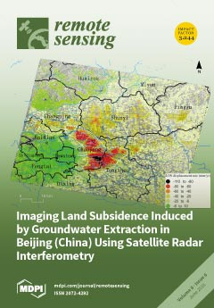
Cover Story (view full-size image): As one of the most water-stressed cities in the world, Beijing has been suffering from land subsidence since 1935 due to over-exploitation of groundwater. Based on detailed analyses of Envisat ASAR images acquired between 2003 and 2010 and TerraSAR-X images from 2010 to 2011, this paper provides new insights into the spatio-temporal distribution characteristics and the key triggering and conditioning factors of land subsidence in Beijing. The maximum subsidence is observed in the eastern part of Beijing with a rate greater than 100 mm/year. The good agreement between InSAR and GPS results suggests that InSAR is a powerful tool for monitoring land subsidence. Interesting relationships in terms of land subsidence were found with groundwater level, active faults, accumulated soft soil thickness, aquifer types and the distances to pumping wells. View this paper
  • Issues are regarded as officially published after their release is announced to the table of contents alert mailing list.
  • You may sign up for e-mail alerts to receive table of contents of newly released issues.
  • PDF is the official format for papers published in both, html and pdf forms. To view the papers in pdf format, click on the "PDF Full-text" link, and use the free Adobe Reader to open them.
Order results
Result details
Section
Select all
Export citation of selected articles as:
15942 KiB  
Article
Deformation and Related Slip Due to the 2011 Van Earthquake (Turkey) Sequence Imaged by SAR Data and Numerical Modeling
by Elisa Trasatti, Cristiano Tolomei, Giuseppe Pezzo, Simone Atzori and Stefano Salvi
Remote Sens. 2016, 8(6), 532; https://doi.org/10.3390/rs8060532 - 22 Jun 2016
Cited by 8 | Viewed by 7468
Abstract
A Mw 7.1 earthquake struck the Eastern Anatolia, near the city of Van (Turkey), on 23 October 2011. We investigated the coseismic surface displacements using the InSAR technique, exploiting adjacent ENVISAT tracks and COSMO-SkyMed images. Multi aperture interferometry was also applied, measuring ground [...] Read more.
A Mw 7.1 earthquake struck the Eastern Anatolia, near the city of Van (Turkey), on 23 October 2011. We investigated the coseismic surface displacements using the InSAR technique, exploiting adjacent ENVISAT tracks and COSMO-SkyMed images. Multi aperture interferometry was also applied, measuring ground displacements in the azimuth direction. We solved for the fault geometry and mechanism, and we inverted the slip distribution employing a numerical forward model that includes the available regional structural data. Results show a horizontally elongated high slip area (7–9 m) at 12–17 km depth, while the upper part of the fault results unruptured, enhancing its seismogenic potential. We also investigated the post-seismic phase acquiring most of the available COSMO-SkyMed, ENVISAT and TERRASAR-X SAR images. The computed afterslip distributions show that the shallow section of the fault underwent considerable aseismic slip during the early days after the mainshock, of tens of centimeters. Our results support the hypothesis of a seismogenic potential reduction within the first 8–10 km of the fault through the energy release during the post-seismic phase. Despite non-optimal data coverage and coherence issues, we demonstrate that useful information about the Van earthquake could still be retrieved from SAR data through detailed analysis. Full article
(This article belongs to the Special Issue Earth Observations for Geohazards)
Show Figures

Graphical abstract

7163 KiB  
Article
Quantifying Fertilizer Application Response Variability with VHR Satellite NDVI Time Series in a Rainfed Smallholder Cropping System of Mali
by Xavier Blaes, Guillaume Chomé, Marie-Julie Lambert, Pierre Sibiry Traoré, Antonius G. T. Schut and Pierre Defourny
Remote Sens. 2016, 8(6), 531; https://doi.org/10.3390/rs8060531 - 22 Jun 2016
Cited by 21 | Viewed by 11411
Abstract
Soil fertility in smallholder farming areas is known to vary strongly on multiple scales. This study measures the sensitivity of the recorded satellite signal to on-farm soil fertility treatments applied to five crop types, and quantifies this fertilization effect with respect to within-field [...] Read more.
Soil fertility in smallholder farming areas is known to vary strongly on multiple scales. This study measures the sensitivity of the recorded satellite signal to on-farm soil fertility treatments applied to five crop types, and quantifies this fertilization effect with respect to within-field variation, between-field variation and field position in the catena. Plant growth was assessed in 5–6 plots per field in 48 fields located in the Sudano-Sahelian agro-ecological zone of southeastern Mali. A unique series of Very High Resolution (VHR) satellite and Unmanned Aerial Vehicle (UAV) images were used to calculate the Normalized Difference Vegetation Index (NDVI). In this experiment, for half of the fields at least 50% of the NDVI variance within a field was due to fertilization. Moreover, the sensitivity of NDVI to fertilizer application was crop-dependent and varied through the season, with optima at the end of August for peanut and cotton and early October for sorghum and maize. The influence of fertilizer on NDVI was comparatively small at the landscape scale (up to 35% of total variation), relative to the influence of other components of variation such as field management and catena position. The NDVI response could only partially be benchmarked against a fertilization reference within the field. We conclude that comparisons of the spatial and temporal responses of NDVI, with respect to fertilization and crop management, requires a stratification of soil catena-related crop growth conditions at the landscape scale. Full article
(This article belongs to the Special Issue Remote Sensing in Precision Agriculture)
Show Figures

Graphical abstract

8459 KiB  
Article
Sixteen Years of Agricultural Drought Assessment of the BioBío Region in Chile Using a 250 m Resolution Vegetation Condition Index (VCI)
by Francisco Zambrano, Mario Lillo-Saavedra, Koen Verbist and Octavio Lagos
Remote Sens. 2016, 8(6), 530; https://doi.org/10.3390/rs8060530 - 22 Jun 2016
Cited by 79 | Viewed by 10065
Abstract
Drought is one of the most complex natural hazards because of its slow onset and long-term impact; it has the potential to negatively affect many people. There are several advantages to using remote sensing to monitor drought, especially in developing countries with limited [...] Read more.
Drought is one of the most complex natural hazards because of its slow onset and long-term impact; it has the potential to negatively affect many people. There are several advantages to using remote sensing to monitor drought, especially in developing countries with limited historical meteorological records and a low weather station density. In the present study, we assessed agricultural drought in the croplands of the BioBío Region in Chile. The vegetation condition index (VCI) allows identifying the temporal and spatial variations of vegetation conditions associated with stress because of rainfall deficit. The VCI was derived at a 250 m spatial resolution for the 2000–2015 period with the Moderate Resolution Imaging Spectroradiometer (MODIS) MOD13Q1 product. We evaluated VCI for cropland areas using the land cover MCD12Q1 version 5.1 product and compared it to the in situ Standardized Precipitation Index (SPI) for six-time scales (1–6 months) from 26 weather stations. Results showed that the 3-month SPI (SPI-3), calculated for the modified growing season (November–April) instead of the regular growing season (September–April), has the best Pearson correlation with VCI values with an overall correlation of 0.63 and between 0.40 and 0.78 for the administrative units. These results show a very short-term vegetation response to rainfall deficit in September, which is reflected in the vegetation in November, and also explains to a large degree the variation in vegetation stress. It is shown that for the last 16 years in the BioBío Region we could identify the 2007/2008, 2008/2009, and 2014/2015 seasons as the three most important drought events; this is reflected in both the overall regional and administrative unit analyses. These results concur with drought emergencies declared by the regional government. Future studies are needed to associate the remote sensing values observed at high resolution (250 m) with the measured crop yield to identify more detailed individual crop responses. Full article
Show Figures

Graphical abstract

2872 KiB  
Article
Posterior Probability Modeling and Image Classification for Archaeological Site Prospection: Building a Survey Efficacy Model for Identifying Neolithic Felsite Workshops in the Shetland Islands
by William P. Megarry, Gabriel Cooney, Douglas C. Comer and Carey E. Priebe
Remote Sens. 2016, 8(6), 529; https://doi.org/10.3390/rs8060529 - 22 Jun 2016
Cited by 14 | Viewed by 6405
Abstract
The application of custom classification techniques and posterior probability modeling (PPM) using Worldview-2 multispectral imagery to archaeological field survey is presented in this paper. Research is focused on the identification of Neolithic felsite stone tool workshops in the North Mavine region of the [...] Read more.
The application of custom classification techniques and posterior probability modeling (PPM) using Worldview-2 multispectral imagery to archaeological field survey is presented in this paper. Research is focused on the identification of Neolithic felsite stone tool workshops in the North Mavine region of the Shetland Islands in Northern Scotland. Sample data from known workshops surveyed using differential GPS are used alongside known non-sites to train a linear discriminant analysis (LDA) classifier based on a combination of datasets including Worldview-2 bands, band difference ratios (BDR) and topographical derivatives. Principal components analysis is further used to test and reduce dimensionality caused by redundant datasets. Probability models were generated by LDA using principal components and tested with sites identified through geological field survey. Testing shows the prospective ability of this technique and significance between 0.05 and 0.01, and gain statistics between 0.90 and 0.94, higher than those obtained using maximum likelihood and random forest classifiers. Results suggest that this approach is best suited to relatively homogenous site types, and performs better with correlated data sources. Finally, by combining posterior probability models and least-cost analysis, a survey least-cost efficacy model is generated showing the utility of such approaches to archaeological field survey. Full article
(This article belongs to the Special Issue Archaeological Prospecting and Remote Sensing)
Show Figures

Graphical abstract

1704 KiB  
Article
An IPCC-Compliant Technique for Forest Carbon Stock Assessment Using Airborne LiDAR-Derived Tree Metrics and Competition Index
by Chinsu Lin, Gavin Thomson and Sorin C. Popescu
Remote Sens. 2016, 8(6), 528; https://doi.org/10.3390/rs8060528 - 22 Jun 2016
Cited by 49 | Viewed by 7257
Abstract
This study developed an IPCC (Intergovernmental Panel on Climate Change) compliant method for the estimation of above-ground carbon (AGC) in forest stands using remote sensing technology. A multi-level morphological active contour (MMAC) algorithm was employed to obtain tree-level metrics (tree height (LH), crown [...] Read more.
This study developed an IPCC (Intergovernmental Panel on Climate Change) compliant method for the estimation of above-ground carbon (AGC) in forest stands using remote sensing technology. A multi-level morphological active contour (MMAC) algorithm was employed to obtain tree-level metrics (tree height (LH), crown radius (LCR), competition index (LCI), and stem diameter (LDBH)) from an airborne LiDAR-derived canopy height model. Seven biomass-based AGC models and 13 volume-based AGC models were developed using a training dataset and validated using a separate validation dataset. Four accuracy measures, mean absolute error (MAE), root-mean-square error (RMSE), percentage RMSE (PRMSE), and root-mean-square percentage error (RMSPE) were calculated for each of the 20 models. These measures were transformed into a new index, accuracy improvement percentage (AIP), for post hoc testing of model performance in estimating forest stand AGC stock. Results showed that the tree-level AGC models explained 84% to 91% of the variance in tree-level AGC within the training dataset. Prediction errors (RMSEs) for these models ranged between 15 ton/ha and 210 ton/ha in mature forest stands, which is equal to an error percentage in the range 6% to 86%. At the stand-level, several models achieved accurate and reliable predictions of AGC stock. Some models achieved 90% to 95% accuracy, which was equal to or superior to the R-squared of the tree-level AGC models. The first recommended model was a biomass-based model using the metrics LDBH, LH, and LCI and the others were volume-based models using LH, LCI, and LCR and LDBH and LH. One metric, LCI, played a critical role in upgrading model performance when banded together with LH and LCR or LDBH and LCR. We conclude by proposing an IPCC-compatible method that is suitable for calculating tree-level AGC and predicting AGC stock of forest stands from airborne LiDAR data. Full article
Show Figures

Graphical abstract

1048 KiB  
Erratum
Erratum: Dupuy, E.; et al. Comparison of XH2O Retrieved from GOSAT Short-Wavelength Infrared Spectra with Observations from the TCCON Network. Remote Sensing 2016, 8, 414
by Remote Sensing Editorial Office
Remote Sens. 2016, 8(6), 527; https://doi.org/10.3390/rs8060527 - 22 Jun 2016
Viewed by 3313
Abstract
In the published paper [1], the plot sizes of Figures 4, 6 and 9 were incorrect.[...] Full article
Show Figures

Figure 4

923 KiB  
Article
Using Different Regression Methods to Estimate Leaf Nitrogen Content in Rice by Fusing Hyperspectral LiDAR Data and Laser-Induced Chlorophyll Fluorescence Data
by Lin Du, Shuo Shi, Jian Yang, Jia Sun and Wei Gong
Remote Sens. 2016, 8(6), 526; https://doi.org/10.3390/rs8060526 - 22 Jun 2016
Cited by 33 | Viewed by 6171
Abstract
Nitrogen is an essential nutrient element in crop photosynthesis and yield improvement. Thus, it is urgent and important to accurately estimate the leaf nitrogen contents (LNC) of crops for precision nitrogen management. Based on the correlation between LNC and reflectance spectra, the hyperspectral [...] Read more.
Nitrogen is an essential nutrient element in crop photosynthesis and yield improvement. Thus, it is urgent and important to accurately estimate the leaf nitrogen contents (LNC) of crops for precision nitrogen management. Based on the correlation between LNC and reflectance spectra, the hyperspectral LiDAR (HSL) system can determine three-dimensional structural parameters and biochemical changes of crops. Thereby, HSL technology has been widely used to monitor the LNC of crops at leaf and canopy levels. In addition, the laser-induced fluorescence (LIF) of chlorophyll, related to the histological structure and physiological conditions of green plants, can also be utilized to detect nutrient stress in crops. In this study, four regression algorithms, support vector machines (SVMs), partial least squares (PLS) and two artificial neural networks (ANNs), back propagation NNs (BP-NNs) and radial basic function NNs (RBF-NNs), were selected to estimate rice LNC in booting and heading stages based on reflectance and LIF spectra. These four regression algorithms were used for 36 input variables, including the reflectance spectral variables on 32 wavelengths and four peaks of the LIF spectra. A feature weight algorithm was proposed to select different band combinations for the LNC retrieval models. The determination coefficient (R2) and the root mean square error (RMSE) of the retrieval models were utilized to compare their abilities of estimating the rice LNC. The experimental results demonstrate that (I) these four regression methods are useful for estimating rice LNC in the order of RBF-NNs > SVMs > BP-NNs > PLS; (II) The LIF data in two forms, including peaks and indices, display potential in rice LNC retrieval, especially when using the PLS regression (PLSR) model for the relationship of rice LNC with spectral variables. The feature weighting algorithm is an effective and necessary method to determine appropriate band combinations for rice LNC estimation. Full article
Show Figures

Graphical abstract

6604 KiB  
Article
Crop Monitoring Based on SPOT-5 Take-5 and Sentinel-1A Data for the Estimation of Crop Water Requirements
by Ana Navarro, João Rolim, Irina Miguel, João Catalão, Joel Silva, Marco Painho and Zoltán Vekerdy
Remote Sens. 2016, 8(6), 525; https://doi.org/10.3390/rs8060525 - 22 Jun 2016
Cited by 71 | Viewed by 10302
Abstract
Optical and microwave images have been combined for land cover monitoring in different agriculture scenarios, providing useful information on qualitative and quantitative land cover changes. This study aims to assess the complementarity and interoperability of optical (SPOT-5 Take-5) and synthetic aperture radar (SAR) [...] Read more.
Optical and microwave images have been combined for land cover monitoring in different agriculture scenarios, providing useful information on qualitative and quantitative land cover changes. This study aims to assess the complementarity and interoperability of optical (SPOT-5 Take-5) and synthetic aperture radar (SAR) (Sentinel-1A) data for crop parameter (basal crop coefficient (Kcb) values and the length of the crop’s development stages) retrieval and crop type classification, with a focus on crop water requirements, for an irrigation perimeter in Angola. SPOT-5 Take-5 images are used as a proxy of Sentinel-2 data to evaluate the potential of their enhanced temporal resolution for agricultural applications. In situ data are also used to complement the Earth Observation (EO) data. The Normalized Difference Vegetation Index (NDVI) and dual (VV + VH) polarization backscattering time series are used to compute the Kcb curve for four crop types (maize, soybean, bean and pasture) and to estimate the length of each phenological growth stage. The Kcb values are then used to compute the crop’s evapotranspiration and to subsequently estimate the crop irrigation requirements based on a soil water balance model. A significant R2 correlation between NDVI and backscatter time series was observed for all crops, demonstrating that optical data can be replaced by microwave data in the presence of cloud cover. However, it was not possible to properly identify each stage of the crop cycle due to the lack of EO data for the complete growing season. Full article
Show Figures

Graphical abstract

5978 KiB  
Article
Sea and Freshwater Ice Concentration from VIIRS on Suomi NPP and the Future JPSS Satellites
by Yinghui Liu, Jeffrey Key and Robert Mahoney
Remote Sens. 2016, 8(6), 523; https://doi.org/10.3390/rs8060523 - 22 Jun 2016
Cited by 43 | Viewed by 9880
Abstract
Information on ice is important for shipping, weather forecasting, and climate monitoring. Historically, ice cover has been detected and ice concentration has been measured using relatively low-resolution space-based passive microwave data. This study presents an algorithm to detect ice and estimate ice concentration [...] Read more.
Information on ice is important for shipping, weather forecasting, and climate monitoring. Historically, ice cover has been detected and ice concentration has been measured using relatively low-resolution space-based passive microwave data. This study presents an algorithm to detect ice and estimate ice concentration in clear-sky areas over the ocean and inland lakes and rivers using high-resolution data from the Visible Infrared Imaging Radiometer Suite (VIIRS) onboard the Suomi National Polar Orbiting Partnership (S-NPP) and on future Joint Polar Satellite System (JPSS) satellites, providing spatial detail that cannot be obtained with passive microwave data. A threshold method is employed with visible and infrared observations to identify ice, then a tie-point algorithm is used to determine the representative reflectance/temperature of pure ice, estimate the ice concentration, and refine the ice cover mask. The VIIRS ice concentration is validated using observations from Landsat 8. Results show that VIIRS has an overall bias of −0.3% compared to Landsat 8 ice concentration, with a precision (uncertainty) of 9.5%. Biases and precision values for different ice concentration subranges from 0% to 100% can be larger. Full article
(This article belongs to the Special Issue Sea Ice Remote Sensing and Analysis)
Show Figures

Graphical abstract

2462 KiB  
Article
Sensitivity of L-Band SAR Backscatter to Aboveground Biomass of Global Forests
by Yifan Yu and Sassan Saatchi
Remote Sens. 2016, 8(6), 522; https://doi.org/10.3390/rs8060522 - 22 Jun 2016
Cited by 124 | Viewed by 12555
Abstract
Synthetic Aperture Radar (SAR) backscatter measurements are sensitive to forest aboveground biomass (AGB), and the observations from space can be used for mapping AGB globally. However, the radar sensitivity saturates at higher AGB values depending on the wavelength and geometry of radar measurements, [...] Read more.
Synthetic Aperture Radar (SAR) backscatter measurements are sensitive to forest aboveground biomass (AGB), and the observations from space can be used for mapping AGB globally. However, the radar sensitivity saturates at higher AGB values depending on the wavelength and geometry of radar measurements, and is influenced by the structure of the forest and environmental conditions. Here, we examine the sensitivity of SAR at the L-band frequency (~25 cm wavelength) to AGB in order to examine the performance of future joint National Aeronautics and Space Administration, Indian Space Research Organisation NASA-ISRO SAR mission in mapping the AGB of global forests. For SAR data, we use the Phased Array L-Band SAR (PALSAR) backscatter from the Advanced Land Observing Satellite (ALOS) aggregated at a 100-m spatial resolution; and for AGB data, we use more than three million AGB values derived from the Geoscience Laser Altimeter System (GLAS) LiDAR height metrics at about 0.16–0.25 ha footprints across eleven different forest types globally. The results from statistical analysis show that, over all eleven forest types, saturation level of L-band radar at HV polarization on average remains ≥100 Mg·ha−1. Fresh water swamp forests have the lowest saturation with AGB at ~80 Mg·ha−1, while needleleaf forests have the highest saturation at ~250 Mg·ha−1. Swamp forests show a strong backscatter from the vegetation-surface specular reflection due to inundation that requires to be treated separately from those on terra firme. Our results demonstrate that L-Band backscatter relations to AGB can be significantly different depending on forest types and environmental effects, requiring multiple algorithms to map AGB from time series of satellite radar observations globally. Full article
(This article belongs to the Special Issue Remote Sensing of Vegetation Structure and Dynamics)
Show Figures

Graphical abstract

7479 KiB  
Article
Generation of Land Cover Maps through the Fusion of Aerial Images and Airborne LiDAR Data in Urban Areas
by Yongmin Kim
Remote Sens. 2016, 8(6), 521; https://doi.org/10.3390/rs8060521 - 22 Jun 2016
Cited by 7 | Viewed by 6379
Abstract
Satellite images and aerial images with high spatial resolution have improved visual interpretation capabilities. The use of high-resolution images has rapidly grown and has been extended to various fields, such as military surveillance, disaster monitoring, and cartography. However, many problems were encountered in [...] Read more.
Satellite images and aerial images with high spatial resolution have improved visual interpretation capabilities. The use of high-resolution images has rapidly grown and has been extended to various fields, such as military surveillance, disaster monitoring, and cartography. However, many problems were encountered in which one object has a variety of spectral properties and different objects have similar spectral characteristics in terms of land cover. The problems are quite noticeable, especially for building objects in urban environments. In the land cover classification process, these issues directly decrease the classification accuracy by causing misclassification of single objects as well as between objects. This study proposes a method of increasing the accuracy of land cover classification by addressing the problem of misclassifying building objects through the output-level fusion of aerial images and airborne Light Detection and Ranging (LiDAR) data. The new method consists of the following three steps: (1) generation of the segmented image via a process that performs adaptive dynamic range linear stretching and modified seeded region growth algorithms; (2) extraction of building information from airborne LiDAR data using a planar filter and binary supervised classification; and (3) generation of a land cover map using the output-level fusion of two results and object-based classification. The new method was tested at four experimental sites with the Min-Max method and the SSI-nDSM method followed by a visual assessment and a quantitative accuracy assessment through comparison with reference data. In the accuracy assessment, the new method exhibits various advantages, including reduced noise and more precise classification results. Additionally, the new method improved the overall accuracy by more than 5% over the comparative evaluation methods. The high and low patterns between the overall and building accuracies were similar. Thus, the new method is judged to have successfully solved the inaccuracy problem of classification that is often produced by high-resolution images of urban environments through an output-level fusion technique. Full article
(This article belongs to the Special Issue Multi-Sensor and Multi-Data Integration in Remote Sensing)
Show Figures

Figure 1

13973 KiB  
Article
Space Geodetic Observations and Modeling of 2016 Mw 5.9 Menyuan Earthquake: Implications on Seismogenic Tectonic Motion
by Yongsheng Li, Wenliang Jiang, Jingfa Zhang and Yi Luo
Remote Sens. 2016, 8(6), 519; https://doi.org/10.3390/rs8060519 - 22 Jun 2016
Cited by 45 | Viewed by 7413
Abstract
Determining the relationship between crustal movement and faulting in thrust belts is essential for understanding the growth of geological structures and addressing the proposed models of a potential earthquake hazard. A Mw 5.9 earthquake occurred on 21 January 2016 in Menyuan, NE Qinghai [...] Read more.
Determining the relationship between crustal movement and faulting in thrust belts is essential for understanding the growth of geological structures and addressing the proposed models of a potential earthquake hazard. A Mw 5.9 earthquake occurred on 21 January 2016 in Menyuan, NE Qinghai Tibetan plateau. We combined satellite interferometry from Sentinel-1A Terrain Observation with Progressive Scans (TOPS) images, historical earthquake records, aftershock relocations and geological data to determine fault seismogenic structural geometry and its relationship with the Lenglongling faults. The results indicate that the reverse slip of the 2016 earthquake is distributed on a southwest dipping shovel-shaped fault segment. The main shock rupture was initiated at the deeper part of the fault plane. The focal mechanism of the 2016 earthquake is quite different from that of a previous Ms 6.5 earthquake which occurred in 1986. Both earthquakes occurred at the two ends of a secondary fault. Joint analysis of the 1986 and 2016 earthquakes and aftershocks distribution of the 2016 event reveals an intense connection with the tectonic deformation of the Lenglongling faults. Both earthquakes resulted from the left-lateral strike-slip of the Lenglongling fault zone and showed distinct focal mechanism characteristics. Under the shearing influence, the normal component is formed at the releasing bend of the western end of the secondary fault for the left-order alignment of the fault zone, while the thrust component is formed at the restraining bend of the east end for the right-order alignment of the fault zone. Seismic activity of this region suggests that the left-lateral strike-slip of the Lenglongling fault zone plays a significant role in adjustment of the tectonic deformation in the NE Tibetan plateau. Full article
(This article belongs to the Special Issue Earth Observations for Geohazards)
Show Figures

Graphical abstract

11555 KiB  
Article
An Automated Approach for Sub-Pixel Registration of Landsat-8 Operational Land Imager (OLI) and Sentinel-2 Multi Spectral Instrument (MSI) Imagery
by Lin Yan, David P. Roy, Hankui Zhang, Jian Li and Haiyan Huang
Remote Sens. 2016, 8(6), 520; https://doi.org/10.3390/rs8060520 - 21 Jun 2016
Cited by 105 | Viewed by 15038
Abstract
Moderate spatial resolution satellite data from the Landsat-8 OLI and Sentinel-2A MSI sensors together offer 10 m to 30 m multi-spectral reflective wavelength global coverage, providing the opportunity for improved combined sensor mapping and monitoring of the Earth’s surface. However, the standard geolocated [...] Read more.
Moderate spatial resolution satellite data from the Landsat-8 OLI and Sentinel-2A MSI sensors together offer 10 m to 30 m multi-spectral reflective wavelength global coverage, providing the opportunity for improved combined sensor mapping and monitoring of the Earth’s surface. However, the standard geolocated Landsat-8 OLI L1T and Sentinel-2A MSI L1C data products are currently found to be misaligned. An approach for automated registration of Landsat-8 OLI L1T and Sentinel-2A MSI L1C data is presented and demonstrated using contemporaneous sensor data. The approach is computationally efficient because it implements feature point detection across four image pyramid levels to identify a sparse set of tie-points. Area-based least squares matching around the feature points with mismatch detection across the image pyramid levels is undertaken to provide reliable tie-points. The approach was assessed by examination of extracted tie-point spatial distributions and tie-point mapping transformations (translation, affine and second order polynomial), dense-matching prediction-error assessment, and by visual registration assessment. Two test sites over Cape Town and Limpopo province in South Africa that contained cloud and shadows were selected. A Landsat-8 L1T image and two Sentinel-2A L1C images sensed 16 and 26 days later were registered (Cape Town) to examine the robustness of the algorithm to surface, atmosphere and cloud changes, in addition to the registration of a Landsat-8 L1T and Sentinel-2A L1C image pair sensed 4 days apart (Limpopo province). The automatically extracted tie-points revealed sensor misregistration greater than one 30 m Landsat-8 pixel dimension for the two Cape Town image pairs, and greater than one 10 m Sentinel-2A pixel dimension for the Limpopo image pair. Transformation fitting assessments showed that the misregistration can be effectively characterized by an affine transformation. Hundreds of automatically located tie-points were extracted and had affine-transformation root-mean-square error fits of approximately 0.3 pixels at 10 m resolution and dense-matching prediction errors of similar magnitude. These results and visual assessment of the affine transformed data indicate that the methodology provides sub-pixel registration performance required for meaningful Landsat-8 OLI and Sentinel-2A MSI data comparison and combined data applications. Full article
Show Figures

Graphical abstract

5662 KiB  
Article
Merging Alternate Remotely-Sensed Soil Moisture Retrievals Using a Non-Static Model Combination Approach
by Seokhyeon Kim, Robert M. Parinussa, Yi Y. Liu, Fiona M. Johnson and Ashish Sharma
Remote Sens. 2016, 8(6), 518; https://doi.org/10.3390/rs8060518 - 21 Jun 2016
Cited by 15 | Viewed by 6112
Abstract
Soil moisture is an important variable in the coupled hydrologic and climate system. In recent years, microwave-based soil moisture products have been shown to be a viable alternative to in situ measurements. A popular way to measure the performance of soil moisture products [...] Read more.
Soil moisture is an important variable in the coupled hydrologic and climate system. In recent years, microwave-based soil moisture products have been shown to be a viable alternative to in situ measurements. A popular way to measure the performance of soil moisture products is to calculate the temporal correlation coefficient (R) against in situ measurements or other appropriate reference datasets. In this study, an existing linear combination method improving R was modified to allow for a non-static or nonstationary model combination as the basis for improving remotely-sensed surface soil moisture. Previous research had noted that two soil moisture products retrieved using the Japan Aerospace Exploration Agency (JAXA) and Land Parameter Retrieval Model (LPRM) algorithms from the same Advanced Microwave Scanning Radiometer 2 (AMSR2) sensor are spatially complementary in terms of R against a suitable reference over a fixed period. Accordingly, a linear combination was proposed to maximize R using a set of spatially-varying, but temporally-fixed weights. Even though this approach showed promising results, there was room for further improvements, in particular using non-static or dynamic weights that take account of the time-varying nature of the combination algorithm being approximated. The dynamic weighting was achieved by using a moving window. A number of different window sizes was investigated. The optimal weighting factors were determined for the data lying within the moving window and then used to dynamically combine the two parent products. We show improved performance for the dynamically-combined product over the static linear combination. Generally, shorter time windows outperform the static approach, and a 60-day time window is suggested to be the optimum. Results were validated against in situ measurements collected from 124 stations over different continents. The mean R of the dynamically-combined products was found to be 0.57 and 0.62 for the cases using the European Centre for Medium-Range Weather Forecasts Reanalysis-Interim (ERA-Interim) and Modern-Era Retrospective Analysis for Research and Applications Land (MERRA-Land) reanalysis products as the reference, respectively, outperforming the statically-combined products (0.55 and 0.54). Full article
(This article belongs to the Special Issue Multi-Sensor and Multi-Data Integration in Remote Sensing)
Show Figures

Graphical abstract

5714 KiB  
Article
Developing a Comprehensive Spectral-Biogeochemical Database of Midwestern Rivers for Water Quality Retrieval Using Remote Sensing Data: A Case Study of the Wabash River and Its Tributary, Indiana
by Jing Tan, Keith A. Cherkauer and Indrajeet Chaubey
Remote Sens. 2016, 8(6), 517; https://doi.org/10.3390/rs8060517 - 21 Jun 2016
Cited by 13 | Viewed by 7048
Abstract
A comprehensive spectral-biogeochemical database was developed for the Wabash River and the Tippecanoe River in Indiana, United States. This database includes spectral measurements of river water, coincident in situ measurements of water quality parameters (chlorophyll (chl), non-algal particles (NAP), and colored dissolved organic [...] Read more.
A comprehensive spectral-biogeochemical database was developed for the Wabash River and the Tippecanoe River in Indiana, United States. This database includes spectral measurements of river water, coincident in situ measurements of water quality parameters (chlorophyll (chl), non-algal particles (NAP), and colored dissolved organic matter (CDOM)), nutrients (total nitrogen (TN), total phosphorus (TP), and dissolved organic carbon (DOC)), water-column inherent optical properties (IOPs), water depths, substrate types, and bottom reflectance spectra collected in summer 2014. With this dataset, the temporal variability of water quality observations was first analyzed and studied. Second, radiative transfer models were inverted to retrieve water quality parameters using a look-up table (LUT) based spectrum matching methodology. Results found that the temporal variability of water quality parameters and nutrients in the Wabash River was closely associated with hydrologic conditions. Meanwhile, there were no significant correlations found between these parameters and streamflow for the Tippecanoe River, due to the two upstream reservoirs, which increase the settling of sediment and uptake of nutrients. The poor relationship between CDOM and DOC indicates that most DOC in the rivers was from human sources such as wastewater. It was also found that the source of water (surface runoff or combined sewer overflow (CSO)), water temperature, and nutrients were important factors controlling instream concentrations of phytoplankton. The LUT retrieved NAP concentrations were in good agreement with field measurements with slope close to 1.0 and the average estimation error was 4.1% of independently obtained lab measurements. The error for chl estimation was larger (37.7%), which is attributed to the fact that the specific absorption spectrum of chl was not well represented in this study. The LUT retrievals for CDOM experienced large variability, probably due to the small data range collected in this study and the insensitivity of Rrs to CDOM change. It is concluded that the success of the LUT method requires accurate spectral measurements and enough a priori information of the environment to construct a representative database for water quality retrieval. Therefore, future work will focus on continuing data collection in other seasons of the year and better characterization of the study area. Full article
Show Figures

Graphical abstract

40326 KiB  
Article
Source Parameters of the 2003–2004 Bange Earthquake Sequence, Central Tibet, China, Estimated from InSAR Data
by Lingyun Ji, Jing Xu, Qiang Zhao and Chengsheng Yang
Remote Sens. 2016, 8(6), 516; https://doi.org/10.3390/rs8060516 - 18 Jun 2016
Cited by 7 | Viewed by 6947
Abstract
A sequence of Ms ≥ 5.0 earthquakes occurred in 2003 and 2004 in Bange County, Tibet, China, all with similar depths and focal mechanisms. However, the source parameters, kinematics and relationships between these earthquakes are poorly known because of their moderately-sized magnitude and [...] Read more.
A sequence of Ms ≥ 5.0 earthquakes occurred in 2003 and 2004 in Bange County, Tibet, China, all with similar depths and focal mechanisms. However, the source parameters, kinematics and relationships between these earthquakes are poorly known because of their moderately-sized magnitude and the sparse distribution of seismic stations in the region. We utilize interferometric synthetic aperture radar (InSAR) data from the European Space Agency’s Envisat satellite to determine the location, fault geometry and slip distribution of three large events of the sequence that occurred on 7 July 2003 (Ms 6.0), 27 March 2004 (Ms 6.2), and 3 July 2004 (Ms 5.1). The modeling results indicate that the 7 July 2003 event was a normal-faulting event with a right-lateral slip component, the 27 March 2004 earthquake was associated with a normal fault striking northeast–southwest and dipping northwest with a moderately oblique right-lateral slip, and the 3 July 2004 event was caused by a normal fault. A calculation of the static stress changes on the fault planes demonstrates that the third earthquake may have been triggered by the previous ones. Full article
(This article belongs to the Special Issue Earth Observations for Geohazards)
Show Figures

Figure 1

5513 KiB  
Article
Large-Area, High-Resolution Tree Cover Mapping with Multi-Temporal SPOT5 Imagery, New South Wales, Australia
by Adrian Fisher, Michael Day, Tony Gill, Adam Roff, Tim Danaher and Neil Flood
Remote Sens. 2016, 8(6), 515; https://doi.org/10.3390/rs8060515 - 18 Jun 2016
Cited by 36 | Viewed by 9880
Abstract
Tree cover maps are used for many purposes, such as vegetation mapping, habitat connectivity and fragmentation studies. Small remnant patches of native vegetation are recognised as ecologically important, yet they are underestimated in remote sensing products derived from Landsat. High spatial resolution sensors [...] Read more.
Tree cover maps are used for many purposes, such as vegetation mapping, habitat connectivity and fragmentation studies. Small remnant patches of native vegetation are recognised as ecologically important, yet they are underestimated in remote sensing products derived from Landsat. High spatial resolution sensors are capable of mapping small patches of trees, but their use in large-area mapping has been limited. In this study, multi-temporal Satellite pour l’Observation de la Terre 5 (SPOT5) High Resolution Geometrical data was pan-sharpened to 5 m resolution and used to map tree cover for the Australian state of New South Wales (NSW), an area of over 800,000 km2. Complete coverages of SPOT5 panchromatic and multispectral data over NSW were acquired during four consecutive summers (2008–2011) for a total of 1256 images. After pre-processing, the imagery was used to model foliage projective cover (FPC), a measure of tree canopy density commonly used in Australia. The multi-temporal imagery, FPC models and 26,579 training pixels were used in a binomial logistic regression model to estimate the probability of each pixel containing trees. The probability images were classified into a binary map of tree cover using local thresholds, and then visually edited to reduce errors. The final tree map was then attributed with the mean FPC value from the multi-temporal imagery. Validation of the binary map based on visually assessed high resolution reference imagery revealed an overall accuracy of 88% (±0.51% standard error), while comparison against airborne lidar derived data also resulted in an overall accuracy of 88%. A preliminary assessment of the FPC map by comparing against 76 field measurements showed a very good agreement (r2 = 0.90) with a root mean square error of 8.57%, although this may not be representative due to the opportunistic sampling design. The map represents a regionally consistent and locally relevant record of tree cover for NSW, and is already widely used for natural resource management in the state. Full article
Show Figures

Graphical abstract

12604 KiB  
Article
A Comparison of Machine Learning Algorithms for Mapping of Complex Surface-Mined and Agricultural Landscapes Using ZiYuan-3 Stereo Satellite Imagery
by Xianju Li, Weitao Chen, Xinwen Cheng and Lizhe Wang
Remote Sens. 2016, 8(6), 514; https://doi.org/10.3390/rs8060514 - 18 Jun 2016
Cited by 114 | Viewed by 10874
Abstract
Land cover mapping (LCM) in complex surface-mined and agricultural landscapes could contribute greatly to regulating mine exploitation and protecting mine geo-environments. However, there are some special and spectrally similar land covers in these landscapes which increase the difficulty in LCM when employing high [...] Read more.
Land cover mapping (LCM) in complex surface-mined and agricultural landscapes could contribute greatly to regulating mine exploitation and protecting mine geo-environments. However, there are some special and spectrally similar land covers in these landscapes which increase the difficulty in LCM when employing high spatial resolution images. There is currently no research on these mixed complex landscapes. The present study focused on LCM in such a mixed complex landscape located in Wuhan City, China. A procedure combining ZiYuan-3 (ZY-3) stereo satellite imagery, the feature selection (FS) method, and machine learning algorithms (MLAs) (random forest, RF; support vector machine, SVM; artificial neural network, ANN) was proposed and first examined for both LCM of surface-mined and agricultural landscapes (MSMAL) and classification of surface-mined land (CSML), respectively. The mean and standard deviation filters of spectral bands and topographic features derived from ZY-3 stereo images were newly introduced. Comparisons of three MLAs, including their sensitivities to FS and whether FS resulted in significant influences, were conducted for the first time in the present study. The following conclusions are drawn. Textures were of little use, and the novel features contributed to improve classification accuracy. Regarding the influence of FS: FS substantially reduced feature set (by 68% for MSMAL and 87% for CSML), and often improved classification accuracies (with an average value of 4.48% for MSMAL using three MLAs, and 11.39% for CSML using RF and SVM); FS showed statistically significant improvements except for ANN-based MSMAL; SVM was most sensitive to FS, followed by ANN and RF. Regarding comparisons of MLAs: for MSMAL based on feature subset, RF achieved the greatest overall accuracy of 77.57%, followed by SVM and ANN; for CSML, SVM had the highest accuracies (87.34%), followed by RF and ANN; based on the feature subsets, significant differences were observed for MSMAL and CSML using any pair of MLAs. In general, the proposed approach can contribute to LCM in complex surface-mined and agricultural landscapes. Full article
Show Figures

Graphical abstract

3712 KiB  
Article
Object-Based Greenhouse Mapping Using Very High Resolution Satellite Data and Landsat 8 Time Series
by Manuel A. Aguilar, Abderrahim Nemmaoui, Antonio Novelli, Fernando J. Aguilar and Andrés García Lorca
Remote Sens. 2016, 8(6), 513; https://doi.org/10.3390/rs8060513 - 18 Jun 2016
Cited by 76 | Viewed by 12023
Abstract
Greenhouse mapping through remote sensing has received extensive attention over the last decades. In this article, the innovative goal relies on mapping greenhouses through the combined use of very high resolution satellite data (WorldView-2) and Landsat 8 Operational Land Imager (OLI) time series [...] Read more.
Greenhouse mapping through remote sensing has received extensive attention over the last decades. In this article, the innovative goal relies on mapping greenhouses through the combined use of very high resolution satellite data (WorldView-2) and Landsat 8 Operational Land Imager (OLI) time series within a context of an object-based image analysis (OBIA) and decision tree classification. Thus, WorldView-2 was mainly used to segment the study area focusing on individual greenhouses. Basic spectral information, spectral and vegetation indices, textural features, seasonal statistics and a spectral metric (Moment Distance Index, MDI) derived from Landsat 8 time series and/or WorldView-2 imagery were computed on previously segmented image objects. In order to test its temporal stability, the same approach was applied for two different years, 2014 and 2015. In both years, MDI was pointed out as the most important feature to detect greenhouses. Moreover, the threshold value of this spectral metric turned to be extremely stable for both Landsat 8 and WorldView-2 imagery. A simple decision tree always using the same threshold values for features from Landsat 8 time series and WorldView-2 was finally proposed. Overall accuracies of 93.0% and 93.3% and kappa coefficients of 0.856 and 0.861 were attained for 2014 and 2015 datasets, respectively. Full article
Show Figures

Graphical abstract

2513 KiB  
Article
Mangroves at Their Limits: Detection and Area Estimation of Mangroves along the Sahara Desert Coast
by Viviana Otero, Katrien Quisthoudt, Nico Koedam and Farid Dahdouh-Guebas
Remote Sens. 2016, 8(6), 512; https://doi.org/10.3390/rs8060512 - 18 Jun 2016
Cited by 16 | Viewed by 7313
Abstract
The northernmost and most arid mangrove ecosystem of West Africa is found in Mauritania, in the Parc National du Banc d’Arguin (PNBA). The existing global and regional maps of Mauritania’s mangroves have little detail, and available estimates of the mangrove area differ among [...] Read more.
The northernmost and most arid mangrove ecosystem of West Africa is found in Mauritania, in the Parc National du Banc d’Arguin (PNBA). The existing global and regional maps of Mauritania’s mangroves have little detail, and available estimates of the mangrove area differ among studies. We assessed the use of automated Remote Sensing classification techniques to calculate the extent and map the distribution of the mangrove patches located at Cap Timiris, PNBA, using QuickBird and GeoEye imagery. It was possible to detect the northernmost contiguous mangrove patches of West Africa with an accuracy of 87% ± 2% using the Maximum Likelihood algorithm. The main source of error was the low spectral difference between mangroves and other types of terrestrial vegetation, which resulted in an erroneous classification between these two types of land cover. The most reliable estimate for the mangrove area obtained in this study was 19.48 ± 5.54 ha in 2011. Moreover, we present a special validation procedure that enables a detailed and reliable validation of the land cover maps. Full article
(This article belongs to the Special Issue Remote Sensing in Coastal Environments)
Show Figures

Graphical abstract

1670 KiB  
Article
Using the NASA EOS A-Train to Probe the Performance of the NOAA PATMOS-x Cloud Fraction CDR
by Andrew Heidinger, Michael Foster, Denis Botambekov, Michael Hiley, Andi Walther and Yue Li
Remote Sens. 2016, 8(6), 511; https://doi.org/10.3390/rs8060511 - 18 Jun 2016
Cited by 18 | Viewed by 6848
Abstract
An important component of the AVHRR PATMOS-x climate date record (CDR)—or any satellite cloud climatology—is the performance of its cloud detection scheme and the subsequent quality of its cloud fraction CDR. PATMOS-x employs the NOAA Enterprise Cloud Mask for this, which is based [...] Read more.
An important component of the AVHRR PATMOS-x climate date record (CDR)—or any satellite cloud climatology—is the performance of its cloud detection scheme and the subsequent quality of its cloud fraction CDR. PATMOS-x employs the NOAA Enterprise Cloud Mask for this, which is based on a naïve Bayesian approach. The goal of this paper is to generate analysis of the PATMOS-x cloud fraction CDR to facilitate its use in climate studies. Performance of PATMOS-x cloud detection is compared to that of the well-established MYD35 and CALIPSO products from the EOS A-Train. Results show the AVHRR PATMOS-x CDR compares well against CALIPSO with most regions showing proportional correct values of 0.90 without any spatial filtering and 0.95 when a spatial filter is applied. Values are similar for the NASA MODIS MYD35 mask. A direct comparison of PATMOS-x and MYD35 from 2003 to 2014 also shows agreement over most regions in terms of mean cloud amount, inter-annual variability, and linear trends. Regional and seasonal differences are discussed. The analysis demonstrates that PATMOS-x cloud amount uncertainty could effectively screen regions where PATMOS-x differs from MYD35. Full article
(This article belongs to the Special Issue Satellite Climate Data Records and Applications)
Show Figures

Graphical abstract

16299 KiB  
Letter
Analysis of Aerosol Radiative Forcing over Beijing under Different Air Quality Conditions Using Ground-Based Sun-Photometers between 2013 and 2015
by Wei Chen, Lei Yan, Nan Ding, Mengdie Xie, Ming Lu, Fan Zhang, Yongxu Duan and Shuo Zong
Remote Sens. 2016, 8(6), 510; https://doi.org/10.3390/rs8060510 - 17 Jun 2016
Cited by 5 | Viewed by 5962
Abstract
Aerosol particles can strongly affect both air quality and the radiation budget of the atmosphere. Above Beijing, the capital city of China, large amounts of aerosols within the atmospheric column have caused the deterioration of local air quality and have influenced radiative forcings [...] Read more.
Aerosol particles can strongly affect both air quality and the radiation budget of the atmosphere. Above Beijing, the capital city of China, large amounts of aerosols within the atmospheric column have caused the deterioration of local air quality and have influenced radiative forcings at both the top and the bottom of the atmosphere (BOA and TOA). Observations of aerosol radiative forcing and its efficiency have been made using two sun-photometers in urban Beijing between 2013 and 2015, and have been analyzed alongside two air quality monitoring stations’ data by dividing air quality conditions into unpolluted, moderately polluted, and heavily polluted days. Daily average PM2.5 concentrations varied greatly in urban Beijing (5.5–485.0 µg/m3) and more than one-third of the analyzed period is classified as being polluted according to the national ambient air quality standards of China. The heavily polluted days had the largest bottom of atmosphere (BOA) and top of atmosphere (TOA) radiative forcings, but the smallest radiative forcing efficiencies, while the unpolluted days showed the opposite characteristics. On heavily polluted days, the averaged BOA aerosol radiative forcing occasionally exceeded −150 W/m2, which represents a value about three-times greater than that for unpolluted days. BOA aerosol radiative forcing was around two-to-three times as large as TOA aerosol radiative forcing under various air quality conditions, although both were mostly negative, suggesting that aerosols had different magnitudes of cooling effects at both the surface and the top of the atmosphere. Unpolluted days had the largest average values of aerosol radiative forcing efficiencies at BOA (and TOA) levels, which exceeded −190 W/m2 (−70 W/m2), compared with the lowest average values in heavily polluted days of around −120 W/m2 (−55 W/m2). These results suggest that the high concentrations of particulate matter pollution in the urban Beijing area had a strong cooling effect at both BOA and TOA levels. Full article
Show Figures

Graphical abstract

4407 KiB  
Article
Time Series MODIS and in Situ Data Analysis for Mongolia Drought
by Munkhzul Dorjsuren, Yuei-An Liou and Chi-Han Cheng
Remote Sens. 2016, 8(6), 509; https://doi.org/10.3390/rs8060509 - 16 Jun 2016
Cited by 44 | Viewed by 9545
Abstract
Drought is a period of abnormally dry weather with a serious shortage of water supply. Drought indices can be an advantageous indicator to assess drought for taking further response actions. However, drought indices based on ground meteorological measurements could not completely reveal the [...] Read more.
Drought is a period of abnormally dry weather with a serious shortage of water supply. Drought indices can be an advantageous indicator to assess drought for taking further response actions. However, drought indices based on ground meteorological measurements could not completely reveal the land use effects over a regional scale. On the other hand, the satellite-derived products provide consistent, spatial and temporal comparisons of global signatures for the regional-scale drought events. This research is to investigate the drought signatures over Mongolia by using satellite remote sensing imagery. The evapotranspiration (ET), potential evapotranspiration (PET) and two-band Enhanced Vegetation Index (EVI2) were extracted from MODIS data. Based on the standardized ratio of ET to PET (ET/PET) and EVI2, the Modified Drought Severity Index (MDSI) anomaly during the growing season from May–August for the years 2000–2013 was acquired. Fourteen-year summer monthly data for air temperature, precipitation and soil moisture content of in situ measurements from sixteen meteorological stations for four various land use areas were analyzed. We also calculated the percentage deviation of climatological variables at the sixteen stations to compare to the MDSI anomaly. Both comparisons of satellite-derived and observed anomalies and variations were analyzed by using the existing common statistical methods. The results demonstrated that the air temperature anomaly (T anomaly) and the precipitation anomaly (P anomaly) were negatively (correlation coefficient r = −0.66) and positively (r = 0.81) correlated with the MDSI anomaly, respectively. The MDSI anomaly distributions revealed that the wettest area occupied 57% of the study area in 2003, while the driest (drought) area occurred over 54% of the total area in 2007. The results also showed very similar variations between the MDSI and T anomalies. The highest (wettest) MDSI anomaly indicated the lowest T anomaly, such as in the year 2003, while the lowest (driest) MDSI anomaly had the highest T anomaly in 2007. By comparing the MDSI anomaly and soil moisture content at a 10-cm depth during the study period, it is found that their correlation coefficient is 0.74. Full article
(This article belongs to the Special Issue Earth Observations for a Better Future Earth)
Show Figures

Graphical abstract

158 KiB  
Editorial
Preface: Remote Sensing of Biodiversity
by Susan L. Ustin
Remote Sens. 2016, 8(6), 508; https://doi.org/10.3390/rs8060508 - 16 Jun 2016
Cited by 2 | Viewed by 4657
Abstract
Since the 1992 Earth Summit in Rio de Janeiro, the importance of biological diversity insupporting and maintaining ecosystem functions and processes has become increasingly understood [1]. Full article
(This article belongs to the Special Issue Remote Sensing of Biodiversity)
12992 KiB  
Article
Transformation Model with Constraints for High-Accuracy of 2D-3D Building Registration in Aerial Imagery
by Guoqing Zhou, Qingli Luo, Wenhan Xie, Tao Yue, Jingjin Huang and Yuzhong Shen
Remote Sens. 2016, 8(6), 507; https://doi.org/10.3390/rs8060507 - 16 Jun 2016
Cited by 4 | Viewed by 5588
Abstract
This paper proposes a novel rigorous transformation model for 2D-3D registration to address the difficult problem of obtaining a sufficient number of well-distributed ground control points (GCPs) in urban areas with tall buildings. The proposed model applies two types of geometric constraints, co-planarity [...] Read more.
This paper proposes a novel rigorous transformation model for 2D-3D registration to address the difficult problem of obtaining a sufficient number of well-distributed ground control points (GCPs) in urban areas with tall buildings. The proposed model applies two types of geometric constraints, co-planarity and perpendicularity, to the conventional photogrammetric collinearity model. Both types of geometric information are directly obtained from geometric building structures, with which the geometric constraints are automatically created and combined into the conventional transformation model. A test field located in downtown Denver, Colorado, is used to evaluate the accuracy and reliability of the proposed method. The comparison analysis of the accuracy achieved by the proposed method and the conventional method is conducted. Experimental results demonstrated that: (1) the theoretical accuracy of the solved registration parameters can reach 0.47 pixels, whereas the other methods reach only 1.23 and 1.09 pixels; (2) the RMS values of 2D-3D registration achieved by the proposed model are only two pixels along the x and y directions, much smaller than the RMS values of the conventional model, which are approximately 10 pixels along the x and y directions. These results demonstrate that the proposed method is able to significantly improve the accuracy of 2D-3D registration with much fewer GCPs in urban areas with tall buildings. Full article
Show Figures

Graphical abstract

2864 KiB  
Article
Learning a Transferable Change Rule from a Recurrent Neural Network for Land Cover Change Detection
by Haobo Lyu, Hui Lu and Lichao Mou
Remote Sens. 2016, 8(6), 506; https://doi.org/10.3390/rs8060506 - 16 Jun 2016
Cited by 281 | Viewed by 17417
Abstract
When exploited in remote sensing analysis, a reliable change rule with transfer ability can detect changes accurately and be applied widely. However, in practice, the complexity of land cover changes makes it difficult to use only one change rule or change feature learned [...] Read more.
When exploited in remote sensing analysis, a reliable change rule with transfer ability can detect changes accurately and be applied widely. However, in practice, the complexity of land cover changes makes it difficult to use only one change rule or change feature learned from a given multi-temporal dataset to detect any other new target images without applying other learning processes. In this study, we consider the design of an efficient change rule having transferability to detect both binary and multi-class changes. The proposed method relies on an improved Long Short-Term Memory (LSTM) model to acquire and record the change information of long-term sequence remote sensing data. In particular, a core memory cell is utilized to learn the change rule from the information concerning binary changes or multi-class changes. Three gates are utilized to control the input, output and update of the LSTM model for optimization. In addition, the learned rule can be applied to detect changes and transfer the change rule from one learned image to another new target multi-temporal image. In this study, binary experiments, transfer experiments and multi-class change experiments are exploited to demonstrate the superiority of our method. Three contributions of this work can be summarized as follows: (1) the proposed method can learn an effective change rule to provide reliable change information for multi-temporal images; (2) the learned change rule has good transferability for detecting changes in new target images without any extra learning process, and the new target images should have a multi-spectral distribution similar to that of the training images; and (3) to the authors’ best knowledge, this is the first time that deep learning in recurrent neural networks is exploited for change detection. In addition, under the framework of the proposed method, changes can be detected under both binary detection and multi-class change detection. Full article
(This article belongs to the Special Issue Monitoring of Land Changes)
Show Figures

Graphical abstract

3873 KiB  
Article
Estimating Snow Water Equivalent with Backscattering at X and Ku Band Based on Absorption Loss
by Yurong Cui, Chuan Xiong, Juha Lemmetyinen, Jiancheng Shi, Lingmei Jiang, Bin Peng, Huixuan Li, Tianjie Zhao, Dabin Ji and Tongxi Hu
Remote Sens. 2016, 8(6), 505; https://doi.org/10.3390/rs8060505 - 16 Jun 2016
Cited by 46 | Viewed by 7631
Abstract
Snow water equivalent (SWE) is a key parameter in the Earth’s energy budget and water cycle. It has been demonstrated that SWE can be retrieved using active microwave remote sensing from space. This necessitates the development of forward models that are capable of [...] Read more.
Snow water equivalent (SWE) is a key parameter in the Earth’s energy budget and water cycle. It has been demonstrated that SWE can be retrieved using active microwave remote sensing from space. This necessitates the development of forward models that are capable of simulating the interactions of microwaves and the snow medium. Several proposed models have described snow as a collection of sphere- or ellipsoid-shaped ice particles embedded in air, while the microstructure of snow is, in reality, more complex. Natural snow usually forms a sintered structure following mechanical and thermal metamorphism processes. In this research, the bi-continuous vector radiative transfer (bi-continuous-VRT) model, which firstly constructs snow microstructure more similar to real snow and then simulates the snow backscattering signal, is used as the forward model for SWE estimation. Based on this forward model, a parameterization scheme of snow volume backscattering is proposed. A relationship between snow optical thickness and single scattering albedo at X and Ku bands is established by analyzing the database generated from the bi-continuous-VRT model. A cost function with constraints is used to solve effective albedo and optical thickness, while the absorption part of optical thickness is obtained from these two parameters. SWE is estimated after a correction for physical temperature. The estimated SWE is correlated with the measured SWE with an acceptable accuracy. Validation against two-year measurements, using the SnowScat instrument from the Nordic Snow Radar Experiment (NoSREx), shows that the estimated SWE using the presented algorithm has a root mean square error (RMSE) of 16.59 mm for the winter of 2009–2010 and 19.70 mm for the winter of 2010–2011. Full article
Show Figures

Graphical abstract

6051 KiB  
Article
Estimation of Daily Solar Radiation Budget at Kilometer Resolution over the Tibetan Plateau by Integrating MODIS Data Products and a DEM
by Laure Roupioz, Li Jia, Françoise Nerry and Massimo Menenti
Remote Sens. 2016, 8(6), 504; https://doi.org/10.3390/rs8060504 - 16 Jun 2016
Cited by 25 | Viewed by 7871
Abstract
Considering large and complex areas like the Tibetan Plateau, an analysis of the spatial distribution of the solar radiative budget over time not only requires the use of satellite remote sensing data, but also of an algorithm that accounts for strong variations of [...] Read more.
Considering large and complex areas like the Tibetan Plateau, an analysis of the spatial distribution of the solar radiative budget over time not only requires the use of satellite remote sensing data, but also of an algorithm that accounts for strong variations of topography. Therefore, this research aims at developing a method to produce time series of solar radiative fluxes at high temporal and spatial resolution based on observed surface and atmosphere properties and topography. The objective is to account for the heterogeneity of the land surface using multiple land surface and atmospheric MODIS data products combined with a digital elevation model to produce estimations daily at the kilometric level. The developed approach led to the production of a three-year time series (2008–2010) of daily solar radiation budget at one kilometer spatial resolution across the Tibetan Plateau. The validation showed that the main improvement from the proposed method is a higher spatial and temporal resolution as compared to existing products. However, even if the solar radiation estimates are satisfying on clear sky conditions, the algorithm is less reliable under cloudy sky condition and the albedo product used here has a too coarse temporal resolution and is not accurate enough over rugged terrain. Full article
Show Figures

Graphical abstract

1073 KiB  
Erratum
Erratum: Cavender-Bares, J.; Meireles, J.E.; Couture, J.; Kaproth, M.A.; Kingdon, C.C; Singh, A; Serbin, S.P.; Center, A; Zuniga, E; Pilz, G; Townsend, P.A. Associations of Leaf Spectra with Genetic and Phylogenetic Variation in Oaks: Prospects for Remote Detection of Biodiversity. Remote Sens. 2016, 8, 221
by Remote Sensing Editorial Office
Remote Sens. 2016, 8(6), 475; https://doi.org/10.3390/rs8060475 - 16 Jun 2016
Viewed by 3624
Abstract
The authors would like to correct the abstract and Figures 3 and 4 of this article [1] as follows:[...] Full article
Show Figures

Figure 3

1714 KiB  
Article
Improving Streamflow Prediction Using Remotely-Sensed Soil Moisture and Snow Depth
by Haishen Lü, Wade T. Crow, Yonghua Zhu, Fen Ouyang and Jianbin Su
Remote Sens. 2016, 8(6), 503; https://doi.org/10.3390/rs8060503 - 15 Jun 2016
Cited by 14 | Viewed by 6029
Abstract
The monitoring of both cold and warm season hydrologic processes in headwater watersheds is critical for accurate water resource monitoring in many alpine regions. This work presents a new method that explores the simultaneous use of remotely sensed surface soil moisture (SM) and [...] Read more.
The monitoring of both cold and warm season hydrologic processes in headwater watersheds is critical for accurate water resource monitoring in many alpine regions. This work presents a new method that explores the simultaneous use of remotely sensed surface soil moisture (SM) and snow depth (SD) retrievals to improve hydrological modeling in such areas. In particular, remotely sensed SM and SD retrievals are applied to filter errors present in both solid and liquid phase precipitation accumulation products acquired from satellite remote sensing. Simultaneously, SM and SD retrievals are also used to correct antecedent SM and SD states within a hydrological model. In synthetic data assimilation experiments, results suggest that the simultaneous correction of both precipitation forcing and SM/SD antecedent conditions is more efficient at improving streamflow simulation than data assimilation techniques which focus solely on the constraint of antecedent SM or SD conditions. In a real assimilation case, results demonstrate the potential benefits of remotely sensed SM and SD retrievals for improving the representation of hydrological processes in a headwater basin. In particular, it is demonstrated that dual precipitation/state correction represents an efficient strategy for improving the simulation of cold-region hydrological processes. Full article
Show Figures

Graphical abstract

Previous Issue
Next Issue
Back to TopTop