Topic Editors

Department of Agroecology, Climate and Water, Aarhus University, 8830 Tjele, Denmark
College of Agriculture, Shihezi University, Shihezi 832003, China
Farmland Irrigation Research Institute, Chinese Academy of Agricultural Sciences, 380 Hongli Road, Xinxiang 453003, China
1. Department of Plant & Soil Science, Texas Tech University, 2500 Broadway, Lubbock, TX 79409, USA
2. Department of Soil and Crop Sciences, Texas A&M University, TAMU 2124, College Station, TX 77843, USA
College of Agriculture, South China Agricultural University, Guangzhou 510642, China

Advances in Smart Agriculture with Remote Sensing as the Core and Its Applications in Crops Field

Abstract submission deadline
31 October 2025
Manuscript submission deadline
31 December 2025
Viewed by
21974

Topic Information

Dear Colleagues,

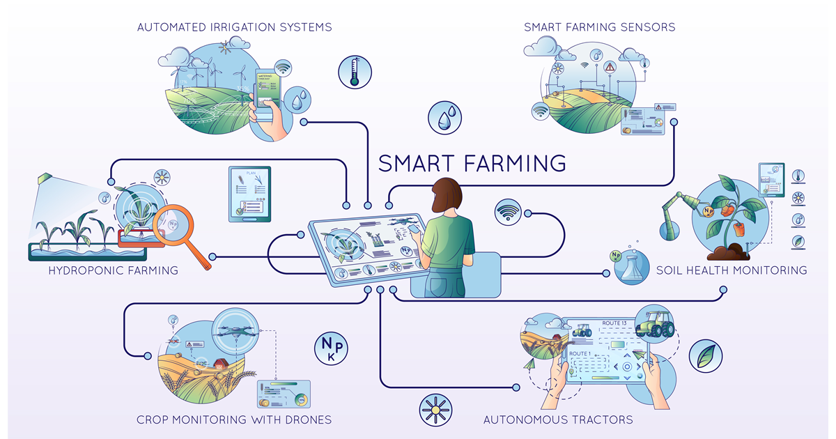
In recent years, smart agriculture with remote sensing and modeling technologies has brought significant benefits in crop fields and has also altered our understanding and management of crops. Remote sensing allows for crop growth monitoring on different scales such as “ground–low altitude–satellite”, while crop modeling provides predictive insights into crop growth and yield based on a diverse set of environmental parameters. Remote sensing and modeling are fully integrated into applications of crop growth, nutrition demands, irrigation management, and pest control in smart agriculture to optimize agricultural practices, enhance resource efficiency, and make substantial contributions to sustainable agricultural development. This research topic aims to seamlessly integrate remote sensing and modeling, essential components in smart agriculture, to address urgent challenges such as optimizing resource utilization and sustainable agricultural development with enhanced crop production.

The scope of this research topic encompasses a broad range of subjects including but not limited to:

  • Integrating remote sensing data with plant traits into crop models to enhance prediction accuracy and decision support.
  • Applying machine learning and AI algorithms in crop modeling for increased accuracy and adaptability.
  • Utilizing the Internet of Things, sensors, and drones for real-time data collection and monitoring in smart agriculture.

We invite authors to contribute original research articles, perspectives, and reviews, providing valuable insights into the ”Advances in Smart Agriculture with Remote Sensing as the Core and Its Applications in Crops Field”.

Dr. Syed Tahir Ata-Ul-Karim
Dr. Yang Liu
Dr. Ben Zhao
Dr. Wenxuan Guo
Dr. Lei Zhang
Topic Editors

Keywords

  • crop
  • remote sensing
  • crop modeling
  • smart agriculture
  • machine learning

Participating Journals

Journal Name Impact Factor CiteScore Launched Year First Decision (median) APC
Remote Sensing
remotesensing
4.2 8.3 2009 23.9 Days CHF 2700 Submit
Agronomy
agronomy
3.3 6.2 2011 17.6 Days CHF 2600 Submit
Agriculture
agriculture
3.3 4.9 2011 19.2 Days CHF 2600 Submit
Crops
crops
- - 2021 22.1 Days CHF 1000 Submit
Plants
plants
4.0 6.5 2012 18.9 Days CHF 2700 Submit

Preprints.org is a multidisciplinary platform offering a preprint service designed to facilitate the early sharing of your research. It supports and empowers your research journey from the very beginning.

MDPI Topics is collaborating with Preprints.org and has established a direct connection between MDPI journals and the platform. Authors are encouraged to take advantage of this opportunity by posting their preprints at Preprints.org prior to publication:

  1. Share your research immediately: disseminate your ideas prior to publication and establish priority for your work.
  2. Safeguard your intellectual contribution: Protect your ideas with a time-stamped preprint that serves as proof of your research timeline.
  3. Boost visibility and impact: Increase the reach and influence of your research by making it accessible to a global audience.
  4. Gain early feedback: Receive valuable input and insights from peers before submitting to a journal.
  5. Ensure broad indexing: Web of Science (Preprint Citation Index), Google Scholar, Crossref, SHARE, PrePubMed, Scilit and Europe PMC.

Published Papers (20 papers)

Order results
Result details
Journals
Select all
Export citation of selected articles as:
17 pages, 9599 KiB  
Article
Research on Walnut (Juglans regia L.) Yield Prediction Based on a Walnut Orchard Point Cloud Model
by Heng Chen, Jiale Cao, Jianshuo An, Yangjing Xu, Xiaopeng Bai, Daochun Xu and Wenbin Li
Agriculture 2025, 15(7), 775; https://doi.org/10.3390/agriculture15070775 - 3 Apr 2025
Viewed by 291
Abstract
This study aims to develop a method for predicting walnut (Juglans regia L.) yield based on the walnut orchard point cloud model, addressing issues such as low efficiency, insufficient accuracy, and high costs in traditional methods. The walnut orchard point cloud is [...] Read more.
This study aims to develop a method for predicting walnut (Juglans regia L.) yield based on the walnut orchard point cloud model, addressing issues such as low efficiency, insufficient accuracy, and high costs in traditional methods. The walnut orchard point cloud is reconstructed using unmanned aerial vehicle (UAV) images, and the semantic segmentation technique is applied to extract the individual walnut tree point cloud model. Furthermore, the tree height, canopy projection area, and volume of each walnut tree are calculated. By combining these morphological features with statistical models and machine learning methods, a prediction model between tree morphology and yield is established, achieving prediction accuracy with a mean absolute error (MAE) of 2.04 kg, a mean absolute percentage error (MAPE) of 17.24%, a root mean square error (RMSE) of 2.81 kg, and a coefficient of determination (R2) of 0.83. This method provides an efficient, accurate, and economically feasible solution for walnut yield prediction, overcoming the limitations of existing technologies. Full article
Show Figures

Graphical abstract

30 pages, 225854 KiB  
Article
LGWheatNet: A Lightweight Wheat Spike Detection Model Based on Multi-Scale Information Fusion
by Zhaomei Qiu, Fei Wang, Tingting Li, Chongjun Liu, Xin Jin, Shunhao Qing, Yi Shi, Yuntao Wu and Congbin Liu
Plants 2025, 14(7), 1098; https://doi.org/10.3390/plants14071098 - 2 Apr 2025
Viewed by 419
Abstract
Wheat spike detection holds significant importance for agricultural production as it enhances the efficiency of crop management and the precision of operations. This study aims to improve the accuracy and efficiency of wheat spike detection, enabling efficient crop monitoring under resource-constrained conditions. To [...] Read more.
Wheat spike detection holds significant importance for agricultural production as it enhances the efficiency of crop management and the precision of operations. This study aims to improve the accuracy and efficiency of wheat spike detection, enabling efficient crop monitoring under resource-constrained conditions. To this end, a wheat spike dataset encompassing multiple growth stages was constructed, leveraging the advantages of MobileNet and ShuffleNet to design a novel network module, SeCUIB. Building on this foundation, a new wheat spike detection network, LGWheatNet, was proposed by integrating a lightweight downsampling module (DWDown), spatial pyramid pooling (SPPF), and a lightweight detection head (LightDetect). The experimental results demonstrate that LGWheatNet excels in key performance metrics, including Precision, Recall, and Mean Average Precision (mAP50 and mAP50-95). Specifically, the model achieved a Precision of 0.956, a Recall of 0.921, an mAP50 of 0.967, and an mAP50-95 of 0.747, surpassing several YOLO models as well as EfficientDet and RetinaNet. Furthermore, LGWheatNet demonstrated superior resource efficiency with a parameter count of only 1,698,529 and GFLOPs of 5.0, significantly lower than those of competing models. Additionally, when combined with the Slicing Aided Hyper Inference strategy, LGWheatNet further improved the detection accuracy of wheat spikes, especially for small-scale targets and edge regions, when processing large-scale high-resolution images. This strategy significantly enhanced both inference efficiency and accuracy, making it particularly suitable for image analysis from drone-captured data. In wheat spike counting experiments, LGWheatNet also delivered exceptional performance, particularly in predictions during the filling and maturity stages, outperforming other models by a substantial margin. This study not only provides an efficient and reliable solution for wheat spike detection but also introduces innovative methods for lightweight object detection tasks in resource-constrained environments. Full article
Show Figures

Figure 1

19 pages, 7050 KiB  
Article
Acquisition of Crop Spatial Patterns Based on Remote Sensing Data from Sentinel-2 Satellite
by Yinan Wang, Kai Guo, Xiangbing Kong, Jintao Zhao, Buhui Chang, Chunjing Zhao and Fengying Jin
Agriculture 2025, 15(6), 633; https://doi.org/10.3390/agriculture15060633 - 17 Mar 2025
Viewed by 278
Abstract
The timely and accurate acquisition of spatial distribution information for crops holds significant scientific significance for crop yield estimation, management, and timely adjustments to crop planting structures. This study revolves around Henan and Shaanxi provinces, employing a spatiotemporal image data fusion approach. Utilizing [...] Read more.
The timely and accurate acquisition of spatial distribution information for crops holds significant scientific significance for crop yield estimation, management, and timely adjustments to crop planting structures. This study revolves around Henan and Shaanxi provinces, employing a spatiotemporal image data fusion approach. Utilizing the characteristic representation of the Normalized difference vegetation index (NDVI) temporal data from Sentinel-2 satellite imagery, a multi-scale segmentation of patches is conducted based on spatiotemporal fusion images. Decision tree classification rules are constructed through the analysis of crop phenological differences, facilitating the extraction of the crop spatial patterns (CSPs) in the two provinces. The classification accuracy is assessed, yielding overall accuracies of 91.11% and 90.12%, with Kappa coefficients of 0.897 and 0.887 for Henan and Shaanxi provinces, respectively. The results indicate the following: (1) the proposed method enhances crop identification capabilities; (2) an accuracy evaluation against the data from the Third National Land Resource Survey and provincial statistical yearbook data for 2022 demonstrates extraction accuracy exceeding 90%; and (3) an analysis of the crop spatial patterns in 2022 reveals that wheat and corn are the predominant crops in Henan and Shaanxi provinces, covering 74.42% and 62.32% of the total crop area, respectively. The research outcomes can serve as a scientific basis for adjusting the crop planting structures in these two provinces. Full article
Show Figures

Figure 1

17 pages, 704 KiB  
Article
Willingness to Pay to Adopt Conservation Agriculture in Northern Namibia
by Teofilus Shiimi and David Uchezuba
Agriculture 2025, 15(5), 568; https://doi.org/10.3390/agriculture15050568 - 6 Mar 2025
Viewed by 668
Abstract
This paper aims to explore the willingness of farmers in the northern Namibia to adopt conservation agriculture (CA), employing the conditional logit model to estimate the probability of farmers choosing to adopt CA in different villages relative to all other alternatives and examining [...] Read more.
This paper aims to explore the willingness of farmers in the northern Namibia to adopt conservation agriculture (CA), employing the conditional logit model to estimate the probability of farmers choosing to adopt CA in different villages relative to all other alternatives and examining the effects of omitted variance and correlations on coefficient estimates, willingness to pay (WTP), and decision predictions. This study has practical significance, as agriculture plays a crucial role in the economic development of and livelihoods in Namibia, especially for those farmers who rely on small-scale farming as a means of subsistence. In terms of methodology, the data for the experimental choice simulation were collected using a structured questionnaire administered through a face-to-face survey approach. This paper adopts the conditional logit model to estimate the probability of farmers choosing to adopt CA in different villages, which is an appropriate choice as the model is capable of handling multi-option decision problems. This paper further enhances its rigor and reliability by simulating discrete choice experiments to investigate the impact of omitted variables and correlations on the estimation results. The research findings indicate that crop rotation and permanent soil cover are the main factors positively influencing farmers’ WTP for adopting CA, while intercropping, the time spent on soil preparation in the first season, and the frequency and rate of weeding consistently negatively influence the WTP for adopting CA. These discoveries provide valuable insights for formulating policy measures to promote the adoption of CA. In terms of policy recommendations, this paper puts forward targeted suggestions, including the appointment of specialized extension technicians by the Ministry of Agriculture, Water, and Land Reform to disseminate information as well as coordinate, promote, and personally implement CA activities across all regions. Additionally, to expedite the adoption of CA, stakeholders should ensure the availability of appropriate farming equipment, such as rippers and direct seeders, in local markets. Full article
Show Figures

Figure 1

34 pages, 13743 KiB  
Article
Integration of UAV Multispectral Remote Sensing and Random Forest for Full-Growth Stage Monitoring of Wheat Dynamics
by Donghui Zhang, Hao Qi, Xiaorui Guo, Haifang Sun, Jianan Min, Si Li, Liang Hou and Liangjie Lv
Agriculture 2025, 15(3), 353; https://doi.org/10.3390/agriculture15030353 - 6 Feb 2025
Viewed by 875
Abstract
Wheat is a key staple crop globally, essential for food security and sustainable agricultural development. The results of this study highlight how innovative monitoring techniques, such as UAV-based multispectral imaging, can significantly improve agricultural practices by providing precise, real-time data on crop growth. [...] Read more.
Wheat is a key staple crop globally, essential for food security and sustainable agricultural development. The results of this study highlight how innovative monitoring techniques, such as UAV-based multispectral imaging, can significantly improve agricultural practices by providing precise, real-time data on crop growth. This study utilized unmanned aerial vehicle (UAV)-based remote sensing technology at the wheat experimental field of the Hebei Academy of Agriculture and Forestry Sciences to capture the dynamic growth characteristics of wheat using multispectral data, aiming to explore efficient and precise monitoring and management strategies for wheat. A UAV equipped with multispectral sensors was employed to collect high-resolution imagery at five critical growth stages of wheat: tillering, jointing, booting, flowering, and ripening. The data covered four key spectral bands: green (560 nm), red (650 nm), red-edge (730 nm), and near-infrared (840 nm). Combined with ground-truth measurements, such as chlorophyll content and plant height, 21 vegetation indices were analyzed for their nonlinear relationships with wheat growth parameters. Statistical analyses, including Pearson’s correlation and stepwise regression, were used to identify the most effective indices for monitoring wheat growth. The Normalized Difference Red-Edge Index (NDRE) and the Triangular Vegetation Index (TVI) were selected based on their superior performance in predicting wheat growth parameters, as demonstrated by their high correlation coefficients and predictive accuracy. A random forest model was developed to comprehensively evaluate the application potential of multispectral data in wheat growth monitoring. The results demonstrated that the NDRE and TVI indices were the most effective indices for monitoring wheat growth. The random forest model exhibited superior predictive accuracy, with a mean squared error (MSE) significantly lower than that of traditional regression models, particularly during the flowering and ripening stages, where the prediction error for plant height was less than 1.01 cm. Furthermore, dynamic analyses of UAV imagery effectively identified abnormal field areas, such as regions experiencing water stress or disease, providing a scientific basis for precision agricultural interventions. This study highlights the potential of UAV-based remote sensing technology in monitoring wheat growth, addressing the research gap in systematic full-cycle analysis of wheat. It also offers a novel technological pathway for optimizing agricultural resource management and improving crop yields. These findings are expected to advance intelligent agricultural production and accelerate the implementation of precision agriculture. Full article
Show Figures

Figure 1

19 pages, 3491 KiB  
Article
Inversion and Fine Grading of Tidal Flat Soil Salinity Based on the CIWOABP Model
by Jin Zhu, Shuowen Yang, Shuyan Li, Nan Zhou, Yi Shen, Jincheng Xing, Lixin Xu, Zhichao Hong and Yifei Yang
Agriculture 2025, 15(3), 323; https://doi.org/10.3390/agriculture15030323 - 1 Feb 2025
Viewed by 708
Abstract
This study on soil salinity inversion in coastal tidal flats based on Sentinel-2 remote sensing imagery is significant for improving saline–alkali soils and advancing tidal flat agriculture. This study proposes an improved approach for soil salinity inversion in coastal tidal flats using Sentinel-2 [...] Read more.
This study on soil salinity inversion in coastal tidal flats based on Sentinel-2 remote sensing imagery is significant for improving saline–alkali soils and advancing tidal flat agriculture. This study proposes an improved approach for soil salinity inversion in coastal tidal flats using Sentinel-2 imagery and a new enhanced chaotic mapping adaptive whale optimization neural network (CIWOABP) algorithm. Novel spectral indices were developed to enhance correlations with salinity, significantly outperforming traditional indexes. The CIWOABP model achieved superior validation accuracy (R2 = 0.815) and reduced root mean square error (RMSE) and mean absolute error (MAE) compared to other machine learning models. The results enable the precise mapping of salinity levels, aiding salt-tolerant crop cultivation and sustainable agricultural management. This method offers a reliable framework for rapid salinity monitoring and precision farming in coastal regions. Full article
Show Figures

Figure 1

21 pages, 10908 KiB  
Article
Canopy Segmentation of Overlapping Fruit Trees Based on Unmanned Aerial Vehicle LiDAR
by Shiji Wang, Jie Ji, Lijun Zhao, Jiacheng Li, Mian Zhang and Shengling Li
Agriculture 2025, 15(3), 295; https://doi.org/10.3390/agriculture15030295 - 29 Jan 2025
Viewed by 629
Abstract
Utilizing LiDAR sensors mounted on unmanned aerial vehicles (UAVs) to acquire three-dimensional data of fruit orchards and extract precise information about individual trees can greatly facilitate unmanned management. To address the issue of low accuracy in traditional watershed segmentation methods based on canopy [...] Read more.
Utilizing LiDAR sensors mounted on unmanned aerial vehicles (UAVs) to acquire three-dimensional data of fruit orchards and extract precise information about individual trees can greatly facilitate unmanned management. To address the issue of low accuracy in traditional watershed segmentation methods based on canopy height models, this paper proposes an enhanced method to extract individual tree crowns in fruit orchards, enabling the improved detection of overlapping crown features. Firstly, a distribution curve of single-row or single-column treetops is fitted based on the detected treetops using variable window size. Subsequently, a cubic spatial region extending infinitely along the Z-axis is generated with equal width around this curve, and all crown points falling within this region are extracted and then projected onto the central plane. The projecting contour of the crowns on the plane is then fitted using Gaussian functions. Treetops are detected by identifying peak points on the curve fitted by Gaussian functions. Finally, the watershed algorithm is applied to segment fruit tree crowns. The results demonstrate that in citrus orchards with pronounced crown overlap, this novel method significantly reduces the number of undetected trees with a recall of 97.04%, and the F1 score representing the detection accuracy for fruit trees reaches 98.01%. Comparisons between the traditional method and the Gaussian fitting–watershed fusion algorithm across orchards exhibiting varying degrees of crown overlap reveal that the fusion algorithm achieves high segmentation accuracy when dealing with overlapping crowns characterized by significant height variations. Full article
Show Figures

Figure 1

23 pages, 7919 KiB  
Article
Interpretable LAI Fine Inversion of Maize by Fusing Satellite, UAV Multispectral, and Thermal Infrared Images
by Yu Yao, Hengbin Wang, Xiao Yang, Xiang Gao, Shuai Yang, Yuanyuan Zhao, Shaoming Li, Xiaodong Zhang and Zhe Liu
Agriculture 2025, 15(3), 243; https://doi.org/10.3390/agriculture15030243 - 23 Jan 2025
Viewed by 760
Abstract
Leaf area index (LAI) serves as a crucial indicator for characterizing the growth and development process of maize. However, the LAI inversion of maize based on unmanned aerial vehicles (UAVs) is highly susceptible to various factors such as weather conditions, light intensity, and [...] Read more.
Leaf area index (LAI) serves as a crucial indicator for characterizing the growth and development process of maize. However, the LAI inversion of maize based on unmanned aerial vehicles (UAVs) is highly susceptible to various factors such as weather conditions, light intensity, and sensor performance. In contrast to satellites, the spectral stability of UAV-based data is relatively inferior, and the phenomenon of “spectral fragmentation” is prone to occur during large-scale monitoring. This study was designed to solve the problem that maize LAI inversion based on UAVs is difficult to achieve both high spatial resolution and spectral consistency. A two-stage remote sensing data fusion method integrating coarse and fine fusion was proposed. The SHapley Additive exPlanations (SHAP) model was introduced to investigate the contributions of 20 features in 7 categories to LAI inversion of maize, and canopy temperature extracted from thermal infrared images was one of them. Additionally, the most suitable feature sampling window was determined through multi-scale sampling experiments. The grid search method was used to optimize the hyperparameters of models such as Gradient Boosting, XGBoost, and Random Forest, and their accuracy was compared. The results showed that, by utilizing a 3 × 3 feature sampling window and 9 features with the highest contributions, the LAI inversion accuracy of the whole growth stage based on Random Forest could reach R2 = 0.90 and RMSE = 0.38 m2/m2. Compared with the single UAV data source mode, the inversion accuracy was enhanced by nearly 25%. The R2 in the jointing, tasseling, and filling stages were 0.87, 0.86, and 0.62, respectively. Moreover, this study verified the significant role of thermal infrared data in LAI inversion, providing a new method for fine LAI inversion of maize. Full article
Show Figures

Figure 1

25 pages, 24423 KiB  
Article
A Landscape-Clustering Zoning Strategy to Map Multi-Crops in Fragmented Cropland Regions Using Sentinel-2 and Sentinel-1 Imagery with Feature Selection
by Guanru Fang, Chen Wang, Taifeng Dong, Ziming Wang, Cheng Cai, Jiaqi Chen, Mengyu Liu and Huanxue Zhang
Agriculture 2025, 15(2), 186; https://doi.org/10.3390/agriculture15020186 - 16 Jan 2025
Viewed by 763
Abstract
Crop mapping using remote sensing is a reliable and efficient approach to obtaining timely and accurate crop information. Previous studies predominantly focused on large-scale regions characterized by simple cropping structures. However, in complex agricultural regions, such as China’s Huang-Huai-Hai region, the high crop [...] Read more.
Crop mapping using remote sensing is a reliable and efficient approach to obtaining timely and accurate crop information. Previous studies predominantly focused on large-scale regions characterized by simple cropping structures. However, in complex agricultural regions, such as China’s Huang-Huai-Hai region, the high crop diversity and fragmented cropland in localized areas present significant challenges for accurate crop mapping. To address these challenges, this study introduces a landscape-clustering zoning strategy utilizing multi-temporal Sentinel-1 and Sentinel-2 imagery. First, crop heterogeneity zones (CHZs) are delineated using landscape metrics that capture crop diversity and cropland fragmentation. Subsequently, four types of features (spectral, phenological, textural and radar features) are combined in various configurations to create different classification schemes. These schemes are then optimized for each CHZ using a random forest classifier. The results demonstrate that the landscape-clustering zoning strategy achieves an overall accuracy of 93.52% and a kappa coefficient of 92.67%, outperforming the no-zoning method by 2.9% and 3.82%, respectively. Furthermore, the crop mapping results from this strategy closely align with agricultural statistics at the county level, with an R2 value of 0.9006. In comparison with other traditional zoning strategies, such as topographic zoning and administrative unit zoning, the proposed strategy proves to be superior. These findings suggest that the landscape-clustering zoning strategy offers a robust reference method for crop mapping in complex agricultural landscapes. Full article
Show Figures

Figure 1

22 pages, 6594 KiB  
Article
Rice Growth-Stage Recognition Based on Improved YOLOv8 with UAV Imagery
by Wenxi Cai, Kunbiao Lu, Mengtao Fan, Changjiang Liu, Wenjie Huang, Jiaju Chen, Zaoming Wu, Chudong Xu, Xu Ma and Suiyan Tan
Agronomy 2024, 14(12), 2751; https://doi.org/10.3390/agronomy14122751 - 21 Nov 2024
Cited by 1 | Viewed by 1180
Abstract
To optimize rice yield and enhance quality through targeted field management at each growth stage, rapid and accurate identification of rice growth stages is crucial. This study presents the Mobilenetv3-YOLOv8 rice growth-stage recognition model, designed for high efficiency and accuracy using Unmanned Aerial [...] Read more.
To optimize rice yield and enhance quality through targeted field management at each growth stage, rapid and accurate identification of rice growth stages is crucial. This study presents the Mobilenetv3-YOLOv8 rice growth-stage recognition model, designed for high efficiency and accuracy using Unmanned Aerial Vehicle (UAV) imagery. A UAV captured images of rice fields across five distinct growth stages from two altitudes (3 m and 20 m) across two independent field experiments. These images were processed to create training, validation, and test datasets for model development. Mobilenetv3 was introduced to replace the standard YOLOv8 backbone, providing robust small-scale feature extraction through multi-scale feature fusion. Additionally, the Coordinate Attention (CA) mechanism was integrated into YOLOv8’s backbone, outperforming the Convolutional Block Attention Module (CBAM) by enhancing position-sensitive information capture and focusing on crucial pixel areas. Compared to the original YOLOv8, the enhanced Mobilenetv3-YOLOv8 model improved rice growth-stage identification accuracy and reduced the computational load. With an input image size of 400 × 400 pixels and the CA implemented in the second and third backbone layers, the model achieved its best performance, reaching 84.00% mAP and 84.08% recall. The optimized model achieved parameters and Giga Floating Point Operations (GFLOPs) of 6.60M and 0.9, respectively, with precision values for tillering, jointing, booting, heading, and filling stages of 94.88%, 93.36%, 67.85%, 78.31%, and 85.46%, respectively. The experimental results revealed that the optimal Mobilenetv3-YOLOv8 shows excellent performance and has potential for deployment in edge computing devices and practical applications for in-field rice growth-stage recognition in the future. Full article
Show Figures

Figure 1

17 pages, 7484 KiB  
Article
Prediction of the Potentially Suitable Areas of Sesame in China Under Climate Change Scenarios Using MaxEnt Model
by Guoqiang Li, Xue Wang, Jie Zhang, Feng Hu, Hecang Zang, Tongmei Gao, Youjun Li and Ming Huang
Agriculture 2024, 14(11), 2090; https://doi.org/10.3390/agriculture14112090 - 20 Nov 2024
Viewed by 981
Abstract
Sesame (Sesamum indicum L, flora of China) is an essential oil crop in China, but its growth and development are affected by climate change. To cope with the impacts of climate change on sesame cultivation, we used the Maximum Entropy (MaxEnt) model [...] Read more.
Sesame (Sesamum indicum L, flora of China) is an essential oil crop in China, but its growth and development are affected by climate change. To cope with the impacts of climate change on sesame cultivation, we used the Maximum Entropy (MaxEnt) model to analyze the bioclimatic variables of climate suitability of sesame in China and predicted the suitable area and trend of sesame in China under current and future climate scenarios. The results showed that the MaxEnt model prediction was excellent. The most crucial bioclimatic variable influencing the distribution of sesame was max temperature in the warmest month, followed by annual mean temperature, annual precipitation, mean diurnal range, and precipitation of the driest month. Under the current climate scenario, the suitable areas of sesame were widely distributed in China, from south (Hainan) to north (Heilongjiang) and from east (Yellow Sea) to west (Tibet). The area of highly suitable areas was 64.51 × 10⁴ km2, accounting for 6.69% of the total land area in China, and was primarily located in mainly located in southern central Henan, eastern central Hubei, northern central Anhui, northern central Jiangxi, and eastern central Hunan. The area of moderately suitable areas and lowly suitable areas accounted for 17.45% and 25.82%, respectively. Compared with the current climate scenario, the area of highly and lowly suitable areas under future climate scenarios increased by 0.10%–11.48% and 0.08%–8.67%, while the area of moderately suitable areas decreased by 0.31%–23.03%. In addition, the increased highly suitable areas were mainly distributed in northern Henan. The decreased moderately suitable areas were mainly distributed in Heilongjiang, Jilin, and Liaoning. This work is practically significant for optimizing the regional layout of sesame cultivation in response to future climate conditions. Full article
Show Figures

Figure 1

38 pages, 7743 KiB  
Article
Forecasting Blue and Green Water Footprint of Wheat Based on Single, Hybrid, and Stacking Ensemble Machine Learning Algorithms Under Diverse Agro-Climatic Conditions in Nile Delta, Egypt
by Ashrakat A. Lotfy, Mohamed E. Abuarab, Eslam Farag, Bilal Derardja, Roula Khadra, Ahmed A. Abdelmoneim and Ali Mokhtar
Remote Sens. 2024, 16(22), 4224; https://doi.org/10.3390/rs16224224 - 13 Nov 2024
Viewed by 998
Abstract
The aim of this research is to develop and compare single, hybrid, and stacking ensemble machine learning models under spatial and temporal climate variations in the Nile Delta regarding the estimation of the blue and green water footprint (BWFP and GWFP) for wheat. [...] Read more.
The aim of this research is to develop and compare single, hybrid, and stacking ensemble machine learning models under spatial and temporal climate variations in the Nile Delta regarding the estimation of the blue and green water footprint (BWFP and GWFP) for wheat. Thus, four single machine learning models (XGB, RF, LASSO, and CatBoost) and eight hybrid machine learning models (XGB-RF, XGB-LASSO, XGB-CatBoost, RF-LASSO, CatBoost-LASSO, CatBoost-RF, XGB-RF-LASSO, and XGB-CatBoost-LASSO) were used, along with stacking ensembles, with five scenarios including climate and crop parameters and remote sensing-based indices. The highest R2 value for predicting wheat BWFP was achieved with XGB-LASSO under scenario 4 at 100%, while the minimum was 0.16 with LASSO under scenario 3 (remote sensing indices). To predict wheat GWFP, the highest R2 value of 100% was achieved with RF-LASSO across scenario 1 (all parameters), scenario 2 (climate parameters), scenario 4 (Peeff, Tmax, Tmin, and SA), and scenario 5 (Peeff and Tmax). The lowest value was recorded with LASSO and scenario 3. The use of individual and hybrid machine learning models showed high efficiency in predicting the blue and green water footprint of wheat, with high ratings according to statistical performance standards. However, the hybrid programs, whether binary or triple, outperformed both the single models and stacking ensemble. Full article
Show Figures

Figure 1

27 pages, 7854 KiB  
Article
An Optimized Semi-Supervised Generative Adversarial Network Rice Extraction Method Based on Time-Series Sentinel Images
by Lingling Du, Zhijun Li, Qian Wang, Fukang Zhu and Siyuan Tan
Agriculture 2024, 14(9), 1505; https://doi.org/10.3390/agriculture14091505 - 2 Sep 2024
Viewed by 1172
Abstract
In response to the limitations of meteorological conditions in global rice growing areas and the high cost of annotating samples, this paper combines the Vertical-Vertical (VV) polarization and Vertical-Horizontal (VH) polarization backscatter features extracted from Sentinel-1 synthetic aperture radar (SAR) images and the [...] Read more.
In response to the limitations of meteorological conditions in global rice growing areas and the high cost of annotating samples, this paper combines the Vertical-Vertical (VV) polarization and Vertical-Horizontal (VH) polarization backscatter features extracted from Sentinel-1 synthetic aperture radar (SAR) images and the NDVI, NDWI, and NDSI spectral index features extracted from Sentinel-2 multispectral images. By leveraging the advantages of an optimized Semi-Supervised Generative Adversarial Network (optimized SSGAN) in combining supervised learning and semi-supervised learning, rice extraction can be achieved with fewer annotated image samples. Within the optimized SSGAN framework, we introduce a focal-adversarial loss function to enhance the learning process for challenging samples; the generator module employs the Deeplabv3+ architecture, utilizing a Wide-ResNet network as its backbone while incorporating dropout layers and dilated convolutions to improve the receptive field and operational efficiency. Experimental results indicate that the optimized SSGAN, particularly when utilizing a 3/4 labeled sample ratio, significantly improves rice extraction accuracy, leading to a 5.39% increase in Mean Intersection over Union (MIoU) and a 2.05% increase in Overall Accuracy (OA) compared to the highest accuracy achieved before optimization. Moreover, the integration of SAR and multispectral data results in an OA of 93.29% and an MIoU of 82.10%, surpassing the performance of single-source data. These findings provide valuable insights for the extraction of rice information in global rice-growing regions. Full article
Show Figures

Figure 1

22 pages, 7164 KiB  
Article
LettuceNet: A Novel Deep Learning Approach for Efficient Lettuce Localization and Counting
by Aowei Ruan, Mengyuan Xu, Songtao Ban, Shiwei Wei, Minglu Tian, Haoxuan Yang, Annan Hu, Dong Hu and Linyi Li
Agriculture 2024, 14(8), 1412; https://doi.org/10.3390/agriculture14081412 - 20 Aug 2024
Cited by 3 | Viewed by 1376
Abstract
Traditional lettuce counting relies heavily on manual labor, which is laborious and time-consuming. In this study, a simple and efficient method for localization and counting lettuce is proposed, based only on lettuce field images acquired by an unmanned aerial vehicle (UAV) equipped with [...] Read more.
Traditional lettuce counting relies heavily on manual labor, which is laborious and time-consuming. In this study, a simple and efficient method for localization and counting lettuce is proposed, based only on lettuce field images acquired by an unmanned aerial vehicle (UAV) equipped with an RGB camera. In this method, a new lettuce counting model based on the weak supervised deep learning (DL) approach is developed, called LettuceNet. The LettuceNet network adopts a more lightweight design that relies only on point-level labeled images to train and accurately predict the number and location information of high-density lettuce (i.e., clusters of lettuce with small planting spacing, high leaf overlap, and unclear boundaries between adjacent plants). The proposed LettuceNet is thoroughly assessed in terms of localization and counting accuracy, model efficiency, and generalizability using the Shanghai Academy of Agricultural Sciences-Lettuce (SAAS-L) and the Global Wheat Head Detection (GWHD) datasets. The results demonstrate that LettuceNet achieves superior counting accuracy, localization, and efficiency when employing the enhanced MobileNetV2 as the backbone network. Specifically, the counting accuracy metrics, including mean absolute error (MAE), root mean square error (RMSE), normalized root mean square error (nRMSE), and coefficient of determination (R2), reach 2.4486, 4.0247, 0.0276, and 0.9933, respectively, and the F-Score for localization accuracy is an impressive 0.9791. Moreover, the LettuceNet is compared with other existing widely used plant counting methods including Multi-Column Convolutional Neural Network (MCNN), Dilated Convolutional Neural Networks (CSRNets), Scale Aggregation Network (SANet), TasselNet Version 2 (TasselNetV2), and Focal Inverse Distance Transform Maps (FIDTM). The results indicate that our proposed LettuceNet performs the best among all evaluated merits, with 13.27% higher R2 and 72.83% lower nRMSE compared to the second most accurate SANet in terms of counting accuracy. In summary, the proposed LettuceNet has demonstrated great performance in the tasks of localization and counting of high-density lettuce, showing great potential for field application. Full article
Show Figures

Figure 1

27 pages, 7575 KiB  
Article
Improving Radiometric Block Adjustment for UAV Multispectral Imagery under Variable Illumination Conditions
by Yuxiang Wang, Zengling Yang, Haris Ahmad Khan and Gert Kootstra
Remote Sens. 2024, 16(16), 3019; https://doi.org/10.3390/rs16163019 - 17 Aug 2024
Cited by 3 | Viewed by 1459
Abstract
Unmanned aerial vehicles (UAVs) equipped with multispectral cameras offer great potential for applications in precision agriculture. A critical challenge that limits the deployment of this technology is the varying ambient illumination caused by cloud movement. Rapidly changing solar irradiance primarily affects the radiometric [...] Read more.
Unmanned aerial vehicles (UAVs) equipped with multispectral cameras offer great potential for applications in precision agriculture. A critical challenge that limits the deployment of this technology is the varying ambient illumination caused by cloud movement. Rapidly changing solar irradiance primarily affects the radiometric calibration process, resulting in reflectance distortion and heterogeneity in the final generated orthomosaic. In this study, we optimized the radiometric block adjustment (RBA) method, which corrects for changing illumination by comparing adjacent images and from incidental observations of reference panels to produce accurate and uniform reflectance orthomosaics regardless of variable illumination. The radiometric accuracy and uniformity of the generated orthomosaic could be enhanced by improving the weights of the information from the reference panels and by reducing the number of tie points between adjacent images. Furthermore, especially for crop monitoring, we proposed the RBA-Plant method, which extracts tie points solely from vegetation areas, to further improve the accuracy and homogeneity of the orthomosaic for the vegetation areas. To validate the effectiveness of the optimization techniques and the proposed RBA-Plant method, visual and quantitative assessments were conducted on a UAV-image dataset collected under fluctuating solar irradiance conditions. The results demonstrated that the optimized RBA and RBA-Plant methods outperformed the current empirical line method (ELM) and sensor-corrected approaches, showing significant improvements in both radiometric accuracy and homogeneity. Specifically, the average root mean square error (RMSE) decreased from 0.084 acquired by the ELM to 0.047, and the average coefficient of variation (CV) decreased from 24% (ELM) to 10.6%. Furthermore, the orthomosaic generated by the RBA-Plant method achieved the lowest RMSE and CV values, 0.039 and 6.8%, respectively, indicating the highest accuracy and best uniformity. In summary, although UAVs typically incorporate lighting sensors for illumination correction, this research offers different methods for improving uniformity and obtaining more accurate reflectance values from orthomosaics. Full article
Show Figures

Figure 1

15 pages, 9712 KiB  
Article
Oilseed Rape Yield Prediction from UAVs Using Vegetation Index and Machine Learning: A Case Study in East China
by Hao Hu, Yun Ren, Hongkui Zhou, Weidong Lou, Pengfei Hao, Baogang Lin, Guangzhi Zhang, Qing Gu and Shuijin Hua
Agriculture 2024, 14(8), 1317; https://doi.org/10.3390/agriculture14081317 - 8 Aug 2024
Cited by 1 | Viewed by 1608
Abstract
Yield prediction is an important agriculture management for crop policy making. In recent years, unmanned aerial vehicles (UAVs) and spectral sensor technology have been widely used in crop production. This study aims to evaluate the ability of UAVs equipped with spectral sensors to [...] Read more.
Yield prediction is an important agriculture management for crop policy making. In recent years, unmanned aerial vehicles (UAVs) and spectral sensor technology have been widely used in crop production. This study aims to evaluate the ability of UAVs equipped with spectral sensors to predict oilseed rape yield. In an experiment, RGB and hyperspectral images were captured using a UAV at the seedling (S1), budding (S2), flowering (S3), and pod (S4) stages in oilseed rape plants. Canopy reflectance and spectral indices of oilseed rape were extracted and calculated from the hyperspectral images. After correlation analysis and principal component analysis (PCA), input spectral indices were screened to build yield prediction models using random forest regression (RF), multiple linear regression (MLR), and support vector machine regression (SVM). The results showed that UAVs equipped with spectral sensors have great potential in predicting crop yield at a large scale. Machine learning approaches such as RF can improve the accuracy of yield models in comparison with traditional methods (e.g., MLR). The RF-based training model had the highest determination coefficient (R2) (0.925) and lowest relative root mean square error (RRMSE) (5.91%). In testing, the MLR-based model had the highest R2 (0.732) and lowest RRMSE (11.26%). Moreover, we found that S2 was the best stage for predicting oilseed rape yield compared with the other growth stages. This study demonstrates a relatively accurate prediction for crop yield and provides valuable insight for field crop management. Full article
Show Figures

Figure 1

18 pages, 5238 KiB  
Article
Research on the Maturity Detection Method of Korla Pears Based on Hyperspectral Technology
by Jiale Liu and Hongbing Meng
Agriculture 2024, 14(8), 1257; https://doi.org/10.3390/agriculture14081257 - 30 Jul 2024
Cited by 3 | Viewed by 1295
Abstract
In this study, hyperspectral imaging technology with a wavelength range of 450 to 1000 nanometers was used to collect spectral data from 160 Korla pear samples at various maturity stages (immature, semimature, mature, and overripe). To ensure high-quality data, multiple preprocessing techniques such [...] Read more.
In this study, hyperspectral imaging technology with a wavelength range of 450 to 1000 nanometers was used to collect spectral data from 160 Korla pear samples at various maturity stages (immature, semimature, mature, and overripe). To ensure high-quality data, multiple preprocessing techniques such as multiplicative scatter correction (MSC), standard normal variate (SNV), and normalization were employed. Based on these preprocessed data, a custom convolutional neural network model (CNN-S) was constructed and trained to achieve precise classification and identification of the maturity stages of Korla pears. Additionally, a BP neural network model was used to determine the characteristic wavelengths for maturity assessment based on the sugar content feature wavelengths. The results demonstrated that the BP model, based on sugar content feature wavelengths, effectively discriminated the maturity stages of the pears. Specifically, the comprehensive recognition rates for the training, testing, and validation sets were 98.5%, 93.5%, and 90.5%, respectively. Furthermore, the combination of hyperspectral imaging technology and the custom CNN-S model significantly enhanced the detection performance of pear maturity. Compared to traditional CNN models, the CNN-S model improved the accuracy of the test set by nearly 10%. Moreover, the CNN-S model outperformed existing techniques based on partial least squares discriminant analysis (PLS-DA) and support vector machine (SVM) in capturing hyperspectral data features, showing superior generalization capability and detection efficiency. The superior performance of this method in practical applications further supports its potential in smart agriculture technology, providing a more efficient and accurate solution for agricultural product quality detection. Additionally, it plays a crucial role in the development of smart agricultural technology. Full article
Show Figures

Figure 1

20 pages, 2415 KiB  
Article
YOLOv8-RCAA: A Lightweight and High-Performance Network for Tea Leaf Disease Detection
by Jingyu Wang, Miaomiao Li, Chen Han and Xindong Guo
Agriculture 2024, 14(8), 1240; https://doi.org/10.3390/agriculture14081240 - 27 Jul 2024
Cited by 1 | Viewed by 1264
Abstract
Deploying deep convolutional neural networks on agricultural devices with limited resources is challenging due to their large number of parameters. Existing lightweight networks can alleviate this problem but suffer from low performance. To this end, we propose a novel lightweight network named YOLOv8-RCAA [...] Read more.
Deploying deep convolutional neural networks on agricultural devices with limited resources is challenging due to their large number of parameters. Existing lightweight networks can alleviate this problem but suffer from low performance. To this end, we propose a novel lightweight network named YOLOv8-RCAA (YOLOv8-RepVGG-CBAM-Anchorfree-ATSS), aiming to locate and detect tea leaf diseases with high accuracy and performance. Specifically, we employ RepVGG to replace CSPDarkNet63 to enhance feature extraction capability and inference efficiency. Then, we introduce CBAM attention to FPN and PAN in the neck layer to enhance the model perception of channel and spatial features. Additionally, an anchor-based detection head is replaced by an anchor-free head to further accelerate inference. Finally, we adopt the ATSS algorithm to adapt the allocating strategy of positive and negative samples during training to further enhance performance. Extensive experiments show that our model achieves precision, recall, F1 score, and mAP of 98.23%, 85.34%, 91.33%, and 98.14%, outperforming the traditional models by 4.22~6.61%, 2.89~4.65%, 3.48~5.52%, and 4.64~8.04%, respectively. Moreover, this model has a near-real-time inference speed, which provides technical support for deploying on agriculture devices. This study can reduce labor costs associated with the detection and prevention of tea leaf diseases. Additionally, it is expected to promote the integration of rapid disease detection into agricultural machinery in the future, thereby advancing the implementation of AI in agriculture. Full article
Show Figures

Figure 1

17 pages, 5407 KiB  
Article
Variable-Rate Fertilization for Summer Maize Using Combined Proximal Sensing Technology and the Nitrogen Balance Principle
by Peng Zhou, Yazhou Ou, Wei Yang, Yixiang Gu, Yinuo Kong, Yangxin Zhu, Chengqian Jin and Shanshan Hao
Agriculture 2024, 14(7), 1180; https://doi.org/10.3390/agriculture14071180 - 18 Jul 2024
Cited by 2 | Viewed by 1340
Abstract
Soil is a heterogeneous medium that exhibits considerable variability in both spatial and temporal dimensions. Proper management of field variability using variable-rate fertilization (VRF) techniques is essential to maximize crop input–output ratios and resource utilization. Implementing VRF technology on a localized scale is [...] Read more.
Soil is a heterogeneous medium that exhibits considerable variability in both spatial and temporal dimensions. Proper management of field variability using variable-rate fertilization (VRF) techniques is essential to maximize crop input–output ratios and resource utilization. Implementing VRF technology on a localized scale is recommended to increase crop yield, decrease input costs, and reduce the negative impact on the surrounding environment. This study assessed the agronomic and environmental viability of implementing VRF during the cultivation of summer maize using an on-the-go detector of soil total nitrogen (STN) to detect STN content in the test fields. A spatial delineation approach was then applied to divide the experimental field into multiple management zones. The amount of fertilizer applied in each zone was determined based on the sensor-detected STN. The analysis of the final yield and economic benefits indicates that plots that adopted VRF treatments attained an average summer maize grain yield of 7275 kg ha−1, outperforming plots that employed uniform-rate fertilization (URF) treatments, which yielded 6713 kg ha−1. Through one-way ANOVA, the yield p values of the two fertilization methods were 6.406 × 10⁻¹⁵, 5.202 × 10⁻¹⁵, 2.497 × 10⁻¹⁵, and 3.199 × 10⁻¹⁵, respectively, indicating that the yield differences between the two fertilization methods were noticeable. This led to an average yield increase of 8.37% ha−1 and a gross profit margin of USD 153 ha−1. In plots in which VRF techniques are utilized, the average nitrogen (N) fertilizer application rate is 627 kg ha−1. In contrast, in plots employing URF methods, the N fertilizer application rate is 750 kg ha−1. The use of N fertilizer was reduced by 16.4%. As a result, there is a reduction in production costs of USD 37.5 ha−1, achieving increased yield while decreasing the amount of applied fertilizer. Moreover, in plots where the VRF method was applied, STN was balanced despite the reduced N application. This observation can be deduced from the variance in summer maize grain yield through various fertilization treatments in a comparative experiment. Future research endeavors should prioritize the resolution of particular constraints by incorporating supplementary soil data, such as phosphorus, potassium, organic matter, and other pertinent variables, to advance and optimize fertilization methodologies. Full article
Show Figures

Figure 1

20 pages, 23128 KiB  
Article
Unmanned Aerial Vehicle-Measured Multispectral Vegetation Indices for Predicting LAI, SPAD Chlorophyll, and Yield of Maize
by Pradosh Kumar Parida, Eagan Somasundaram, Ramanujam Krishnan, Sengodan Radhamani, Uthandi Sivakumar, Ettiyagounder Parameswari, Rajagounder Raja, Silambiah Ramasamy Shri Rangasami, Sundapalayam Palanisamy Sangeetha and Ramalingam Gangai Selvi
Agriculture 2024, 14(7), 1110; https://doi.org/10.3390/agriculture14071110 - 9 Jul 2024
Cited by 8 | Viewed by 1915
Abstract
Predicting crop yield at preharvest is pivotal for agricultural policy and strategic decision making. Despite global agricultural targets, labour-intensive surveys for yield estimation pose challenges. Using unmanned aerial vehicle (UAV)-based multispectral sensors, this study assessed crop phenology and biotic stress conditions using various [...] Read more.
Predicting crop yield at preharvest is pivotal for agricultural policy and strategic decision making. Despite global agricultural targets, labour-intensive surveys for yield estimation pose challenges. Using unmanned aerial vehicle (UAV)-based multispectral sensors, this study assessed crop phenology and biotic stress conditions using various spectral vegetation indices. The goal was to enhance the accuracy of predicting key agricultural parameters, such as leaf area index (LAI), soil and plant analyser development (SPAD) chlorophyll, and grain yield of maize. The study’s findings demonstrate that during the kharif season, the wide dynamic range vegetation index (WDRVI) showcased superior correlation coefficients (R), coefficients of determination (R2), and the lowest root mean square errors (RMSEs) of 0.92, 0.86, and 0.14, respectively. However, during the rabi season, the atmospherically resistant vegetation index (ARVI) achieved the highest R and R2 and the lowest RMSEs of 0.83, 0.79, and 0.15, respectively, indicating better accuracy in predicting LAI. Conversely, the normalised difference red-edge index (NDRE) during the kharif season and the modified chlorophyll absorption ratio index (MCARI) during the rabi season were identified as the predictors with the highest accuracy for SPAD chlorophyll prediction. Specifically, R values of 0.91 and 0.94, R2 values of 0.83 and 0.82, and RMSE values of 2.07 and 3.10 were obtained, respectively. The most effective indices for LAI prediction during the kharif season (WDRVI and NDRE) and for SPAD chlorophyll prediction during the rabi season (ARVI and MCARI) were further utilised to construct a yield model using stepwise regression analysis. Integrating the predicted LAI and SPAD chlorophyll values into the model resulted in higher accuracy compared to individual predictions. More exactly, the R2 values were 0.51 and 0.74, while the RMSE values were 9.25 and 6.72, during the kharif and rabi seasons, respectively. These findings underscore the utility of UAV-based multispectral imaging in predicting crop yields, thereby aiding in sustainable crop management practices and benefiting farmers and policymakers alike. Full article
Show Figures

Graphical abstract

Back to TopTop