Next Issue
Volume 10, April
Previous Issue
Volume 10, February


Water, Volume 10, Issue 3 (March 2018) – 111 articles

Cover Story (view full-size image): 
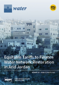
Water storage tanks atop Jordanian homes attest to the long piped water supply interruptions in the country, introduced to limit high network losses. Restoring the pipe network for continuous supply would require increased cost recovery. This issue features one of the largest econometric analyses of factors influencing residential water demand in Jordan. The results are used to identify water tariffs that improve cost recovery while reducing the cost burden on essential uses. Tariffs with rates based on per-capita consumption perform best. (Cover photo: André Künzelmann, UFZ). View this paper
  • Issues are regarded as officially published after their release is announced to the table of contents alert mailing list.
  • You may sign up for e-mail alerts to receive table of contents of newly released issues.
  • PDF is the official format for papers published in both, html and pdf forms. To view the papers in pdf format, click on the "PDF Full-text" link, and use the free Adobe Reader to open them.
Order results
Result details
Section
Select all
Export citation of selected articles as:
27 pages, 4351 KiB  
Article
Exploring the Role of Relational Practices in Water Governance Using a Game-Based Approach
by Piotr Magnuszewski, Karolina Królikowska, Anna Koch, Michal Pająk, Craig Allen, Victoria Chraibi, Anil Giri, Danielle Haak, Noelle Hart, Michelle Hellman, Donald Pan, Nathan Rossman, Jan Sendzimir, Maggi Sliwinski, Joanna Stefańska, Tharsi Taillieu, Denise Marie Weide and Ilonka Zlatar
Water 2018, 10(3), 346; https://doi.org/10.3390/w10030346 - 20 Mar 2018
Cited by 18 | Viewed by 6986
Abstract
The growing complexity and interdependence of water management processes requires the involvement of multiple stakeholders in water governance. Multi-party collaboration is increasingly vital at both the strategy development and implementation levels. Multi-party collaboration involves a process of joint decision-making among key stakeholders in [...] Read more.
The growing complexity and interdependence of water management processes requires the involvement of multiple stakeholders in water governance. Multi-party collaboration is increasingly vital at both the strategy development and implementation levels. Multi-party collaboration involves a process of joint decision-making among key stakeholders in a problem domain directed towards the future of that domain. However, the common goal is not present from the beginning; rather, the common goal emerges during the process of collaboration. Unfortunately, when the conflicting interests of different actors are at stake, the large majority of environmental multi-party efforts often do not reliably deliver sustainable improvements to policy and/or practice. One of the reasons for this, which has been long established by many case studies, is that social learning with a focus on relational practices is missing. The purpose of this paper is to present the design and initial results of a pilot study that utilized a game-based approach to explore the effects of relational practices on the effectiveness of water governance. This paper verifies the methods used by addressing the following question: are game mechanisms, protocols for facilitation and observation, the recording of decisions and results, and participant surveys adequate to reliably test hypotheses about behavioral decisions related to water governance? We used the “Lords of the Valley” (LOV) game, which focuses on the local-level management of a hypothetical river valley involving many stakeholders. We used an observation protocol to collect data on the quality of relational practices and compared this data with the quantitative outcomes achieved by participants in the game. In this pilot study, we ran the game three times with different groups of participants, and here we provide the outcomes within the context of verifying and improving the methods. Full article
Show Figures

Figure 1

13 pages, 1483 KiB  
Article
Effects of Drip Irrigation Models on Chemical Clogging under Saline Water Use in Hetao District, China
by Lili Zhangzhong, Peiling Yang, Wengang Zheng, Caiyuan Wang, Chong Zhang and Minglei Niu
Water 2018, 10(3), 345; https://doi.org/10.3390/w10030345 - 20 Mar 2018
Cited by 10 | Viewed by 6105
Abstract
Saline water is a major resource for agricultural irrigation in arid-semi arid regions, especially when it is combined with drip irrigation. However, highly saline water can easily cause clogging of the emitters in drip irrigation systems, adversely affecting crop growth. Hence, a 2a [...] Read more.
Saline water is a major resource for agricultural irrigation in arid-semi arid regions, especially when it is combined with drip irrigation. However, highly saline water can easily cause clogging of the emitters in drip irrigation systems, adversely affecting crop growth. Hence, a 2a processing tomatoes drip irrigation study was conducted in Hetao irrigation district. The chemical clogging of the emitters was analyzed using four drip irrigation models: RI1 (all fresh water irrigation), RI2 (saline water use in the flowering stage, fresh water in the fruiting stage), RI3 (fresh water use in the flowering stage, saline water in the fruiting stage), and RI4 (all saline water irrigation). The results revealed that the discharge ratio variation (Dra) and the Christiansen uniformity coefficient (CU) of RI4 decreased to 74.0% and 70.9%, respectively, which is considered as a clogged condition with poor irrigation uniformity. When compared to the all saline water irrigation model, the Dra and CU of fresh-saline alternating irrigation models (RI2 and RI3) were higher by 12.16% and 18.05%, respectively. Additionally, the dry weight (DW) of emitters fouling was less than that of RI4 by 16.30%. The Dra and CU showed linear relationships (R2 > 0.79) for the different irrigation models. However, as the Dra declined, the more adverse influence on maintaining the high CU was found in RI4. Using irrigation models with alternating fresh-saline water were recommended to control chemical clogging in drip irrigation systems. Calcium carbonate (CaCO3) was the dominant scale formed, which caused the emitters to clog when processing tomatoes were grown using a drip irrigation system with saline water. Full article
(This article belongs to the Special Issue Data-Driven Methods for Agricultural Water Management)
Show Figures

Figure 1

12 pages, 715 KiB  
Article
The Magnitude and Cost of Groundwater Metering and Control in Agriculture
by Armando Ursitti, Giacomo Giannoccaro, Maurizio Prosperi, Emilio De Meo and Bernardo C. De Gennaro
Water 2018, 10(3), 344; https://doi.org/10.3390/w10030344 - 20 Mar 2018
Cited by 14 | Viewed by 3636
Abstract
Volumetric pricing as envisaged within the Water Framework Directive (60/2000) is a considerable challenge in terms of irrigation in Mediterranean regions, since a large share of the water source is groundwater. Enforcing this pricing scheme involves systematic metering and control (M&C) systems with [...] Read more.
Volumetric pricing as envisaged within the Water Framework Directive (60/2000) is a considerable challenge in terms of irrigation in Mediterranean regions, since a large share of the water source is groundwater. Enforcing this pricing scheme involves systematic metering and control (M&C) systems with subsequent high costs. This paper aims to fill the gap in the literature related to the assessment of costs for the metering and control of irrigation groundwater. The full operational cost of all activities related to the hypothetical services provided by a public agency is assessed for Apulia (a region in southern Italy). The results show that point-to-point metering services are quite costly, ranging from 38.5 to 59 euros per delivery point. New questions arise regarding whether the M&C of groundwater abstraction should be fully charged to end users (i.e., farmers), or also shared with the whole society as a public service aimed at environmental enhancement. Full article
Show Figures

Figure 1

18 pages, 4443 KiB  
Article
Trading Natural Riparian Forests for Urban Shelterbelt Plantations—A Sustainability Assessment of the Kökyar Protection Forest in NW China
by Siegmund Missall, Abdulla Abliz, Ümüt Halik, Niels Thevs and Martin Welp
Water 2018, 10(3), 343; https://doi.org/10.3390/w10030343 - 20 Mar 2018
Cited by 8 | Viewed by 6520
Abstract
Cities at the fringe of the Taklimakan desert in NW China are prone to dust and sand storms with serious consequences for human well-being. The Kökyar Protection Forest was established in the 1980s as an ecological engineering project with the intent of protecting [...] Read more.
Cities at the fringe of the Taklimakan desert in NW China are prone to dust and sand storms with serious consequences for human well-being. The Kökyar Protection Forest was established in the 1980s as an ecological engineering project with the intent of protecting the city of Aksu, NW China, from these impacts. It is designed as a combination of poplar shelterbelts and orchards, irrigated by river water from the Aksu River, the main tributary of the Tarim River. Prevalent literature describes it as an afforestation project for combatting desertification with manifold positive effects for the economic, social, and environmental dimension of sustainable development. This paper sets out to challenge these claims by a sustainability assessment in which the plantation is examined from a broader perspective, embedding it to the wider context of social and environmental problems in South Xinjiang. Methods comprise evapotranspiration calculations, interviews, a socioeconomic household survey, stakeholder dialogues, and literature research. Results affirm its economic sustainability, but see a mixed record for the social sphere. From the nature conservation point of view, it has to be classified as unsustainable because its high irrigation water consumption results in the downstream desiccation and desertification of natural riparian forests along the Tarim River, causing a forest loss in the downstream area twice the size of the forest gain in the upstream area. There is a trade-off between artificial shelterbelt plantations for urban ecosystem services on the one hand side, and natural riparian forests and their biodiversity on the other hand side. The paper recommends restricting agricultural extension, and using locally adapted less water consuming agroforestry schemes to protect urban dwellers from dust stress. Full article
(This article belongs to the Special Issue The Future of Water Management in Central Asia)
Show Figures

Figure 1

10 pages, 4295 KiB  
Article
Gas Exchanges and Stem Water Potential Define Stress Thresholds for Efficient Irrigation Management in Olive (Olea europea L.)
by Giulia Marino, Tiziano Caruso, Louise Ferguson and Francesco Paolo Marra
Water 2018, 10(3), 342; https://doi.org/10.3390/w10030342 - 20 Mar 2018
Cited by 32 | Viewed by 4843
Abstract
With climate change and decreased water supplies, interest in irrigation scheduling based on plant water status is increasing. Stem water potential (ΨSWP) thresholds for irrigation scheduling in olive have been proposed, however, a physiologically-based evaluation of their reliability is needed. A [...] Read more.
With climate change and decreased water supplies, interest in irrigation scheduling based on plant water status is increasing. Stem water potential (ΨSWP) thresholds for irrigation scheduling in olive have been proposed, however, a physiologically-based evaluation of their reliability is needed. A large dataset collected at variable environmental conditions, growing systems, and genotypes was used to characterize the relation between ΨSWP and gas exchanges for olive. Based on the effect of drought stress on the ecophysiological parameters monitored, we described three levels of stress: no stress (ΨSWP above about −2 MPa), where the high variability of stomatal conductance (gs) suggests a tight stomatal control of water loss that limit ΨSWP drop, irrigation volumes applied to overcome this threshold had no effect on assimilation but reduced intrinsic water use efficiency (iWUE); moderate-stress (ΨSWP between about −2.0 and −3.5 MPa), where iWUE can be increased without damage to the photosynthetic apparatus of leaves; and high-stress (ΨSWP below about −3.5 MPa), where gs dropped below 150 mmol m−2 s−1 and the intercellular CO2 concentration increased proportionally, suggesting non-stomatal limitation to photosynthesis was operative. This study confirmed that olive ΨSWP should be maintained between −2 and −3.5 MPa for optimal irrigation efficiency and to avoid harmful water stress levels. Full article
(This article belongs to the Special Issue Advances in Agriculture Water Efficiency)
Show Figures

Figure 1

13 pages, 900 KiB  
Article
Uncertainty Analysis of the Water Scarcity Footprint Based on the AWARE Model Considering Temporal Variations
by Jong Seok Lee, Min Hyeok Lee, Yoon-Young Chun and Kun Mo Lee
Water 2018, 10(3), 341; https://doi.org/10.3390/w10030341 - 19 Mar 2018
Cited by 15 | Viewed by 4331
Abstract
The purpose of this paper is to compare the degree of uncertainty of the water scarcity footprint using the Monte Carlo statistical method and block bootstrap method. Using the hydrological data of a water drainage basin in Korea, characterization factors based on the [...] Read more.
The purpose of this paper is to compare the degree of uncertainty of the water scarcity footprint using the Monte Carlo statistical method and block bootstrap method. Using the hydrological data of a water drainage basin in Korea, characterization factors based on the available water remaining (AWARE) model were obtained. The uncertainties of the water scarcity footprint considering temporal variations in paddy rice production in Korea were estimated. The block bootstrap method gave five-times smaller percentage uncertainty values of the model output compared to that of the two different Monte Carlo statistical method scenarios. Incorrect estimation of the probability distribution of the AWARE characterization factor model is what causes the higher uncertainty in the water scarcity footprint value calculated by the Monte Carlo statistical method in this study. This is because AWARE characterization factor values partly follows discrete distribution with extreme value on one side. Therefore, this study suggests that the block bootstrap method is a better choice in analyzing uncertainty compared to the Monte Carlo statistical method when using the AWARE model to quantify the water scarcity footprint. Full article
Show Figures

Figure 1

22 pages, 7195 KiB  
Article
Real-Time Flood Control by Tree-Based Model Predictive Control Including Forecast Uncertainty: A Case Study Reservoir in Turkey
by Gökçen Uysal, Rodolfo Alvarado-Montero, Dirk Schwanenberg and Aynur Şensoy
Water 2018, 10(3), 340; https://doi.org/10.3390/w10030340 - 19 Mar 2018
Cited by 17 | Viewed by 4914
Abstract
Optimal control of reservoirs is a challenging task due to conflicting objectives, complex system structure, and uncertainties in the system. Real time control decisions suffer from streamflow forecast uncertainty. This study aims to use Probabilistic Streamflow Forecasts (PSFs) having a lead-time up to [...] Read more.
Optimal control of reservoirs is a challenging task due to conflicting objectives, complex system structure, and uncertainties in the system. Real time control decisions suffer from streamflow forecast uncertainty. This study aims to use Probabilistic Streamflow Forecasts (PSFs) having a lead-time up to 48 h as input for the recurrent reservoir operation problem. A related technique for decision making is multi-stage stochastic optimization using scenario trees, referred to as Tree-based Model Predictive Control (TB-MPC). Deterministic Streamflow Forecasts (DSFs) are provided by applying random perturbations on perfect data. PSFs are synthetically generated from DSFs by a new approach which explicitly presents dynamic uncertainty evolution. We assessed different variables in the generation of stochasticity and compared the results using different scenarios. The developed real-time hourly flood control was applied to a test case which had limited reservoir storage and restricted downstream condition. According to hindcasting closed-loop experiment results, TB-MPC outperforms the deterministic counterpart in terms of decreased downstream flood risk according to different independent forecast scenarios. TB-MPC was also tested considering different number of tree branches, forecast horizons, and different inflow conditions. We conclude that using synthetic PSFs in TB-MPC can provide more robust solutions against forecast uncertainty by resolution of uncertainty in trees. Full article
(This article belongs to the Special Issue Adaptive Catchment Management and Reservoir Operation)
Show Figures

Figure 1

18 pages, 2672 KiB  
Article
Implementation of a Two-Source Model for Estimating the Spatial Variability of Olive Evapotranspiration Using Satellite Images and Ground-Based Climate Data
by Fernando Fuentes-Peñailillo, Samuel Ortega-Farías, César Acevedo-Opazo and David Fonseca-Luengo
Water 2018, 10(3), 339; https://doi.org/10.3390/w10030339 - 19 Mar 2018
Cited by 19 | Viewed by 4050
Abstract
A study was carried out to evaluate the potential use of the two-source Shuttleworth and Wallace (SW) model to compute the intra-orchard spatial variability of actual evapotranspiration (ET) of olive trees using satellite images and ground-based climate data. The study was conducted in [...] Read more.
A study was carried out to evaluate the potential use of the two-source Shuttleworth and Wallace (SW) model to compute the intra-orchard spatial variability of actual evapotranspiration (ET) of olive trees using satellite images and ground-based climate data. The study was conducted in a drip-irrigated olive orchard using satellite images (Landsat 7 ETM+), which were acquired on clear sky days during the main phenological stages (2009/10 growing season). The performance of the SW model was evaluated using instantaneous latent heat flux (LE) measurements that were obtained from an eddy correlation system. At the time of satellite overpass, the estimated values of net radiation ( Rn i ) and soil heat flux ( G i ) were compared with ground measurements from a four-way net radiometer and soil heat flux plates, respectively. The results indicated that the SW model subestimated instantaneous LE (W m−2) and daily ET (mm d−1), with errors of 12% and 10% of observed values, respectively. The root mean square error (RMSE) and mean absolute error (MAE) values for instantaneous LE were 26 and 20 W m−2, while those for daily values of ET were 0.31 and 0.28 mm d−1, respectively. Finally, the submodels computed Rn i and G i with errors of between 4.0% and 8.0% of measured values and with RMSE and MAE between 25 and 39 W m−2. Full article
(This article belongs to the Special Issue Innovation Issues in Water, Agriculture and Food)
Show Figures

Figure 1

16 pages, 6585 KiB  
Article
Groundwater Chemistry Regulated by Hydrochemical Processes and Geological Structures: A Case Study in Tongchuan, China
by Xinyan Li, Hao Wu, Hui Qian and Yanyan Gao
Water 2018, 10(3), 338; https://doi.org/10.3390/w10030338 - 19 Mar 2018
Cited by 62 | Viewed by 6237
Abstract
Knowledge of hydrochemical processes in groundwater helps to identify the relationship between geochemical processes and groundwater quality as well as to understand the hydrochemical evaluation of groundwater, which is important for the sustainable management of groundwater resources. This study aims to identify the [...] Read more.
Knowledge of hydrochemical processes in groundwater helps to identify the relationship between geochemical processes and groundwater quality as well as to understand the hydrochemical evaluation of groundwater, which is important for the sustainable management of groundwater resources. This study aims to identify the chemical characteristics of groundwater in the area of Tongchuan City, China. A total of 58 groundwater samples were collected. A hierarchical cluster analysis divided samples into three clusters and six sub-clusters (cluster 1a, 1b, 2a, 2b, 3a, 3b) according to hydrochemical facies. Graphical plots of multiple ionic ratios, saturation indices, and ion exchange indices were employed to examine hydrochemical processes that result in different hydrochemical facies of each cluster. Results show the predominance of carbonate and silicate weathering in cluster 1, silicate weathering in cluster 2, and carbonate weathering in cluster 3. Ionic exchange is a ubiquitous process among all clusters. The distribution of clusters is related to the regional geology, which may result in different hydrochemical processes. Two stratigraphic sections identify the differences in hydrochemical processes resulting from complex stratum structures and varied aquifer media. Cluster 2a shows an interesting difference in water chemistry along the groundwater flow path. Further study by oxygen and hydrogen isotope indicated that mixing between Quaternary and the Permian aquifers resulting from faulting is the main reason for the distinctive characteristic of cluster 2a. Full article
Show Figures

Figure 1

9 pages, 2404 KiB  
Review
A Review of Permeable Pavement Clogging Investigations and Recommended Maintenance Regimes
by Mostafa Razzaghmanesh and Simon Beecham
Water 2018, 10(3), 337; https://doi.org/10.3390/w10030337 - 17 Mar 2018
Cited by 56 | Viewed by 8436
Abstract
Understanding clogging mechanisms in permeable pavements can help optimize the required maintenance regime. In this review paper, methods for investigating clogging mechanisms are described. These include surface infiltration methods, the use of embedded sensors, and the development of modelling tools. Previously conducted surface [...] Read more.
Understanding clogging mechanisms in permeable pavements can help optimize the required maintenance regime. In this review paper, methods for investigating clogging mechanisms are described. These include surface infiltration methods, the use of embedded sensors, and the development of modelling tools. Previously conducted surface infiltration tests indicate the importance of the age of a permeable pavement system and also local climatic conditions, including rainfall intensity. The results indicate that porous concrete generally has the highest infiltration capacity and this is followed by permeable interlocking concrete pavement and then porous asphalt. The measured infiltration rates decreased significantly even within two years of installation. There was an indirect relationship between surface infiltration rates and the age of the pavements. It was also found that the rainfall characteristics are important in selecting the type of pavement. Sensor technologies have been used mainly in the United States and there has been a reluctance to use such technologies in other parts of the world. Few studies have been conducted into modelling the changing performance of permeable pavement systems over time and there is a need to develop more general models. Various methods and machinery have been developed for cleaning and maintaining permeable pavements and there is no universally preferred approach currently available. Indeed, several of the commonly used maintenance methods have been shown to be relatively ineffective. Full article
(This article belongs to the Special Issue Permeable Pavements and Their Role in Sustainable Urban Development)
Show Figures

Figure 1

17 pages, 10550 KiB  
Article
Occurrence Probabilities of Wet and Dry Periods in Southern Italy through the SPI Evaluated on Synthetic Monthly Precipitation Series
by Tommaso Caloiero, Beniamino Sirangelo, Roberto Coscarelli and Ennio Ferrari
Water 2018, 10(3), 336; https://doi.org/10.3390/w10030336 - 17 Mar 2018
Cited by 11 | Viewed by 3434
Abstract
The present article investigates dry and wet periods in a large area of the Mediterranean basin. First, a stochastic model was applied to a homogeneous database of monthly precipitation values of 46 rain gauges in five regions of southern Italy. In particular, after [...] Read more.
The present article investigates dry and wet periods in a large area of the Mediterranean basin. First, a stochastic model was applied to a homogeneous database of monthly precipitation values of 46 rain gauges in five regions of southern Italy. In particular, after estimating the model parameters, a set of 104 years of monthly precipitation for each rain gauge was generated by means of a Monte Carlo technique. Then, dry and wet periods were analyzed through the application of the standardized precipitation index (SPI) over 3-month and 6-month timespan (short-term) and 12-month and 24-month period (long-term). As a result of the SPI application on the generated monthly precipitation series, higher occurrence probabilities of dry conditions than wet conditions have been detected, especially when long-term precipitation scales are considered. Full article
Show Figures

Figure 1

15 pages, 11993 KiB  
Article
Land Use and Land Cover Changes (LULCC), a Key to Understand Soil Erosion Intensities in the Maritsa Basin
by Emre Ozsahin, Umit Duru and Ilker Eroglu
Water 2018, 10(3), 335; https://doi.org/10.3390/w10030335 - 17 Mar 2018
Cited by 46 | Viewed by 6834
Abstract
Soil erosion is a major environmental and economic concern affecting all continents around the world. Soil loss facilitates land degradation, threatening both agricultural and natural environments in continental Europe. The overall objective of the present study is to reveal temporal changes of erosion [...] Read more.
Soil erosion is a major environmental and economic concern affecting all continents around the world. Soil loss facilitates land degradation, threatening both agricultural and natural environments in continental Europe. The overall objective of the present study is to reveal temporal changes of erosion risk in the Maritsa Basin, and also assess the temporal effects of land use and land cover changes (LULCC) on the gross erosion rate. The Revised Universal Soil Loss Equation (RUSLE) was utilized to monitor the distribution of the erosion risk zones and soil loss in the basin. The variables were either directly derived from the satellite imagery or computed using established equations or previous studies. The dynamic parameters were categorized into two-time frames as 1990 and 2015. The results indicate that the annual average erosion rate decreased from 0.895 to 0.828 t ha−1 year−1. This reduction is within the range of modeling error, potentially originated from input data uncertainties. The most extensive changes in the gross soil loss were found in both agricultural and artificial areas, which emphasize the significance of these two classes in soil erosion models. The research summarized here enhances understanding the impacts of land use and land cover (LULC) classes on erosion intensities. Full article
(This article belongs to the Special Issue Soil Erosion by Water)
Show Figures

Figure 1

14 pages, 1556 KiB  
Article
Comparison of Public Perception in Desert and Rainy Regions of Chile Regarding the Reuse of Treated Sewage Water
by Daniela Segura, Valentina Carrillo, Francisco Remonsellez, Marcelo Araya and Gladys Vidal
Water 2018, 10(3), 334; https://doi.org/10.3390/w10030334 - 17 Mar 2018
Cited by 12 | Viewed by 5058
Abstract
The objective of this study was to compare the public perception in desert and rainy regions of Chile regarding the reuse of treated sewage water. The methodology of this study consisted of applying a survey to the communities of San Pedro de Atacama [...] Read more.
The objective of this study was to compare the public perception in desert and rainy regions of Chile regarding the reuse of treated sewage water. The methodology of this study consisted of applying a survey to the communities of San Pedro de Atacama (desert region) and Hualqui (rainy region) to identify attitudes about the reuse of sewage water. The survey was applied directly to men and women, 18 to 90 years old, who were living in the studied communities. The results indicate that inhabitants of San Pedro de Atacama (desert region) were aware of the state of their water resources, with 86% being aware that there are water shortages during some part of the year. In contrast, only 55% of residents in Hualqui (rainy region) were aware of water shortages. With respect of the reuse of treated sewage water, 47% of respondents in San Pedro de Atacama understood the concept, as compared to 27% in Hualqui. There was more acceptance of using treated sewage water for non-potable purposes than as drinking water. Full article
Show Figures

Figure 1

15 pages, 11715 KiB  
Article
Case Study on Water Quality Improvement in Xihu Lake through Diversion and Water Distribution
by Minxi Zhang, Azam Dolatshah, Wenlong Zhu and Guoliang Yu
Water 2018, 10(3), 333; https://doi.org/10.3390/w10030333 - 16 Mar 2018
Cited by 21 | Viewed by 5896
Abstract
Eutrophication in lakes and reservoirs is a serious environmental problem that has damaged ecosystem health worldwide. Water diversion is one of the most popular methods for improving the water quality in shallow lakes, as it dilutes pollutants in and diverts them out of [...] Read more.
Eutrophication in lakes and reservoirs is a serious environmental problem that has damaged ecosystem health worldwide. Water diversion is one of the most popular methods for improving the water quality in shallow lakes, as it dilutes pollutants in and diverts them out of the lake. However, simple diversion without rational water distribution cannot significantly enhance water exchange in the entire lake because dead water zones always exist. This paper illustrates a case study on water quality improvement in Xihu Lake by diversion and water distribution. Based on theoretical calculation, the diversion water discharge was determined and rationally distributed into four different locations. According to the field observations after the implementation of the diversion and water distribution project, the average velocity over the dead water zones increased approximately 50 times over that of prior to the project. The average water exchange period reduced from 68 days to 22.5 days. The average turbidity was 8.8% and 12.4% lower than before after two and four months of diversion, respectively. The maximum turbidity reduced from the original 27.5 NTU (Nephelometric Turbidity Unit) to 20.1 NTU after two months of diversion, then to 16.1 NTU after four months of diversion. It shows that this diversion and rational water distribution eliminates most of the dead water zones and achieves a favorable flow field, thus reducing the turbidity and increasing water transparency, which is conducive to the improvement of water quality. Full article
(This article belongs to the Special Issue Eutrophication Management: Monitoring and Control)
Show Figures

Figure 1

12 pages, 8014 KiB  
Article
Applicability of Constructed Wetlands for Water Quality Improvement in a Tea Estate Catchment: The Pussellawa Case Study
by G. M. P. R. Weerakoon, K. B. S. N. Jinadasa, G. B. B. Herath, M. I. M. Mowjood and W. J. Ng
Water 2018, 10(3), 332; https://doi.org/10.3390/w10030332 - 16 Mar 2018
Cited by 9 | Viewed by 5046
Abstract
Water in agricultural catchments is prone to pollution from agricultural runoff containing nutrients and pesticides, and contamination from the human population working and residing therein. This study examined the quality of water in a drainage stream which runs through a congested network of [...] Read more.
Water in agricultural catchments is prone to pollution from agricultural runoff containing nutrients and pesticides, and contamination from the human population working and residing therein. This study examined the quality of water in a drainage stream which runs through a congested network of ‘line houses’ (low-income housing, typically found arranged in straight ‘lines’ on estates) in the tea estate catchment area of Pussellawa in central Sri Lanka. The study evaluated the applicability of vertical subsurface flow (VSSF) and horizontal subsurface flow (HSSF) constructed wetlands for water polishing, as the residents use the stream water for various domestic purposes with no treatment other than possibly boiling. Water flow in the stream can vary significantly over time, and so investigations were conducted at various flow conditions to identify the hydraulic loading rate (HLR) bandwidth for wetland polishing applications. Two wetland models of 8 m × 1 m × 0.6 m (length × width × depth) were constructed and arranged as VSSF and HSSF units. Stream water was diverted to these units at HLRs of 3.3, 4, 5, 10, 20, and 40 cm/day. Results showed that both VSSF and HSSF wetland units were capable of substantially reducing five-day biochemical oxygen demand (BOD5), total suspended solids (TSS), fecal coliform (FC), total coliform (TC), ammonia nitrogen (NH4+-N), and nitrate nitrogen (NO3-N) up to 20 cm/day HLR, with removal efficiencies of more than 64%, 60%, 90%, 93%, 70%, and 59% for BOD5, TSS, FC, TC, NH4+-N, and NO3-N, respectively, in the VSSF wetland unit; and more than 66%, 62%, 91%, 90%, 53%, and 77% for BOD5, TSS, FC, TC, NH4+-N, and NO3-N, respectively, in the HSSF wetland unit. Full article
(This article belongs to the Special Issue Wetlands for the Treatment of Agricultural Drainage Water)
Show Figures

Figure 1

18 pages, 2654 KiB  
Article
A Thermodynamical Approach for Evaluating Energy Consumption of the Nanofiltration-Crystallization Process on Selective Separation of Chloride and Sulfate
by Ming-yuan Du, Lan-mu Zeng and Xiao-lin Wang
Water 2018, 10(3), 331; https://doi.org/10.3390/w10030331 - 16 Mar 2018
Cited by 3 | Viewed by 3644
Abstract
Nanofiltration (NF) coupling processes have been applied to treat high salinity wastewater in many studies. The main reason that affects the industrialization of the wastewater treatment is the high cost, which is mainly caused by the energy consumption of the entire system. Therefore, [...] Read more.
Nanofiltration (NF) coupling processes have been applied to treat high salinity wastewater in many studies. The main reason that affects the industrialization of the wastewater treatment is the high cost, which is mainly caused by the energy consumption of the entire system. Therefore, how to evaluate the energy consumption of different process configurations is an important issue. In this work, a thermodynamical approach was explained in detail, which could be used for evaluating energy consumption for pressure-driven membrane processes (e.g., NF and reverse osmosis) and osmotically driven membrane processes (e.g., forward osmosis). The coupling process configurations of NF, reverse osmosis (RO) and crystallization (Cryst) were selected to evaluate the energy consumption for high NaCl and Na2SO4 concentration wastewater in this paper. Four different process configurations (NF-Cryst, RO-Cryst, RO-NF-Cryst, NF-RO-Cryst) were simulated using Aspen Plus. The processes were discussed using a thermodynamical approach with a customized NF model. The electrolyte Non-Random Two-Liquid (electrolyte-NRTL) model was employed to calculate the thermodynamic properties of the solutions. The simulation results showed that the energy consumption per cubic meter of treated water (Ewater) in NF-Cryst and NF-RO-Cryst processes were lower than that of RO-Cryst and RO-NF-Cryst. When c f , N a 2 S O 4 was low (e.g., 15 g·L−1), there was not much difference in energy consumption between NF-Cryst and NF-RO-Cryst processes. Moreover, the high efficiency of NF was revealed in the separation of salt and decrease in the energy consumption of the whole process. Full article
Show Figures

Figure 1

18 pages, 847 KiB  
Article
Human Aspects of Water Management at Impoverished Settlements. The Case of Doornkop, Soweto
by Rafael Robina Ramírez and Luis A. Sañudo-Fontaneda
Water 2018, 10(3), 330; https://doi.org/10.3390/w10030330 - 16 Mar 2018
Cited by 6 | Viewed by 4885
Abstract
Since 1996, the South African government has undertaken a considerable project to fulfil the proclaimed right of citizens to access sufficient water and sanitation (Government of South Africa, 1996) through traditional water management and water governance. However, democracy has not yet provided significant [...] Read more.
Since 1996, the South African government has undertaken a considerable project to fulfil the proclaimed right of citizens to access sufficient water and sanitation (Government of South Africa, 1996) through traditional water management and water governance. However, democracy has not yet provided significant improvements to informal dwellers. Doornkop (Soweto) is a clear example of a community fighting for its rights to access clean water and adequate wastewater sanitation systems. Beyond traditional water management and social and environmental water governance, an ethical view of managing water policies through principles of “human dignity” and “human equality” has arisen in order to provide basic water services. Equal opportunities to manage water are provided, analysing the impact of the principles of the United Nations Educational, Scientific and Cultural Organisation (UNESCO) upon South African informal communities through the implementation of human water governance. The objectives of the study ascertain if those two principles are relevant to improve the community’s living conditions as well as to positively affect the “Principles of water governance” and the “Water principles”. With this aim, a case study was set up at Doornkop (Soweto), in which 416 informal dwellers among a relocated group, a tenure group and a squatter group were tested through the Smart PLS method. Results showed that water services can be highly improved through human water management, a model that can be applied to other underdeveloped areas in the world. Full article
Show Figures

Figure 1

21 pages, 6484 KiB  
Article
Evaluating Regime Change of Sediment Transport in the Jingjiang River Reach, Yangtze River, China
by Li He, Dong Chen, Shiyan Zhang, Meng Liu and Guanglei Duan
Water 2018, 10(3), 329; https://doi.org/10.3390/w10030329 - 15 Mar 2018
Cited by 12 | Viewed by 3872
Abstract
The sediment regime in the Jingjiang river reach of the middle Yangtze River has been significantly changed from quasi-equilibrium to unsaturated since the impoundment of the Three Gorges Dam (TGD). Vertical profiles of suspended sediment concentration (SSC) and sediment flux can be adopted [...] Read more.
The sediment regime in the Jingjiang river reach of the middle Yangtze River has been significantly changed from quasi-equilibrium to unsaturated since the impoundment of the Three Gorges Dam (TGD). Vertical profiles of suspended sediment concentration (SSC) and sediment flux can be adopted to evaluate the sediment regime at the local and reach scale, respectively. However, the connection between the vertical concentration profiles and the hydrologic conditions of the sub-saturated channel has rarely been examined based on field data. Thus, vertical concentration data at three hydrological stations in the reach (Zhicheng, Shashi, and Jianli) are collected. Analyses show that the near-bed concentration (within 10% of water depth from the riverbed) may reach up to 15 times that of the vertical average concentration. By comparing the fractions of the suspended sediment and bed material before and after TGD operation, the geomorphic condition under which the distinct large near-bed concentrations occur have been examined. Based on daily discharge-sediment hydrographs, the reach scale sediment regime and availability of sediment sources are analyzed. In total, remarkable large near-bed concentrations may respond to the combination of wide grading suspended particles and bed material. Finally, several future challenges caused by the anomalous vertical concentration profiles in the unsaturated reach are discussed. This indicates that more detailed measurements or new measuring technologies may help us to provide accurate measurements, while a fractional dispersion equation may help us in describing. The present study aims to gain new insights into regime change of sediment suspension in the river reaches downstream of a very large reservoir. Full article
(This article belongs to the Special Issue Adaptive Catchment Management and Reservoir Operation)
Show Figures

Figure 1

15 pages, 1983 KiB  
Article
Statistically-Based Comparison of the Removal Efficiencies and Resilience Capacities between Conventional and Natural Wastewater Treatment Systems: A Peak Load Scenario
by Long Ho, Wout Van Echelpoel, Panayiotis Charalambous, Ana P. L. Gordillo, Olivier Thas and Peter Goethals
Water 2018, 10(3), 328; https://doi.org/10.3390/w10030328 - 15 Mar 2018
Cited by 8 | Viewed by 5181
Abstract
Emerging global threats, such as climate change, urbanization and water depletion, are driving forces for finding a feasible substitute for low cost-effective conventional activated sludge (AS) technology. On the other hand, given their low cost and easy operation, nature-based systems such as constructed [...] Read more.
Emerging global threats, such as climate change, urbanization and water depletion, are driving forces for finding a feasible substitute for low cost-effective conventional activated sludge (AS) technology. On the other hand, given their low cost and easy operation, nature-based systems such as constructed wetlands (CWs) and waste stabilization ponds (WSPs) appear to be viable options. To examine these systems, a 210-day experiment with 31 days of peak load scenario was performed. Particularly, we conducted a deliberate strategy of experimentation, which includes applying a preliminary study, preliminary models, hypothetical tests and power analysis to compare their removal efficiencies and resilience capacities. In contrast to comparable high removal efficiencies of organic matter—around 90%—both natural systems showed moderate nutrient removal efficiencies, which inferred the necessity for further treatment to ensure their compliance with environmental standards. During the peak period, the pond treatment systems appeared to be the most robust as they indicated a higher strength to withstanding the organic matter and nitrogen shock load and were able to recover within a short period. However, high demand of land—2.5 times larger than that of AS—is a major concern of the applicability of WSPs despite their lower operation and maintenance (O&M) costs. It is also worth noting that initial efforts on systematic experimentation appeared to have an essential impact on ensuring statistically and practically meaningful results in this comparison study. Full article
Show Figures

Figure 1

17 pages, 8799 KiB  
Article
Analysis of Drought Intensity and Trends Using the Modified SPEI in South Korea from 1981 to 2010
by Seungjong Bae, Sang-Hyun Lee, Seung-Hwan Yoo and Taegon Kim
Water 2018, 10(3), 327; https://doi.org/10.3390/w10030327 - 15 Mar 2018
Cited by 44 | Viewed by 6318
Abstract
The aim of this study is to analyze the characteristics of drought, such as intensity and trends, based on SPEI (Standardized Precipitation Evapotranspiration Index) at 8 stations in South Korea from 1981 to 2010. The traditional SPEI is based on the Thornthwaite equation [...] Read more.
The aim of this study is to analyze the characteristics of drought, such as intensity and trends, based on SPEI (Standardized Precipitation Evapotranspiration Index) at 8 stations in South Korea from 1981 to 2010. The traditional SPEI is based on the Thornthwaite equation for estimating evapotranspiration; SPEI_th. However, a standard of agricultural water management in Korea suggests the FAO Penman-Monteith equation; SPEI_pm. Therefore, we analyzed the intensity, variability, and trends of drought using SPEI_th and SPEI_pm, respectively, and compared the results. SPEI_pm showed slightly more intensive drought rather than SPEI_th except for Chuncheon and Gwangju. In 5 stations—excluding Cheoncheon, Gwangju and Jinju—the cumulative probability that SPEI_pm was below −1.5 was significantly increased from 1981–1995 to 1996–2010. In addition, the northwest and southwest regions had higher intensity of 1-month droughts, and the central and southwest regions had a higher intensity of 3-month droughts. According to the Mann–Kendall test, there was a decreasing trend of 1-month SPEI during the fall season and 3-month SPEI during winter season. Full article
Show Figures

Figure 1

16 pages, 13242 KiB  
Article
Multi-Objective Assessment of the Ecological Flow Requirement in the Upper Yangtze National Nature Reserve in China Using PHABSIM
by Huan Wang, Hao Wang, Zhenchun Hao, Xu Wang, Meng Liu and Yali Wang
Water 2018, 10(3), 326; https://doi.org/10.3390/w10030326 - 15 Mar 2018
Cited by 16 | Viewed by 4158
Abstract
Many dams have been constructed or are planned all around China. These dams significantly change the hydrological regime and sand concentration downstream, and subsequently affect the river habitat and riverbed substances. Therefore, a good understanding of the river habitat is urgently required to [...] Read more.
Many dams have been constructed or are planned all around China. These dams significantly change the hydrological regime and sand concentration downstream, and subsequently affect the river habitat and riverbed substances. Therefore, a good understanding of the river habitat is urgently required to undertake efficient measures for fish diversity conservation. A multi-objective assessment method based on the Physical Habitat Simulation system (PHABSIM) was utilized to calculate the ecological river flow demand using maximum weighted usable area (WUA) and minimum river discharge as the main objectives. The study employed this method to assess ecological water flow demand in the National Nature Reserve for Rare and Endemic Fish in the Upper Reaches of the Yangtze River in China. Multiple factors such as the degree of endangerment, fish value (ecological value, economic value and scientific research value), data acquisition difficulty, and species representativeness were taken into consideration during selection of indicator fish for coupled habitat analysis. Requirements for both growth and breeding during the study period were considered. Ten species of fishes were chosen as indicator fishes, including floating egg and sinking egg fishes. Additionally, we applied the principle of “minimization of habitat demand and maximization of ecological demand” to include the needs of all indicator fishes. Further, this method comprehensively considered requirements for ecological flow and economic development. The results highlighted that an optimal ecological river flow demand of 2395 m3/s was needed to satisfy the needs for habitat protection and 1890 m3/s was required to meet the needs of social and economic development. The methods used in this study and results obtained, provide a valuable reference for water resources planning and ecosystem protection in other rivers and lakes. Full article
Show Figures

Figure 1

18 pages, 2680 KiB  
Article
Dynamic Management of Water Storage for Flood Control in a Wetland System: A Case Study in Texas
by Arturo S. Leon, Yun Tang, Duan Chen, Ahmet Yolcu, Craig Glennie and Steven C. Pennings
Water 2018, 10(3), 325; https://doi.org/10.3390/w10030325 - 15 Mar 2018
Cited by 13 | Viewed by 5775
Abstract
In this study, we assess the costs and benefits of dynamic management of water storage to improve flood control in a system of wetlands. This management involves releasing water from wetlands ahead of (e.g., a few hours or days before) a rainfall event [...] Read more.
In this study, we assess the costs and benefits of dynamic management of water storage to improve flood control in a system of wetlands. This management involves releasing water from wetlands ahead of (e.g., a few hours or days before) a rainfall event that is forecasted to produce flooding. Each project site may present different challenges and topographical conditions, however as long as there is a relatively small hydraulic gradient between the wetland water surface and the drainage ditch (e.g., >0.9 m), wetlands can be engineered for the purpose of flood control. We present a case study for a system comprised of four wetland areas encompassing 925 acres in the coastal plain south of Houston, Texas. The benefit–cost analysis shows that, in general, the benefits of wetland ecosystems far surpass the costs of construction and maintenance for all considered periods of analysis and assumed degrees of dynamic management of wetland storage. The analysis also shows that the benefit/cost ratios increase over the period of analysis. Considering flood protection only (e.g., not considering the value of other ecosystem services), as long as dynamic management of wetland storage increases flood protection by about 50% compared to that with no management (e.g., a typical wetland with no controlled release of water), the construction of a wetland system would have a benefit/cost ratio of at least 1.9. Full article
Show Figures

Figure 1

14 pages, 3861 KiB  
Article
Treatability of a Highly-Impaired, Saline Surface Water for Potential Urban Water Use
by Frederick Pontius
Water 2018, 10(3), 324; https://doi.org/10.3390/w10030324 - 15 Mar 2018
Cited by 5 | Viewed by 4628
Abstract
As freshwater sources of drinking water become limited, cities and urban areas must consider higher-salinity waters as potential sources of drinking water. The Salton Sea in the Imperial Valley of California has a very high salinity (43 ppt), total dissolved solids (70,000 mg/L), [...] Read more.
As freshwater sources of drinking water become limited, cities and urban areas must consider higher-salinity waters as potential sources of drinking water. The Salton Sea in the Imperial Valley of California has a very high salinity (43 ppt), total dissolved solids (70,000 mg/L), and color (1440 CU). Future wetlands and habitat restoration will have significant ecological benefits, but salinity levels will remain elevated. High salinity eutrophic waters, such as the Salton Sea, are difficult to treat, yet more desirable sources of drinking water are limited. The treatability of Salton Sea water for potential urban water use was evaluated here. Coagulation-sedimentation using aluminum chlorohydrate, ferric chloride, and alum proved to be relatively ineffective for lowering turbidity, with no clear optimum dose for any of the coagulants tested. Alum was most effective for color removal (28 percent) at a dose of 40 mg/L. Turbidity was removed effectively with 0.45 μm and 0.1 μm microfiltration. Bench tests of Salton Sea water using sea water reverse osmosis (SWRO) achieved initial contaminant rejections of 99 percent salinity, 97.7 percent conductivity, 98.6 percent total dissolved solids, 98.7 percent chloride, 65 percent sulfate, and 99.3 percent turbidity. Full article
(This article belongs to the Special Issue Development of Alternative Water Sources in the Urban Sector)
Show Figures

Figure 1

21 pages, 8956 KiB  
Article
High-Frequency Monitoring of Suspended Sediment Variations for Water Quality Evaluation at Deep Bay, Pearl River Estuary, China: Influence Factors and Implications for Sampling Strategy
by Qu Zhou, Liqiao Tian, Onyx W. H. Wai, Jian Li, Zhaohua Sun and Wenkai Li
Water 2018, 10(3), 323; https://doi.org/10.3390/w10030323 - 15 Mar 2018
Cited by 7 | Viewed by 3913
Abstract
Suspended sediment (SS) is an important water quality indicator of coastal and estuarine ecosystems. Field measurement and satellite remote sensing are the most common approaches for water quality monitoring. However, the efficiency and precision of both methods are typically affected by their sampling [...] Read more.
Suspended sediment (SS) is an important water quality indicator of coastal and estuarine ecosystems. Field measurement and satellite remote sensing are the most common approaches for water quality monitoring. However, the efficiency and precision of both methods are typically affected by their sampling strategy (time and interval), especially in highly dynamic coastal and estuarine waters, because only limited measurements are available to analyze the short-term variations or the long-term trends of SS. Dramatic variations of SS were observed, with standard deviation coefficients of 48.9% and 54.1%, at two fixed stations in Deep Bay, China. Therefore, it is crucial to resolve the temporal variations of SS and its main influencing factors, and thus to develop an improved sampling strategy for estuarine ecosystems. Based on two years of continuous high-frequency measurements of SS and concurrent tidal and meteorological data, we demonstrated that the tide is the dominant factor influencing the SS variation among tide, wind (speed and direction), and rainfall in Deep Bay, China. For the monitoring of maximum suspended sediment concentration (SSC), the recommended optimum sampling time coincides with the occurrence of the ebb tides, whereas multiple sampling times are recommended for monitoring of minimum SSC. Although variations of SS are also affected by other factors, the recommended sampling strategy could capture the maximum and minimum SSC variations exactly more than 85% days in a year on average in Deep Bay. This study provides a baseline of SS variation and direct sampling strategy guidance for future SS monitoring and could be extended to other coastal or estuarine waters with similar climatological/tidal exposures. Full article
(This article belongs to the Section Water Quality and Contamination)
Show Figures

Graphical abstract

19 pages, 2893 KiB  
Article
Coastal California Wastewater Effluent as a Resource for Seawater Desalination Brine Commingling
by Kelly E. Rodman, Ahron A. Cervania, Valerie Budig-Markin, Cory F. Schermesser, Oliver W. Rogers, Joshua M. Martinez, Julia King, Patrick Hassett, Jacob Burns, Malia S. Gonzales, Alexandra Folkerts, Peter Duin, Alyssa S. Virgil, Michelle Aldrete, Amanda Lagasca, Alejandro Infanzon-Marin, John R. Aitchison, Drew White, Brandon C. Boutros, Samantha Ortega, Brent Davis, Vu N. Tran and Andrea Achilliadd Show full author list remove Hide full author list
Water 2018, 10(3), 322; https://doi.org/10.3390/w10030322 - 14 Mar 2018
Cited by 11 | Viewed by 6564
Abstract
California frequently experiences water scarcity, especially in high population areas. This has generated increased interest in using the Pacific Ocean as a water resource, with seawater desalination becoming a popular solution. To mitigate the environmental impacts of the high salinity brine from seawater [...] Read more.
California frequently experiences water scarcity, especially in high population areas. This has generated increased interest in using the Pacific Ocean as a water resource, with seawater desalination becoming a popular solution. To mitigate the environmental impacts of the high salinity brine from seawater desalination, California recommends commingling brine with wastewater effluent before ocean discharge. Results reveal that throughout the California coast, approximately 4872 MLD (1287 MGD) of treated wastewater are discharged into the ocean and might be available as dilution water. Most of this dilution water resource is produced in Southern California (3161 MLD or 835 MGD) and the San Francisco Bay Area (1503 MLD or 397 MGD), which are also the areas with the highest need for alternative water sources. With this quantity of dilution water, in principle, over 5300 MLD (1400 MGD) of potable water could be produced in California through seawater desalination. Furthermore, this study provides a survey of the treatment levels and typical discharge violations of ocean wastewater treatment facilities in California. Full article
(This article belongs to the Special Issue Sustainable Water Supply through Desalination and Wastewater Reuse)
Show Figures

Figure 1

18 pages, 267 KiB  
Article
Household Water Demand in Andorra: Impact of Individual Metering and Seasonality
by Arnaud Reynaud, Marc Pons and Cristina Pesado
Water 2018, 10(3), 321; https://doi.org/10.3390/w10030321 - 14 Mar 2018
Cited by 17 | Viewed by 6915
Abstract
Despite the large literature focused on residential water use, our knowledge of the impact of individual metering on household water consumption remains limited. Our work aims to fill this gap by providing the first estimate of the residential water demand function in the [...] Read more.
Despite the large literature focused on residential water use, our knowledge of the impact of individual metering on household water consumption remains limited. Our work aims to fill this gap by providing the first estimate of the residential water demand function in the Principality of Andorra, where collective and individual metering coexists. Using a panel dataset covering the years 2006 to 2015, we propose estimating a domestic water demand function for the municipality of Andorra La Vella (the capital of Andorra). Our estimates reveal a price elasticity of the residential water demand equal to –0.7. Facing a price increase of 10 percent, households will react in the short run by reducing their water consumption by 7 percent. Interestingly, the price elasticity is found to be significantly different in single-family units compared to multi-family units. This may suggest a significant impact of individual metering on domestic water consumption in Andorra. Full article
(This article belongs to the Special Issue Advances in the Economic Analysis of Residential Water Use)
Show Figures

Figure 1

21 pages, 5037 KiB  
Article
Effect of Meteorological Patterns on the Intensity of Streambank Erosion in a Proglacial Gravel-Bed River (Spitsbergen)
by Waldemar Kociuba and Grzegorz Janicki
Water 2018, 10(3), 320; https://doi.org/10.3390/w10030320 - 14 Mar 2018
Cited by 12 | Viewed by 4041
Abstract
Lower parts of proglacial rivers are commonly assumed to be characterised by a multiannual aggradation trend, and streambank erosion is considered to occur rarely and locally. In the years 2009–2013, detailed measurements of channel processes were performed in the Scott River (SW Spitsbergen). [...] Read more.
Lower parts of proglacial rivers are commonly assumed to be characterised by a multiannual aggradation trend, and streambank erosion is considered to occur rarely and locally. In the years 2009–2013, detailed measurements of channel processes were performed in the Scott River (SW Spitsbergen). More than 60% of its surface area (10 km2) occupies non-glaciated valleys. Since the end of the Little Ice Age, the Scott Glacier has been subject to intensive retreat, resulting in the expansion of the terminoglacial and paraglacial zones. In this area, the Scott River develops an alluvial valley with a proglacial river, which has led to a comparatively low rate of fluvial transport, dominance of suspension over bedload, and the occurrence of various channel patterns. Measurements, performed in the lower course of the valley in two fixed cross-sections of the Scott River channel, document variable annual tendencies with a prevalence of scour over deposition processes in the channel bottom. The balance of scour and fill also differs in particular measurement cross-sections and during the summer season. The maximum erosion indices (1.7 m2) were related to single periods of floods with snow-glacier melt and rainfall origin. The contribution of streambank erosion was usually lower than that of deep erosion both in the annual cycle and during extreme events. The channel-widening index also suggests variable annual (from −1 m to +1 m) and inter-annual tendencies. During a three-day flood from August 2013, in a measurement profile at the mouth of the river, the NNW bank was laterally shifted by as much as 3 m. Annual and inter-seasonal indices of total channel erosion, however, show that changes in the channel-bottom morphology are equalised relatively fast, and in terms of balance the changes usually do not exceed 0.5% of a cross section’s area. Full article
(This article belongs to the Special Issue Streambank Erosion: Monitoring, Modeling and Management)
Show Figures

Figure 1

13 pages, 5864 KiB  
Article
Improving the Computational Performance of an Operational Two-Dimensional Real-Time Flooding Forecasting System by Active-Cell and Multi-Grid Methods in Taichung City, Taiwan
by Che-Hao Chang, Ming-Ko Chung, Song-Yue Yang, Chih-Tsung Hsu and Shiang-Jen Wu
Water 2018, 10(3), 319; https://doi.org/10.3390/w10030319 - 14 Mar 2018
Cited by 3 | Viewed by 3355
Abstract
An operational two-dimensional real-time flood forecasting system has been developed in Taiwan to prevent urban inundation. This system takes an hour to come up with forecasts for the next three hours, and the resolution of the forecasts is 40 × 40 m. This [...] Read more.
An operational two-dimensional real-time flood forecasting system has been developed in Taiwan to prevent urban inundation. This system takes an hour to come up with forecasts for the next three hours, and the resolution of the forecasts is 40 × 40 m. This study used a large urban area of 126 km2 in downtown Taichung City for the case study and adopted the active-cell and multi-grid methods to meet the target by computing from data of a 12-h rainfall within one hour at 20 m × 20 m spatial resolution to provide faster forecasting and more hours for flood preparation. With the active-cell method, the Central Processing Unit (CPU) time was reduced by 65.04% from 659 m 29 s to 230 m 33 s under the 200-year return period storm. Further, with multi-grid methods, the CUP time was reduced by 73.98% from 230 m 33 s to 60 m 0 s. In general, the computing time of this model has been reduced 11-fold. The error validation coefficients of inundation areas were between 89.39~97.45% with an average error of depth between 1.06~3.22 cm. Full article
Show Figures

Graphical abstract

17 pages, 9043 KiB  
Article
Trend and Variability in Droughts in Northeast China Based on the Reconnaissance Drought Index
by Yuan Yue, Shuang-he Shen and Qi Wang
Water 2018, 10(3), 318; https://doi.org/10.3390/w10030318 - 14 Mar 2018
Cited by 30 | Viewed by 4202
Abstract
Drought is a recurrent meteorological phenomenon that can be disastrous for humans; however, drought characteristics vary substantially in different regions. We use meteorological data from 140 stations in Northeast China for the period 1970–2014 to calculate the reconnaissance drought index (RDI) in order [...] Read more.
Drought is a recurrent meteorological phenomenon that can be disastrous for humans; however, drought characteristics vary substantially in different regions. We use meteorological data from 140 stations in Northeast China for the period 1970–2014 to calculate the reconnaissance drought index (RDI) in order to examine droughts. We also analyze the strength of the relationships between the main large-scale atmospheric circulation patterns and RDI. Drought trends in the region are largely decreasing, but in the majority of cases, there is no statistical significance. Spatially, the pattern of droughts is a less frequent occurrence with greater severity and longer duration, mainly in the western part of the region. Severe droughts for the periods 1975–1979 and 2000–2004 were found, and most of these droughts occurred in the western part of Northeast China. The correlations between RDI and the atmospheric circulation indices POL, IAZC, and IEAT are negative, but the correlation between RDI and PDO is positive. The relationship between RDI and POL is stronger than the others, and the lagged effect is particularly obvious; thus POL can be recognized as the major driver of droughts over the period 1970–2014 in Northeast China. Full article
Show Figures

Figure 1

15 pages, 3102 KiB  
Article
Spatial Patterns and Temporal Stability of Throughfall in a Mature Douglas-fir Forest
by César Cisneros Vaca, Chandra Prasad Ghimire and Christiaan Van der Tol
Water 2018, 10(3), 317; https://doi.org/10.3390/w10030317 - 14 Mar 2018
Cited by 8 | Viewed by 3840
Abstract
Forest plays a key role in spatial distribution of rainfall and nutrients at fine spatial scales. Areas of localized rainfall and nutrient input at the soil surface may have a large effect on several hydrological and biogeochemical processes. In this paper, a Douglas-fir [...] Read more.
Forest plays a key role in spatial distribution of rainfall and nutrients at fine spatial scales. Areas of localized rainfall and nutrient input at the soil surface may have a large effect on several hydrological and biogeochemical processes. In this paper, a Douglas-fir stand was revisited to evaluate the changes in the throughfall spatial distribution and its temporal stability due to forest growth and thinning. We used 32 funnel-type collectors distributed in a random stratified array within a 0.2 ha plot to measure throughfall amounts from February to November 2015. The throughfall variability was much lower as compared to the values reported ~25 years ago in the same site. We further assessed the spatial patterns of throughfall in spring and summer. We detected a spatial correlation length of 12 m and 8 m for spring and summer, respectively, which are higher than the values reported for other mature Douglas-fir forests in similar climatic conditions. Temporal stability plots confirmed that detected spatial patterns were stable in time. Full article
Show Figures

Figure 1

Previous Issue
Next Issue
Back to TopTop